The corners Sonoma Highway makes with Boyes Blvd. and Vallejo Ave. are the heart of Boyes Hot Springs. From the 1890s to now, it has been our commercial hub. Many buildings are gone, but significant ones remain, if altered. The Post Office has been there, in three different buildings, for over one hundred years. Many new businesses thrive and more are planned. During the season, we now have a weekly farmers market.
The path the highway follows was probably originated by mastadons migrating to the coast. Boyes Blvd. and Vallejo Ave. came along much later, during the early 20th century, when speculators started to subdivide the land.
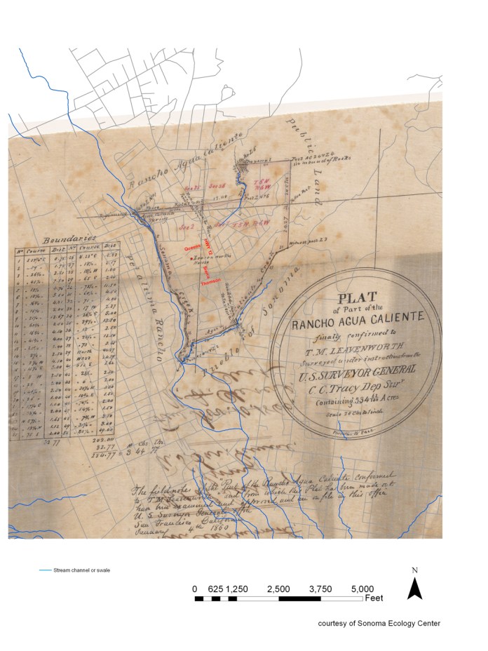
Only the highway ( called “Road to Santa Rosa”) was there in 1860 when the United States Court confirmed Thaddeus Leavenworth’s claim to 534 and 62/100 acres of land in the Rancho Agua Caliente, land that was to become Boyes Hot Springs, Agua Caliente, and Fetters hot Springs.
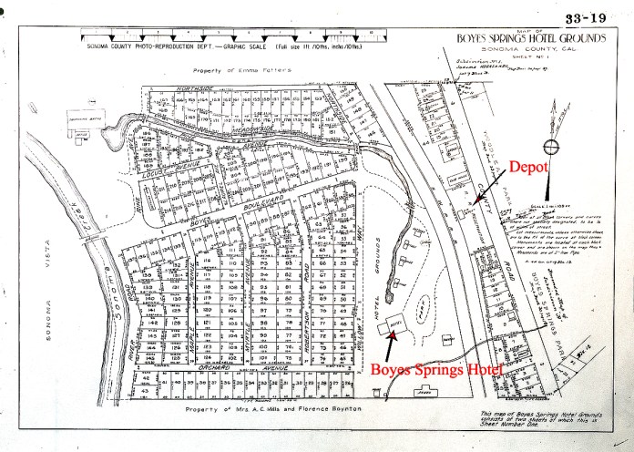
The highway is just called “County Road” in the 1916 Hotel Grounds subdivision map, which also show Boyes Blvd. but does not extend to the east, so no Vallejo.
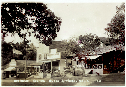
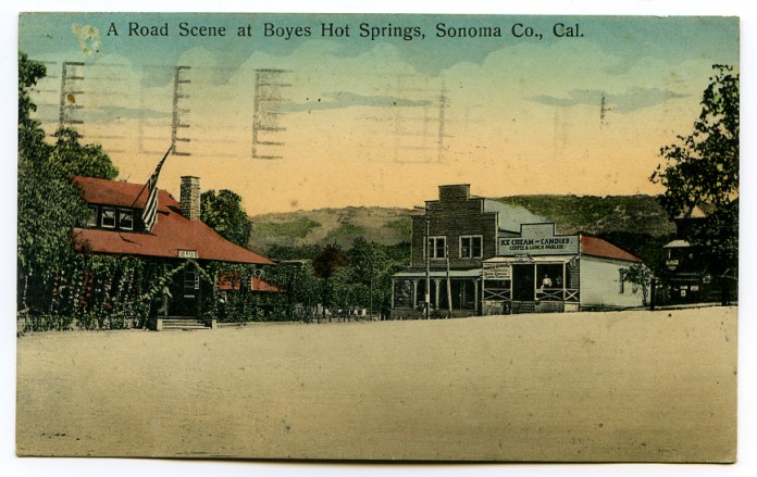
Possibly the oldest photographs of the location are scenes of The Club House (Red roof in lower photo, shown on the Hotel Grounds map), Grahams Store, and other businesses, from around 1910.
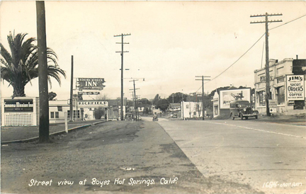
A beautiful 1939 shot shows the entrance to the Sonoma Mission Inn, the Richfield Station, Jim’s café, other businesses and the palm tree in the center of “Boyes Plaza.”
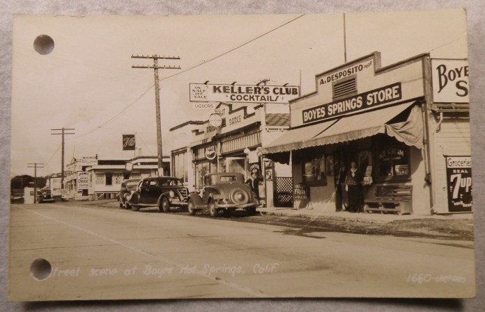
Shot from slightly farther south, this 1930s photo also show Jim’s, in the distance, and two buildings in the foreground that are still there in 2019.
Now looking south at the Center Building, that housed Jim’s, past the corner of Vallejo Ave.
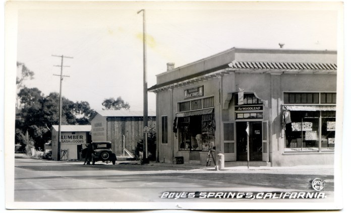
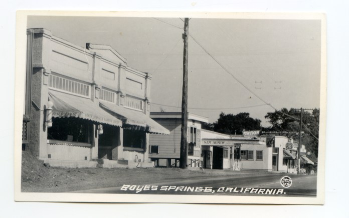
The southwest corner with the Woodleaf Store, around the same time (1930s).
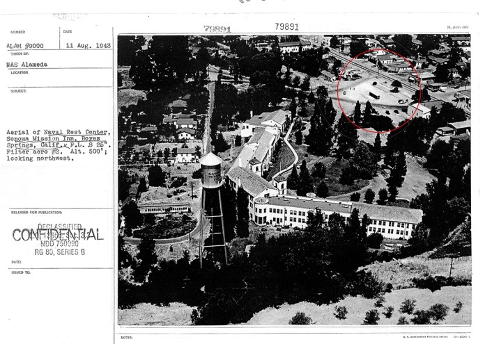
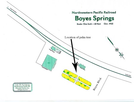
This 1943 Naval aerial photo shows the train depot and palm tree in the upper right corner.
In the early 1950s, the Plaza Center building replaced the Boyes Plaza. The Center Building (opposite side of the highway) has become Polidori’s 5 + 10 cent store.
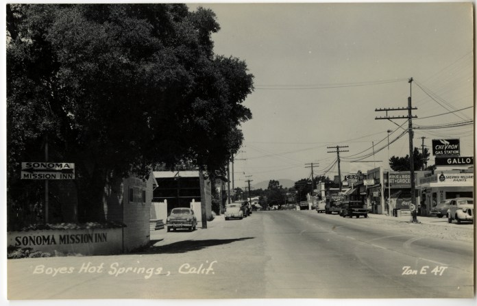
The Mission Inn entrance in the 1950s. On the right, signs for Gallo Brothers Service, Mike And Rose’s market and the C.O.G. club.
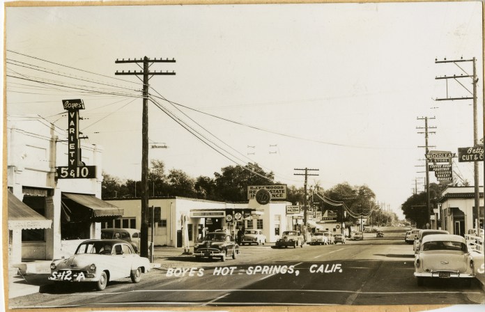
A little later in the 50s, Polidori’s has become the Boyes Variety store. The Woodleaf Market sign is promienent on the right, as well as Betty’s Cut and Curl.
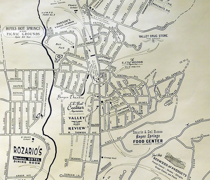
In 1955 the Chamber of Commerce issued a map showing many local businesses, including ones at our corner.


The Big three closed in 2016, never to reopen? Buildings come and go. It’s inevitable. But preservation should be important to all of us. Let’s hope we can do what is needed to preserve the Big Three/Woodleaf from demolition.
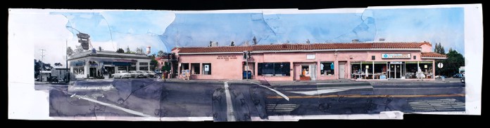
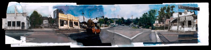
Two artistic interpretations of the intersection from the Valley of the Moon Main Stem Project, by Michael Acker.
Thanks to Arthur Dawson for the Leavenworth Plat interpretation and general info. Other images courtesy of the Sonoma Valley Historical Society, the Northwestern Pacific Railroad Historical Society, the Sonoma County Recorder’s Office, and Stanford Library Special Collections.