and a few digressions
Farrell’s Resort existed on land near the corner of Siesta Way and Sonoma Highway, between the years 1945 and 1958. A county court photograph from that year shows the resorts sign on the highway. An Index Tribune story in 1959 about a barn fire on the property mentioned “the pioneer Ferrell’s Resort property,” which implies, to me, it didn’t exist in 1959, as the barn was being burned by the fire department for training.
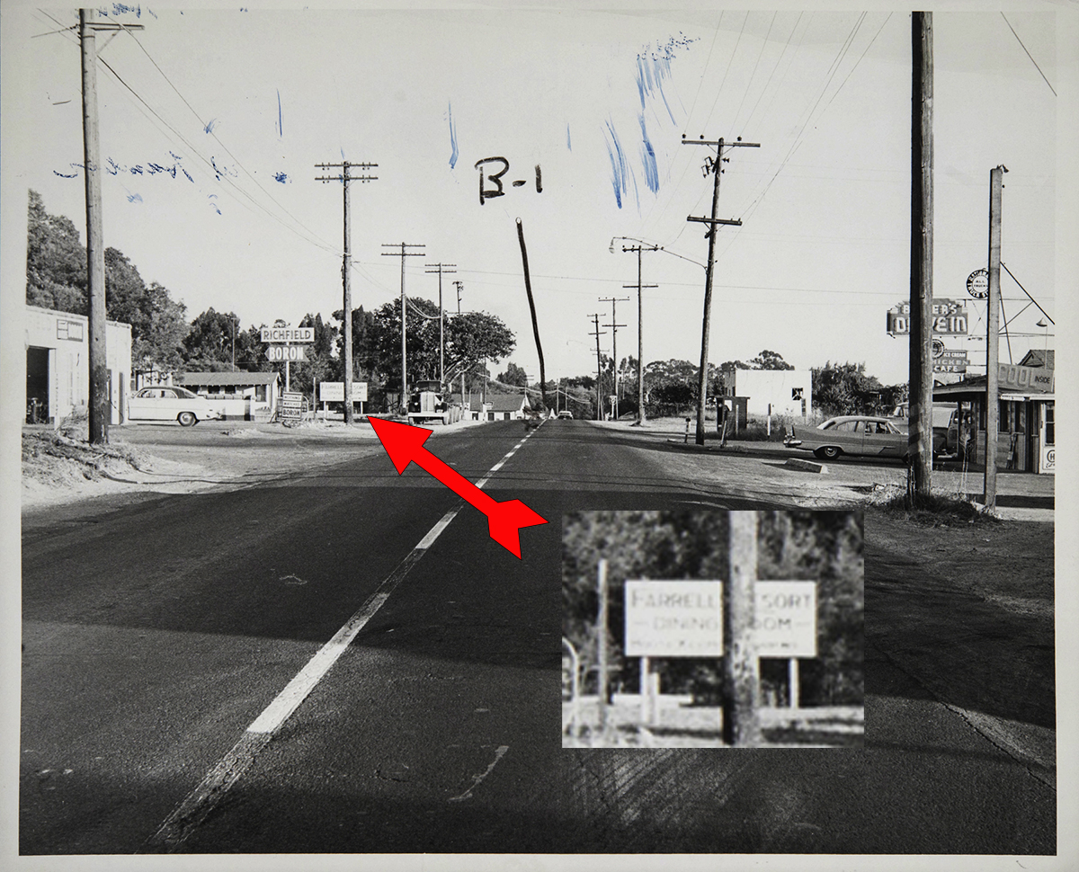
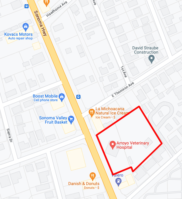
This photo is an exhibit from a lawsuit involving a traffic accident in 1958, courtesy of the Sonoma County Library. Difficult to see, at left, below the Richfield sign, half obscured by a power pole (!) is a sign advertising Farrell’s Resort. Thomson Ave (not East Thomson!) is at left. Across the highway is Baker’s Drive-In, current site of the Fruit Basket.
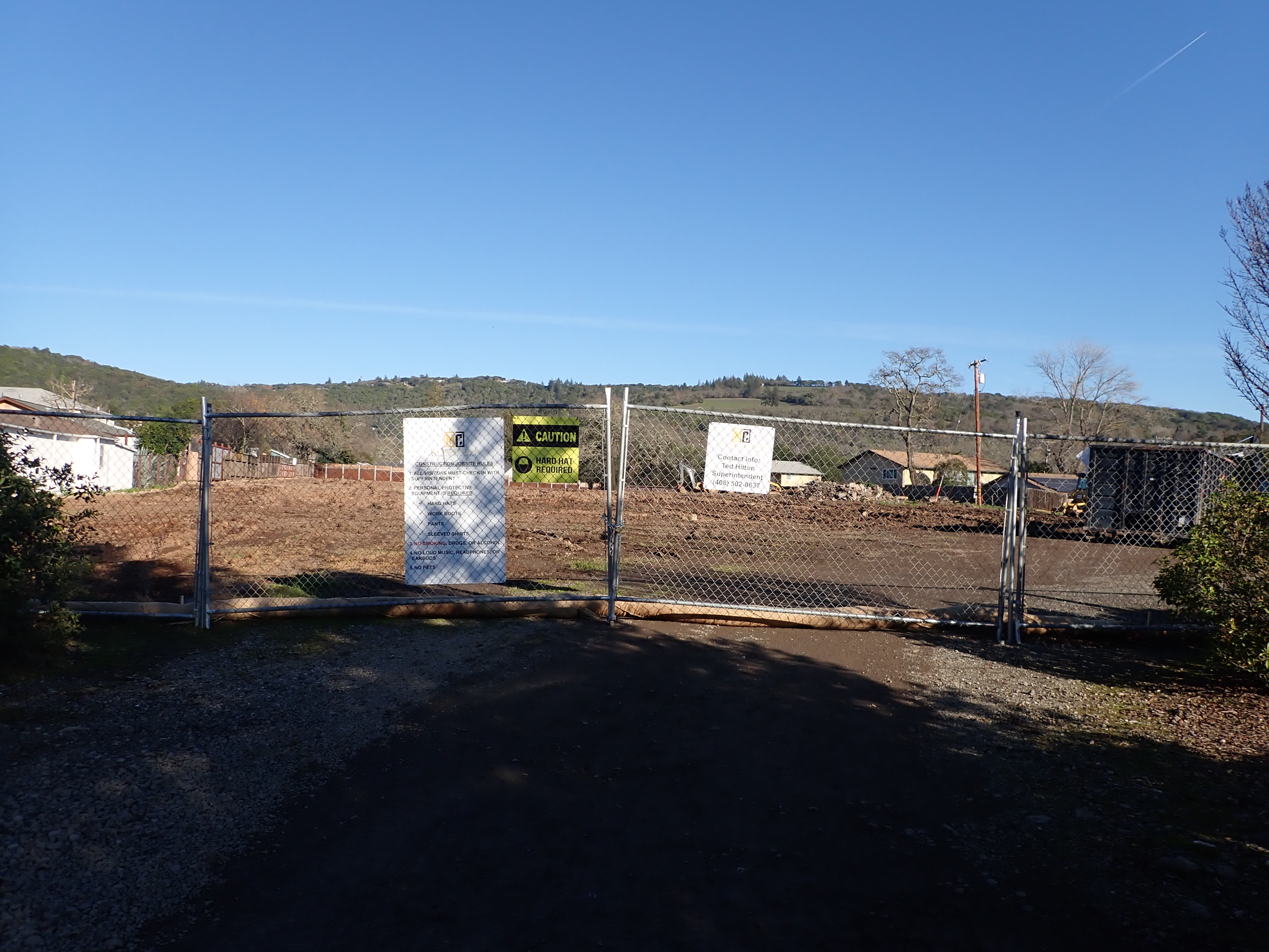
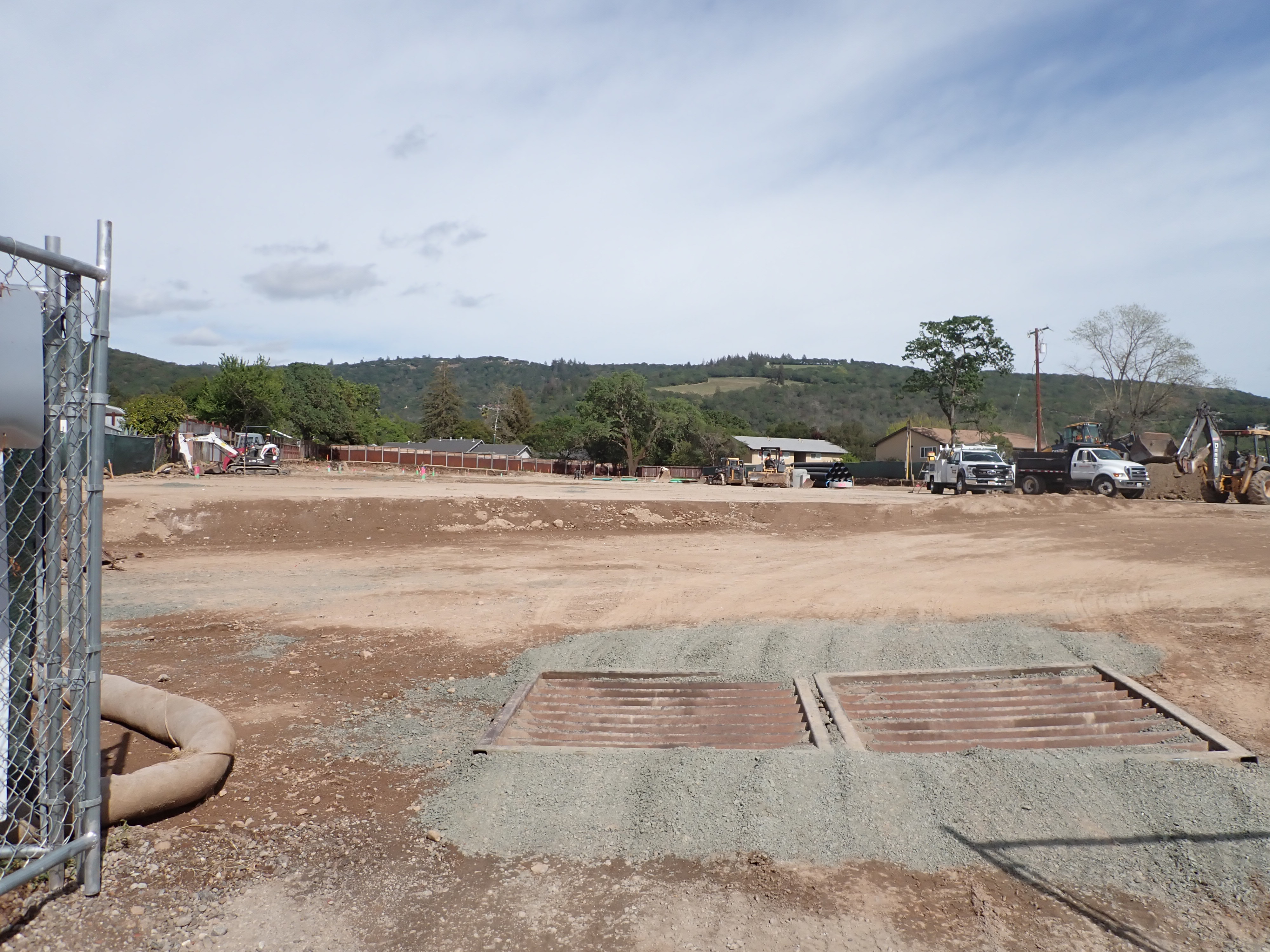
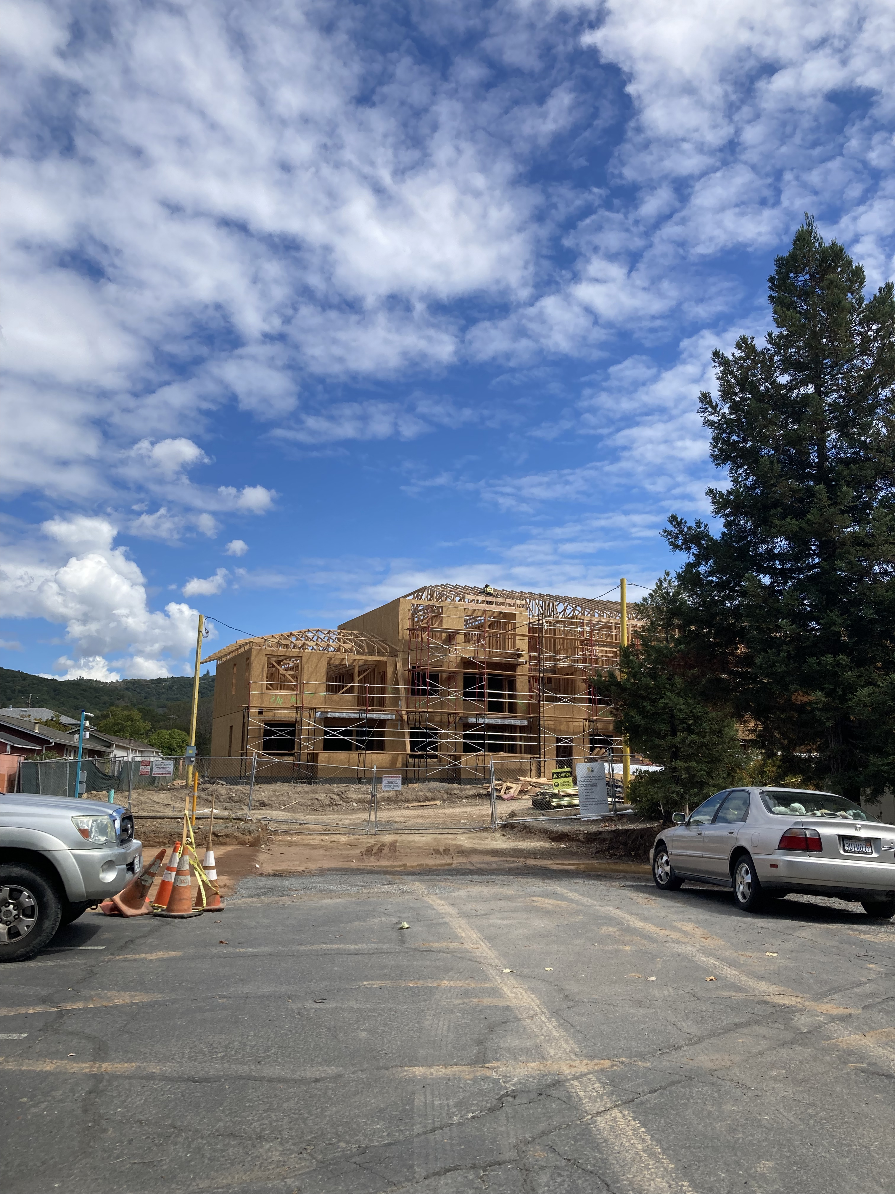
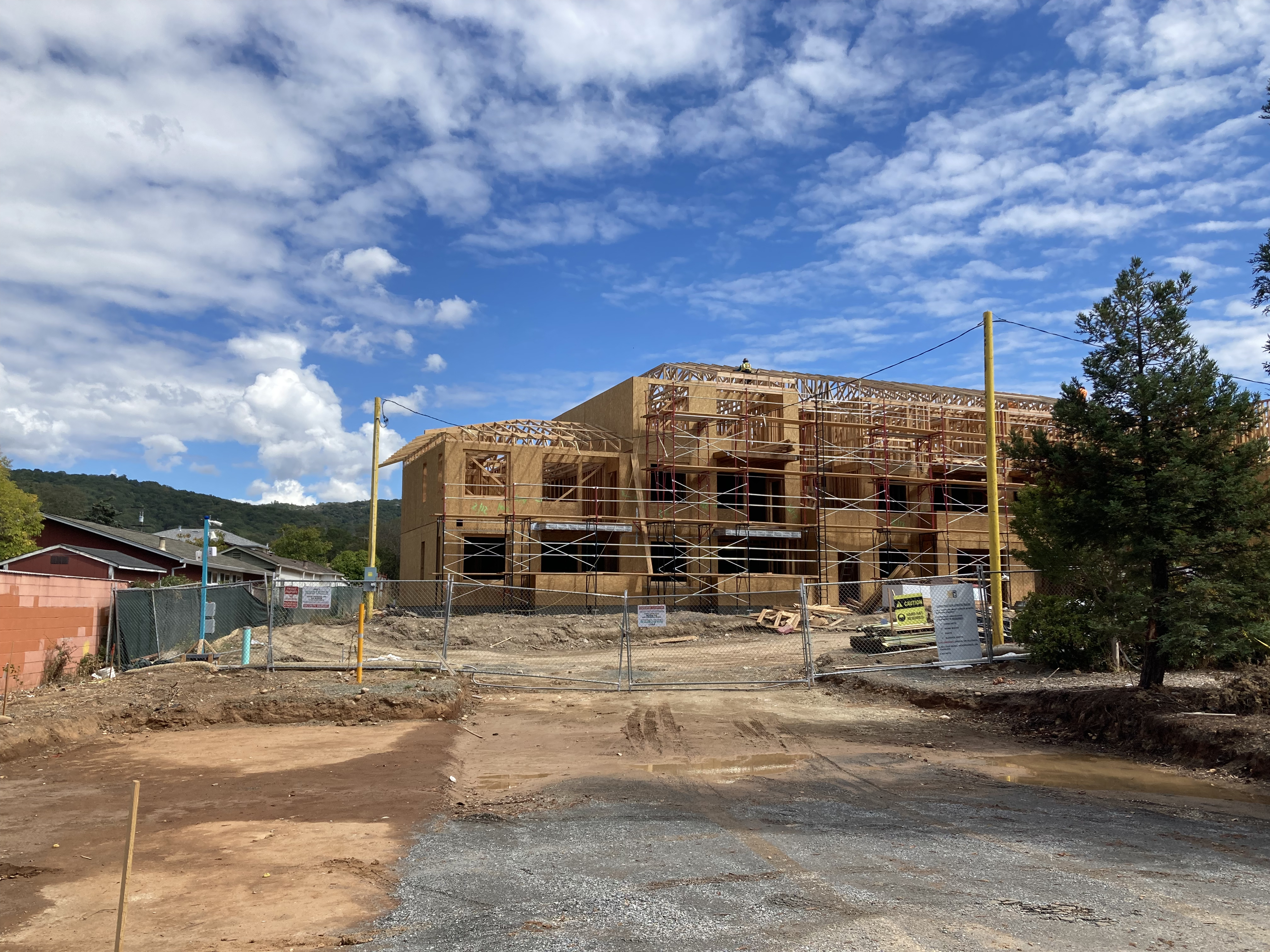
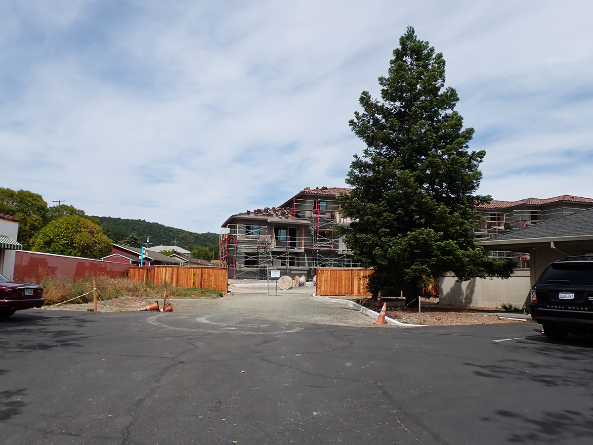
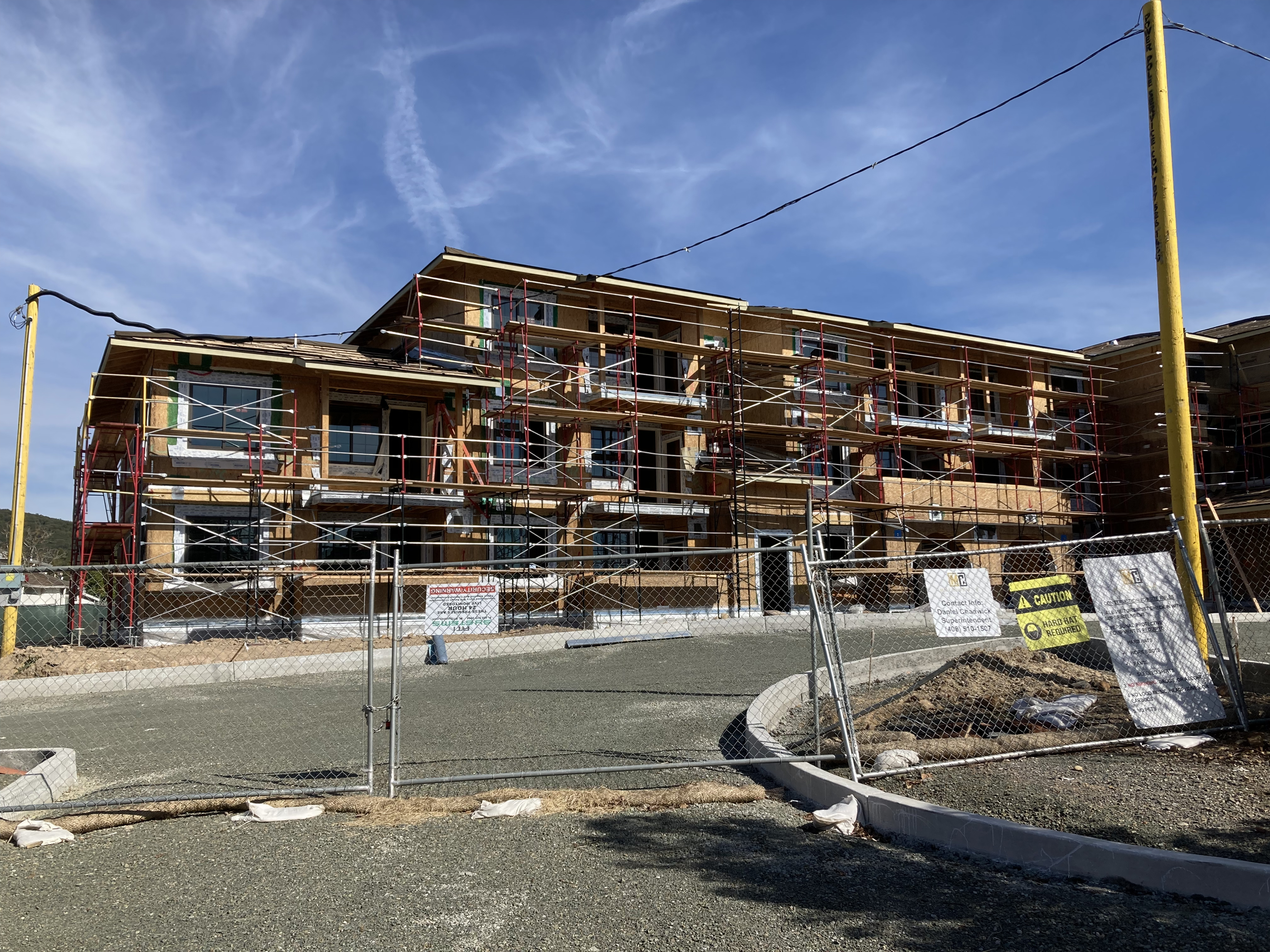
The property behind the Arroyo Vet building continued as a trailer park until 2020 when affordable developer Milestone Housing (https://milestonehousing.com/projects/) bought the land. In 2022 they started construction on a 92 unit apartment complex intended for senior households that have incomes in the 30 to 60 per cent of area median income. In May of 2023 construction is ongoing. See photos below.
In 1977, on part of the Farrell’s site facing the highway, Stan Goldsmith built a commercial building to house his Mark’s Sporting Goods. Goldsmith owned the whole property and told the Index Tribune that “…future plans at the 1.5 acre site include similar buildings housing quality small shops and possibly a patio restaurant.”
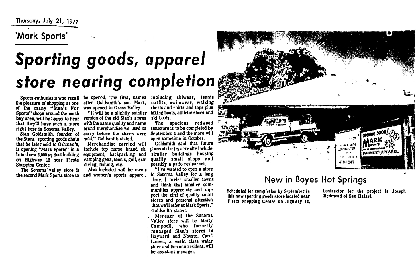
Goldsmith had founded a successful chain of sporting goods stores, located throughout California, which he sold before moving to Boyes Hot Springs. According to some of his ad copy, “In 1954 Stan Goldsmith revolutionized the retail sporting goods business by building the largest sport store in northern California (10,000 sq ft.) and becoming the first to combine active sportswear with sports equipment…Stan Goldsmith founded the Marin Skin Divers Club, the Northwoods Bowmen’s Club and designed the first nylon covered sleeping bag. Stan’s and the first air compressor to fill dive tanks in Northern California.” Index Tribune advertisement, 1979.
Mark’s Sporting Goods in Boyes Hot Springs, named after Stan’s son, opened in 1977. It was the second Mark’s. the first one was in Grass Valley, in an identical building.
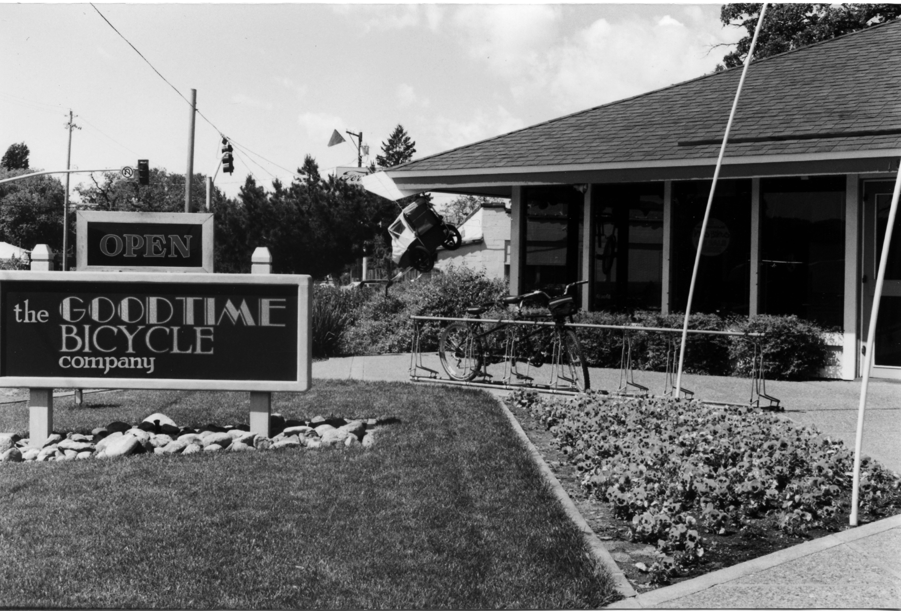
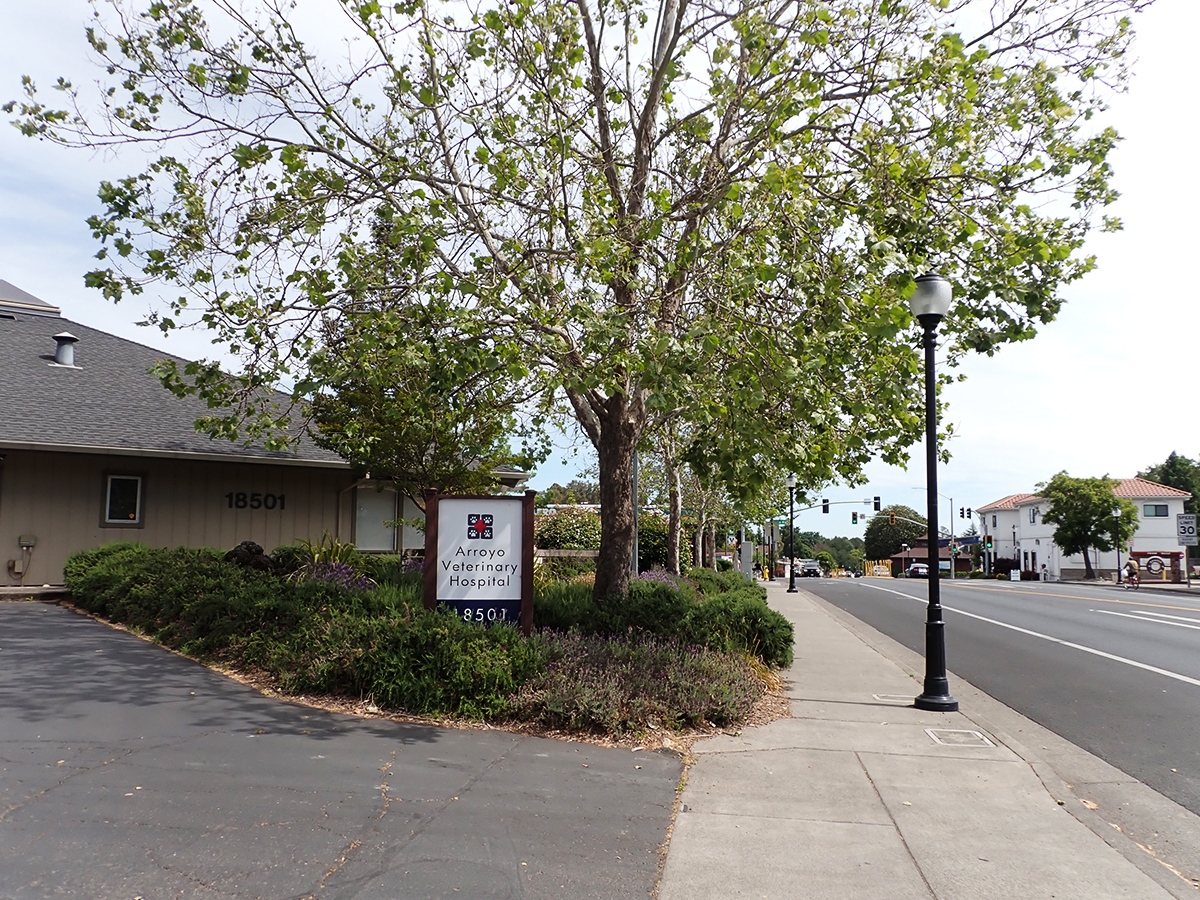
Tragically, Stan was killed in the crash of his private plane in 1982. His widow sold and the store continued operating until 1990, when Doug McKesson bought the building, but not the entire parcel, to house his Goodtime Bicycle Company. McKesson sold to Dr. Rhonda Stallings and Rich Lee in 2000. A major remodel was necessary to convert the space. The new Arroyo veterinary Hospital opened in 2001.
1990s
2023
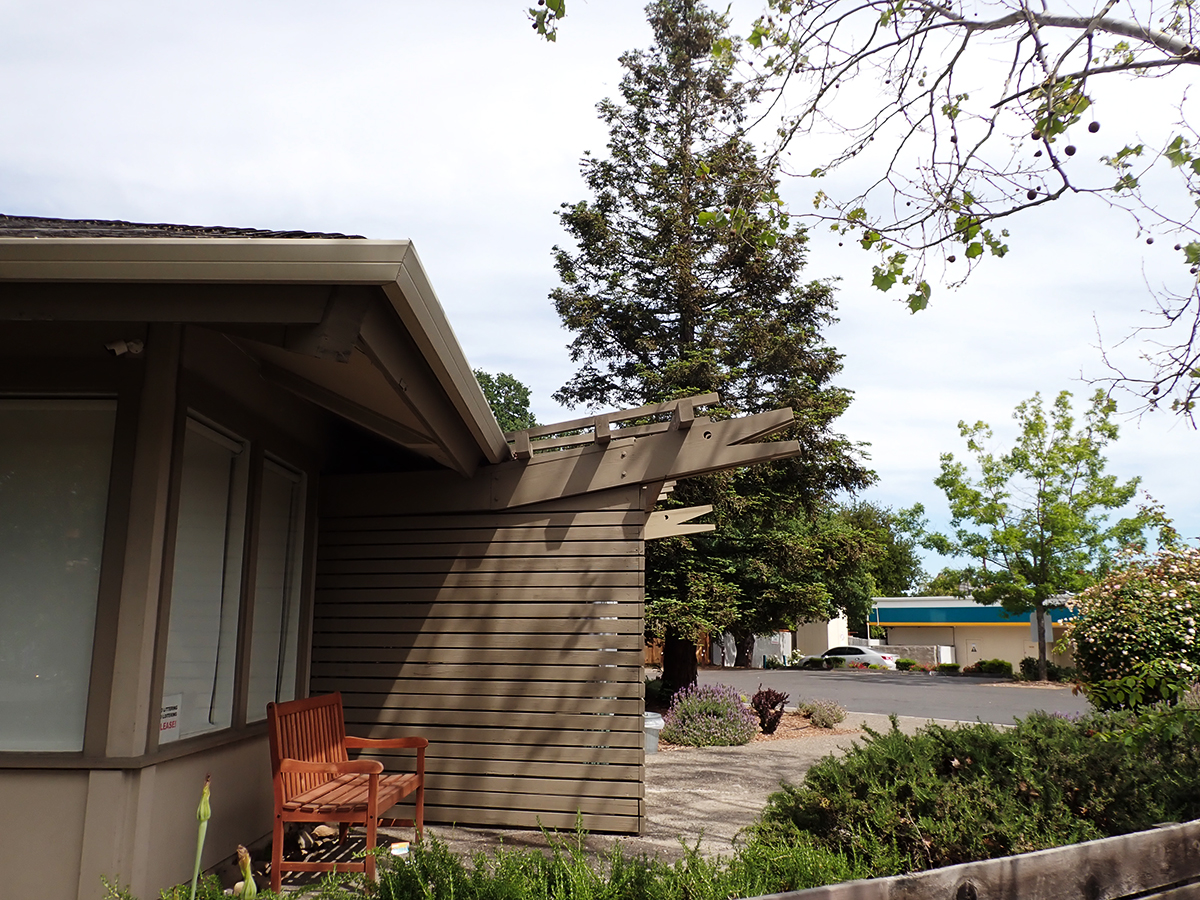
Appropriate, whimsical rafter-tails were added during the conversion to an animal hospital.
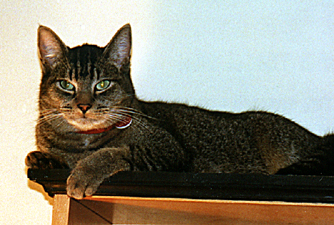
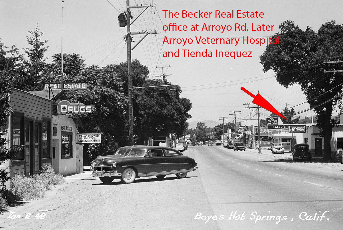
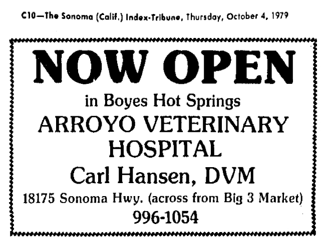
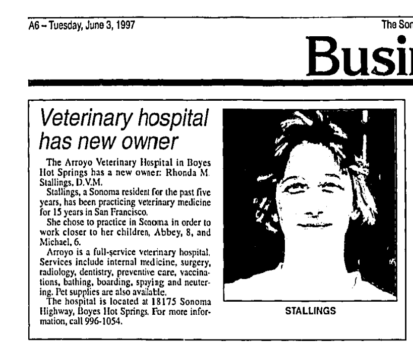
Digression the First: The original Arroyo Vet Hospital was started by Dr. Hansen 1979, in a building on Sonoma Highway at Arroyo Rd, which was probably built in the 1920s, and had housed various businesses including Becker’s Real Estate Agency. Dr. Rhonda Stallings took over from Dr. Hansen in 1997, the same year your correspondent moved into a house just a block up Arroyo Road. Imagine our sense of security knowing we could WALK our sick cat to the vet’s office. And thank you to Rhonda for saving Ralph’s life.
1950s
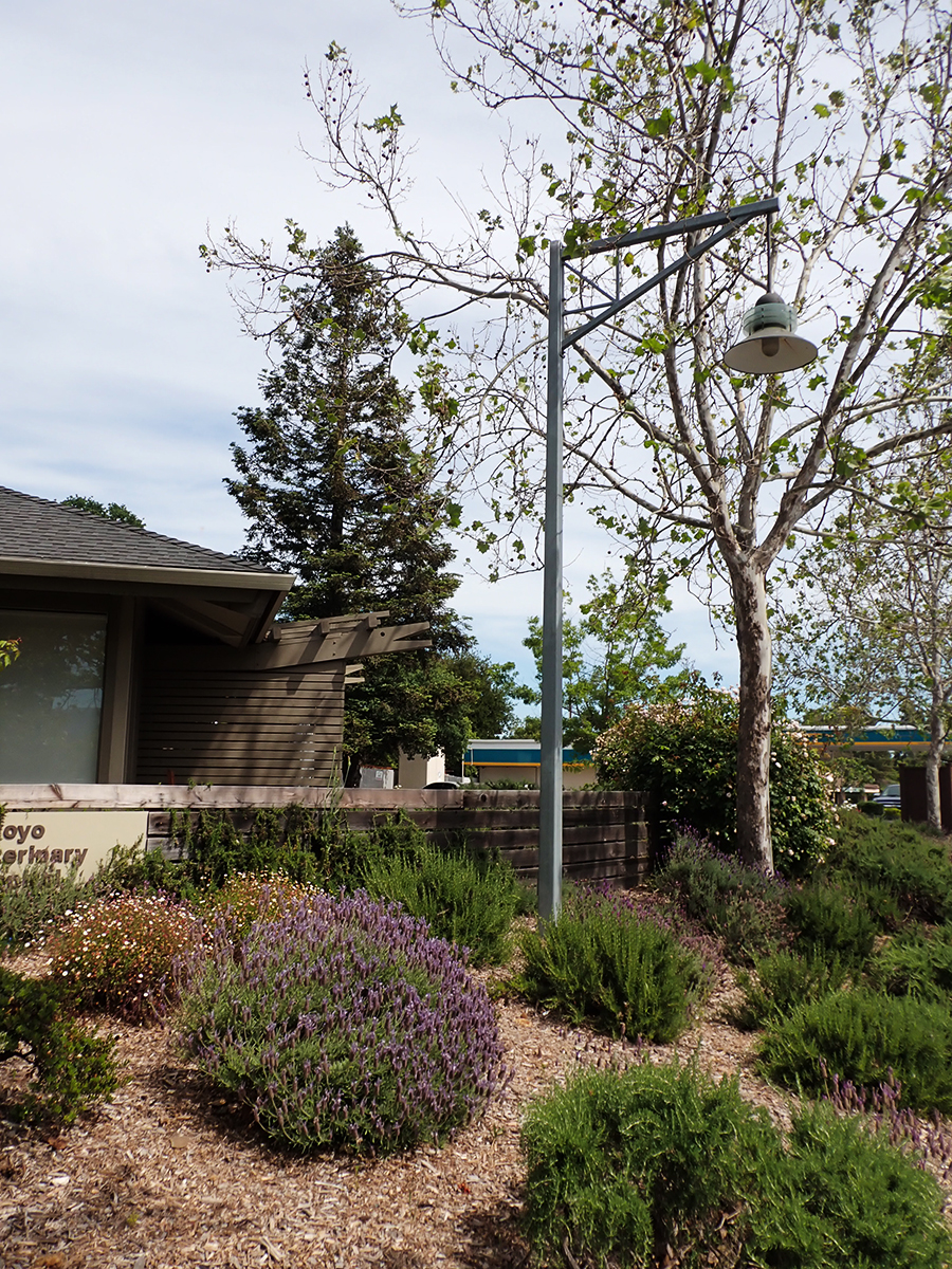
Digression the Second: The photo below shows a streetlight proposed for the Redevelopment sidewalk project. This was offered by landscape architect Ron Wellander and installed in 1997. The design was not used. It stands today, in 2023, lonely, unlit.
The first hearings for the sidewalk project were held in 1984. The initial pilot project was completed in 2002. The entire project, two miles of sidewalks and streetlights, was finished (except for one very irritating and dangerous gap) in 2016. Thirty. two. years.
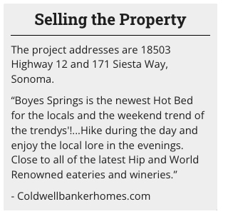
I can’t resist sharing this text from a Coldwell Banker website. The addresses represent the apartment site.
Please stay tuned to the Springs Museum. We aim to bring you all the best in local lore!
Thanks to Rich Lee and Doug McKesson for their memories
Index Tribune courtesy of the Sonoma Valley Historical Society
Zan postcard courtesy of Stanford University Library, Special Collections
UPDATE, September 17, 2023
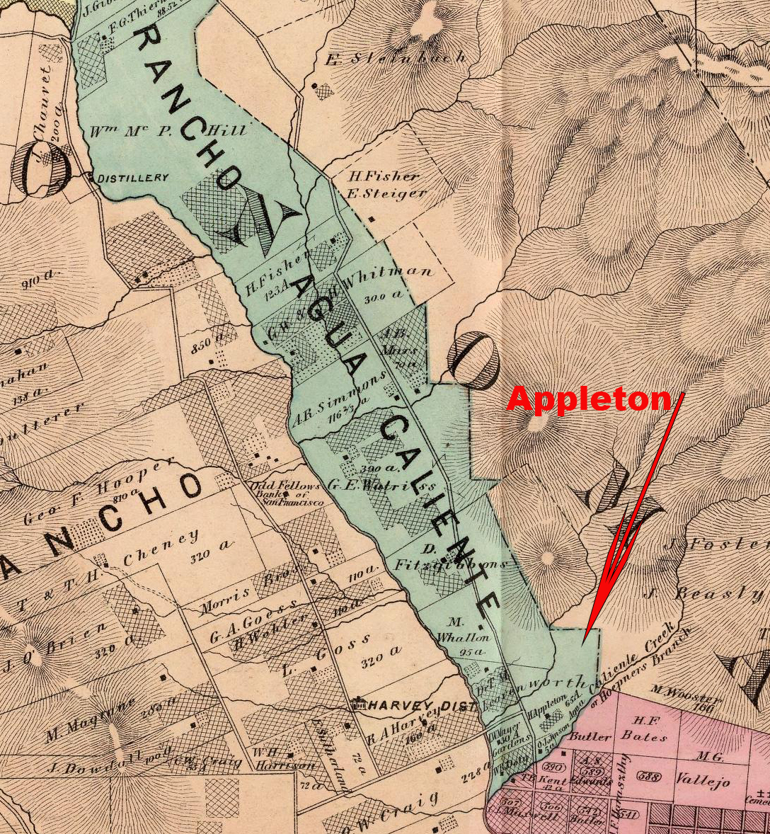
According to Mrs. Mary Farrell’s obituary in the Index Tribune in January of 1956, her resort was “part of the former Appleton ranch.” Before Appleton, a certain ”Mrs. Loud came to California in 1864…Her husband was Alfred C. Loud, who settled on what was afterward the Appleton ranch.” Index Tribune of Jan 14,1922 obit of Mrs. Loud.
In the 1975 obituary for Appleton’s daughter, the renowned Carrie Burlingame, Horatio Appleton established his ranch “in the Springs area in 1865.” He was “a pioneer vineyardist and a descendant of the Greenleaf and Adams families of New England.” He was instrumental in identifying the Phylloxera louse that decimated American vineyards in the 19th century.
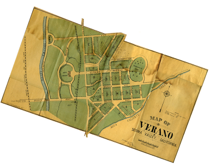
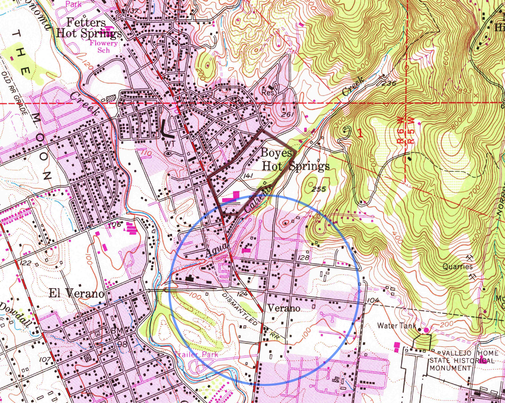
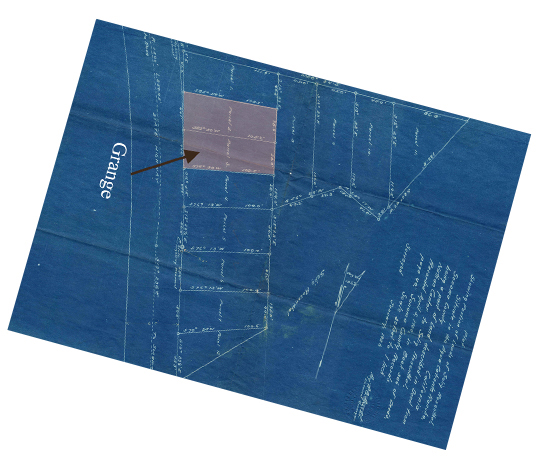
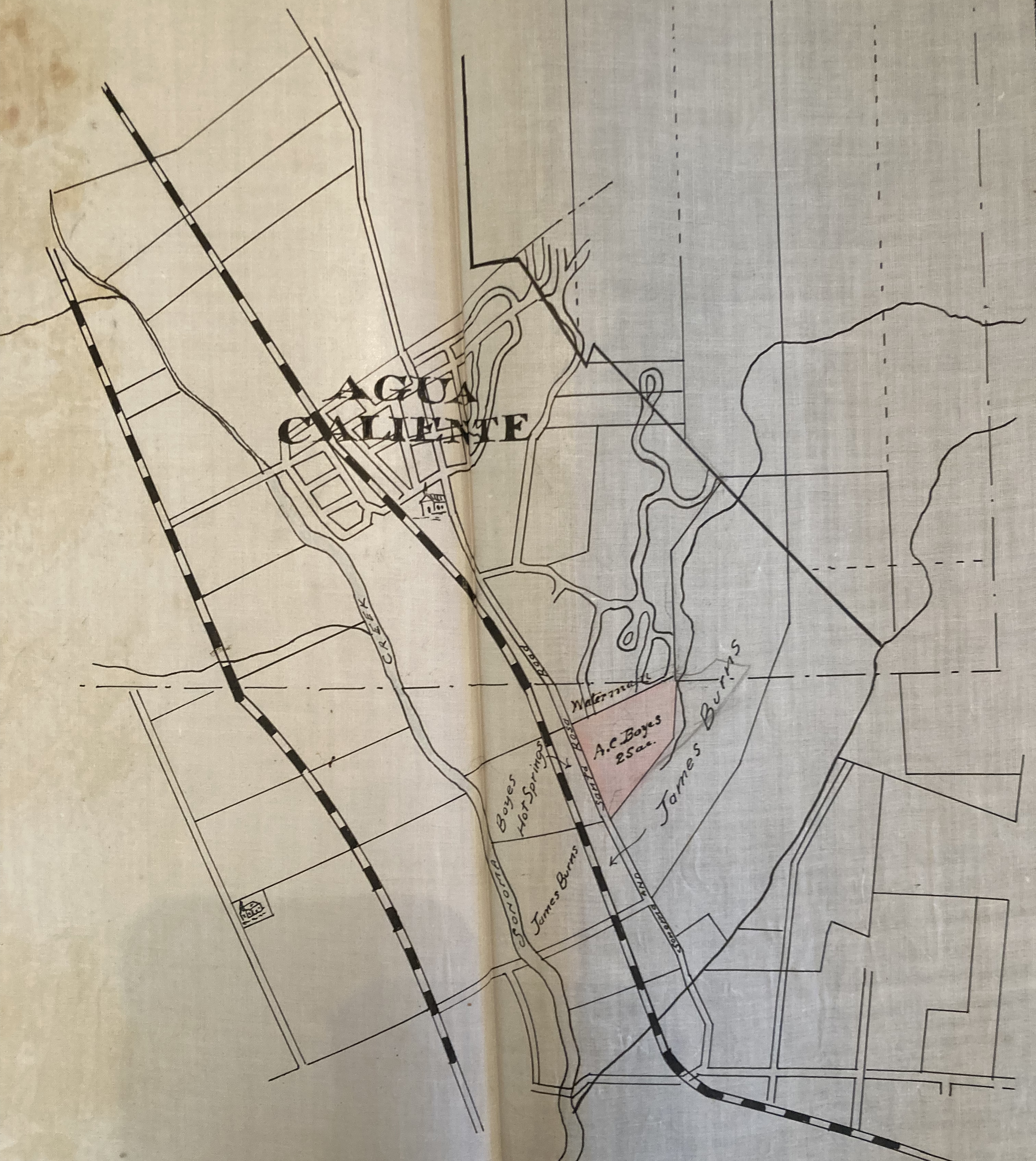
Appleton appears as a property owner on the Reynolds and Proctor maps of 1877 (65 acres) and 1889 (160 acres). (See below). According to the Index Tribune, in 1888: “Several new town sites have been laid out and surveyed in this valley the past few months…Verano is …another new town site which has lately been laid off on the Appleton and Burns places…” (see Boyes abstract map). Parts of the town of Verano (not El Verano), were later owned by Nathan Cantor and Selig Rosenthal. Some of this became the Acacia Grove mobile home park with a carve-out for the Grange in 1934. Read more about Rosenthal, et al, here.
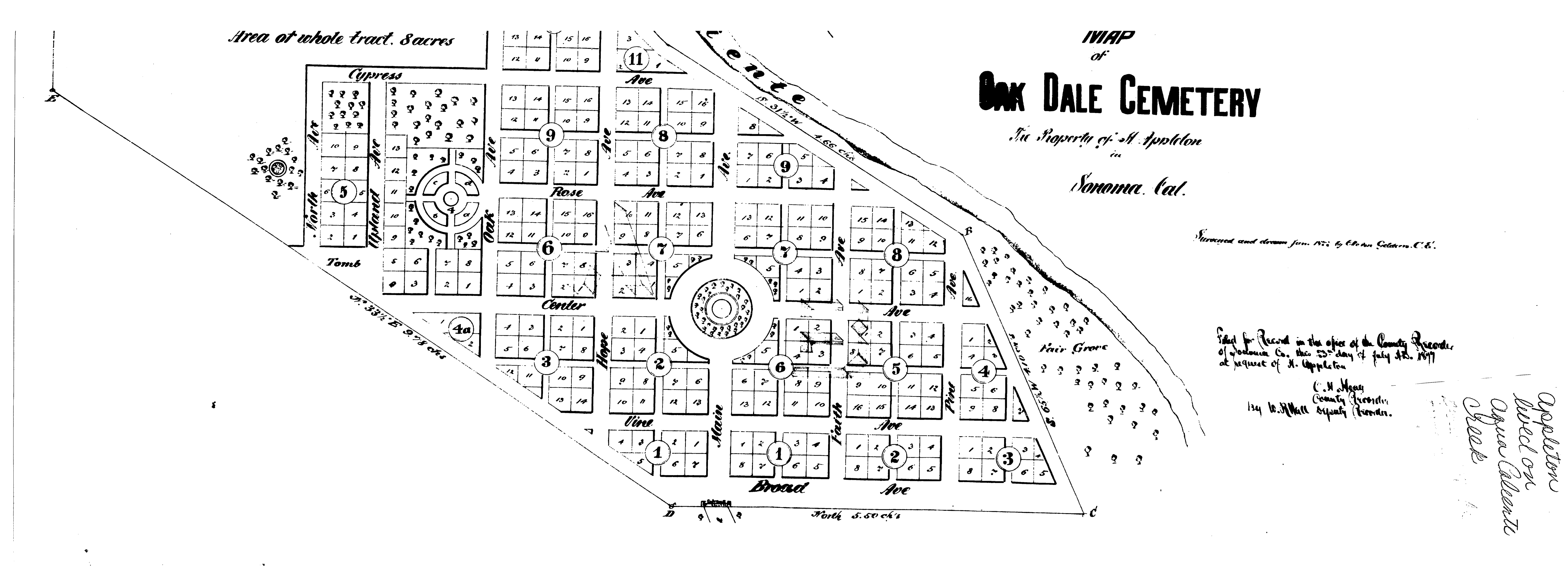
in 1877 Horatio Appleton published a plat of a cemetery on part of his land. (see below)
Thanks to the Sonoma Valley Historical Society, for everything, really, and to the Rumsey Map Collection.
