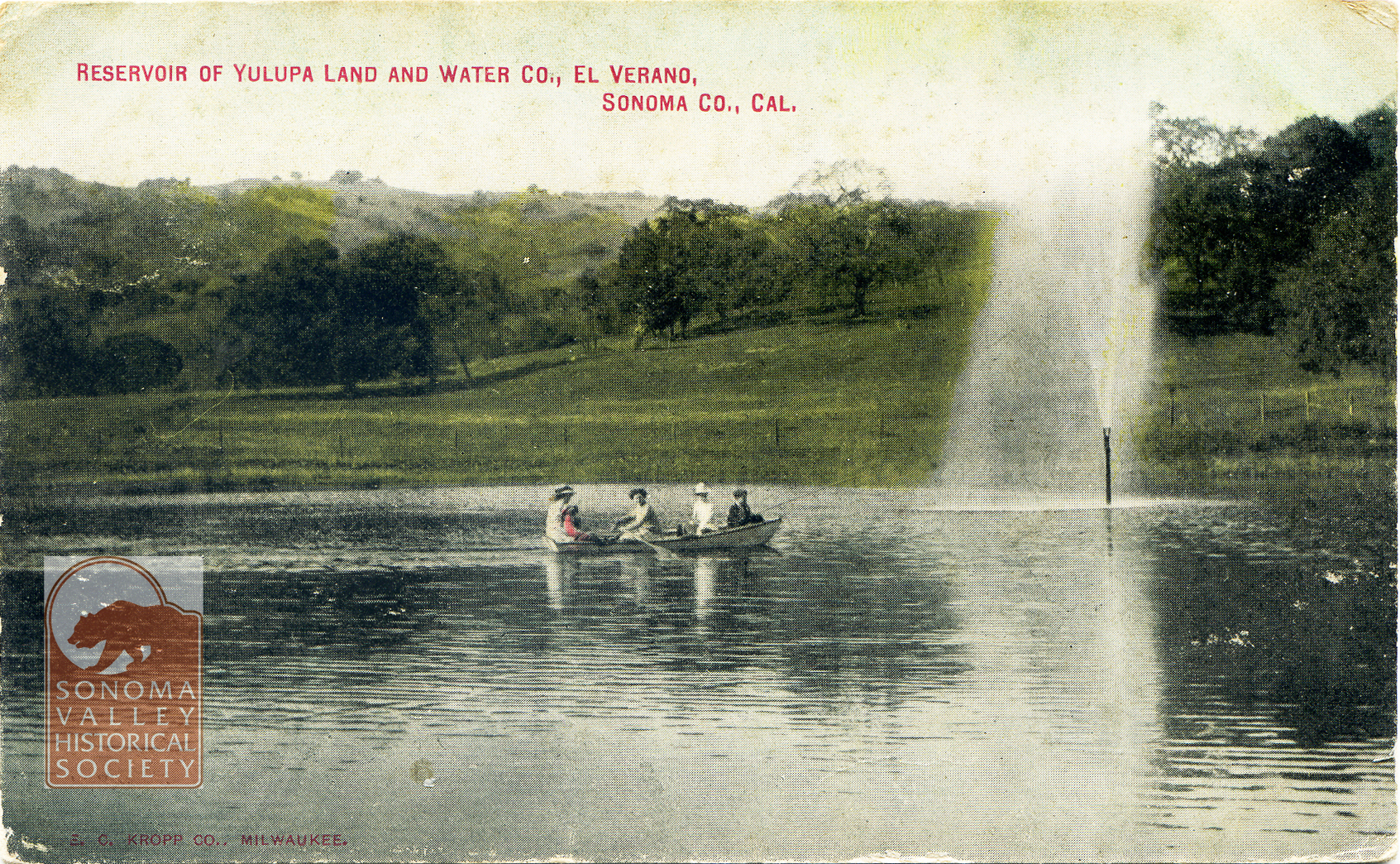
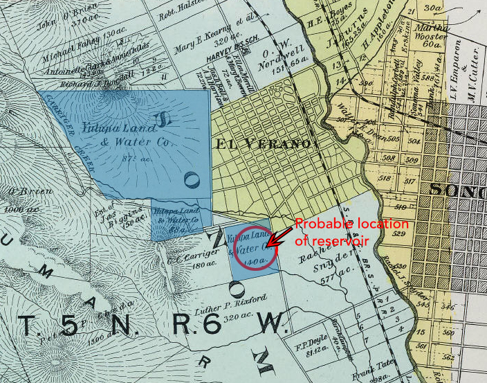
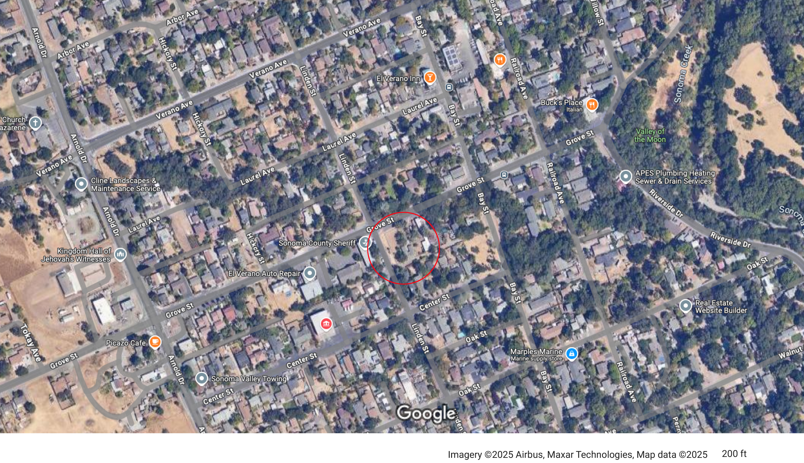
Post marked 1910. The Yulupa Land and Water Company holdings appear on an 1898 Reynolds and Proctor map (Rumsey Collection).
Judging by the hills in the background in the post card, the reservoir was probably located near the corner of Grove and Linden Streets.
In 1910, the Sonoma Valley Water, Light and Power Company acquired the Yulupa Land and Water Company.
1913- “J.A. Dinsella, the enterprising plumber of this city, has secured a contract from Sonoma Vista Land Co. near this city, to build its pipeline of 4-inch mains and 2-inch laterals.”
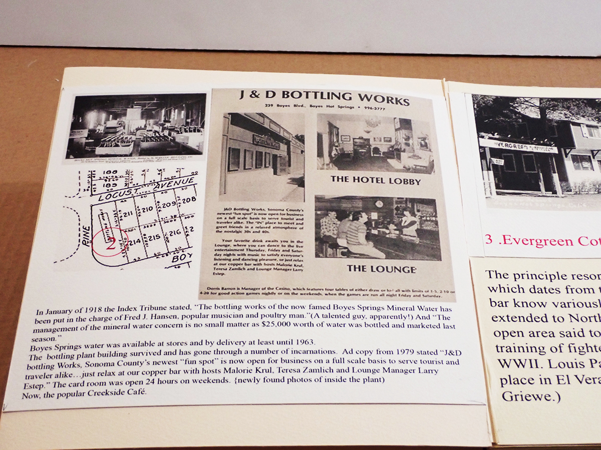
In 1923 J.W. Minges sold his Boyes Springs Water System, which mainly served Woodleaf Park, to N.M. Peterson, proprietor of the Mountain Water Avenue system. The merger “will enable the operating company to give better service…” even then that was the rationale!
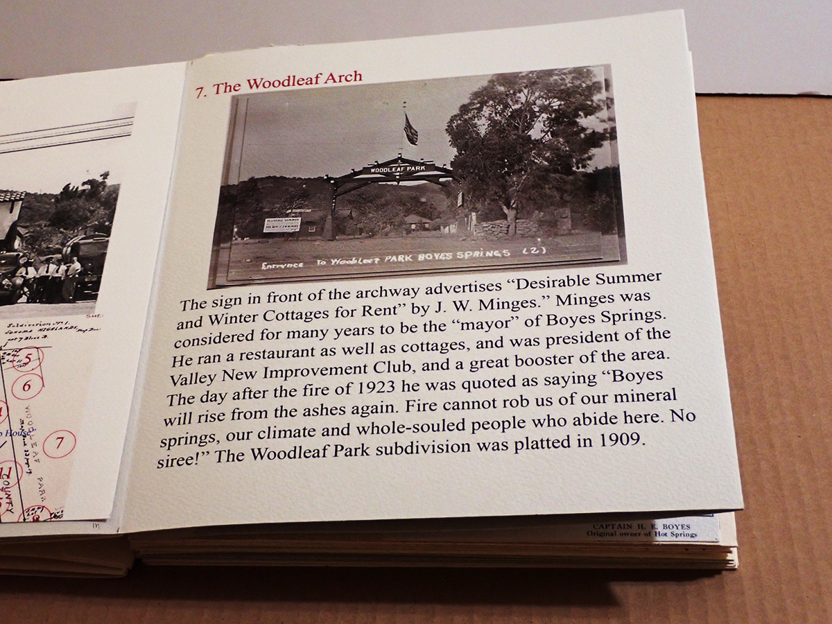
J.W. Minges was known as the “mayor” of Boyes Hot Springs.
“Another company at Boyes Springs which has supplied many customers in the vicinity of the hotel and Boyes Springs Park is owned and operated by James Baines.” of Baines St.
1958-Mountain Ave. Water Co. was sold to Mr. and Mrs Peterson Jr. whose parents had bought from Minges. The Petersons’ company served Boyes Hot Springs for 35 years. Improvements included an office building at 18640 Highland (An address that cannot exist, apparently, as the street ends at 18075), and a new tank at the top of Mountain Ave. An existing tank is located above Highland, circa 2025.
From the Valley of the Moon Water District website: “In 1957, the Valley of the Moon Fire District was evaluated by the Pacific Fire Board which at that time noticed the lack of a dependable water supply source. Subsequent inquiries of Fire District Board members, J. Udvic. T. Polidori and F. Serres, revealed that many wells in the area were failing due to drops in the groundwater levels in the Valley. Early attempts to have Sonoma County build an aqueduct from Santa Rosa to the Sonoma Water and Irrigation Company failed due to the inability of the latter to deposit a $25,000 cash bond with the County.”
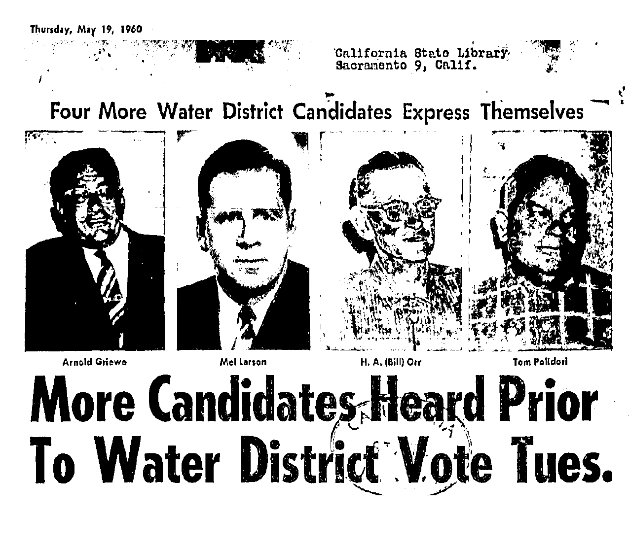
In 1960 voters authorized the establishment of a water district. Candidates for directors at that time were Arnold Griewe, Mel Larson, Bill Orr ,Tom Polidori,Col R. C. Buell, Marin Carlson, A. L. Ford and Nino Vailetti.
“Acquisition of the Sonoma Water and Irrigation Company and the Mountain Avenue Water System was completed in early 1962 and the Valley of the Moon County Water District started management and operation of the systems on June 1, 1962.” VOMD website.
1963-Sonoma Aqueduct dedicated, bringing Coyote Dam water to the valley.
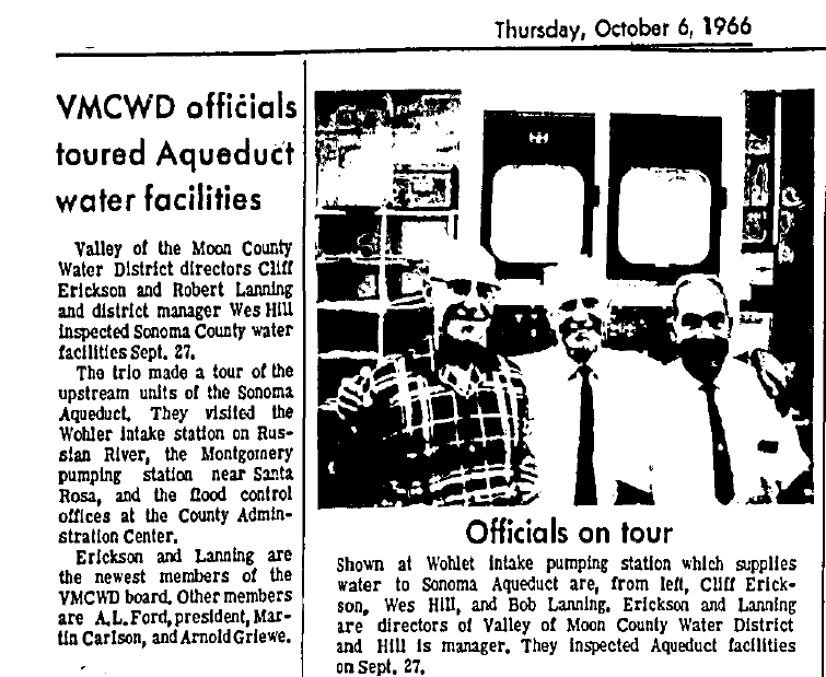
The Water District had new directors Robert Lanning and Cliff Erickson in 1966.
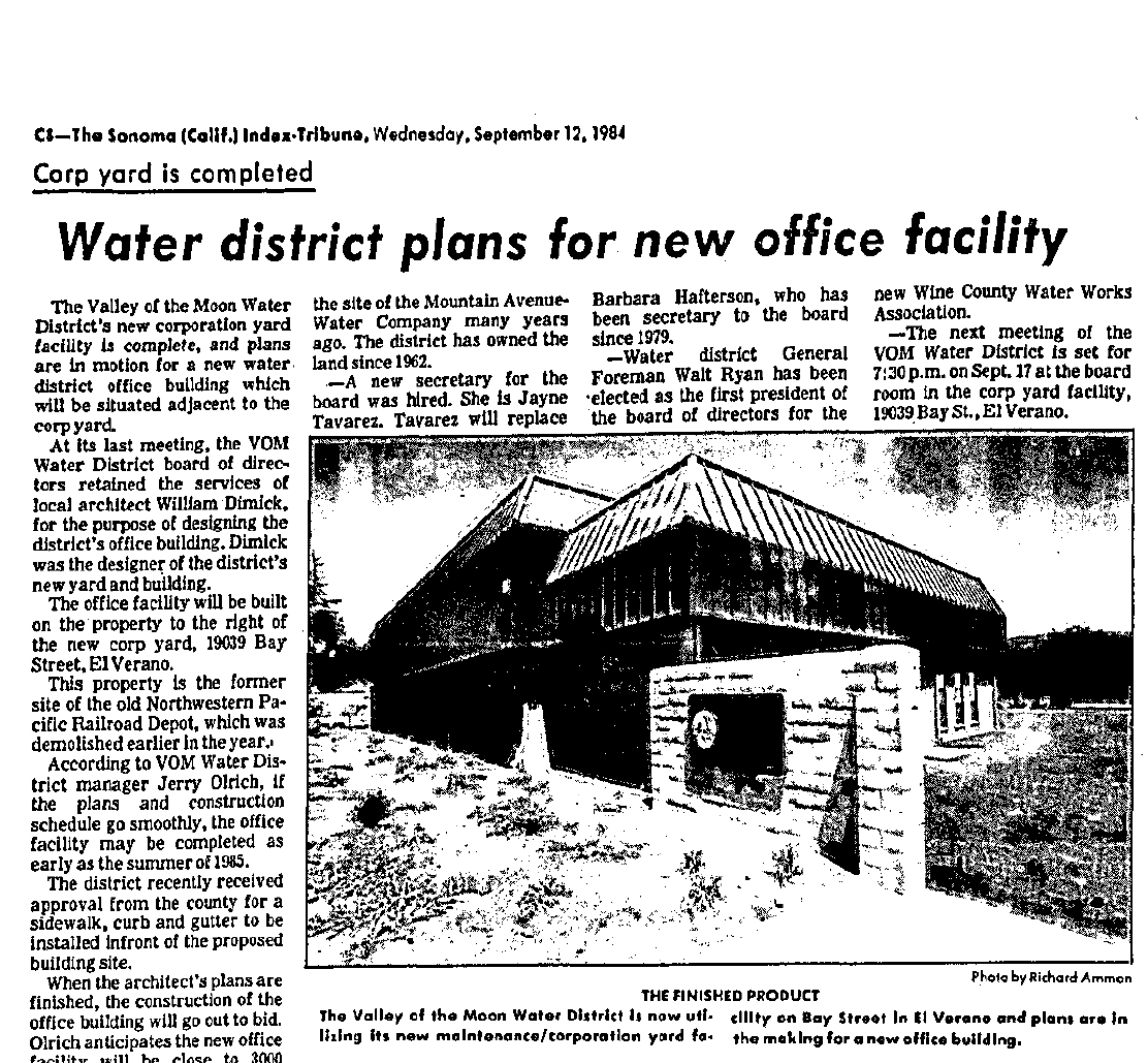
In 1984 a new office building was planned, to be built on the site of the El Verano railroad depot.
Alas!
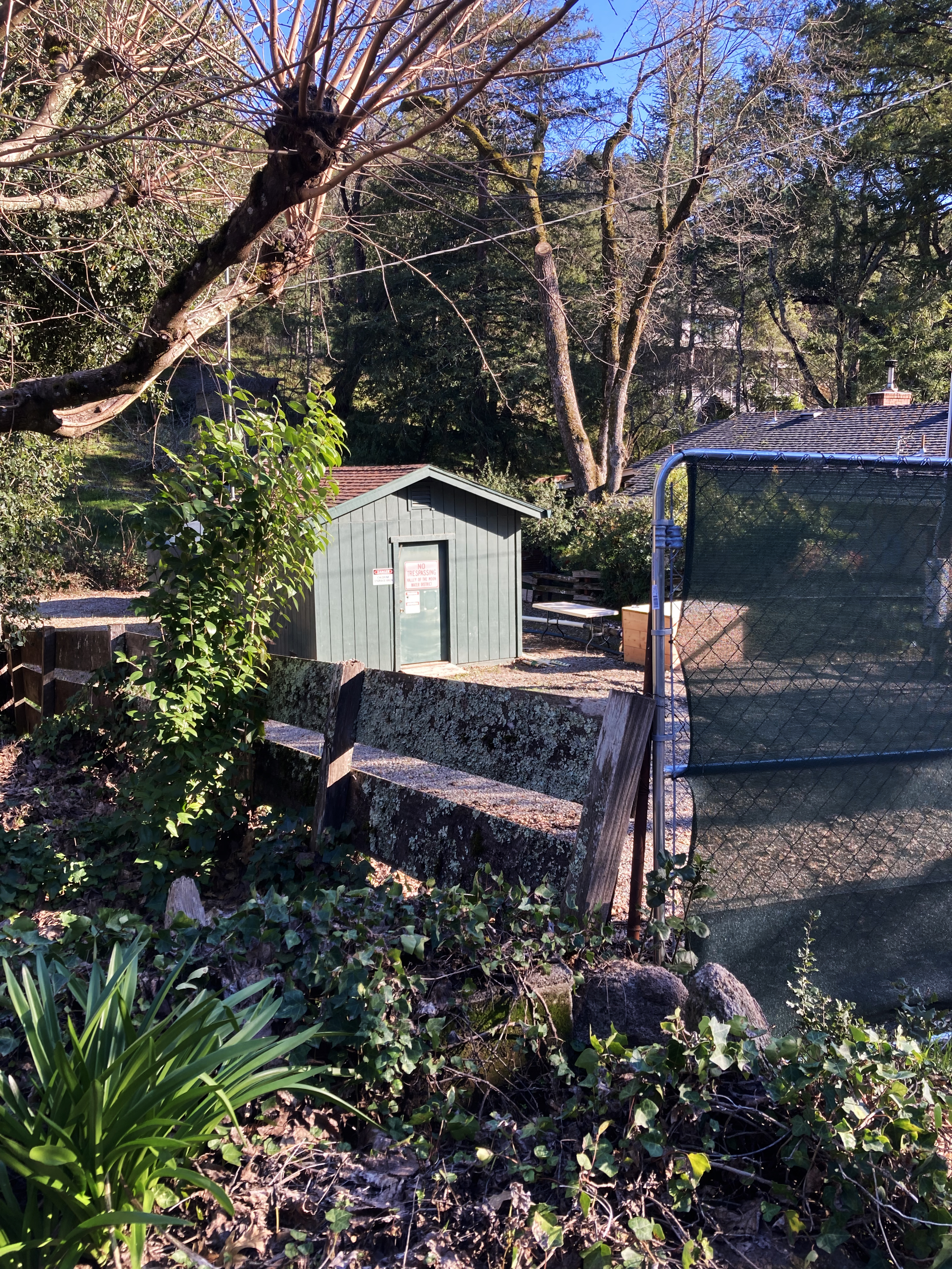
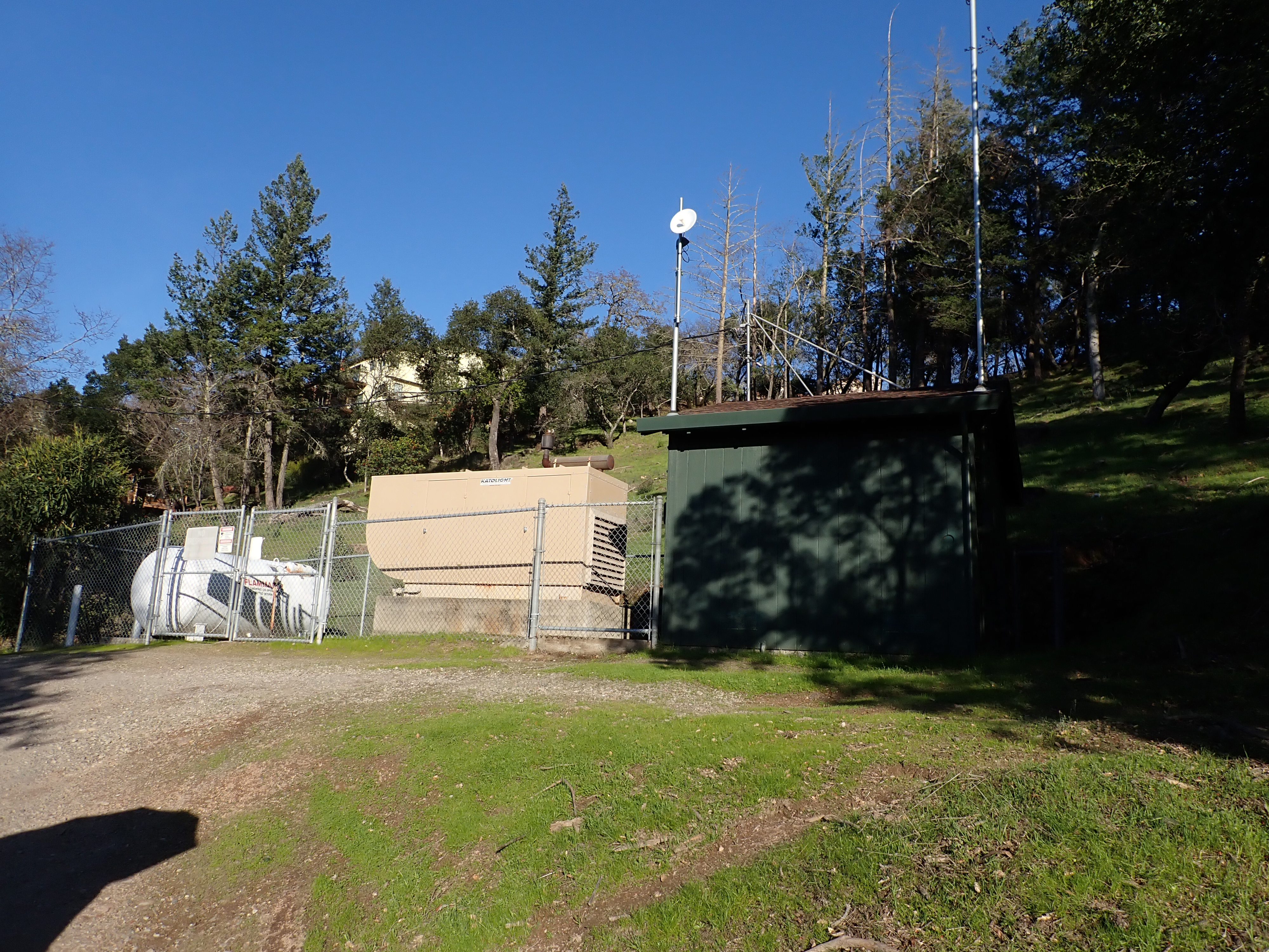
The District still has wells in the Valley.
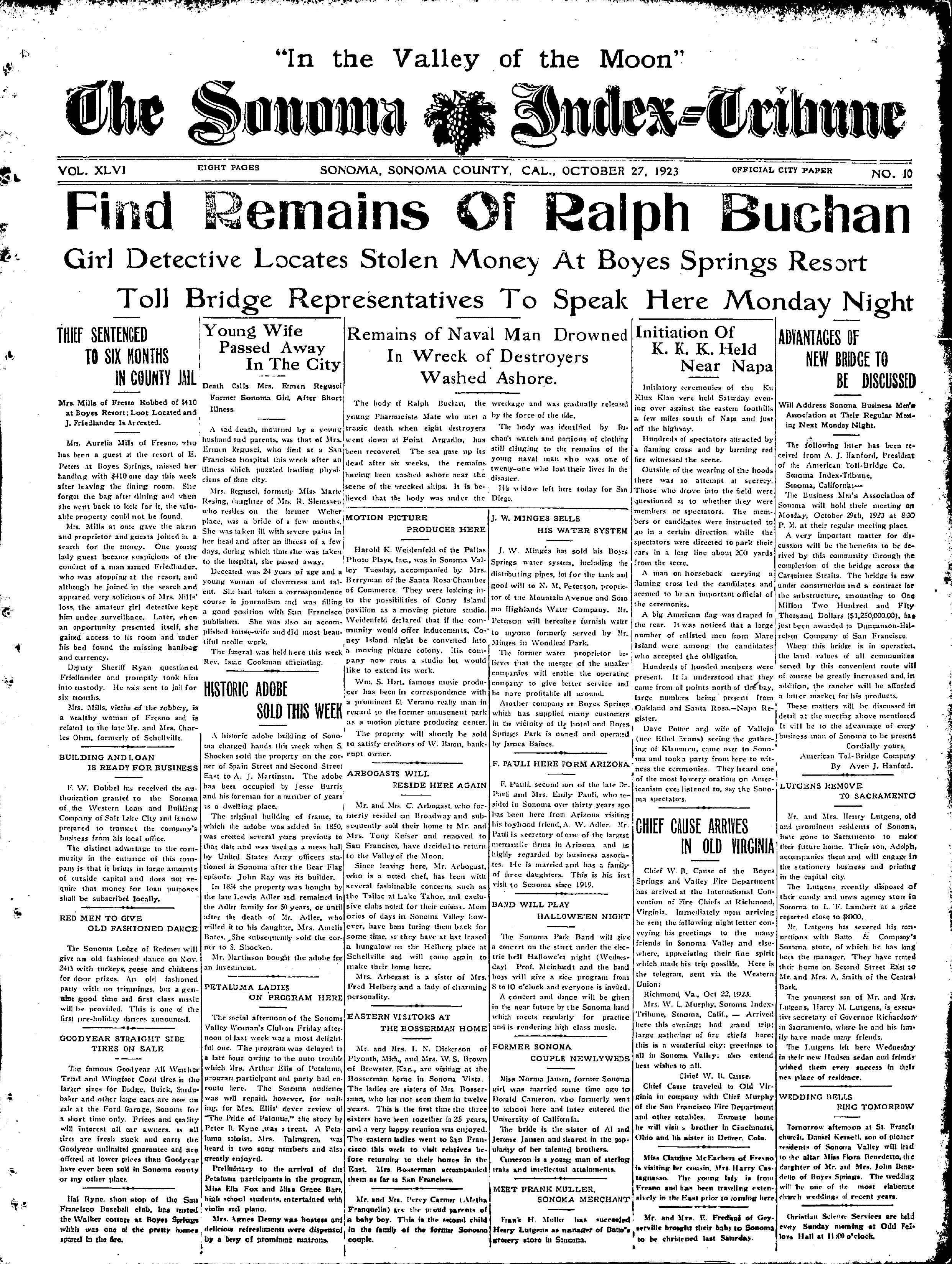
Park Avenue well.Kearney Street well.One comes across many interesting things when looking at old newspapers. Things not relevant to the subject at hand, nonetheless important. This front-page description of a Klan meeting in the Napa Valley is vivid and disturbing, and rings bells that are still reverberating today.
Index Tribune courtesy of the sonoma Valley Historical Society.
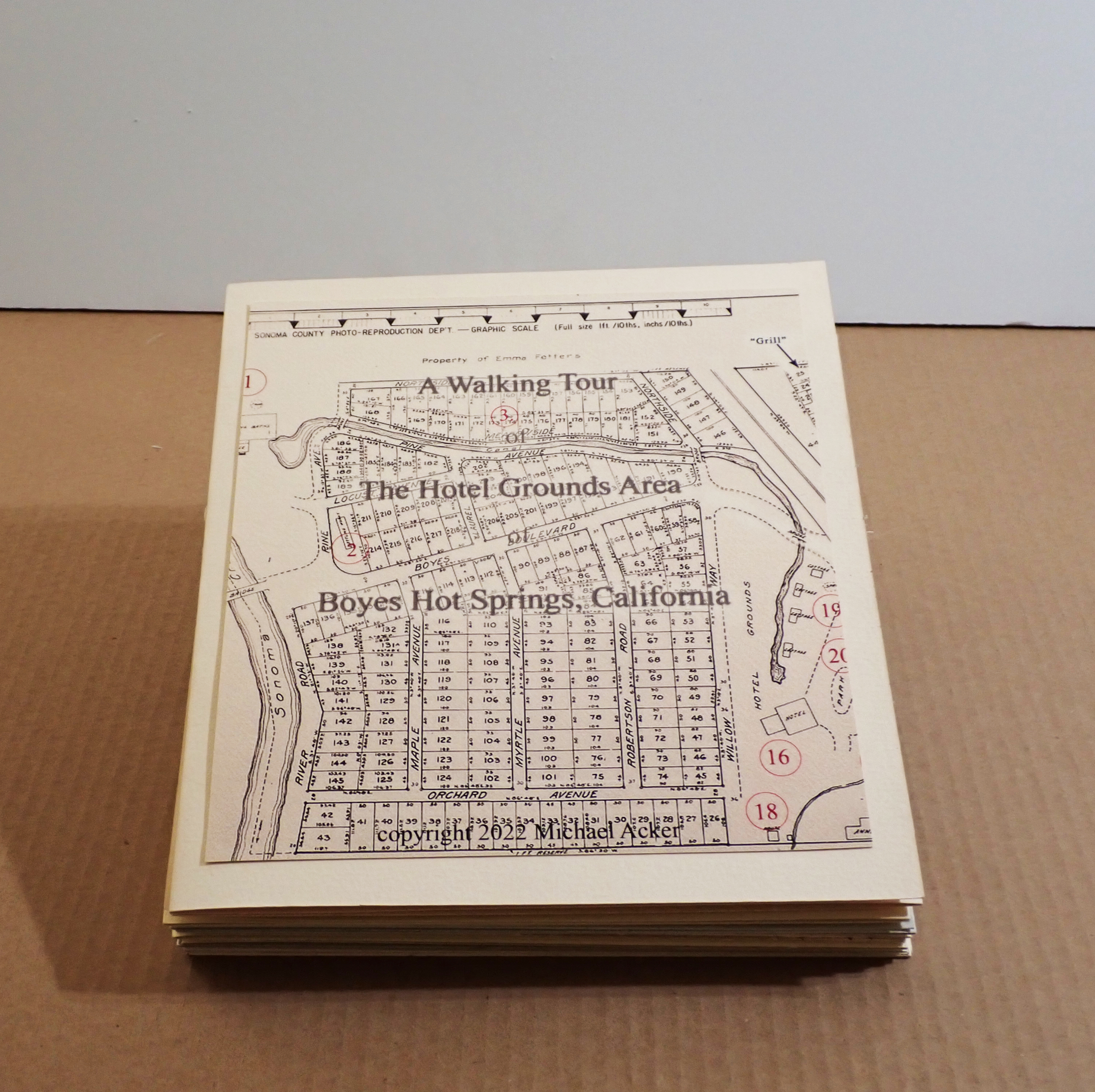
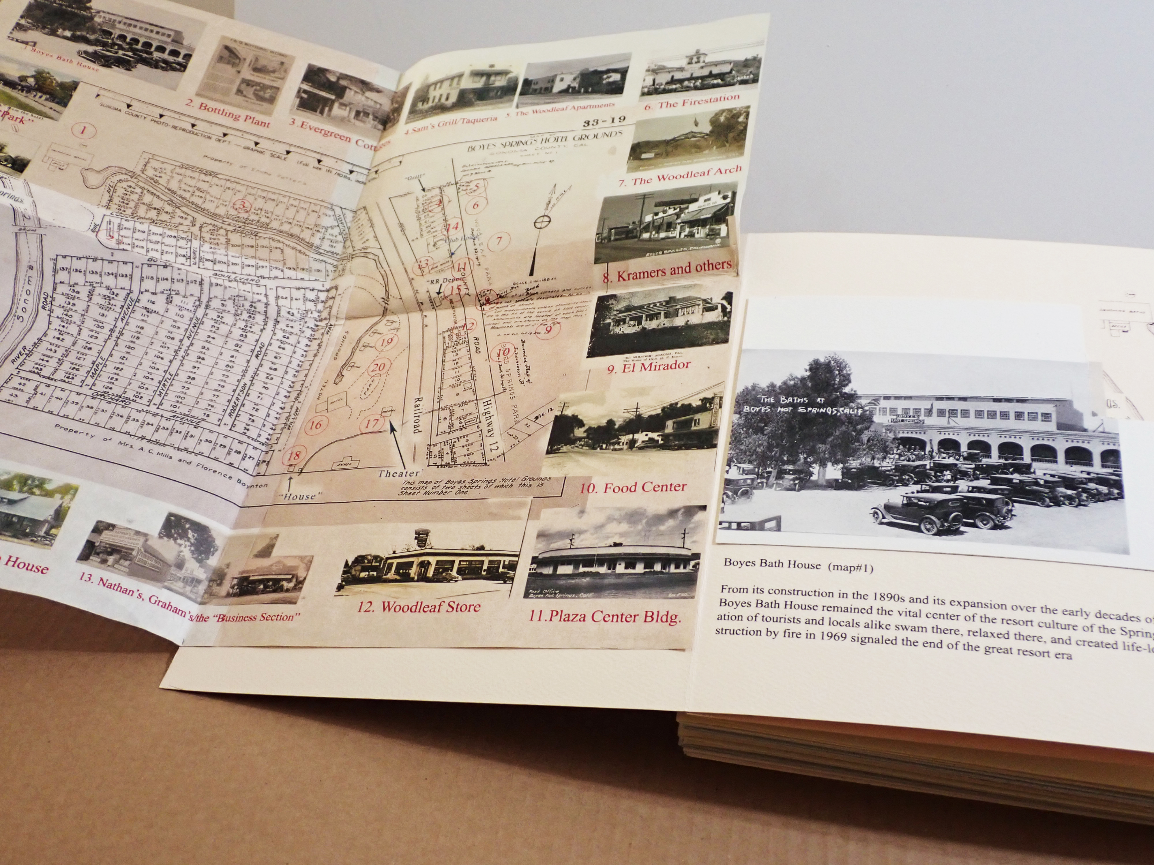
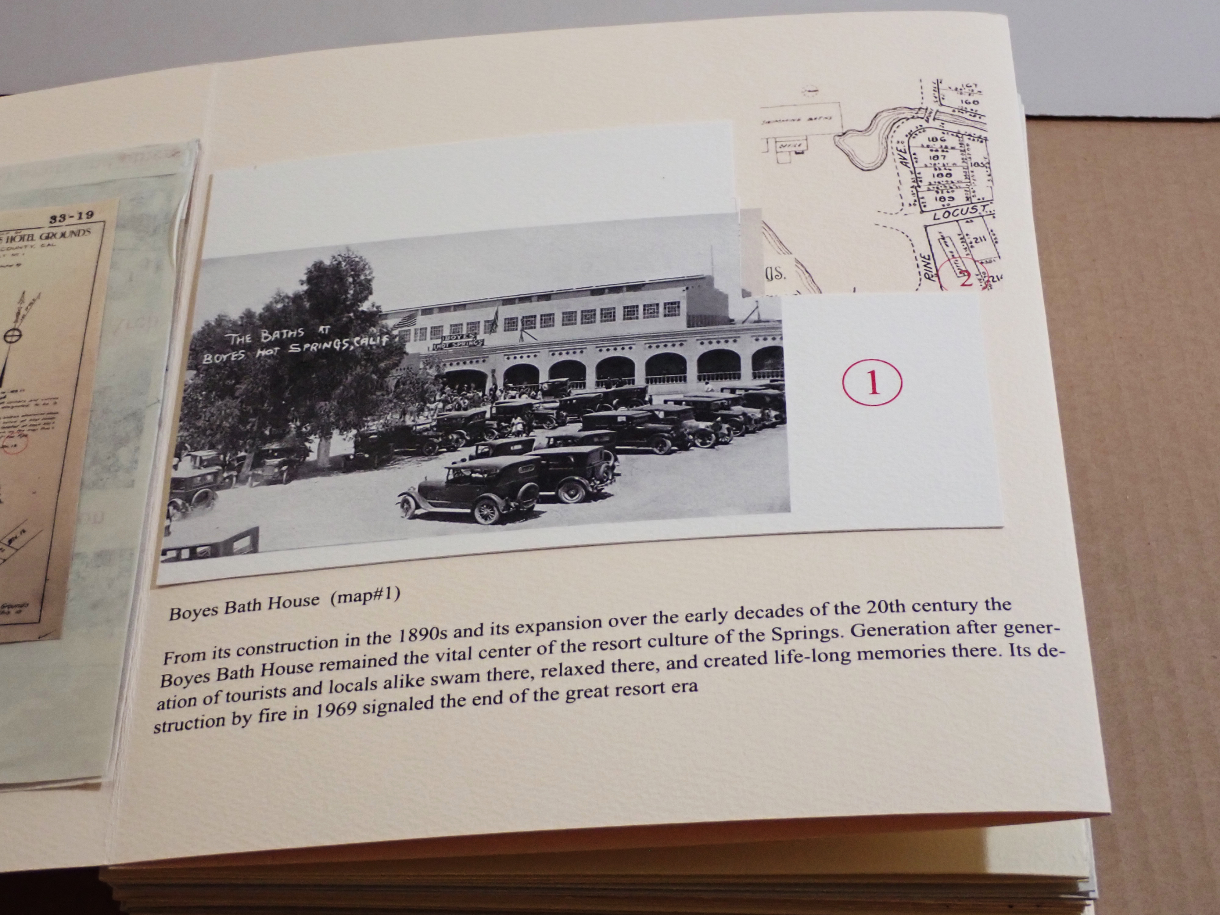
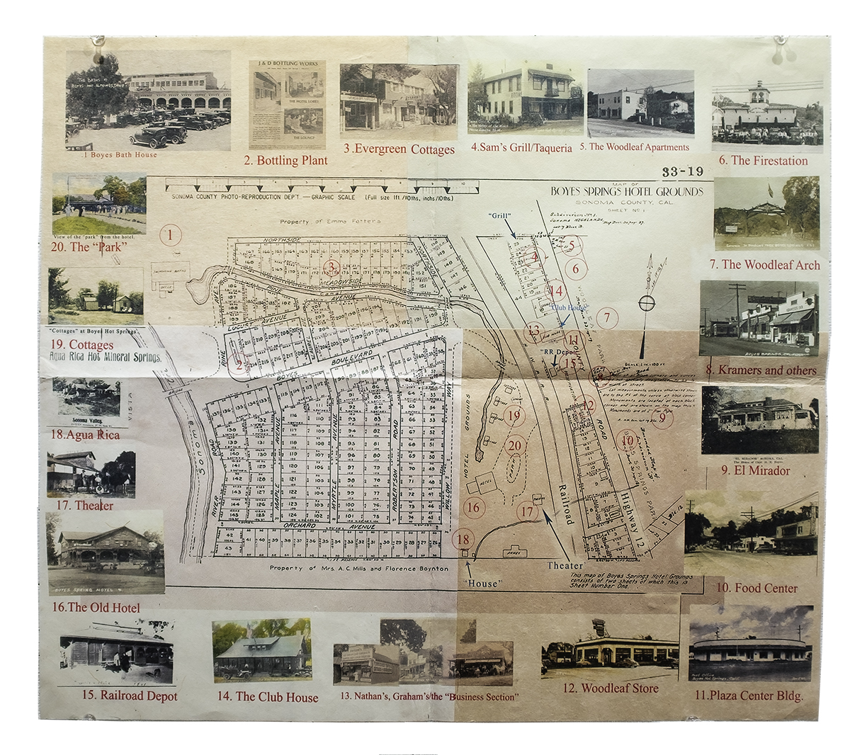
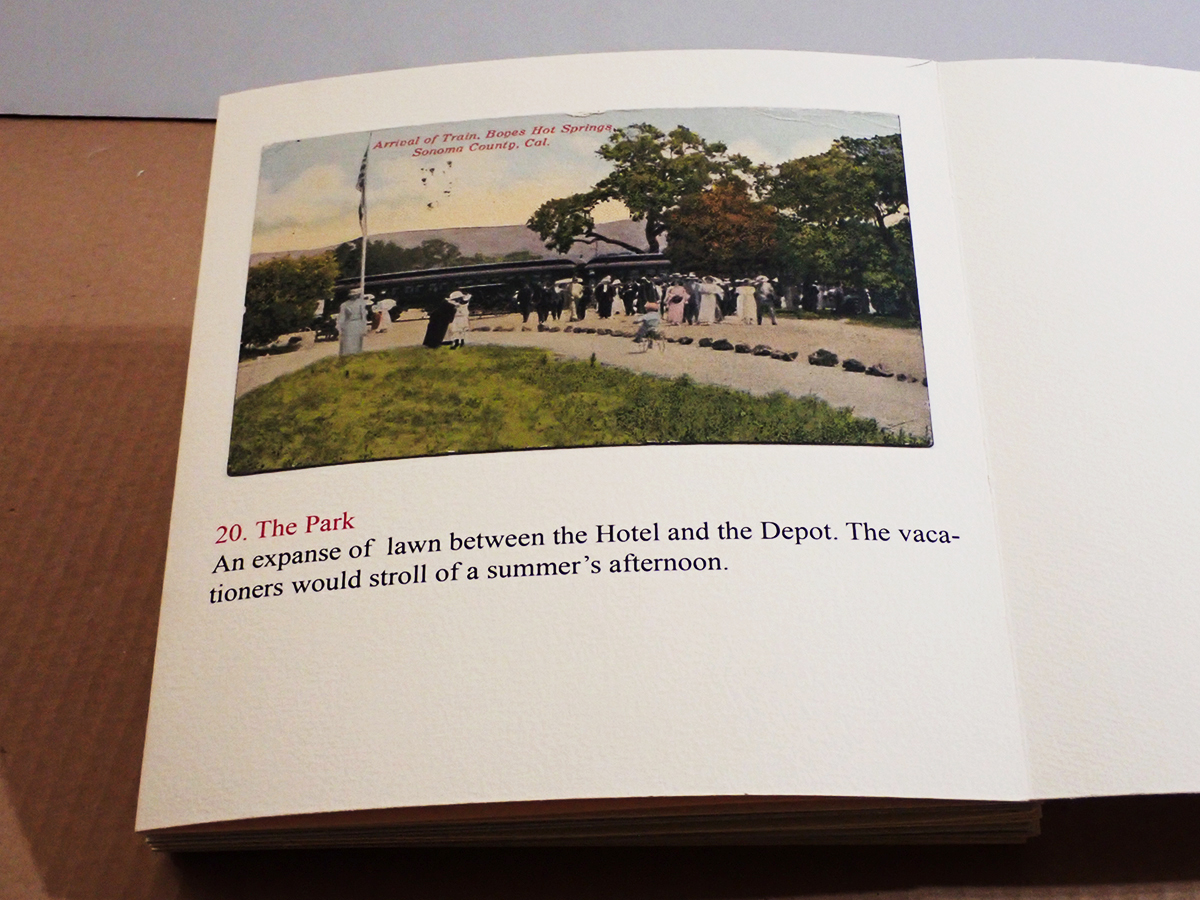
A historic walking tour of Boyes Hot Springs requires a bit of imagination: Many buildings are gone, but they have left traces in the form of photographs and other artifacts, as well as memories. Some day you will be invited to participate, in The Real World, as they say. (Click to enlarge images.)
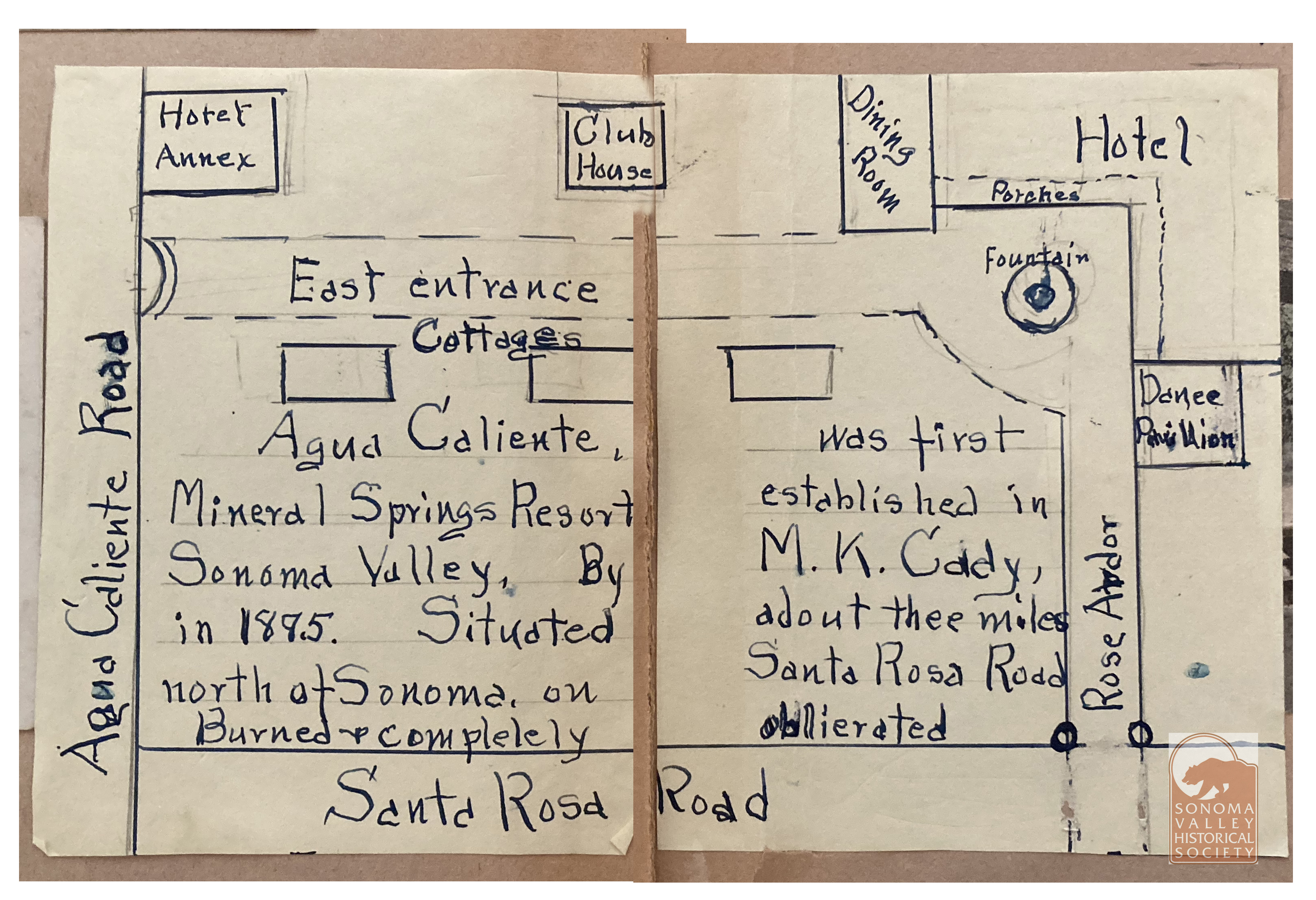
Martin Kellog Cady was born in New London Connecticut in 1847. From the History of New London County, Connecticut (1882), a biographical sketch of the elder Martin K. Cady, who was a prominent businessman in New London in the mid 19th century, listing his children, says “Martin Kellog, eldest son, is assistant coiner at the United States Mint at San Francisco, and has been for some years. He married Jeannie B. daughter of Hon. Charles Gorham, of Marysville, CA.” The book was published in 1882 but must have been written earlier because our M K Cady had left the Mint and settled in Sonoma Valley by 1881.
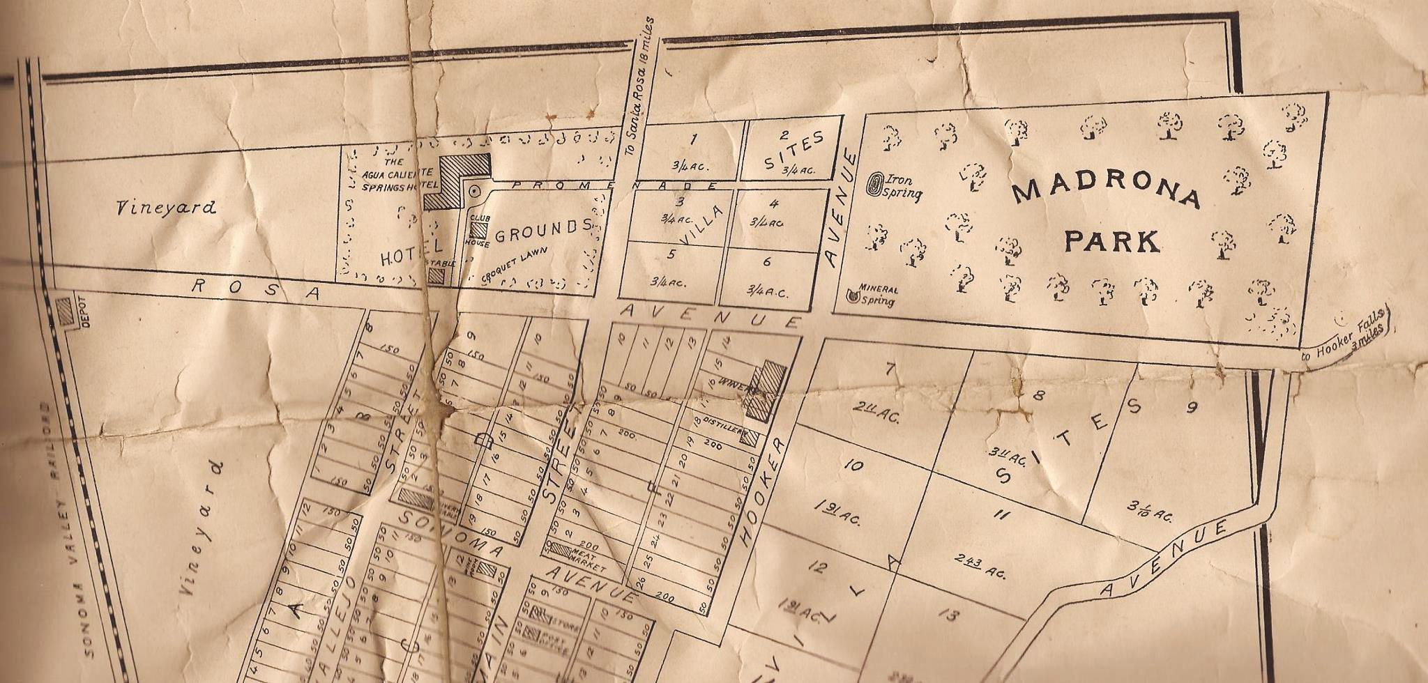
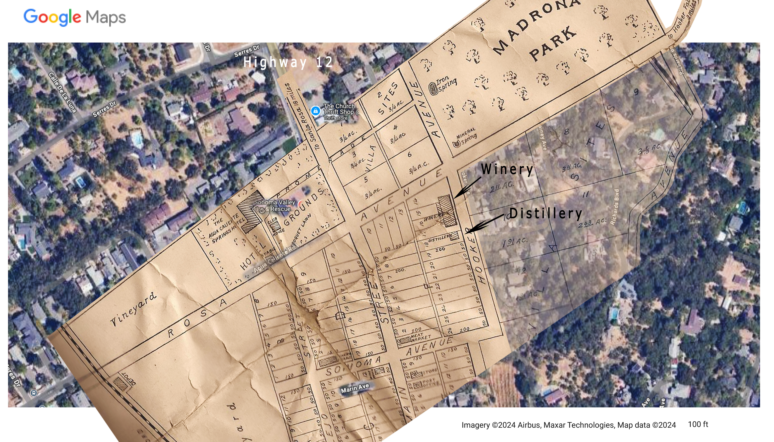
In that year the Index Tribune tells us, “M.K. Cady, formerly of the San Francisco mint, buys Alexander farm,” and that it is “Located on the Santa Rosa and Sonoma road, about three miles from the pioneer city.(Sonoma)” Also in 1882, Cady established a distillery and wine cellar (see map), built of stone from a “quarry on his own farm in the “Flowery” district.”
Map from Jeff Gilbert’s collection.Jeff’s map superimposed on the Google map. The resort was located at the intersection of the current Highway 12 and Agua Caliente Road, then called Santa Rosa Avenue. The winery and distillery were on Hooker Avenue, named for General Joseph Hooker, of Civil War fame, who was an early land owner in the area. The Agua Caliente Resort site was later known as Hooker Oaks. Today, the Sonoma Valley Fire Department station is there. The road at upper right is labeled “To Hooker Falls, 3 miles.” Click to enlarge.From a scrapbook at the Marcy House archives, date and author unknown.
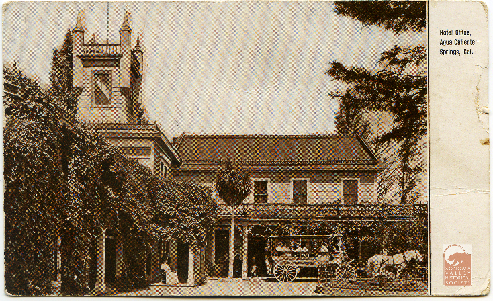
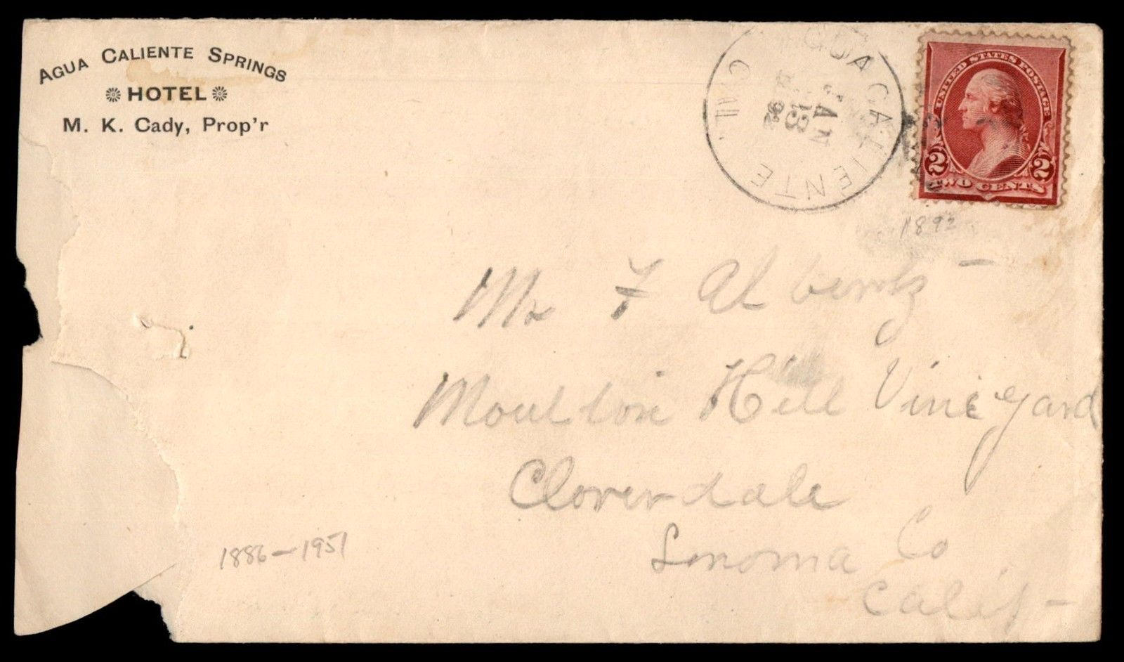
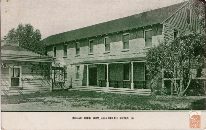
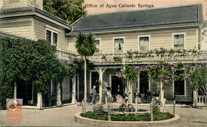
An advertisement in the Index Tribune in June of 1885 informs that the Agua Caliente Hotel, under the proprietorship of M. K. Cady will be opening in June of that year, so the resort was founded between 1881 and 1885.
An puff piece in an 1889 issue of the Index Tribune read, in part, “the famous health-giving springs, delightful location and basalt block interests of this progressive little village is destined at no distant day to make it a place of considerable importance. The town was laid out a little over a year ago (incorrect!) by M.K. Cady, one of Sonoma Valley’s most energetic and public-spirited men. The railroad runs through the place which boasts of an express office, post office, schoolhouse, hotel general merchandising store, butcher shop, and a blacksmiths shop. During the spring and summer months the Agua Caliente Springs Hotel is crowded with health and pleasure seekers who come to lave in its health restoring water and bask in never failing sunshine and balmy breezes. An Episcopal Church will be erected a Agua Caliente this summer.”
In 1888 Cady sells to the Verano Land Company: “M.K. Cady of Agua Caliente has sold his hotel property and villa sites in that town to the Verano Land Company. Mr. Cady retains his winery and some forty acres of choice vineyard and will build a residence on the heights overlooking the wine cellar.” (This could be the site that became Keaton’s Shack.) After six months, Cady takes the property back. It seems, it has been closed the entire time “owing to a disagreement among the directors, who have been fighting like cats and dogs…” The Verano Land Company developed the “towns” of Verano and El Verano. Their brochure touting the developments is priceless early 20th century hype.
In 1888 Cady runs for county supervisor and is elected. The Index Triubne says “Mr. Cady is the right man in the right place and the people of Sonoma and Vallejo Townships ought to congratulate themselves on having so able a man to look after their affairs at the county seat”
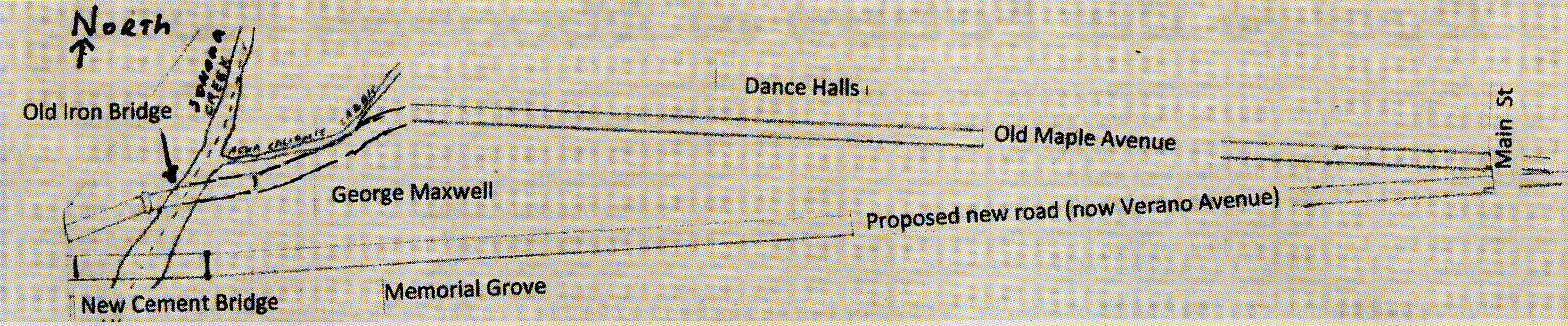
New road leading to the new bridge over Sonoma Creek at Verano.
Also in 1888 “A petition was received from citizens of Sonoma road district praying for a new road from the iron bridge across Sonoma creek at Sonoma to the town of El Verano, and for the abandonment of the old road from the old bridge to where the same connects with Petaluma Avenue. On motion of Mr. Coulter, the same was received and placed on file, the accompanying bond approved and W. K. Nichols, M.K. Cady and G. C. P. Sears were appointed to view and lay out said proposed new road and report at the next meeting.” Please see The Arroyo of Arroyo Road
Interestingly, in 1891 the IT opined “(Cady’s) hotel is located in one of the most picturesque spots in California, and is destined at no distant day to be to this State what Saratoga is to New York.” However, they weren’t reckoning with Calistoga, which was so named because it was deemed the Saratoga of California.
All was not smooth sailing for Mr. Cady. In a September 1893 article in the IT headlined ”Agua Caliente Post Office Squabble. Cady and Morris on Top-Postmaster John Austin Down and in Jail,” we learn that Austin was the owner of a general store in Agua Caliente, which housed the post office. He also ran a bar that competed with Cady’s. Morris was the “mail Messenger” responsible for carrying the mail from the railroad depot to the Post Office. Morris and Austin had bad blood between them stemming from a fist fight the previous July. Morris and Cady wanted to get the Post Office moved to Cady’s’ resort. They accused Austin of opening their mail, and Austin was arrested and taken to jail in San Francisco. Austin claimed he was framed in order get the post office away from him.
That November, Cady was indeed appointed by President Cleveland to be post master of Agua Caliente, “a little old one-horse affair, the salary amounting to from $3 to $5 per month.” In October the story took a strange turn as Austin, having written to his wife in Agua Caliente that he would be home the next day, disappeared. Then, on April 7, 1894: “The Santa Rosa Republican is authority for the statement that John Austin, ex Postmaster of Agua Caliente, near this place, recently fell from a scaffold in a town in South America and sustained injuries that resulted in his death.”
Circa 1930
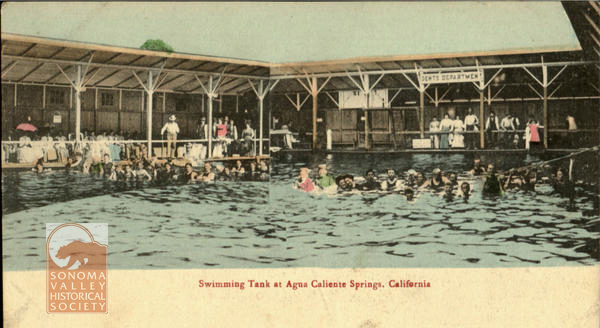
Apparently Cady defaulted on his mortgage in 1895. “A Mr. Dean of San Francisco took possession this week of the Agua Caliente Springs ranch to satisfy a mortgage of $25,000 executed by the former owner, M,K. Cady, who has been in possession of the property for over fifteen years {making Cady’s arrival in the valley no later than 1879}. The Hotel, swimming baths, wine cellar and hotel grounds have been disposed of by Mr. Dean to Dr. Nordin of Alameda, who will improve the hotel and grounds and conduct the same as a first class summer resort and sanitarium. Mr. Cady has leased for the present the handsome cottage which was erected near the wine cellar a few years ago by Mr. McGrew of San Francisco.”
However, Doctor and Mrs. Nordin did not see eye-to-eye. Shortly after he purchased the resort and investing $30,000 of her money in refurbishing it, Mrs. Nordin sued her husband, whom she says took her money under false pretenses and she wanted it back.
The Index Tribune, after saying that Mr. Cady “ran the resort into the ground,” informs us that Cady was appointed receiver of the property during the law suit!
“The bondsmen for M. K. Cady, who was appointed receiver of the Agua Caliente Springs by Judge Crawford, are J. B. Moris and Horace Appleton. Each swears he was worth $3000 over and above his just debts and qualified for $6,000 double the amount of the bond.”
The story continues. September 1895, “The Nordin case, which is the all absorbing topic of conversation in this valley, was resumed in the Superior Court last Monday. It will be recollected that last week Judge Crawford put and injunction on the Agua Caliente springs Resort, appointed M. K. Cady receiver of the property, and accepted as his bondsmen H.B. Morris and Horace Appleton.
Later court action: “The proceedings Monday was devoted to filing a motion to dissolve the injunction….” Nordin alleges that Cady is insolvent, and “that…during the greater portion of the time since his appointment as receiver (has been) under the influence of intoxicants.”
Nordin continues to allege that Cady has fired all the staff and put his wife, daughter, niece on the payroll, and “that the Cady tribe has taken up their abode on the promises.”
Additionally “The affidavit says the order appointing Cady as receiver covers all the personal property on the premised and that some of the guests at the hotel wish to leave, and that Mr. Cady has refused to let them have their trunks and wearing apparel”!
November 9, 1895-The Nordin suit was continued. “The property is still in the hands of Trustee Cady. Dr. Nordin is residing in San Francisco and Mrs. Nordin is the guest of Alameda friends.”
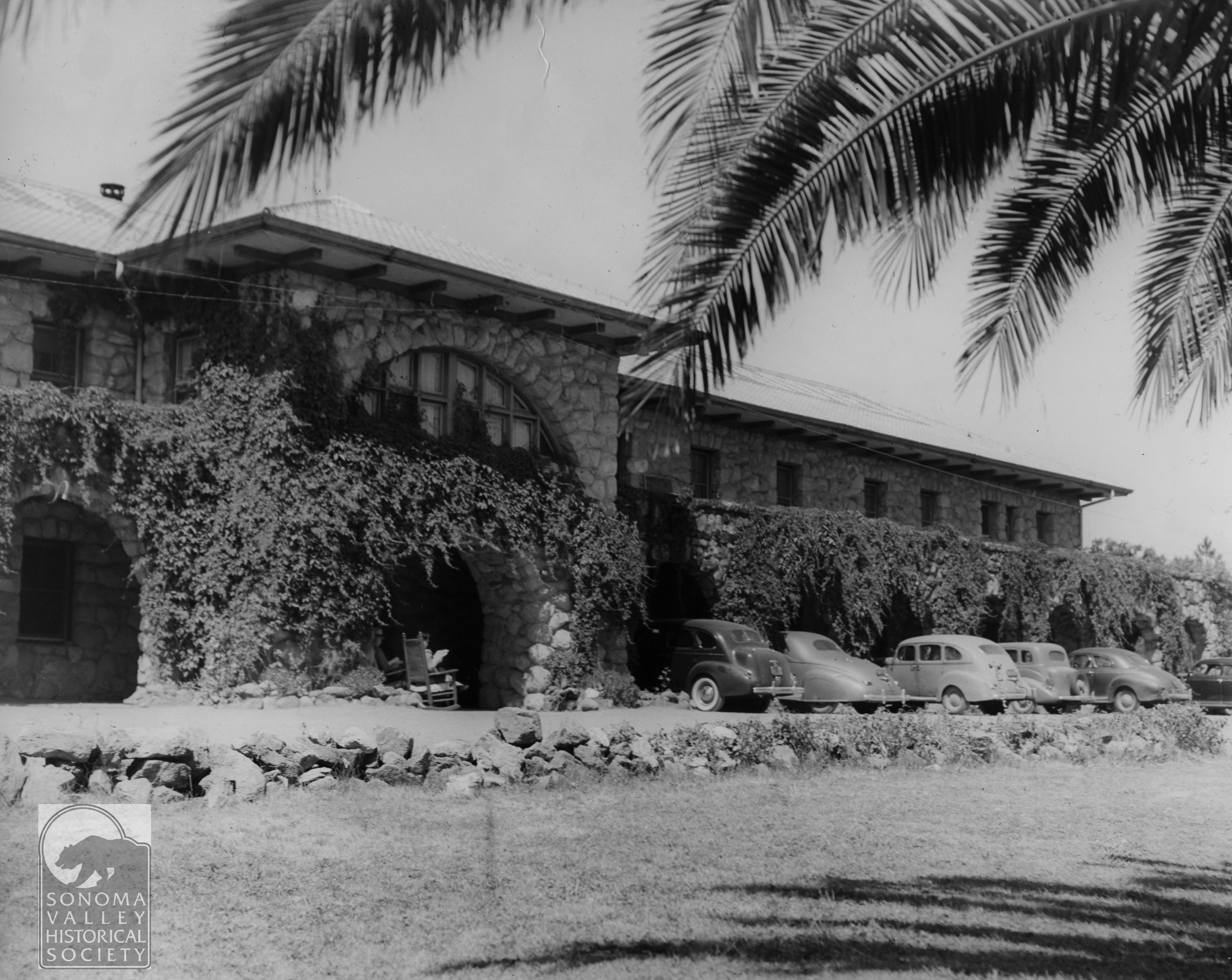
April 11, 1896, the suit is settled with Dr. Nordin getting $1000 and Mrs. Nordin getting the property, but no word of what happened to the “Cady Tribe.” Mrs. Nordin continued running the resort. Details are in short supply. The magnificent hotel burned some time before 1916, when the new, stone building was built.
The “new” Agua Caiente Hotel, built in 1916, still stands in 2024
Martin Kellog Cady died November 18, 1903, in San Francisco.
All quotes are from the Sonoma Index Tribune unless otherwise noted.
Sonoma Index Tribune and many images courtesy of the Sonoma Valley Historical Society
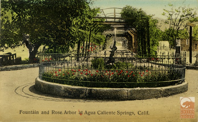
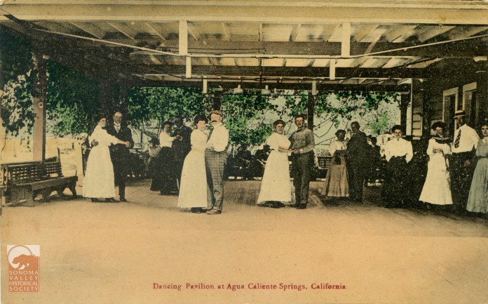
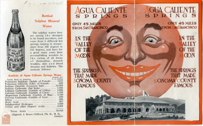
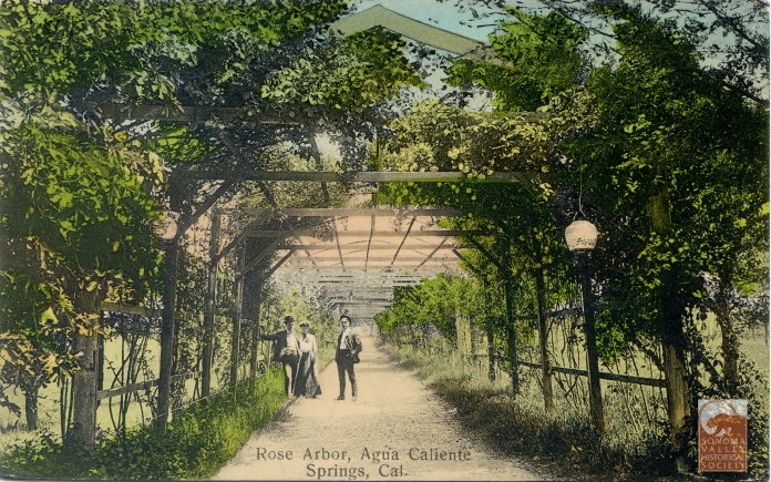
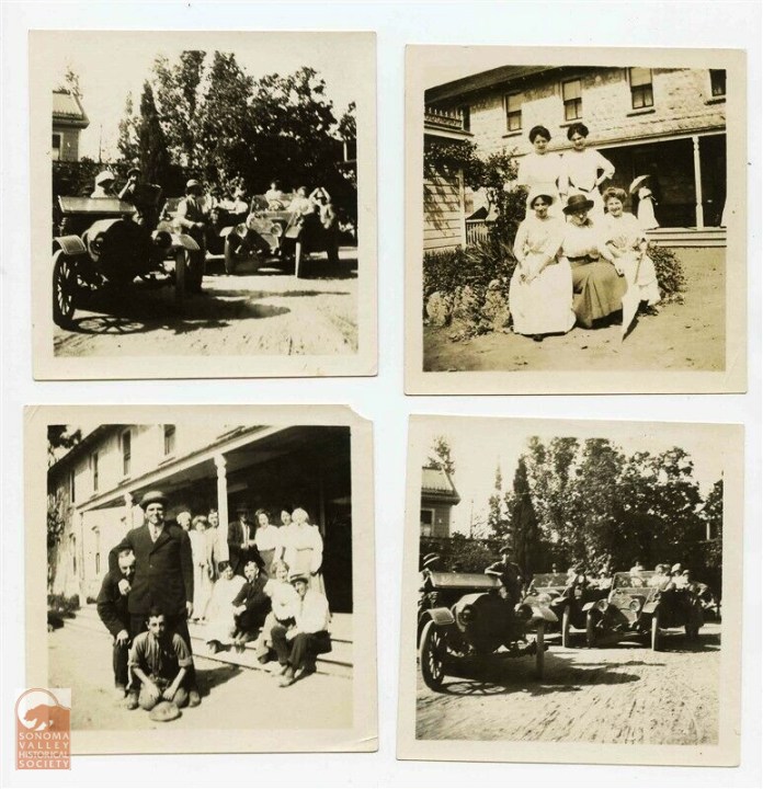
The Agua Caliente Resort, and vicinity, was well documented by photographers. The following is a slide show of some of those photos and post cards.
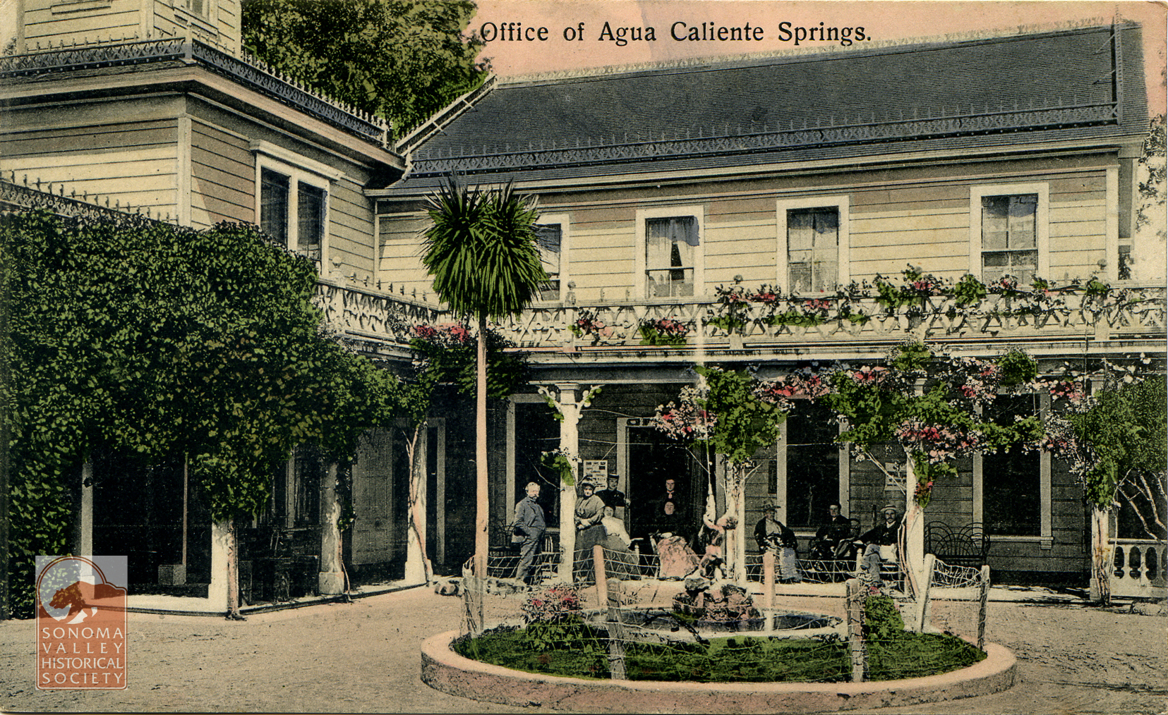
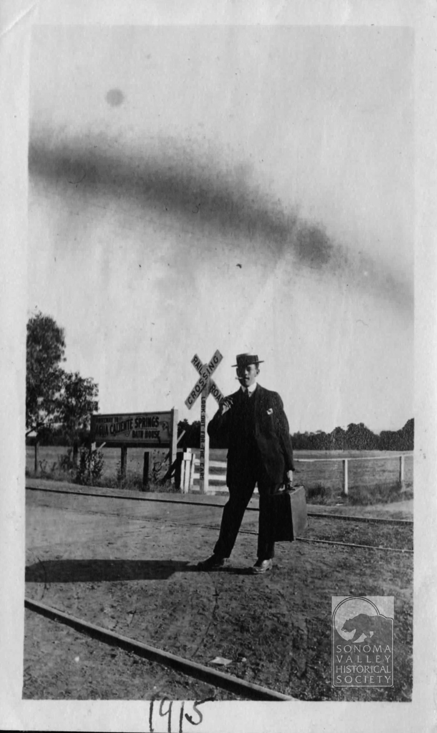
I started posting on this website in July 2014. I have striven to post every month, and I’m close to that goal. Ten years and nearly six months in, I’m still enthusiastic and have many more topics to investigate. I’m currently working on an article about M.K. Cady, the founder of Agua Caliente, and his resort, but it won’t be done this month. In the meantime, enjoy some of the images I have collected. All are from 1912-1915.
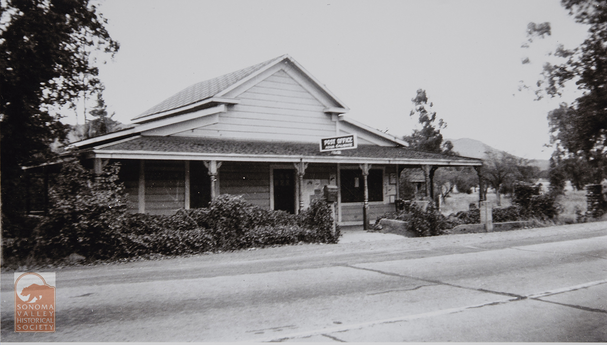
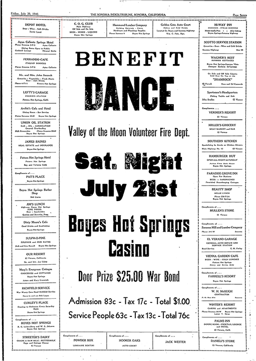
The Depot Hotel, not the one on First Street West in Sonoma, was located on Agua Caliente Road and Lake Street in Agua Caliente. It was probably preceded by Annie’s Resort at the same location, which David Luzzi listed in his liquor application in 1939. Luzzi was listed as the proprietor of the Hotel in an ad in the IT in 1945.
This is the only image I have. I received it from Laura Rondou, a Luzzi descendant.These full page ads listing the sponsors of charitable (usually) events are invaluable lists of local businesses. The Depot Hotel is upper left.
Annie’s had gained some ink in the Index Tribune as far back as 1932, when two men, one of whom, Joaquin “Duke” Faber, know as “The Sheppard of the Hills,” was arrested there for the alleged molestation of girls from the Sonoma State Home (later known as the Sonoma Developmental Center.) According to the IT two of the ”victims, decided Monday to pay a visit to “their Shepherd” and stole away from home under cover of darkness. They reached the home in the hills shortly before midnight, following the railroad tracks from the home, using a map furnished them by another inmate who had visited the ”temple of the Shepherd” on previous occasions.”!
The girls later confessed to their transgression. The two accused men denied any involvement with the girls. “When the men were arrested at Annie’s Resort, near Agua Caliente, the officers were surrounded by a group of Mexicans and Indians who demanded the reasons for the arrest of their two pals. Officers rushed the men into awaiting automobiles and brought them to the county jail.” As we used to say, this story is “one for the screenplay!”
Faber’s trial date was set for later in 1932. The outcome is unknown as of this writing, however he was sentenced to 90 days for stealing chickens in 1941.
In 2017, Robert Singleton shared this on Facebook: “A little history of the OK corral on Agua Caliente. and Lake St. Originally the Depot Hotel. In or about 1948 (actually 1942) the trains stopped running and it sat abandoned until 1951 when my Dad and Mom bought the old hotel and about 4 acres. My older brother built or remodeled a house under the water tower and lived there. In 1961. Or 62. Jim Doyle and Eddie Hadem rented the Depot hotel and stated the OK Corral. my Mother sold the buildings to Mr.and Mrs Bates. They owned the place for about 10 years. End of my recall.”
The only mention of the OK Corral I found is of the building being for sale in 1966. The ad called it “roomy and historical.”
David Luzzi died in april of 1955 in Ukaih. His wife Cecilia, co-proprietor of the Hotel, had died in 1954 in Sonoma.
Index Tribune courtesy of the Sonoma Valley Historical Society.
Public art grows in fits and starts hereabouts but we are starting to build up a nice stock of murals. Here we look at four of them.
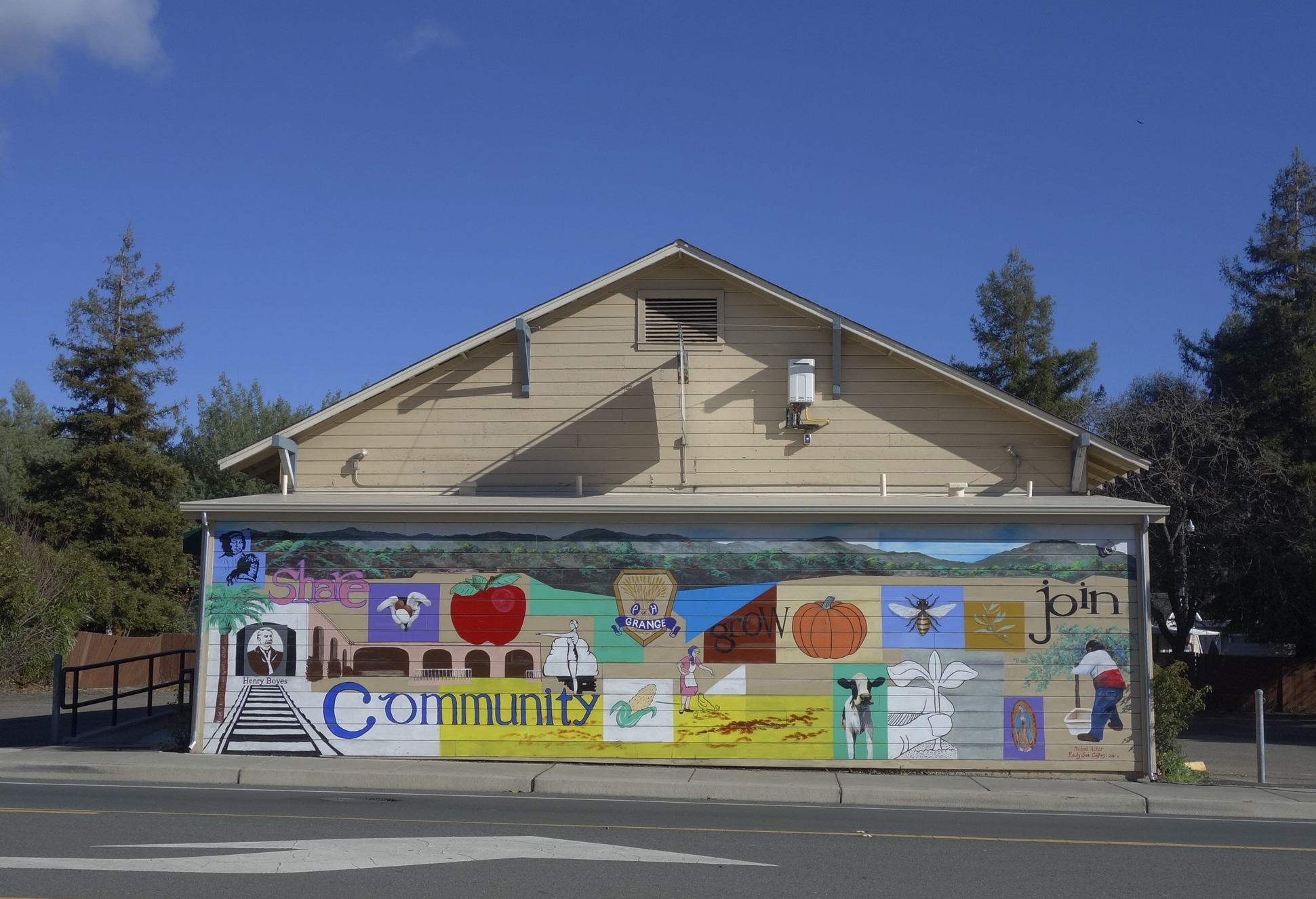
The mural on the front of the Sonoma Valley Grange building, located at 18627 Sonoma Highway. The Grange has owned the building, which was probably originally a dance hall, since 1934. See (https://springsmuseum.org/2022/06/28/the-sonoma-valley-grange-traditionchange-and-renewal/) for more about the Grange. Through the Redevelopment Façade Improvement project, the Grange got funding for the mural in 2010. It was designed by Michael Acker and painted in collaboration with Randy Sue Collins. It depicts a bit of Boyes Hot Springs and Grange history. It being on the west facing wall, it takes a terrific beating from the sun, and has been restored twice.
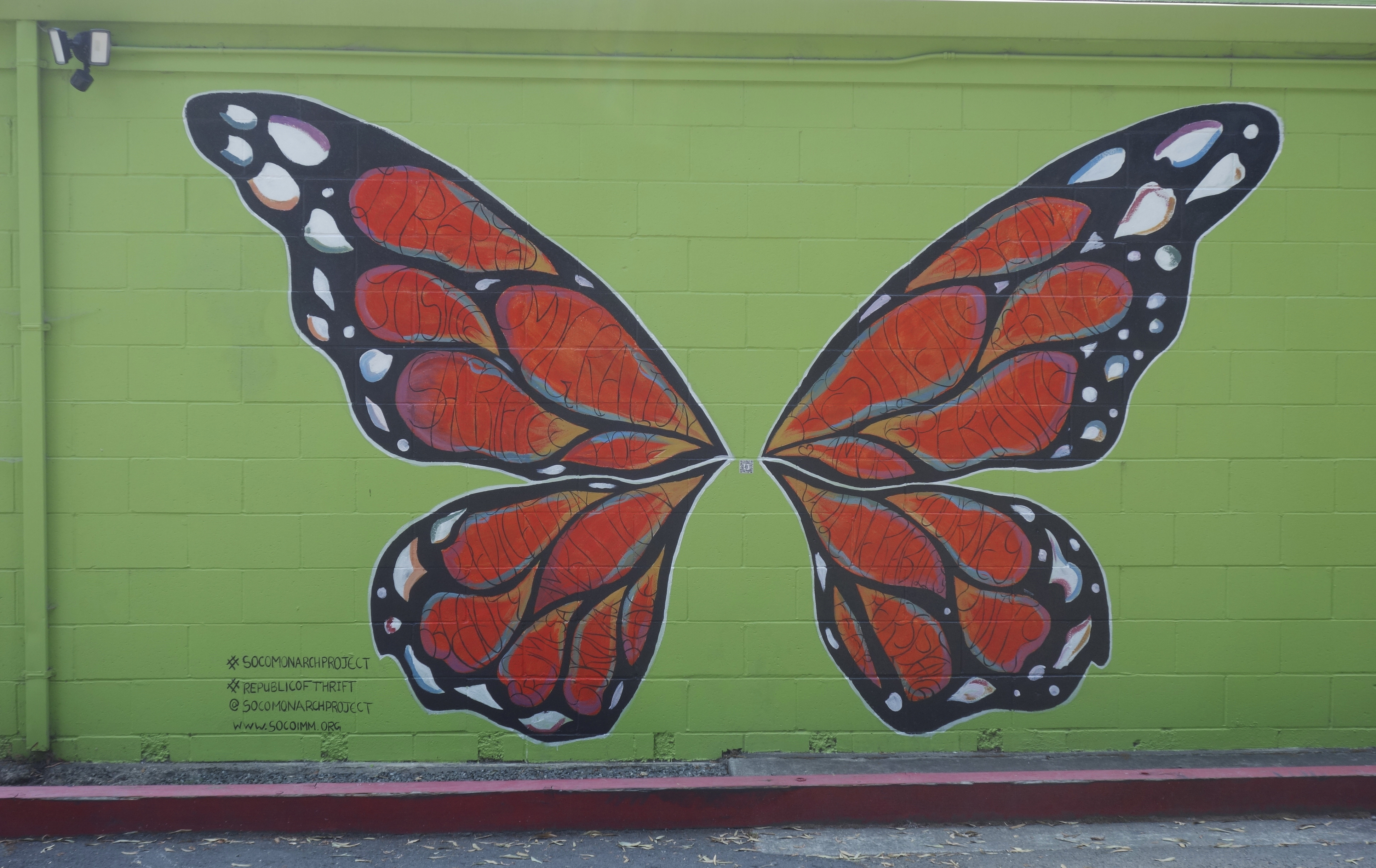
The Republic of Thrift building at 17496 Sonoma Highway has two murals sponsored by the Monarch Project (https://www.socoimm.org/) along with others. On the west facing wall is the giant Monarch butterfly, completed in June 2020. According to the Index Tribune, “Artist Rima Makaryan, just 17 years old, painted a Monarch butterfly as part of “The Monarch Project,” a Sonoma County nonprofit organization working to tell the stories of immigrants and empower the community.” “We are working to have a conversation about immigration through art,” said Makaryan. “Oftentimes immigrants are labeled aliens or talked about negatively. The goal of the Monarch Project is to find beauty in the subject.” The mural, painted on the west-facing wall of the thrift store, features a Monarch butterfly filled with words describing the immigrant experience, such as resilience, hope, amor, sacrifice and fear. Makaryan noted, “The words are meant to embody the journey and diversity of all migrants. It’s all about the beauty of the topic, good and bad.”
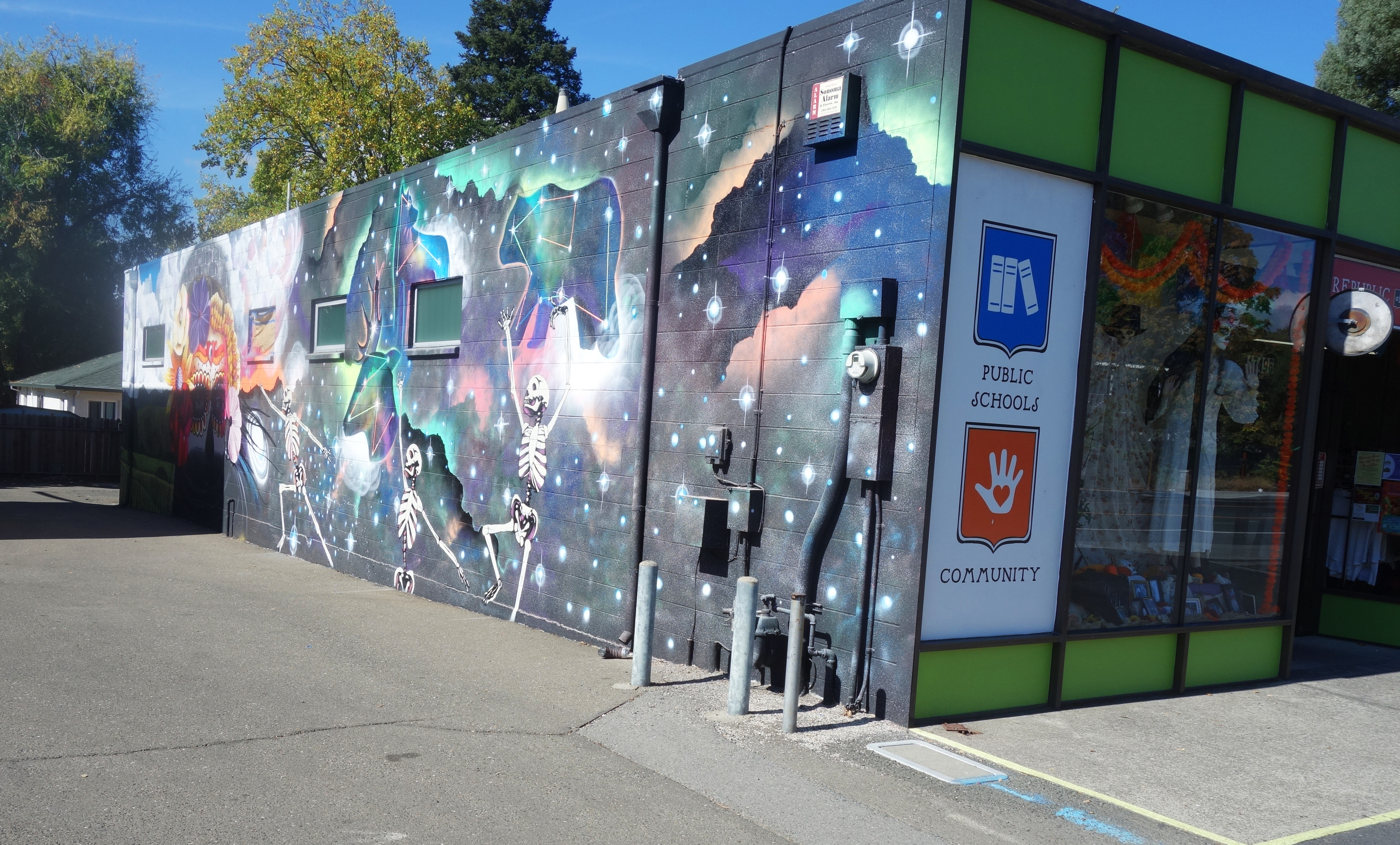
On the east wall a fantastical spray-paint mural by the artist Chor Boogie (https://chorboogie.com/), along with a crew of high school students was painted in 2018. the Led by Sonoma Valley Museum of Art, community partners were Artescape and La luz Center. Co-sponsors were the California Arts Council, the NEA, and the Bank of Marin.
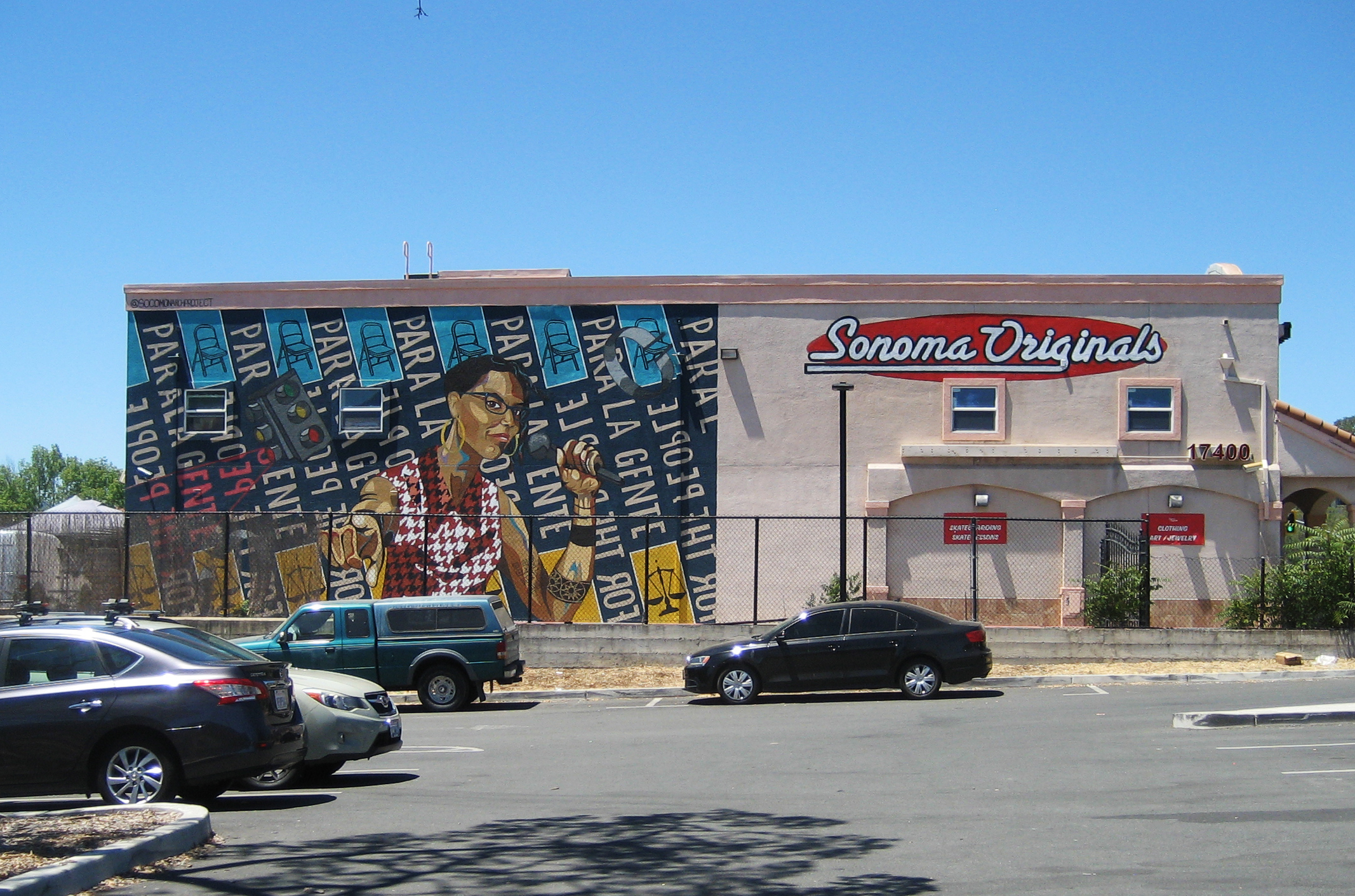
The building at 17400 Sonoma Highway displays yet another Monarch Project mural. Completed in June 2021, it features an image of Dmitra Smith, “…a powerful force fighting against racism in Sonoma County,” according to their website. “Ms. Smith is the former Chair of the Sonoma County Commission on Human Rights, and was the program manager for the Junior Commission, having mentored over 100 Sonoma County students between 2013- 2020. Smith is a co-founder of the essential workers’ mutual aid collective Food for All – Comida para Todos.”
At the time the mural was painted, the building was the home of Sonoma Originals skate shop. Sadly, it is now empty.
We actually have a lot of art in the Springs, some of it “official,” as the above are, some harder to find, personal expressions, often ephemeral, but worth noting, as we will do in future posts
Index Tribune courtesy of the Sonoma Valley Historical Society
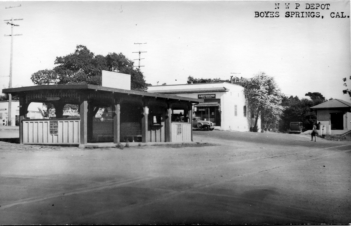
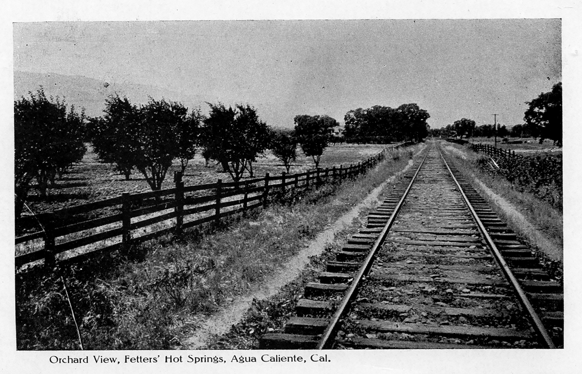
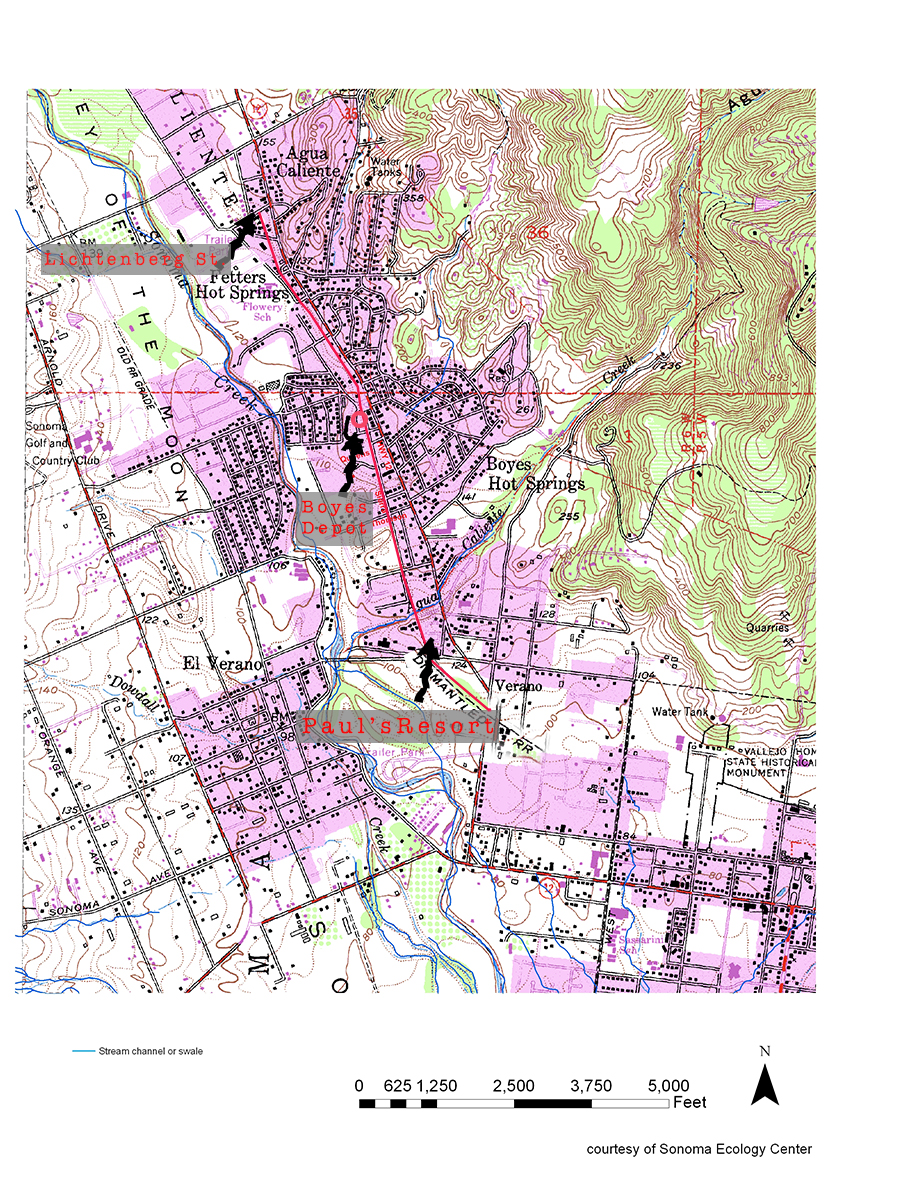
The last year of operation for the Northwest Pacific Railroad in Sonoma Valley, which ran on the east side of Sonoma Creek, was 1942. That year freight service ended, and the tracks were torn up for steel for the war effort. Traces of the right-of-way can be seen in several places in El Verano, Boyes Hot Springs, Fetters Hot Springs, and Agua Caliente.
From El Verano going north:
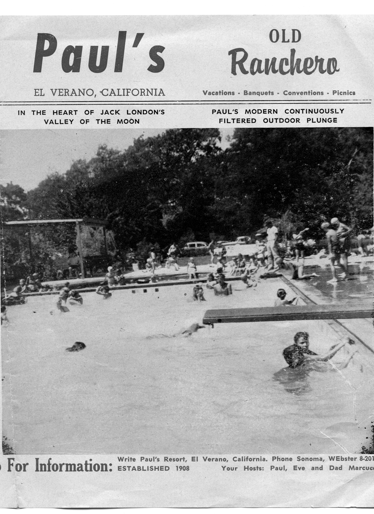
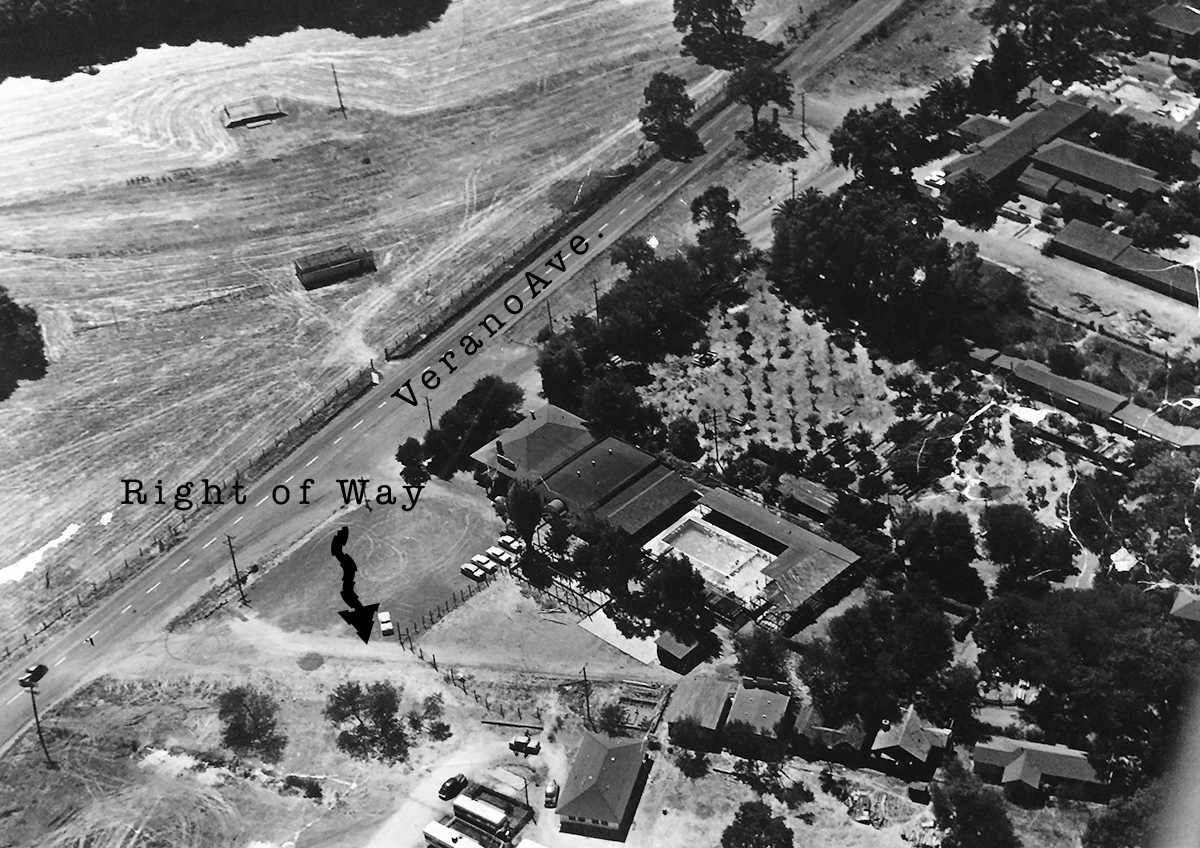
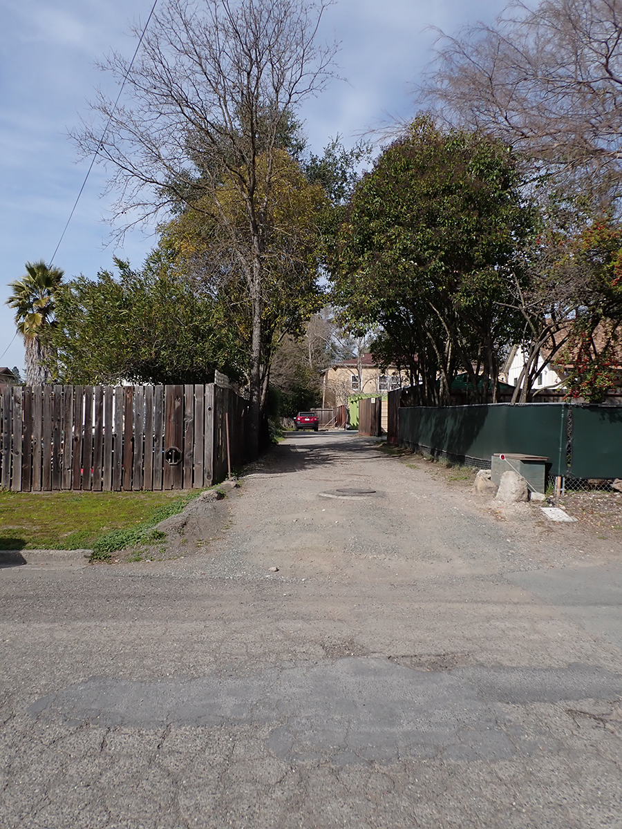
In El Verano the tracks run through the Paul’s Resort property, where the Verano (not El Verano) depot was located.
Paul’s Resort, 1960s
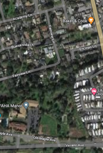
From there it parallels Fairview Ln. (which may have been right-of-way) until it gets to Thompson, where Sierra Dr., formerly Meinke Ave., takes over the roadbed. (More about Sierra and Mienke.) Manzanita St. might have been a spur. It features several buildings that look as if they could have been built by the railroad.
House on Manzanita near Academy Lane
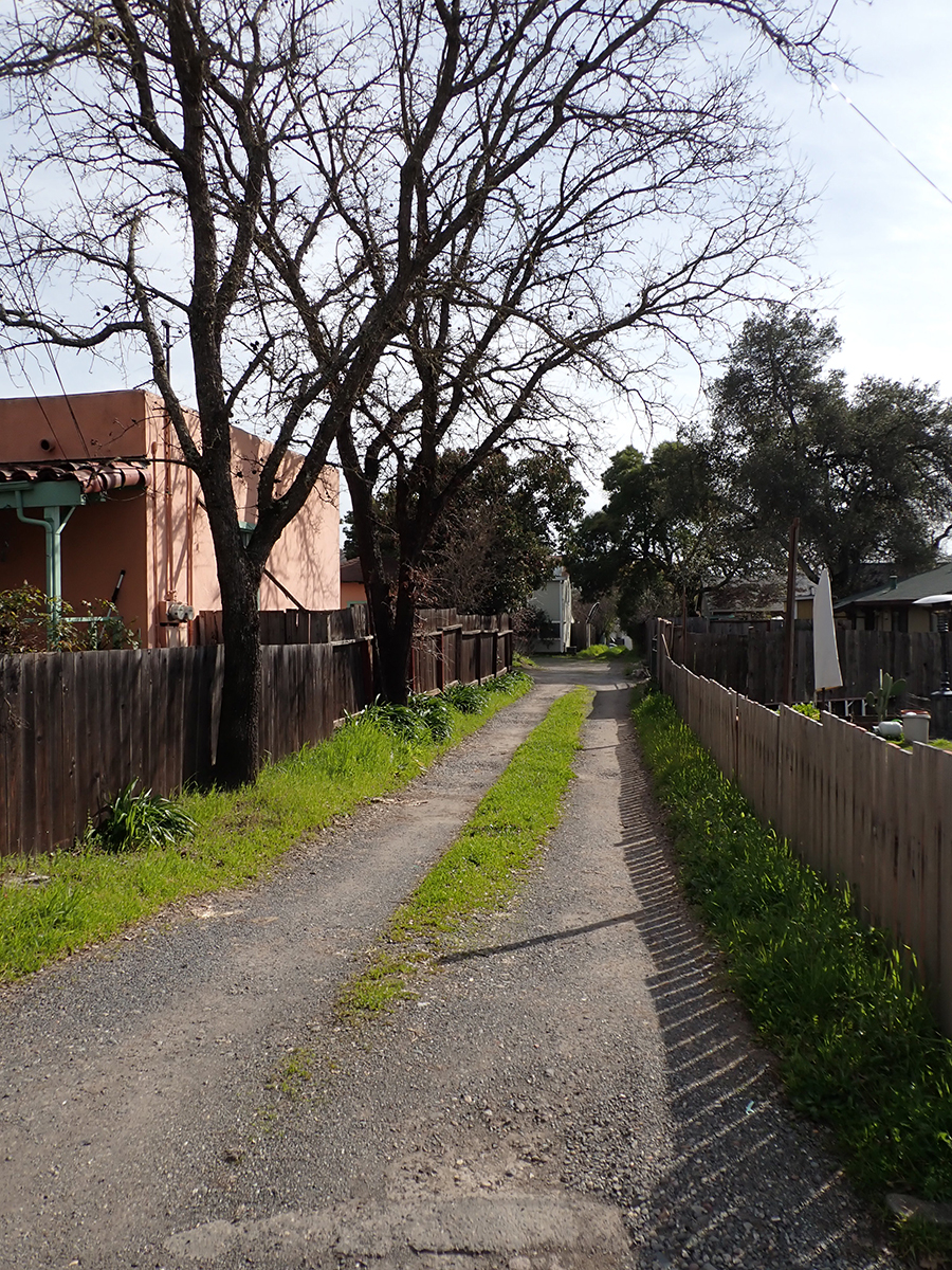
Where Sierra turns east to the Highway the right of way continues north through the Sonoma Mission Inn (originally the Boyes Hot Springs Resort) grounds and past the BHS depot, which land is now the parking lot for the Plaza Center building (More here).
Boyes Depot 1942
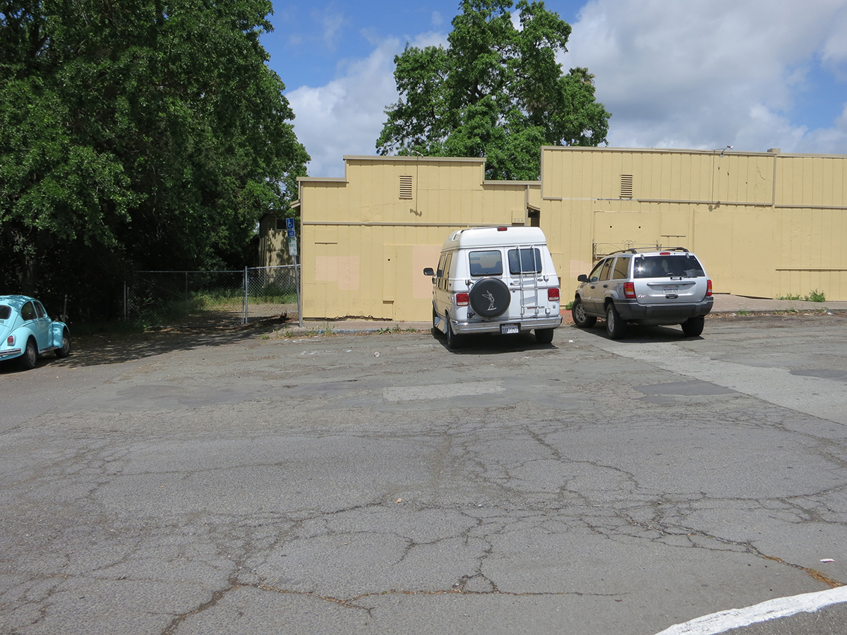
Right-of-way next to old commercial buildings at Boyes Plaza, which were demolished in 2018. Photo taken from the apporxiamte location of the Boyes Depot.
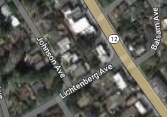
Continuing north it parallels the Highway and can be seen crossing Lichtenberg Ave, parallel to Johnson Ave.
At Lichtenberg.
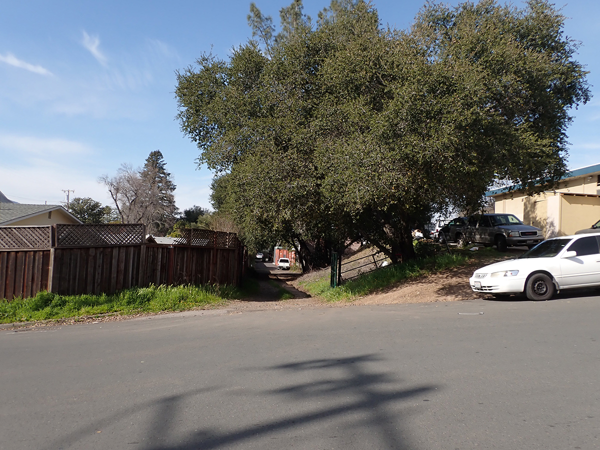
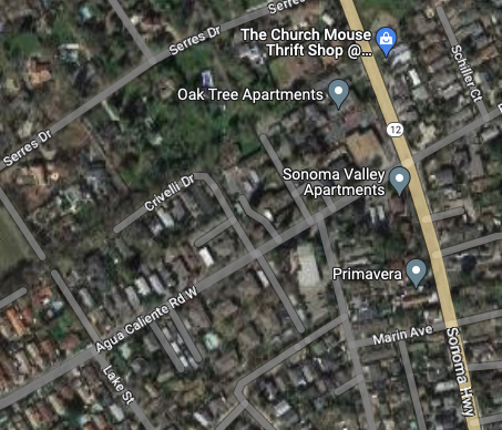
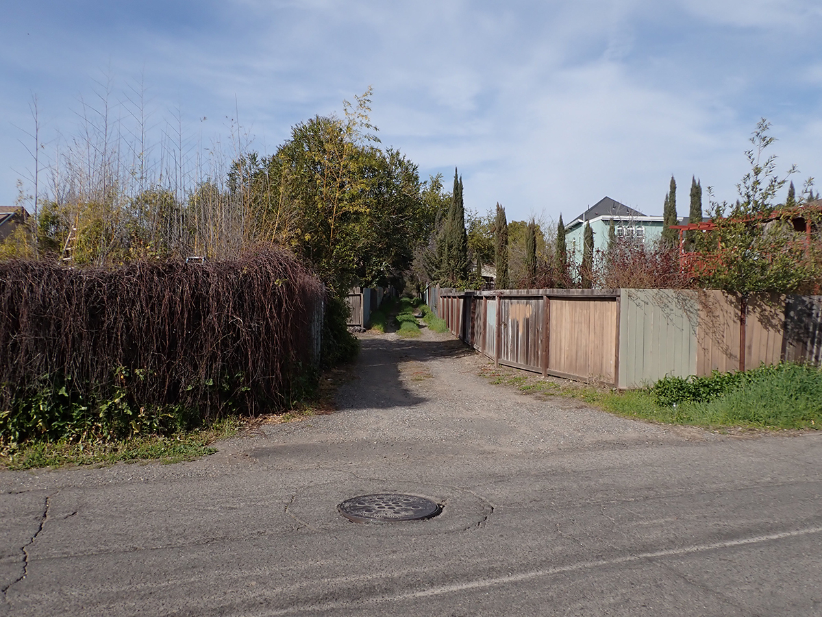
The next trace is the old Fetters Depot building on Depot Rd in front of Flowery School. It crosses the Fetters Apartments and Charter School properties and is seen again at Vialetti Dr. The old roadbed has become the alley the runs from Vailetti to Marin Ave. That is the last appearance of the right-of-way in the area.
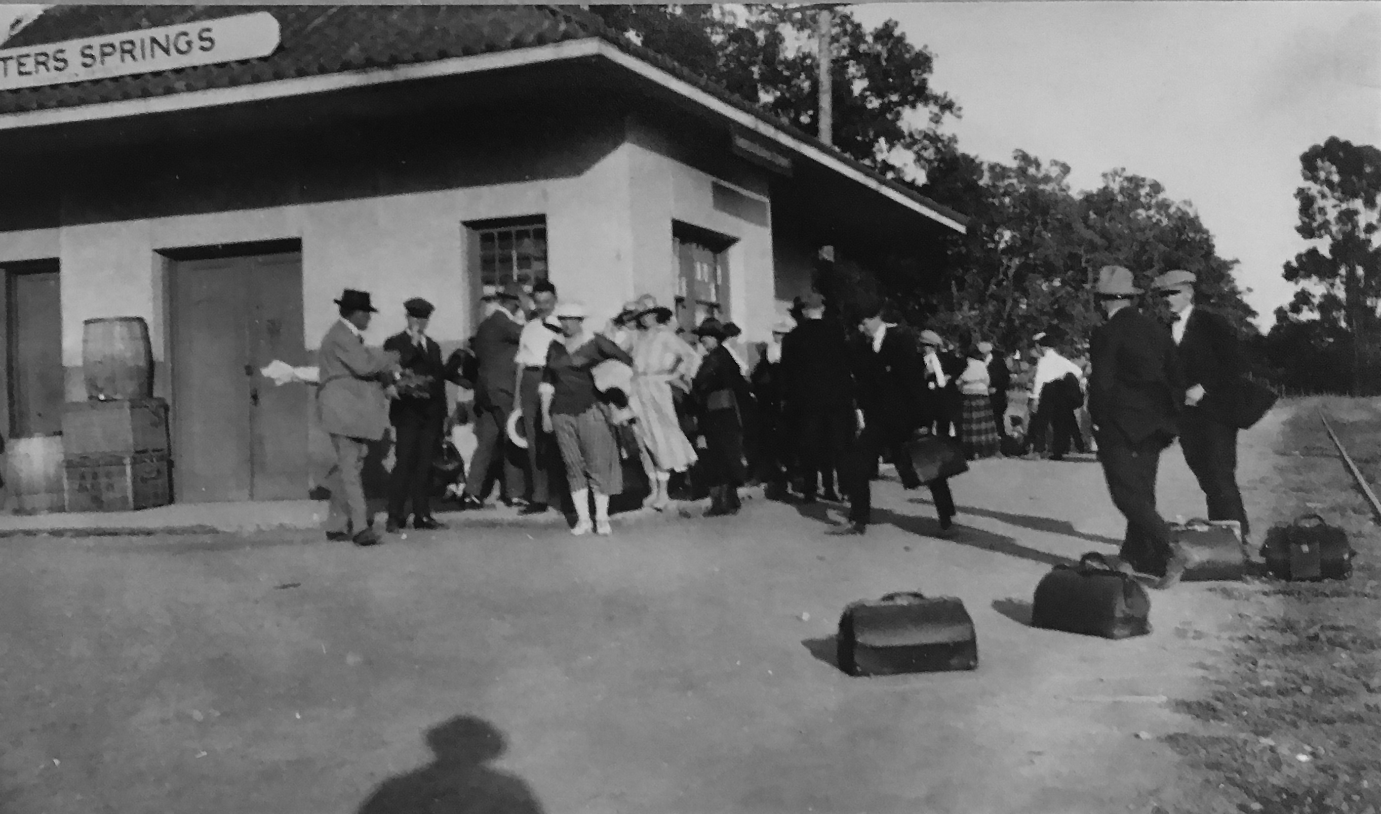
Fetters Depot 1910s
1910s
At Marin Ave. looking south.
At Marin Ave. looking north.
At Vailetti Rd. looking north
Maps and photographs courtesy of the sonoma Valley Historical Society unless noted otherwise.
Temporary, informal, unsanctioned, cryptic. Personal expression, job related. Faded, half-obscured.
Ephemeral and permanent.
Highway 12 through Boyes Hot Springs, Fetters Hot Springs, and Agua Caliente, California, though a heavily used commercial and residential street, had almost no sidewalks until 2009/2010. Dirt shoulders for walking was not a problem when traffic was light. Even at the height of the resort era (1950s), people would ride horses down the middle of the highway. That’s how quiet it could be.
Starting in the 1980s, locals started to agitate for a safer road. They wanted sidewalks and streetlights. Along came Redevelopment to provide the funds. Part of the project was completed by 2010 (a good twenty five years after agitation began). Redevelopment was abolished by dear old Jerry Brown. Thanks Jerry! The project languished. Finally, the Sonoma County Board of Supervisors came through with the money to finish. Thanks Susan Gorin!
The following is a collection of street markings from before during and after sidewalks were installed. Some are the ephemeral spray paint graphics of the contractors, which can be interesting. The more enduring marks are by the people who happened to walk by when the concrete was wet. These are also interesting, even poetic at times. One example is pure nature.
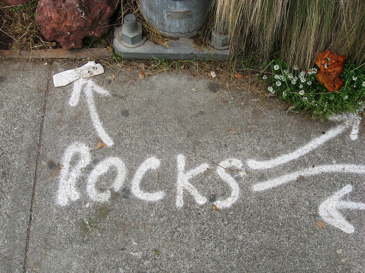
2008-Before demolition started a lot of marks went down. Why was it necessary to point out the rocks?
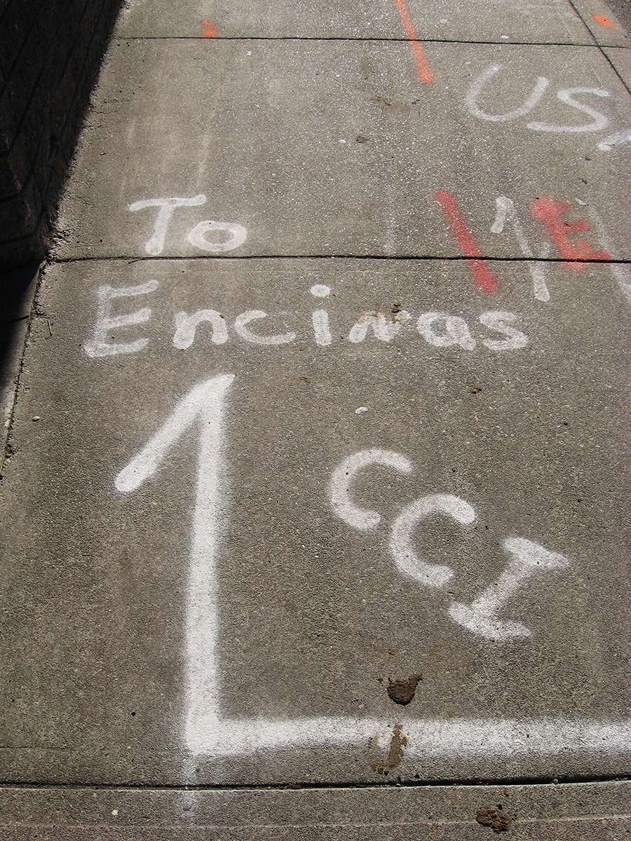
2009. Underground Service Alert (USA) finds all the pipes and wires and marks the surface. Not sure what “CCI” stands for.
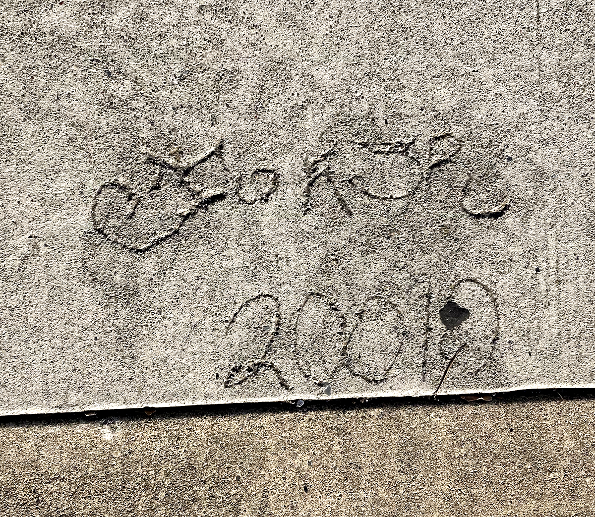
2010 or “20010”. Our first folk marks! It’s an ornate tag that is hard to read.
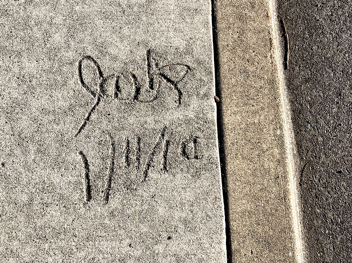
Jack has helpfully given us the day, month and year. I hope he went on to a career as an archivist.
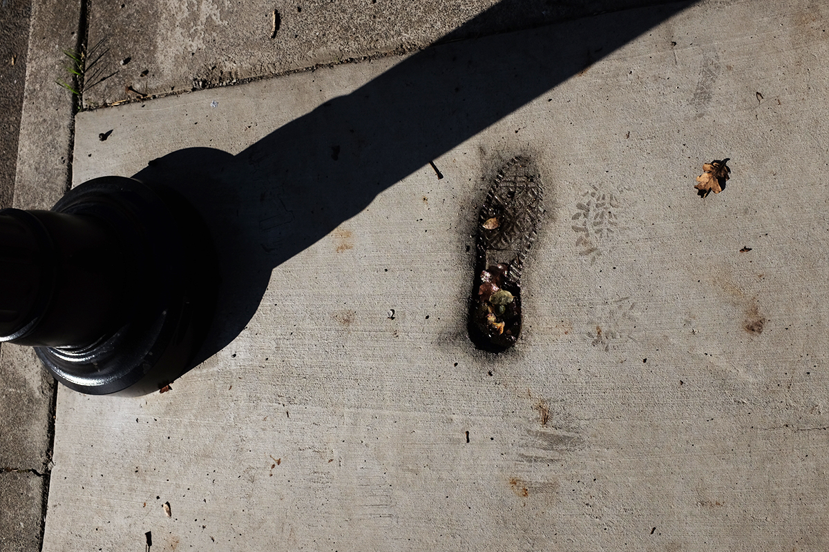
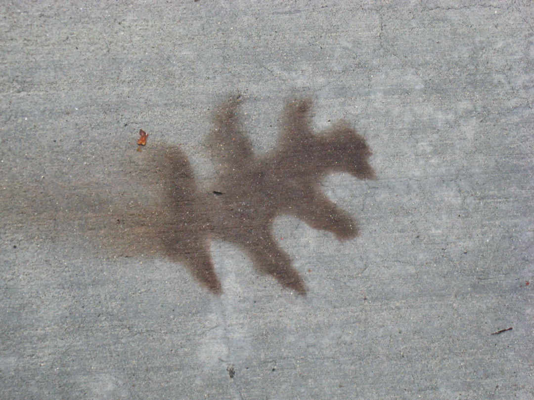
2016. Phase Two. The only actual footprint, gracefully holding leaves and water.
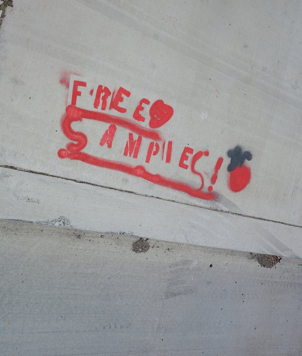
Year of mark unknown, but Phase Two. Someone is trying very hard with the use of a stencil. Is he offering free samples of tagging? Do people pay for tagging?
2019. Right after Phase Two was completed, some corrections that necessitated new concrete were needed. It looks like the left portion of this group of signifying friends was cut off.
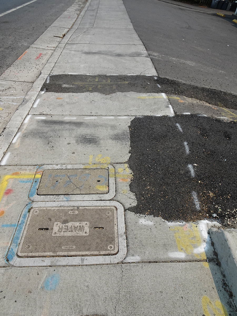
In 2021 PGE had some business under the pavement. This tells you all about it, if you could only read it.
2021/ Nobody’s perfect!
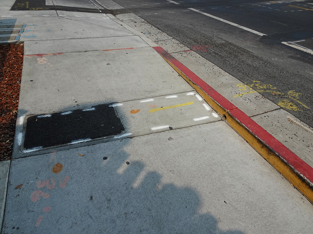
2021. This one and the next two offer lush compositions of black and gray featuring inscribed and spray-painted lines and hard and soft textures.
2021. The lines, the colors, the textures, and, the shadows!
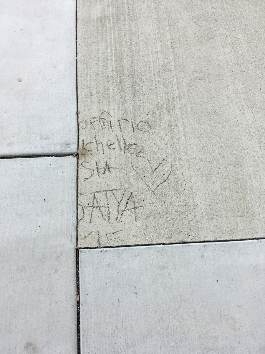
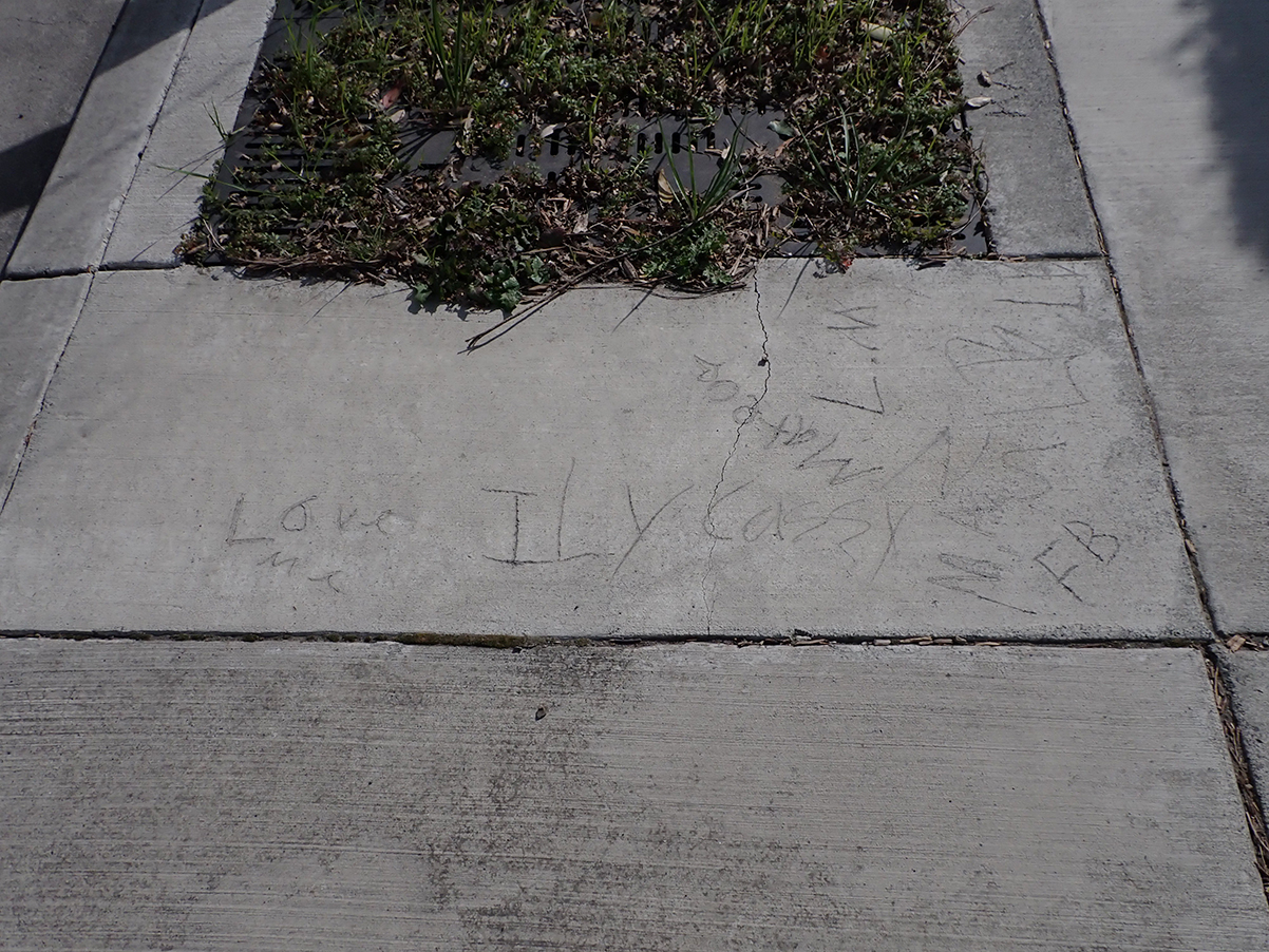
Photographed in 2023, actual date unknown, but Phase Two. “Love me.” “ILY Cazzy.” “Mateo.” “FB, LM”
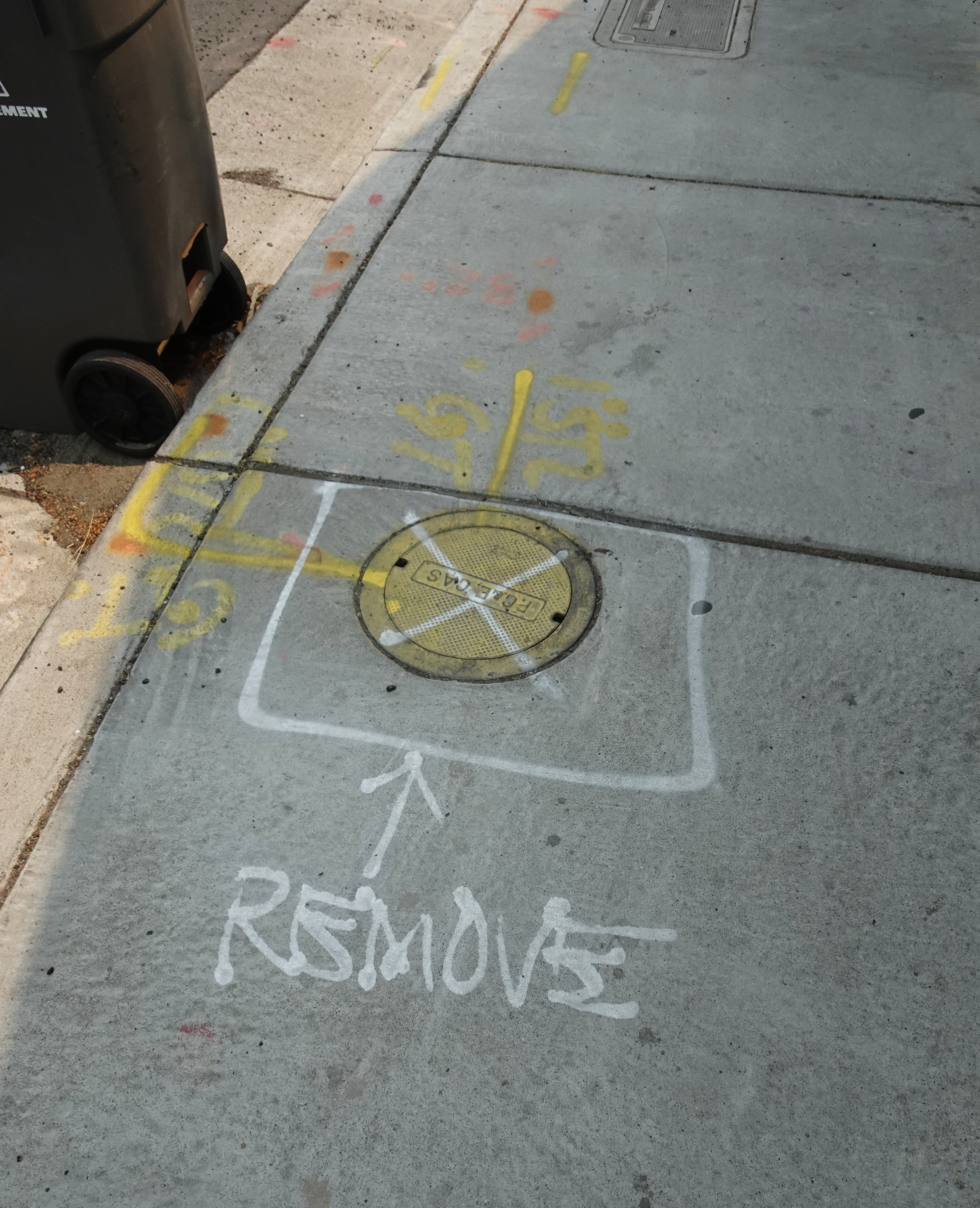
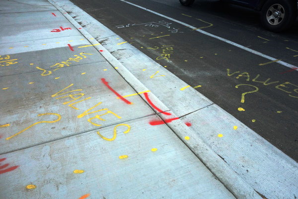
2021. Dude! Where’s my valves!
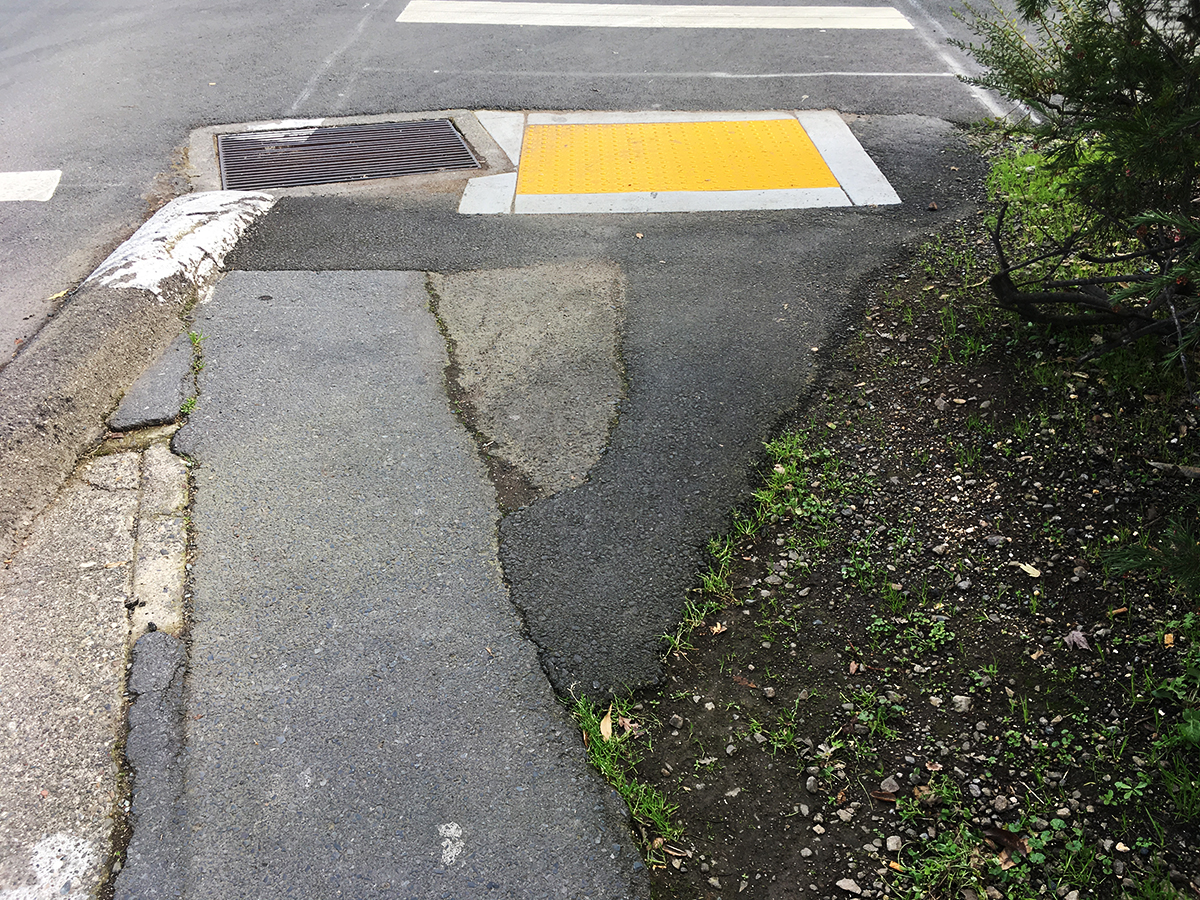
A bit off the highway, but such a lovely composition!
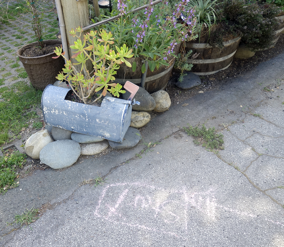
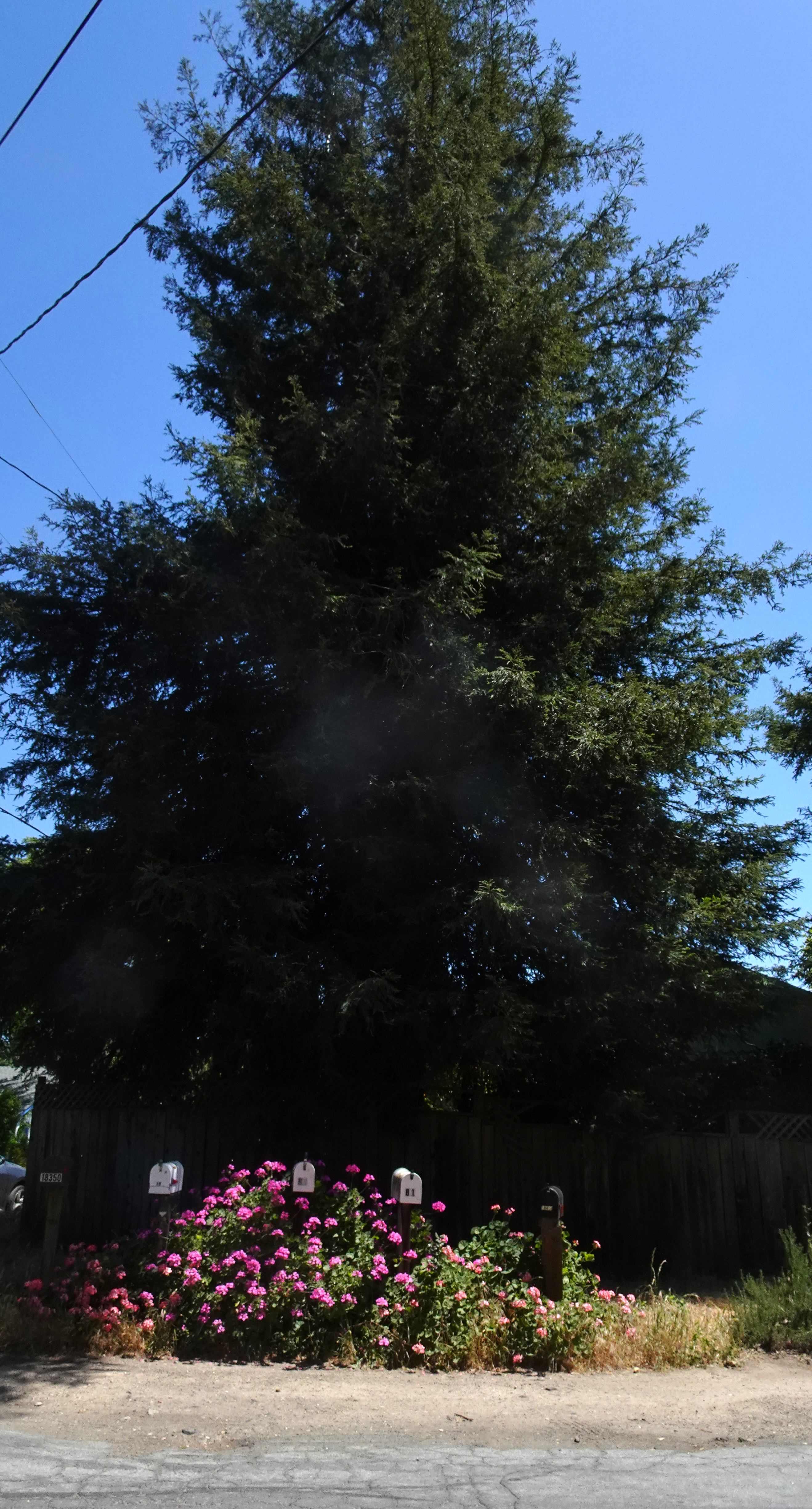
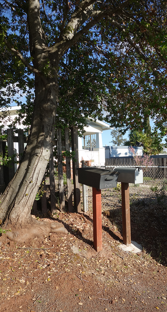
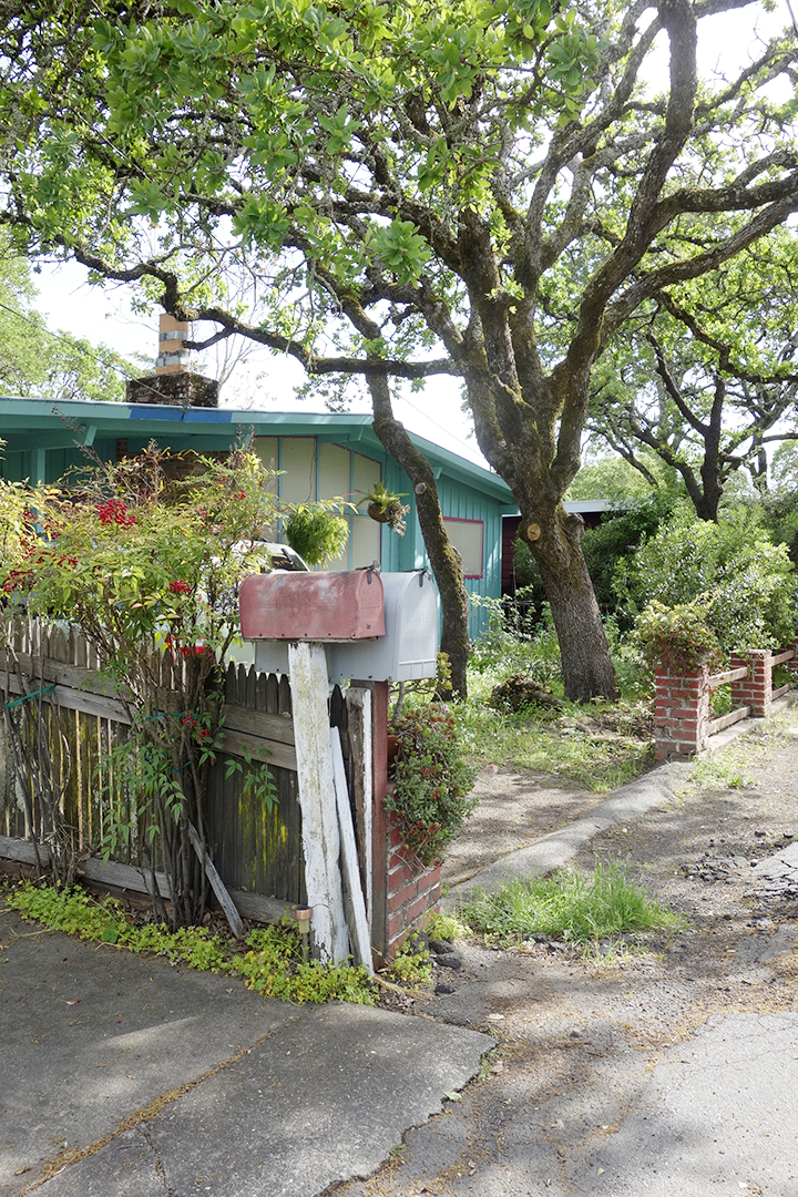
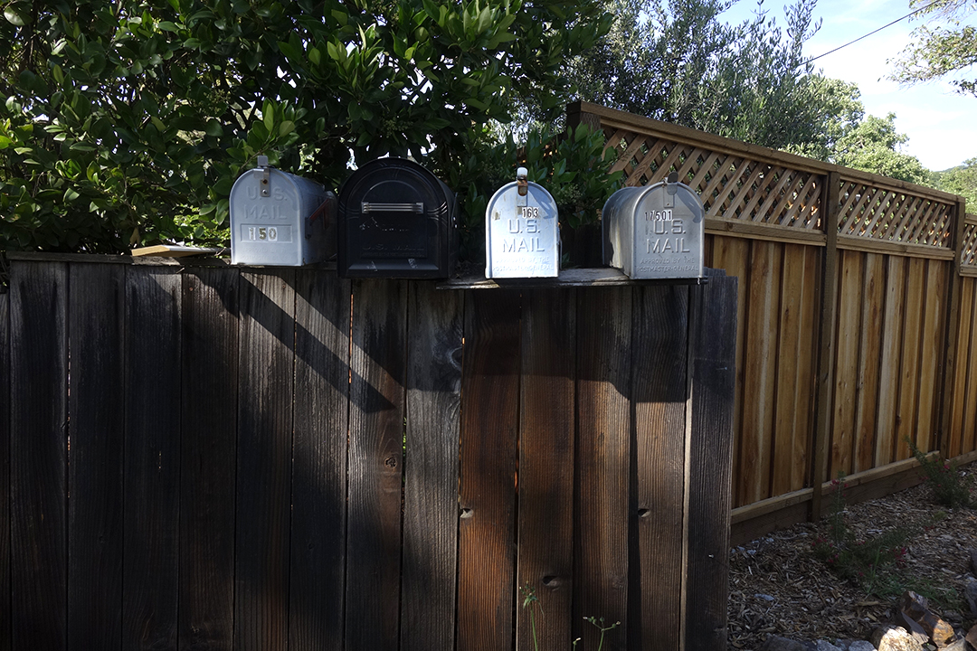
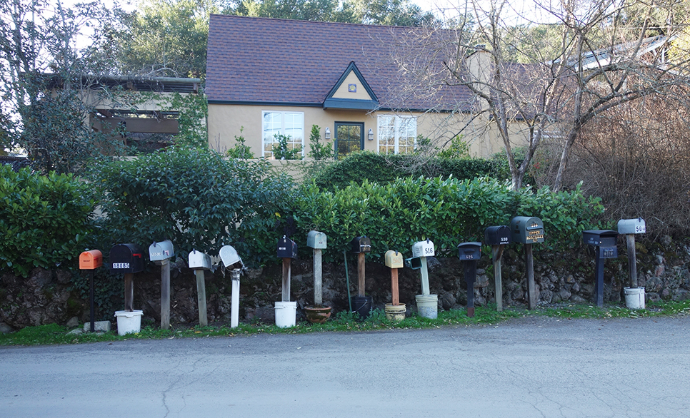
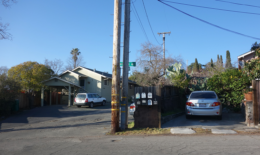
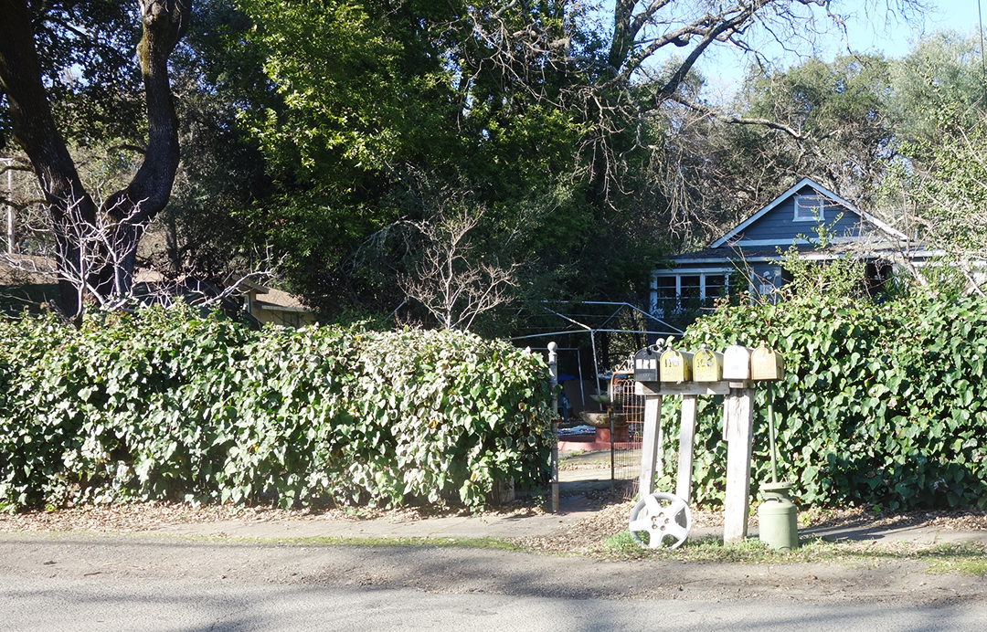
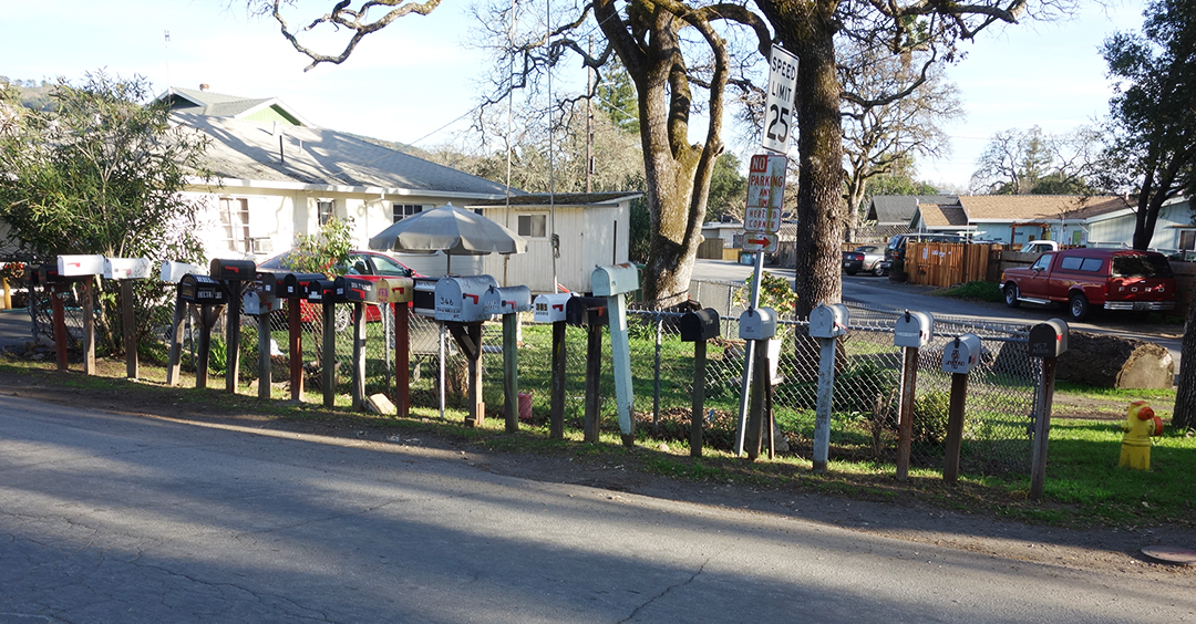
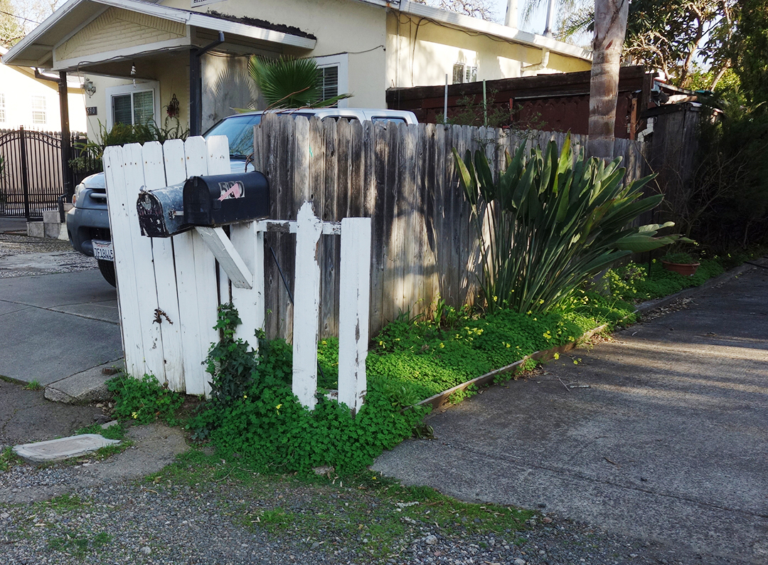
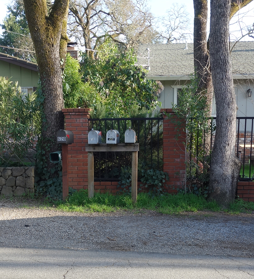
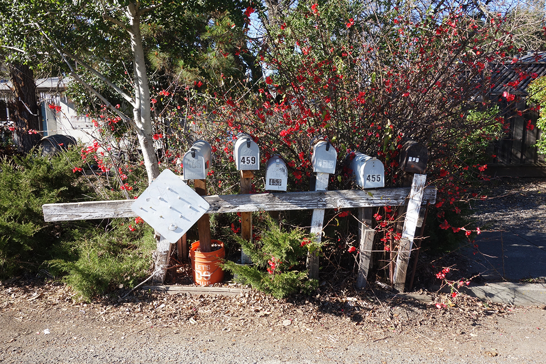
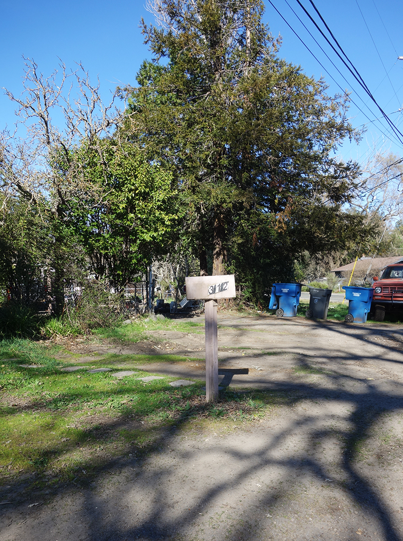
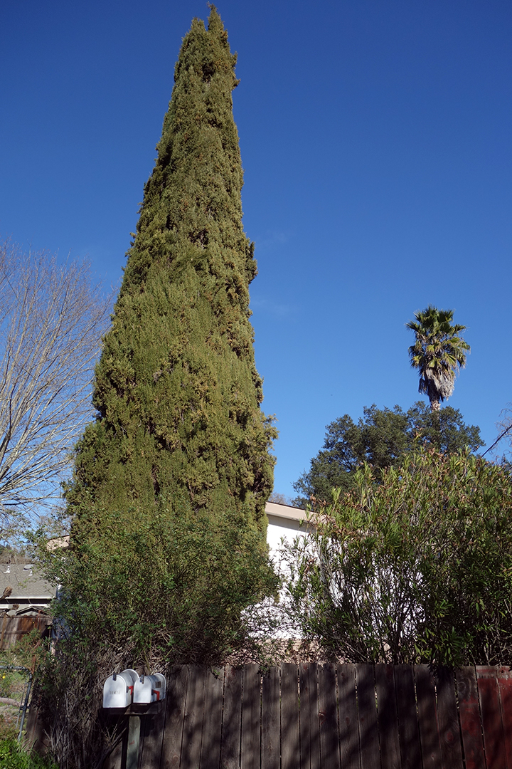
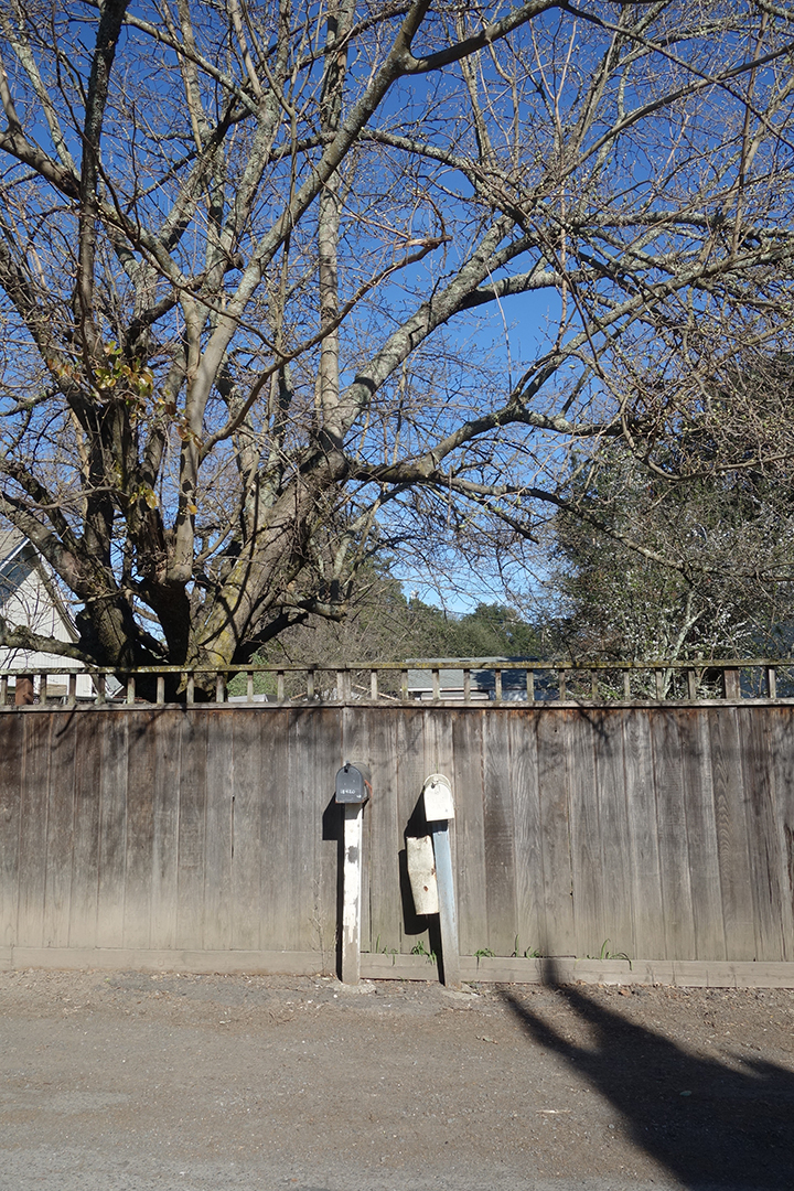
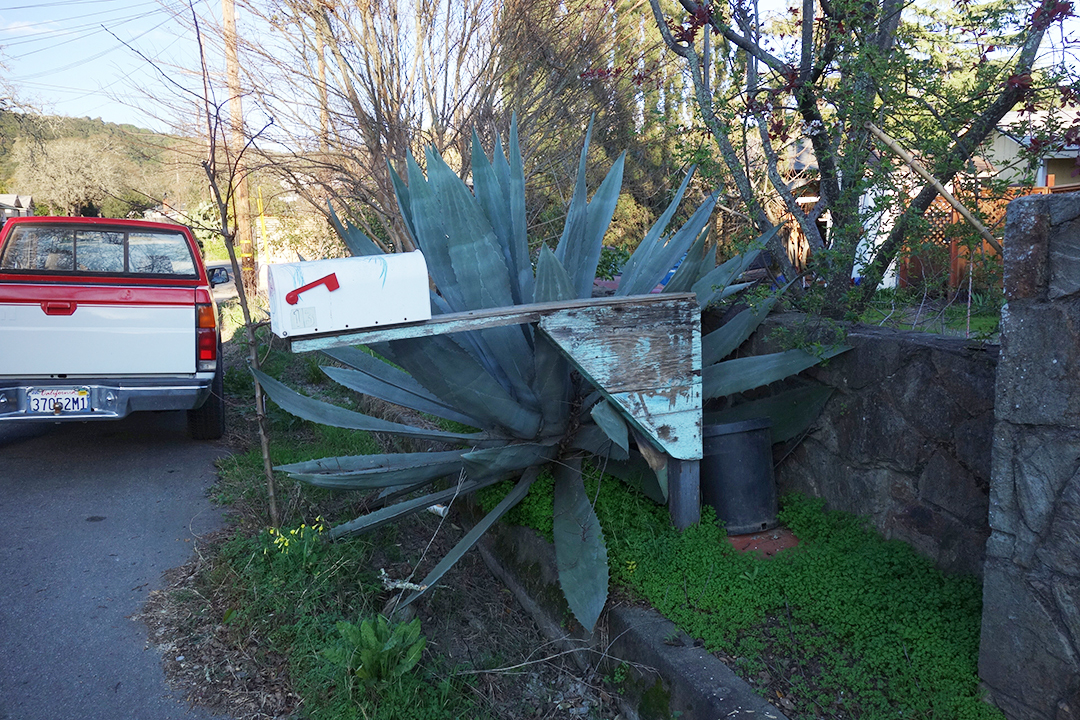
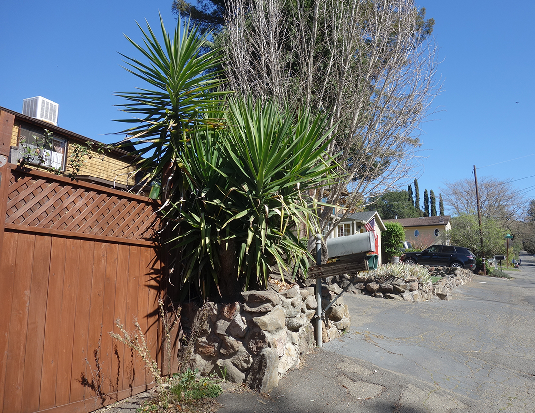
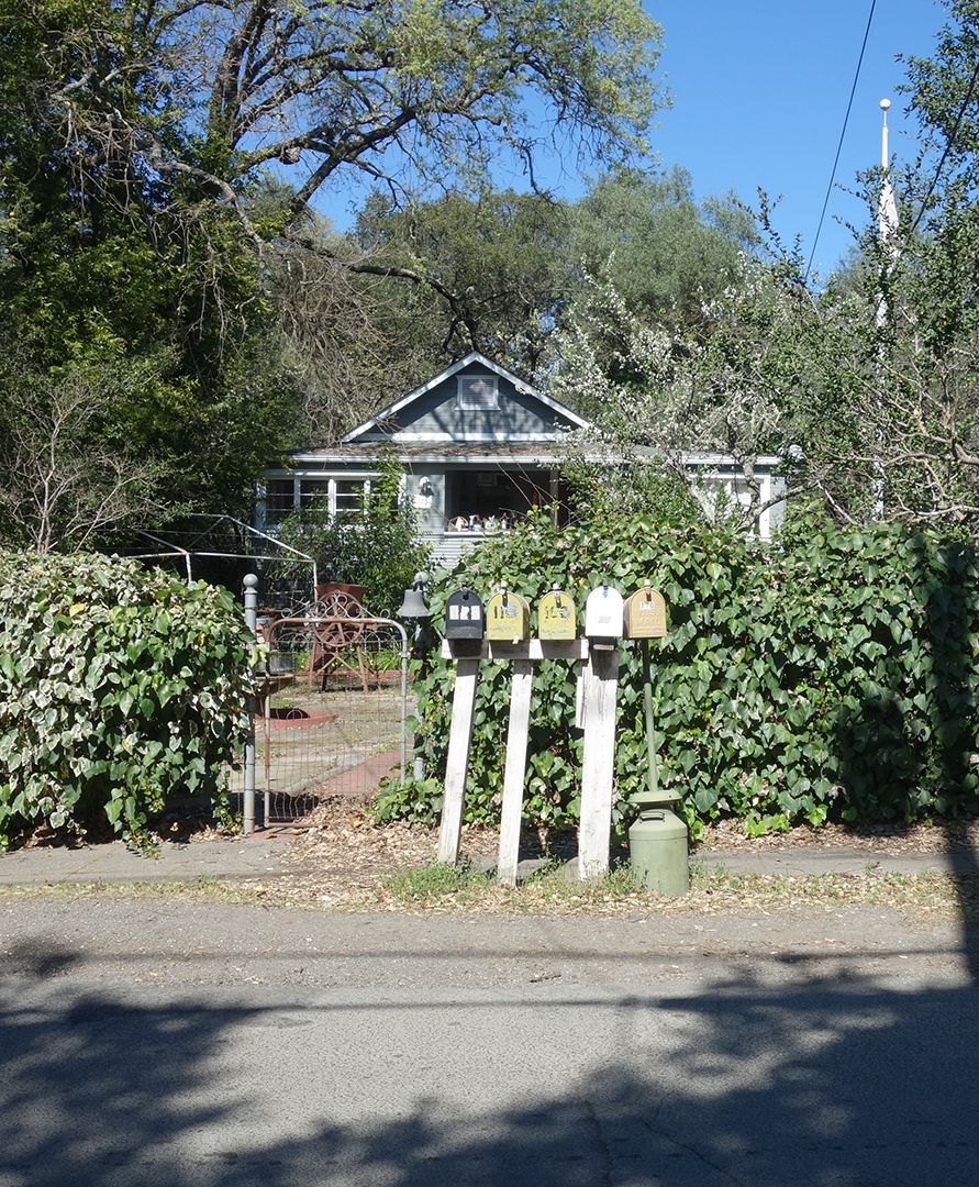
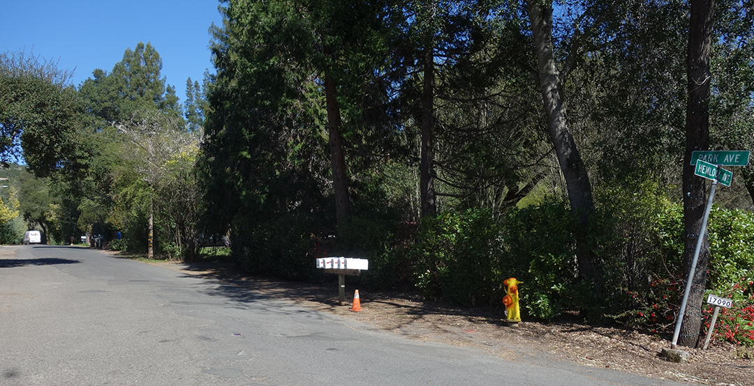
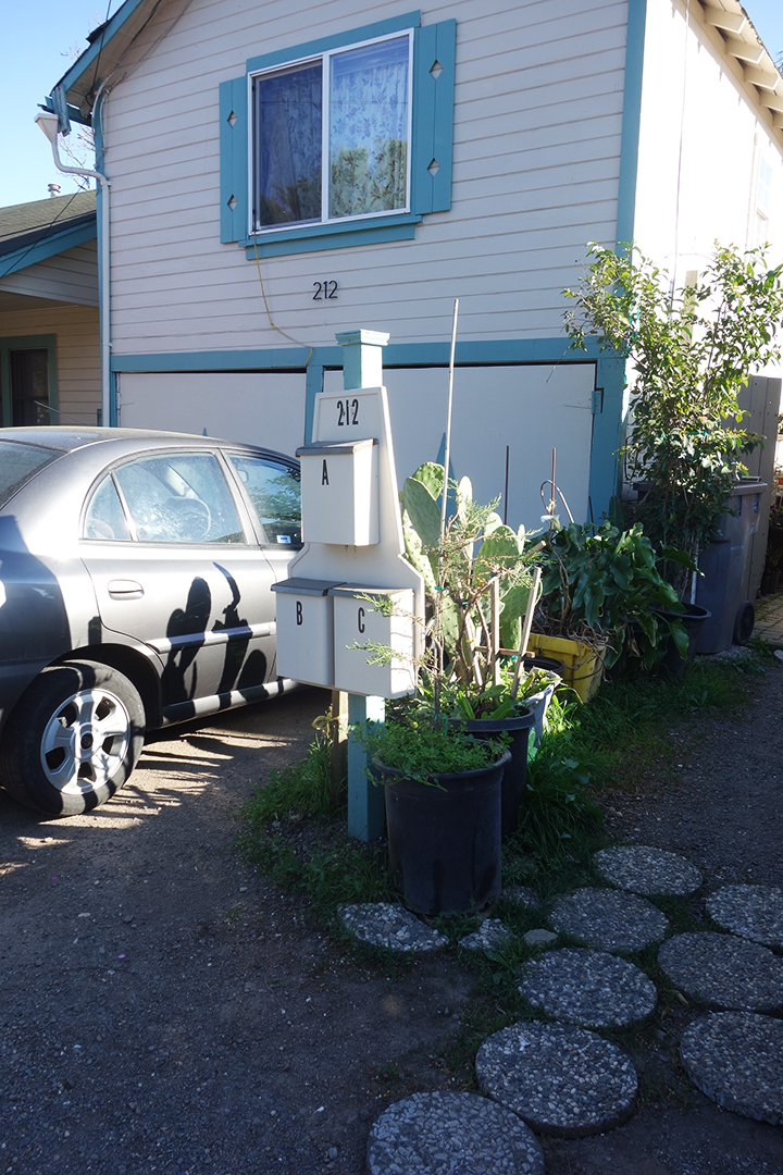
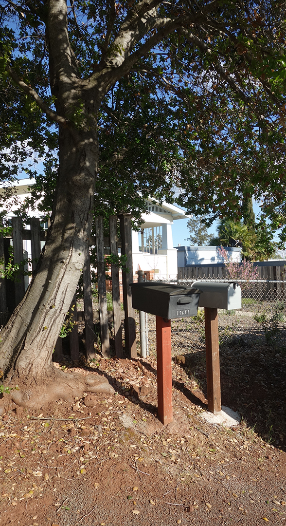
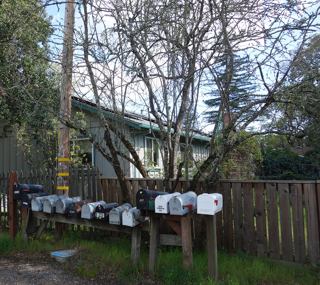
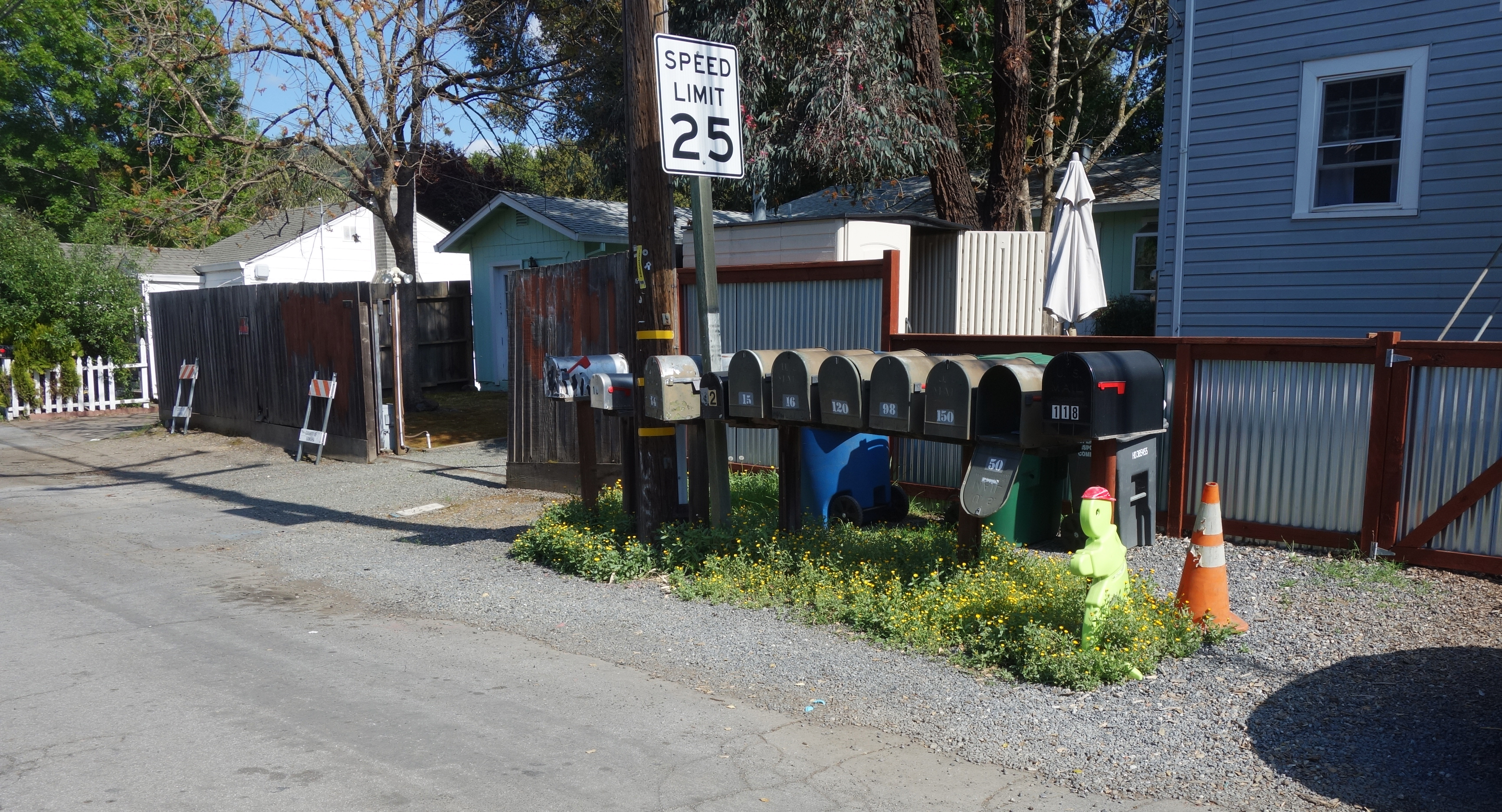
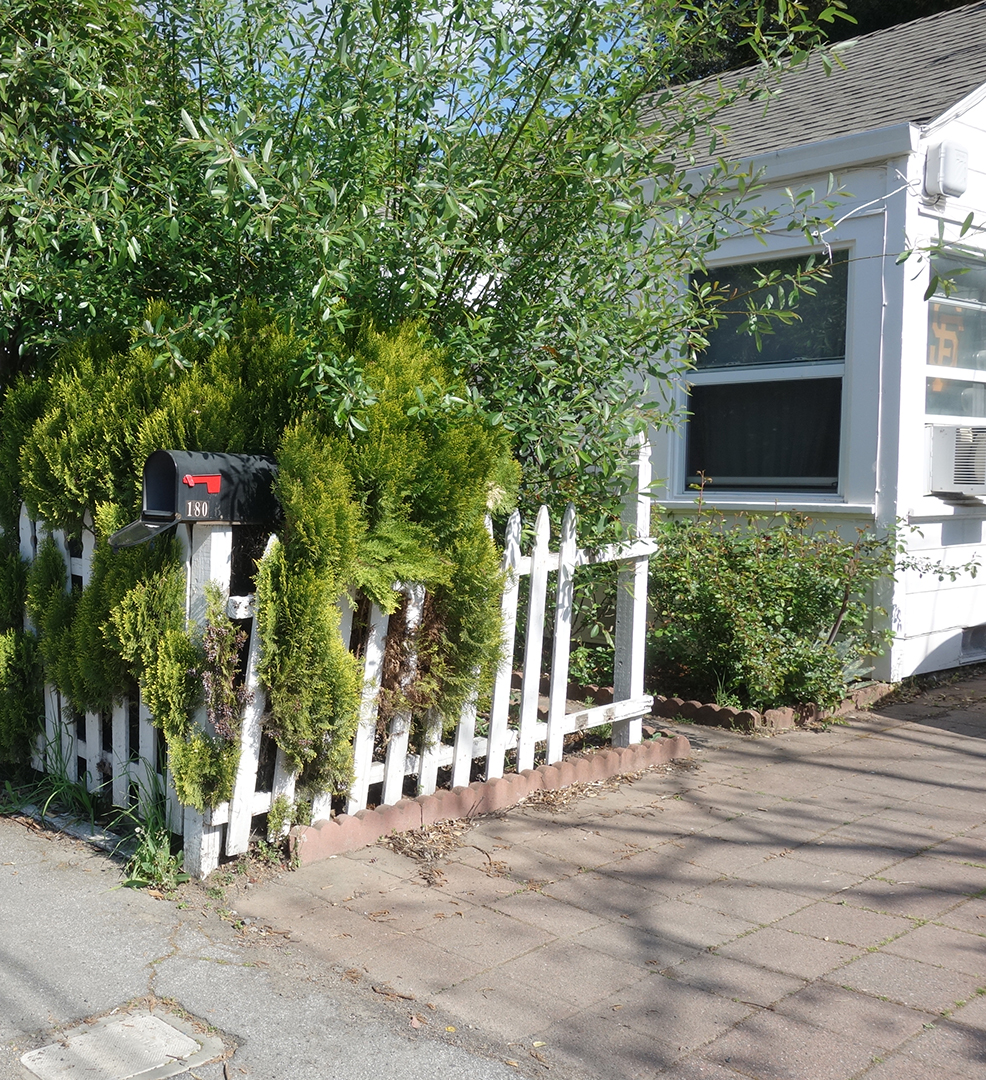
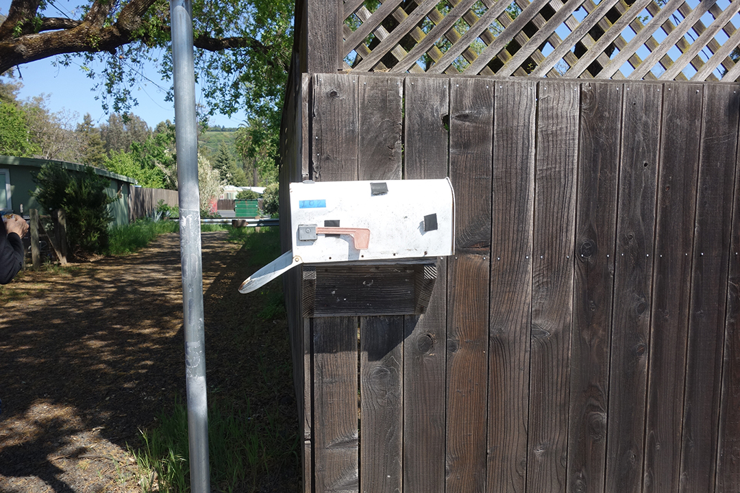
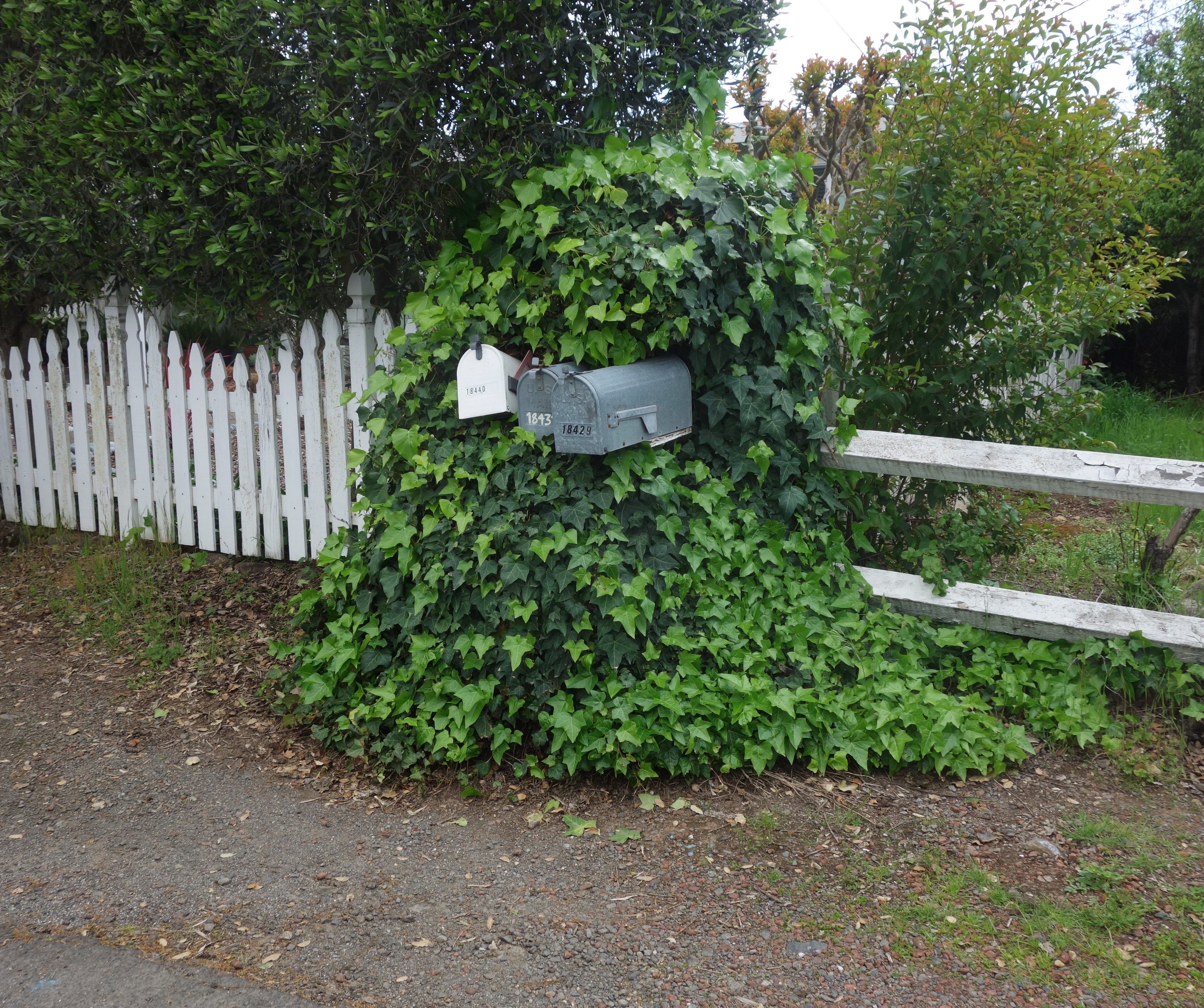
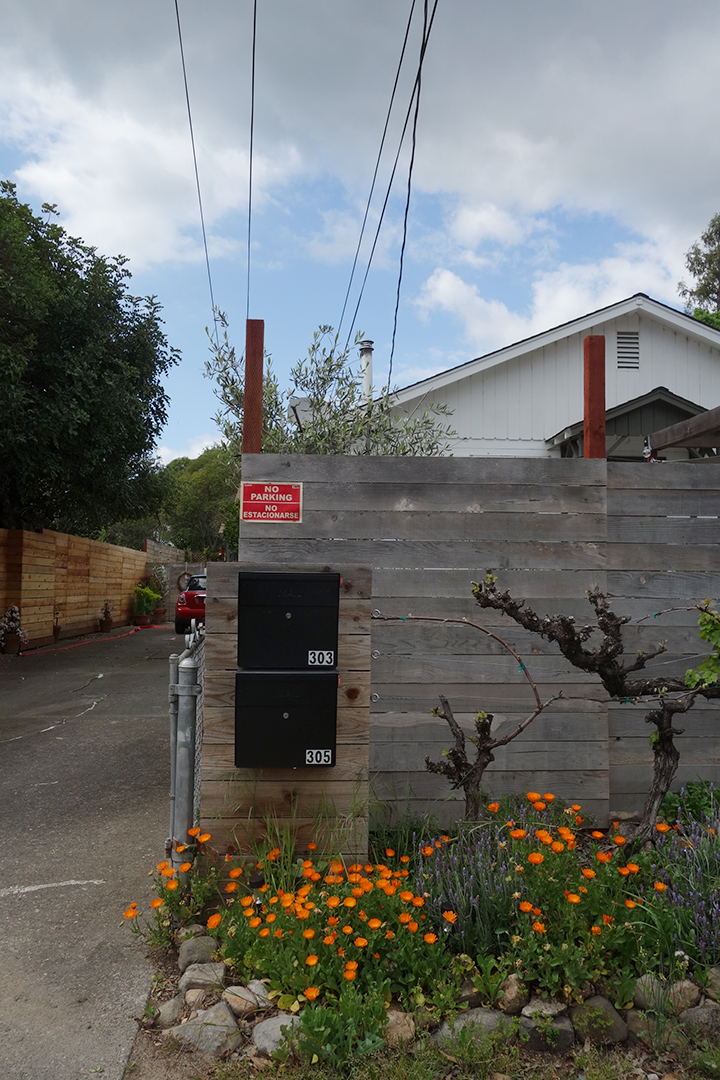
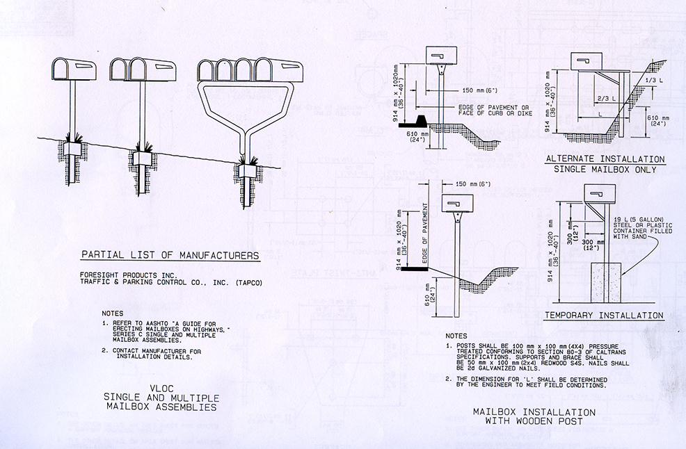
The United States Postal Service does not deliver mail to many houses in Boyes Hot Springs, Fetters Hot Springs, Agua Caliente, and El Verano, so people put mailboxes out on the street. Over time, these boxes, singly and in groups, take on personalities.
In a sense, this exhibit is a follow-up to Michael Acker’s book “The Springs, Resort Towns of Sonoma Valley,” (Arcadia Publishing, 2017) with many more photographs and ephemera, and in color. Here is a small preview.
Thanks to the Sonoma Valley Historical Societyfor assistance, especially Lorrie Baetge Fulton, Patricia Cullinan, Kate Shertz, Peter Meyerhoff, Roy Tennant, and Lynn Downey, and for images, and access to the Index Tribune archive.
Thanks also to the many community members who have shared their memories and photographs with the author.