UPDATE at the end of the post.
Highway 12 is thought by Breck Parkman, retired State Parks archeologist, to have originally been a mammoth trail from the valley that is now the Bay out to the Russian River.
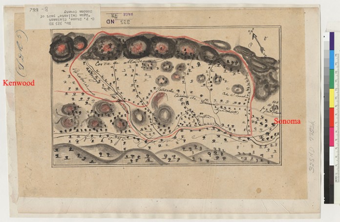
The Diseño is a hand-drawn map showing the boundaries of a land grant, used in Alta California during the Mexican period. Several were drawn for the Rancho Agua Caliente, which encompassed the Springs area. Ecological historian Arthur Dawson interprets it this way:
“The mission is on the far right, Hwy 12 route is marked ‘camino de sonoma’–For some reason it changes from grey to red just west of ‘Portuzuelo’, which means a pass or a gap and I would bet refers to the area around the CalFire station by the Regional Park. In a car it’s not very noticeable, but on foot or horseback it does qualify as a pass. Also notice the Casa de Rancho, somewhere near Fiesta Market; Agua Caliente; and ‘siembra’ which means ‘plowed field. Arroyo Grande is Sonoma Creek. Corte de Madera is the neighborhood of Atwood Ranch. ‘Arroyo de los Guilucos’ =Nunn’s Canyon. Outline of the ranch is in red as is part of the road, which is a little confusing. But once you know that it makes sense.”
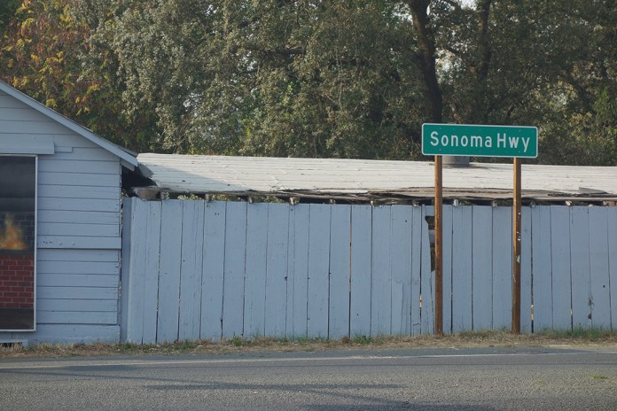
California State Highway 12, know as Sonoma Highway from the Town of Sonoma to Santa Rosa, once referred to as the Santa Rosa Road, is the main street of the old resort area of Sonoma Valley, including Boyes Hot Springs, Fetters Hot Springs, and Agua Caliente. Only a little west of the Highway is El Verano, the fourth settlement in the resort quartet. The entire road runs from Sebastopol in the west, to the town of San Andreas in the Gold Country to the east. In Napa County it runs through the Carneros region. It was there that photographer Charles O’Rear snapped the picture that was to become “Bliss,” the Microsoft screen saver that some claim is the most viewed photograph in history (see note.)
Sonoma Highway at Spain St. in Sonoma
According to Californiahighways.org (a massive resource!):
“Historically, this route is close to the original “El Camino Real” (The Kings Road). A portion of this route has officially been designated as part of “El Camino Real.
The portion of this route running through Sonoma County is called the “Valley of the Moon Scenic Route“. “Valley of the Moon” was the name Jack London, resident of Glen Ellen, coined for this area. The first such sign with this name is when the Farmers Lane portion ends in Santa Rosa.
South of the town of Sonoma, Route 12 is called Broadway until it intersects Route 121 near Schellville. Route 12/Route 121 to Napa County is called alternately “Fremont Drive” or “Carneros Highway.” The latter term continues into Napa County.“https://www.cahighways.org/009-016.html#012
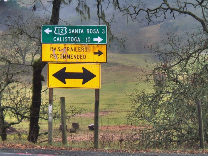
At Calistoga Rd. in Santa Rosa.
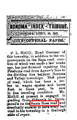
- First mention in the IT of the “Santa Rosa Road.”
P.L. McGill, Road Overseer of the township, in addition to the improvements on the Napa road, mention of which was made a few weeks ago, has just finished repairing the Petaluma road from Agnew’s Lane to the dividing line between Sonoma and Vallejo townships. This piece of road, which has been a terror to wagon spokes and horse flesh in times past, is now in fine traveling condition. Mr. McGill at present is engaged in grading from Gibson’s to Drummond’s on the Santa Rosa road and eventually expects to have every bad road in his township in a through state of repair.
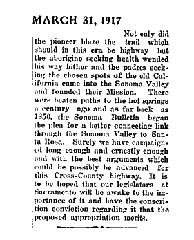
In 1917, arguing for highway improvements, the IT states “There were beaten paths to the hot springs a century ago and as far back as 1850, the Sonoma Bulletin began the plea for a better connecting link through the Sonoma Valley to Santa Rosa.”
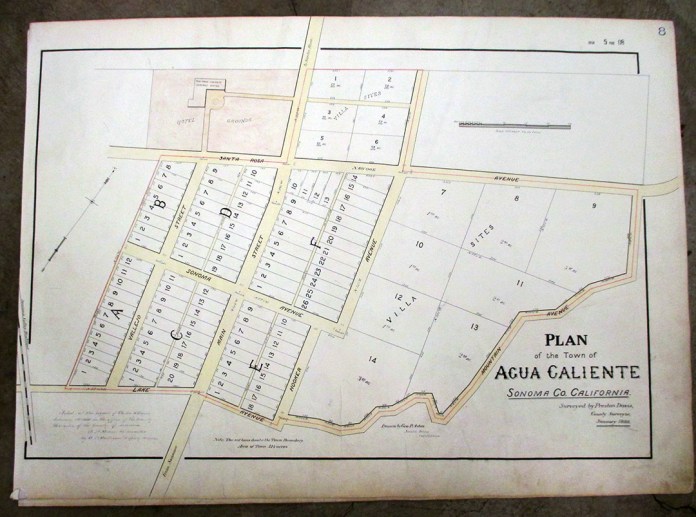
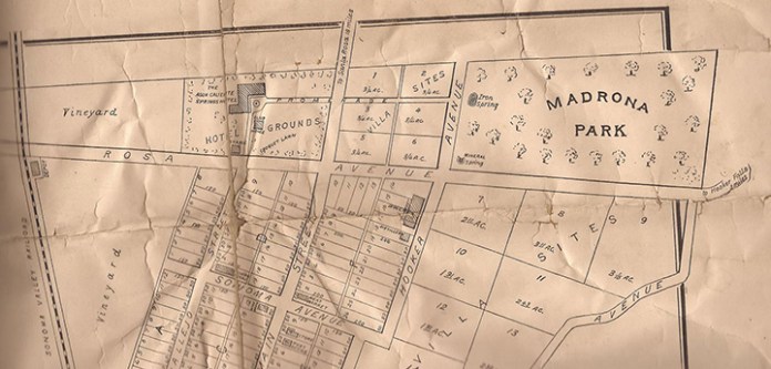
On these maps of Agua Caliente from 1888, the road from Sonoma to Santa Rosa is called Main Street.
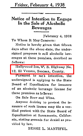
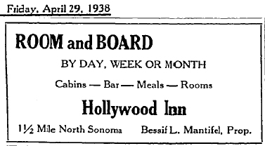
In 1938 Bessie L. Mantifel applied for a liquor license for her Hollywood Inn, located on W. S. State Highway #12, El Verano, Sonoma County.
Promotional match book covers and brochures had maps inside.


Before the 1964 renumbering, this route was signed as Sign Route 12 for most of its length. However, SR 12 was designated as Legislative Route 51 (LR 51) from SR 116 to SR 121.
1940 Census map.
Note on “Bliss”:
In January 1996 former National Geographic photographer Charles O’Rear was on his way from his home in St. Helena, California, in the Napa Valley north of San Francisco, to visit his girlfriend, Daphne Irwin (whom he later married), in the city, as he did every Friday afternoon. He was working with Irwin on a book about the wine country. He was particularly alert for a photo opportunity that day, since a storm had just passed over and other recent winter rains had left the area especially green.[4] Driving along the Sonoma Highway (California State Route 12 and 121) he saw the hill, free of the vineyards that normally covered the area; they had been pulled out a few years earlier following a phylloxera infestation.[5] “There it was! My God, the grass is perfect! It’s green! The sun is out; there’s some clouds,” he remembered thinking. He stopped somewhere near the Napa–Sonomacounty line and pulled off the road to set his Mamiya RZ67 medium-format camera on a tripod, choosing Fujifilm‘s Velvia, a film often used among nature photographers and known to saturate some colors.[1][6] O’Rear credits that combination of camera and film for the success of the image. “It made the difference and, I think, helped the ‘Bliss’ photograph stand out even more,” he said. “I think that if I had shot it with 35 mm, it would not have nearly the same effect.”[7] While he was setting up his camera, he said it was possible that the clouds in the picture came in. “Everything was changing so quickly at that time.” He took four shots and got back into his truck.[4][8] According to O’Rear, the image was not digitally enhanced or manipulated in any way. [9
Over the next decade it has been claimed to be the most viewed photograph in the world during that time.[3] Other photographers have attempted to recreate the image, some of which have been included in art exhibitions. Wikipeidia
Paste copy of cease and desist order from Microsoft here.
Index Tribune courtesy of the Sonoma Valley Historical Society
Diseño courtesy Bancroft Library
2nd Agua Caliente map courtesy Jeff Gilbert
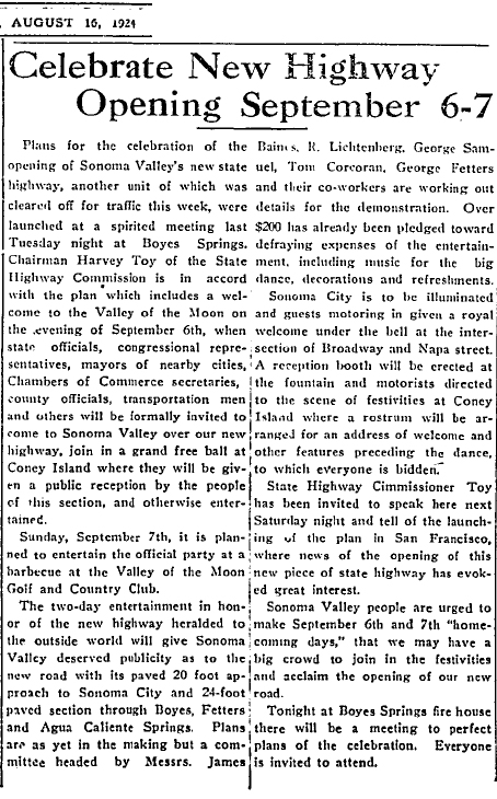
In 1924 we celebrated the opening of the newly paved highway. It was quite a grand event! Chairman of the State Highway Commission Harvey Toy is mentioned. There is a Toy Lane in Boyes Hot Springs.