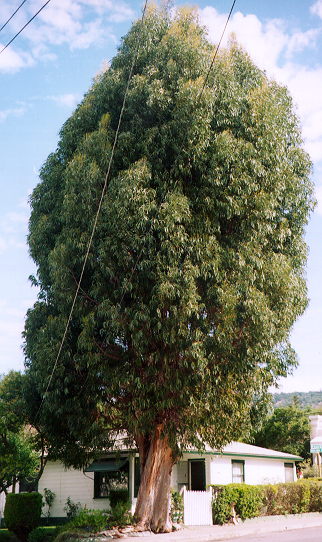
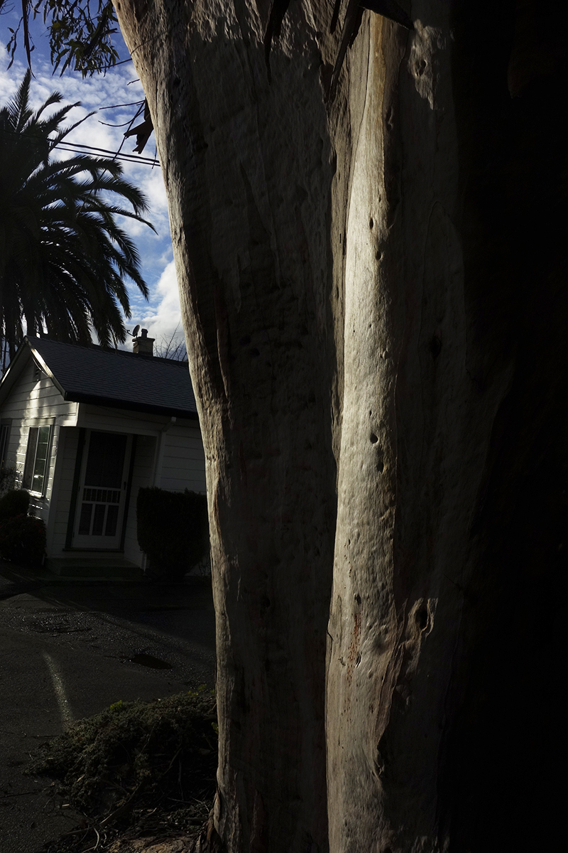
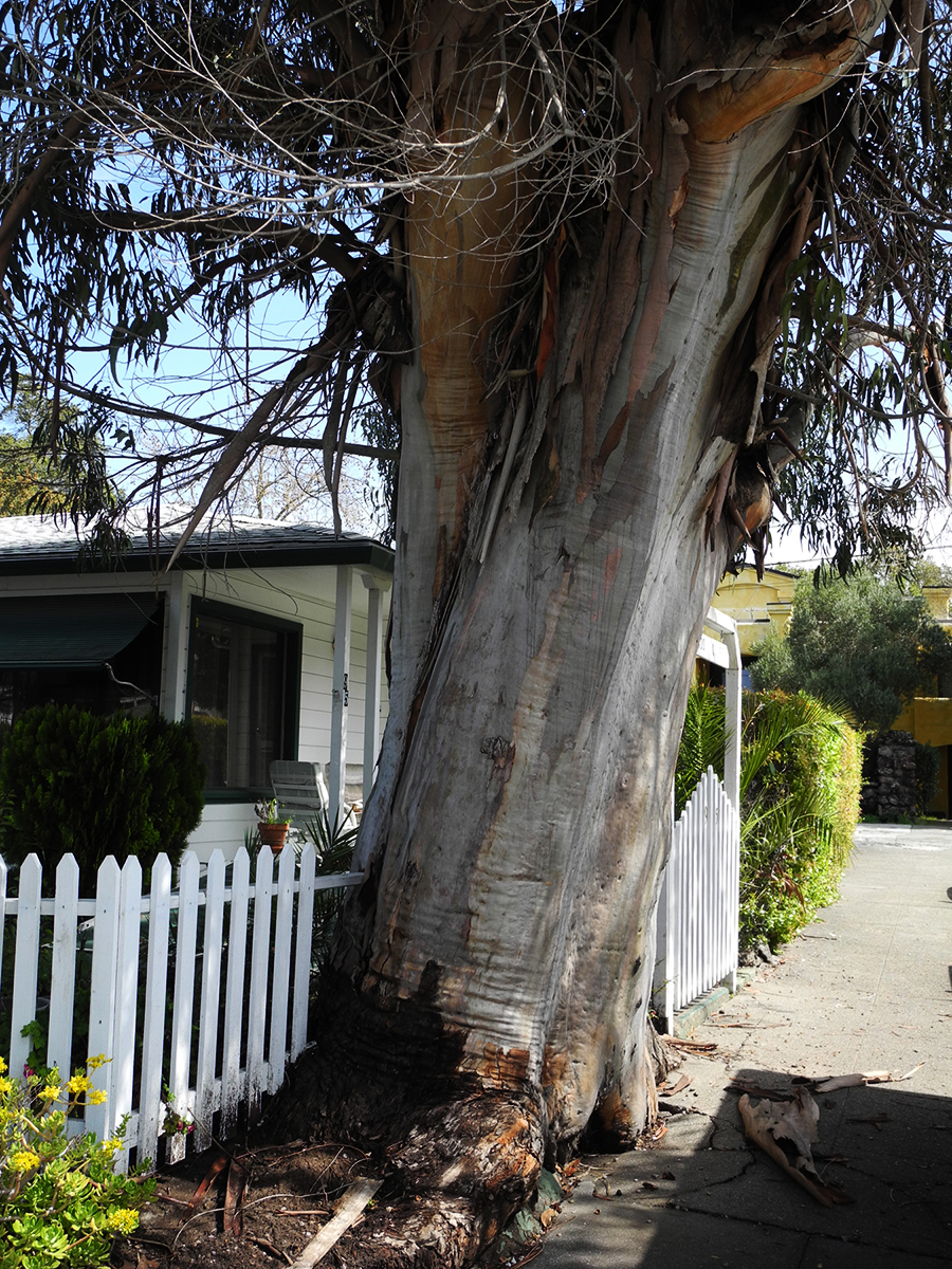
It’s always sad when we lose a tree. I called it “the Big Euc.”
I know eucalyptus are exotic, invasive, and sometimes dangerous (they are highly flammable and may have other impacts, but the story is not only negative: see https://ucanr.edu/site/igors-urban-website/eucalyptus-california) .But they are, by now naturalized in California and in our minds. We have grown up with them. Their fragrance is embedded in our olfactory cortexes. The beauty of their variegated bark delights.
This friend grew on Vallejo Ave. near Highlands Blvd. in Boyes Hot Springs. Probably a volunteer, it may have sprouted around the time the motor court behind it was built, possible just after the 1923 fire. https://springsmuseum.org/2017/11/01/fire/
2007
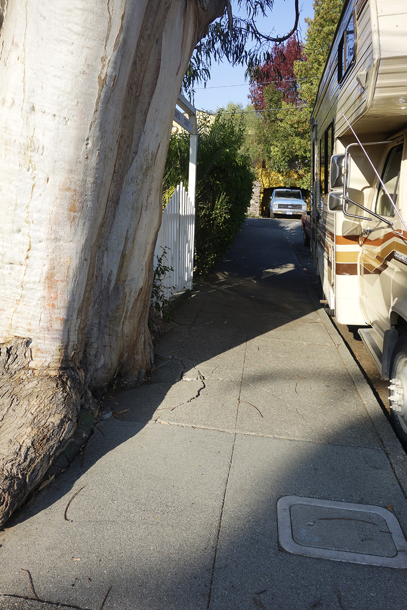
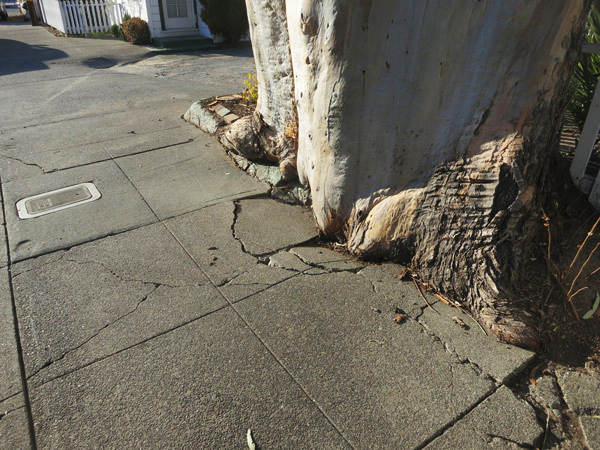
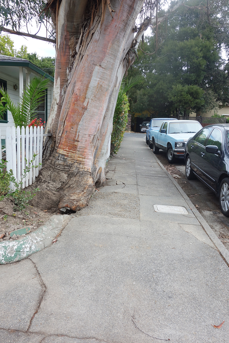
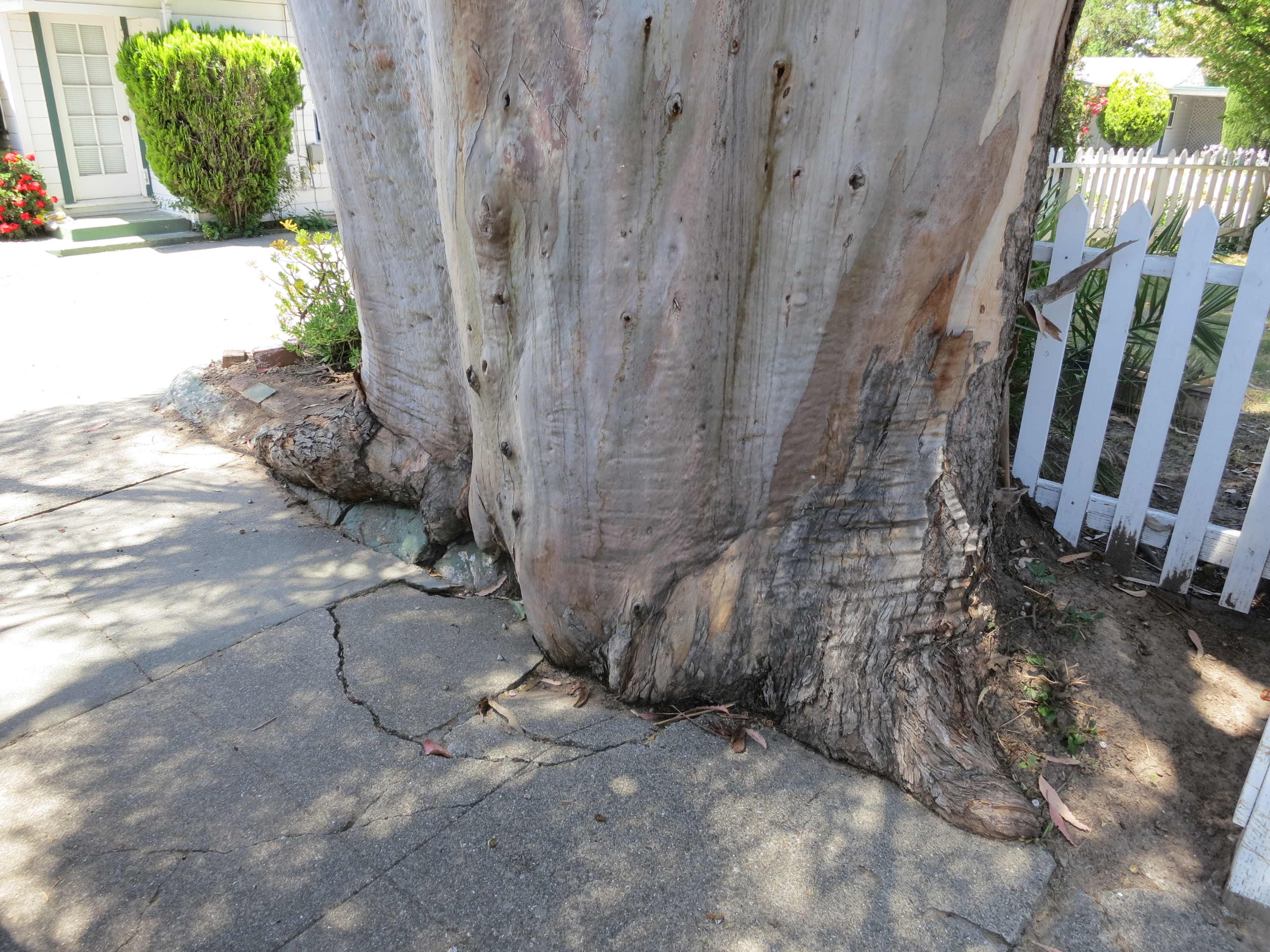
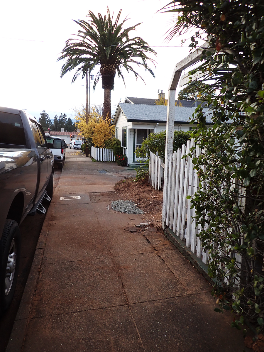
I actually liked the way this tree was grinding up the concrete sidewalk, like a very slow motion wave of living wood. I have special place in my heart for the interaction of trees and the built environment.
Makes beautiful shadows.
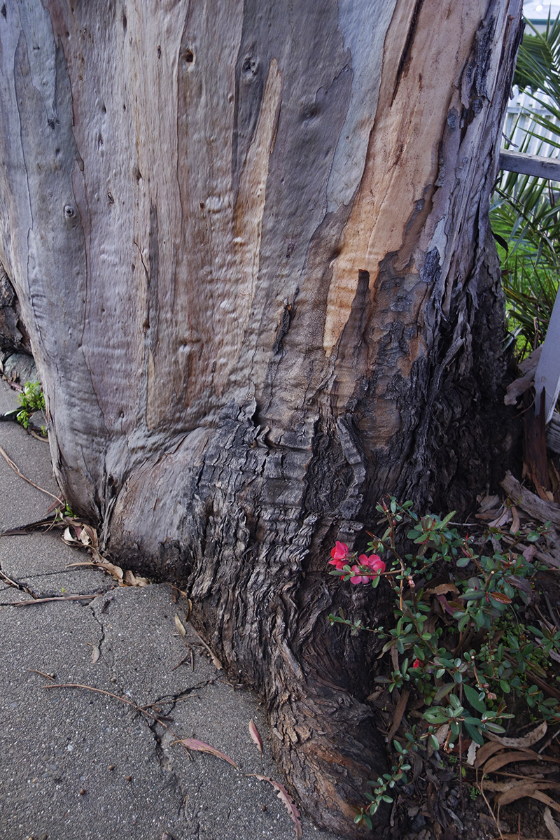
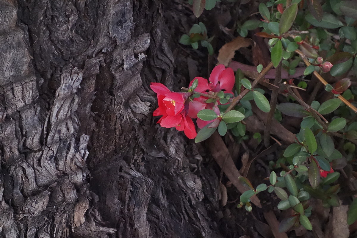
This quince volunteer bloomed every February for Lunar New Year.
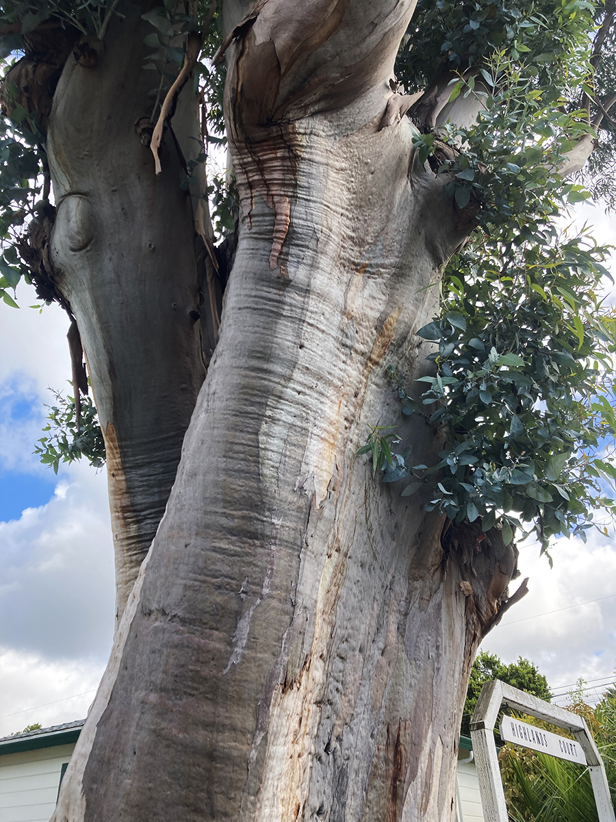
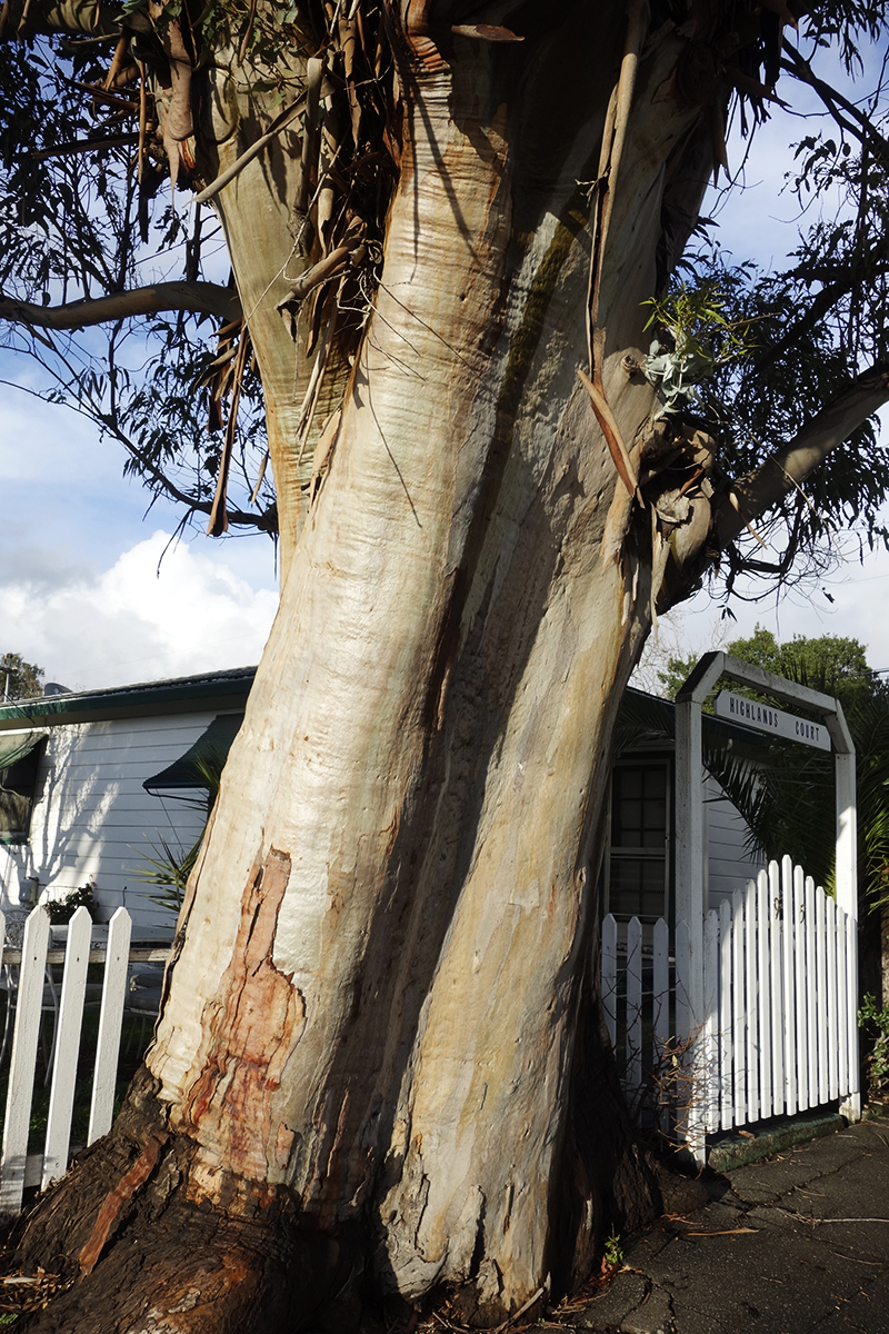
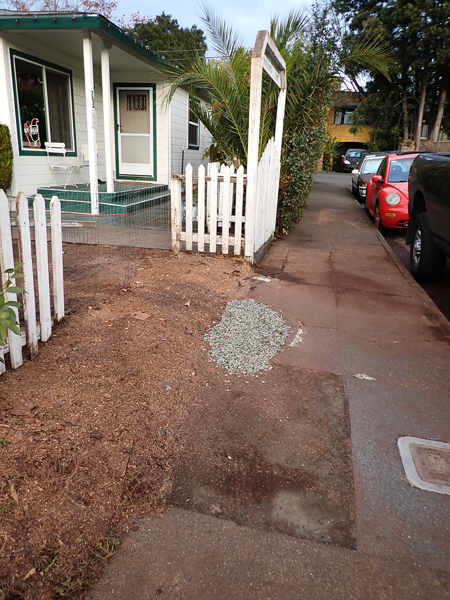
Eventually a piece of the concrete was removed for some underground plumbing repair and replaced with crushed rock.
The green concrete curb continues to be submerged in tree.
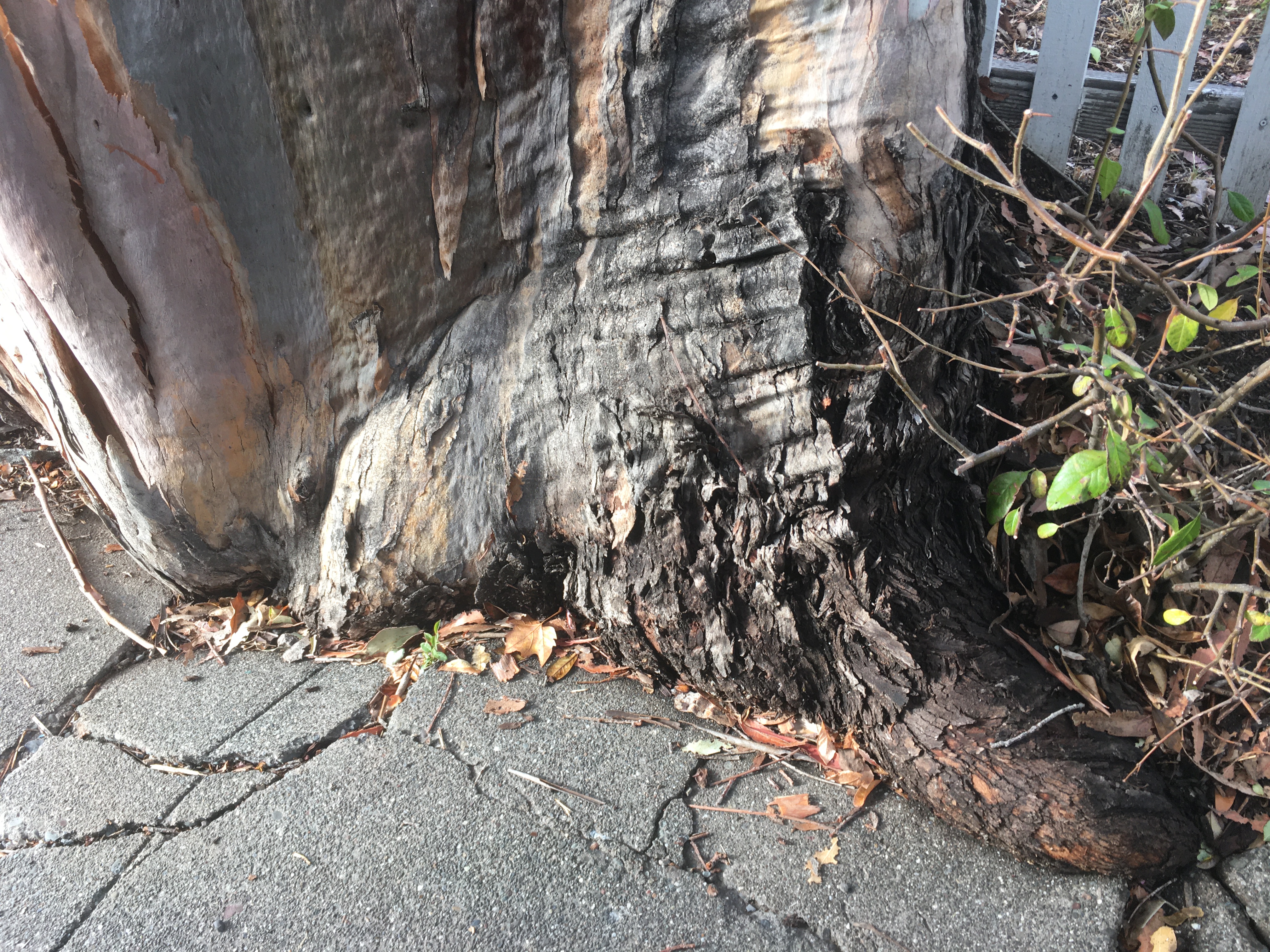
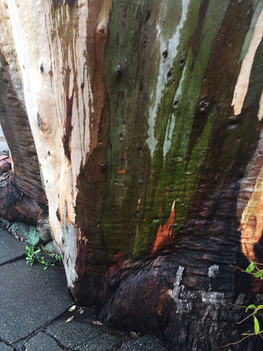
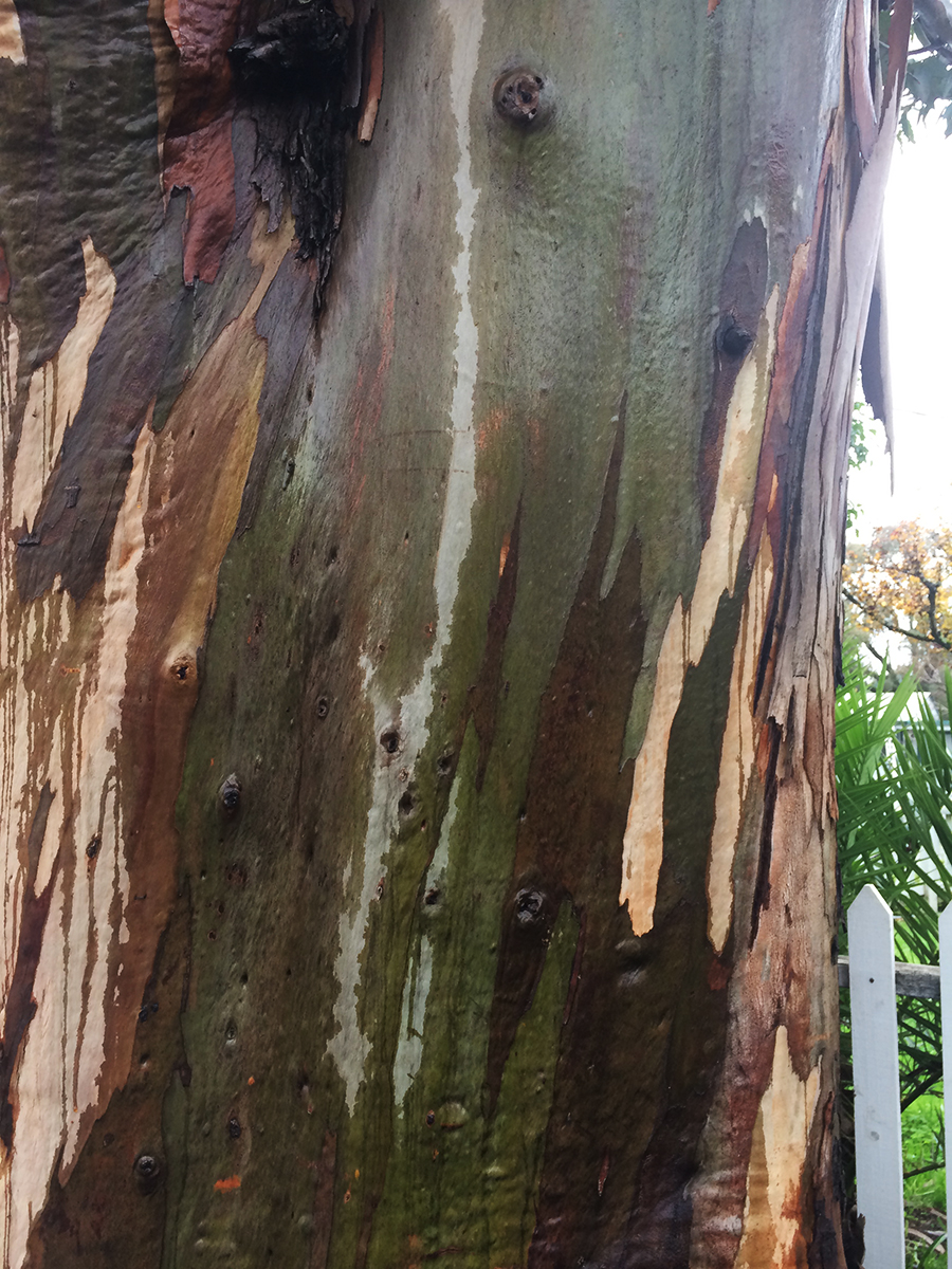
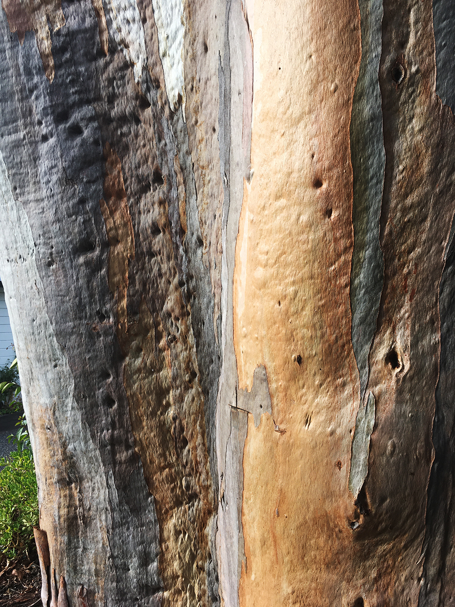
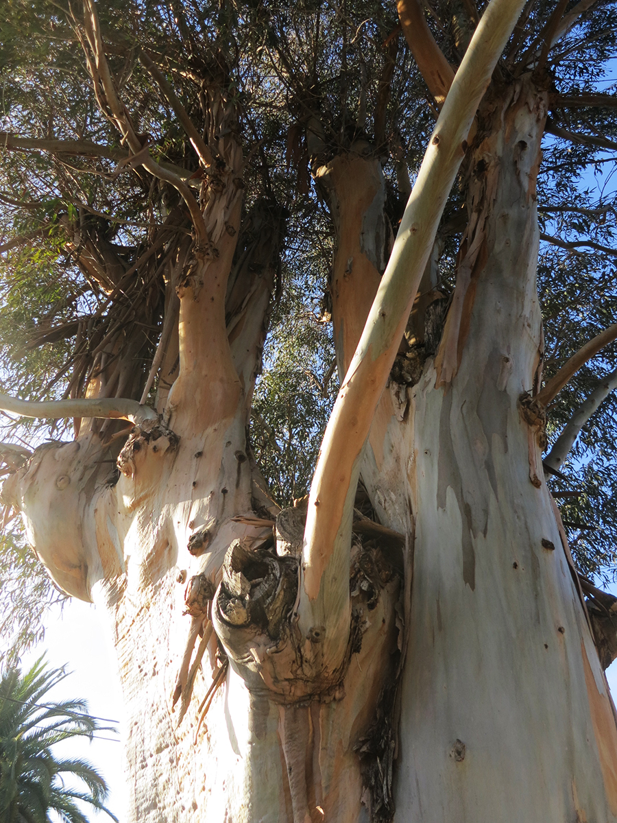
Some beauty shots.
The wet bark is even more beautiful, and the fragrance intensifies.
So limb-like, sensuous.
December 2025
Just a memory
The palm stands alone
“Bark and Bite.” Painted photo collage circa 20″x30″. 2019. Michael Acker
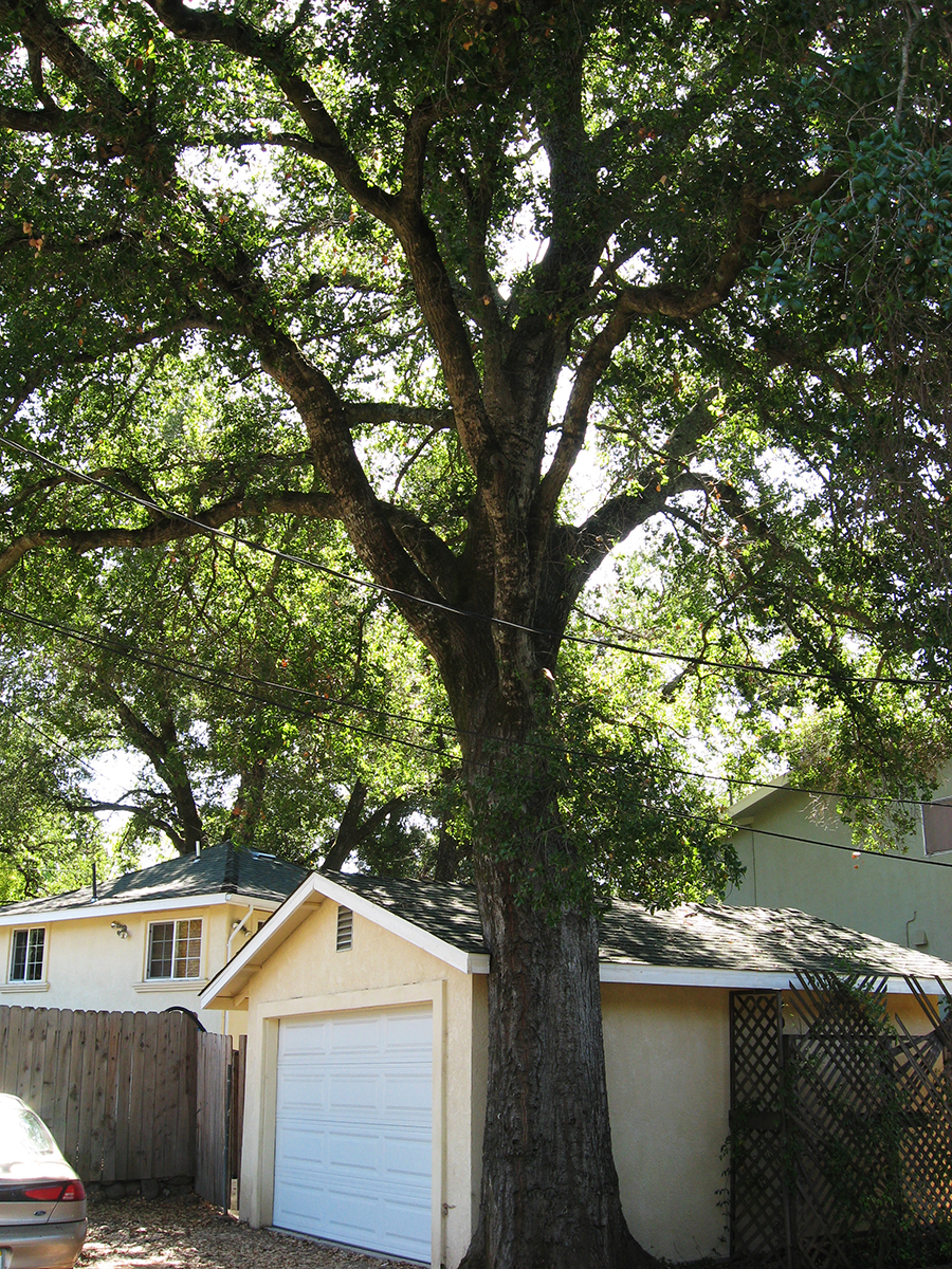
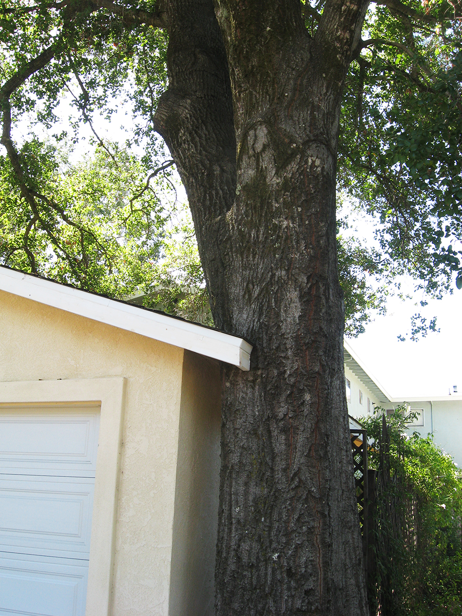
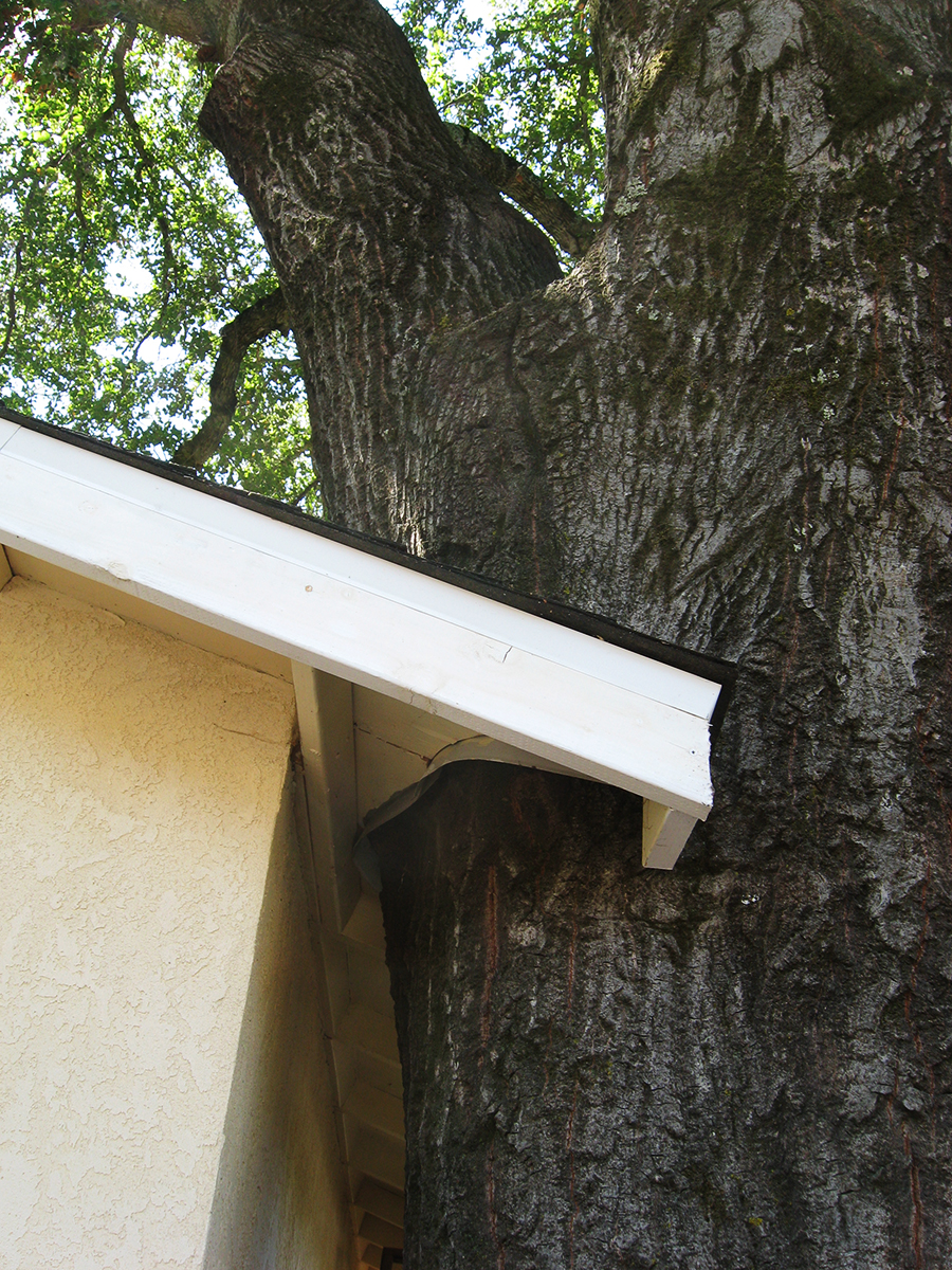
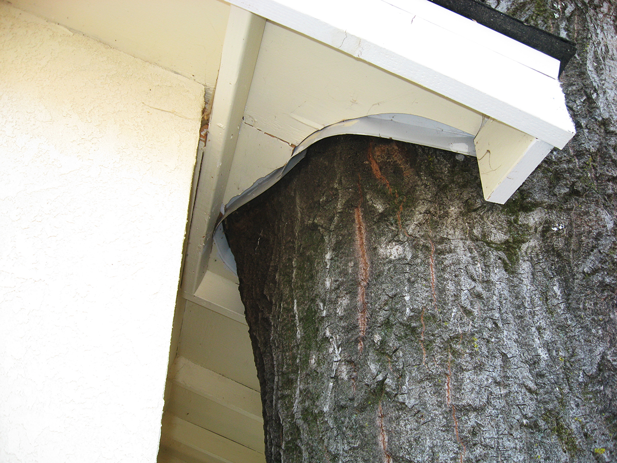
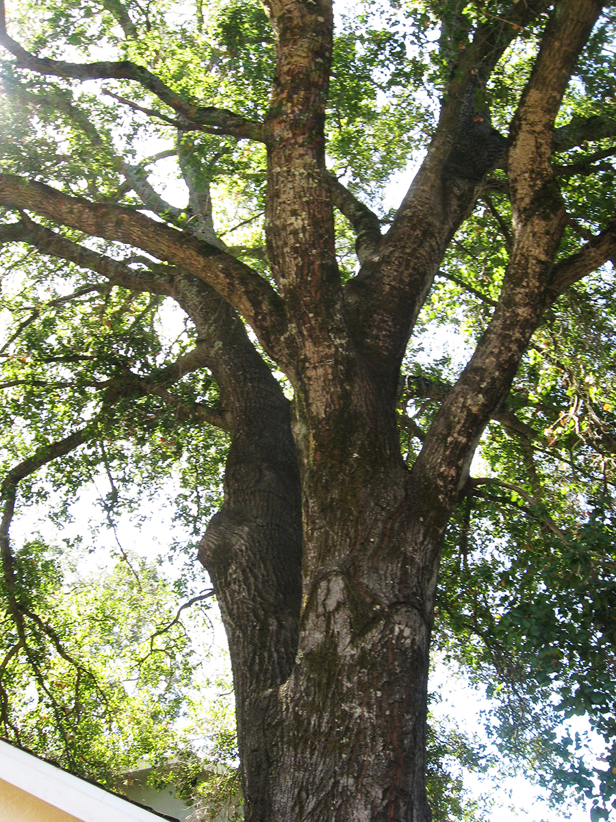
On Vallejo Ave. near the corner of Calle del Monte, in Boyes Hot Springs, there stood a prime example of the ongoing interaction between trees and the built environment: A garage was built next to an oak, the oak grew, humans adapted the structure to accommodate the native tree. This was a lovely thing to see.
Prior to 2009 when I first photographed it, the structure had been so dilapidated that I was sure they were going to tear it down. But they restored it and did a neat job of cutting the roof overhang around the mighty Quercus.
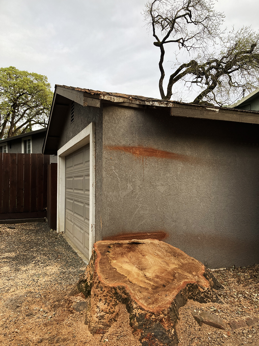
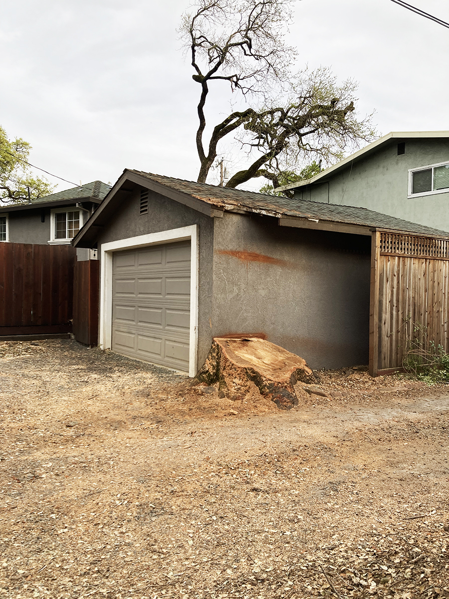
Flash forward to 2024. The tree is gone, its pleasant pool of shade just a memory. In the last two photos you can see that another tree, in the background, has also been removed (see the first photo), for fire safety, they say. Whether necessary or not, we always mourn the loss of a tree.
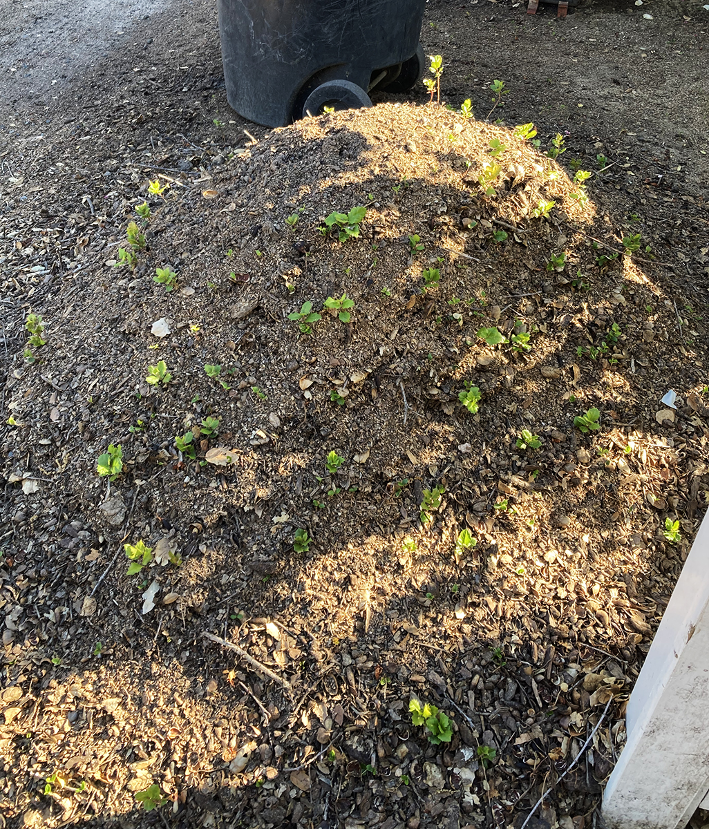
Below are photos of a mound of earth and wood chips next to the stump. It is absolutely covered in oak seedlings. Nature continues!
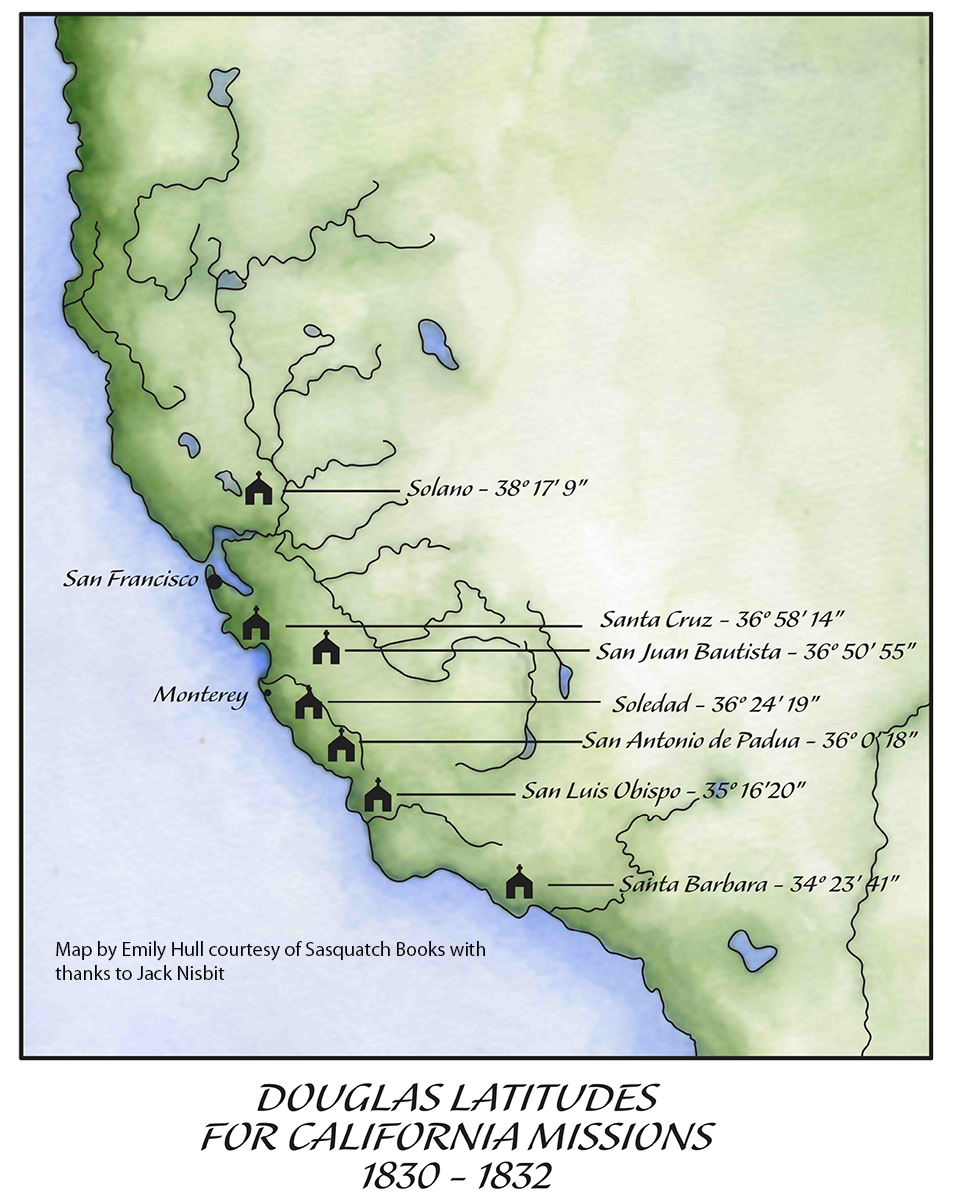
David Douglas, the great English botanist, for whom the Douglas Fir, and many other plants is named, collected in the Pacific Northwest, the Eastern seaboard, and Hawaii, in the years 1823-1834. He also spent some time in California. (čəbidac is the Lushootseed name for D. Fir. Another Coast Salish name for the tree, used in the Halkomelem language, is lá:yelhp https://shoreline.libguides.com/treecampus/douglas_fir)
He traveled in there during the years 1830-32, collecting many species then unknown to botanists. He visited the colonial settlements from Santa Barbara to Sonoma, measuring the latitude and longitude at many of them. While in Sonoma he probably spent some time with the Mission fathers, as he had further south. He appreciated them as educated men who spoke fluent Latin.
Back in London in 1827, Douglas had trained in surveying with geographer and astronomer Edward Sabine. On his 1829 return voyage around the Horn to North America, Douglas practiced with the instruments and studied the math. He became proficient at the difficult task of measuring longitude, given the unreliability of chronometers at that time.
The longitude as measured today: 38° 17′ 41.2368” N.
According to Willis Jepson, the dean of California botany, writing in 1933, “He was the first botanical collector in California in residence for any extended period and during this time he traveled through the Coast Ranges from Monterey north to the Mission San Francisco De Solano (Sonoma) and south to the Mission of Santa Barbara. He was not only the first traveler to collect the extensively rich and varied spring flora of the Coast Ranges, nearly all the species of which were new to botanical science, but also the first to leave some written description of it. Hundreds of new species, our most familiar plants, were based on the Douglas collection…” And “It has been suggested that Douglas visited Mt. Diablo, but the form of Calochortus pulchellus which he obtained might have been collected in the Sonoma region.”
Willis Linn Jepson was a co-founder of the Sierra Club and founder of the California Botanical Society. The oldest known California Bay Laurel (Umbellularia californica) is named after him. https://www.smcgov.org/parks/what-see-crystal-springs-trail
Calflora: Information on California plants for education, research and conservation. [web application]. Berkeley, California: The Calflora Database [a non-profit organization]. Available: https://www.calflora.org/ (Accessed: April 30, 2023).
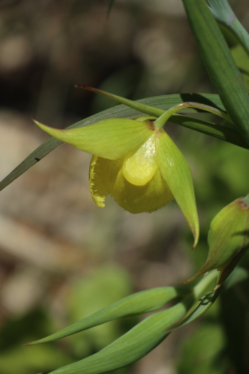
Calochortus pulchellus is a rare species of flowering plant in the lily family known by the common name Mt. Diablo fairy-lantern or Mount Diablo globelily.
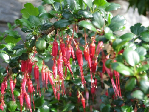
Of the first plant he encountered in California, Douglas stated (one-upping his mentor Menzies?), “Early as was my arrival on this Coast Spring had commenced. The first plant I took in my hand in full flower was Ribes Staminum, (Smith) remark able for the length and crimson splendour of its stamens, a plant not surpassed in beauty by the finest Fuchsia, for the discovery of which we are indebted to the good Sir Arch. Menzies in 1779.” The epithet Ribes staminum is way out of date. It has been suggested to me by the esteemed botanist Steve Acker, Phd. That the species described by Douglas would be Ribes divaricatum var. pubiflorum. However, given Douglas’ description it could be Fuchsiaflower Gooseberry, Ribes speciosum
My thanks to Peter Meyerhoff and Jack Nisbit for assistance. Jack is the author of two books about David Douglas, “The Collector: David Douglas and the Natural History of the Northwest” and “David Douglas: A Naturalist at Work” available from Sasquatch Books: https://sasquatchbooks.com/
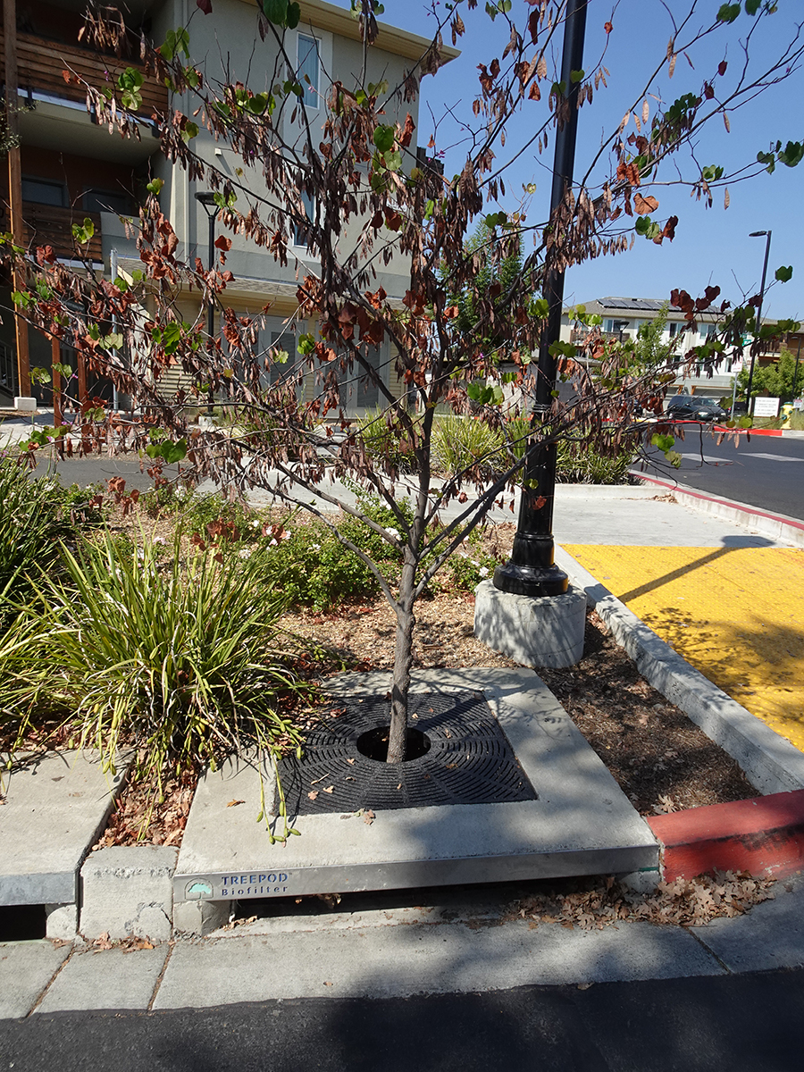
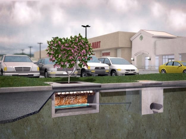
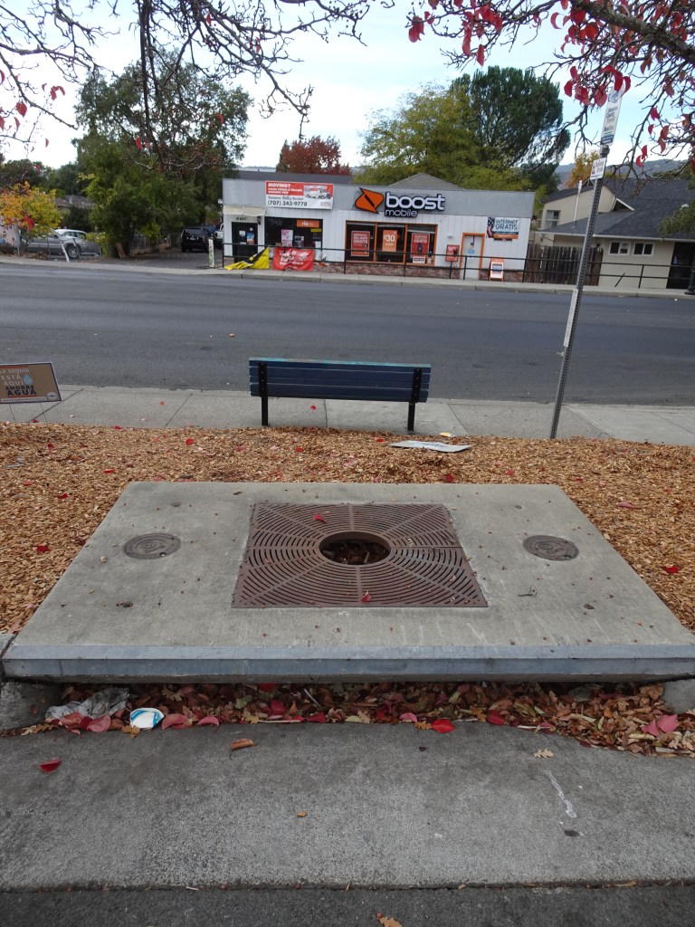
“Filterra is an engineered high-performance bioretention
system.” What is a bioretention system? Read on.
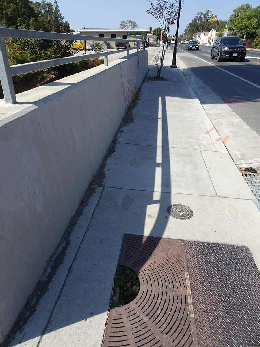
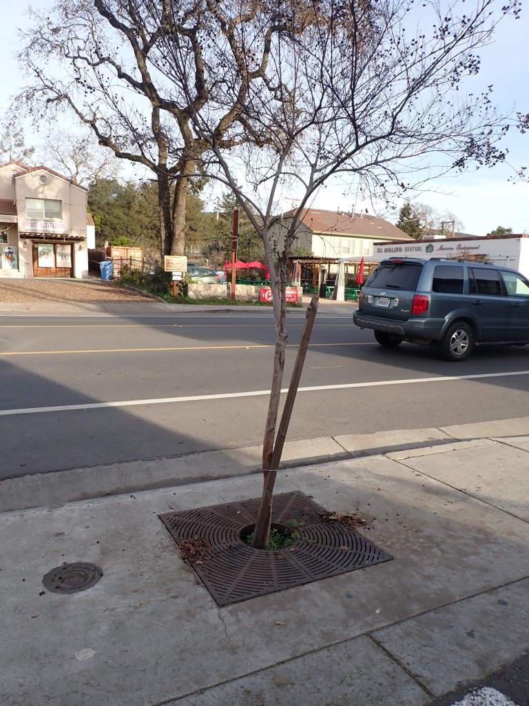
Location:El Molino restaurant at Central Ave.
How does Filterra work? Again, from the brochure:
“Stormwater enters the Filterra through a pipe, curb inlet, or sheet flow and ponds over the pretreatment mulch layer,
capturing heavy sediment and debris. Organics and microorganisms within the mulch trap and degrade metals and
hydrocarbons. The mulch also provides water retention for the system’s vegetation.
2. Stormwater flows through engineered Filterra media which filters fine pollutants and nutrients. Organic material in the
media removes dissolved metals and acts as a food source for root-zone microorganisms. Treated water exits through an
underdrain pipe or infiltrates (if designed accordingly).
3. Rootzone microorganisms digest and transform pollutants into forms easily absorbed by plants.
4. Plant roots absorb stormwater and pollutants that were transformed by microorganisms, regenerating the media’s
pollutant removal capacity. The roots grow, provide a hospitable environment for the rootzone microorganisms and
penetrate the media, maintaining hydraulic conductivity.
5. The plant trunk and foliage utilize nutrients such as Nitrogen and Phosphorus for plant health, sequester heavy metals into
the biomass, and provide evapotranspiration of residual water within the system.”
They filter out contaminants in storm water using plants, soil, and microorganisms. Clear?
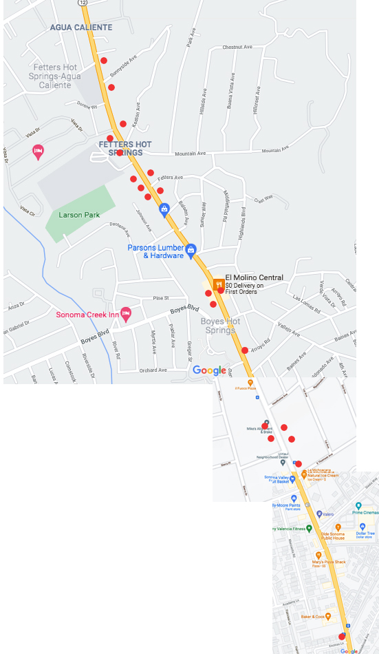
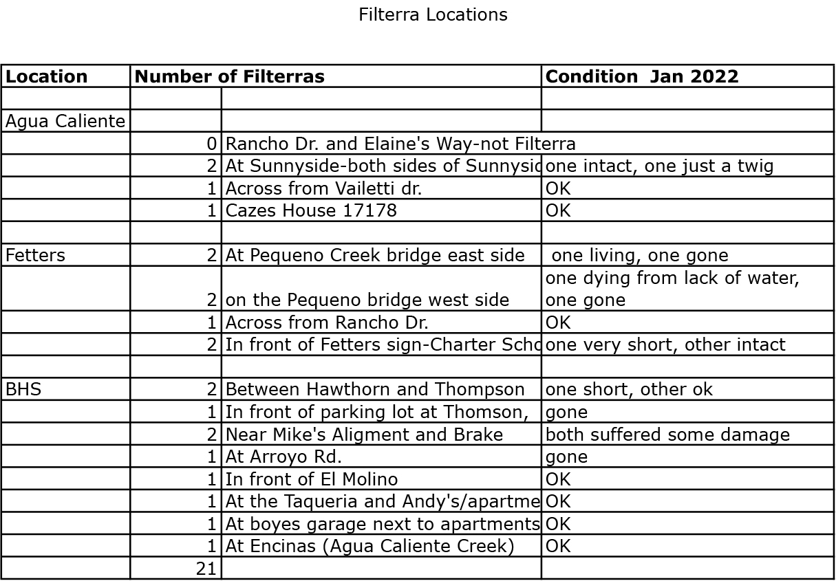
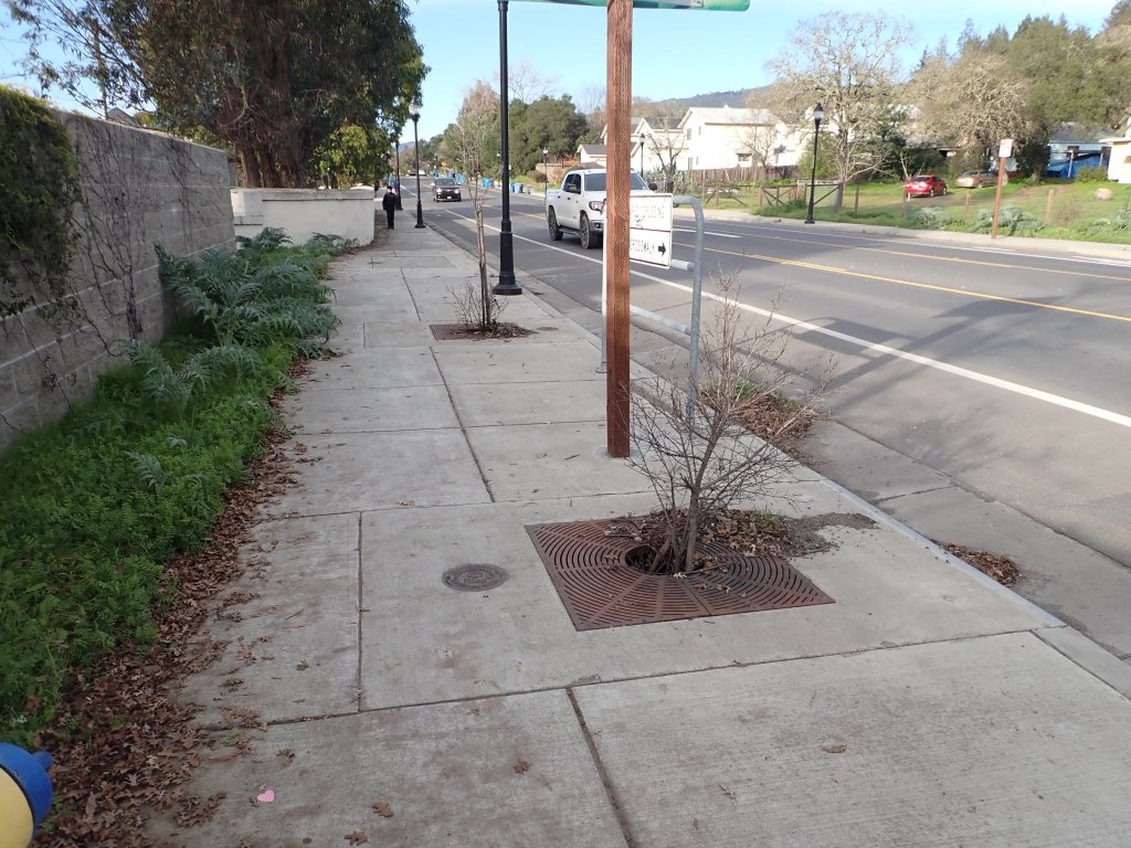
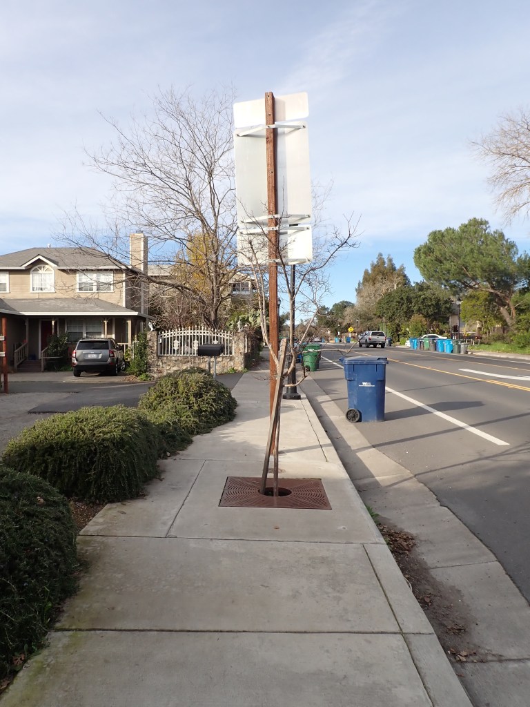
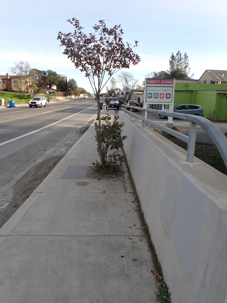
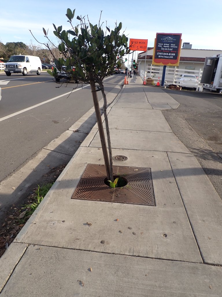
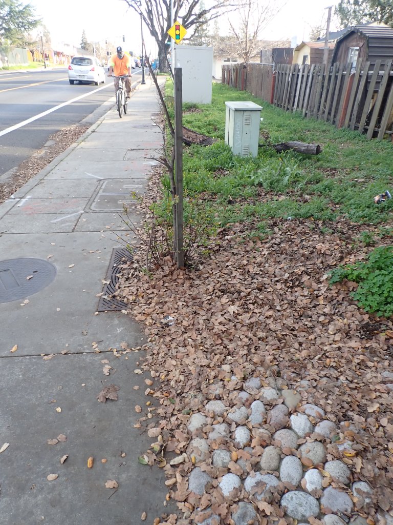
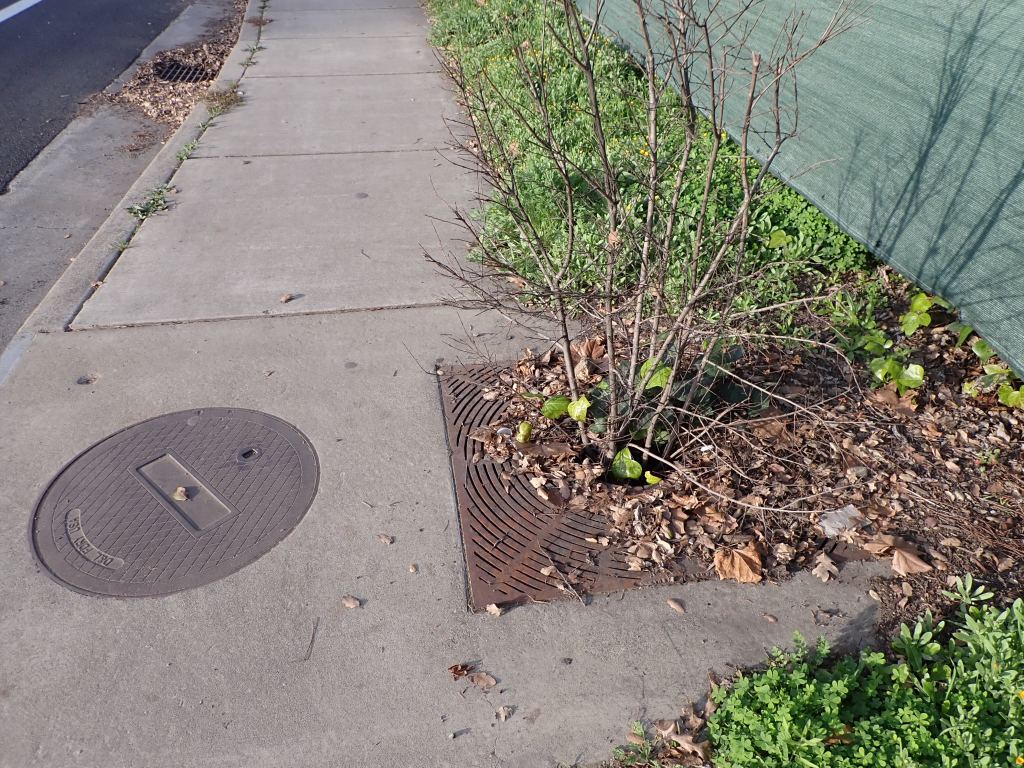
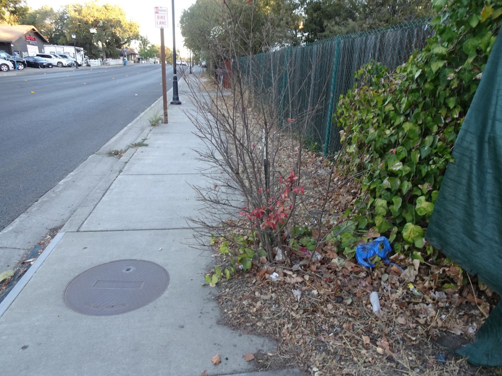
Page one of the Storm Water Treatment Plan of the Highway 12 Redevelopment project for sidewalks and streetlights. Dated 9/30/08. The table lists eight Filterra units. This is for the first phase of the project. When the entire project was done, there were twenty-one.
Page two shows the units near Thompson St. the drawing shows two units at the parking lot. Only one was installed.
Filterra locations
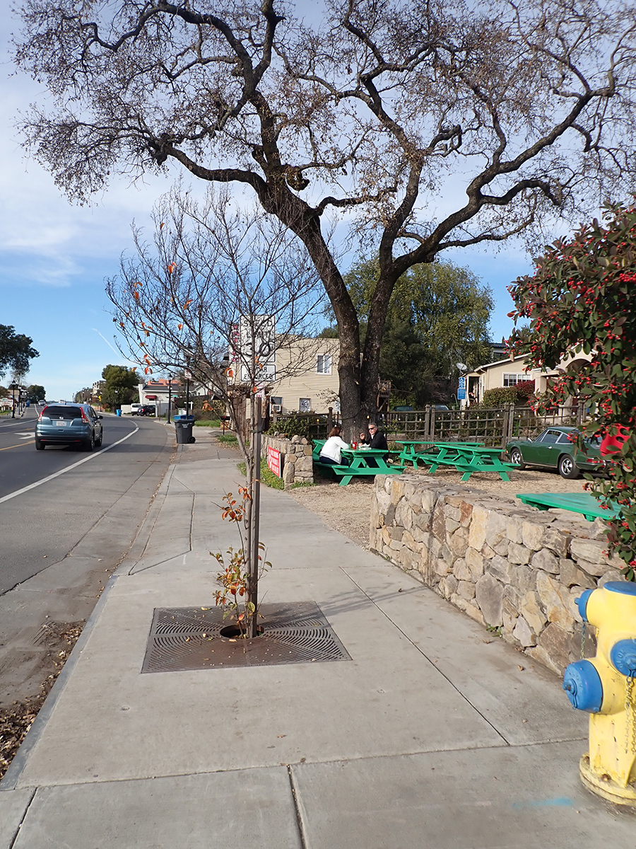
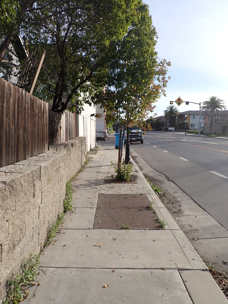
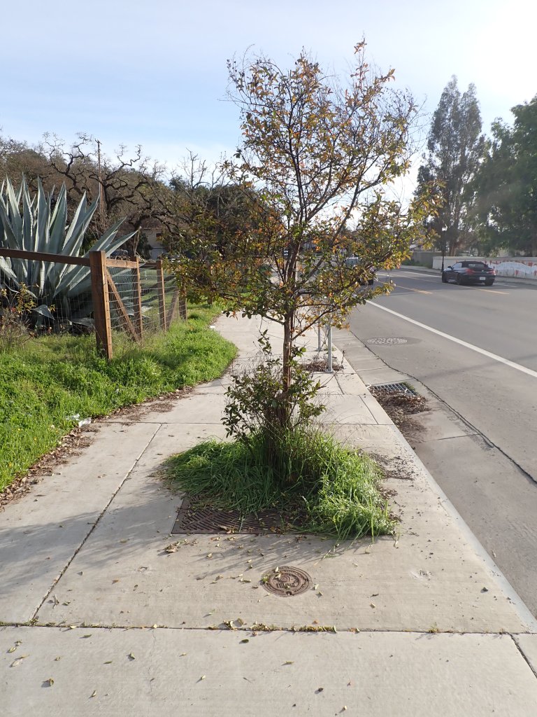
There were two problems from the start: the trees were not watered, or not watered enough, in the months after they were planted, and they were repeatedly vandalized. Well, three problems actually. Some of the units were installed in sidewalks so narrow that you couldn’t easily push a baby carriage around them or walk two-abreast around them. This is particularly glaring on the west side of the bridge over Pequeno Creek.
The units on the Pequeño Creek bridge, west side. the removal of the tree in the foreground might be considered a practical adaptation rather than vandalism.
From the “Common Issues” section of the brochure:
“the most apparent sign of an issue with a Filterra is dead vegetation. A dead tree will not absorb any pollutants through its roots. If you notice any of these issues occurring in your system, or if you have recently installed a unit that needs maintenance, it’s time to call AQUALIS. Our maintenance and repair teams will ensure that your Filterra units are regularly inspected and operating at peak efficiency,” and
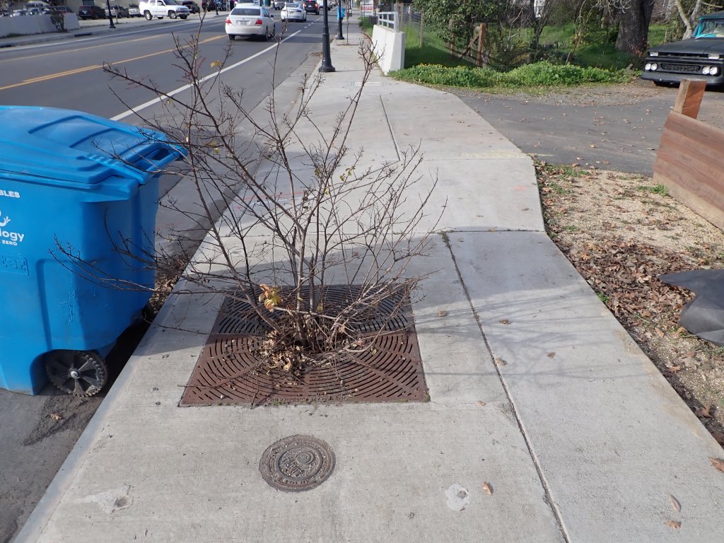
“Typically, using vegetation that naturally grows in the area is the best option, and there are specific plants required by the manufacturer. If you notice that the plant in your system is dying, it may be because the wrong type of vegetation is being used.” What species were used? I know one of the units contains nandina domestica, a decidedly non-native plant that has toxic berries and is considered invasive in some places in the U.S.
Current conditions of the plants in the Filterra units: 12 alive, 5 vandalized but still alive, 4 completely missing.
In 2021 your correspondent had this exchange with Supervisor Gorin’s office about maintenance along the highway.
My original question:
Hello,
Can you tell me who has responsibility for the areas between the sidewalks and the building along the highway in the Springs? These areas are always full of weeds and look terrible. A Caltrans worker told me the County was responsible per an agreement. At any rate, nobody is paying attention to them. Also those “Filterra” trees need attention. Thanks!, Mike
From: Karina.Garcia@sonoma-county.org
Mike,
Below the response from TPW:
…the trees in the filterra bioswales in the sidewalk are the responsibility of the county. Evidently, these trees have been repeatedly destroyed/broken by the public. Anything behind the sidewalk is the responsibility of each property owner. This means that the property owners are responsible for the grass strips noted below. Thanks!
On behalf of Supervisor Gorin thank you reaching out and bringing this matter to our attention. We also thank you for providing a clear description and picture.
Your email was shared with our Caltrans contacts as well as Sonoma County Transportation and Public Works. I am including Arielle Kubu-Jones and Hannah Whitman from our office for follow up, as I will be out of the office for a week starting Tuesday.
Kindly,
Karina
My answer: Thanks for your reply Karina. That the areas in question are the responsibility of the property owners does not square with the fact that Caltrans cleaned up a large strip in Agua Client a few months ago. At the time, the worker told me it was really the county’s responsibility, but they were doing it. However, if it really is the responsibility of the property owners, how can the County help inform and coordinate efforts at clean up and beatification? Whoever has the legal responsibility, it’s a community matter that effects us all. We fought long and hard for the sidewalks and street lights and are happy to have them, but these eyesore diminish that positive impact. Below is an example of the cleanup Caltrans did in July. (Image)
Actually, Caltrans was cleaning up the sidewalk of debris that has fallen from the private property along side. But my comment about this being a community matter, no matter who is responsible for what, stands. The County should lead on this, as on many other matters on which they are hands–off.
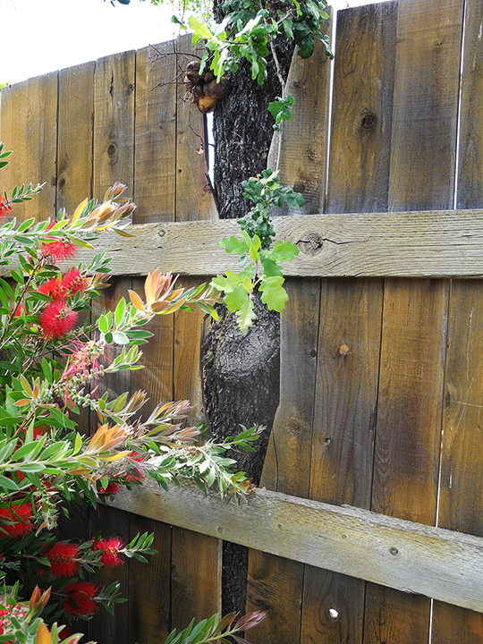
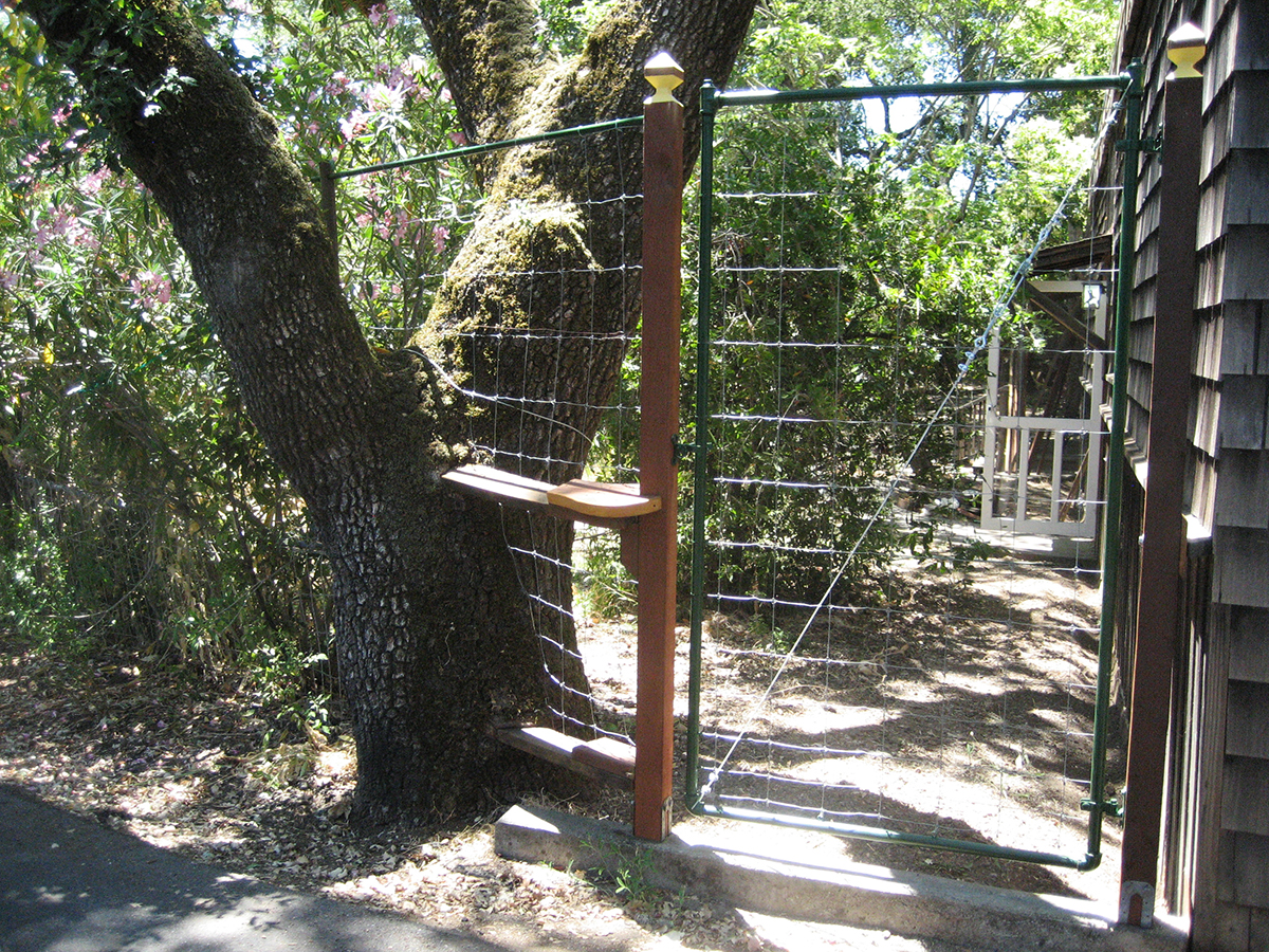
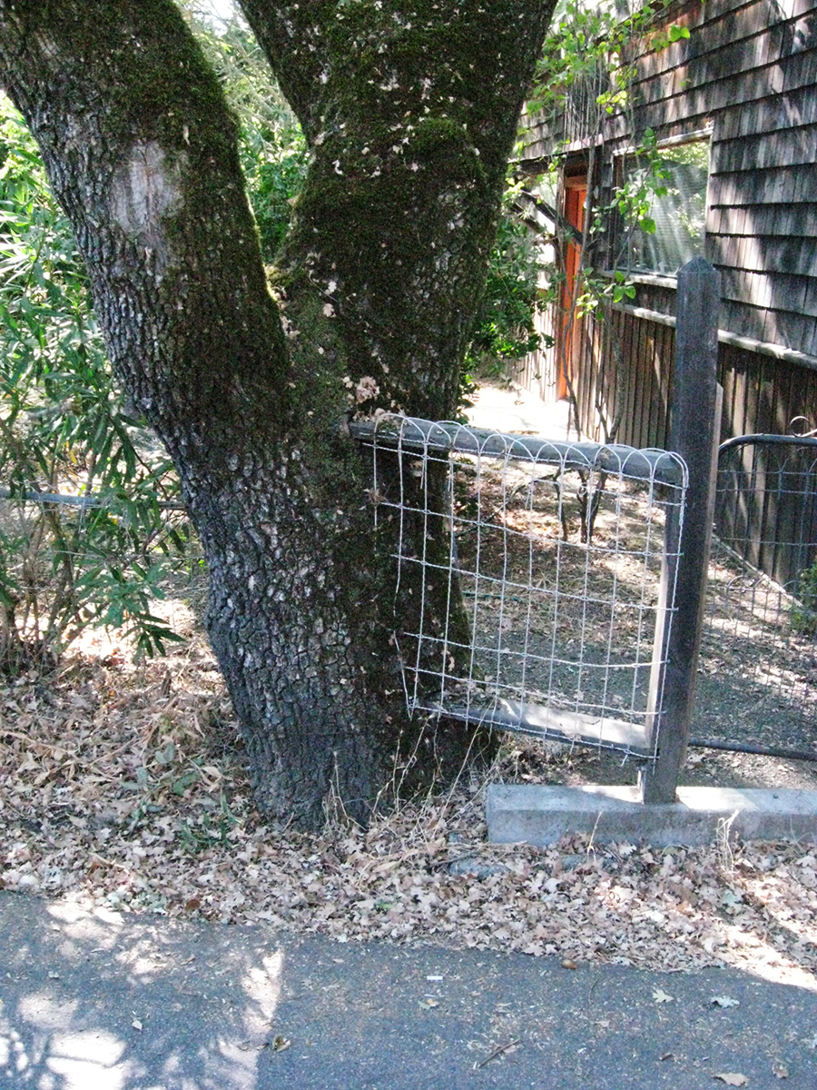
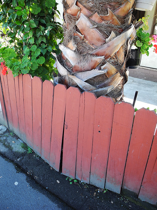
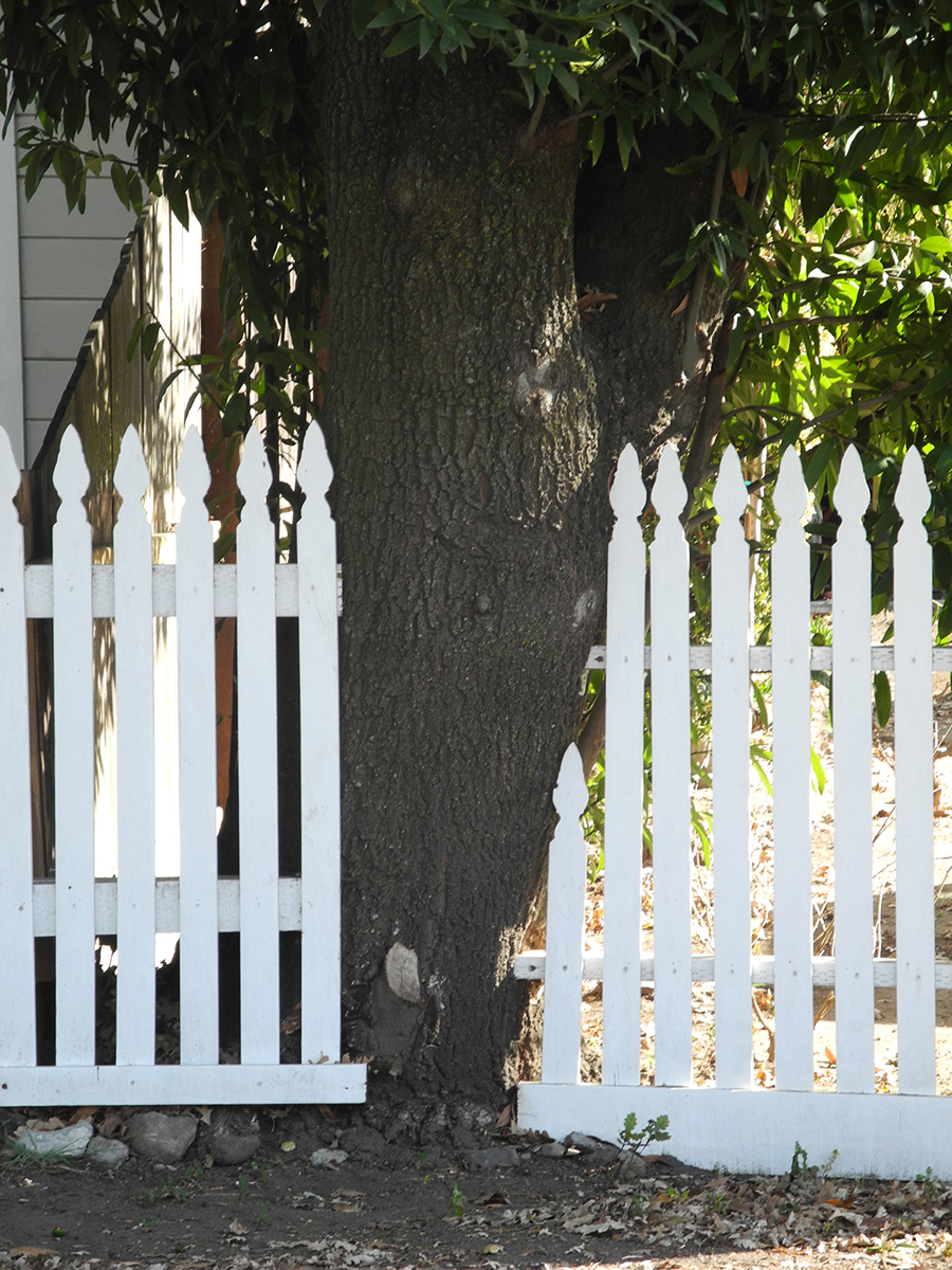
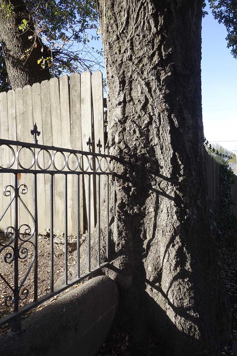
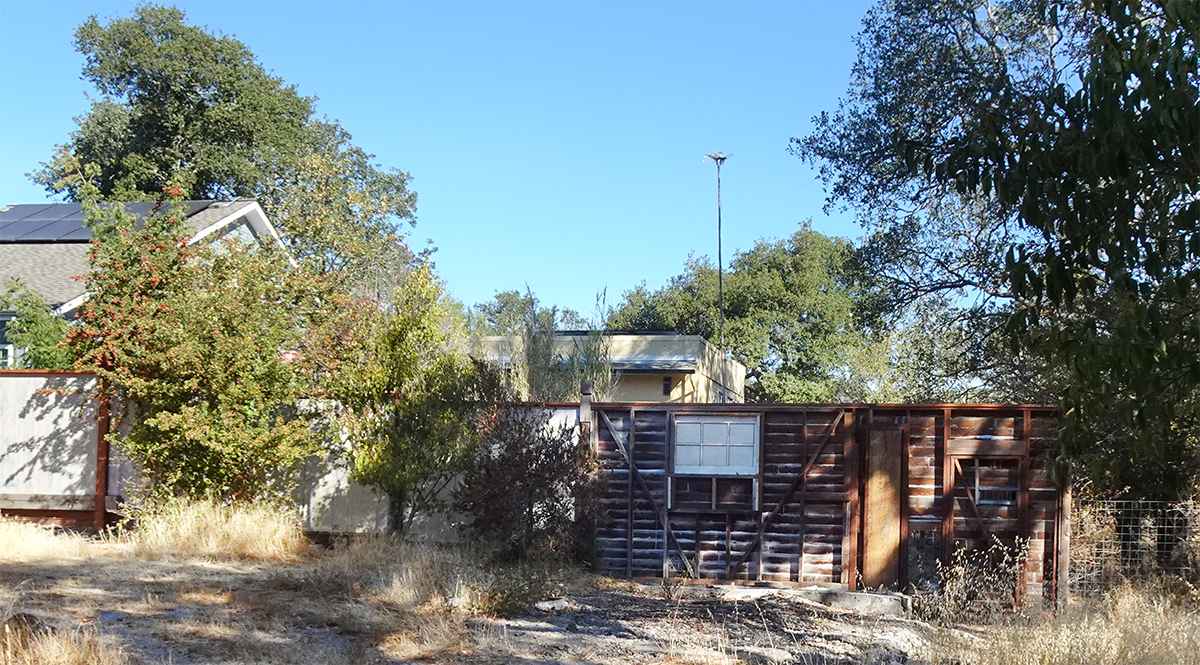
Fences and trees: they have conversations, disputes, collaborations. Time is involved.
Around and through.20212007A gentle push.Stately interruption.Direct confrontation.This one deserves special mention. Actually it deserves an award for adaptive reuse. During the house addition build, the old garage was torn down, but the back wall was retained and incorporated into the new fence.
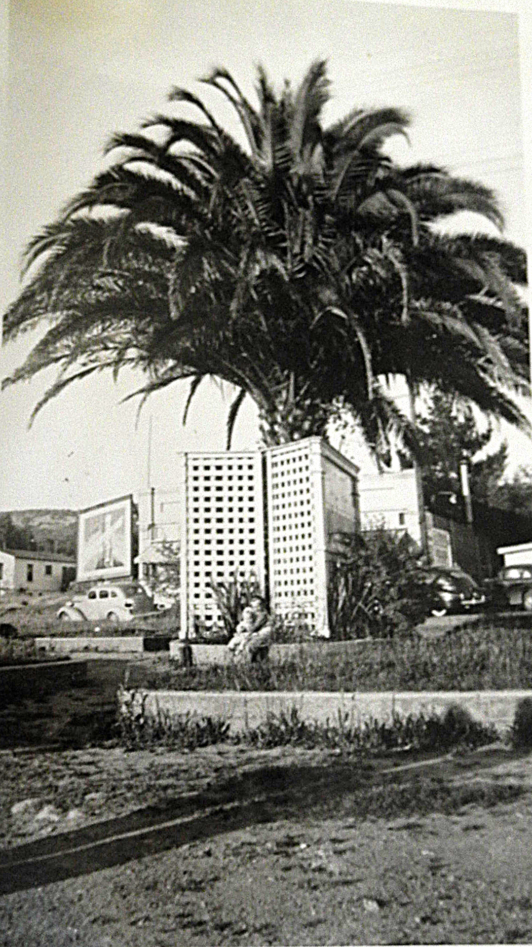
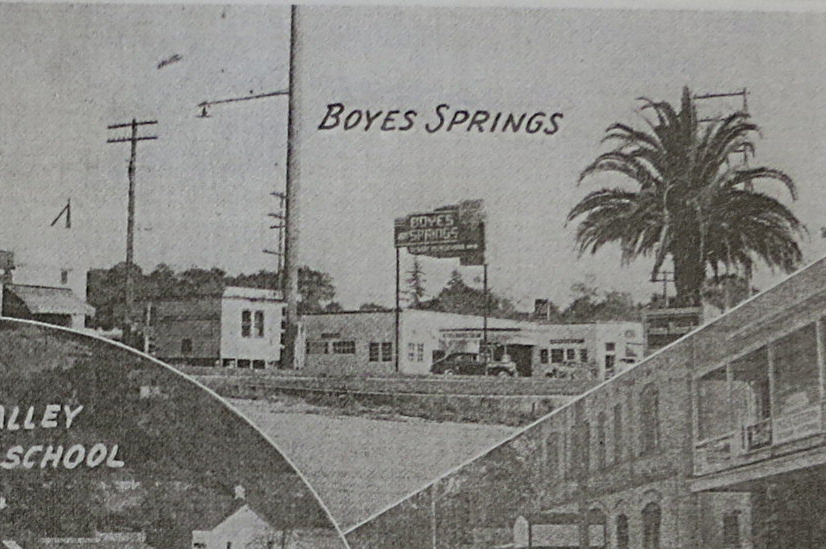
On December 20, 1956, the Sonoma Index Tribune reported “Old timers in Boyes felt some remorse this Monday when the old stately palm tree in the Boyes Plaza was cut down to make way for a new building.” The new building was the second half of the Plaza Center building, which houses the post office today. The IT went on, “They (the old timers) could remember standing beneath that tree when the old train used to unload vacationers at the railroad station, located years ago, right near the tree.”
The Boyes Hot Springs Plaza palm tree, 1943. courtesy Bruce Greiwe
Aurthor’s collection
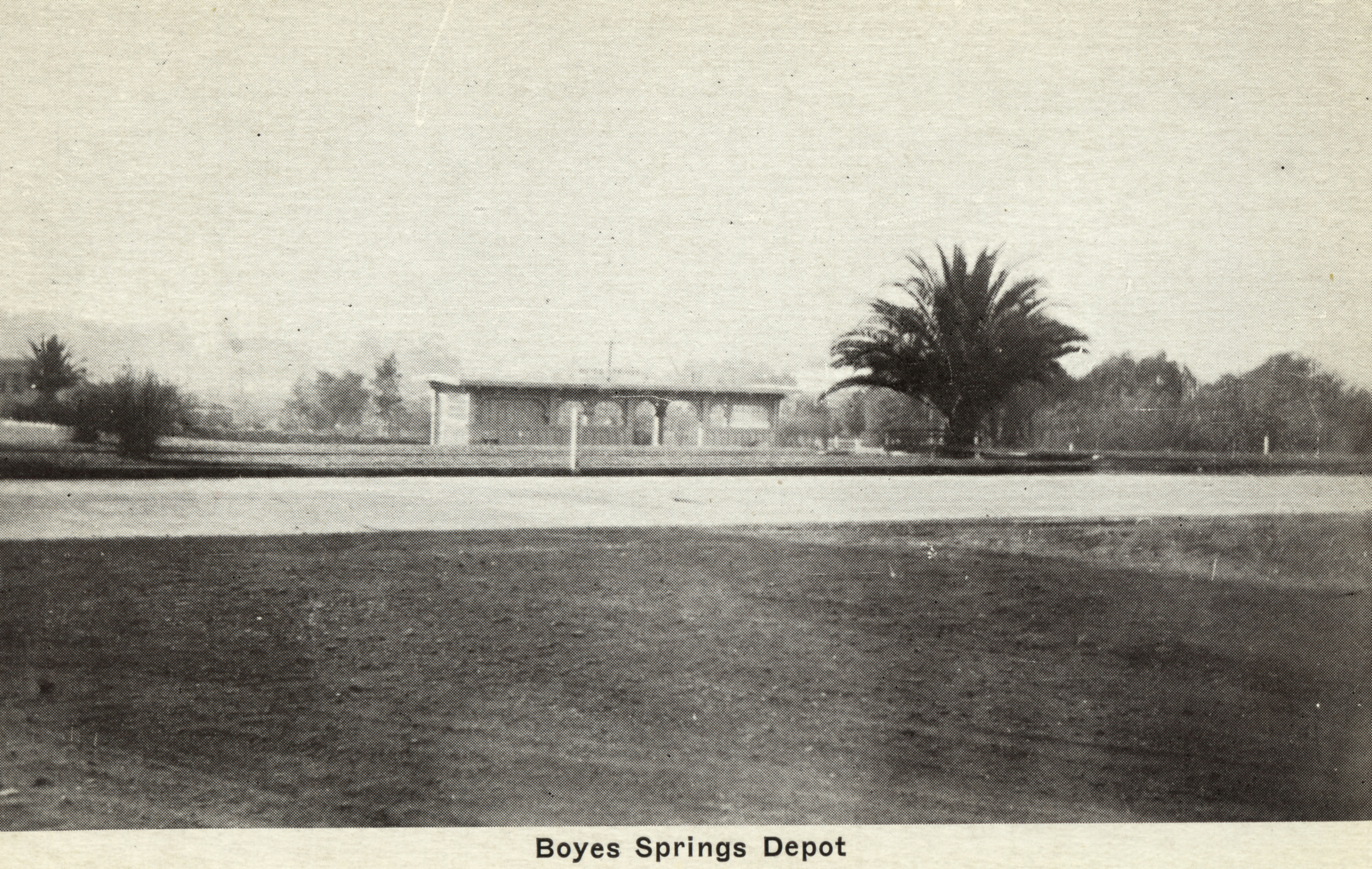
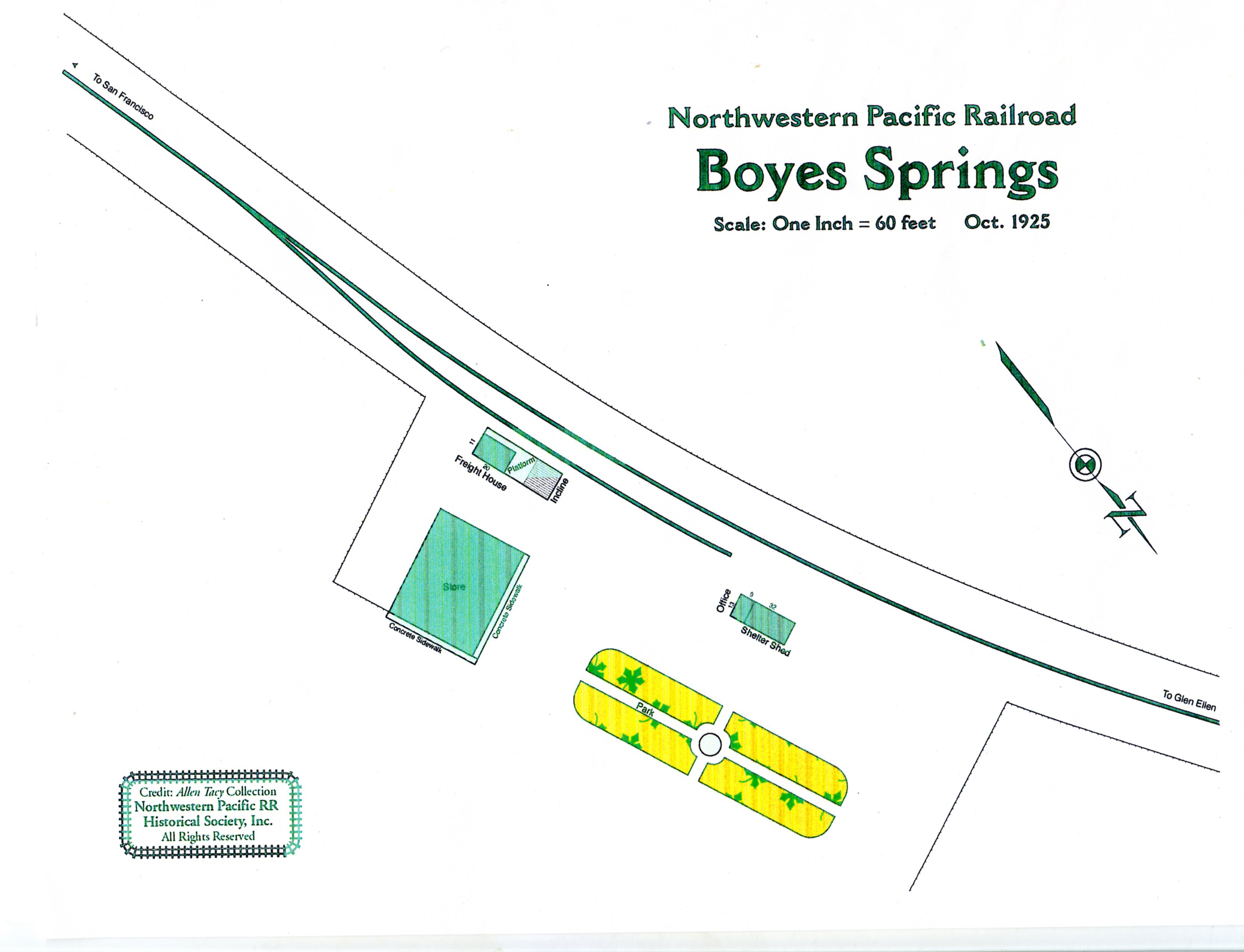
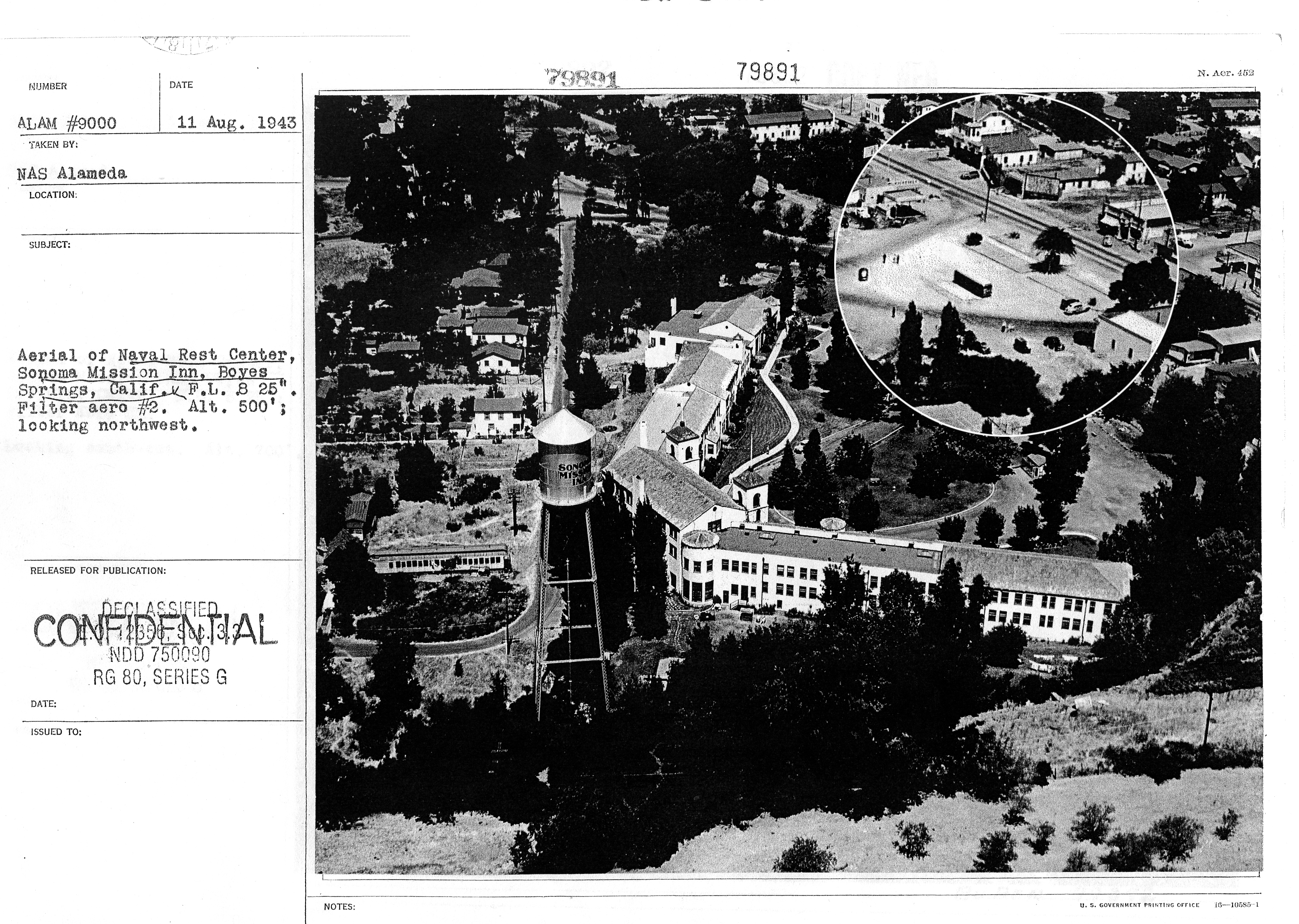
Yes, there was a Plaza in Boyes Springs. It existed as part of the land owned by the Northwestern Pacific Railroad. A railroad map from 1925 shows an elongated lozenge shaped feature, parallel to the tracks, bisected by pathways at right angles, and with a circular form at the center. The palm tree was there, according to an aerial photo from 1943.
Plaza showing palm tree. The depot had been removed the previous year. Photo courtesy Bob Palmelee.
In 1949 the IT reported that the Boyes Springs Boosters Club voted to “ put a new lawn at the Boyes Hot Springs Plaza and pay for the electricity used in keeping the “Boyes Hot Springs Welcome” sign lighted each evening.
Courtesy Jerry Biers
In 1941 plans for the celebration of the centennial of the Bear Flag revolt included an event at the BHS Plaza.
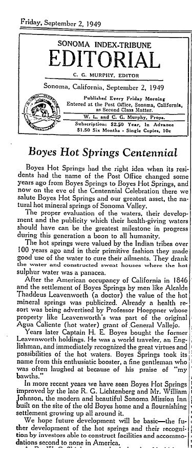
In 1949, the community celebrated its own “centennial.” How 1849 was chosed as a founding year is unclear. The hot springs had been commercialized by 1847 by Andrew Heoppner. Thaddeus Leavenworth arrived in 1849, but Boyes didn’t show up until 1882.
At any rate, the editorial page of the Index Tribune approved.
The Plaza and palm looking north, 1930s.
The idea of a new Boyes Hot Springs Plaza has resurfaced in recent years. Several architects have produced conceptual plans. Below is the Ross, Drulis Cusenberry version.
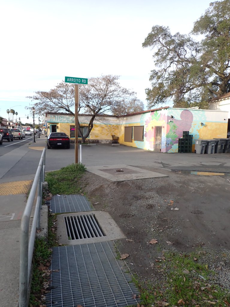
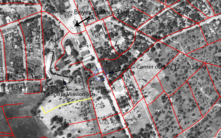
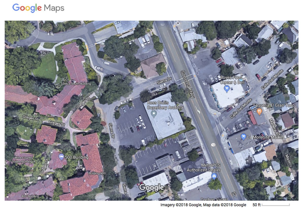
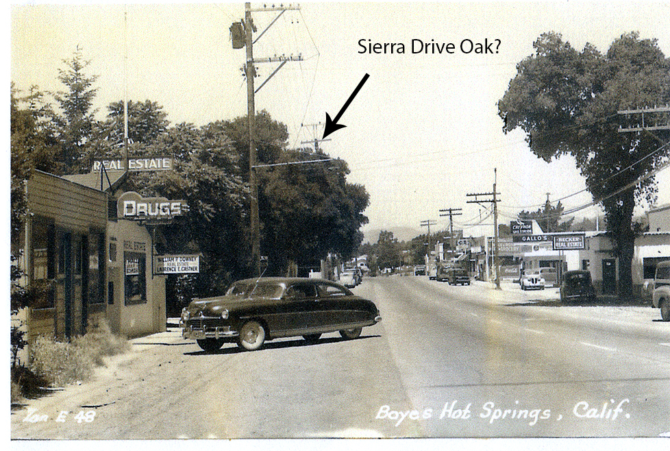
Just south of the Sonoma Mission Inn, on the west side of Highway 12, Sierra Drive intersects.
Aerial photo with streets courtesy of Arthur Dawson
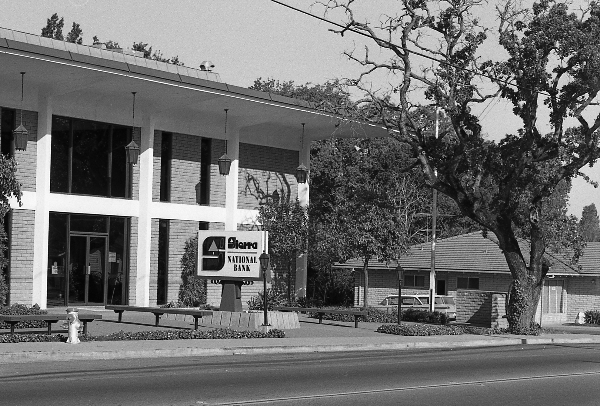
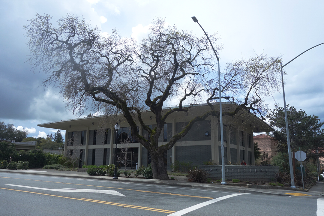
At that corner stands one of our landmark oak trees. The tree is in front of the building that now houses Ross Drulis Cusenberry Architects. The building was built in 1966 for Sierra National Bank. It seems that the street, originally known as Meincke Road (more on that later), was renamed for the bank. The street also has the distinction of being on the former NWPRR right-of-way (the tracks were removed in 1942).
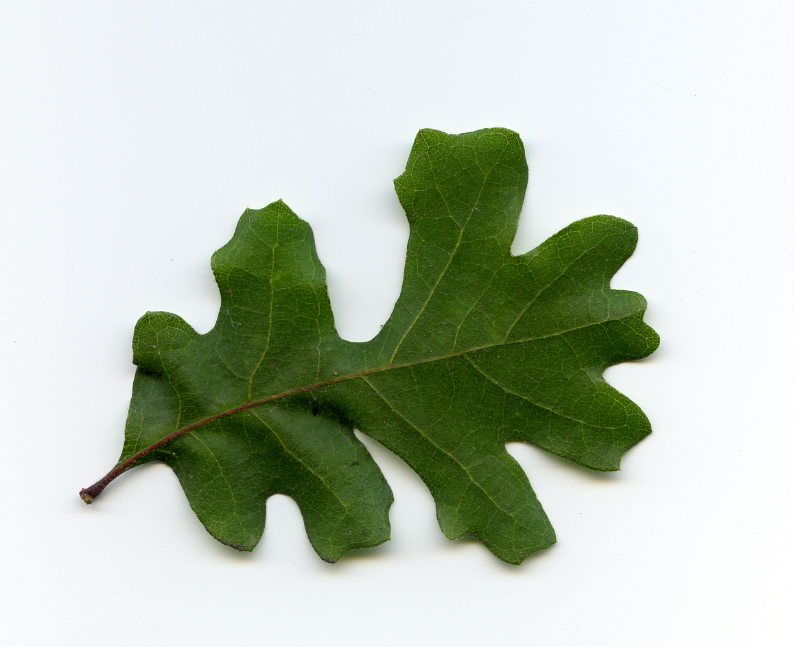
Our tree is a Valley Oak, Quercus lobata. According to the California Native Plant Society (http://calscape.org/), the Valley Oak ranges over the interior valleys of the State, and needs to be near a source of water (Lily Creek*, which flows down Arroyo Road, tunnels under the highway very near the tree.) It can grow to 100’ in height and live for as many as 500 years. The tree in question, which has three trunks, certainly could be 100 years old. We have a photograph of the tree (and building) from 1973, which shows it to be in pretty poor shape. In 2018 it appears to be much healthier.
*Thanks to Greg Larson for the creek name.
1973 top. 2018 bottom. Top photo courtesy of the Sonoma Valley Historical Society.
The tree may appear in some other historic photos.
Boyes Depot, 1930s, (approximately located in the parking lot behind the Plaza Center Building), looking north to Sonoma Mountain. The oak in the foreground is possibly the Sierra Drive tree.
Photo by Zan Stark, 1950s. The location is opposite Arroyo Road on the Highway.
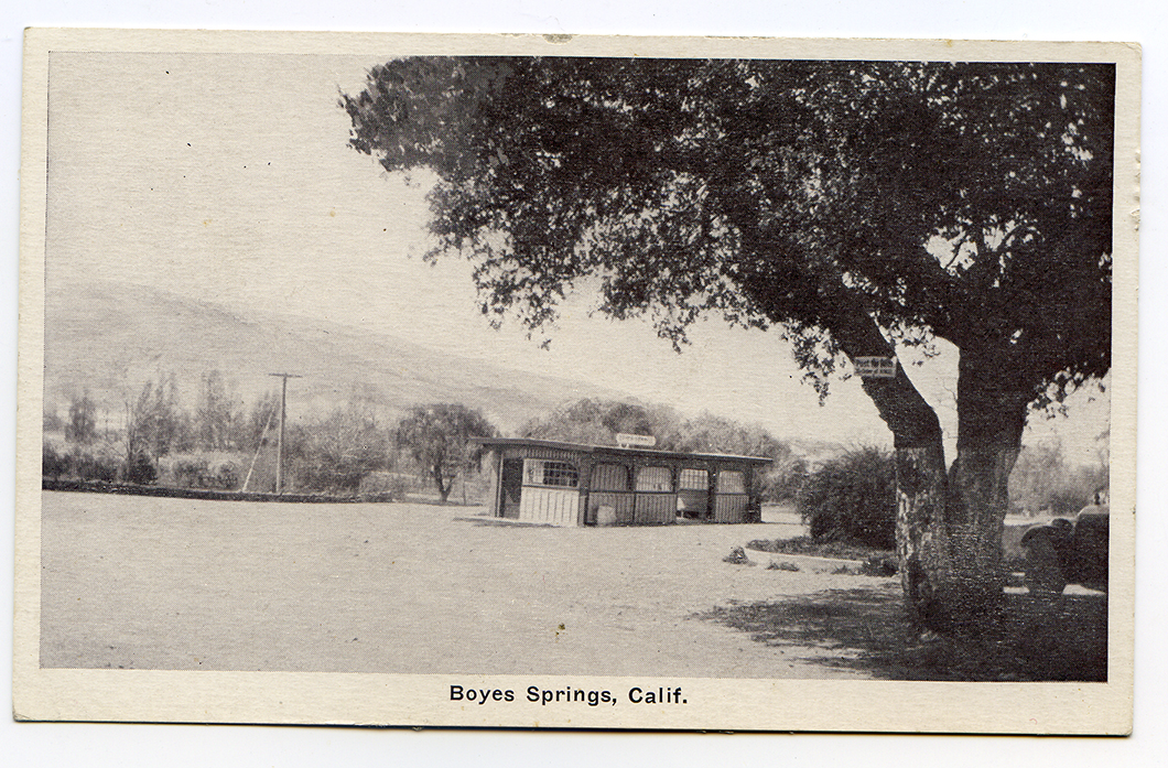
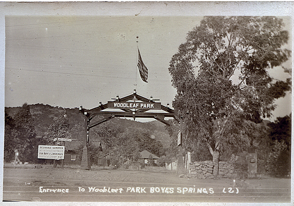
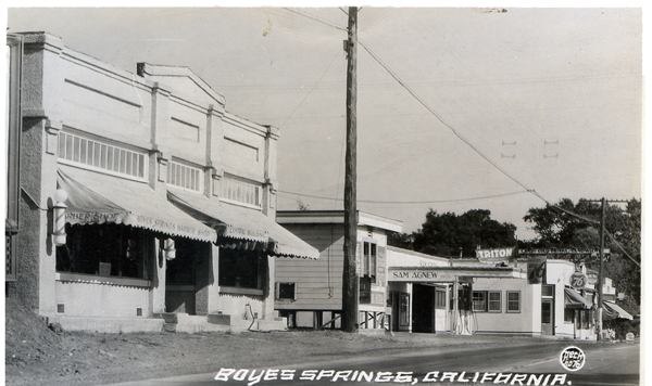
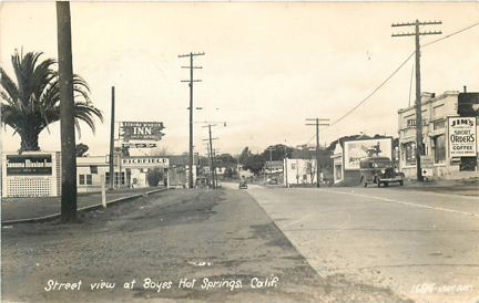
The site at the corner of Vallejo and Highway 12, now in use as the employee parking lot for the Sonoma Mission Inn, has a long history.
This postcard, post marked 1913, shows the entry arch, to Woodleaf Park (in the middle of the lot), which was one of the early subdivisions in Boyes Hot Springs. The sign at left reads “Desirable Summer and Winter Cottages for rent. J. W. Minges.” Minges was a prominent land owner and businessman in early twentieth century Boyes Hot Springs and was often referred to as the “mayor” of Boyes Springs.
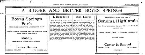
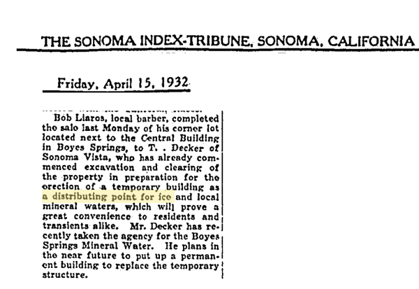
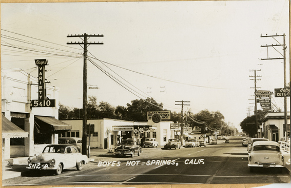
This is part of a full page ad (above) from 1925 promoting Boyes Hot Springs. It reads, in part, “In place of the frame building and barber shop that was located next to the original post Office at Boyes, the enterprising business man (Bob Liaros) let the contract for a handsome hollow-tile building with concrete floors and fireproof throughout.”
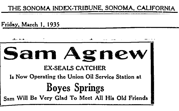
The view from the 1930s (below) shows the building mentioned above. Lairos was another Boyes booster and long-time business owner. Beyond the Liaros building are the ice plant and Sam Agnew’s service station at Vallejo St.
Liaros sold part of his land to the proprietor of the ice plant.
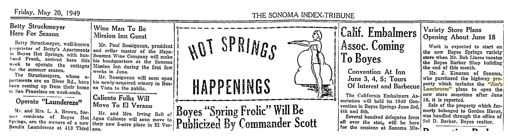
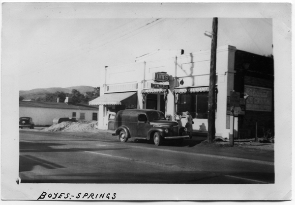
The building changed hands in 1949.
This article mentions that Jim’s Lunchroom is located in the building. If only we could get the Embalmers to come back! Perhaps they could “frolic?”
The above mentioned variety store, operated at one time by the Polidori family.
1930s ?1950s
1992
The building was demolished as an eyesore in 1992. Progress!?
In 1997, a lone California Bay tree stood on the lot, but it was dying.
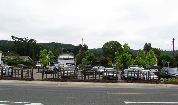
The merely functional parking lot in 2008.
Thanks to the Sonoma Valley Historical Society, Stanford University Library Special Collections, and Mr. Lloyd Cripps.
Addendum:
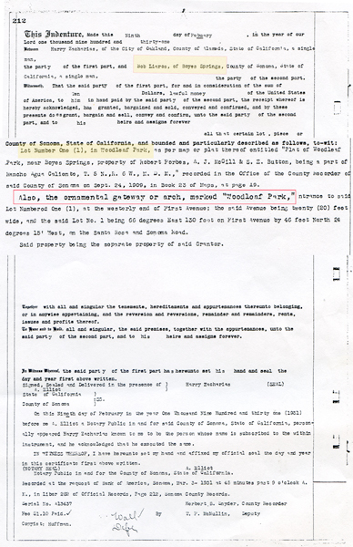
Document describing the land in Woodleaf Park that Bob Liaros bought in 1931, including the ornamental arch.
Thanks to the Sonoma Valley Historical Society for photos and the Index Tribune. If you enjoy the Springs Museum, please consider donating; use the button on theHome page! Thank you!
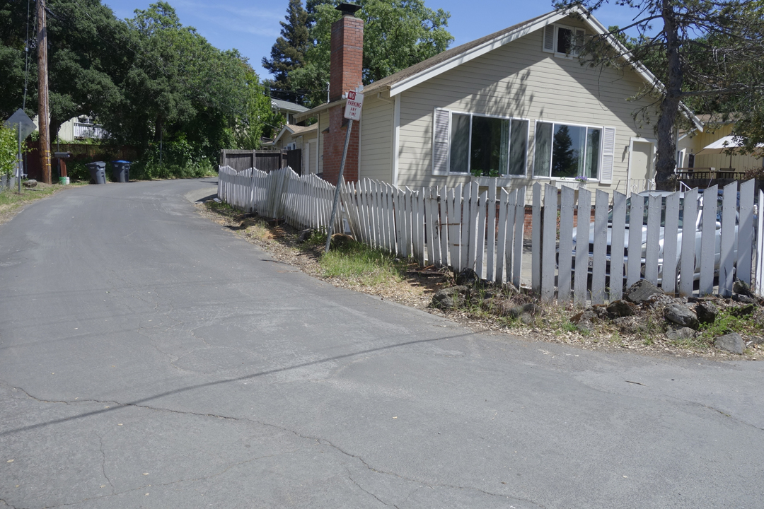
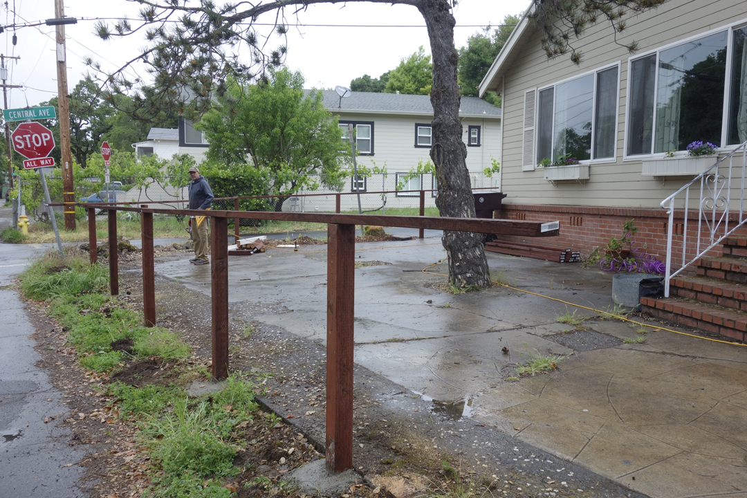
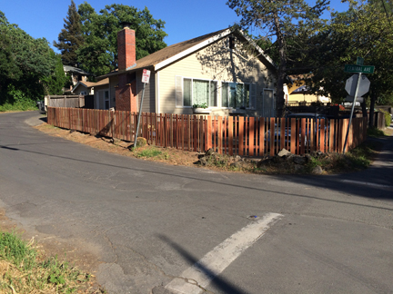
At the corner of Central and Highlands in Boyes Springs, these trees had been “influencing” the fence for many years, in a wonderful display of found sculpture. In April of 2017, big changes happened.
The trees, which had been menacing the house’s foundation, were removed and a new fence was built. It’s sad to see trees go, but they don’t live forever, just like people.


 1930s ?
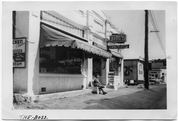
 1950s
1950s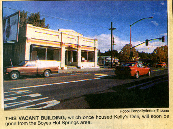 1992
1992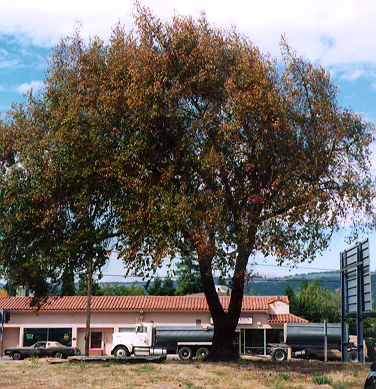


 It’s sad to see trees go, but they don’t live forever, just like people.