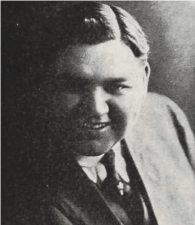
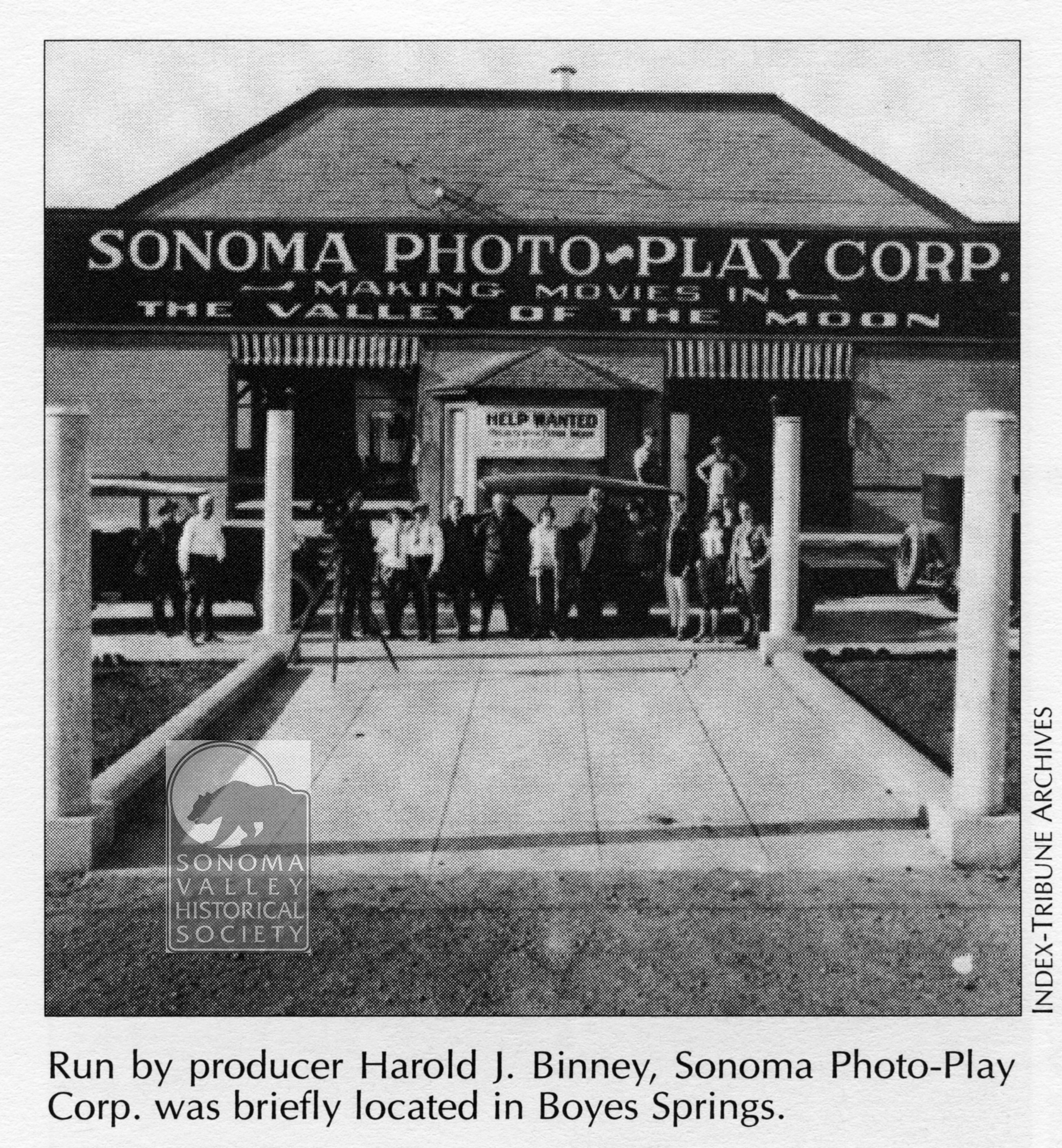
Harold Joshua Binney was born in Missouri in 1889. Died Los Angeles 1956. In between he was a legitimate producer, director, and star of silent films and talkies; also a conman
He started his show biz career in vaudeville. Not much more is known about his early days.
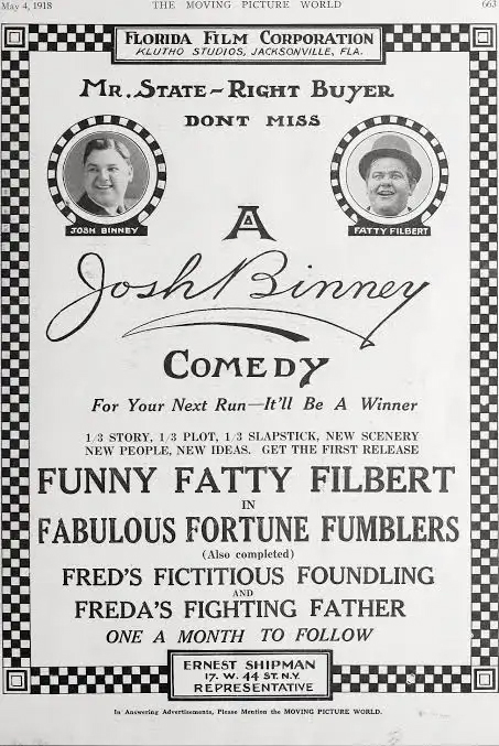
In 1918 he founded the Florida Film Co., in Jacksonville, and its main arm, Josh Binney Comedies, for which produced and directed silent two-reelers that were built around an overweight clown named Hilliard Karr, also known as “Funny Fatty Filbert.”
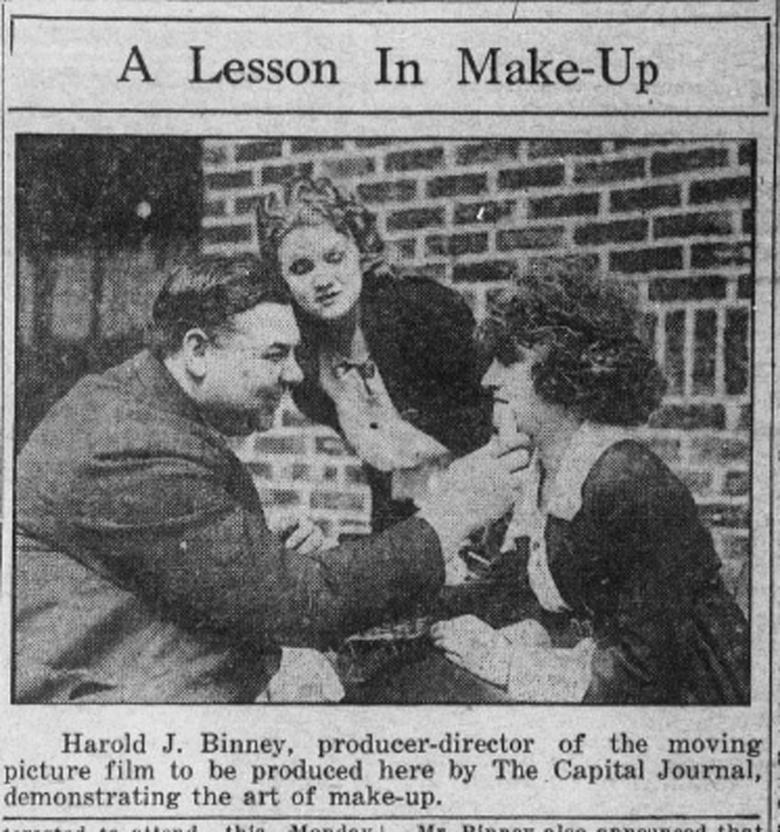
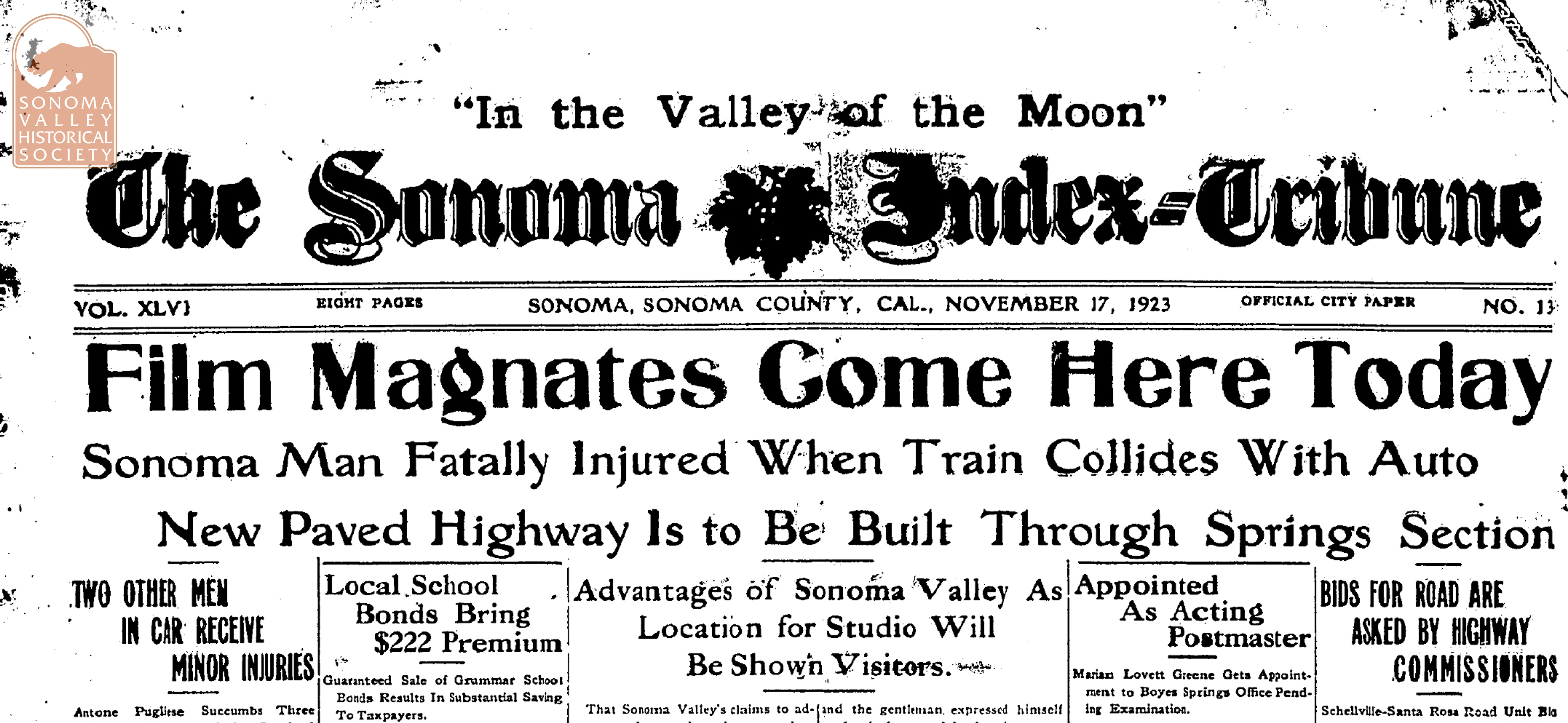
By 1922 he was in Salem, Oregon, beguiling the mayor of that capital, as well as the state’s governor, with visions of Hollywood productions. It doesn’t seem that he made any movies in Oregon, and, in November of 1923 Binney visited Sonoma looking to produce film comedies in the Valley of the Moon.
Salem, Oregon Capital Journal
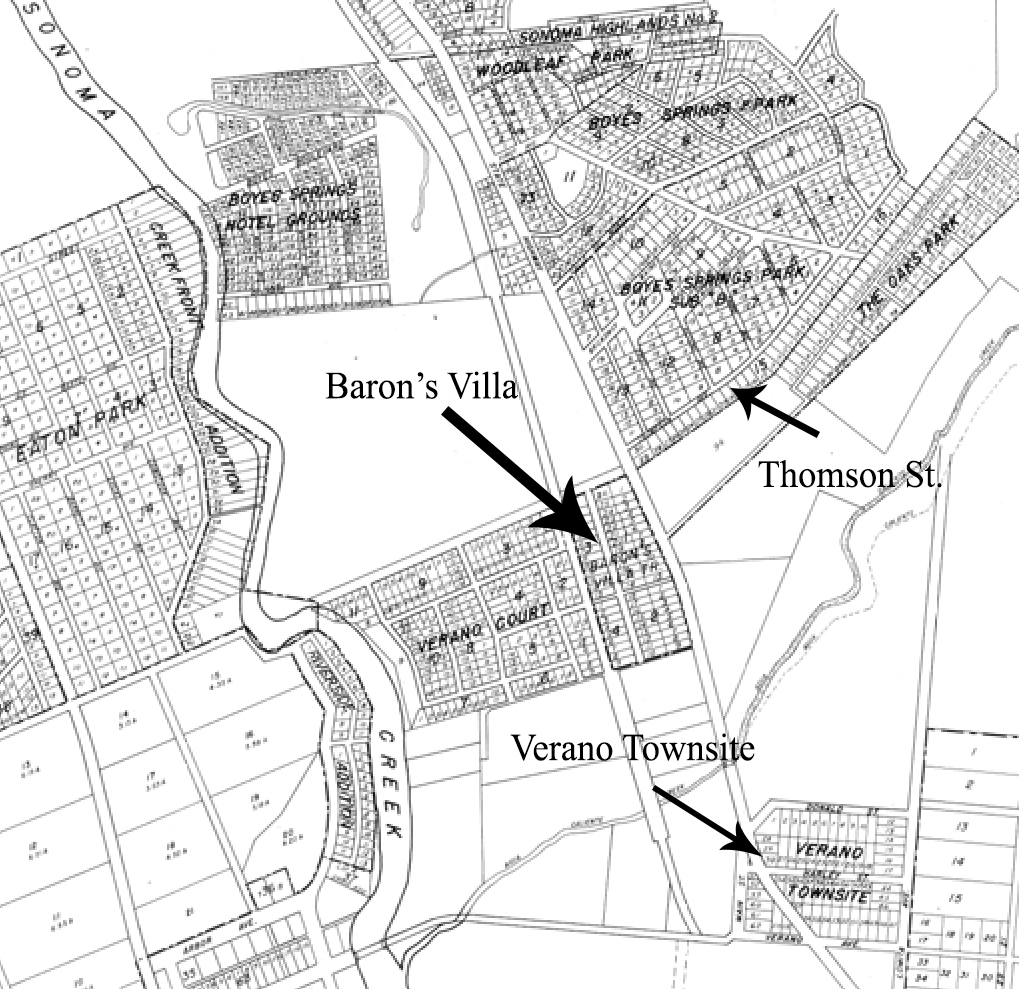
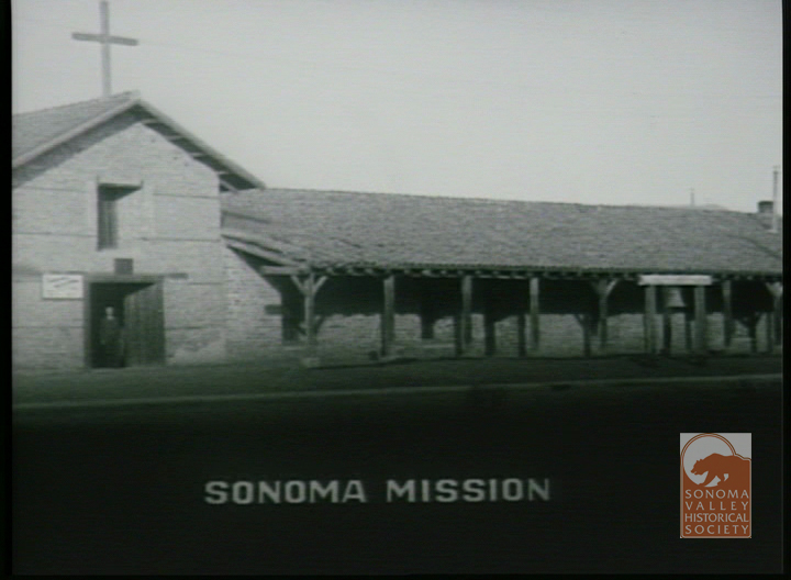
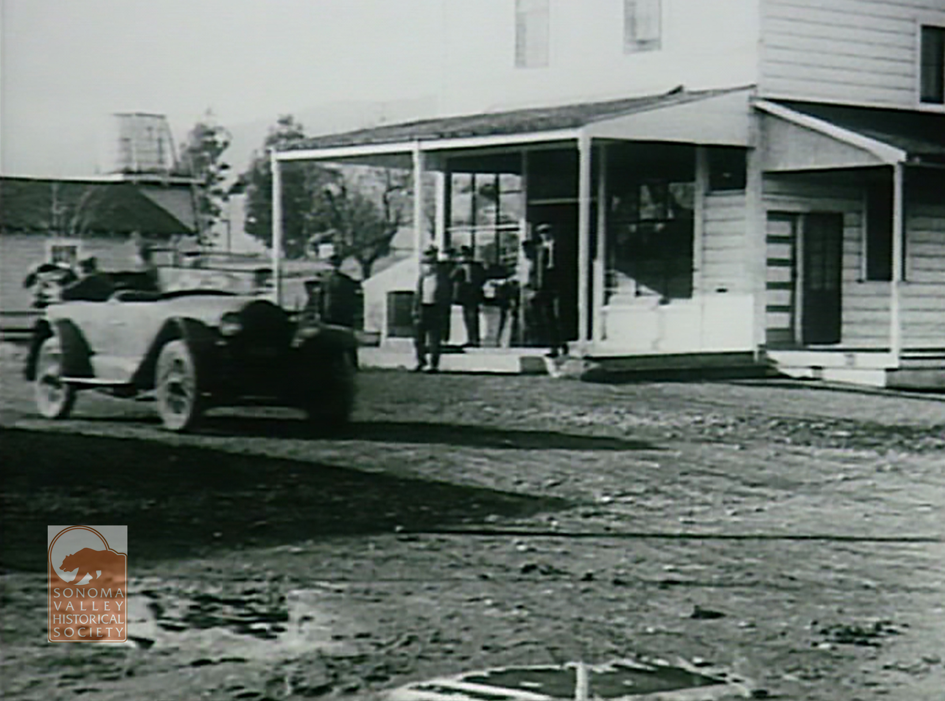
In 1924 he leased Wolf Baron’s Coney Island Resort on the Santa Rosa Road, as Highway 12 was then known (site of the current Mary’s Pizza) to establish his studio. He started production on a proposed series of twelve short comedies, the first one (the only one, it turned out) titled “The Account of the No Account Count,” a copy of which is in the collection of the Sonoma Valley Historical Society.
Circa 1920 map courtesy of the Sonoma Valley Historical Society
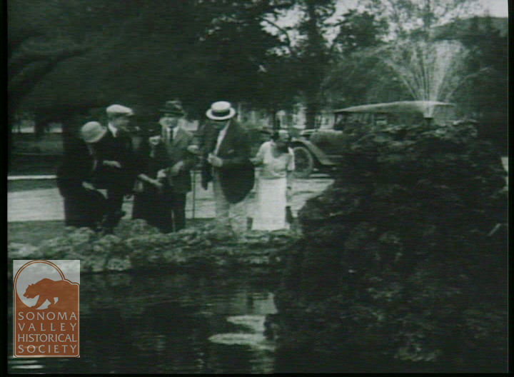
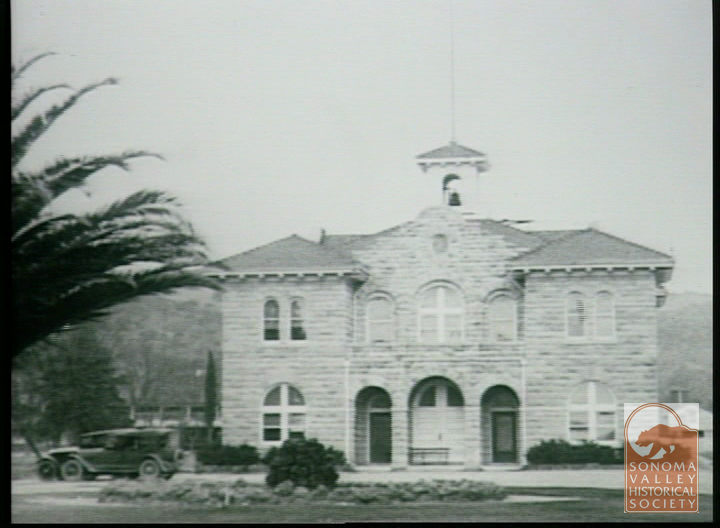
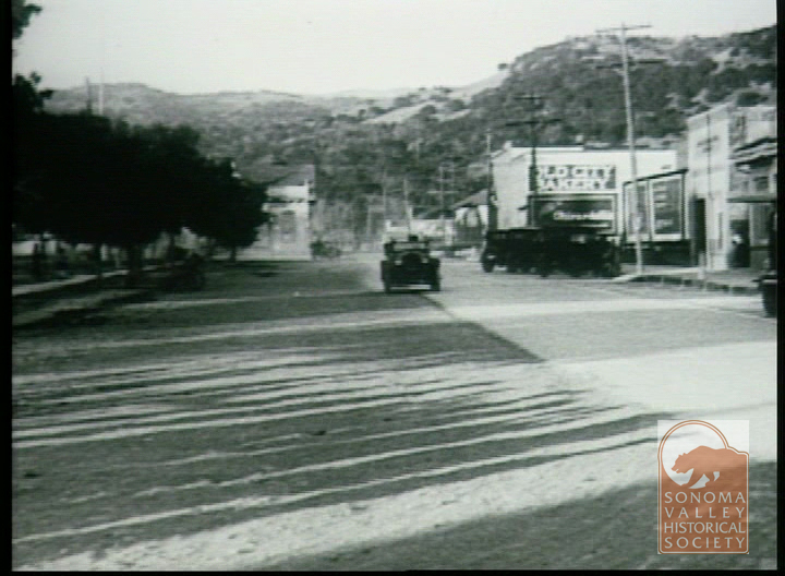
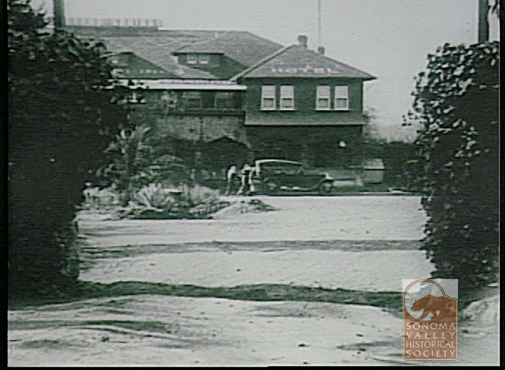
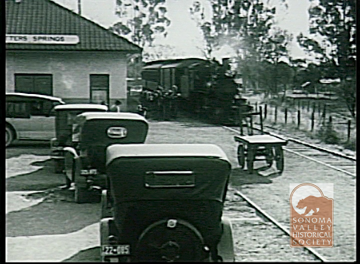
Images from this film are wonderful archival shots of local scenes.
The fountain in front of City Hall.Sonoma City Hall.First Street East, SonomaFetters ResortFetters Depot. Watch a clip here https://www.youtube.com/watch?v=wspmaGnUoUMMullen’s Store, El Verano
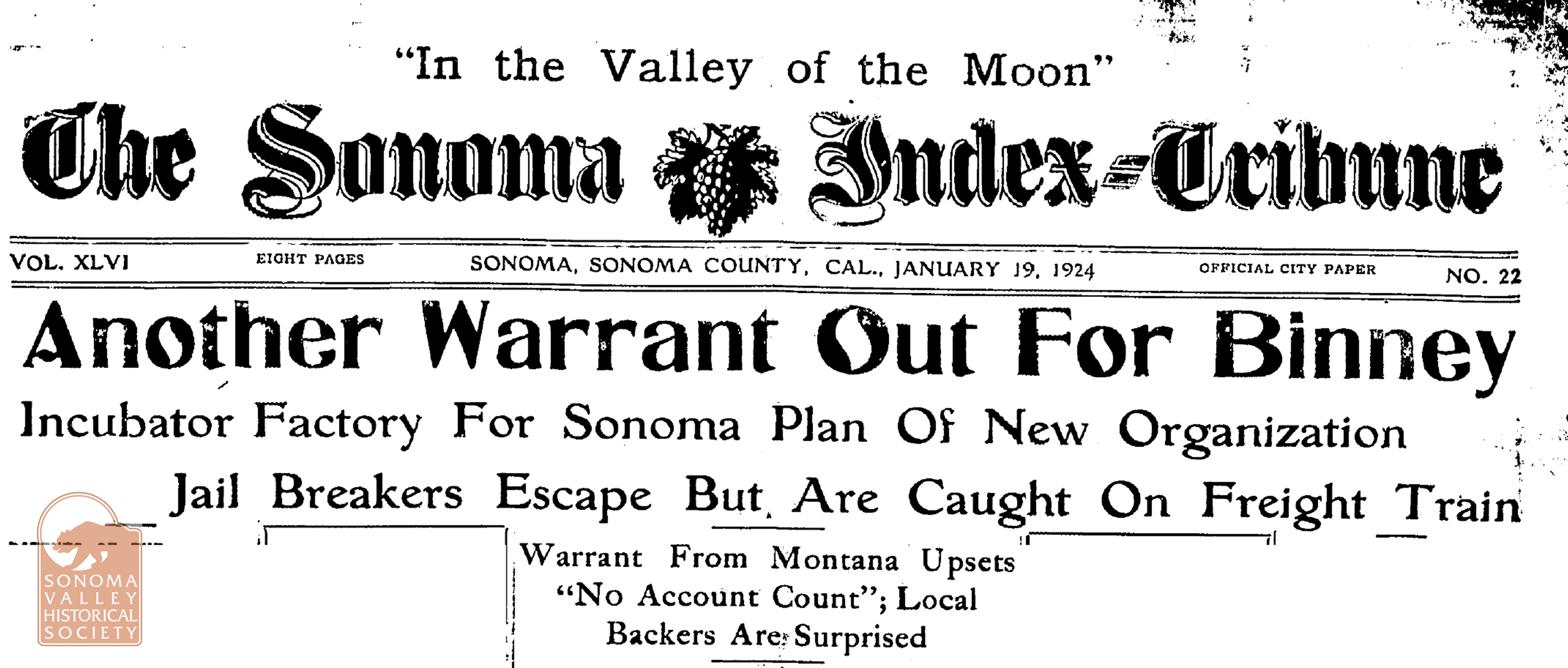
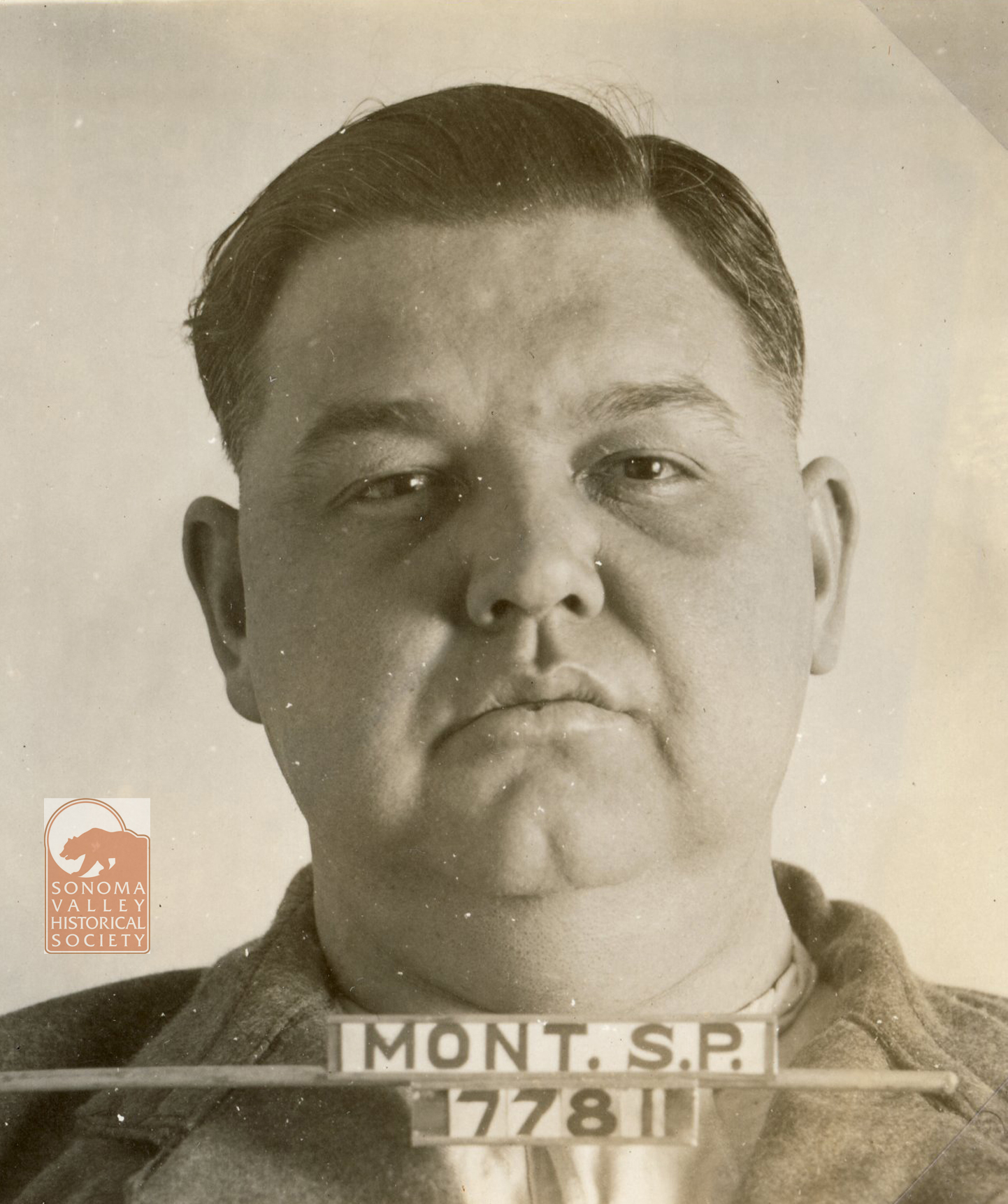
Later that year he was caught passing a bad check with local merchants. His backers paid his debts, but he was soon under investigation in Montana for bilking investors there. Extradited to Butte, in 1924, he was tried and convicted of fraud and sentenced to three to six years in prison. He was paroled in November of 1925.
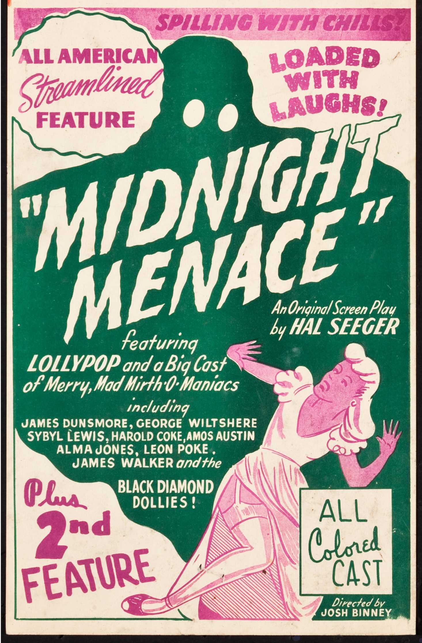
Undaunted, Binney went on to have a career as a producer /director in Hollywood. One of his best-known movies was “Hi Dee Ho” starring Cab Calloway. I’m not including the “Hi Dee Ho” poster because of racist imagery.
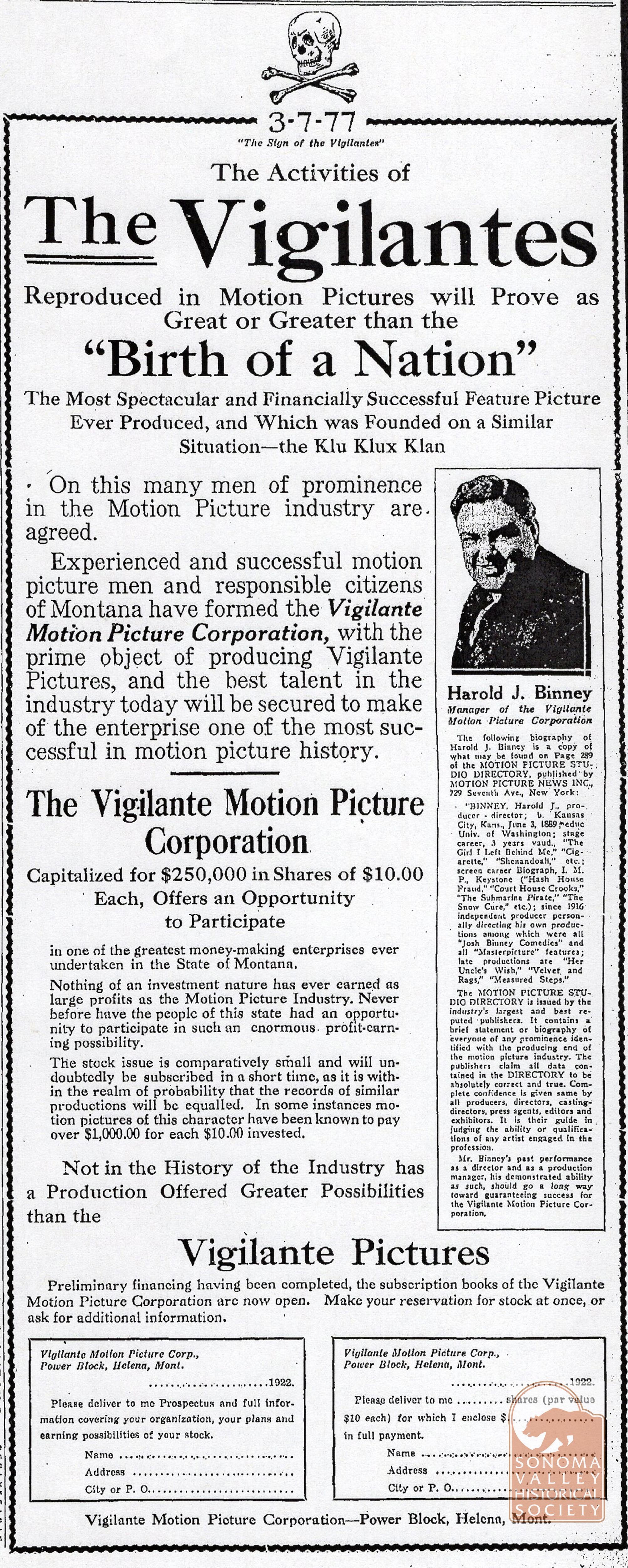
The dark side of Josh Binney: Terribly ironically, in 1922, in Helena Montana, Binney advertised in the Helena Daily Independent “The Vigilante Picture Corporation,” with aim of depicting the “activities of the vigilantes” in a production that would be “as great or greater than the Birth of the Nation,” which is famously a propaganda piece for the KKK. The ad was a solicitation for investors. Of course, it was a scam, but one that catered to the racist feelings of white Montanans. This is truly ugly and I’m sorry it’s part of the story!
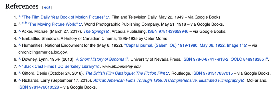
Me citing Wikipedia citing myself and Lynn Downey, among others. Index Tribune and movie stills courtesy of the Sonoma Valley Historical Society. Join today!
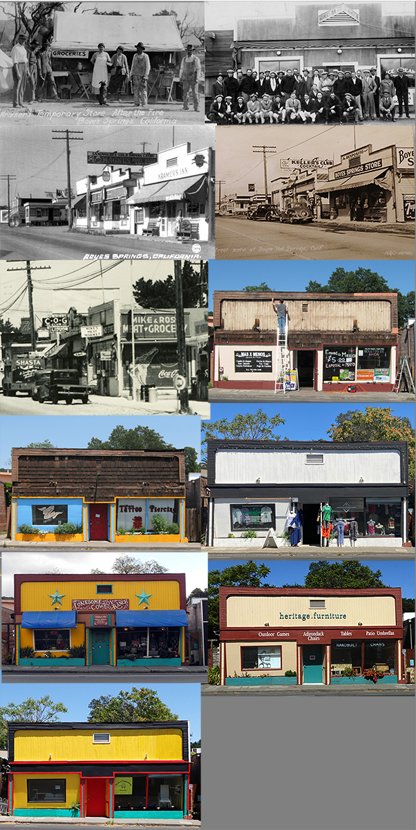
The building now known as 18135 Highway 12, in Boyes Hot Springs, is one of the oldest commercial buildings in the area. The original business, Kramer’s Inn, goes back at least to 1918. That building was destroyed in the great fire of 1923, and the current one dates from that year. It has housed many other businesses since, including, Keller’s, Mike and Rose’s Grocery, Mas por Menos, Highway Tattoo, Lucrative Clothing Store, Onesome Cowboy Ranch, Heritage Furniture, and now, in 2026, The Art of Upholstering.
Long may it stand and serve our community!
The first five photos, courtesy of the Sonoma County Historical Society. Join today and watch for the reopening of the museum this fall!
A popular resort hotel in the 1920s, vacant in the 1970s and after, it was the subject of several serious attempts at reuse, all of which failed.
Circa 1920s. To the left is the Associated gas station, to the right, Zwickl (or Zwickles) Resort. The trees at center line Mountain Avenue. The Zwikl building still stands, much altered.
In March of 1922 the Index Tribune informs us that “C. Clementi (sometimes spelled Clemente), well known resort man of Fetters Springs, has started construction on his new hotel. The building will be of solid brick construction and will contain 15 rooms with all modern conveniences…Mr. and Mrs. Clementi have been very successful since establishing their resort in Sonoma Valley and their excellent French cuisine has won for them a big patronage.” The Charles Clementi family immigrated from France sometime between 1912 and 1915, and established a French restaurant in their brick home in Fetters Springs. Mrs. Clemente’s brother-in-law, a Mr. Schaff, constructed additions to the house, creating the hotel. The Clemente’s sold in 1928, moving to Ben Lomond in Santa Cruz County. (On various documents and articles, the year it was built is listed as 1906, 1909, 1910, and 1922.)
Here is a timeline accoridng to what’s available in the Index Tribune:
1931- the building was called the Robin Hood Inn, owned by Robert Whitehead, “wealthy retired capitalist of Oakland…”
1935- it was noted that “William Scott opened the Robin Hood Inn.”
1936- “Norman Jensen, a San Francisco architect, is stopping at the Robin Hood Inn. He is making plans for the reconstruction of the baths at Boyes Springs.
1938 “Mora Castle Property at Fetters Sold.” Sold to Mr. and Mrs. Paul H. Zielke of Sant Rosa. “ The fine brick building is to be renovated, redecorated, Venetian blinds added, and other improvements made.”
An ego-based name change!
Then in December of 1940 “Hotel being Changed to Apartments” “Paul Zielke Converting Brick Holtel At Fetters Into Modern Quarters.”
“The famous brick hotel at Fetters Springs, known as Paul’s Castle and one time called Clementi’s after its original owners and later Robin Hood Inn, is being converted into ten apartments. Paul Zielke, the owner who now operates the Golf Clubhouse, believes that small modern apartments will help solve the housing problem in Sonoma Valley”(!) So, not a new problem!
March 1942 -“Trade Apartments Here For Big Ranch and Resort” “Mr. and Mrs. Paul Zielke have traded their apartment house formerly Robin Hood Inn at Fetters, for a large ranch and Eel River resort.”
Circa 1950s. Stucco has been applied to the brick.
Apparently it was vacant and all but abandoned after 1972. There is no mention of the Clemente or Clementi Inn again until January of 1981, when a DBA Clementi Inn was established by a partnership of three men, Kenneth Crutchlow, Dennis Kirby, James Felich. “It was purchased for $25,000 by Kenneth Crutchlow of England, along with a full set of plans. ‘I bought it from four guys who specialized in historic buildings,’ he said. ‘I don’t know why they couldn’t make a go of it.’Not sure who these men were, but what an ominous statement!
April 1981- For Sale. “Clementi’s Inn in Sonoma County Landmark No.28, and comes with 77 years of history. Plans are approved for restoration in 6 residential apartments.” $105,000″
July 1983- For sale, $150000
Feb 1984- For Sale 80,000
Jan 1984-For sale $145,000
Feb 1985- For Sale $69,500
April 1983- Letter to the editor from Kenneth Crutchlow stating that the property was in foreclosure.
July 1983- For sale, $150000
Feb 1984 -For Sale 80,000
Jan 1984-Fro Sale $145,000
Feb 1985- For Sale $69,500
On 10, 1989 County design review of proposal to develop as 12 room hotel, by Reiner Keller, architect.
June 9, 1989 Owner listed as Michael Brausen, developer.
Dec 1989 – “There’s absolutely no doubt in Michael Brausen’s mind that the Clemente Inn will rise Phoenix-like, reinvigorated and restored as a showplace hotel, rivaled only by the Sonoma Mission Inn.” “The small clapboard house next to the inn on Hwy 12 was bought to provide parking…According to Brausen, the house itself has a little bit of history-it was once owned by Sally Stanford, reputed madame, ex-mayor of Sausalito, and long time associate of Jaunita Musson…”
Brausen started the long, convoluted permit process. He got approval from the Board of Supervisors, but, since he wanted mini-bars in the rooms, the Liquor Board insisted he have a full bar. However, the Supes approved his permit with the stipulation that there would be no bar. In November of 1990, the bar impasse was resolved. He would have a bar in name only!
Then in July 1991, this astounding headline in the IT: “Old Fetters inn eyed by Soviet buyers.” “Glasnost flourished Sunday as four Soviet businessmen gathered around a Western-style barbecue to kick off a week of negotiations which may culminate in a historic Soviet/American joint venture in Fetters Hot Springs….”The Soviets will actually own the property, ”Brausen says. “This will be the first time an American can actually stay in a Soviet hotel, built by Soviets and run by Soviets and Americans.”
Aug 1991-More about the Soviet deal: “They plan to bring Soviet woodworkers, restaurant personnel, and other artisans to deck out the dilapidated inn, using many finished and unfinished materials from the USSR…When you come in, you will think your are in Moscow,” Brausen said. “If this doesn’t work, the building will probably have to be torn down,” Brausen said prophetically. (Amazing how it being a Soviet hotel was considered a good thing.)
“Russian architect Edouard Ovsipian’s plans suggest a miniature Russian palace, with extensive façade and hight-pitched roof and towers.”…”Ovsipian is an award-winning Soviet architect who built Moscow’s first Baskin-Robbins Ice Cream parlor.”
Whatever you think about the design, it would have been an awesome landmark for the Springs
And then, in 1992, “Soviet collapse doesn’t topple ‘Club Red’”! Soviet funding is gone as Yelstin has frozen the nation’s assets.”…Brausen is now “regrouping” with American investors…
Sept 1993- “‘Club Red” near dead”-“A local entrepreneur still hopes to turn a dilapidated hotel in Agua Caliente (not Fetters?) into a Russian-American “Club Red”- but the plan has been stalled for so long that he’s now trying to sell the building.” …Brausen said the ailing California economy-not to mention the dissolutions of the government of the former Soviet Union-has kept the local project from becoming reality.”
May 1996-Enter Jon Early
Shortly after this ad was published, Jon Early teamed with developer Rick Derringer, who was also developing the Chauvet Hotel in Glen Ellen, to work on the Clementi project. They got the support of the Citizens Advisory Commission and then, in 1997, got the approval of the Board of Supervisors for general plan amendments, zoning changes and use permits for a fourteen room hotel.
Five months later, Early decides to sell. In a peeved letter to the editor of the Index Tribune he said “(the author of the article)leaves readers with his naïve and ignorant impression that somehow it is socially unacceptable for developers such as myself to expect a profit after buying a foreclosed property at a good price, and then spending a year of major headaches with the county bureaucracy and many thousands of dollars on unretrievable fees and consultation expenses on the hope that I might get logical entitlements to do something nice with a crappy old eyesore.”
2000-Marty Edwards buys the building, but after so many years of neglect, the structure is beyond salvaging. In June 2009, the building was demolished, leaving a huge pile of bricks behind a chain link fence. The county backed out of buying the lot for parking, the Permit Department threatened to fine her for having a junk yard, and a contractor wanted $80,000 to haul away the bricks. The ruble was hauled away eventually, but I don’t know the details.
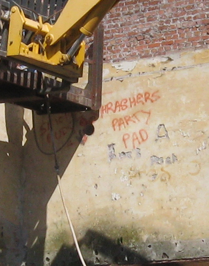
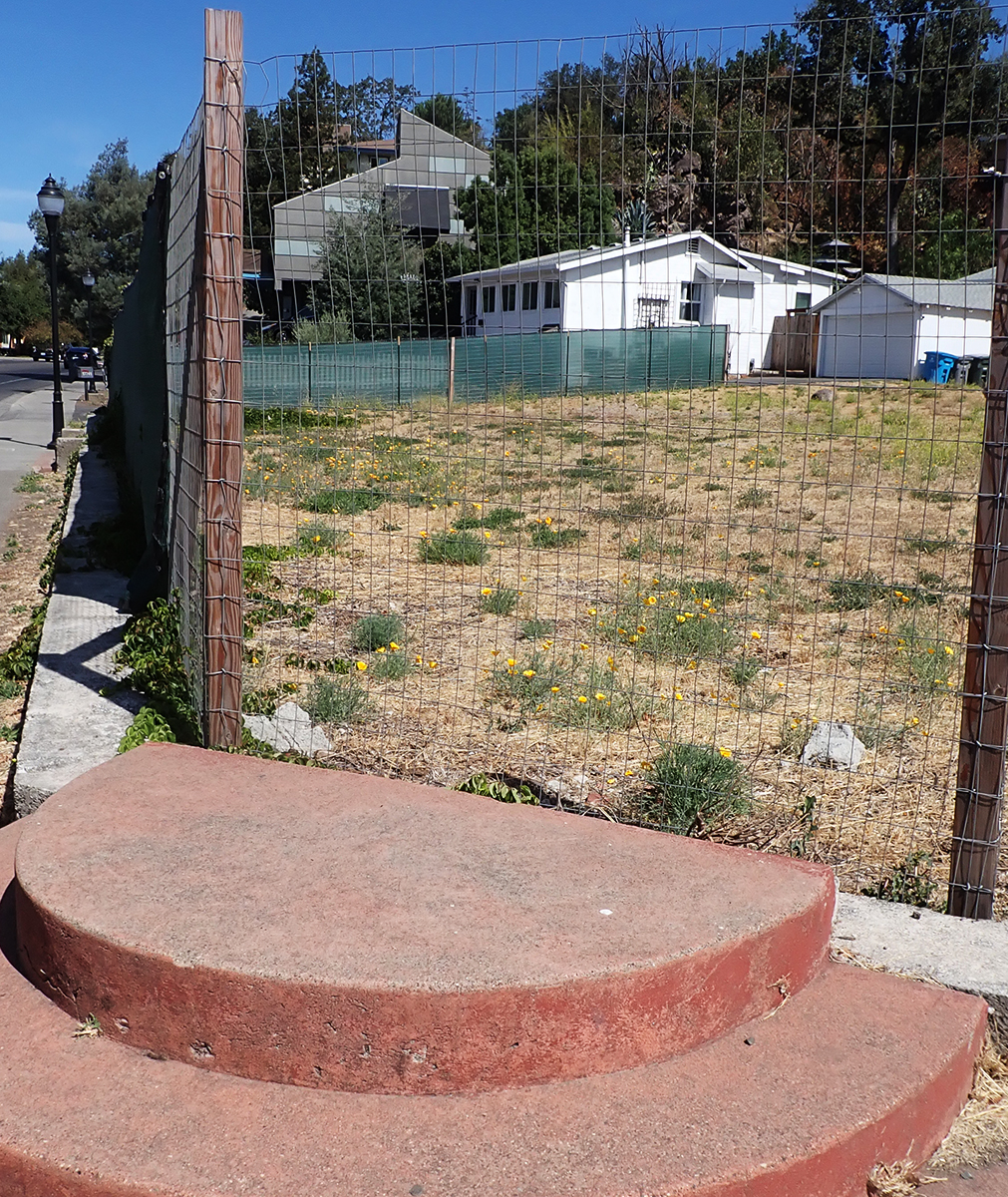
Yes, the ruble stayed there until 2012.Grafitti exposed during demo hints at the unauthorized use of the building during its abandonment.The vacant lot in 2013. 2026. The poppies are taking over. I’m not sure if that is the “Sally Stanford house” in the background.
I covered this in a previous post, but I thought it was worth a new look.
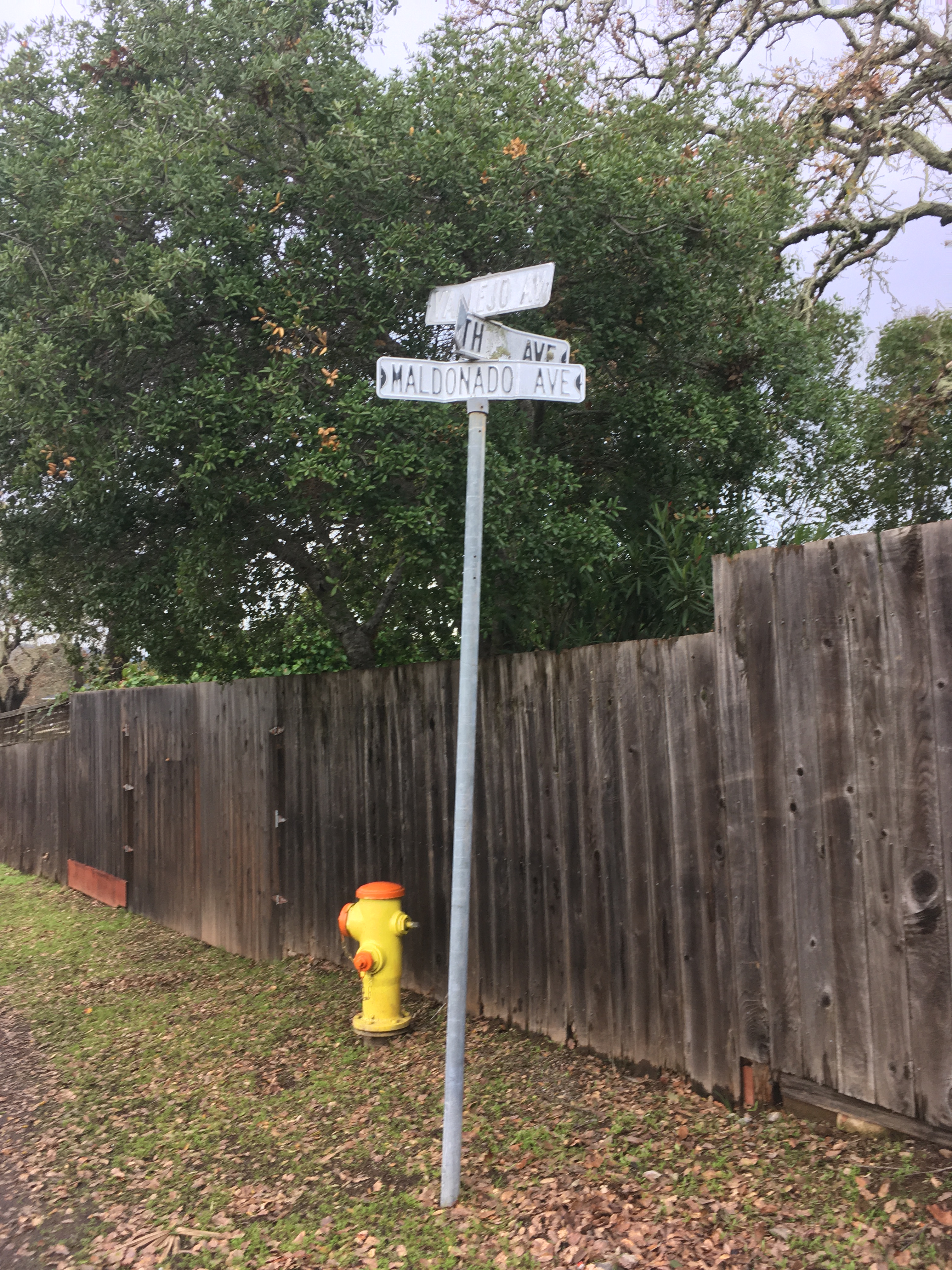
The intersection of Vallejo, Fourth, and Maldanodo showing the wonderfully distressed first generation sign, which has been replaced. If I had thougt faster, I could have gotten County Roads to give me the old sign. Alas, it was junked.
In 2020 I started photographing every every street sign in my immediate neighborhood with the intention of creating a database of intersections. Why? Obsessiveness. Completeness. The desire to record and collect (see website introduction.) Future use. It’s history. Because it might all burn down, and no one would remember what it looked like. And, I really like databases and consider them an art medium. I have also included photographs of the Neighborhood Phenomena in the vicinity of the intersections.
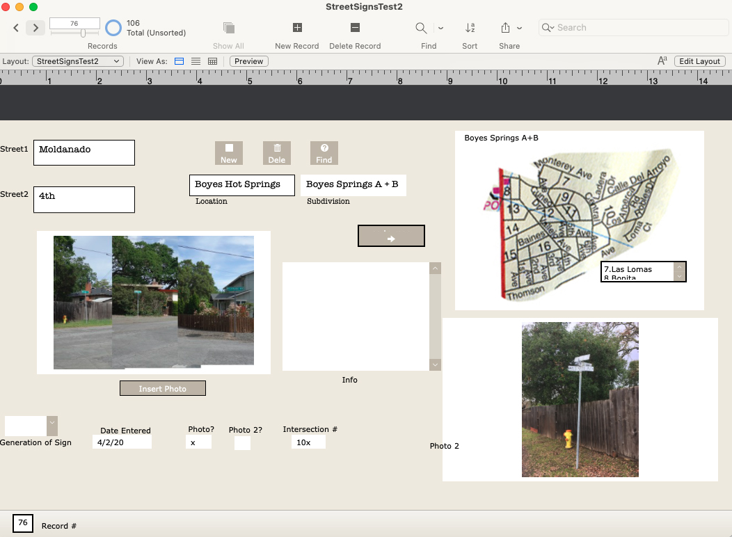
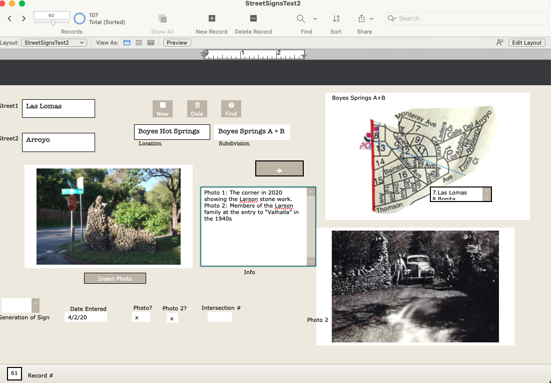
A record form the data base, under construction.
In addition to my photographs, I have included older (“historic”) ones, where they exist, newspaper clippings, and other ephemera. I know of no older photographs of intersections other than the ones at Highway 12, which were made primarily for commercial purposes.
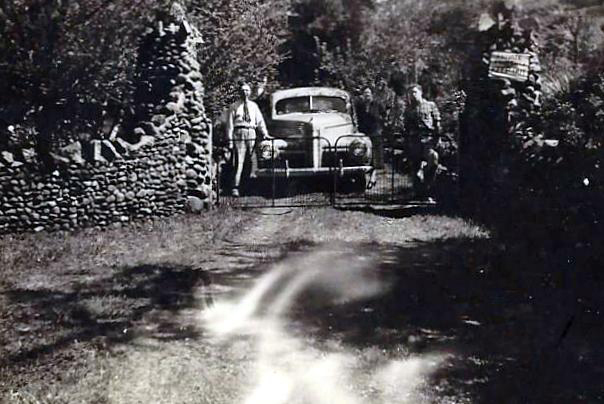
Las Lomas and Arroyo, featuring the stone walls built by the Larson family.1942. The entrance to the Larson family compound.
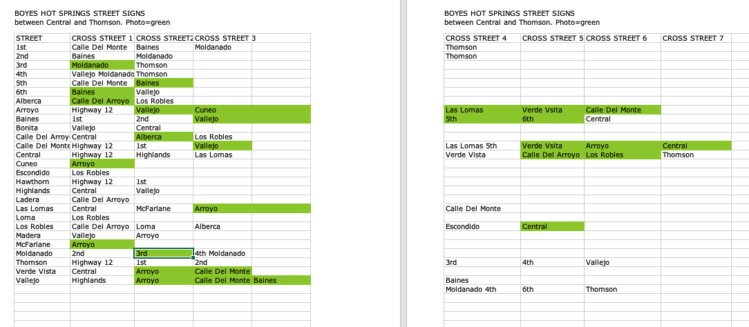
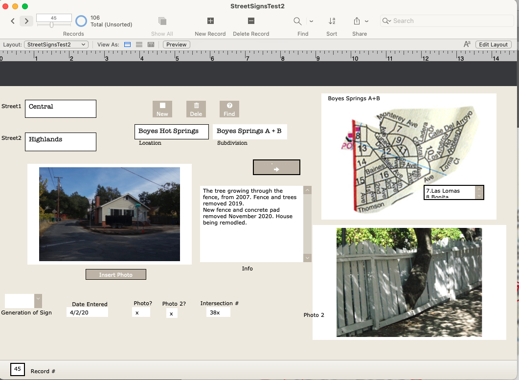
There are 107 records in the database (I probably missed some), one for each intersection in the Boyes Springs A and B subdivisions. The fields include “Generation of Sign” because three distinct styles of sign exist.Time permitting, the database would be expanded to include the surrounding subdivisions (link to post) Sonoma Highlands, Woodleaf Park, etc.Each record contains two photos or other images (sometimes newspaper clippings, other documents), and the map, which is still under development (ie, my Filemaker skills need improving.)
Samplle page of the database as an Excel fileAnother example of a Filemaker Pro record
Of course, the only constant is change, which means hours of fun for me updating the database.
The Sonoma Valley Redevelopment area was established by the board of Supervisors of Sonoma County in 1984. The area comprised a strip along Highway 12 from Agua Caliente Blvd. in the north to Verano Ave. at the south end, and parts of major intersecting streets.The main goals of the project were to remediate “blight”, to encourage commercial activity, and to facilitate construction of low-income housing. Major storm drain work and electrical undergrounding were done at the very beginning.
The wheels turned slowly, to say the least. By 1992 the final plan for the highway, a crucial element, hadn’t been decided. At that time Caltrans wanted to make it eight lanes!
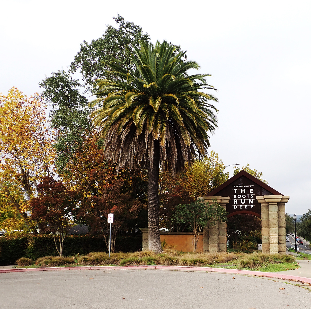
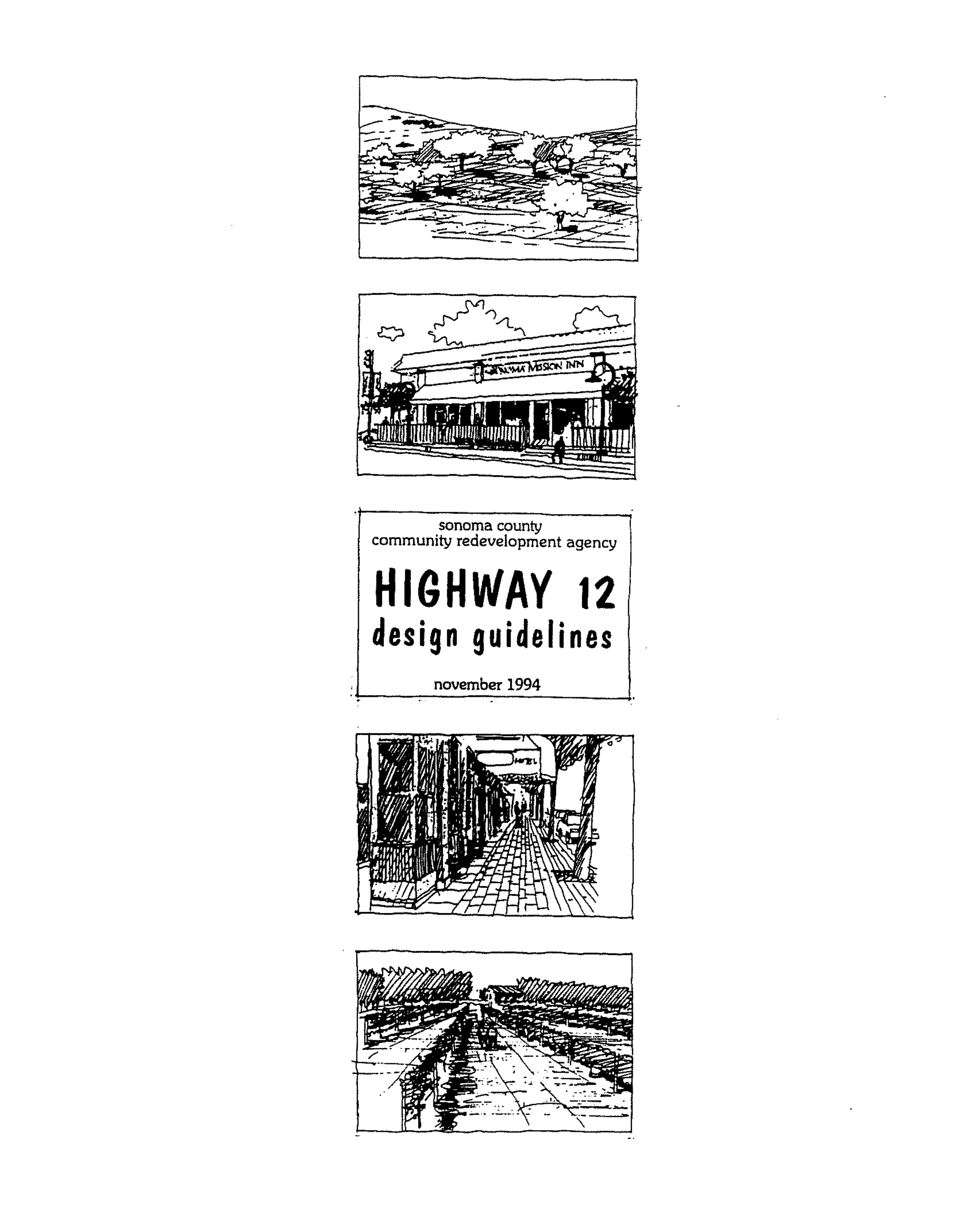
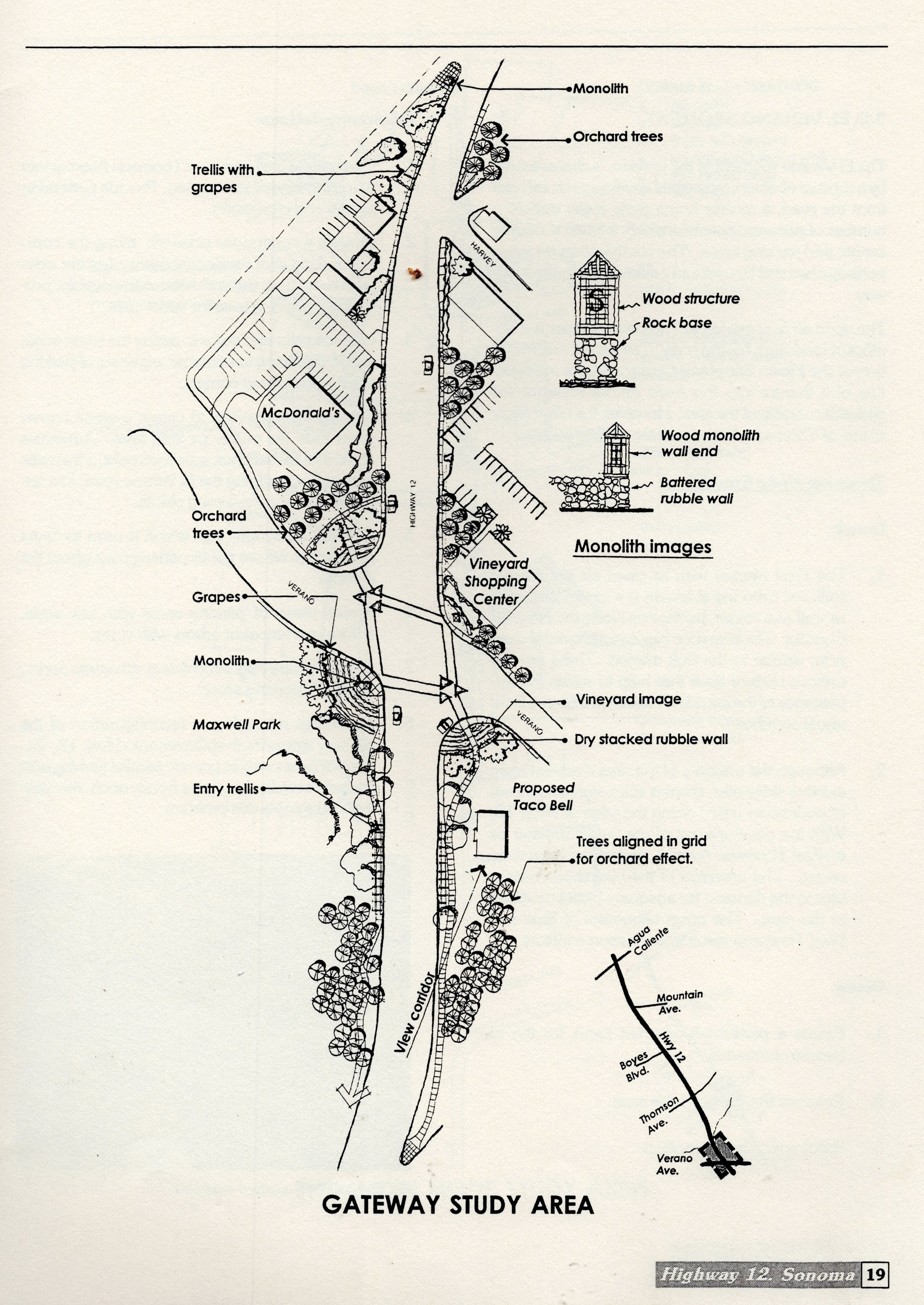
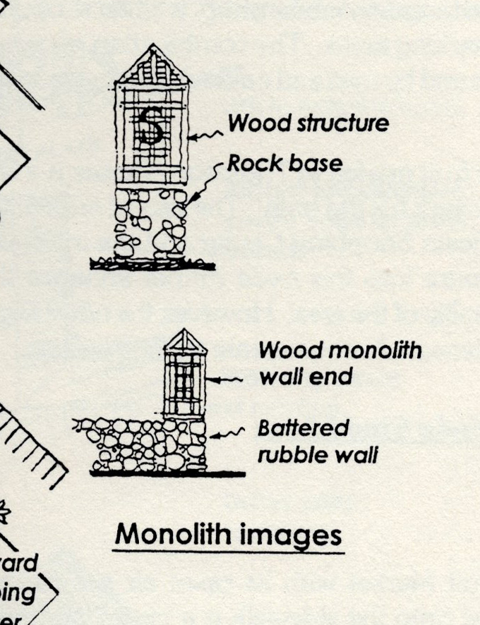
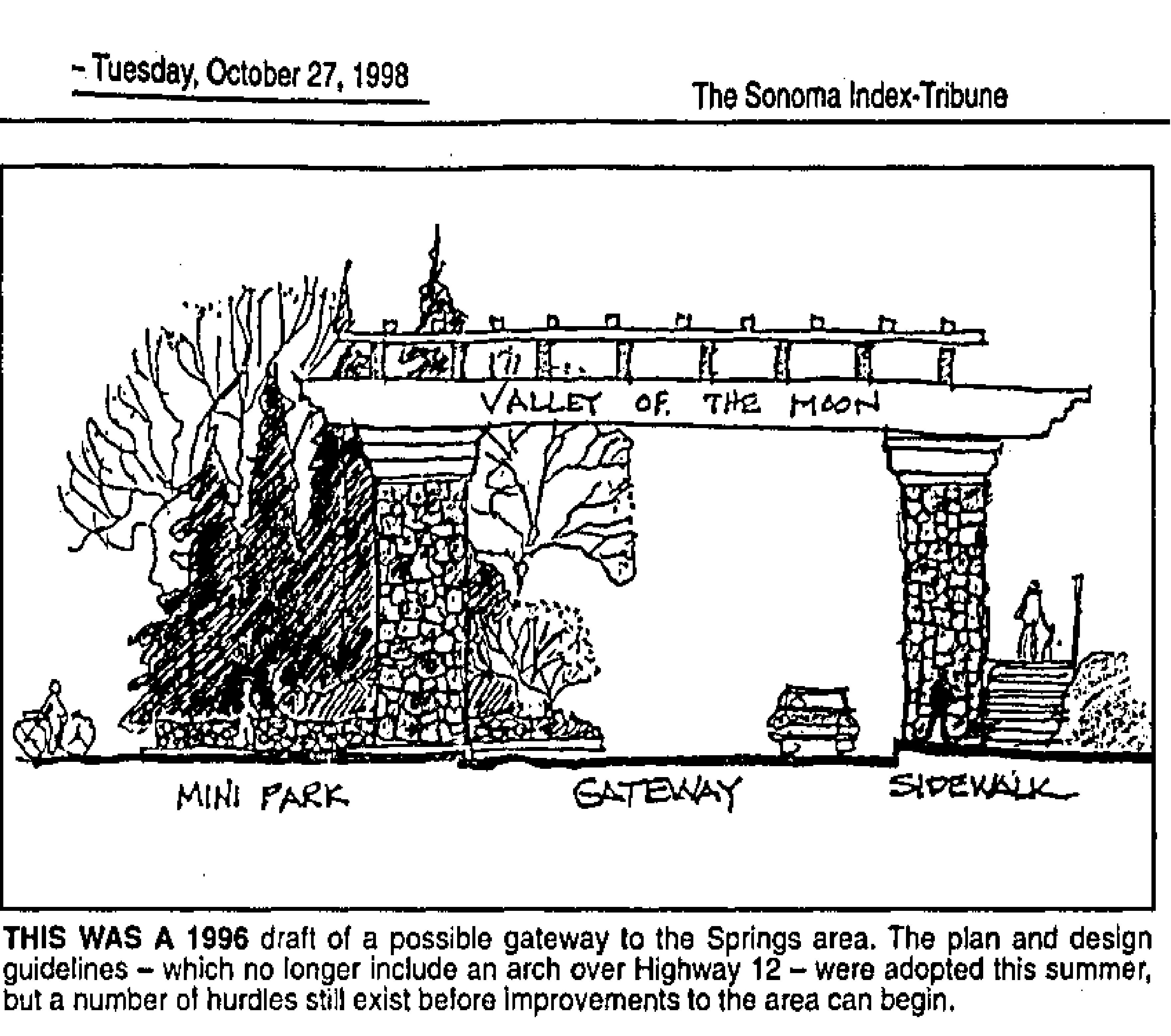
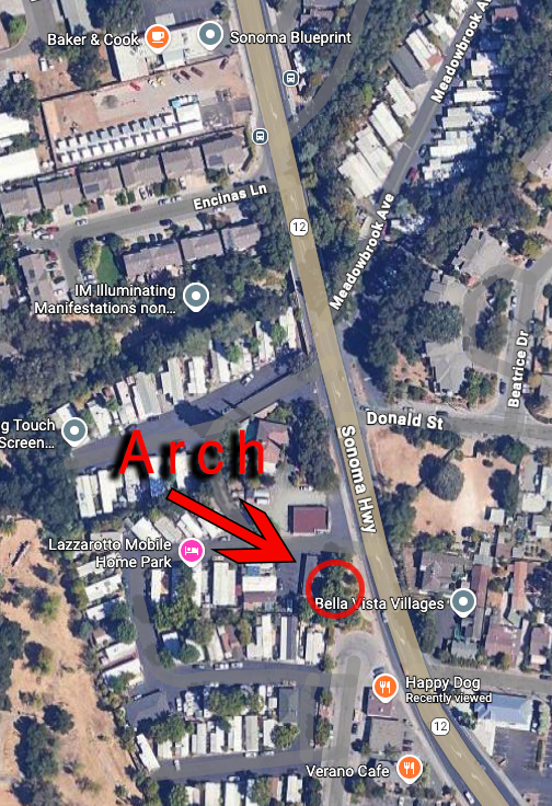
In 1994 an extensive set of design guidelines were issued. Under “Corridor Desing Concept, Southern Gateway Segment,” there is a study area map showing a “monolith” on the highway at the approximate present location of the arch (see map.) A small elevation of the monolith shows a wood trellis like structure atop a stone base. Trellises and dry-stacked walls, along with trees planted in grids to mimic orchards, are also included. These were all intended to be part of the symbolic entryway to the Springs. The last of the Recommendations in the guideline’s states “Develop further detailed design studies by retaining a consultant or by holding design competitions.”
A draft of the Redevelopment plan was issued in 1996. The Pilot Project was announced. “The plans call for a pilot project to the southern gateway. It includes closing a portion of Main Street, which cuts from Highway 12 to Verano Avenue behind the McDonalds restaurant; an archway or other gateway concept, trees and light fixtures,” we learn from the Index Tribune. Landscape Architect Ron Wellander was hired to manage. “A gateway gives definition between one community and another,” explained Robert Behrens, a site-specific sculptor who worked on the planning stages of the program.” Behrens is best known in Sonoma as designer of the Veterans Memorial Park.
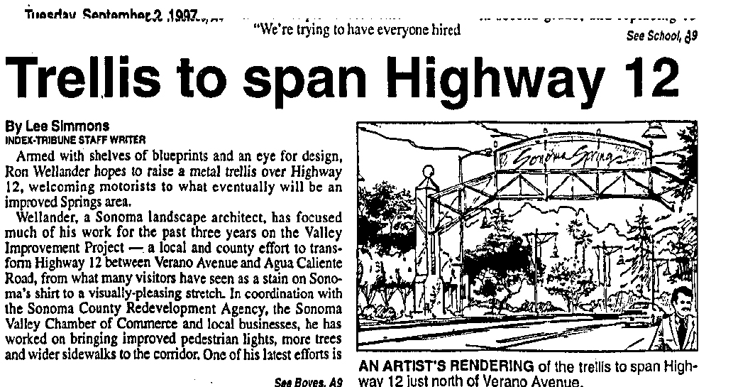
In July of 1997 the Index Tribune announced that “ Among the many improvements for Highway 12 between Boyes Blvd. and Agua Caliente Road will be a metal archway…the archway will consist of two posts, one at either side of the road near Boyes Boulevard, with a metal trellis extending over the road showing a welcome to drivers heading north. It was felt by the consultant (Wellander) that we need something that would announce dramatically the entrance to the springs,” (This is confusing. First, the Redevelopment area starts at Verano Ave, second, the pilot project is nowhere near Boyes Blvd.) The cost was estimated at $200,000.
In September of 1997, Caltrans informed the County that “We do not allow these type of structures to be built over highways.” End (of this part ) of the story.
Construction still had not been started by early 1999. “…the $700,000 first phase of the project…has suffered a number of setbacks. The most widely publicized of these was the proposal to buil a 20-foot-high metal trellis spanning the state highway just north of Verano Avenue (not Boyes Bldv!) While a relatively minor part of the project as a whole, the arch was widely criticized as unsightly and unnecessary.” Index Triune Feb 2, 1999. To complicate matters more, landscape architect Wellander filed for bankruptcy.
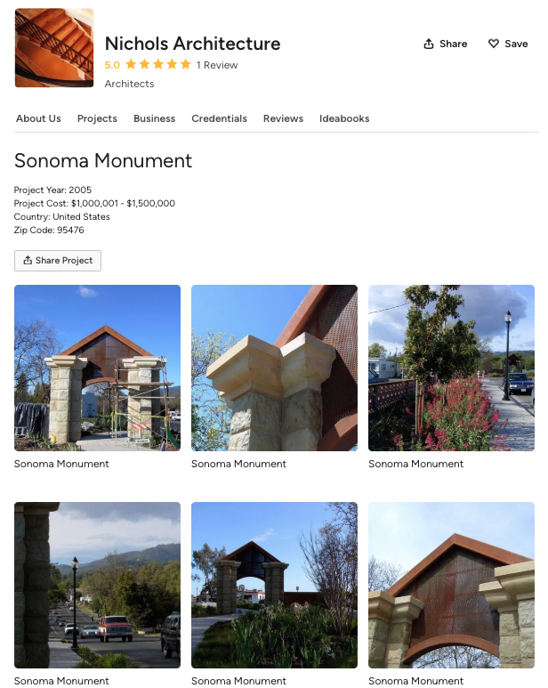
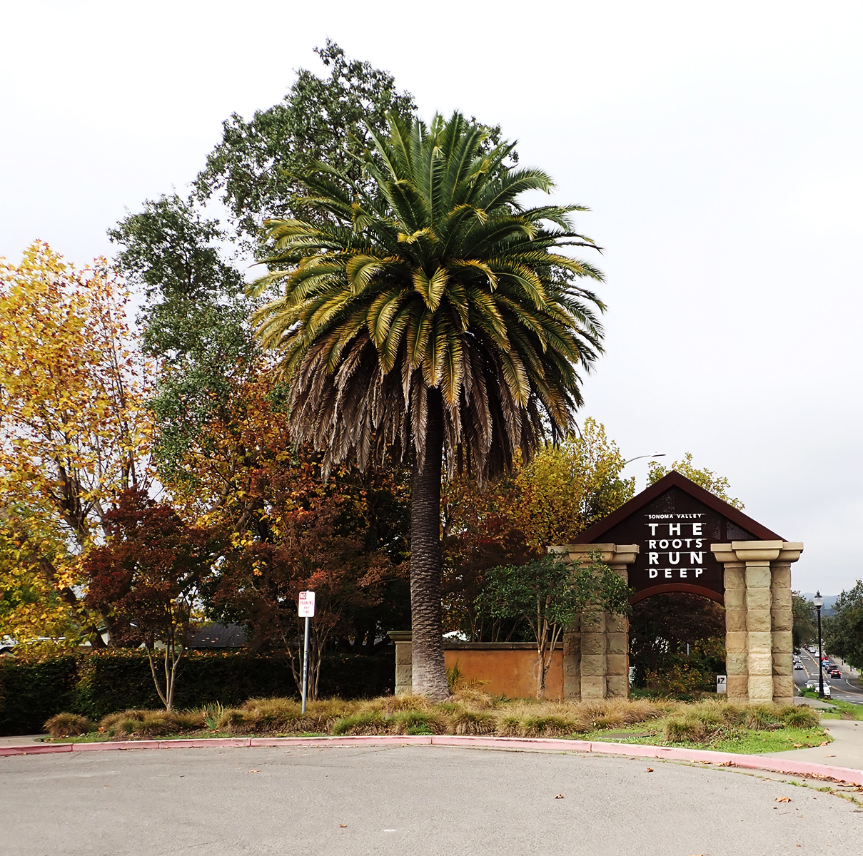
Our current gateway arch was built sometime between 2003 and 2005. The architect was Dan Nichols. According to the Houzz website, the year is 2005 and the budget was “1,000,000-1,500,000,” which seems a bit high. The budget for the entire pilot project was only $700,000. A friend who attended public meetings at the time remembers the cost as being $611,000. I have not been able to make contact with Mr. Nichols.
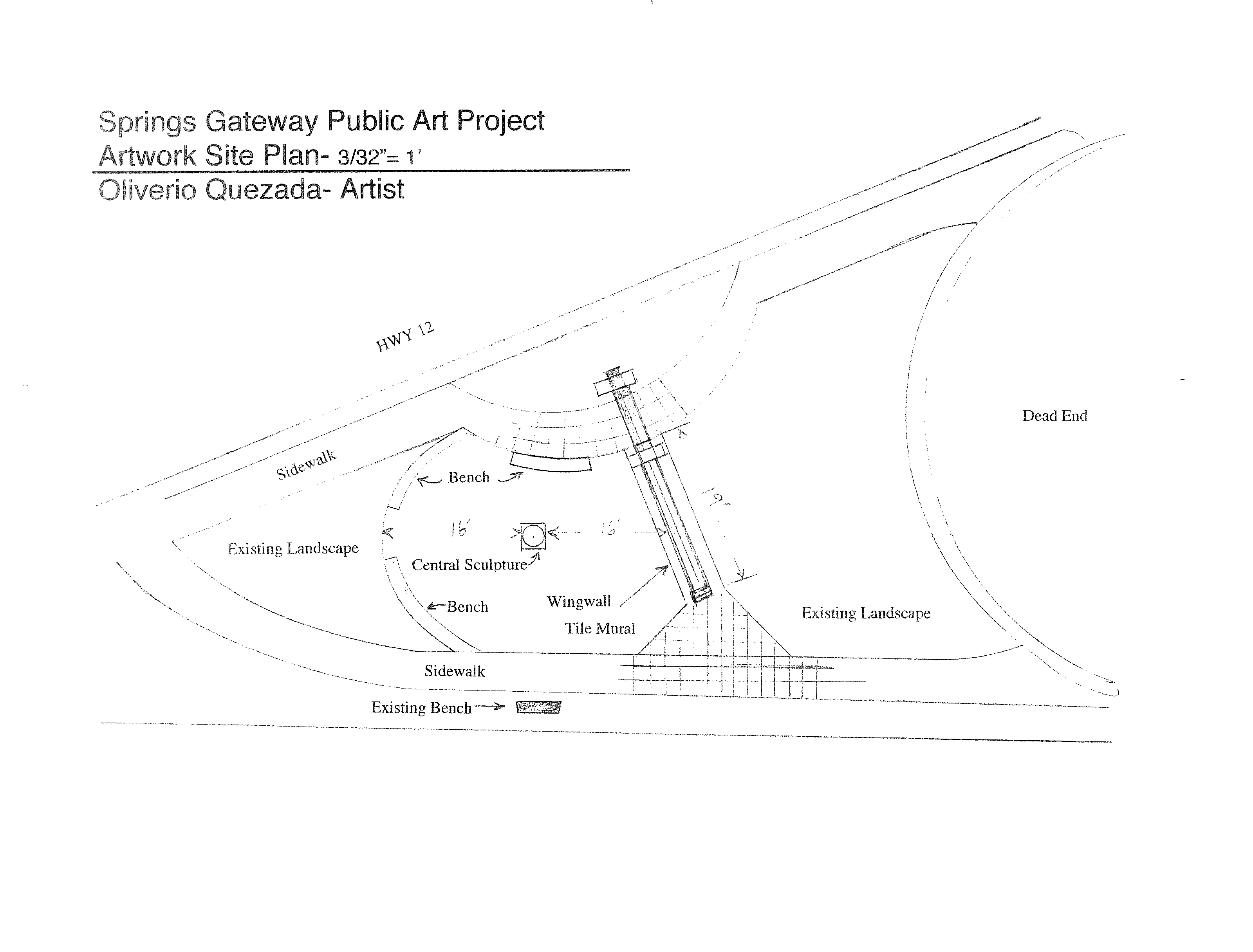
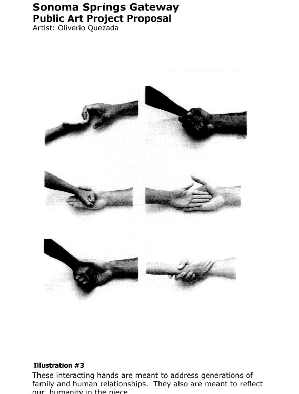
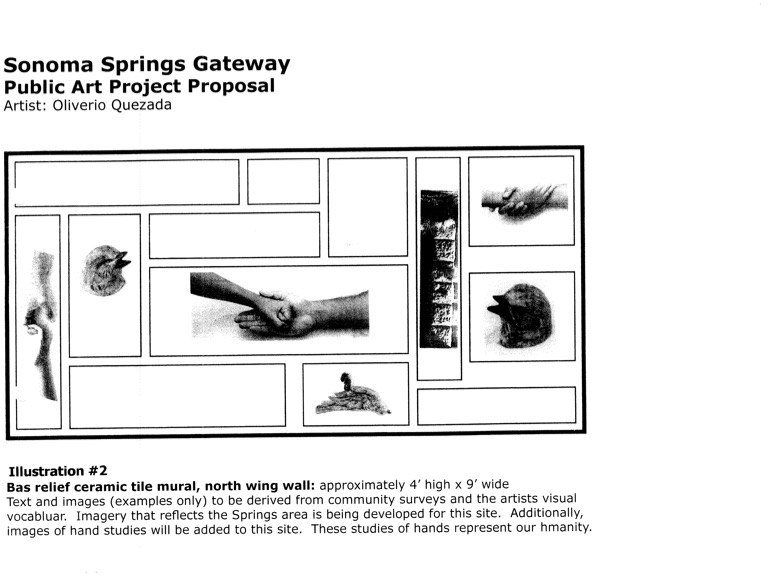
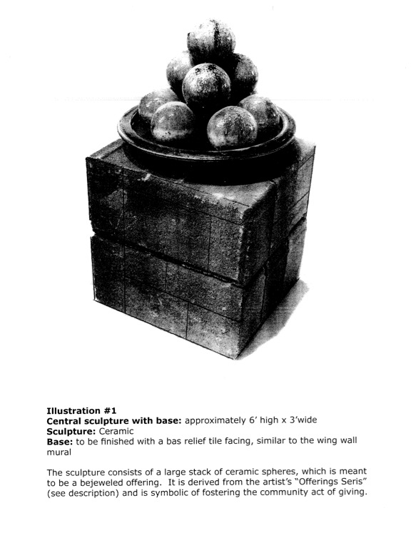
The original intention was to have art placed on the concrete posts and wall, which were left bare for that purpose. In 2007, ceramic artist Oliverio Quezada was “hired” to propose art. It’s unclear how he was chosen. On July 25, 2007, the Board approved redevelopment grant funds up to $35,000 to approve a Special Services Agreement between Quezada and CDC to design, manufacture, create and install an original artwork at the gateway. His proposal includes a concrete bench, a central sculpture, tile artwork on the wall, and a welcoming sign designed with the help of local school children.Images from artist’s proposal
However, the Advisory Committee of the Springs Redevelopment the RAC) had some questions. The tile were to be covered in text. “”I want the text and imagery to be as pure and beautiful as possible, incorporating the best of everything existing in the Spring Area’s past, present and future,” Quezada said in his written proposal, but the RAC wanted to see all of it before they would OK the total art project. However again, these objections seem to have faded away, with a new problem arising in 2008: money for maintenance of the artwork. The CDC could fund it but could not to maintain it. Other agencies like Public Works or Parks, didn’t have the money for the (continuing) job. “Kathleen Kane, executive director of the county’s Community Development Commission, told the local panel that maintenance questions and funding need to be resolved before the project can continue. “Kane said that the project could be in danger of fading away. “If we can’t get it settled to the satisfaction of public works, it could die,” she said.” Fade away it did.
Soon after, the rusticated stone cladding was applied to the bare concrete pillars.
Now we have an essentially meaningless public art work with a wine-centered advertising slogan on the steel upper part, installed by persons unknown. Inquiries have been made. None of the powers that be have an answer.
Mu contention is that the Gateway Arch could still be transformed into a real symbol of our community. We have plenty of creative talent. All we need is money. HA!
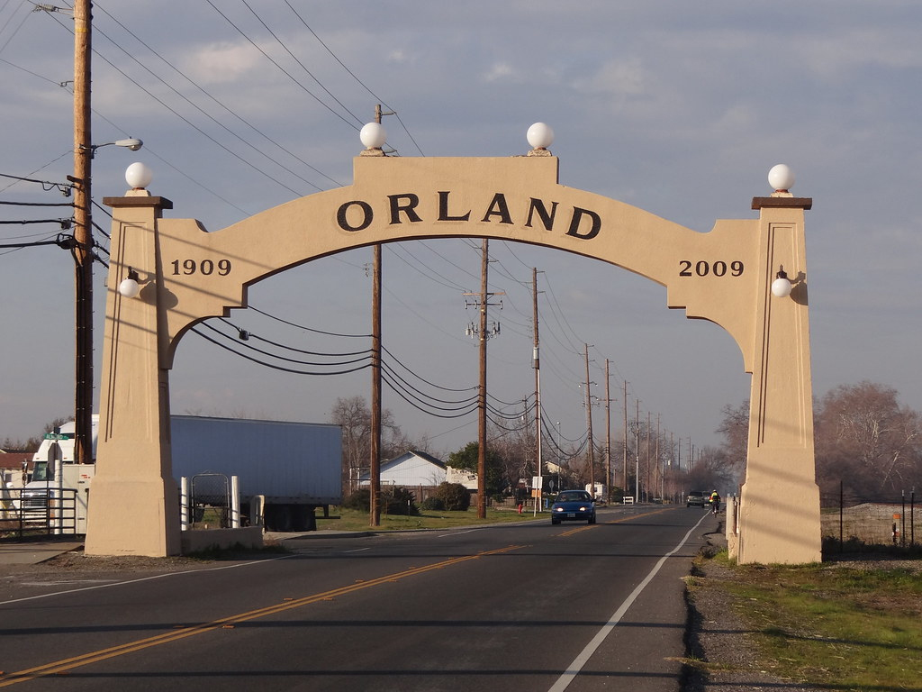
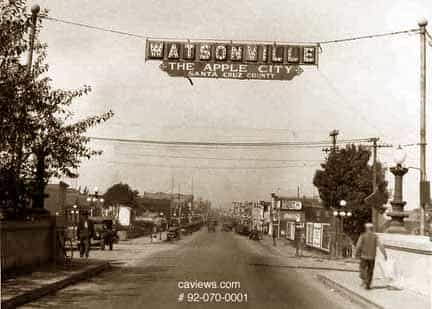
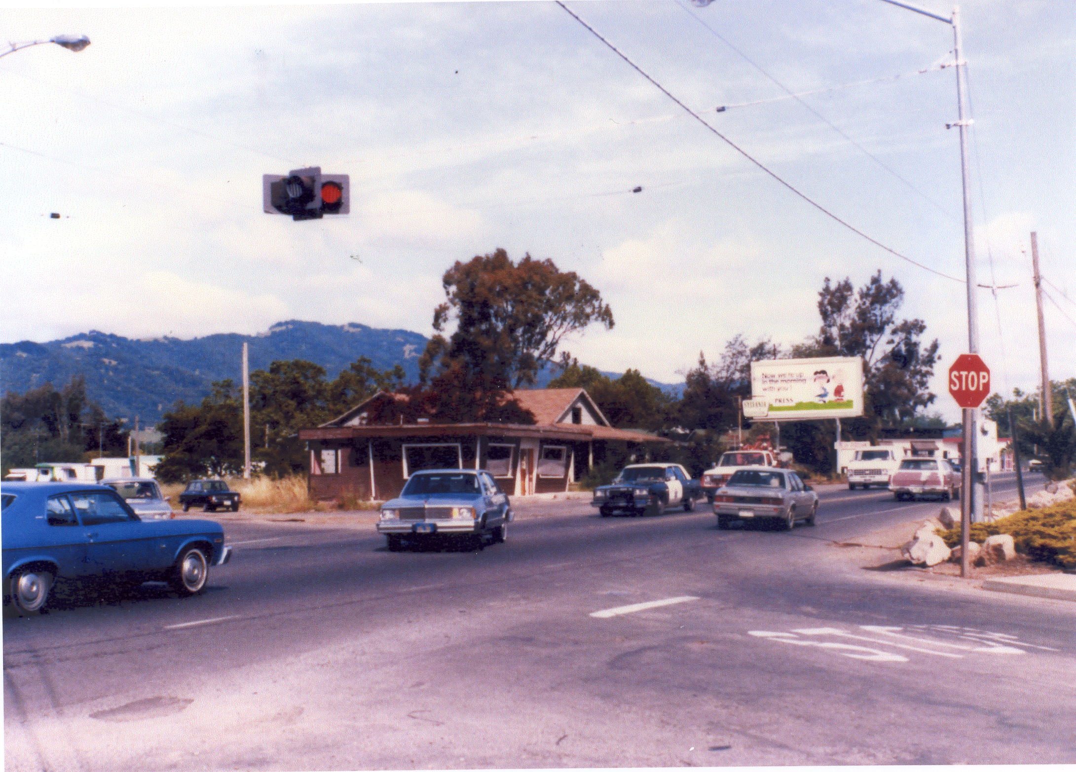
The Orland and Watsonville arches predated Caltrans. The upper right image is the corner of Verano Avenue and Highway 12 in the 1970s(?) Caltrans had no problem with hanging a traffic signal over the road.
The database is a Filemaker Pro catalog of my collection, most of which now belongs to the Sonoma Valley Historical Society, but I’m always adding to it.
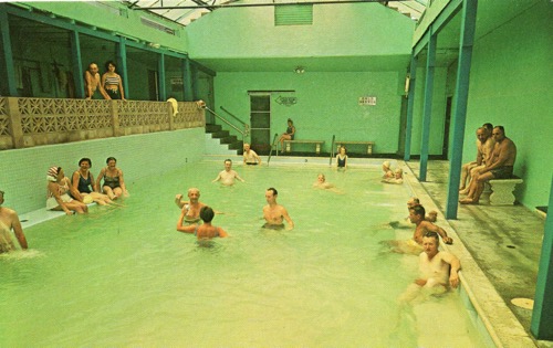
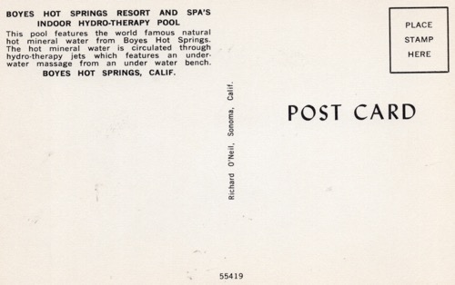
Richard O’Neil was a well-known commercial photographer in Sonoma, from the 1940s through the 1960s. He photographed many weddings, school portraits, and newspaper pieces. This weirdly green image is probably from the mid 1960s. More about the Bath House here.
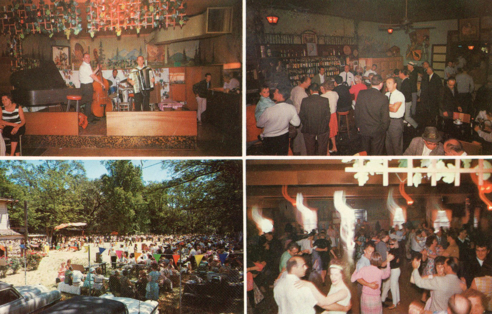
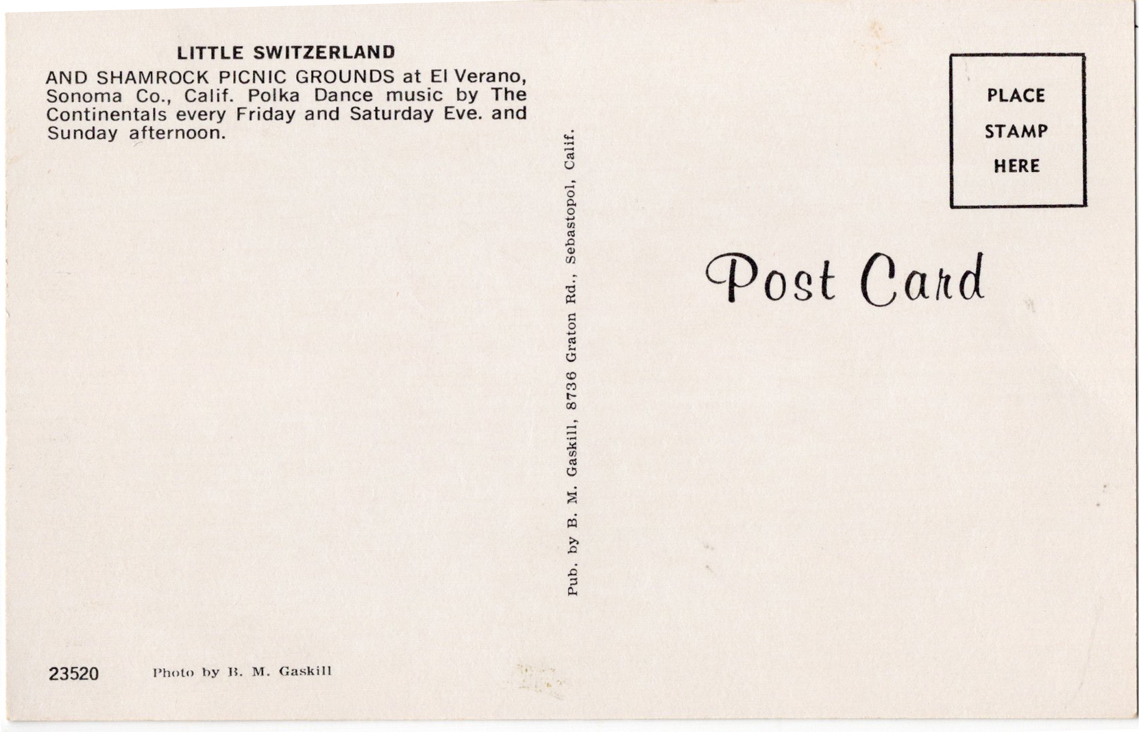
B.M. Gaskill was another commercial photographer working in Sonoma county in the mid-century. There are much better photos of Little Switzerland, but I’m interested to discover this photographer, and I’m in search of more of his images.
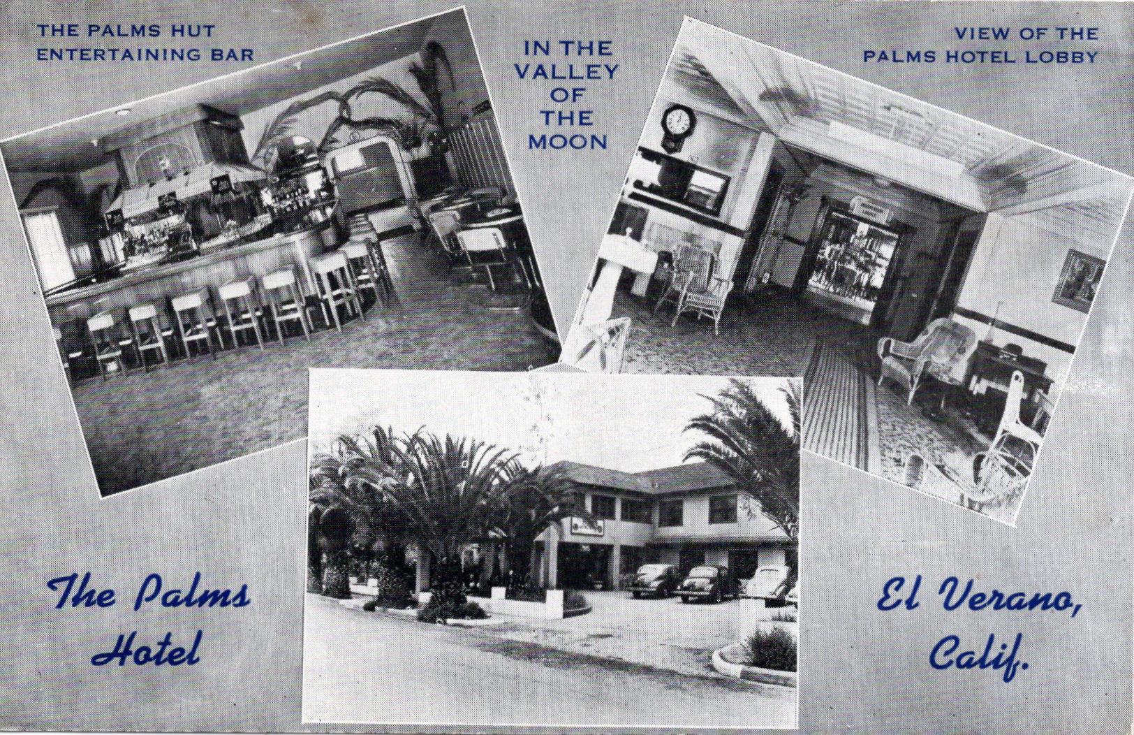
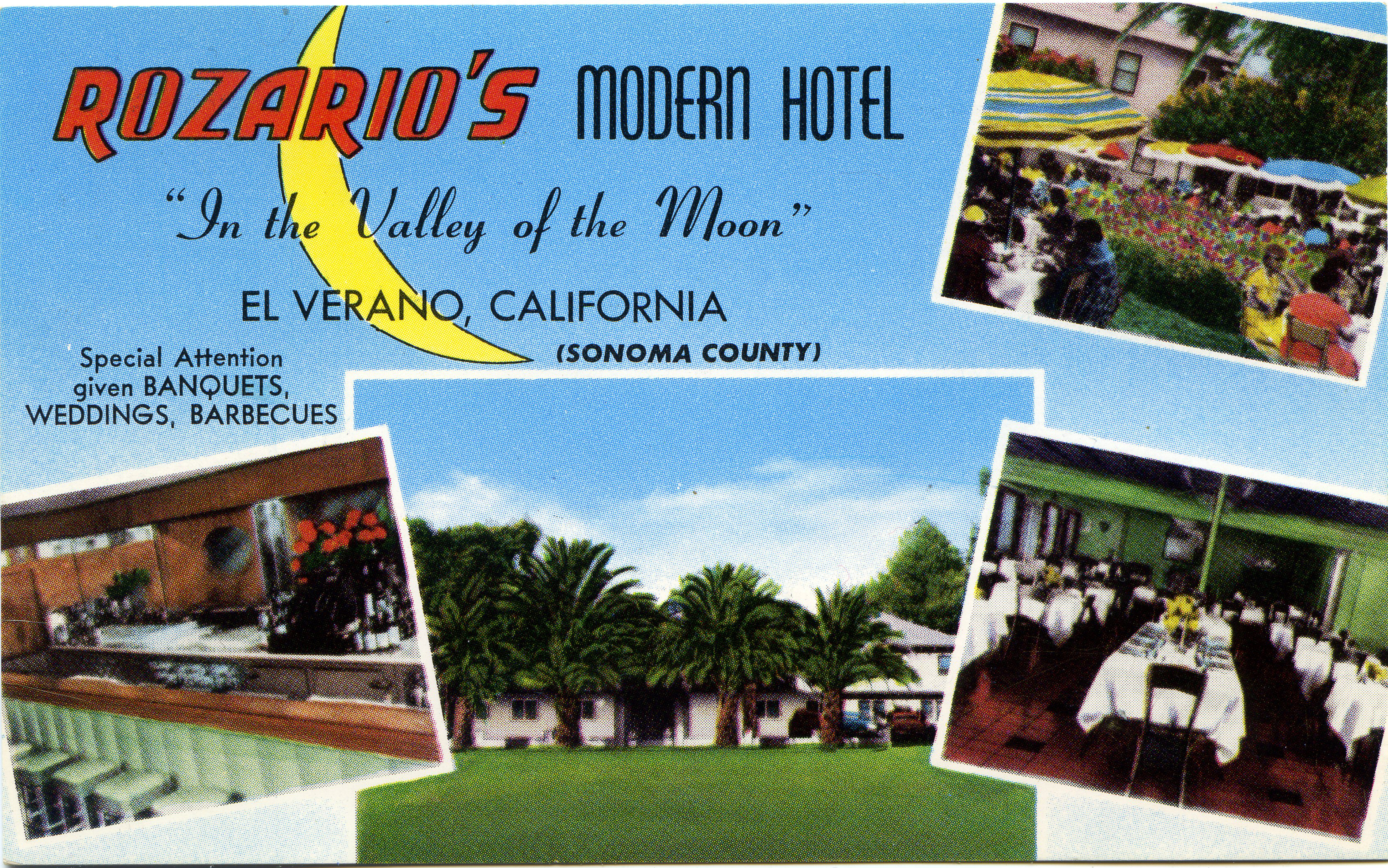
The Palms Hotel, 1940s, later known as Rozario’s. Not sure when the name changed, but an ad in the Index Tribune in 1949 called it “Rozarios’ Palm Inn.”
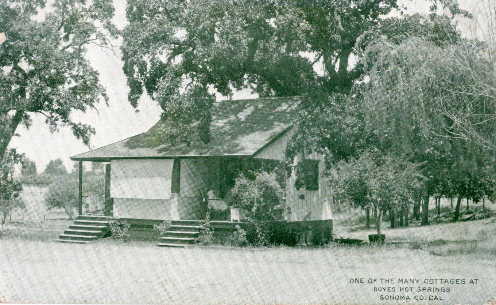
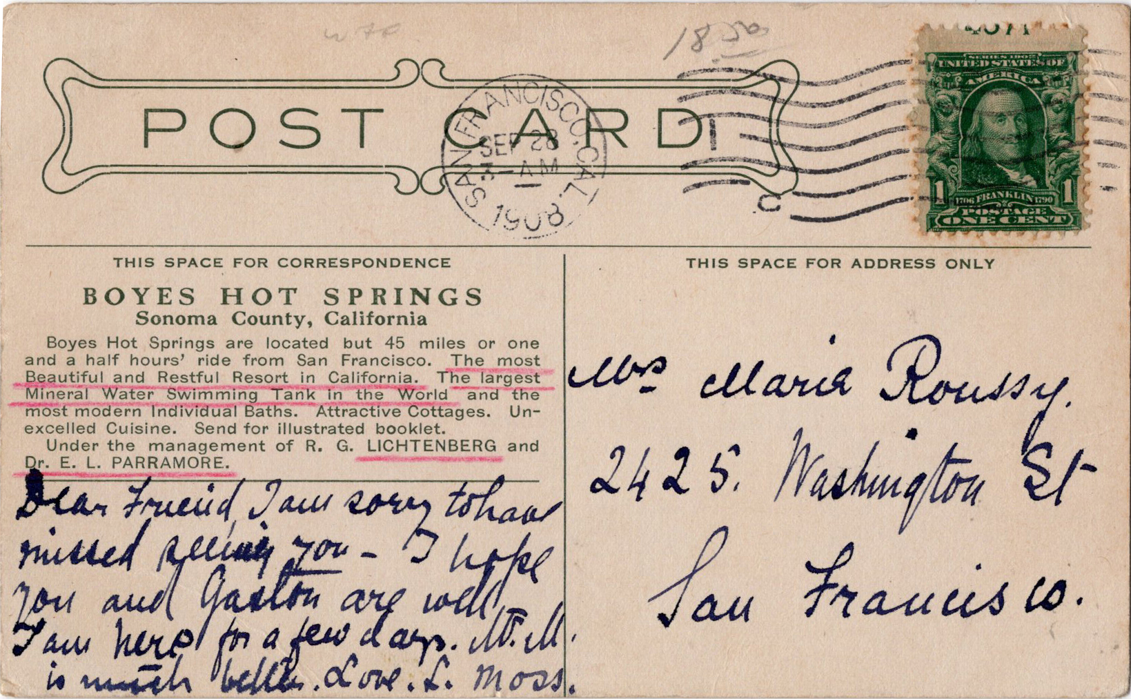
1908 image of “one of the many cottages,” most of which either burned in 1923, or survived to become year-round homes today.
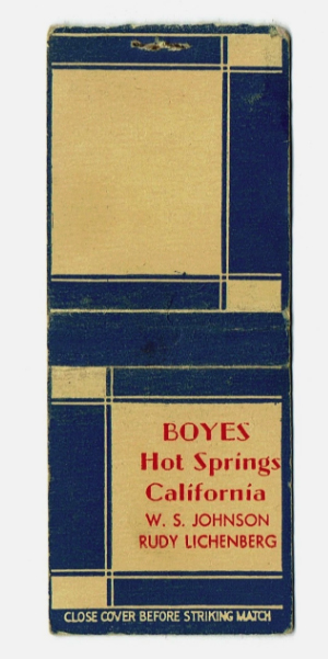
Beautiful design of the matchbook cover, naming Lichtenberg and later partner W.S Johnson. Probably 1950s.
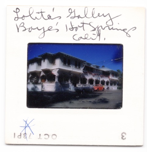
Color slide wrongly naming “Lolita’s Galley!” It was actually the famous Juanita’s Galley. 1970s
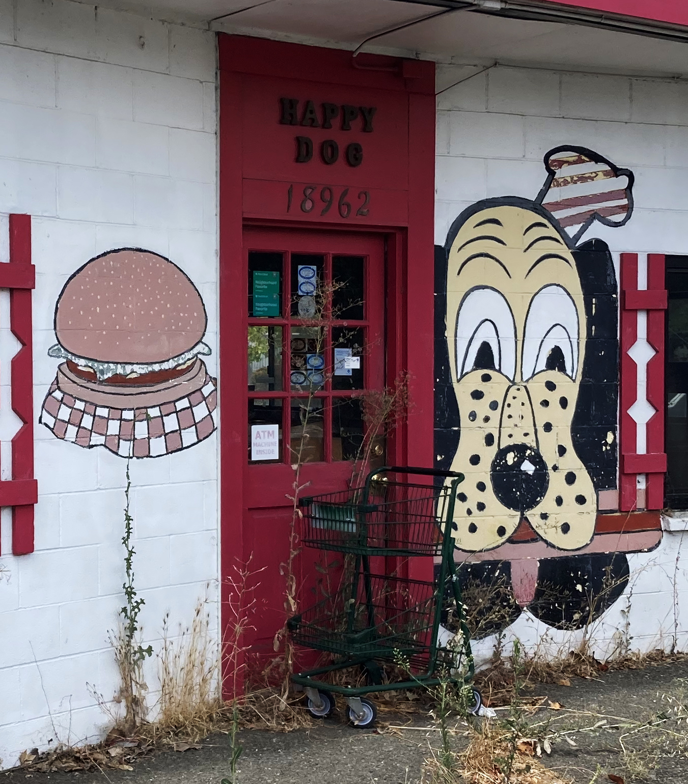
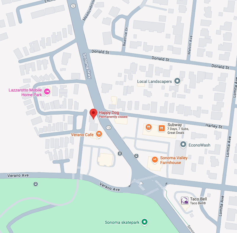
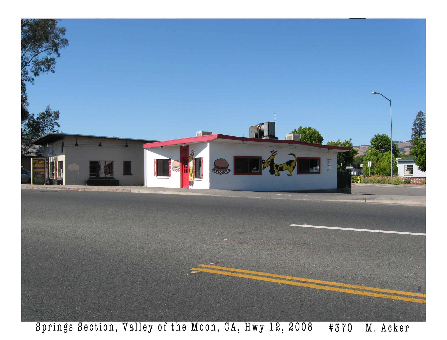
I thought I was going to write about the Springs gateway arch, but I ended up looking at the general area, which includes the old Happy Dog hamburger joint, so I thought I’d write about that. But then I started looking at the Index Tribune archives and found info on other buildings close by, which had some interest. First, that Contented Canine.
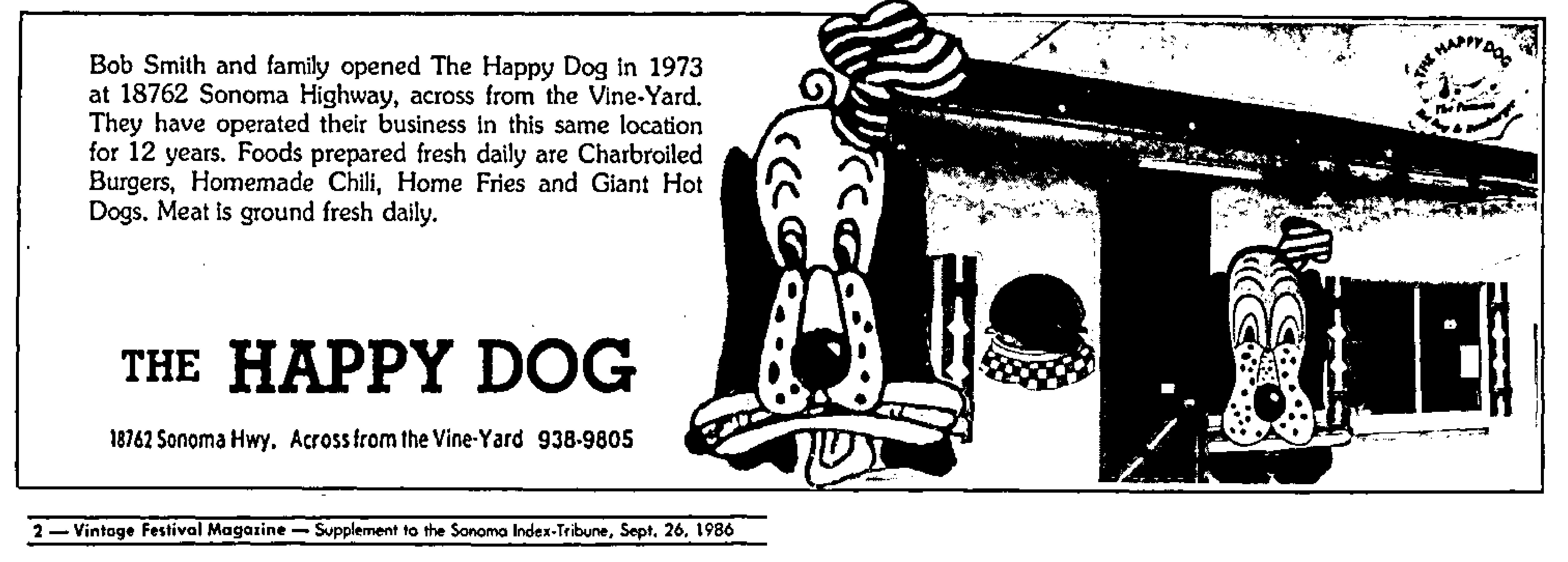
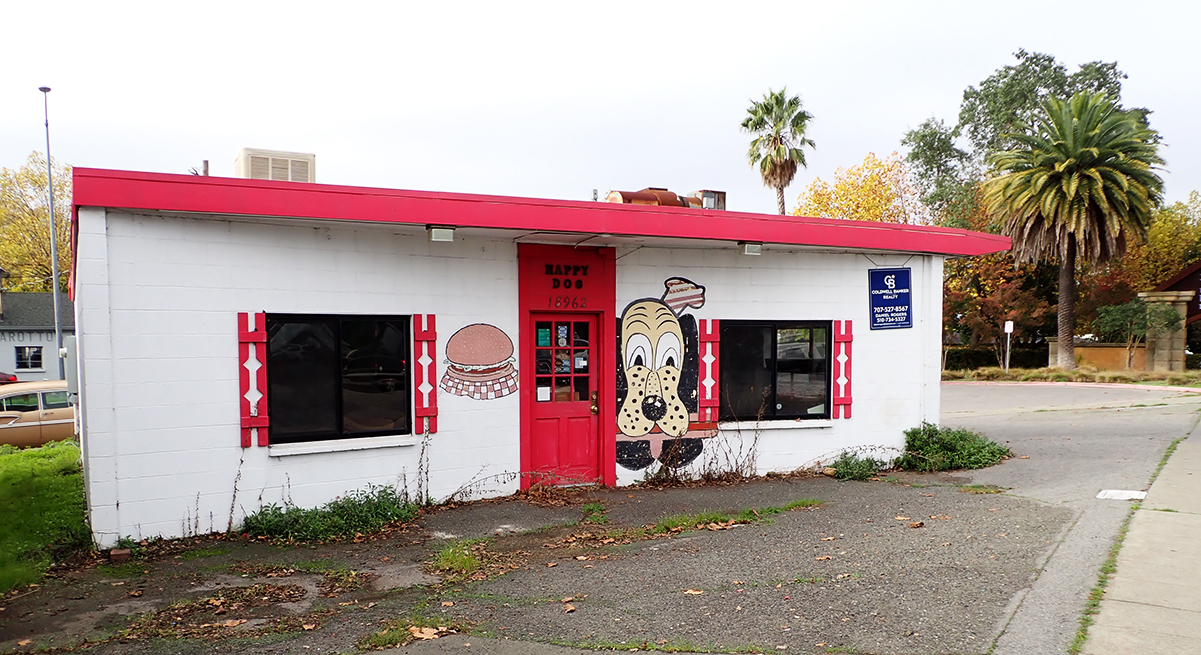
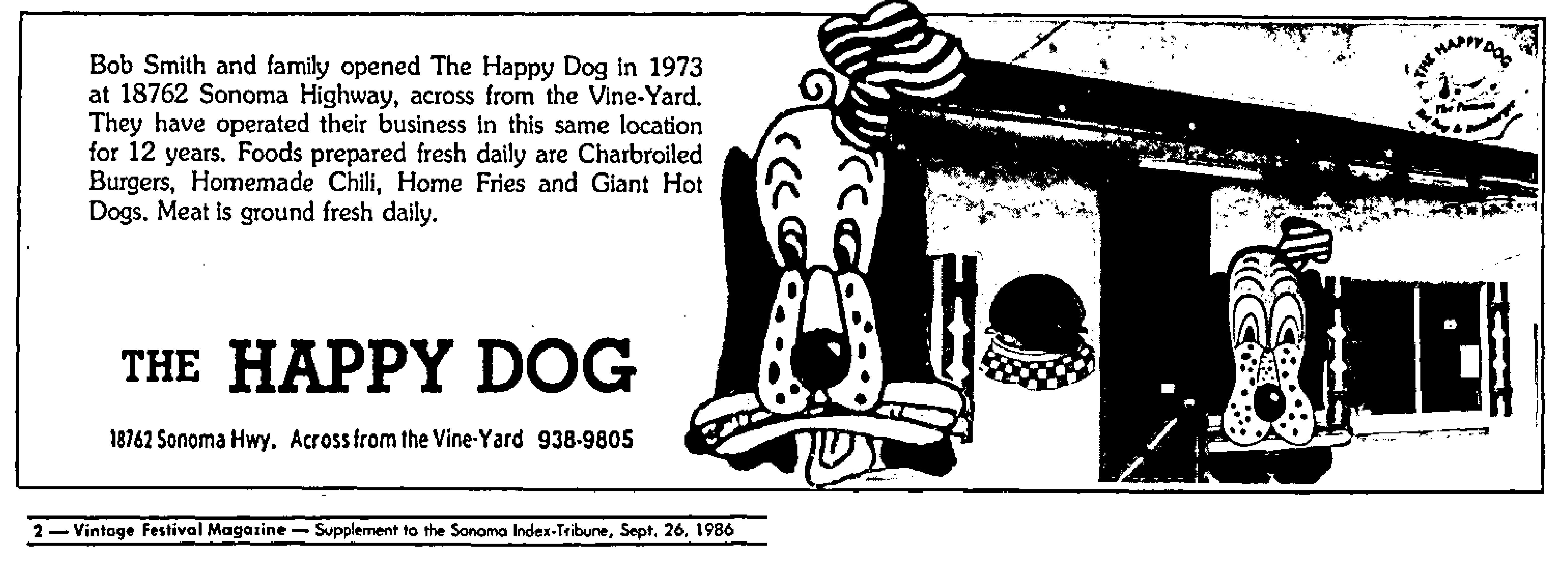
Robert Smith, a native of Canada, veteran of WWII in the Pacific, and former Real Estate Broker, looking for a career change, founded the Happy Dog in 1973. It started out as a hotdog stand, but soon added hamburgers, which became famous in the Bay Area. By 1984 they were selling 100,000 hamburgers per year. It’s fame caught the attention of the San Francisco Chronicle, which featured the restaurant in 2016 in a section they called “Cheap Thrills.” Generations of Sonoma Valley teenagers got their starts in the work-world at the Dog.
“Across from the Vine-Yard”
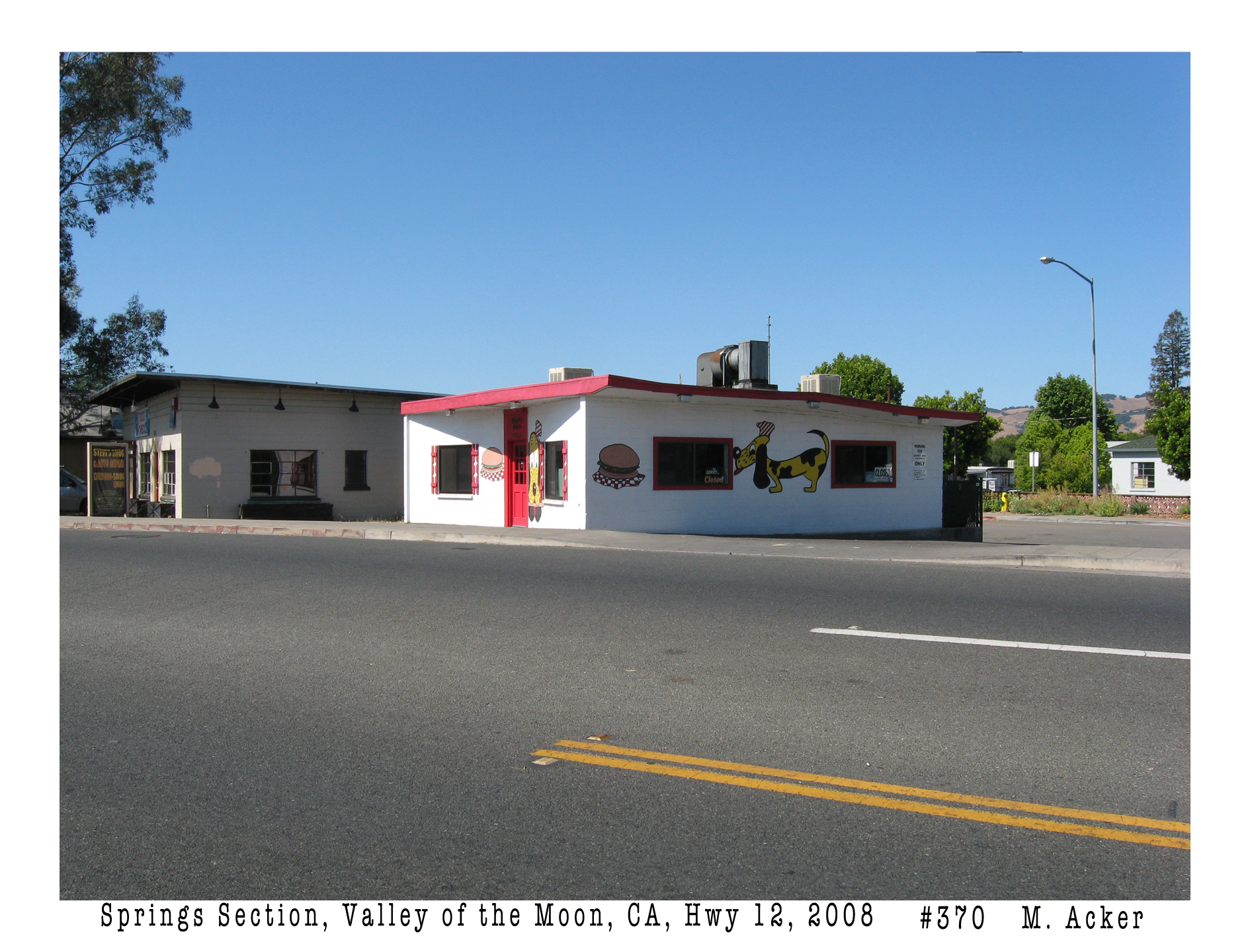
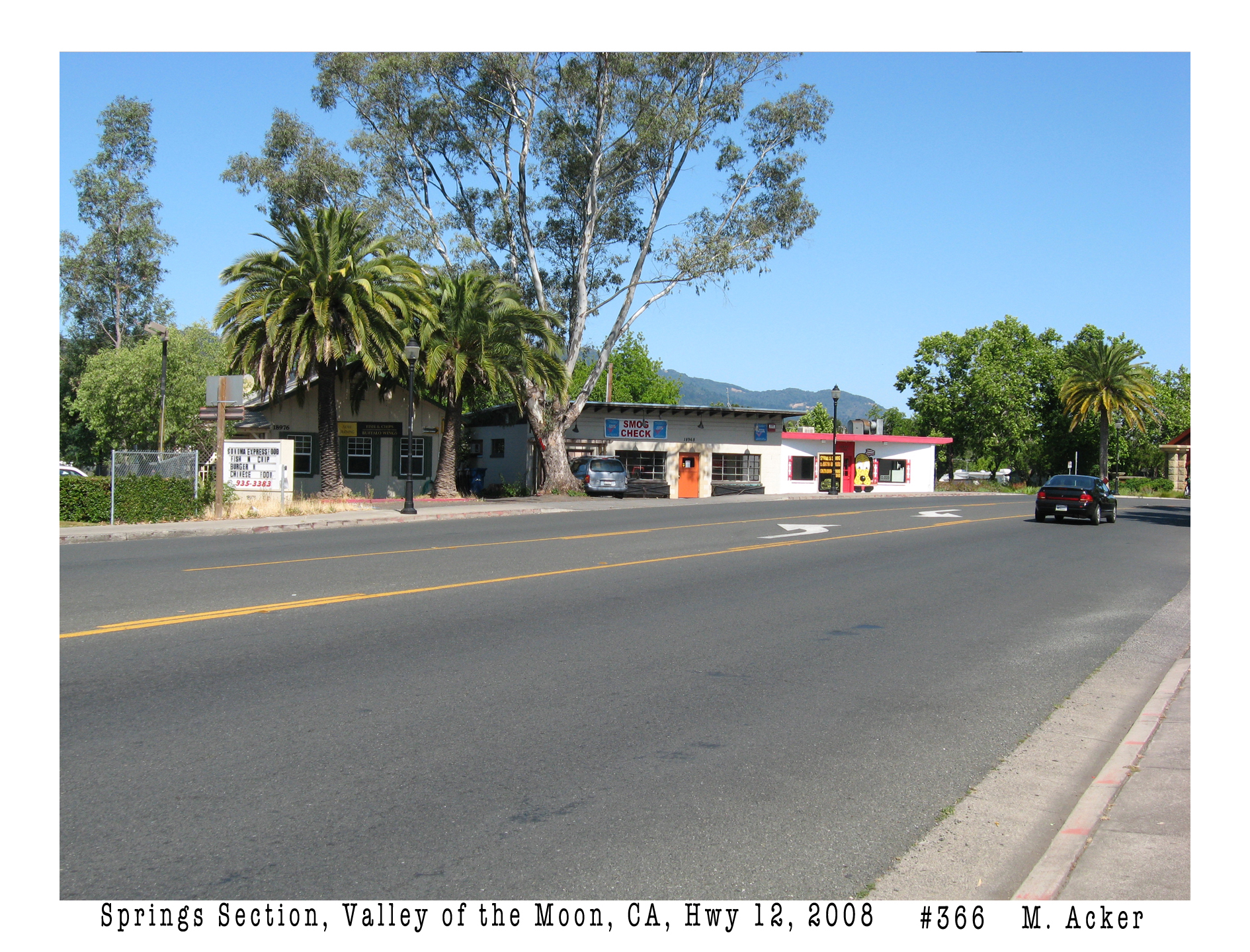
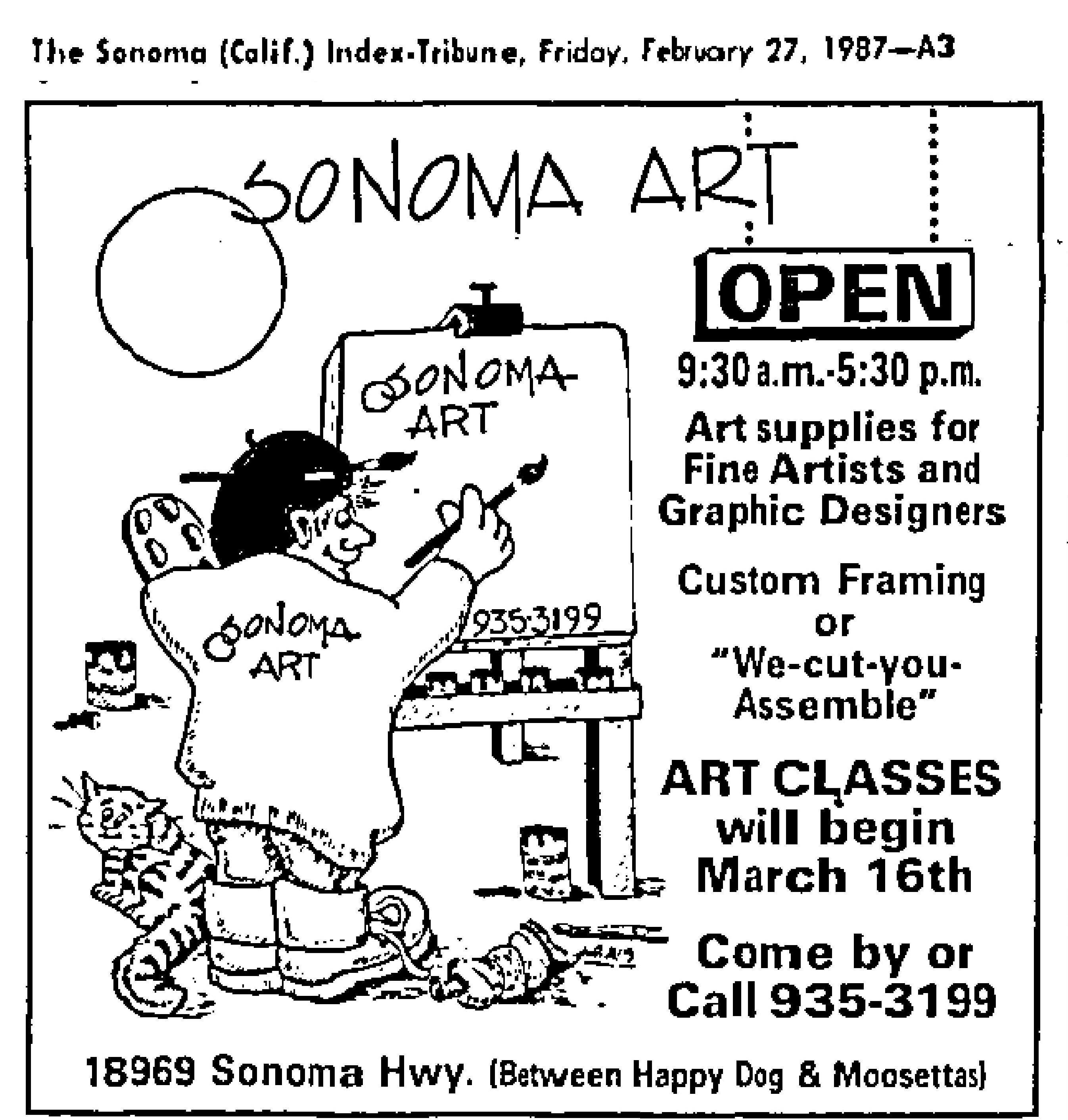
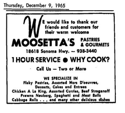
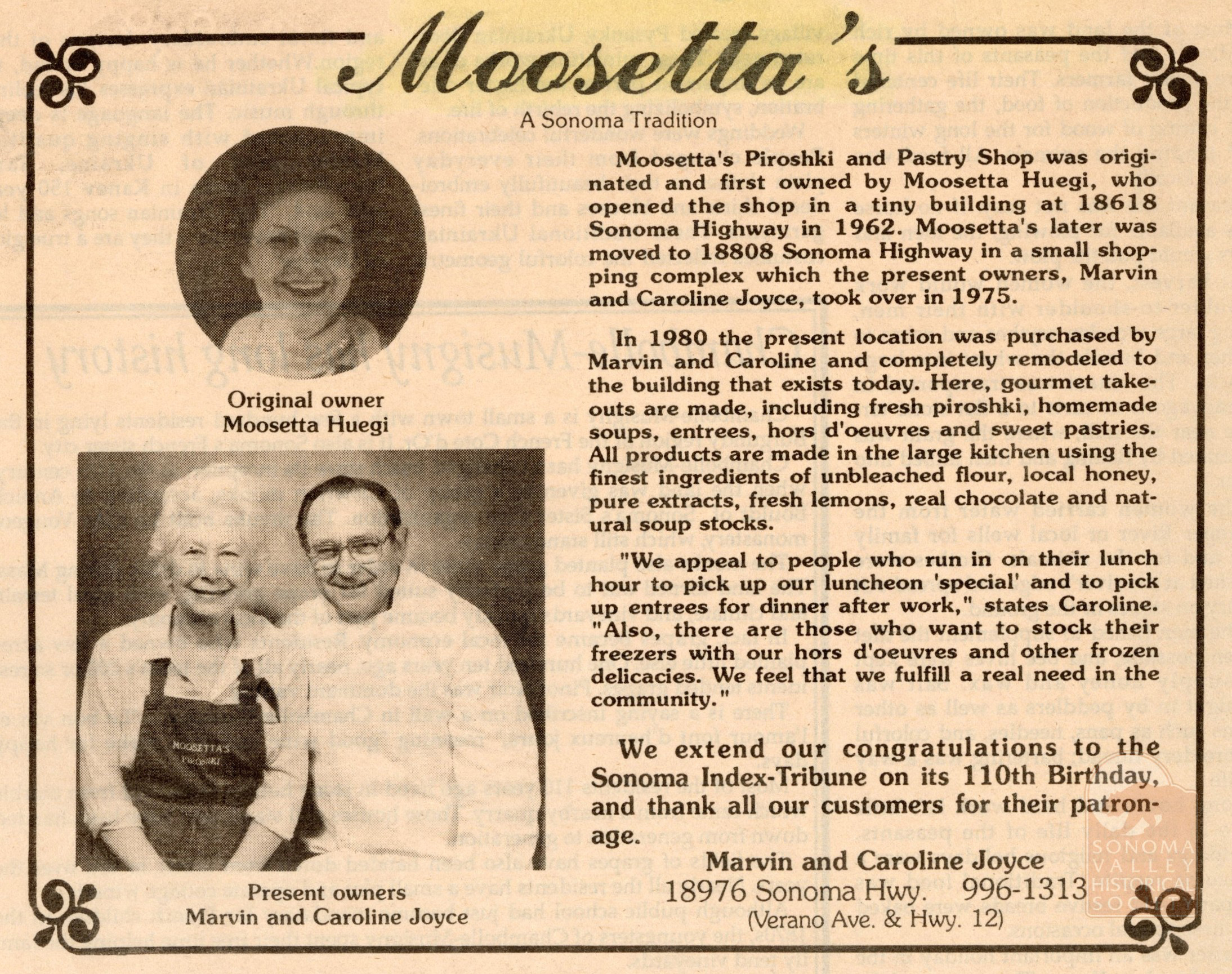
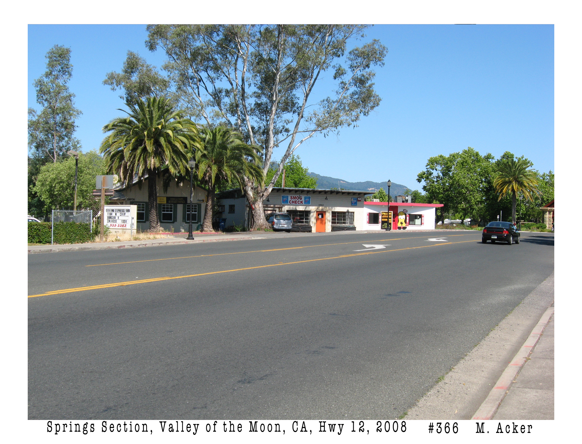
The concrete block building with the dog murals is one of three in close proximity to each other along Highway 12 in El Verano. In 1987, Terry and Bob Morris opened an art supply store in the building next door (now Steve’s Auto shop). The southern-most building (18976 Highway 12), closest to McDonalds, now the Verano Cafe, was once the home of Moosetta’s Piroshki and Pastry Shop, which opened in 1962 at a different location. The Art Store soon moved to 5th Street West. Moosetta’s moved north to the small commercial center at 18808. That space was later the Rocket Café and is now Baker and Cook.
A good location, “Between Happy Dog and Moosettas!”Moosetta’s original location, where the gas station is now, across from Siesta Way.1989.
Judy and Kuoseng Chang bought the Dog in 1989 and changed nothing. Why mess with success? But running a restaurant is strenuous. In the Press Democrat in 2014, Diane Reber Hart noted “both in their early 60s, the Changs put in 12-hour workdays six days a week. Their only employee is their nephew Steve Chang, 42, who plans to take over the business whenever the couple retires.” I don’t know if this happened, but the Dog has been closed since 2021. In 2022 Kathleen Hill reported in the Index Tribune that the building had been sold, for what use was not disclosed by the buyers. Well, no use, apparently. As of January 2026 it still sits empty.
2025. The Gateway Arch can be glimpsed at the far right.The slogan was installed some time late in 2025, who knows by whom.
The Arch is a relic of the Redevelopment Pilot Project of the late 1990s. It was designed by architect Dan Nichols and built around 2000. More on this in another post.
bonus Happy Dog images:
2016, from Yelp.2025 State #1
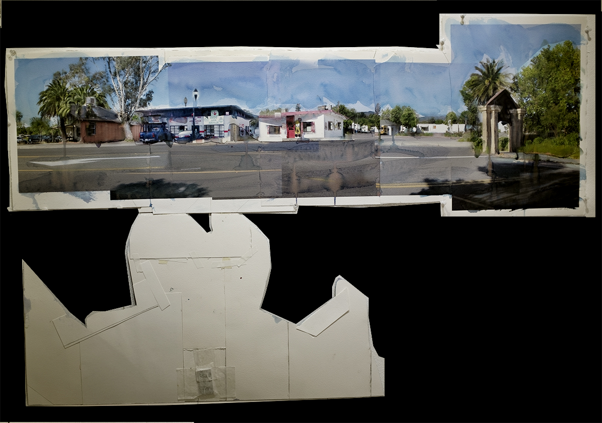
In 2021, as part of my Valley of the Moon Main Stem project, I thought of using the iconic Happy Dog as a grand entry arch. Why not? It would be more meaningful than what we got. The collage is 45.5″x15.”
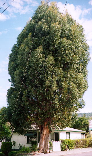
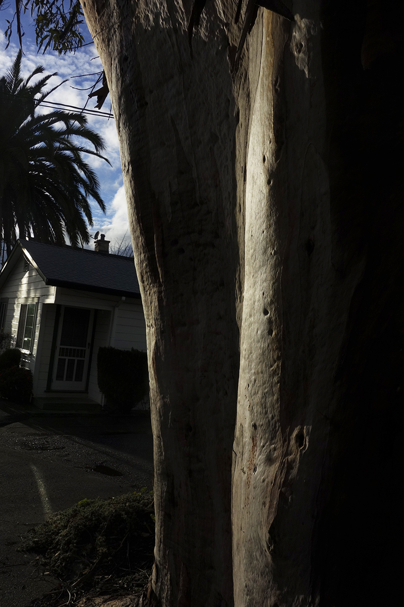
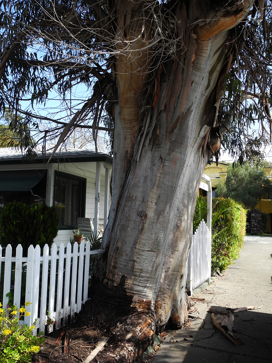
It’s always sad when we lose a tree. I called it “the Big Euc.”
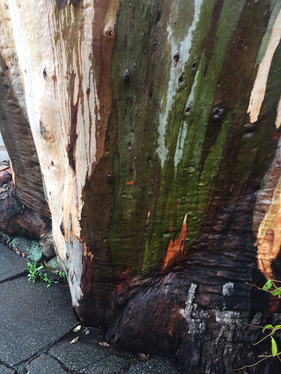
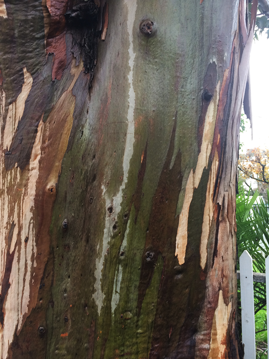
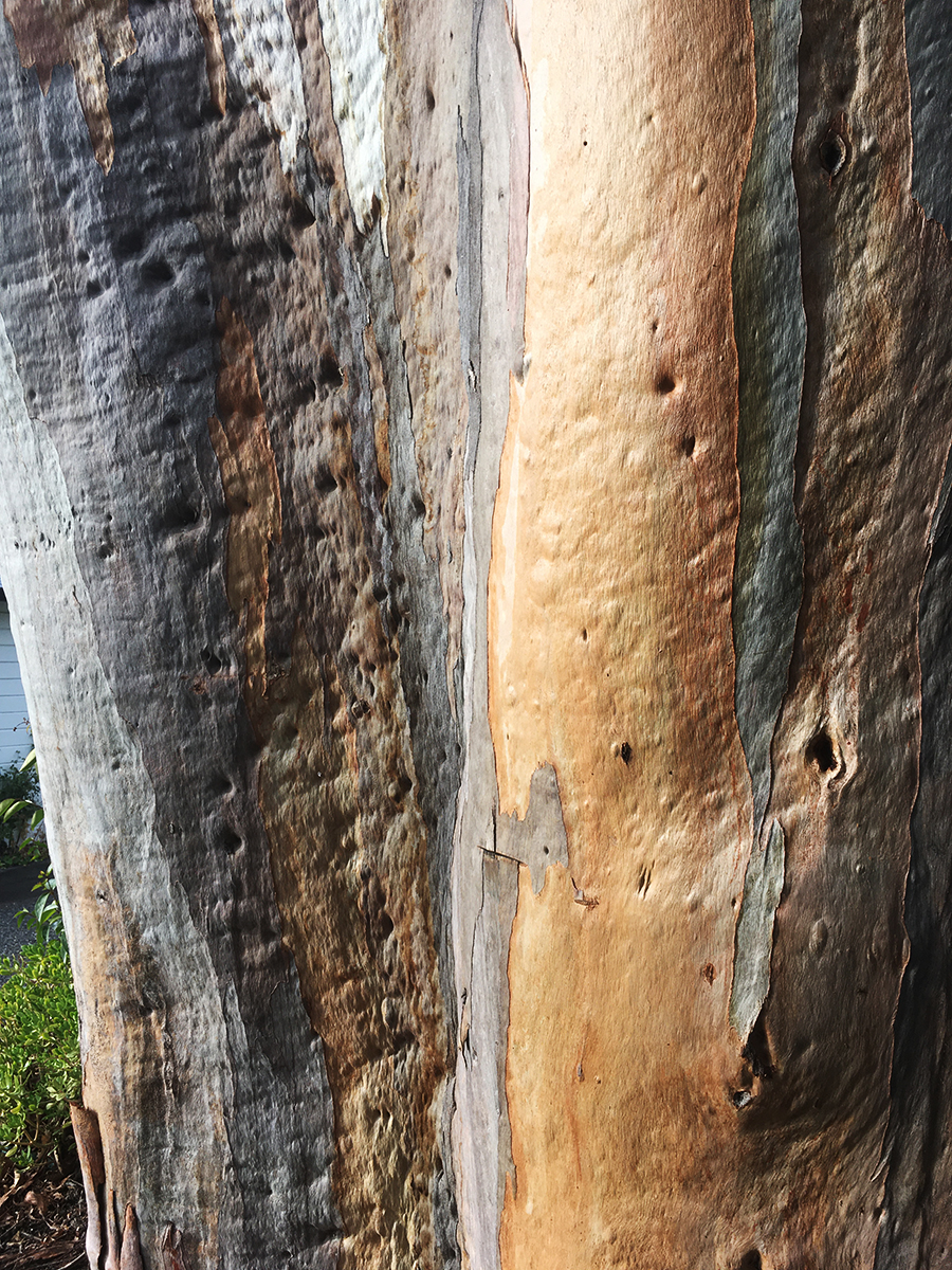
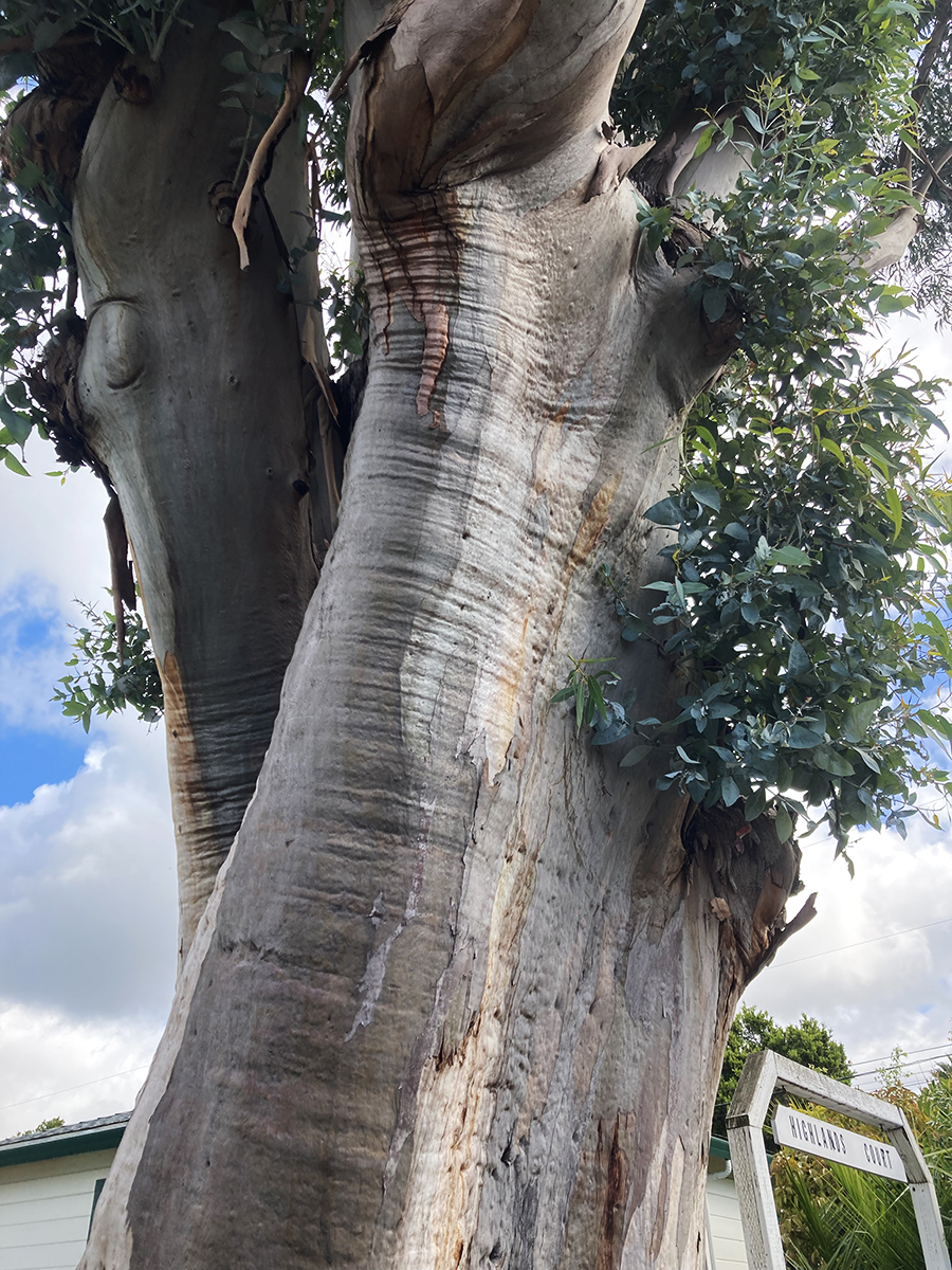
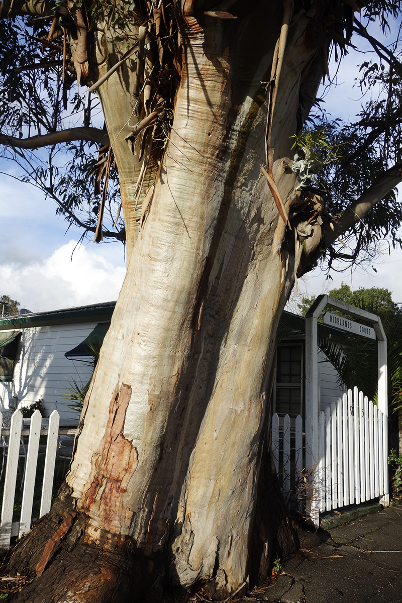
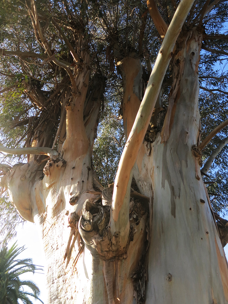
I know eucalyptus are exotic, invasive, and sometimes dangerous (they are highly flammable and may have other impacts, but the story is not only negative: see https://ucanr.edu/site/igors-urban-website/eucalyptus-california) .But they are, by now naturalized in California and in our minds. We have grown up with them. Their fragrance is embedded in our olfactory cortexes. The beauty of their variegated bark delights.
This friend grew on Vallejo Ave. near Highlands Blvd. in Boyes Hot Springs. Probably a volunteer, it may have sprouted around the time the motor court behind it was built, possible just after the 1923 fire. https://springsmuseum.org/2017/11/01/fire/
2007
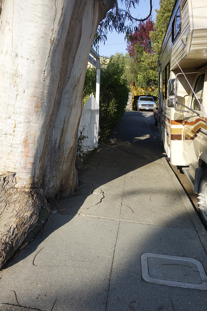
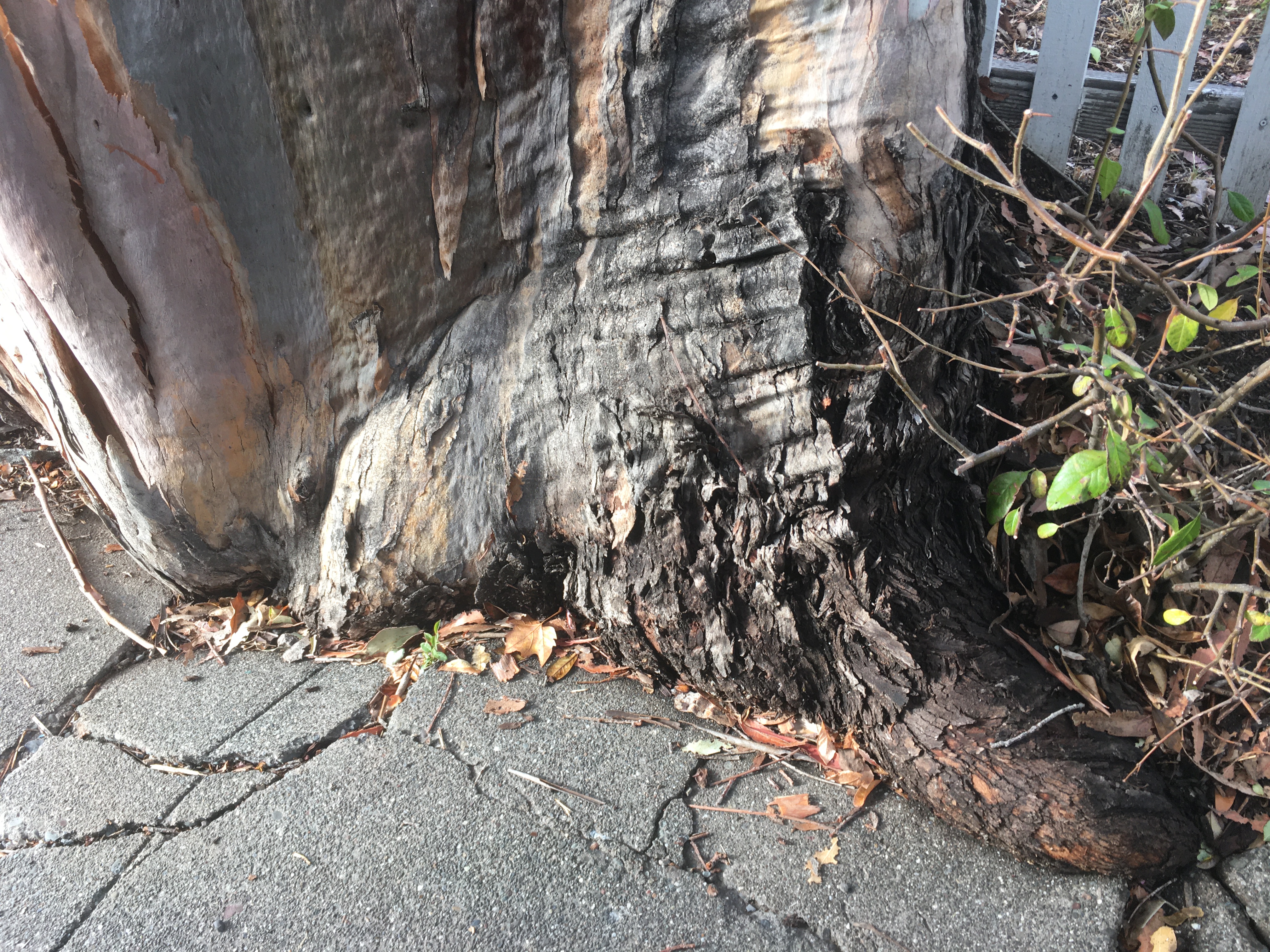
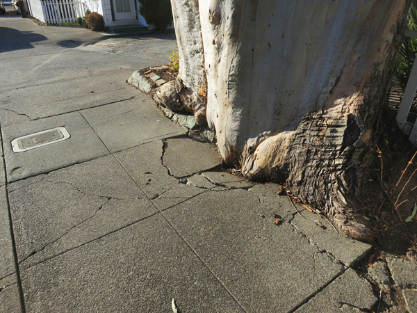
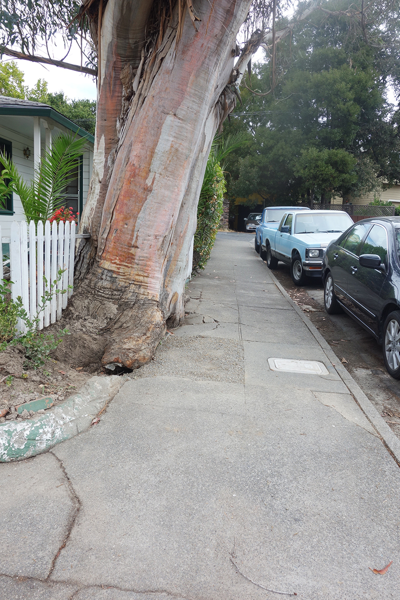
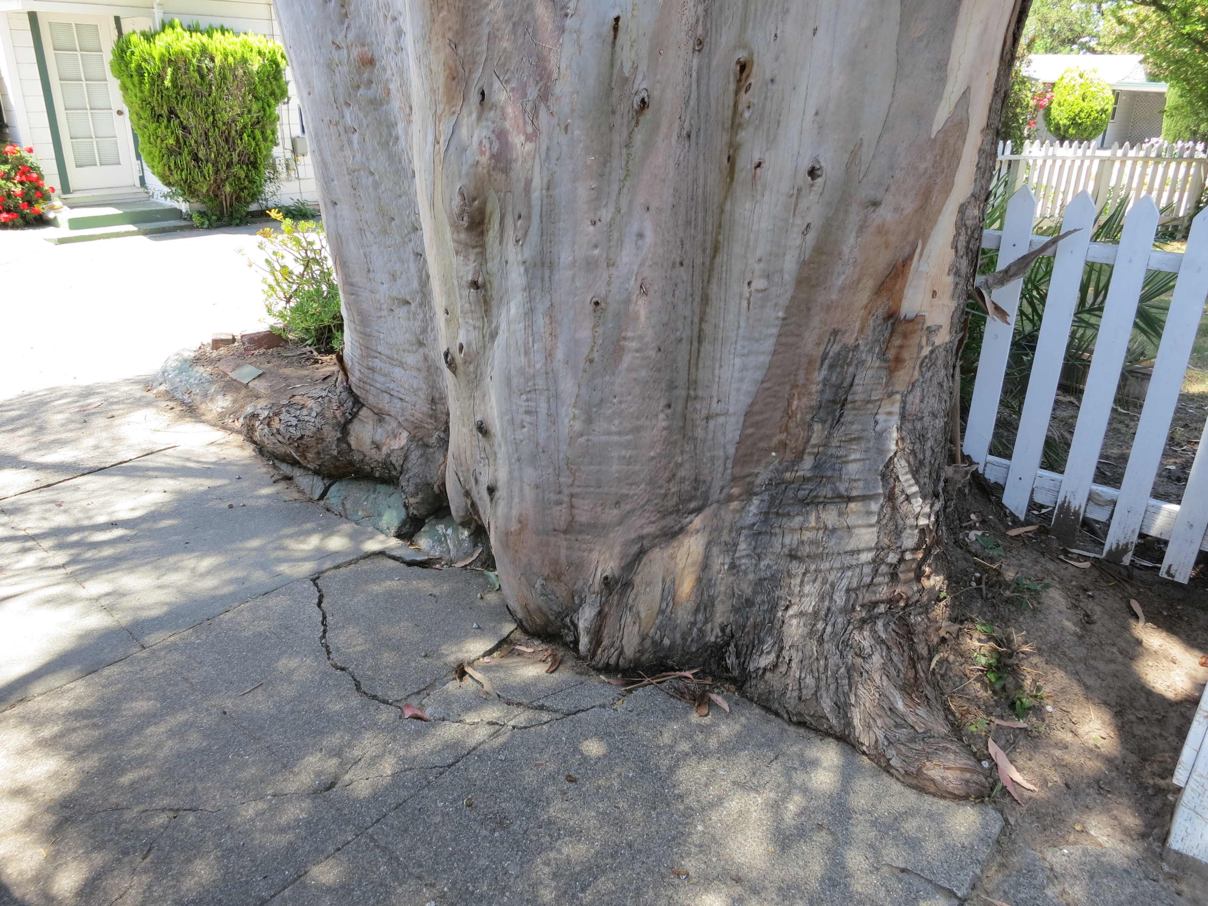
I actually liked the way this tree was grinding up the concrete sidewalk, like a very slow motion wave of living wood. I have special place in my heart for the interaction of trees and the built environment.
Makes beautiful shadows.
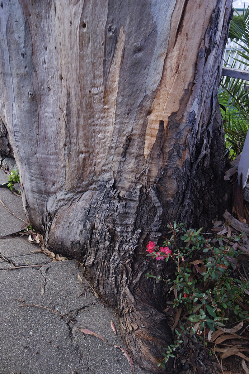
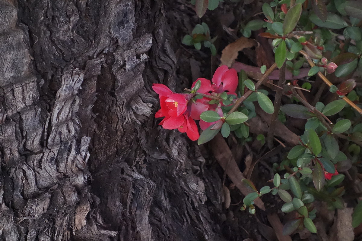
This quince volunteer bloomed every February for Lunar New Year.
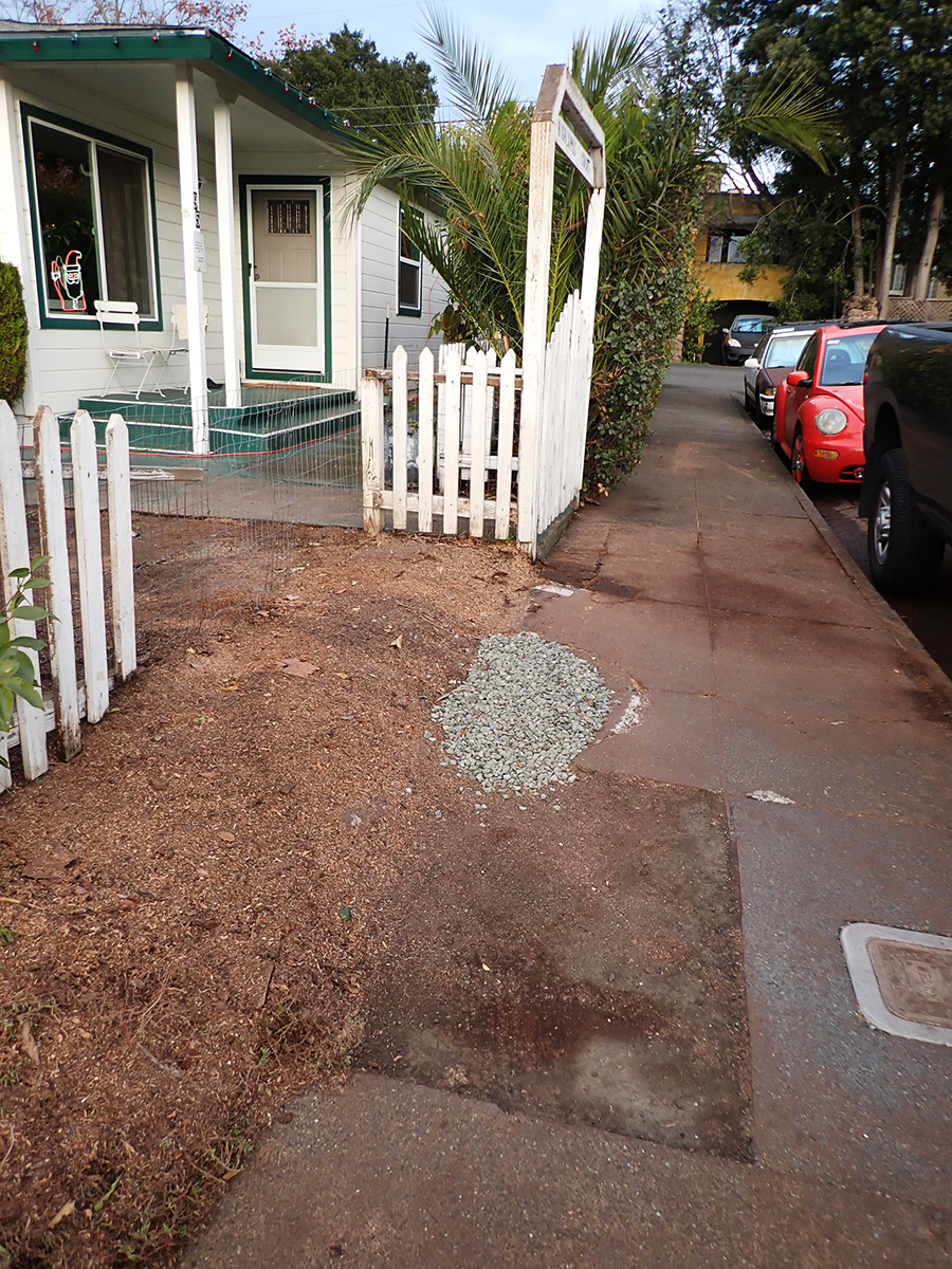
Eventually a piece of the concrete was removed for some underground plumbing repair and replaced with crushed rock.
The green concrete curb continues to be submerged in tree.
Some beauty shots.
The wet bark is even more beautiful, and the fragrance intensifies.
So limb-like, sensuous.
December 2025
Just a memory
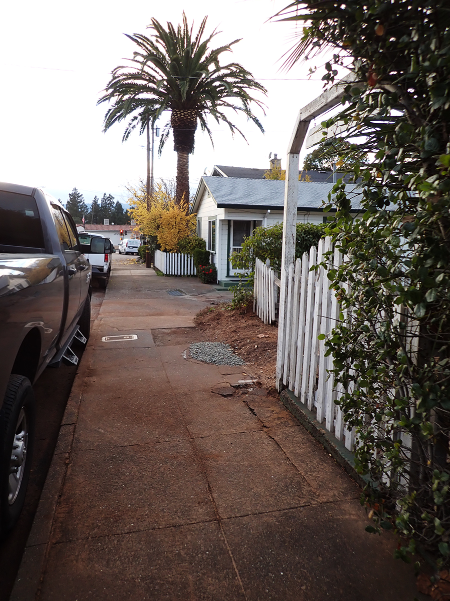
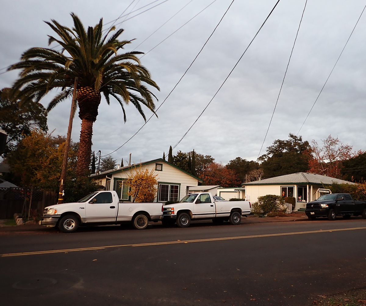
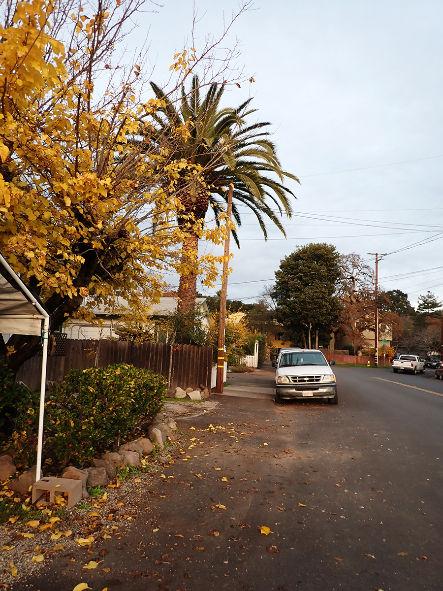
The palm stands alone
“Bark and Bite.” Painted photo collage circa 20″x30″. 2019. Michael Acker
I’ve been working for some time on a couple of posts about the Happy Dog and the Gateway Arch, both on Highway 12 near Verano Ave. Obviously, you can’t talk about one without talking about the other. (Well, not so obvious to me until I started thinking bout the nature of human made landmarks). As usual, there is a lot more to know than I originally expected. I found it necessary to include Moosetta’s Deli and other buildings in the post. Progress was slow, and then, as they say, life happened. Everyone is fine, but some hospital time was experienced. So, I did not finish either post.
Next month!
Here is a teaser.
Above is from the archive of photos I created in 2008. I printed two copies of all 477 images and gave one to the Sonoma County Library and the other to the Sonoma Valley Historical Society.The Arch in 2025, with the new advertising.Left to right, what is today the Verano Cafe, the Steve’s Auto building, and the Happy Dog. Moosetta’s was located in the first building, the Art Store in the second. Moosetta’s had at least three locations.
Hey! Why don’t you click over here and shoot some rasbuckniks to the Springs Museum? Er..donate, that is, please!
Index Tribune courtesy of the Sonoma Valley Historical Society.