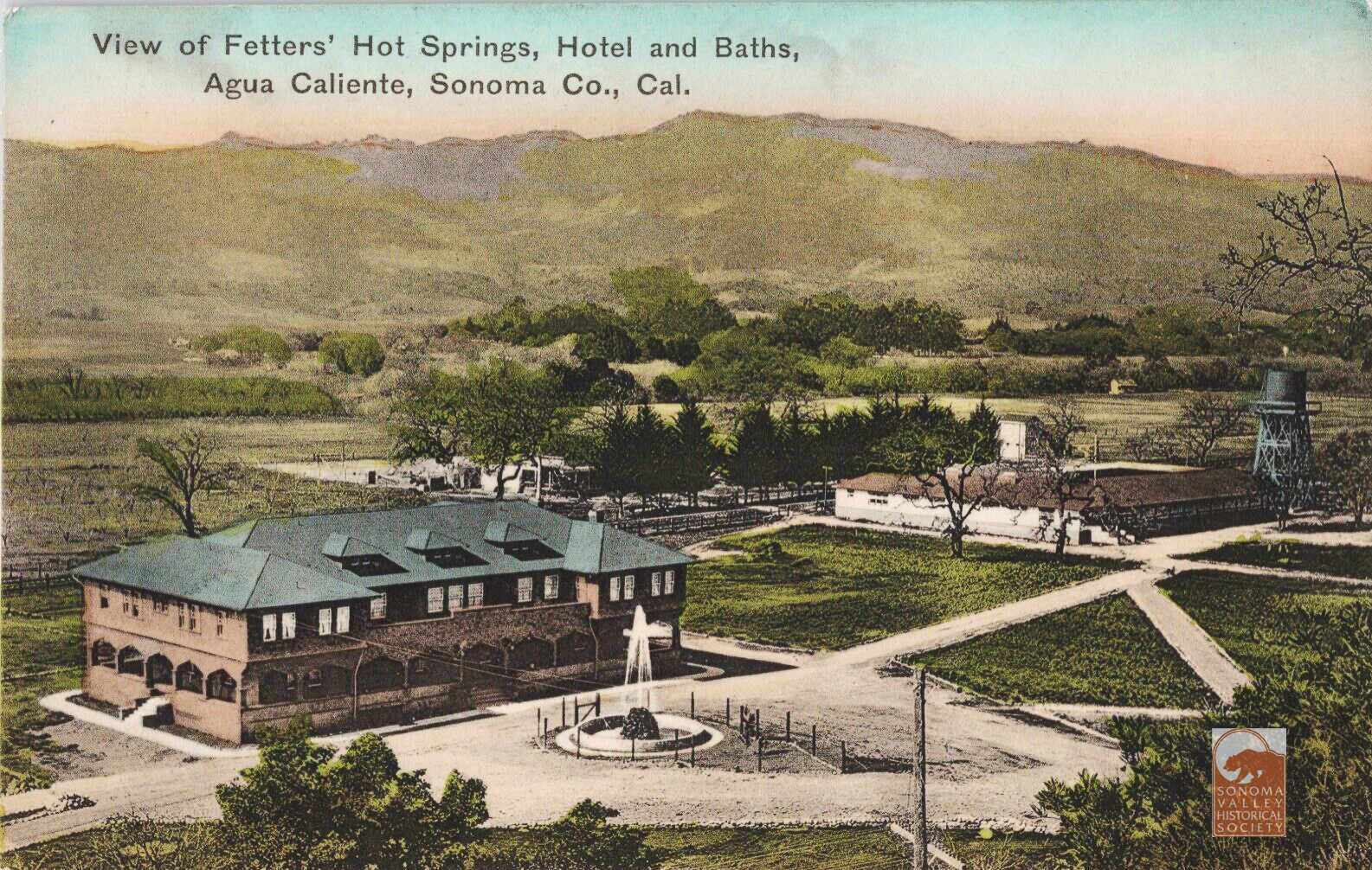
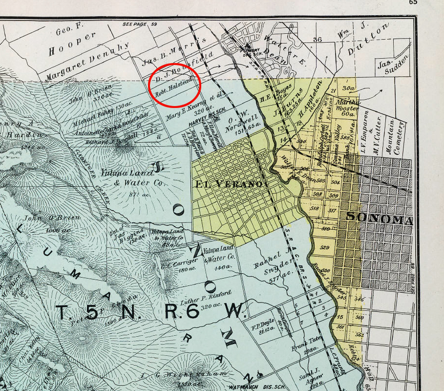
The success of the resort founded by Henry and Antoinette Boyes proved to be an example to others. In 1907, a couple from Pittsburg (Emma was originally from Austria) by way of San Francisco, George and Emma Fetters, bought the old Halstead ranch just a mile north of the Boyes’ property. Robert Halstead (“a wealthy sugar planter from Hawaii” according to the Index Tribune) had bought the property from E.P. Thomson, who planted olive trees on it in the 1880s. Many of those now large trees are still there.
The Halstead property crossed the Northwest Pacific railway line and Sonoma Creek, just south of Agua Caliente. Some early post cards identify its location as Agua Caliente. The boundaries were flexible. Map courtesy of the Rumsey Collection.Courtesy Dennis O’ Rourke
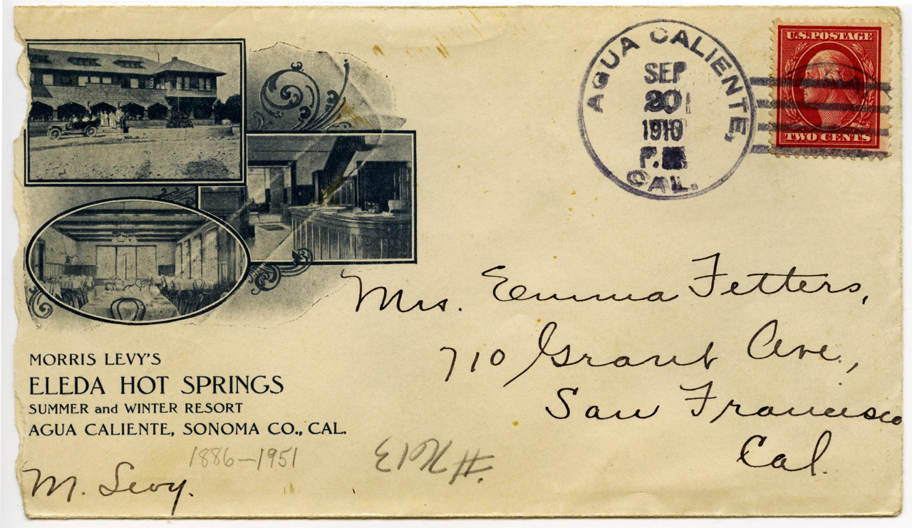
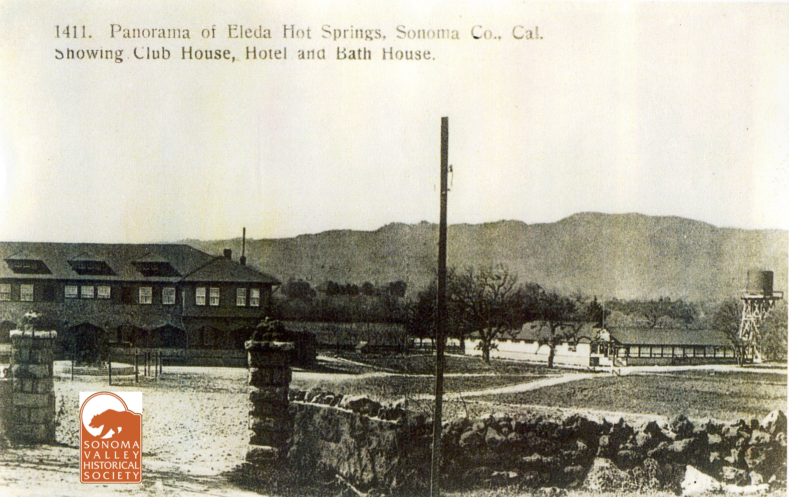
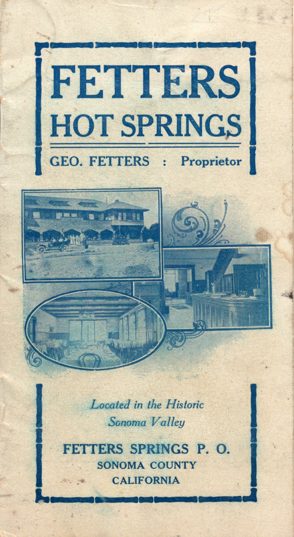
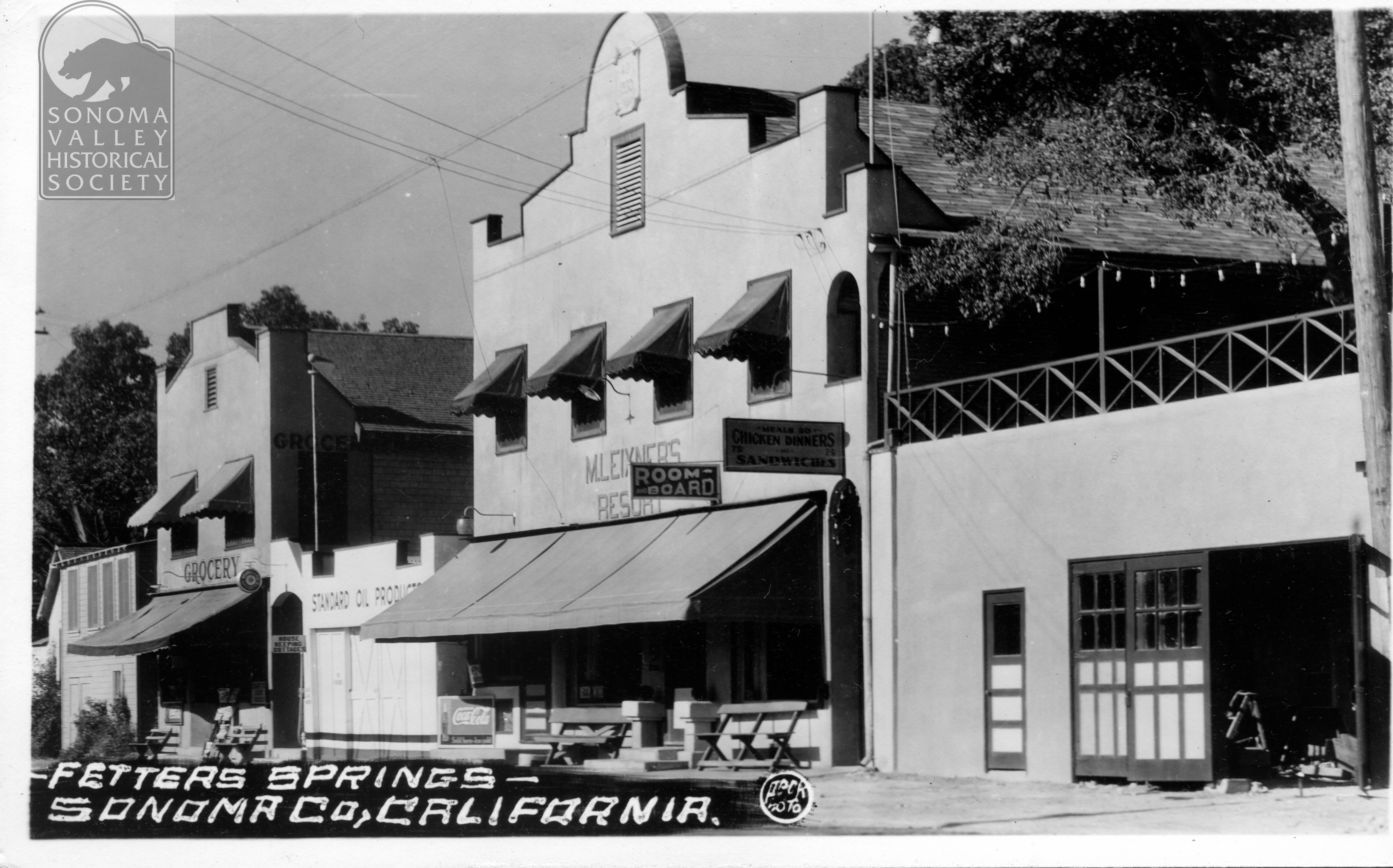
George had been in the hotel business in Pittsburg. The money for the land and the ambition to open a resort were mostly Emma’s. The next year they opened Fetters Hot Springs Resort. Soon after, they leased their resort to Morris Levy, a prize fight promoter from San Francisco, who renamed it Eleda Hot Springs.
1907
The Fetters took over operation again in 1911. In 1913, apparently bearing a grudge over losing the lease to the resort, Levy testified in opposition to a liquor license being granted to Fetters. They received the license, but this would not be the first time the Fetters got into legal trouble over liquor. In 1918 they were tried for the offense of providing liquor to enlisted men (a crime under the War Emergency Act.)
Testifying in their defense were “Fred Boyngton, the well known lumber yard man, E.G. Koenig of Boyes Springs, and Lillian the “entertainer,” among others.” Despite Lillian, both Fetters were convicted, but George’s conviction was overturned on appeal. Emma’s sentence was later commuted. Both George and Emma were in and out of court many times, being sued for damages by resort guests, and once for libel.
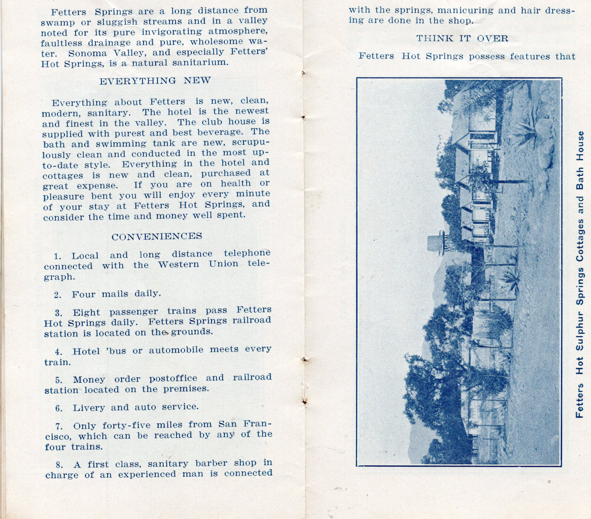
The Fetters were constantly improving the resort, bringing in moving pictures in 1923, sidewalks in 1924,and a new dance hall in 1925. George donated the land for the Boyes Springs ball field, and at its dedication in 1940, he threw out the first ball.
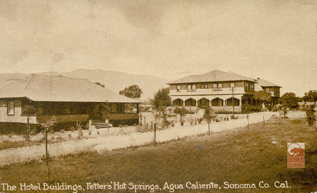
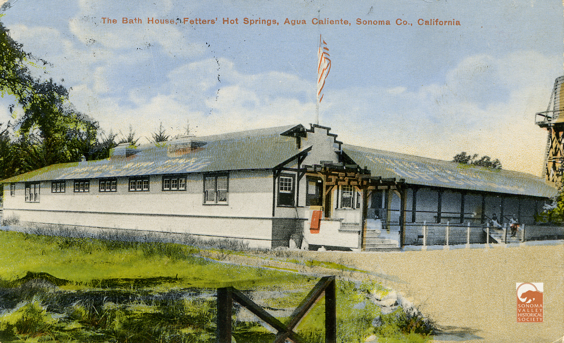
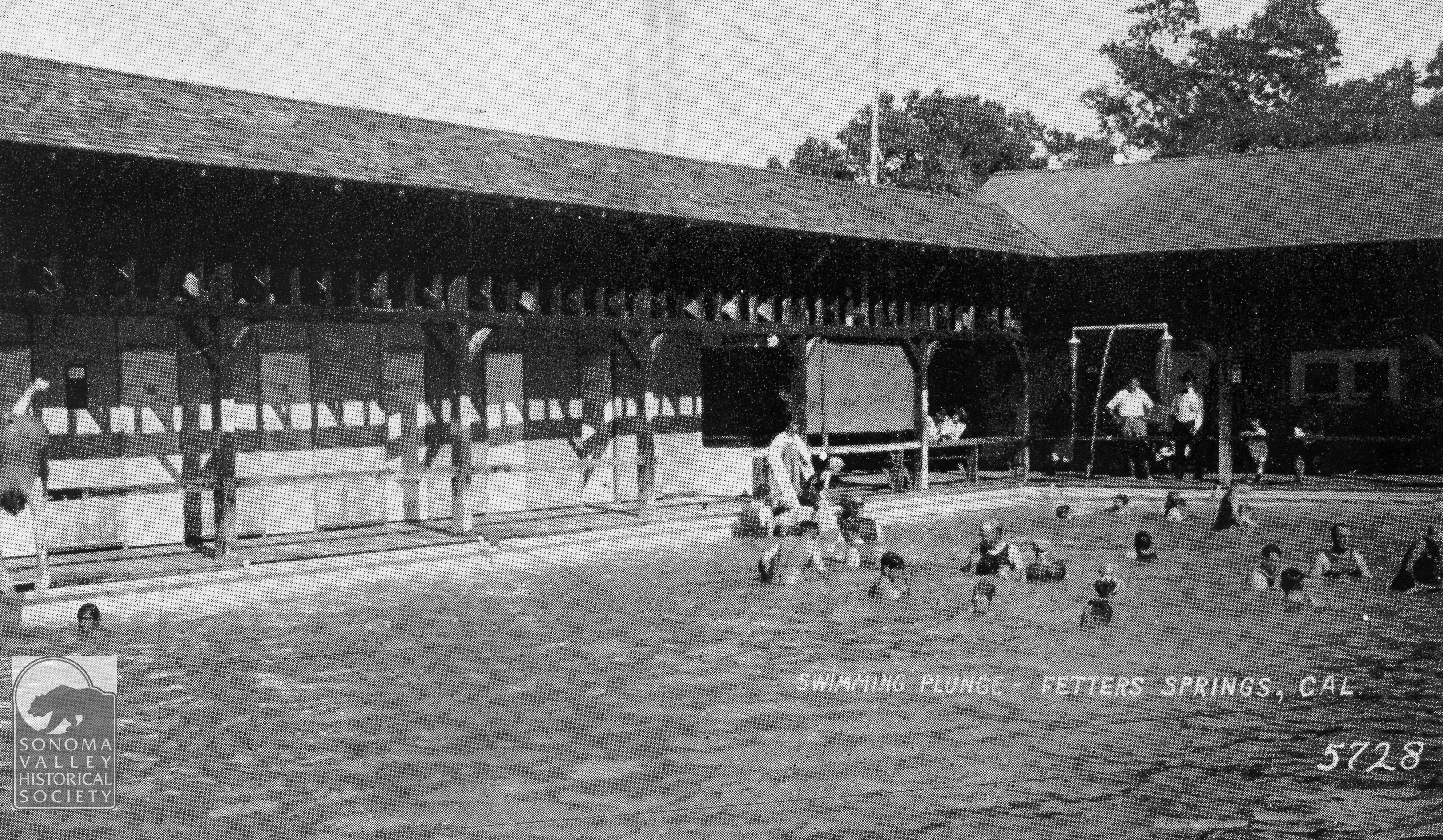
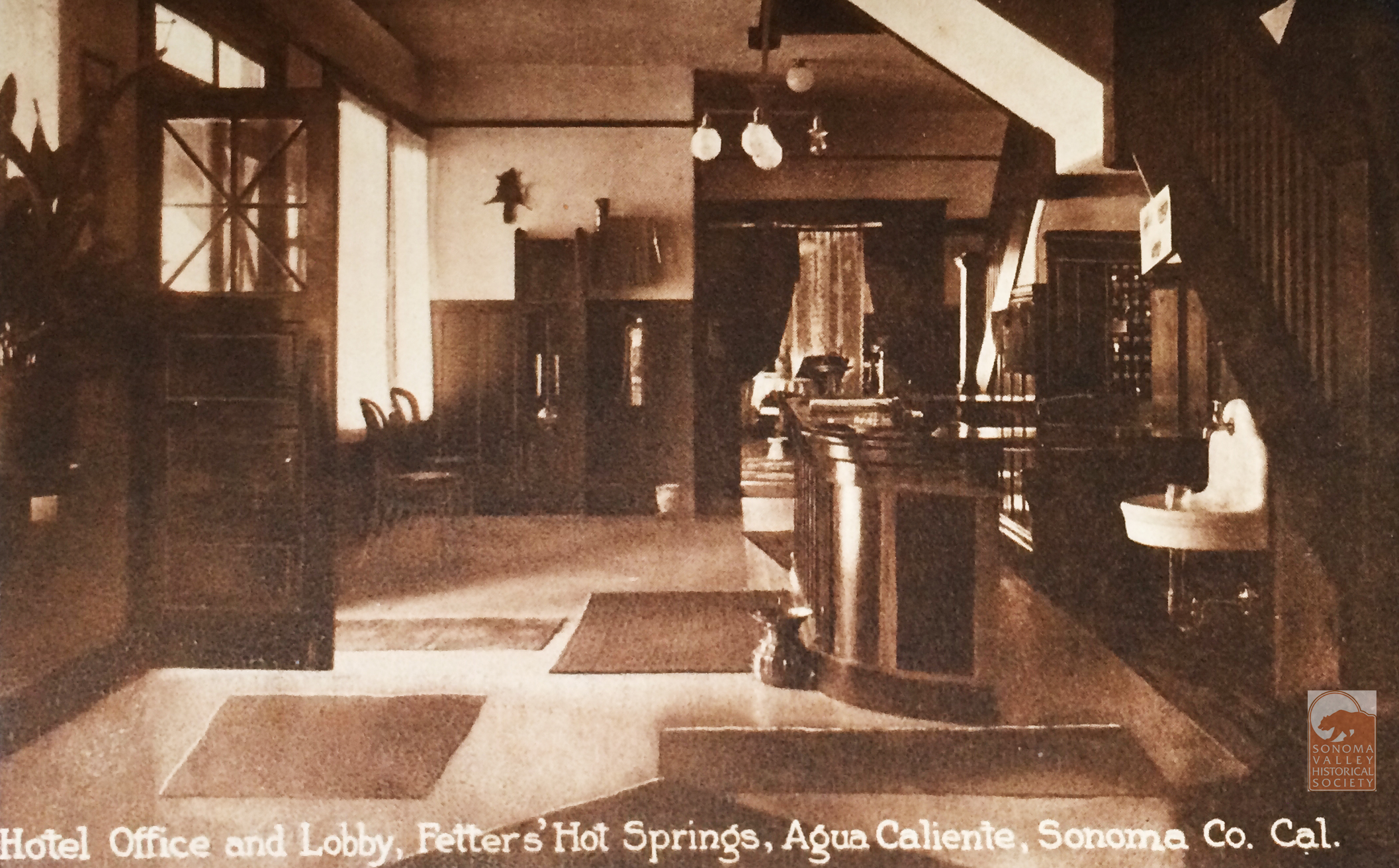
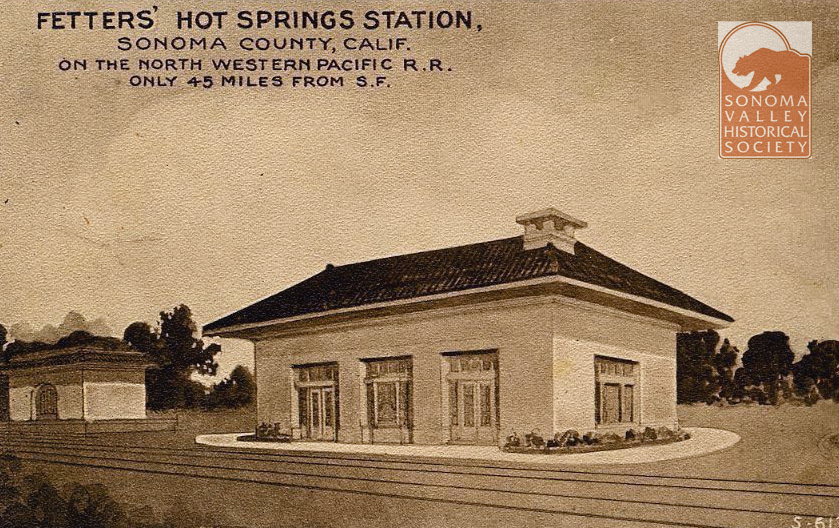
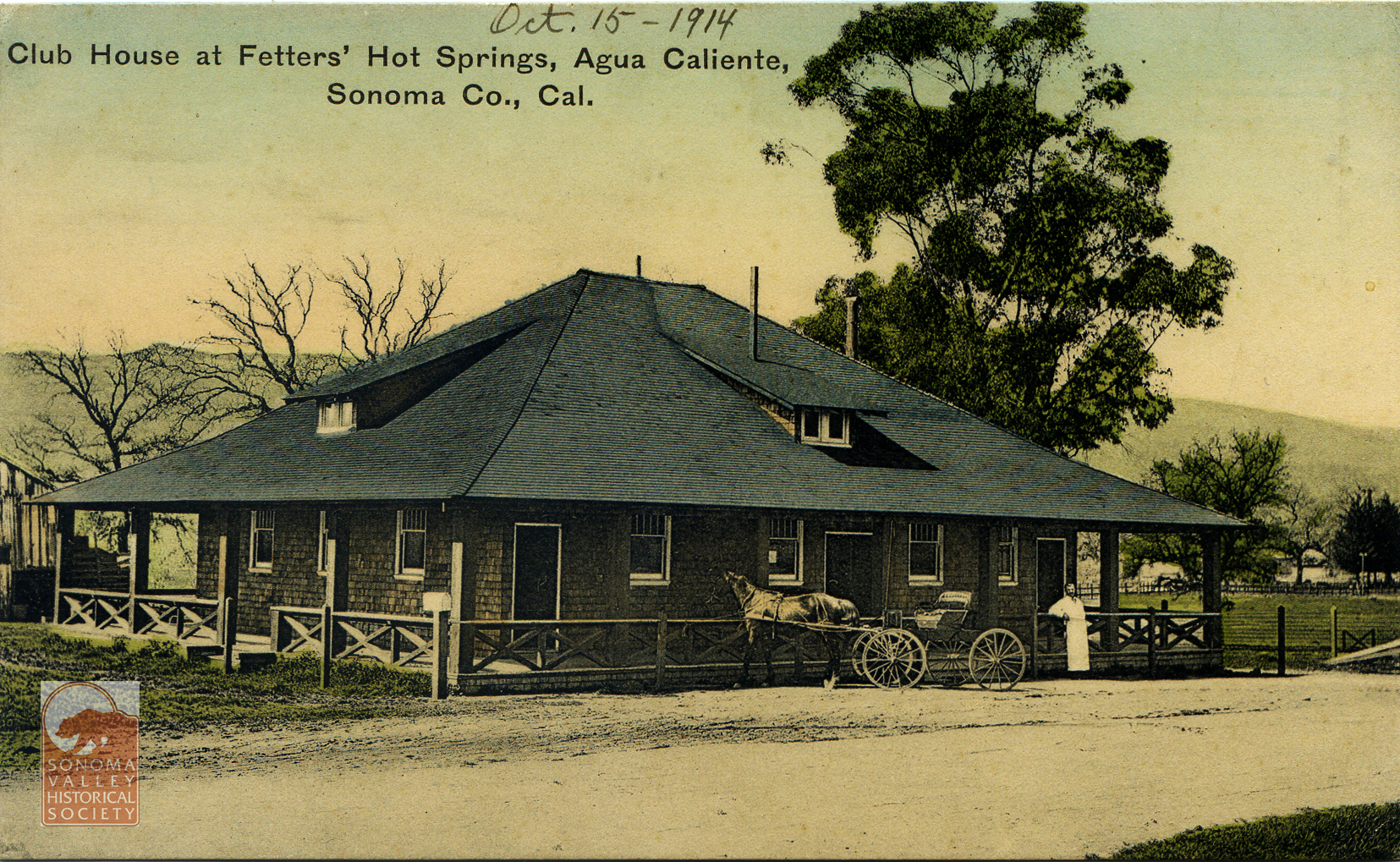
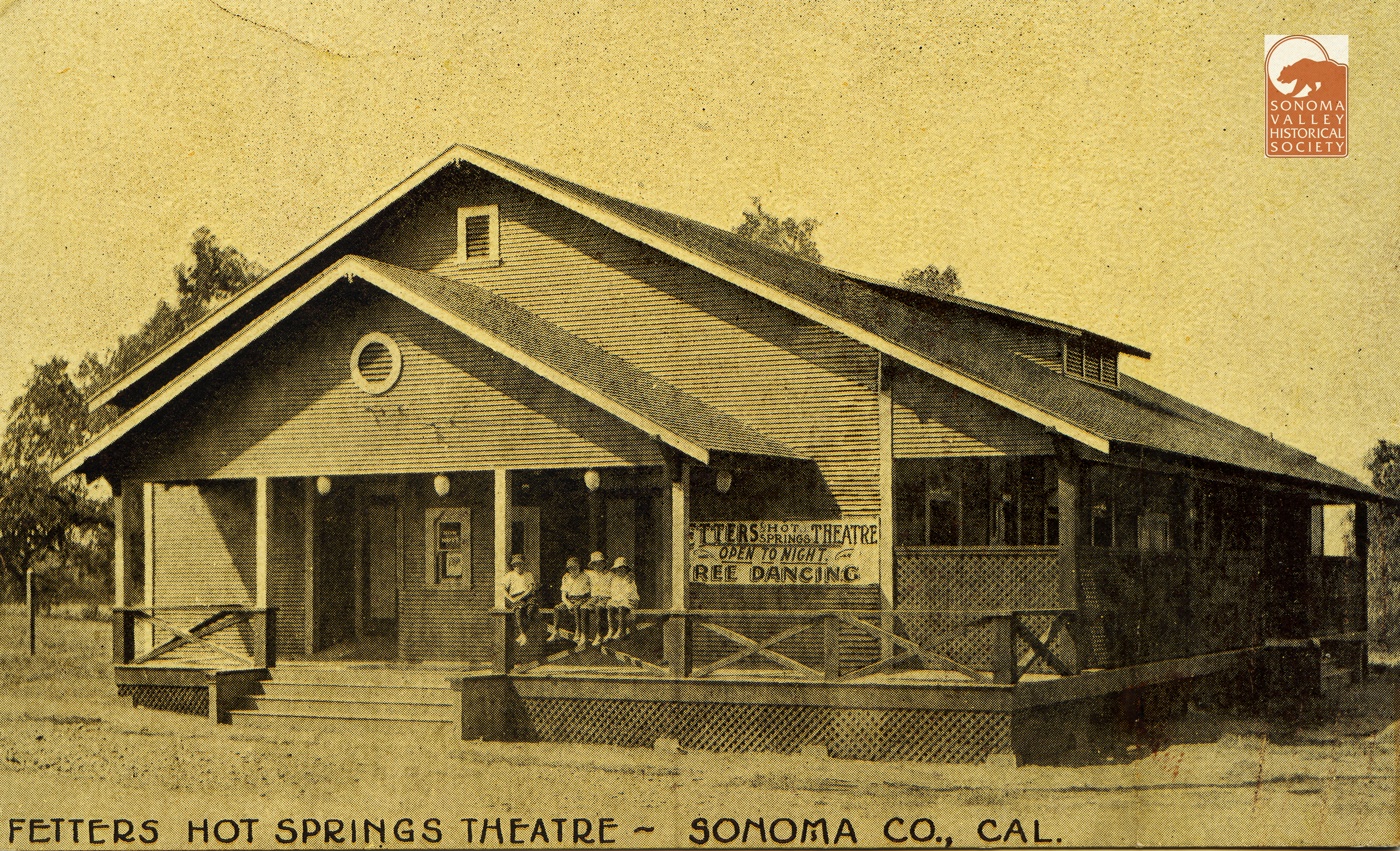
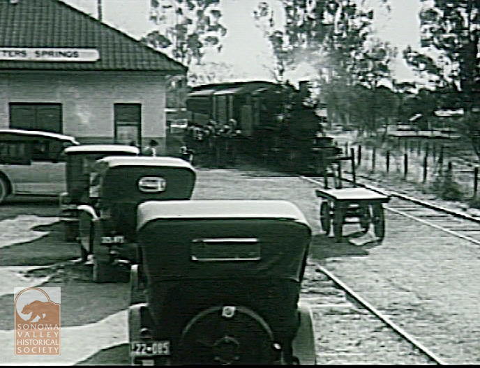
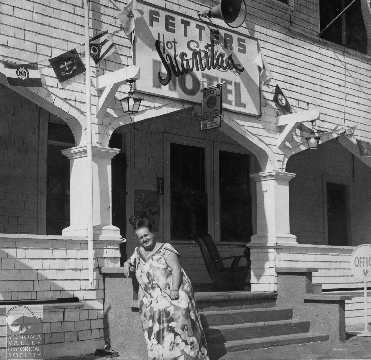
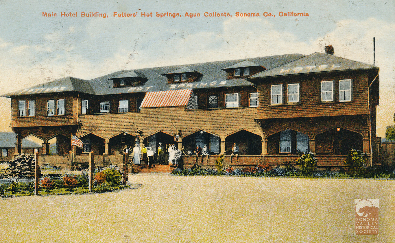
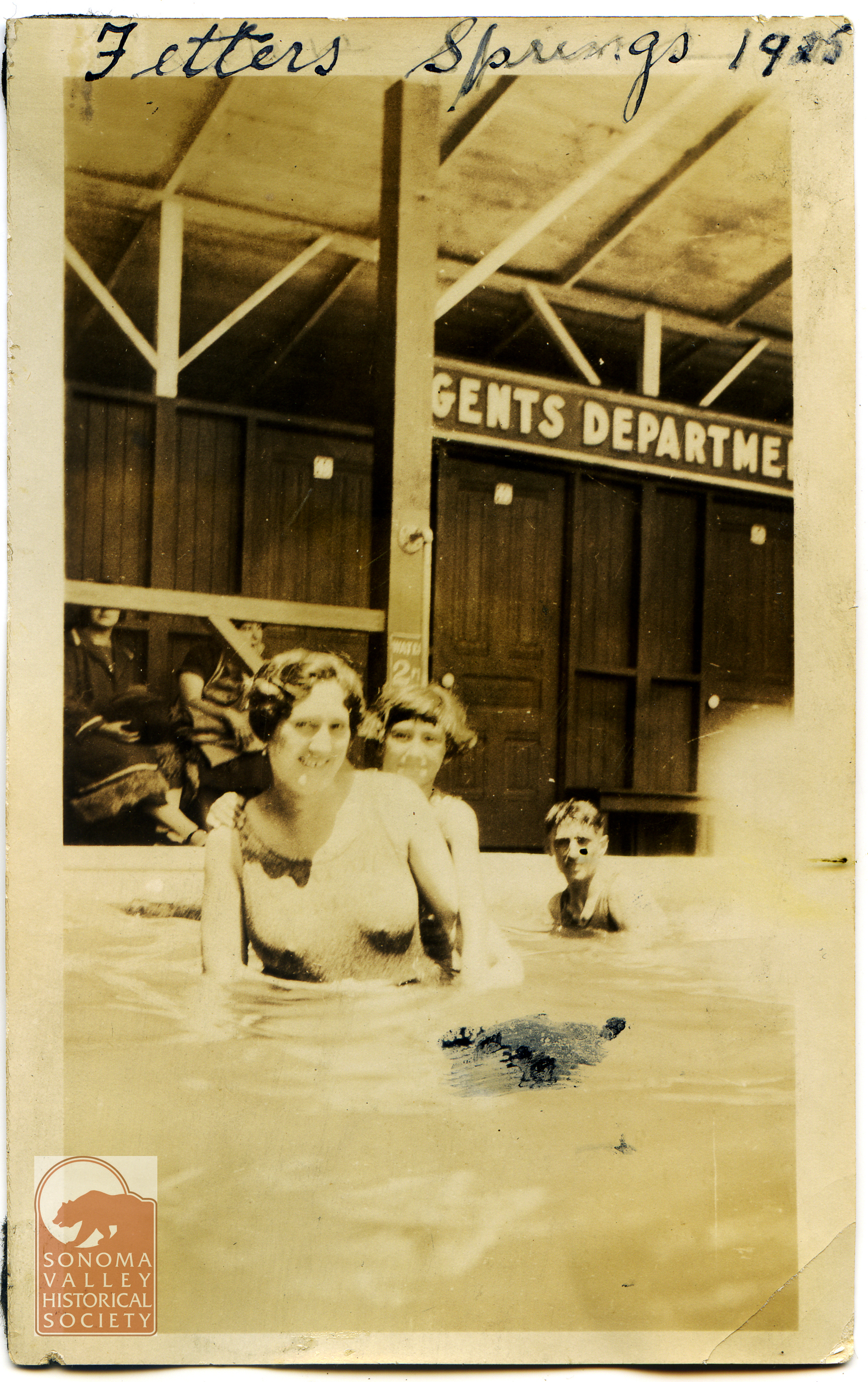
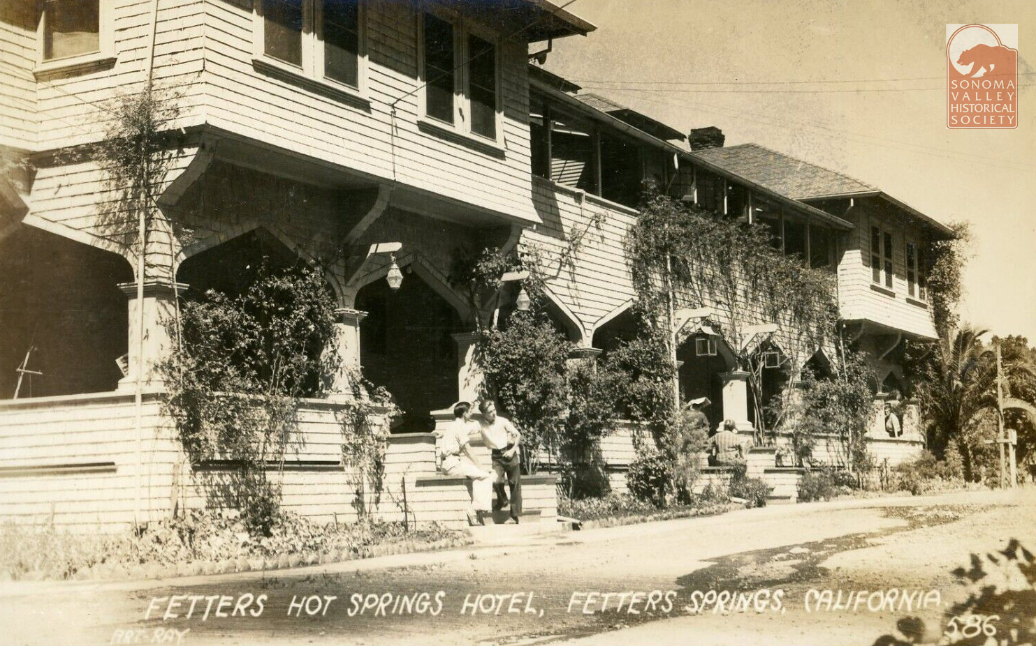
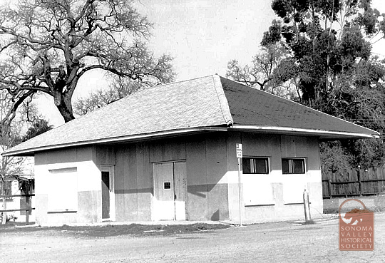
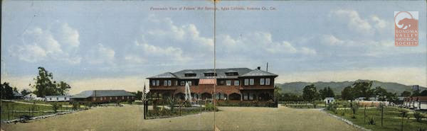
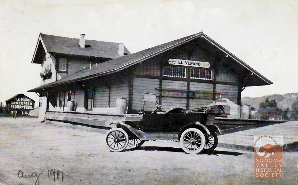
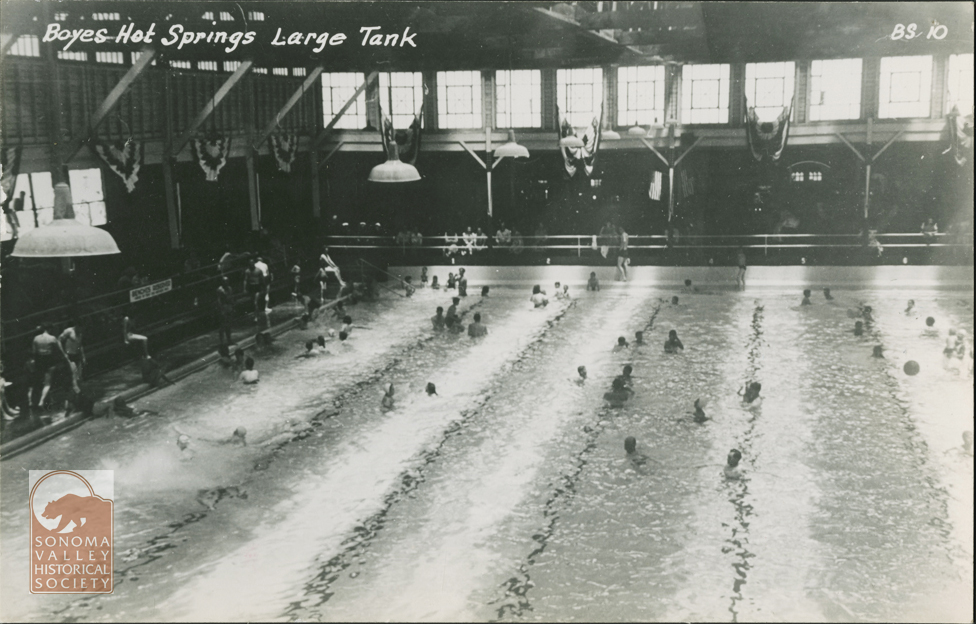
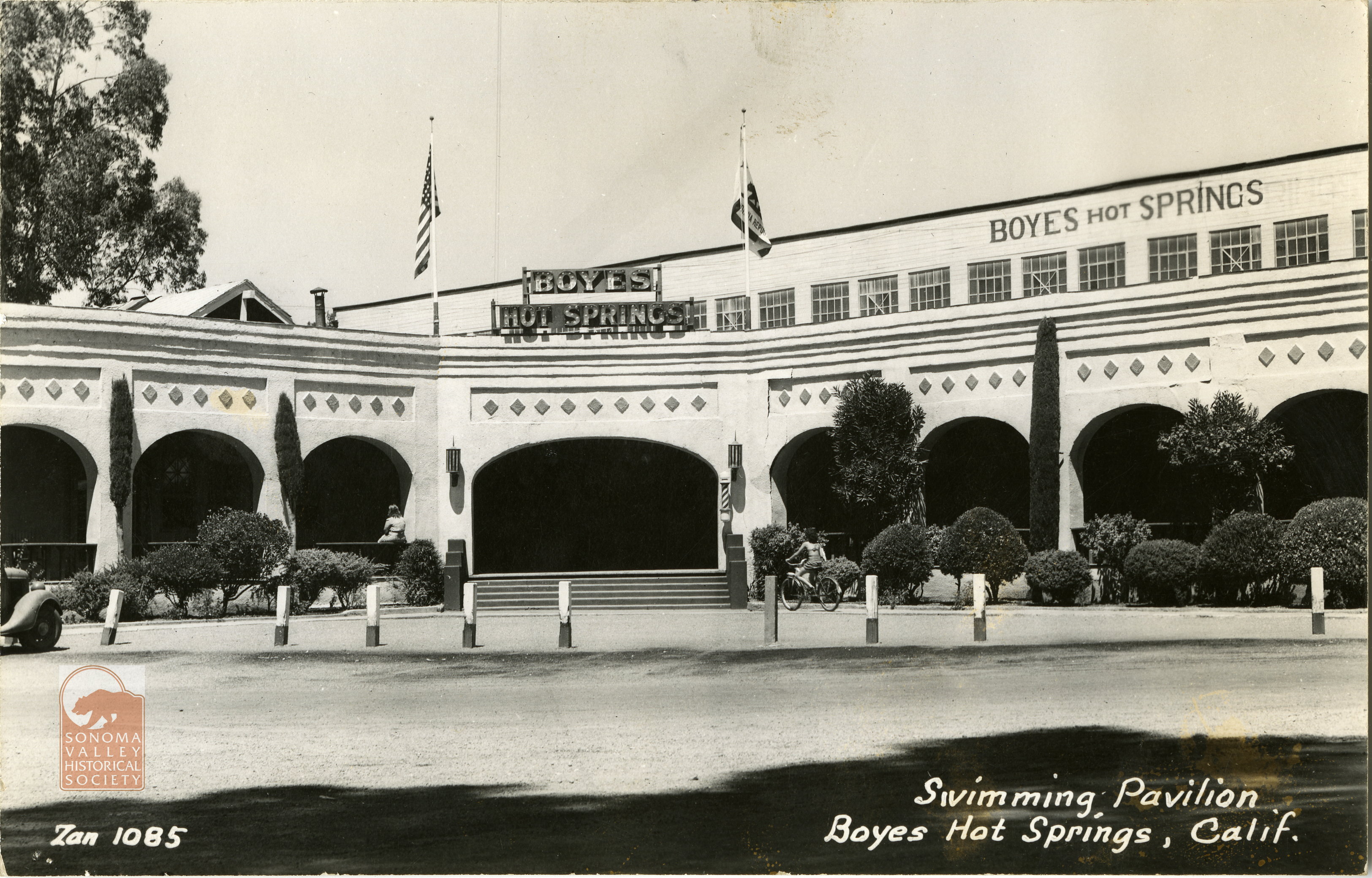
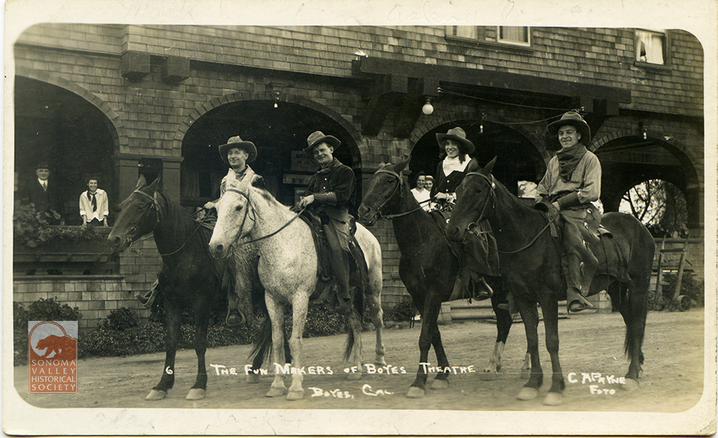
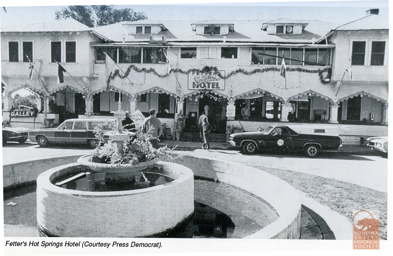
According to the Index Tribune, Emma Fetters was “an energetic woman of wealth and enterprise.” The Fetters built not only the resort, with its hotel, swimming pavilion and theater, but the Fetters Depot of the Northwest Pacific Railroad. Mrs. Fetters also owned much real estate in the area, and once owned the Chauvet Hotel in Glen Ellen.
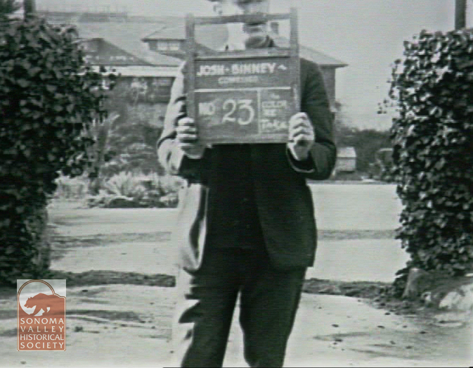
In 1923 a movie company came to town and shot some scenes in and around Fetters Resort (and that’a another story!)
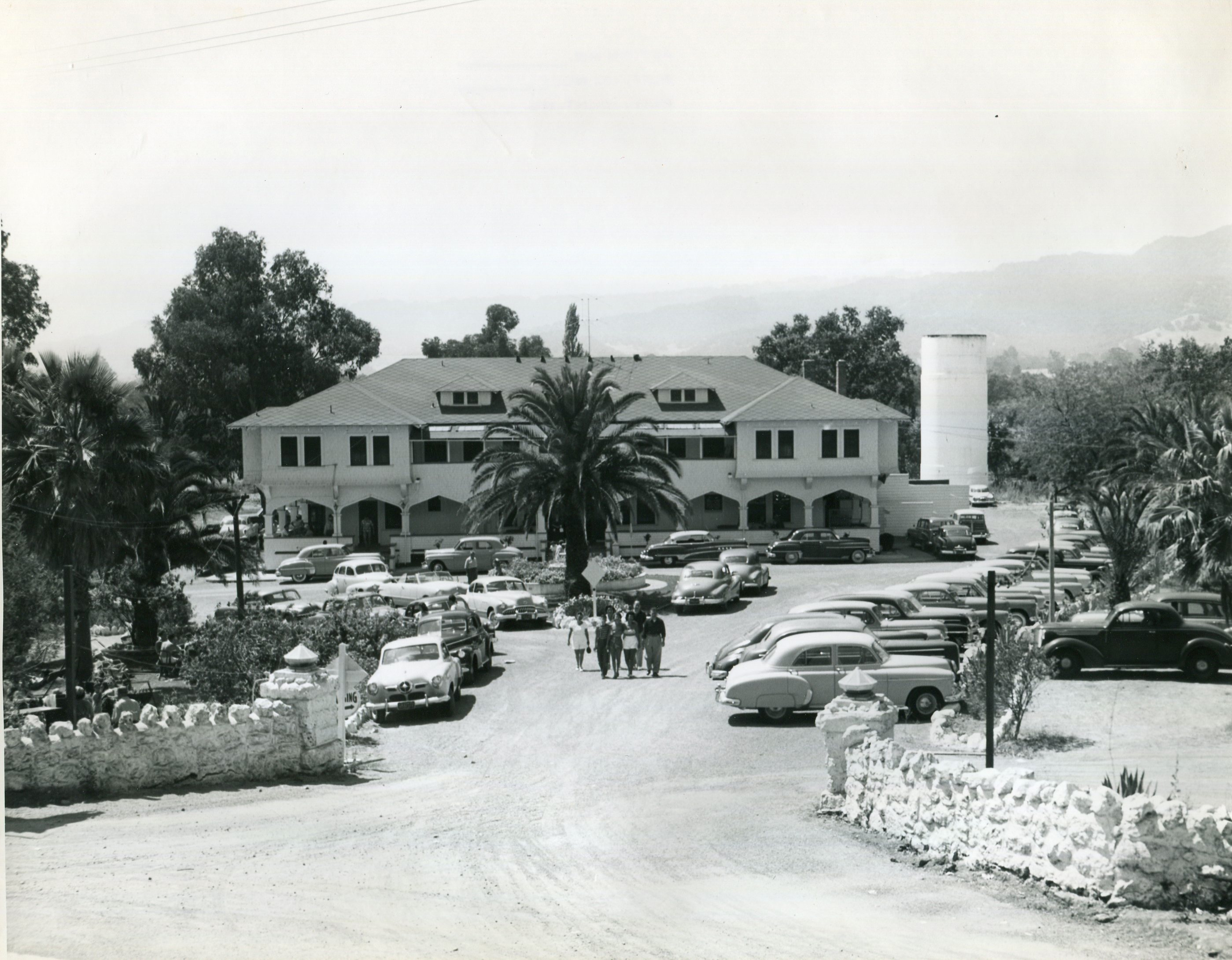
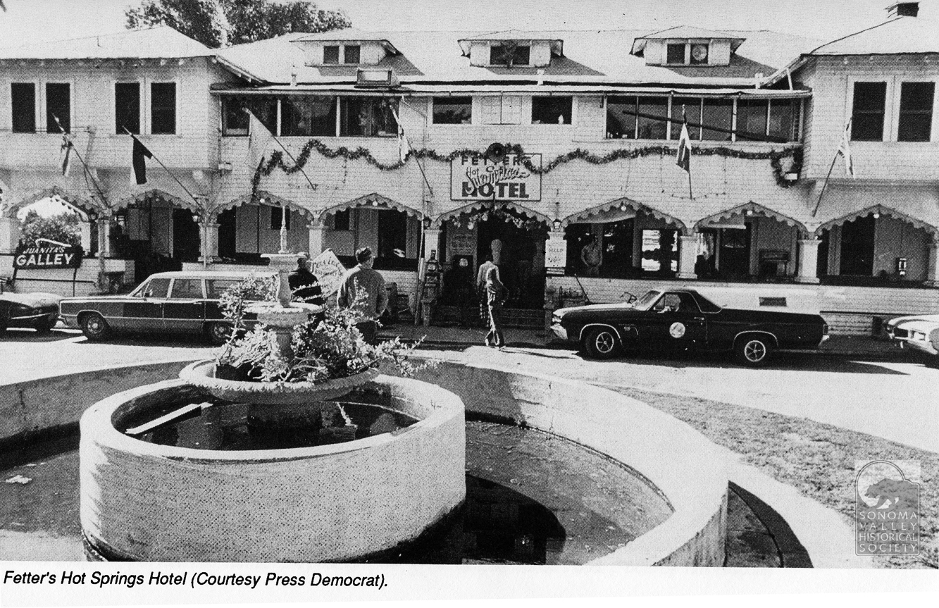
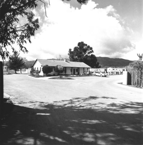
The resort era continued into the 1950s and beyond. Photo courtesy of Sonoma County Library.
The notorious and beloved, by some, Juanita Musson operated her restaraunt in the hotel from 1969 to 1975. I havn’t written a post soley devoted to Juanita, yet, but more here.
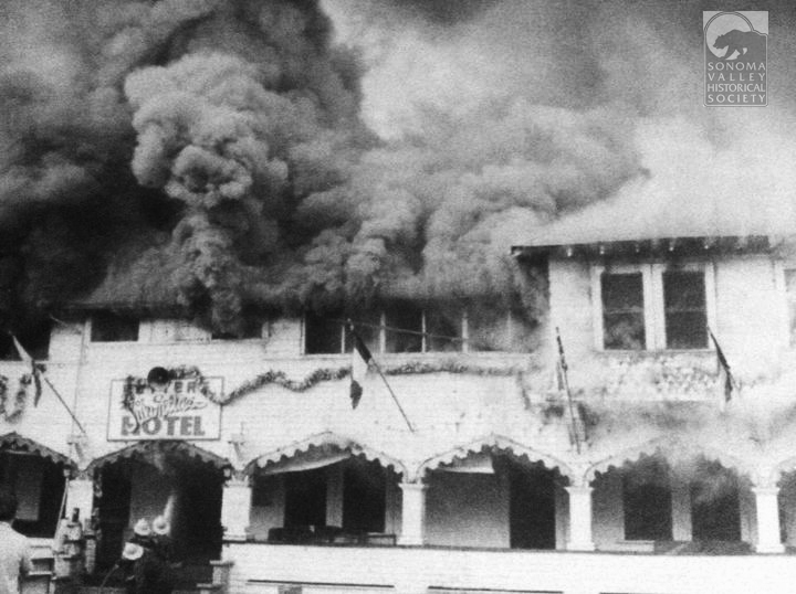
The hotel burned down in 1975.
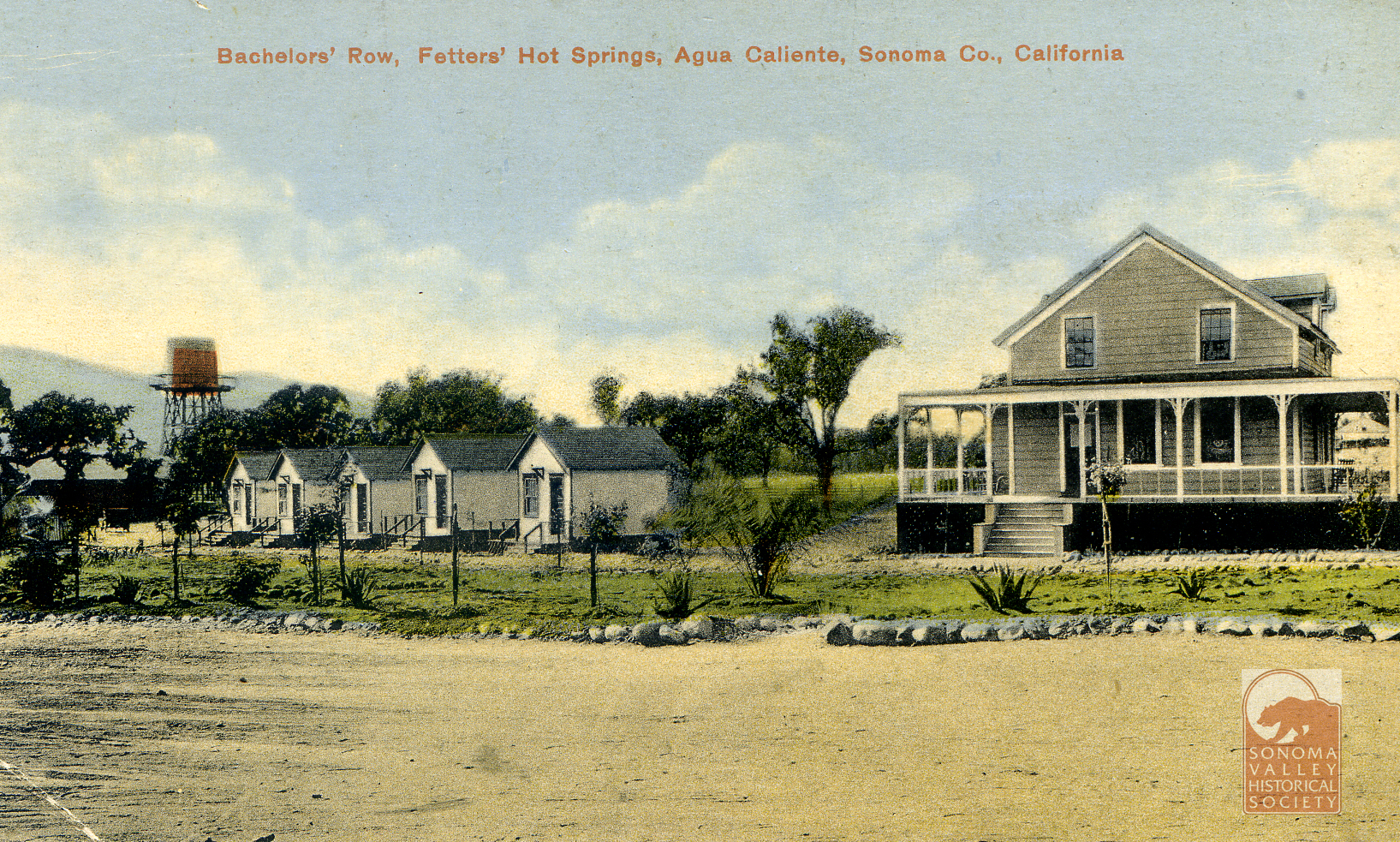
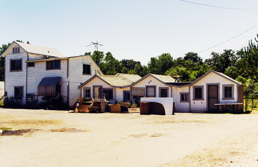
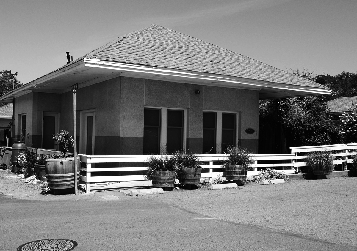
In 2009 this was all that was left of Fetters Resort. It appears to be “Bachelors Row,” shown above. I met Juanita when she lived in one of these cabins. Authors photo.
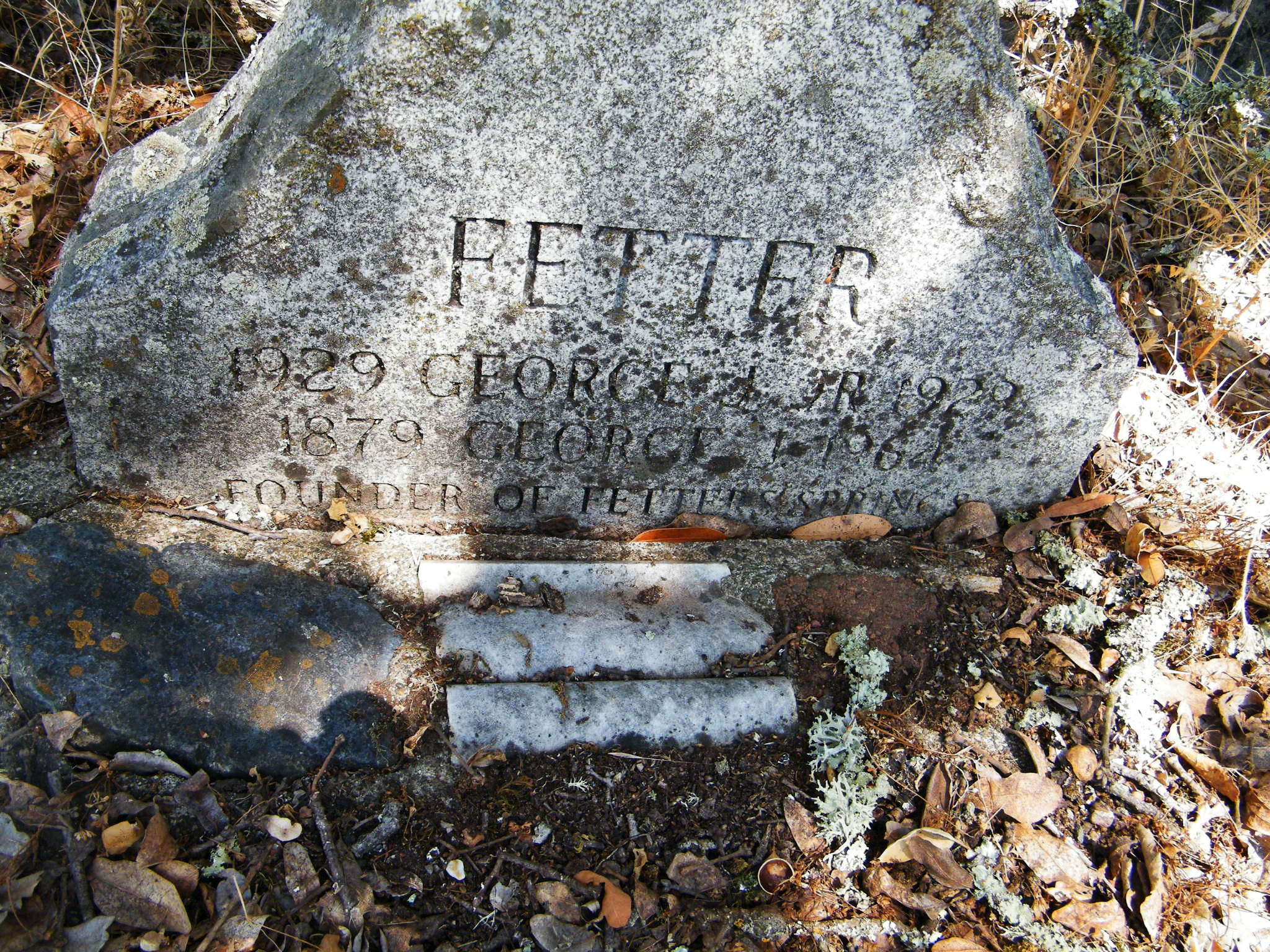
Emma Fetters died in 1922, of pneumonia. George was a prominent member of the community and continued to run the resort until he sold in 1944. He died in 1964. Interesting that the gravestone omits the S at the end of the name.
Fetters Resort is well photo-documented. A few bonus images below.
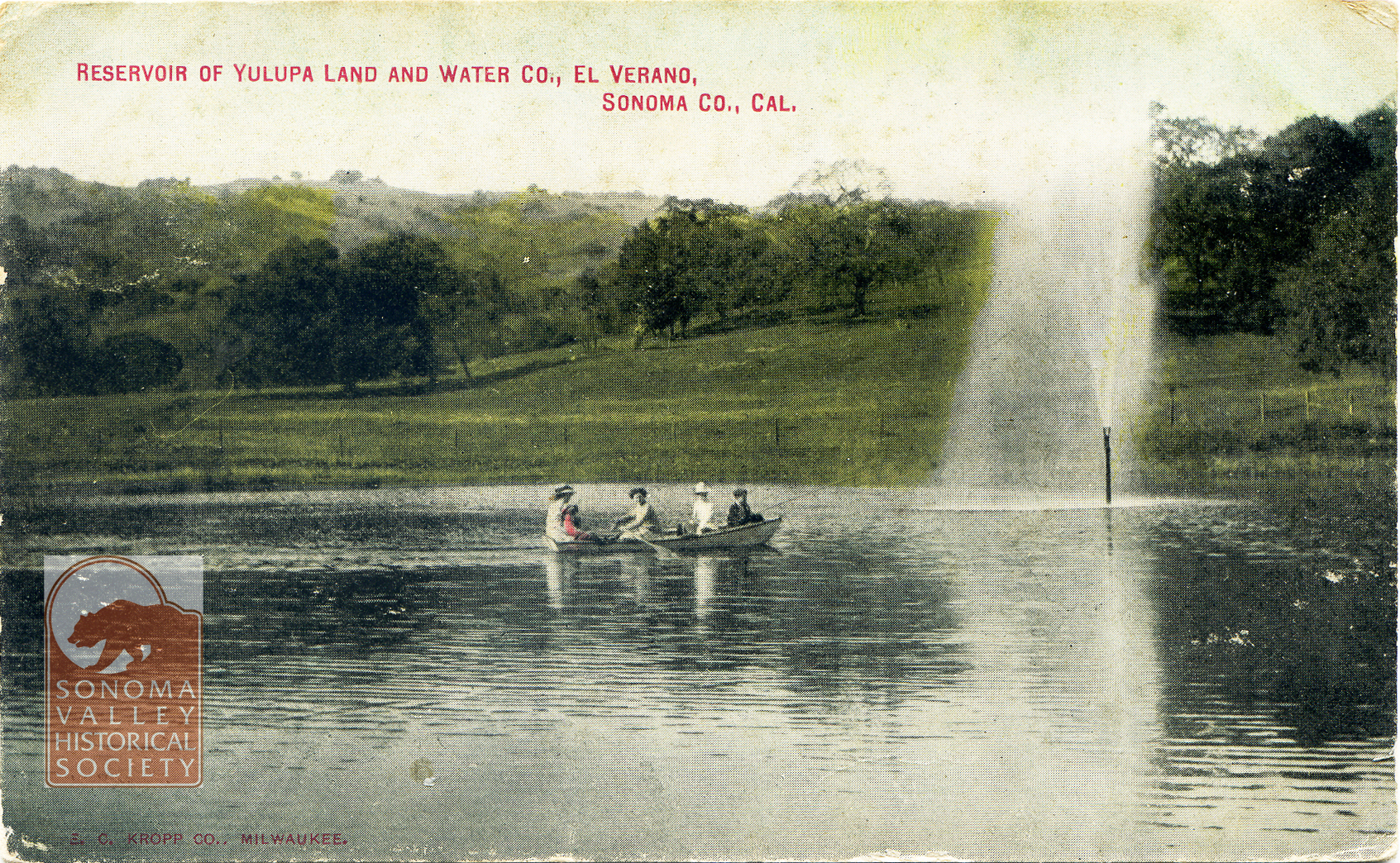
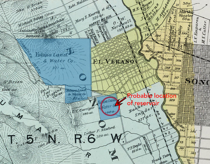
Post marked 1910. The Yulupa Land and Water Company holdings appear on an 1898 Reynolds and Proctor map (Rumsey Collection).
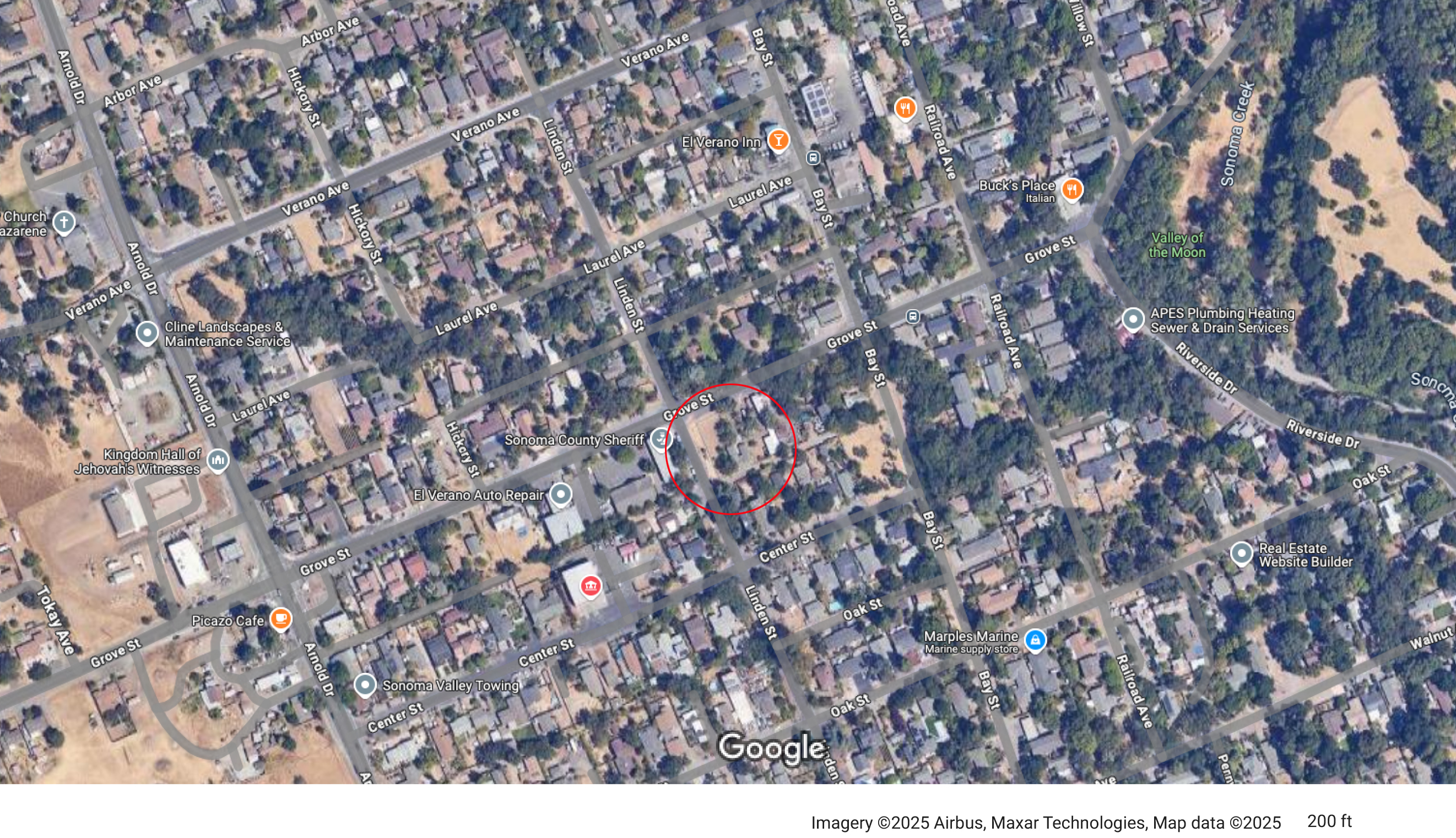
Judging by the hills in the background in the post card, the reservoir was probably located near the corner of Grove and Linden Streets.
In 1910, the Sonoma Valley Water, Light and Power Company acquired the Yulupa Land and Water Company.
1913- “J.A. Dinsella, the enterprising plumber of this city, has secured a contract from Sonoma Vista Land Co. near this city, to build its pipeline of 4-inch mains and 2-inch laterals.”
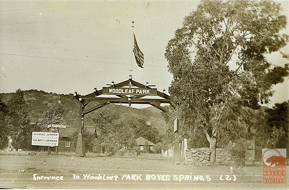
In 1923 J.W. Minges sold his Boyes Springs Water System, which mainly served Woodleaf Park, to N.M. Peterson, proprietor of the Mountain Water Avenue system. The merger “will enable the operating company to give better service…” even then that was the rationale!
J.W. Minges was known as the “mayor” of Boyes Hot Springs.
“Another company at Boyes Springs which has supplied many customers in the vicinity of the hotel and Boyes Springs Park is owned and operated by James Baines.” of Baines St.
1958-Mountain Ave. Water Co. was sold to Mr. and Mrs Peterson Jr. whose parents had bought from Minges. The Petersons’ company served Boyes Hot Springs for 35 years. Improvements included an office building at 18640 Highland (An address that cannot exist, apparently, as the street ends at 18075), and a new tank at the top of Mountain Ave. An existing tank is located above Highland, circa 2025.
From the Valley of the Moon Water District website: “In 1957, the Valley of the Moon Fire District was evaluated by the Pacific Fire Board which at that time noticed the lack of a dependable water supply source. Subsequent inquiries of Fire District Board members, J. Udvic. T. Polidori and F. Serres, revealed that many wells in the area were failing due to drops in the groundwater levels in the Valley. Early attempts to have Sonoma County build an aqueduct from Santa Rosa to the Sonoma Water and Irrigation Company failed due to the inability of the latter to deposit a $25,000 cash bond with the County.”
In 1960 voters authorized the establishment of a water district. Candidates for directors at that time were Arnold Griewe, Mel Larson, Bill Orr ,Tom Polidori,Col R. C. Buell, Marin Carlson, A. L. Ford and Nino Vailetti.
“Acquisition of the Sonoma Water and Irrigation Company and the Mountain Avenue Water System was completed in early 1962 and the Valley of the Moon County Water District started management and operation of the systems on June 1, 1962.” VOMD website.
1963-Sonoma Aqueduct dedicated, bringing Coyote Dam water to the valley.
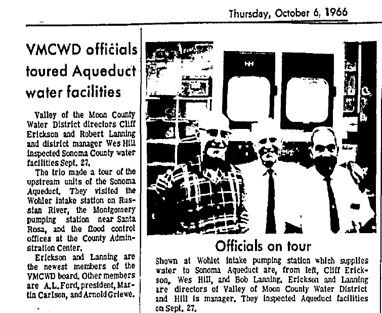
The Water District had new directors Robert Lanning and Cliff Erickson in 1966.
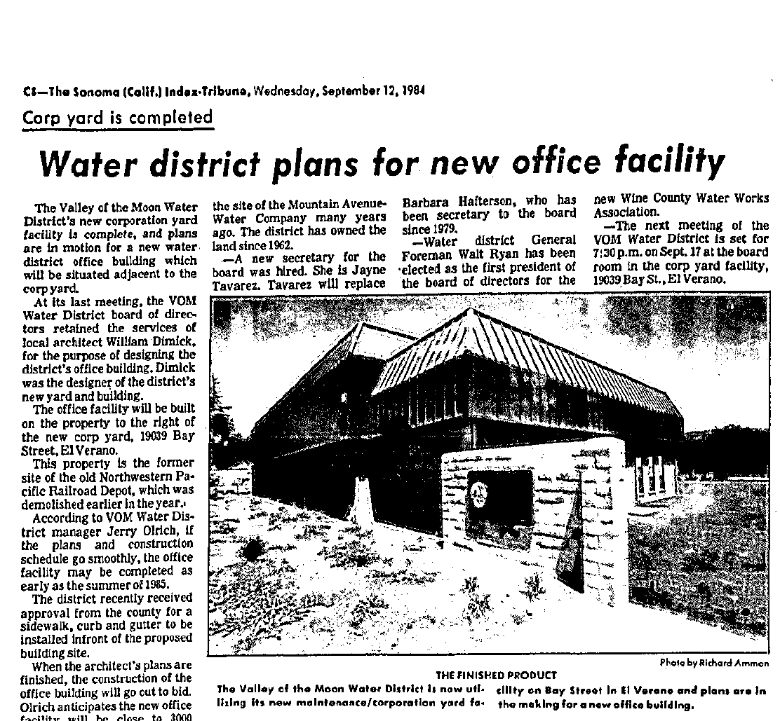
In 1984 a new office building was planned, to be built on the site of the El Verano railroad depot.
Alas!
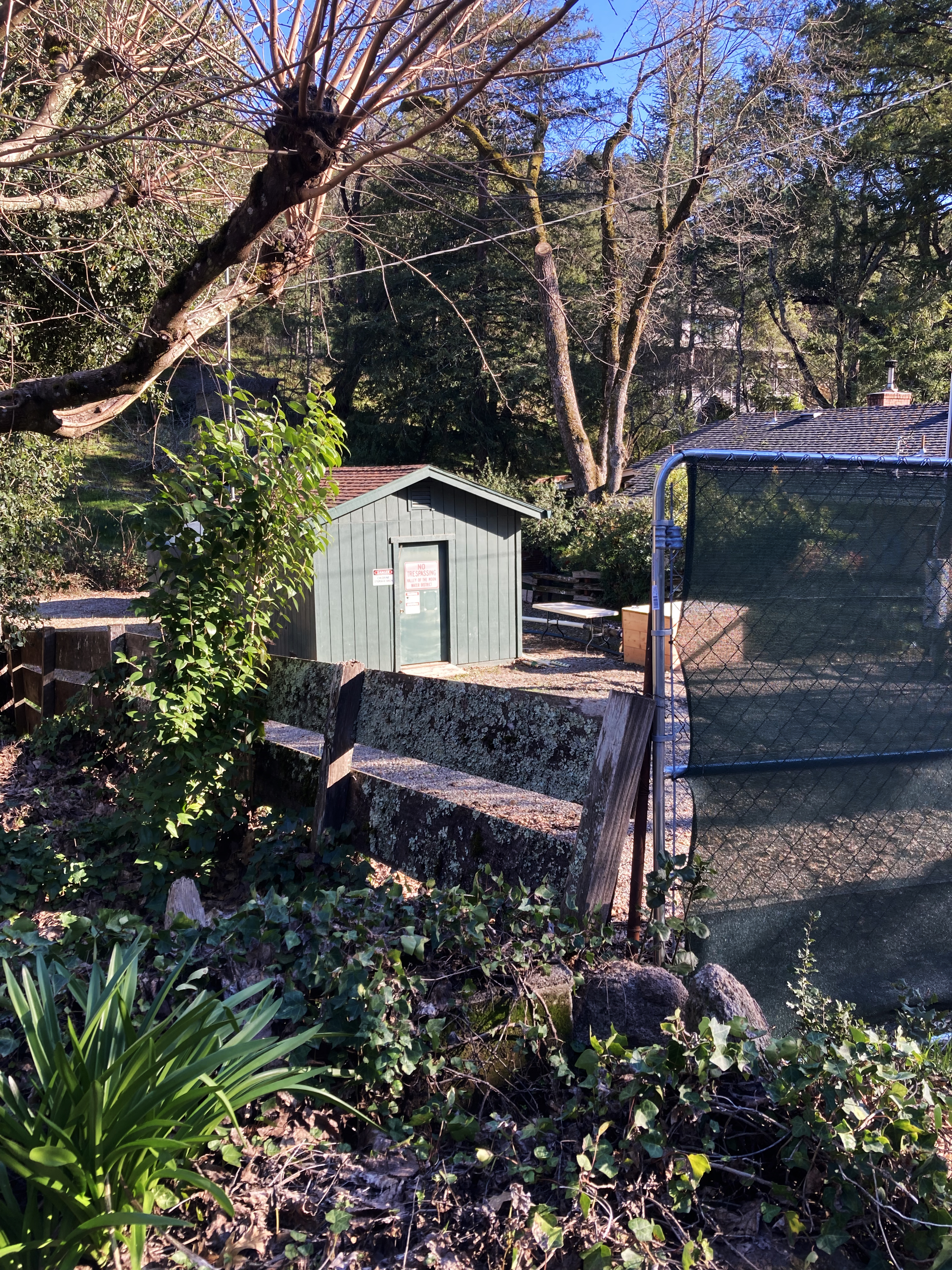
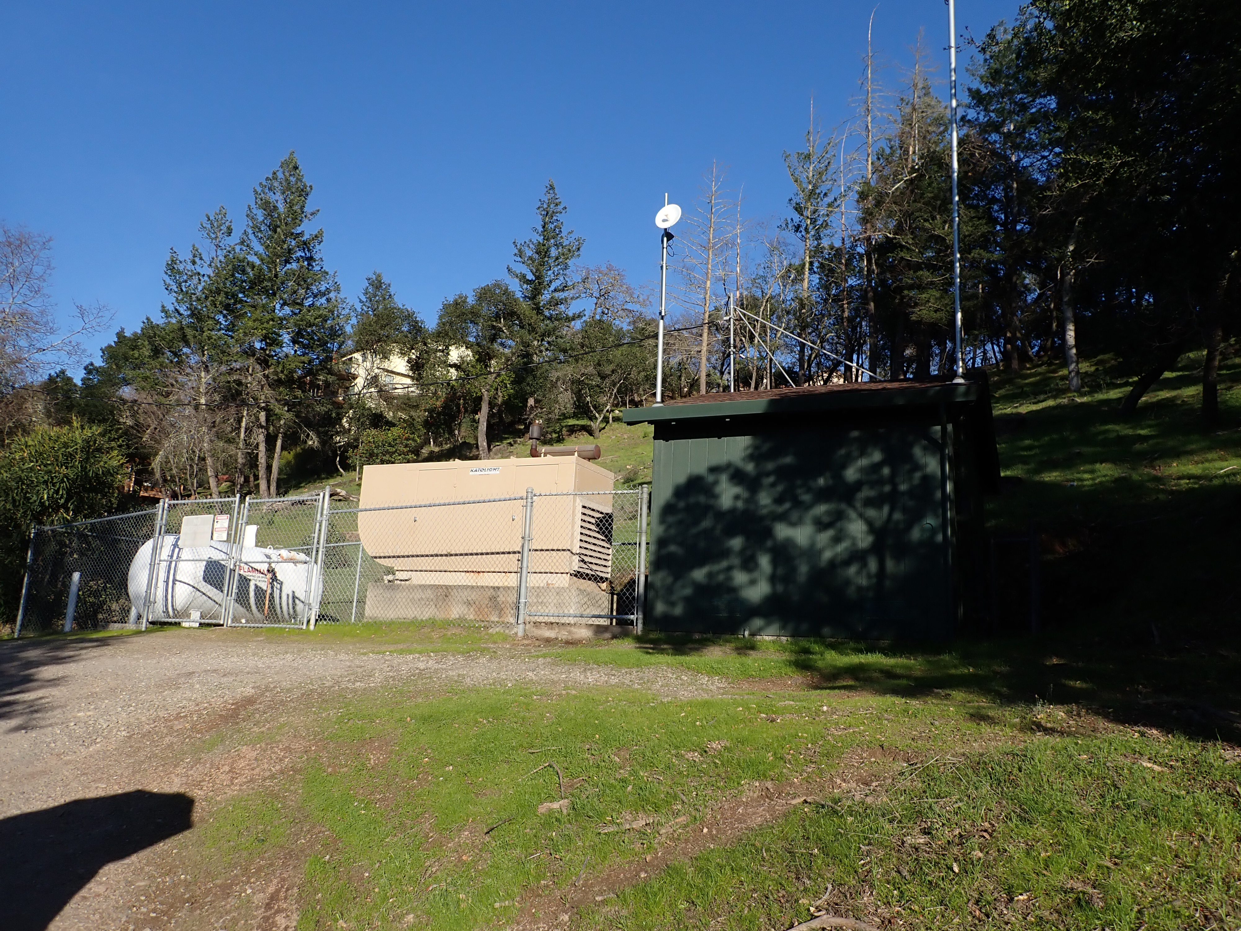
The District still has wells in the Valley.
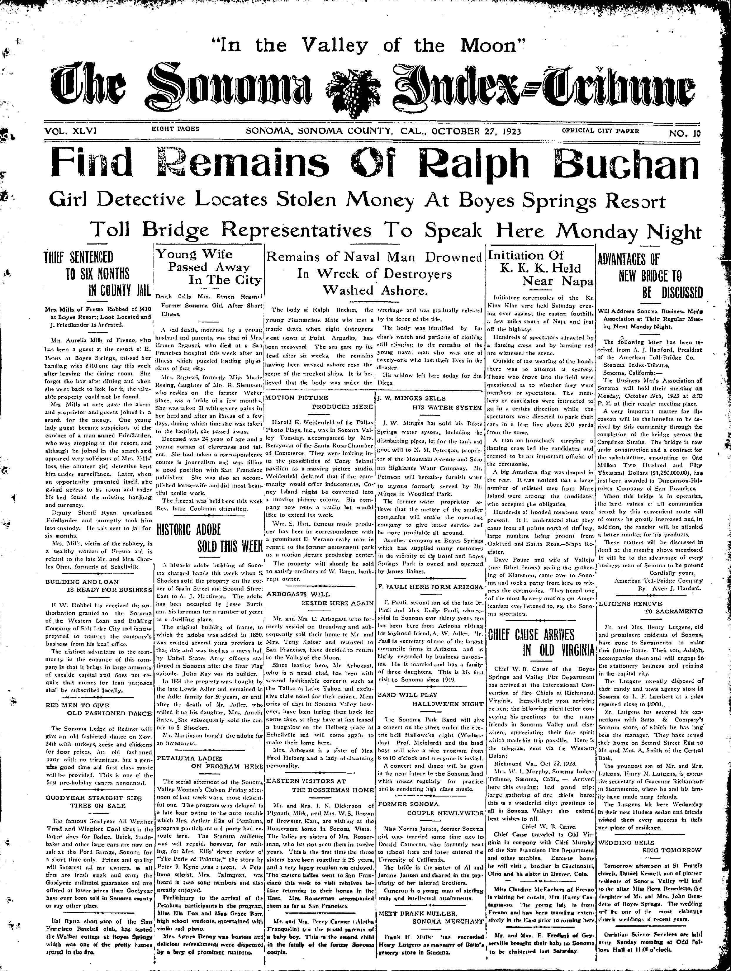
Park Avenue well.Kearney Street well.One comes across many interesting things when looking at old newspapers. Things not relevant to the subject at hand, nonetheless important. This front-page description of a Klan meeting in the Napa Valley is vivid and disturbing, and rings bells that are still reverberating today.
Index Tribune courtesy of the sonoma Valley Historical Society.
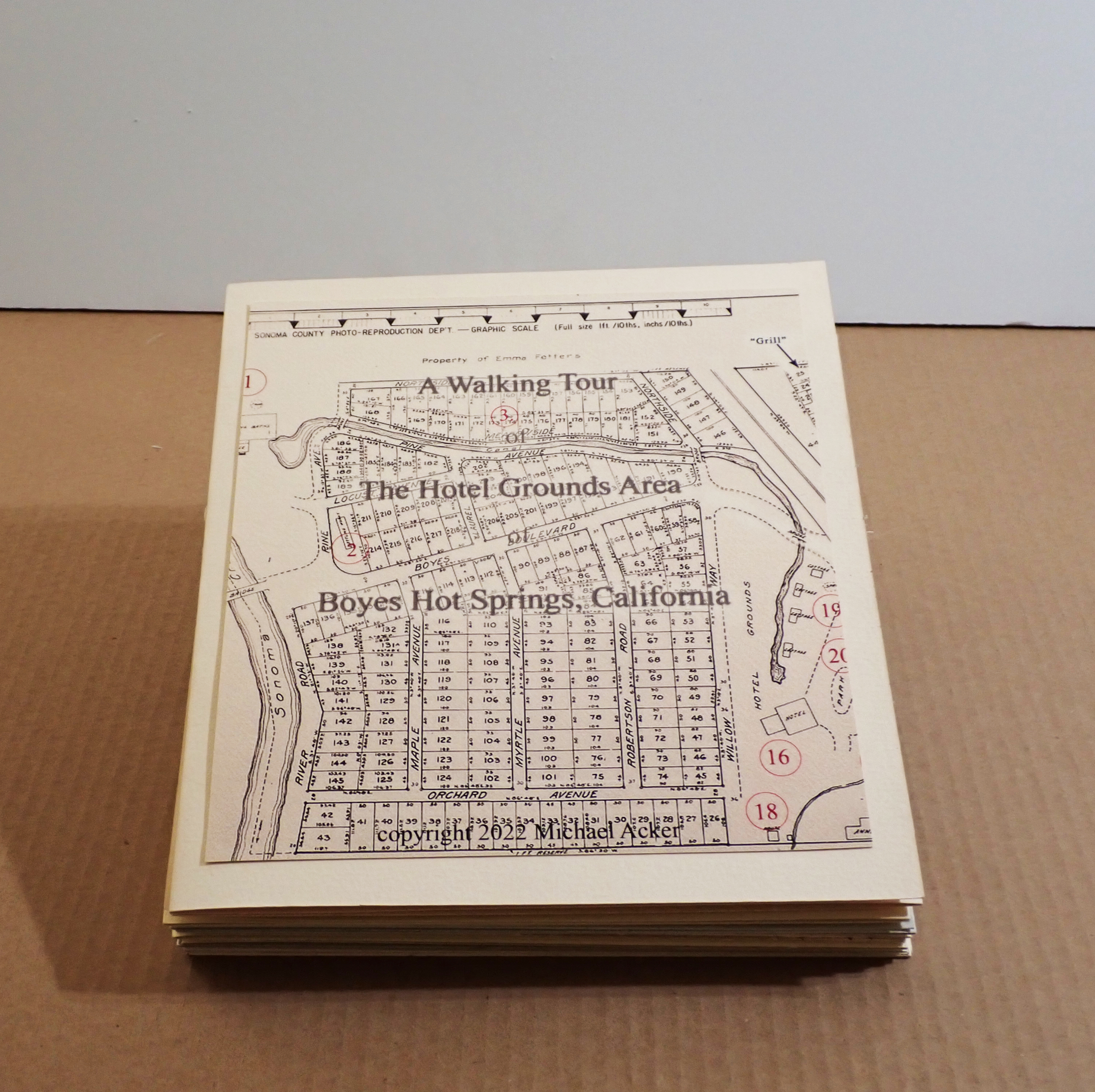
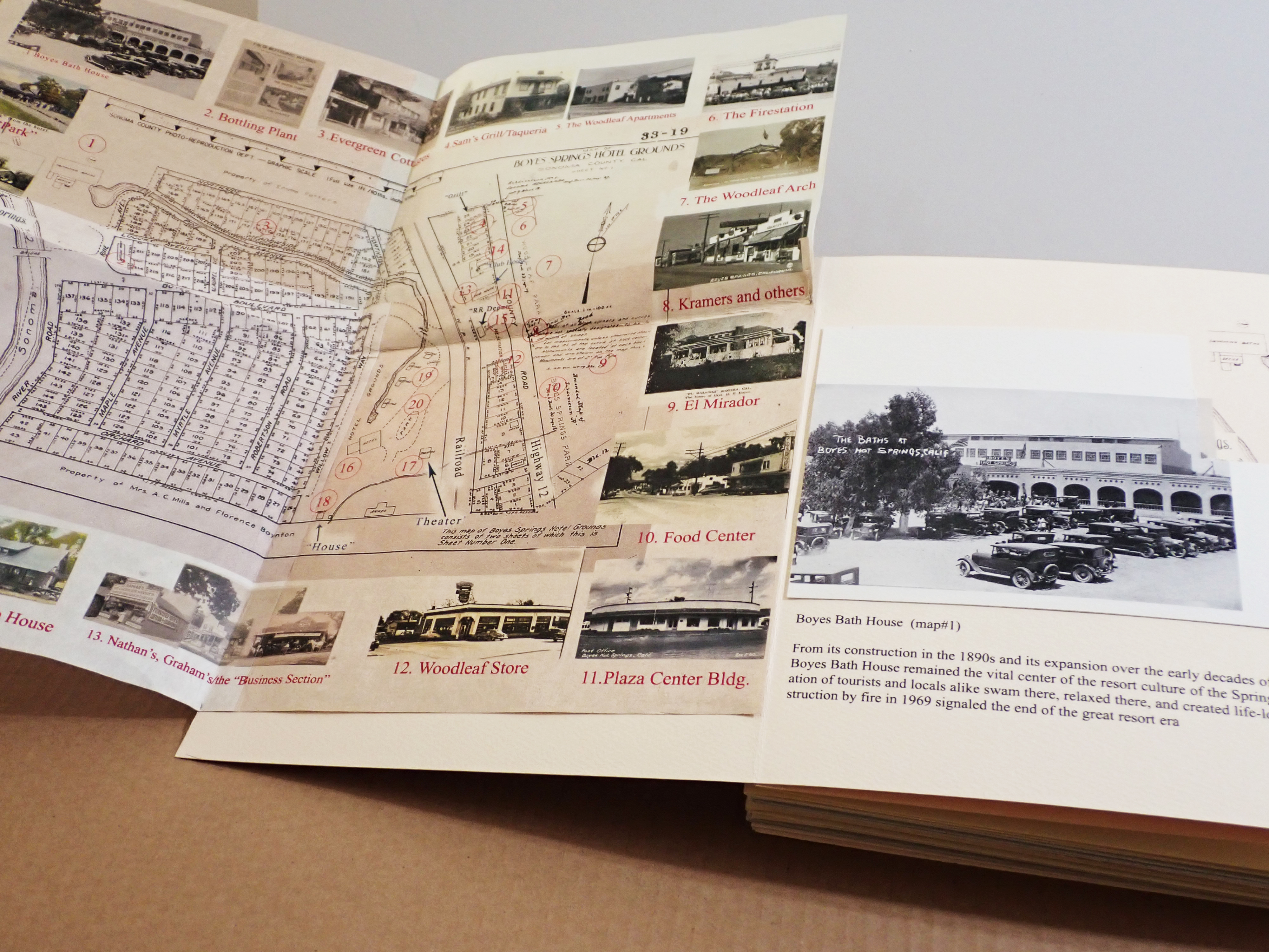
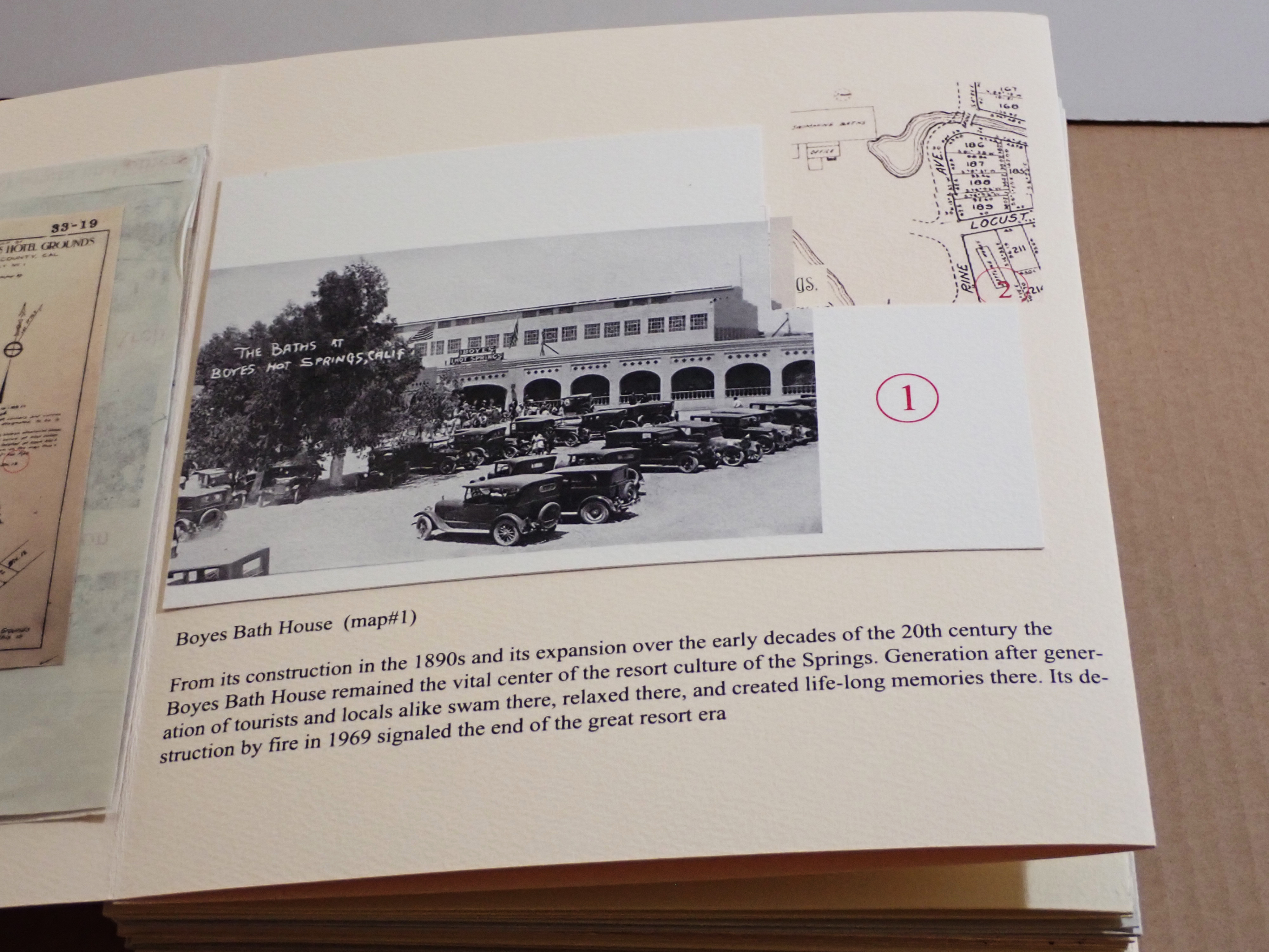
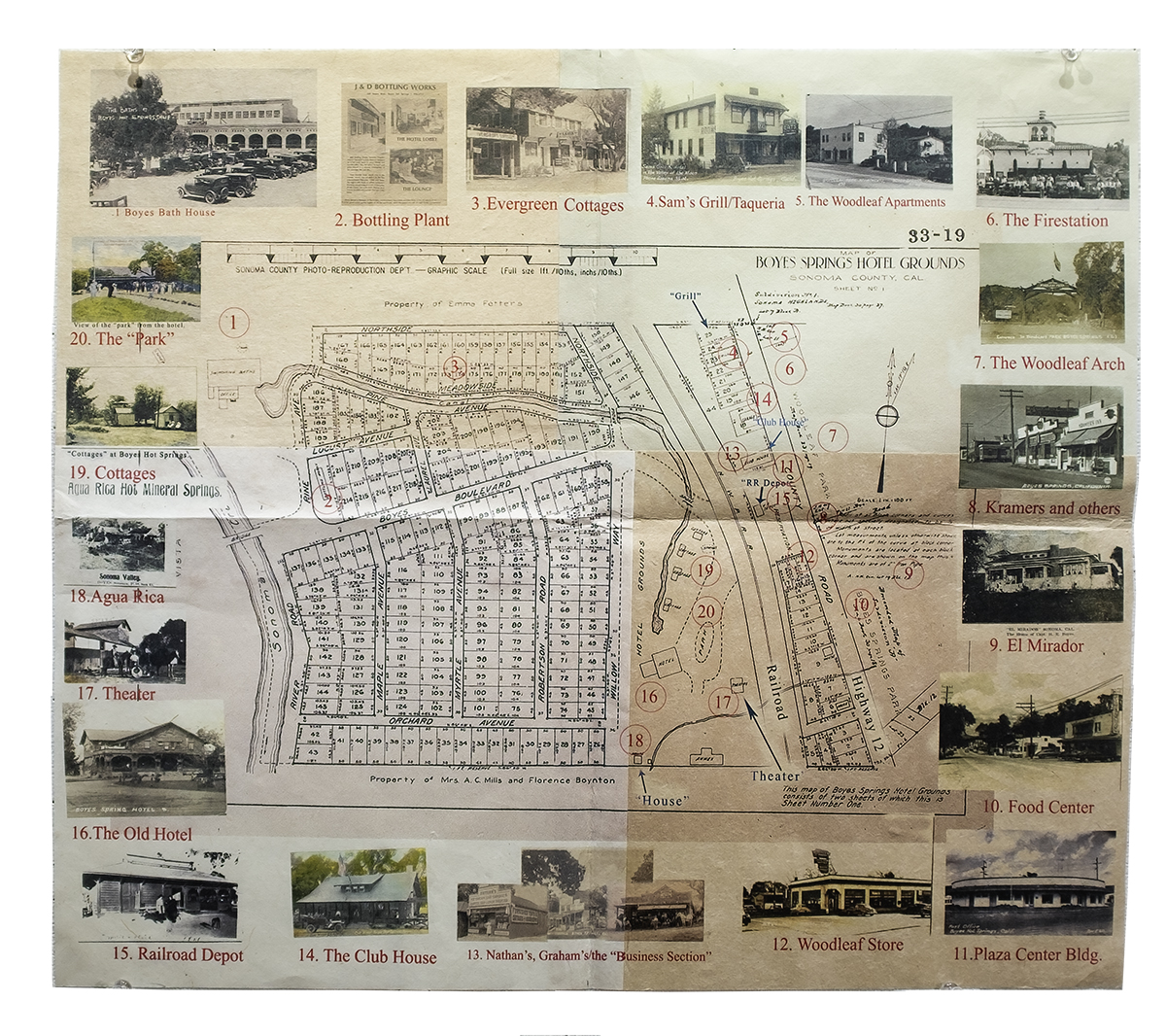
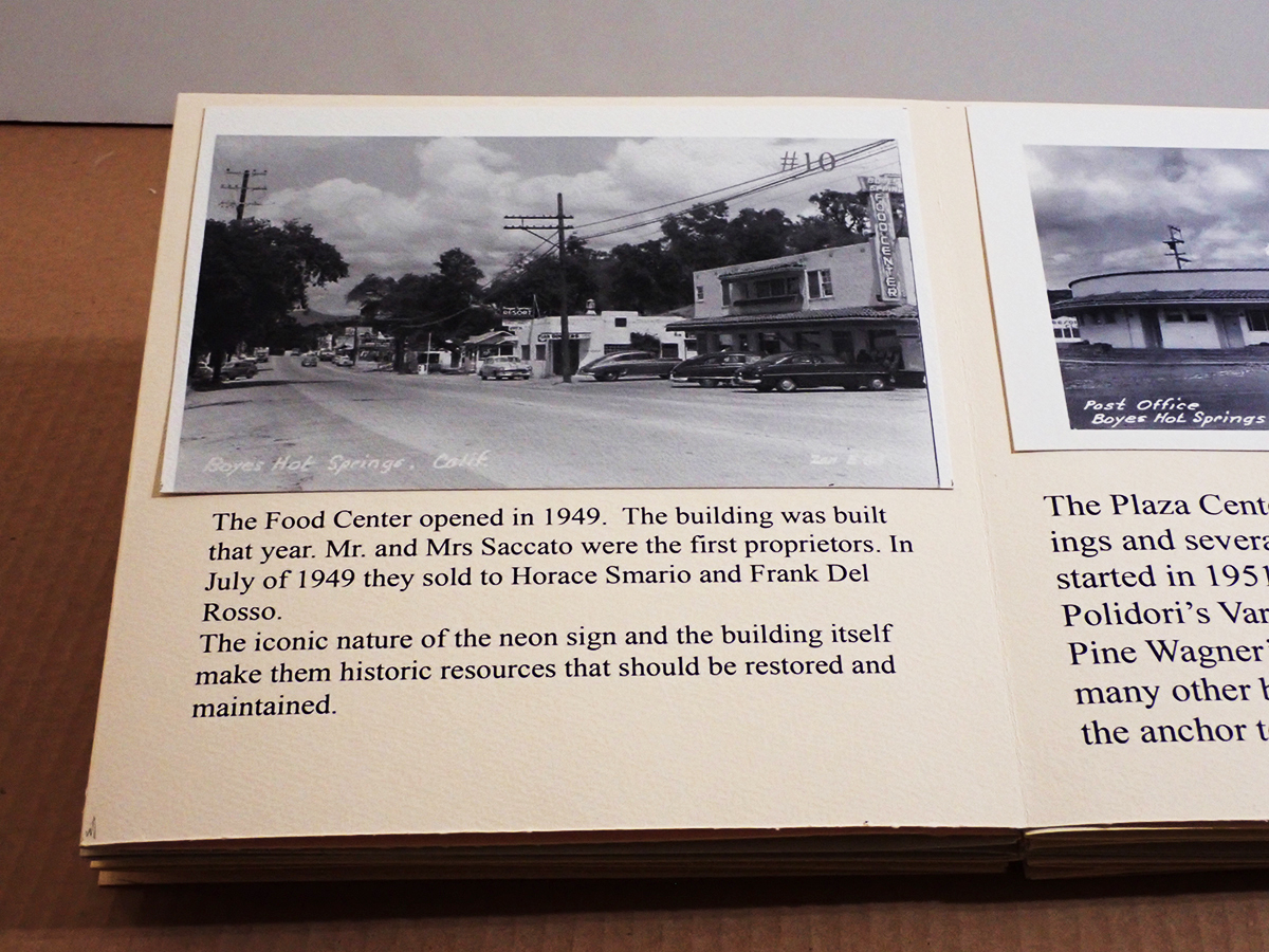
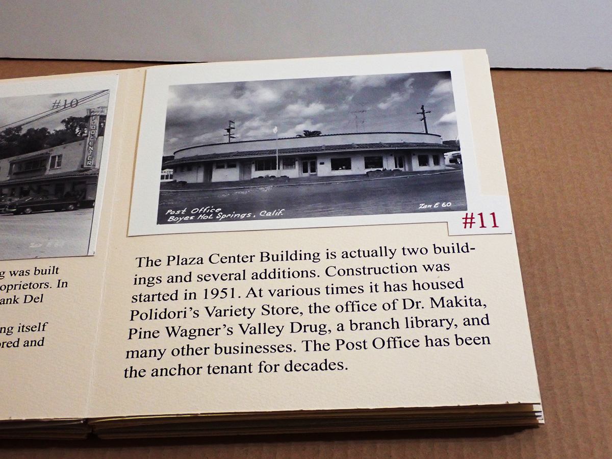
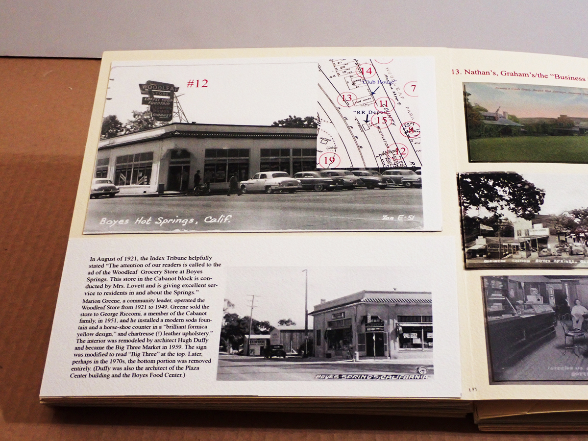
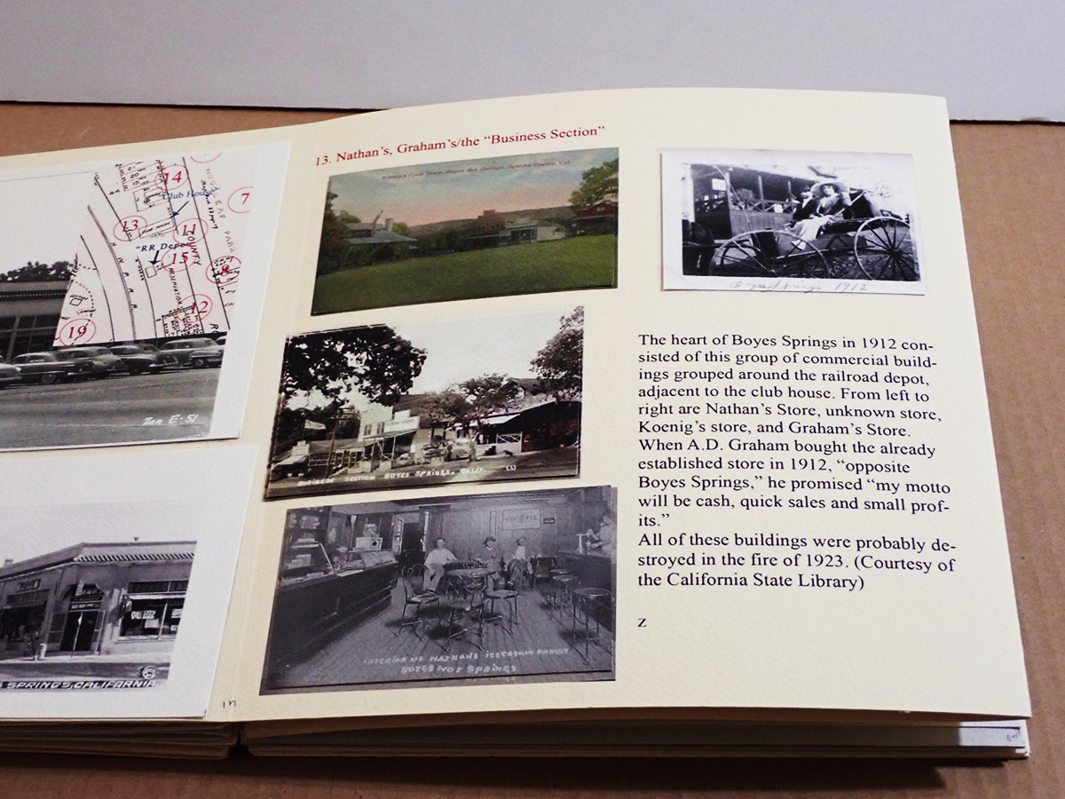
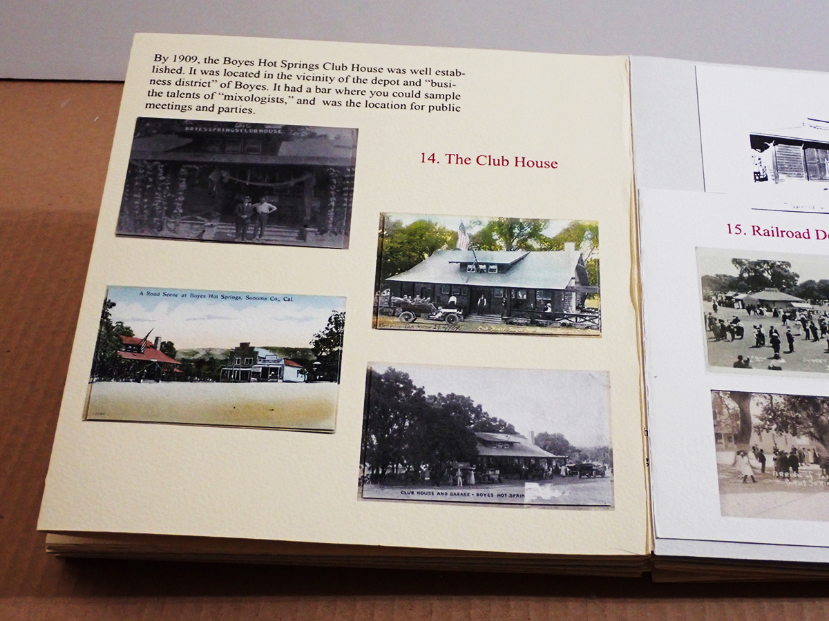
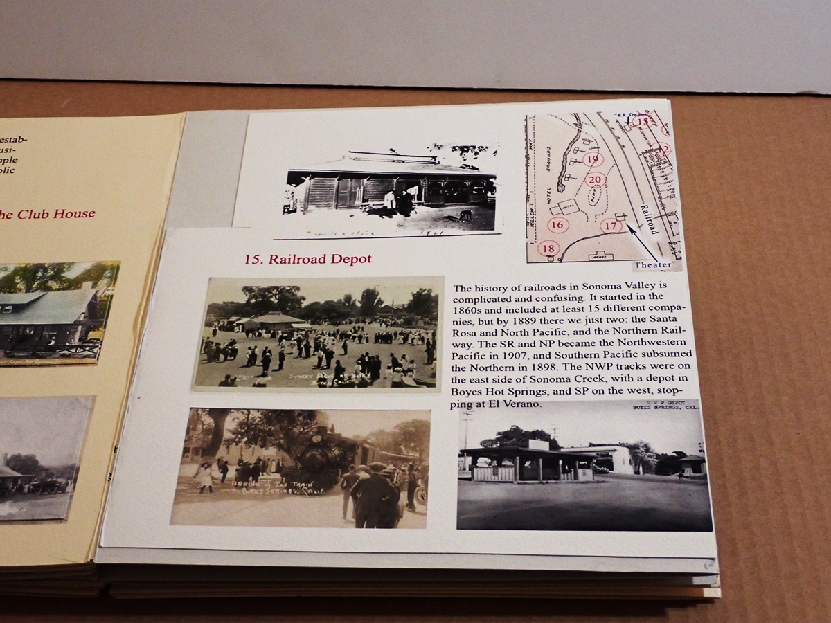
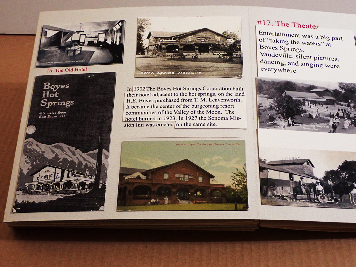
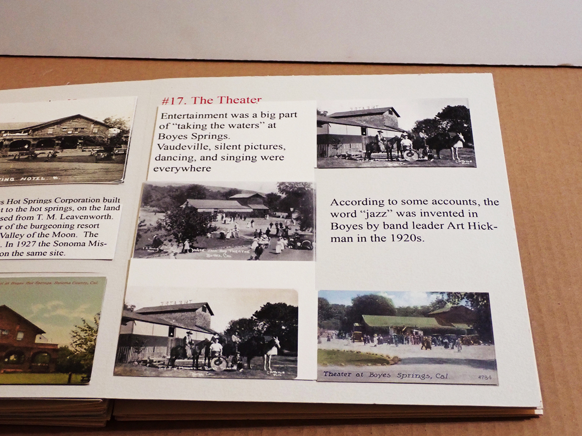
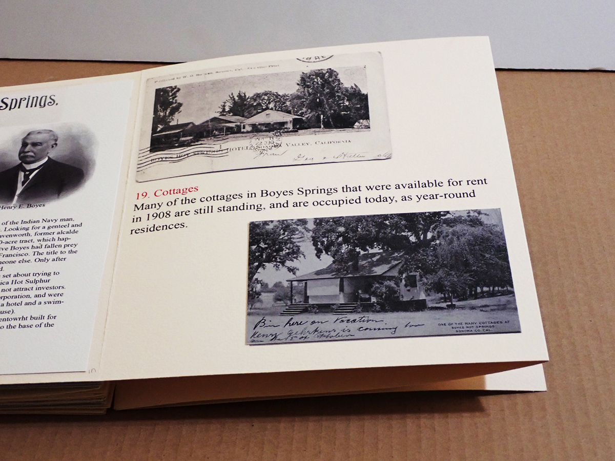
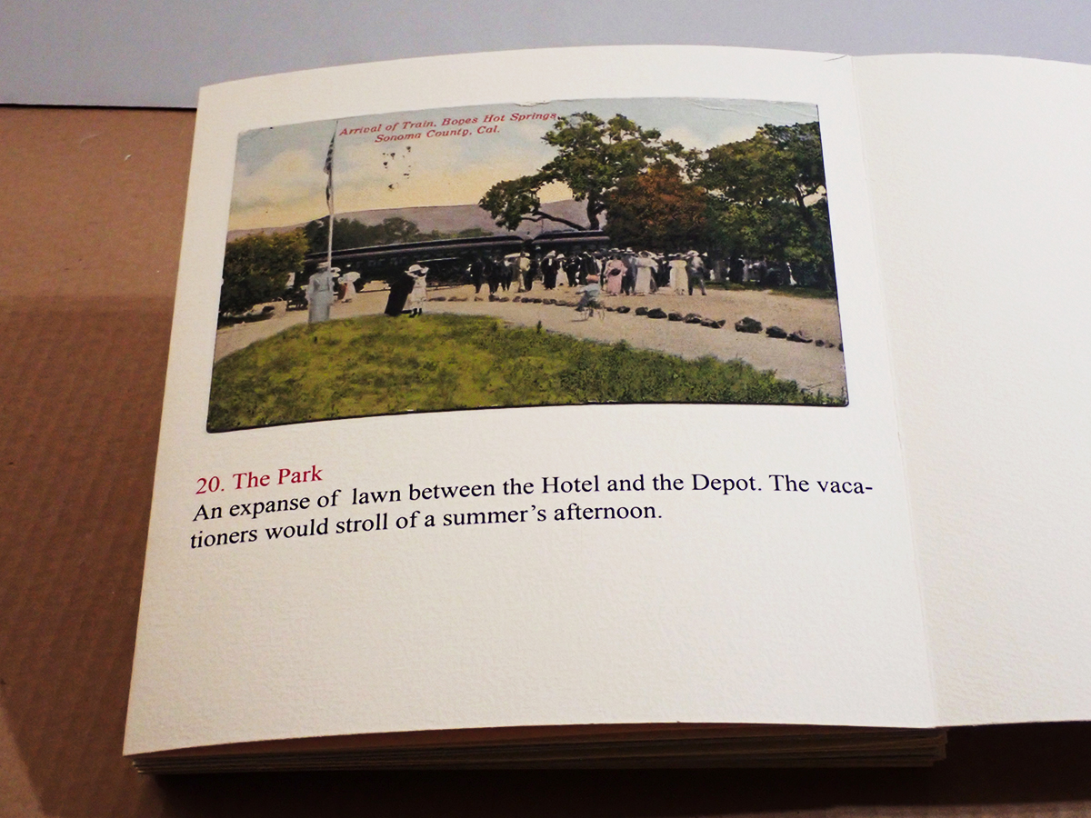
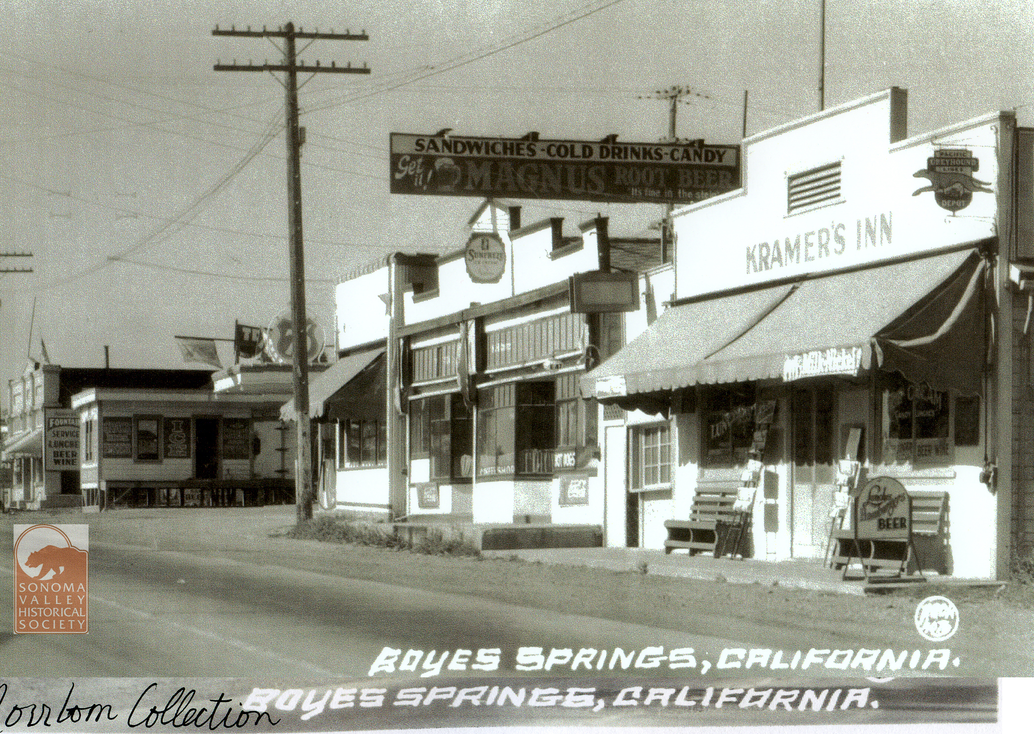
A historic walking tour of Boyes Hot Springs requires a bit of imagination: Many buildings are gone, but they have left traces in the form of photographs and other artifacts, as well as memories. Some day you will be invited to participate, in The Real World, as they say. (Click to enlarge images.)
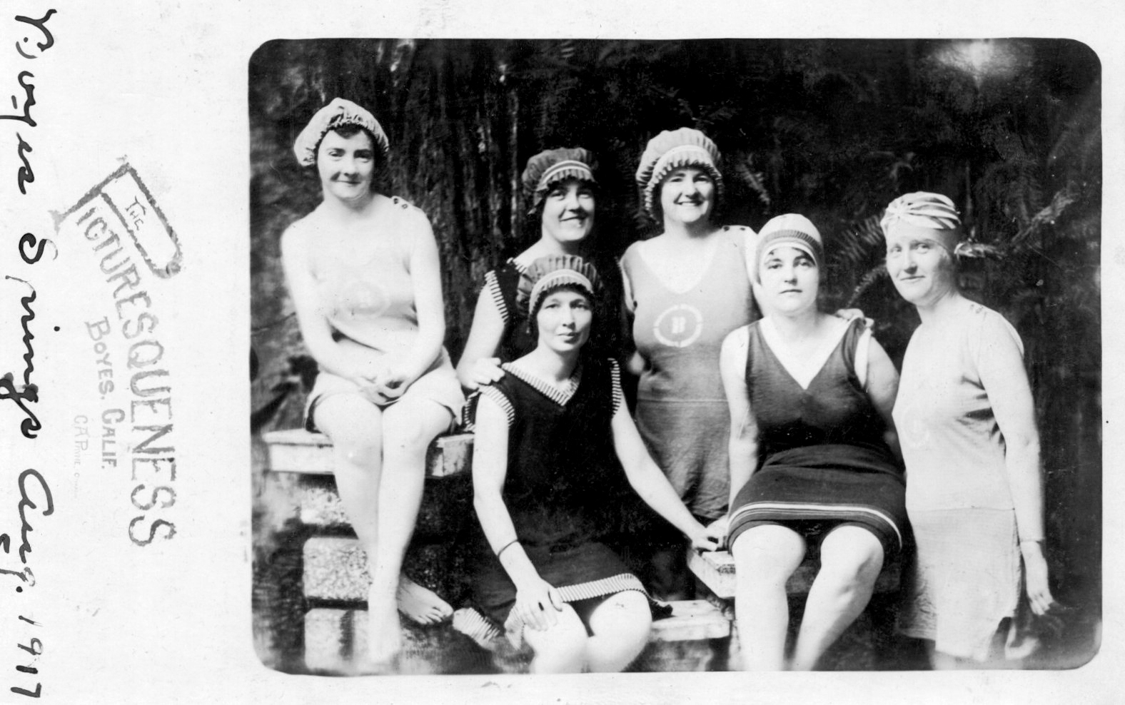
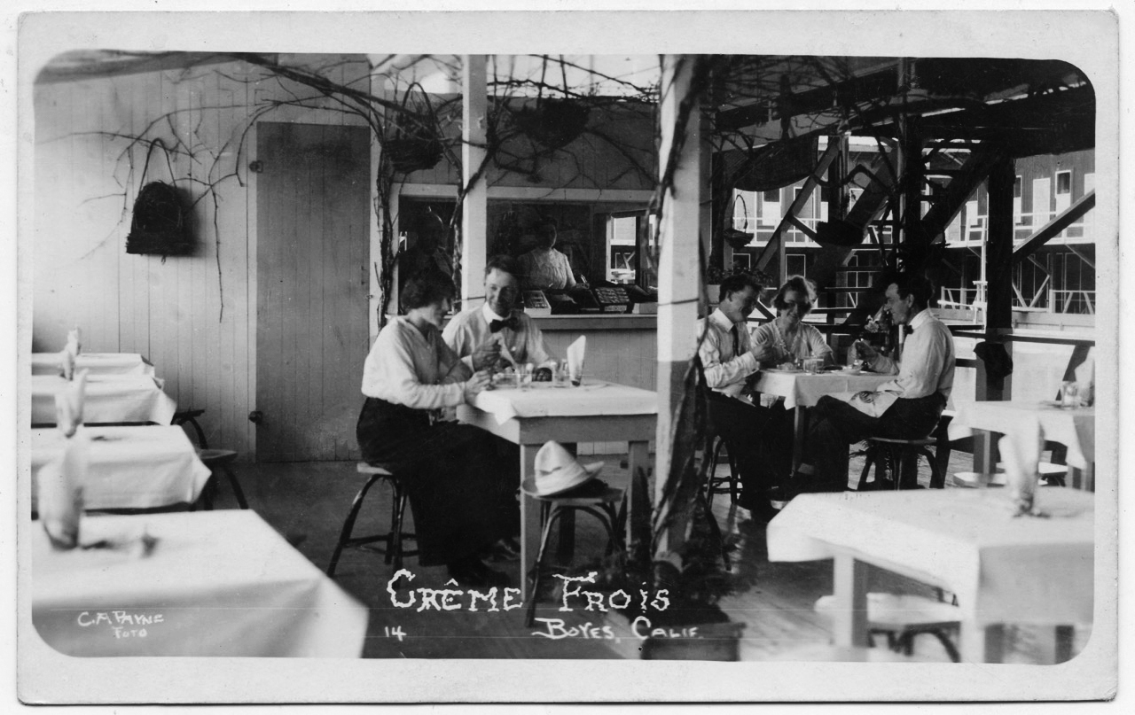
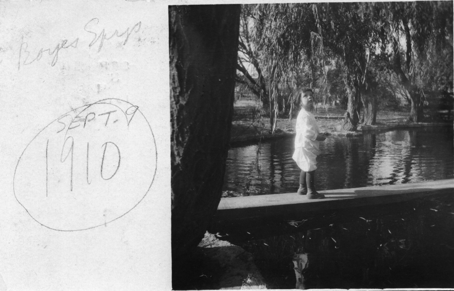
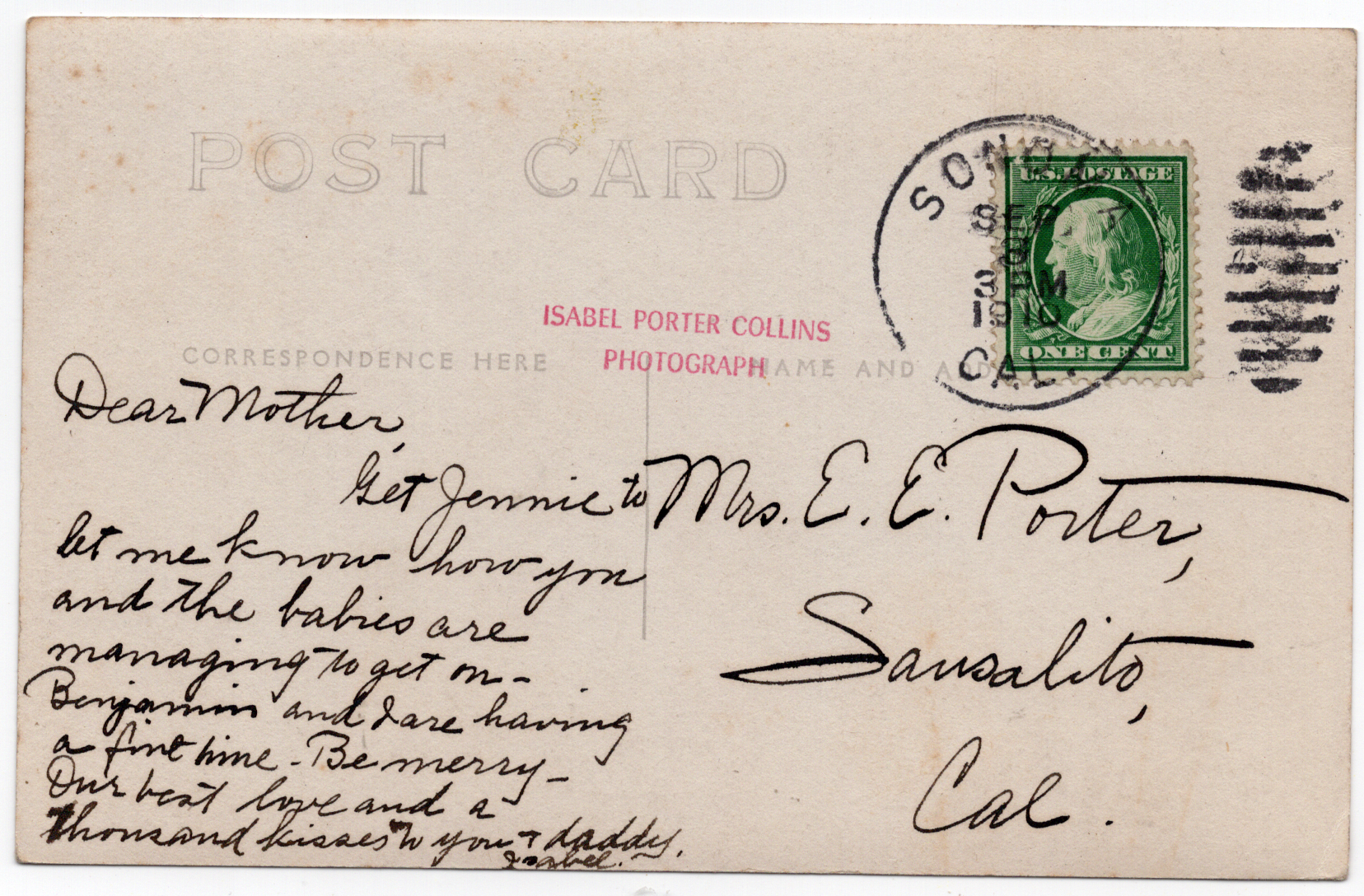
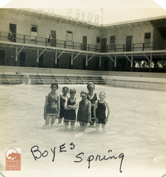
Bathers at Boyes Hot Springs, 1917Circa 1910sLooks like the Fetters Resort pool. Quite a genteel setting! C.A. Payne is the photographer. Thanks to Dennis O’Rorke for the photo.Front and back of a card, photo by Isabel Porter Collins, born in Petaluma, 1875, died 1954. Artist, photographer, jewelry designer, teacher. Extensively documented Bay Area places and people in the first half of the 20th century.
Jean Marie Cazes was born in Nestier,France in 1867. He arrived in the US in 1883 (aboard the ship Chateau Lafitte!). After spending a significant amount of time in New York, working in the wine business, he decamped for California and the Valley of the Moon in 1920.
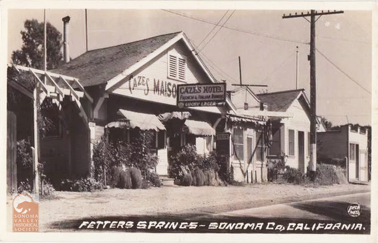
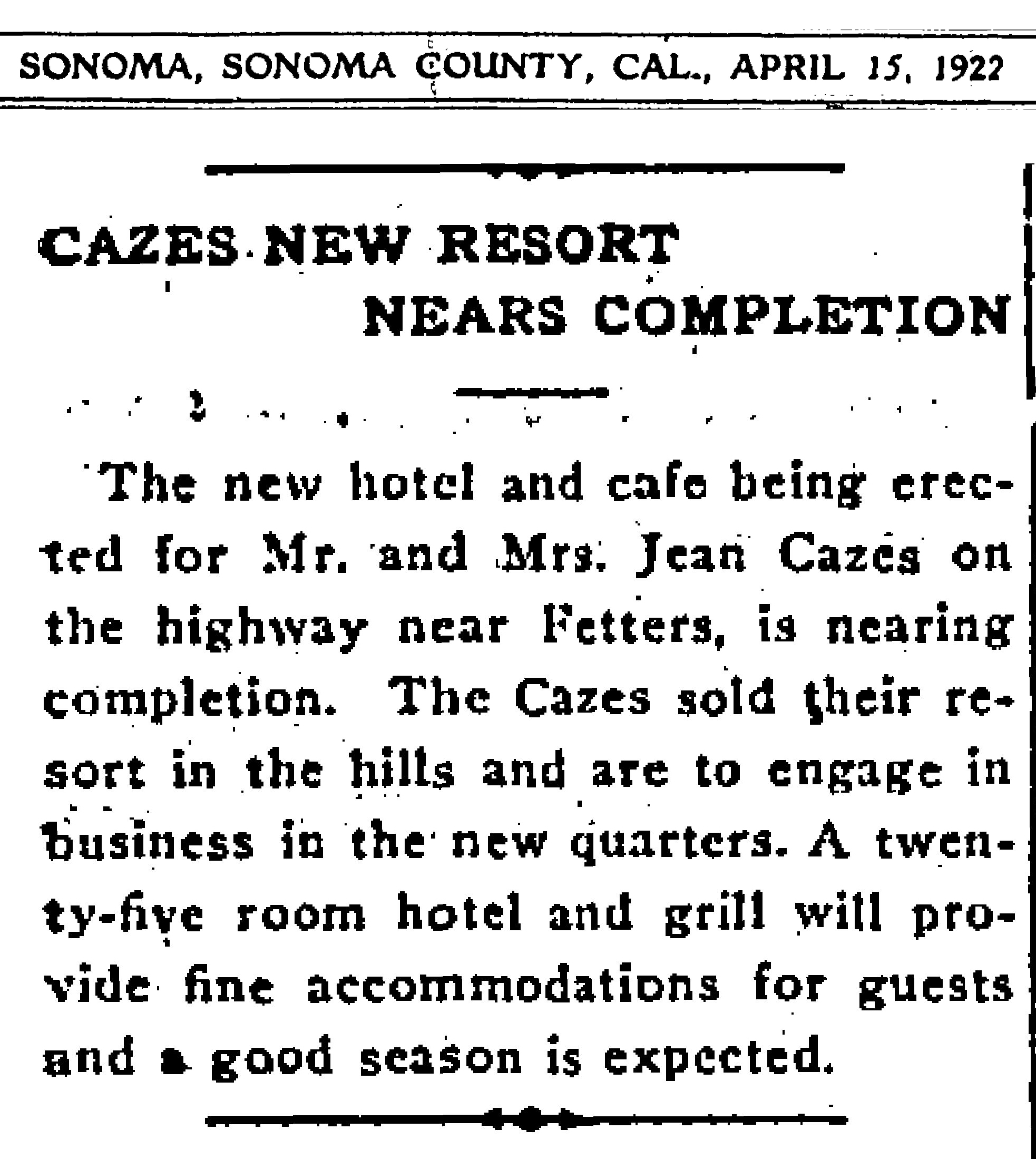
In 1922, Jean and Genevieve Cazes started construction of their new resort on the Sonoma Highway in Fetters Hot Springs. In April of that year, according to the Index Tribune, “The new hotel and café being erected for Mr. and Mrs. Jean Cazes on the highway near Fetters, is nearing completion. The Cazes sold their resort in the hills and are to engage in business in the new quarters. A twenty-five room hotel and grill will provide fine accommodations for guests and a good season is expected.” The name of their “resort in the hills” is unknown as of this writing.
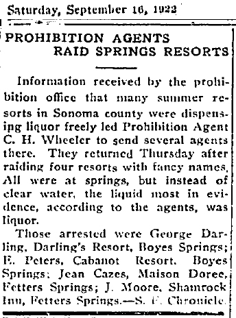
Prohibition being the law of the land, raids of public establishments became common. The Index Tribune (via the S.F. Chronicle) tells us, in September of 1922, under the headline “Prohibition Agents Raid Springs Resorts,” Jean Cazes was arrested along with some other resort proprietors. He eventually received a $250 fine for his transgressions.
By 1924, Jean Cazes had sold his resort to a Domenico Rovigna, who conitunued business under the Cazes name. (However, a 1942 article about a robbery at the resort, calls Mrs. Cazes “the proprietor.” It also erroneously calls her “Mrs. Doree Cazes.” Her name was Genevieve.)
Jean Cazes died in Fetters Springs in 1941. His obit in the IT said he “was among the first café proprietors in Fetters Springs and…had been prominent in California wine circles before that for many years.”
Genevieve Cazes was also born in France, in 1881, and died in 1970 at her home on Mountain Avenue, Fetters Springs. Her obituary states she was the owner of Maison Doree for fifty-five years, which suggests she still owned it when she died.
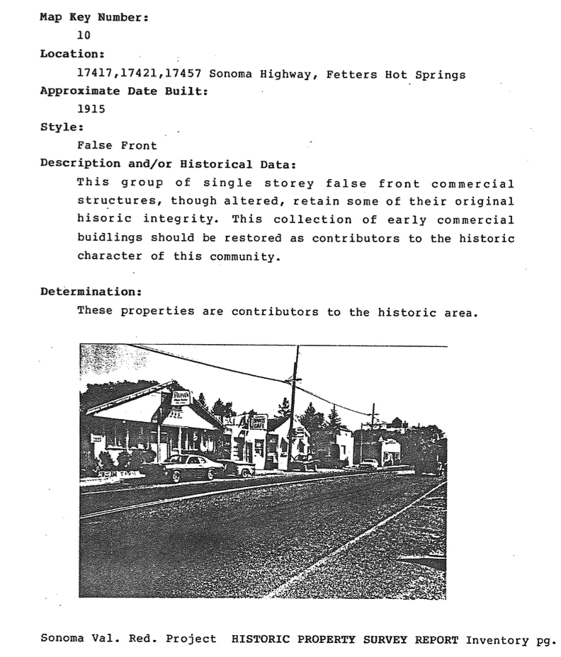
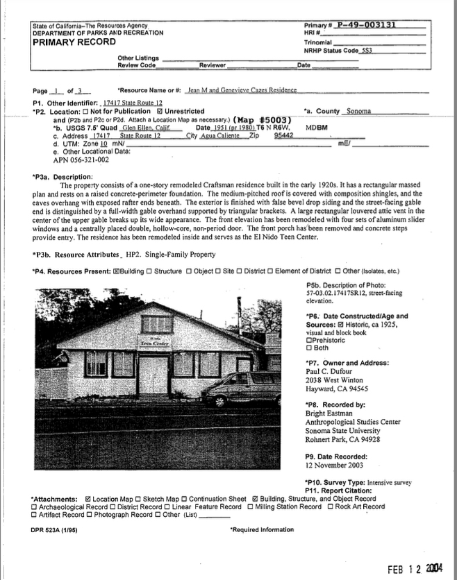
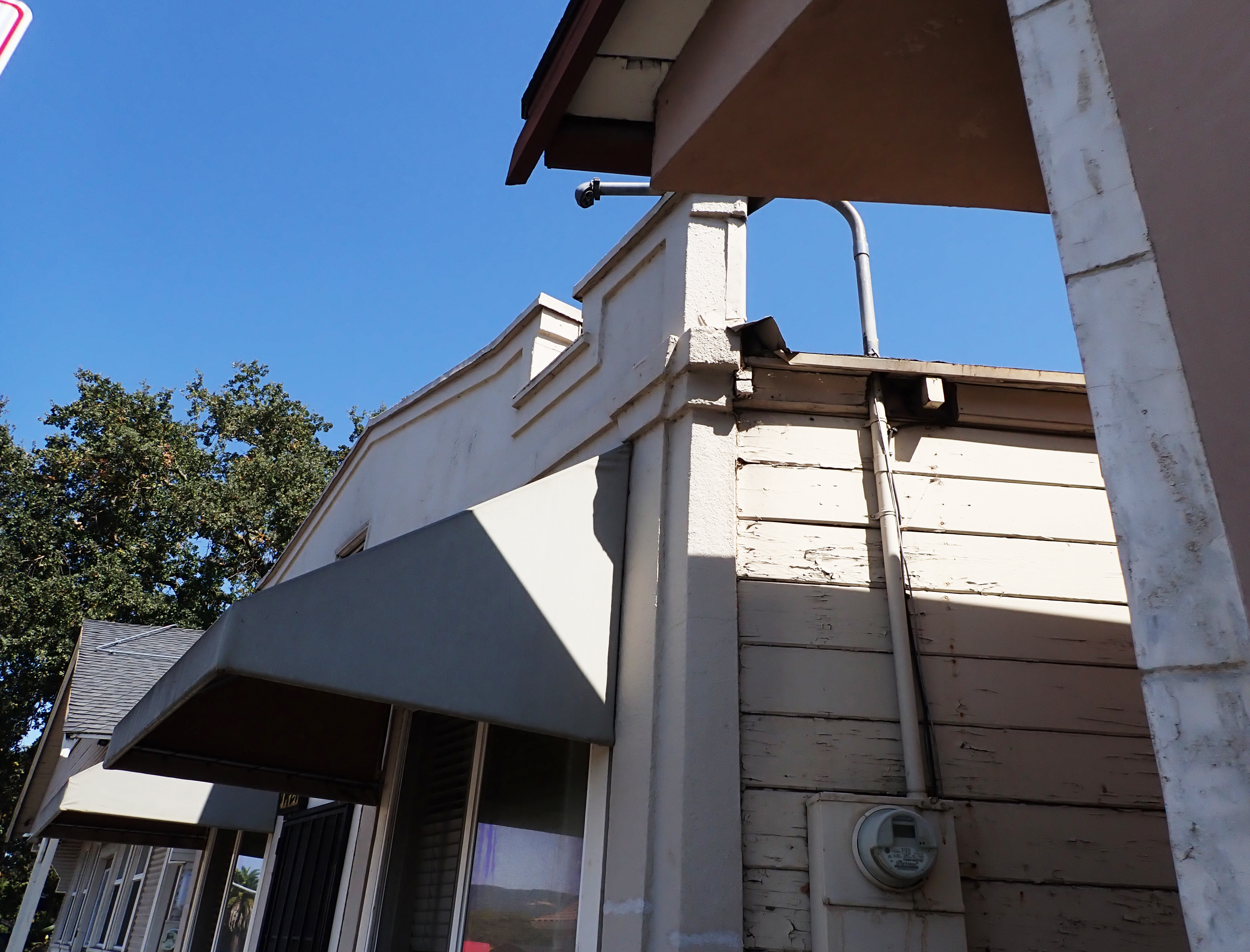
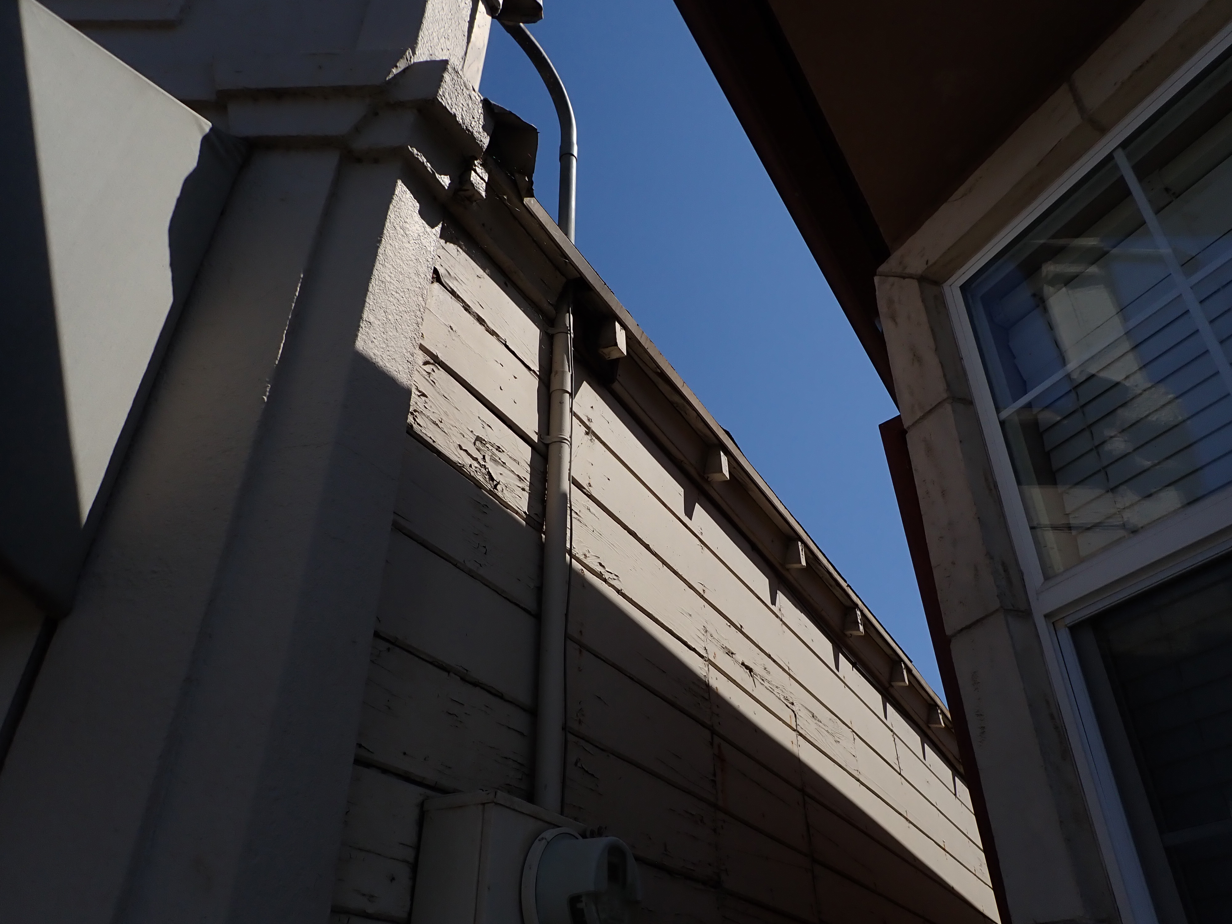
The Historic Survey, done for the Redevelopment project in 1984 (below), listed the construction date for the Cazes building as approximately 1915. Dan Petersen, the author of the report, noted , “this collection of early commercial buildings should be restored as contributors to the historic character of this community,” If only this suggestion had been acted on! However, the buildings(s) do exist (in 2024), in highly altered states.
A subsequent Historic Survey done in 2004, listed the construction date as 1925 and the building “the Jean M. and Genevieve Cazes residence.” The authors seem to be unaware of the existence of the resort.
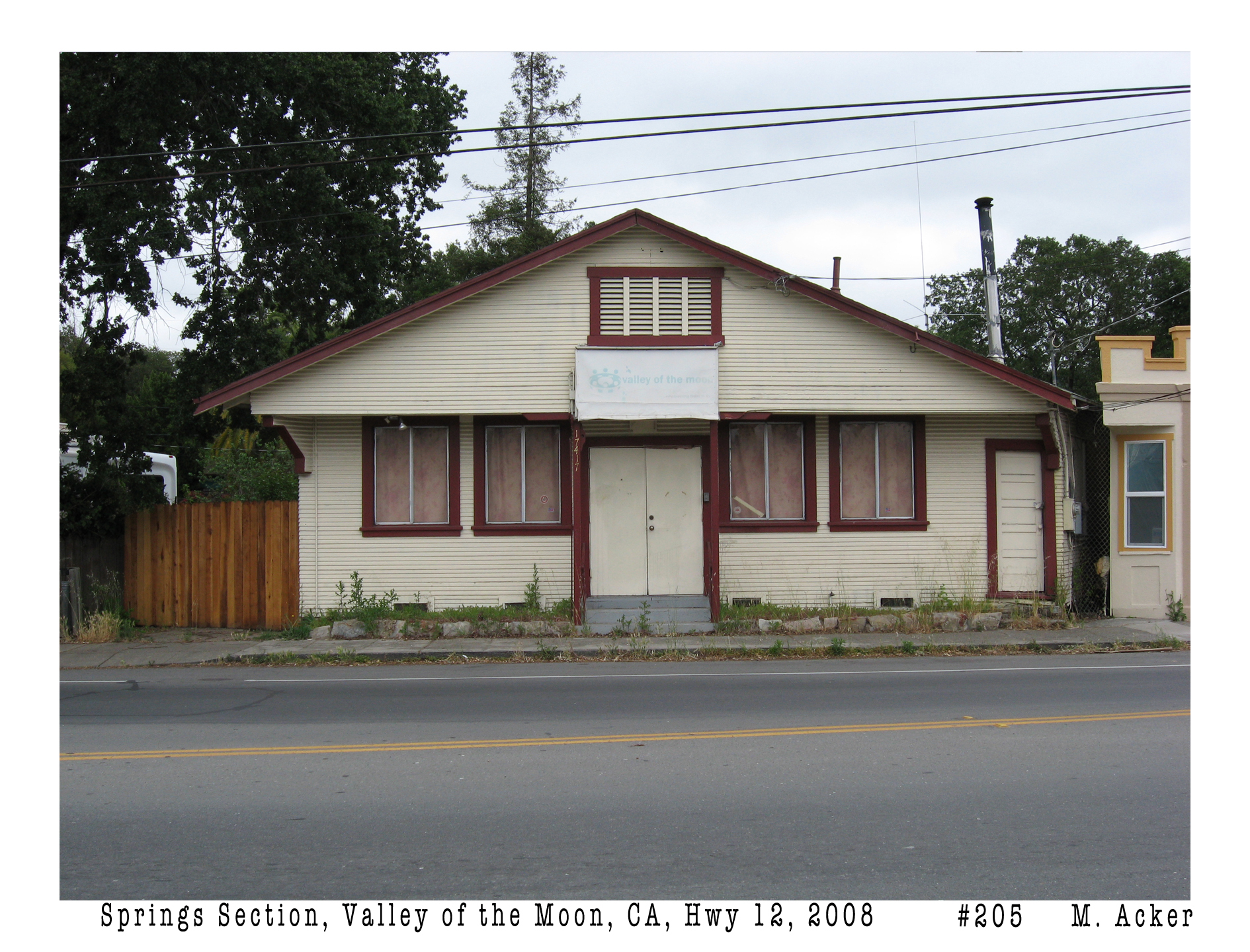
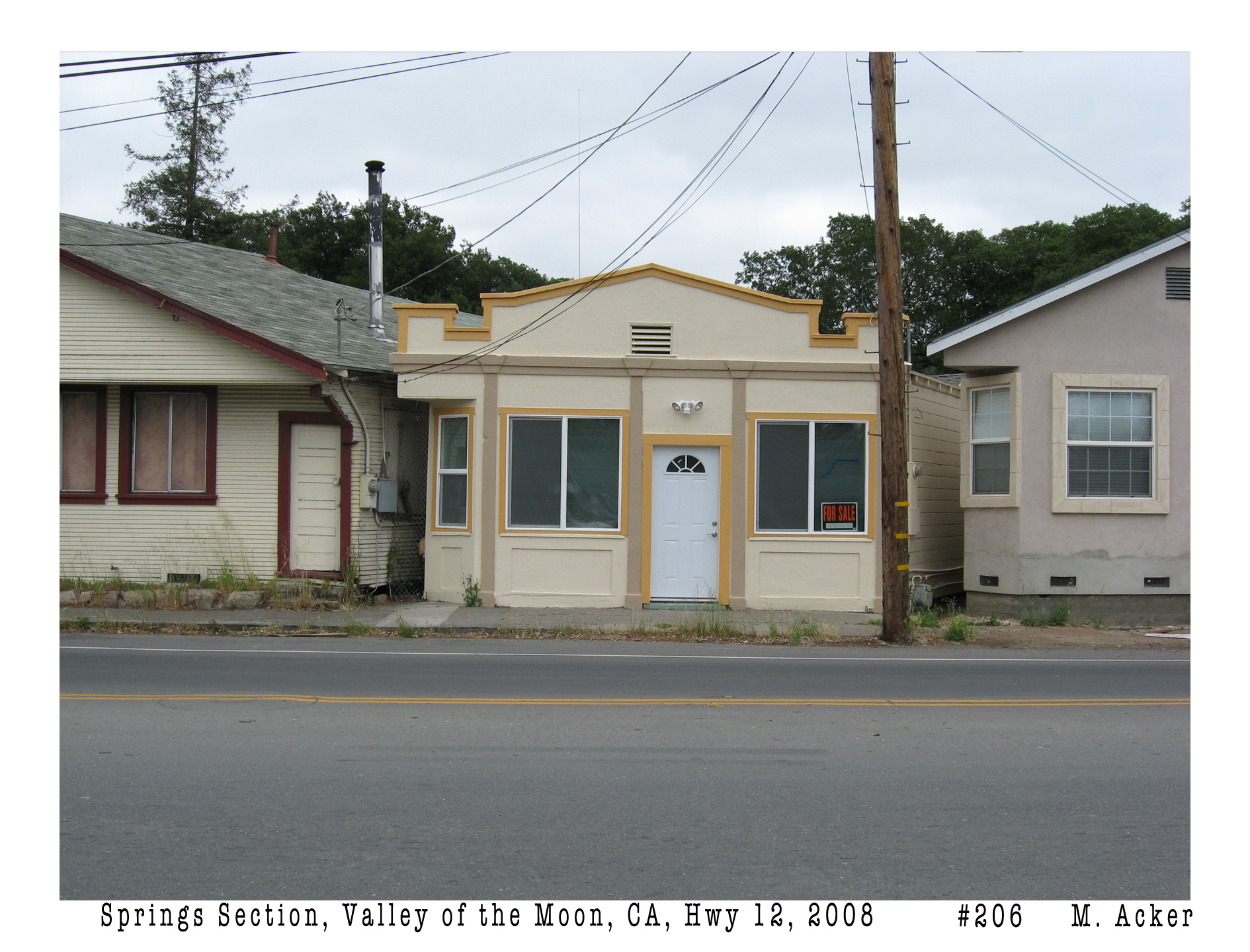
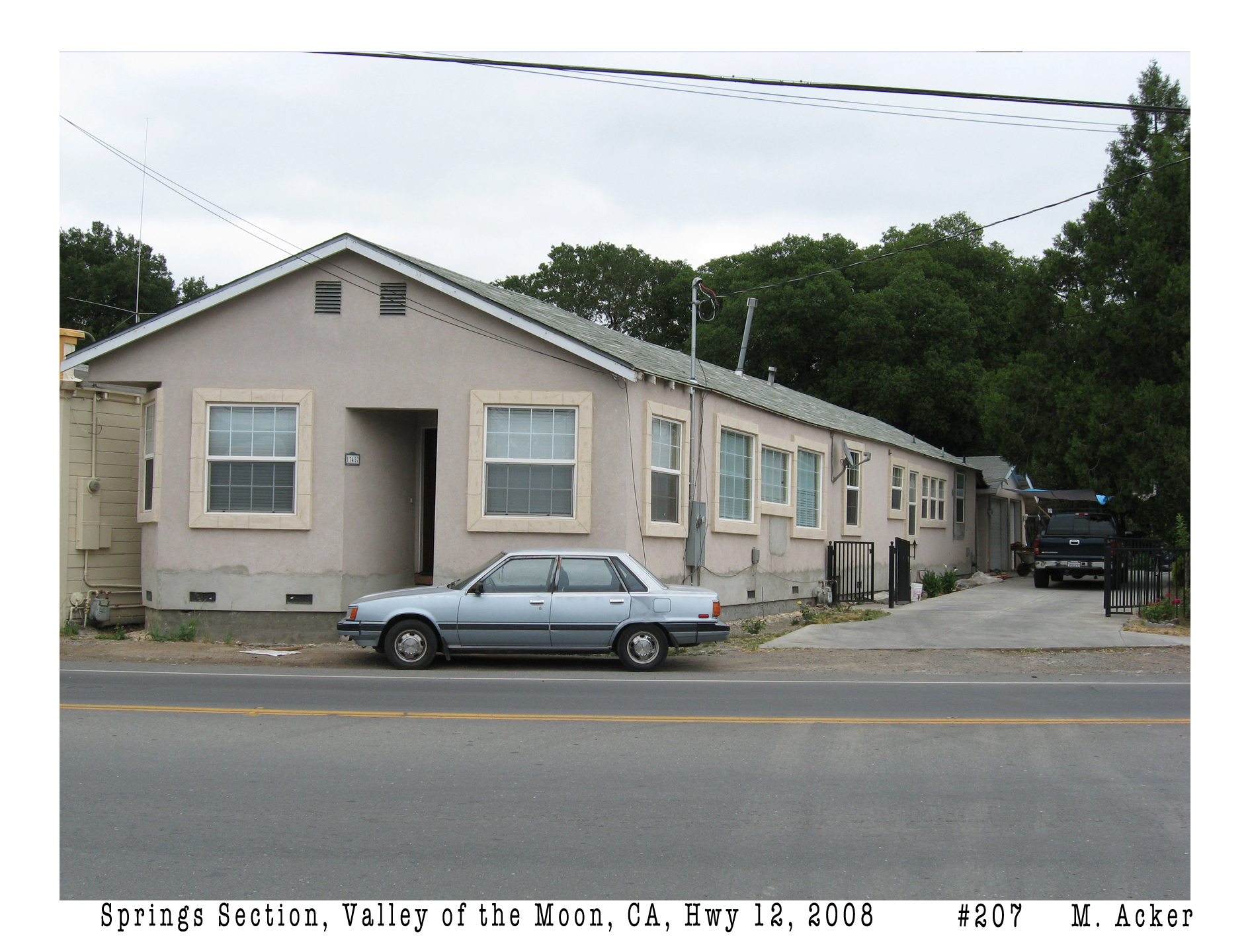
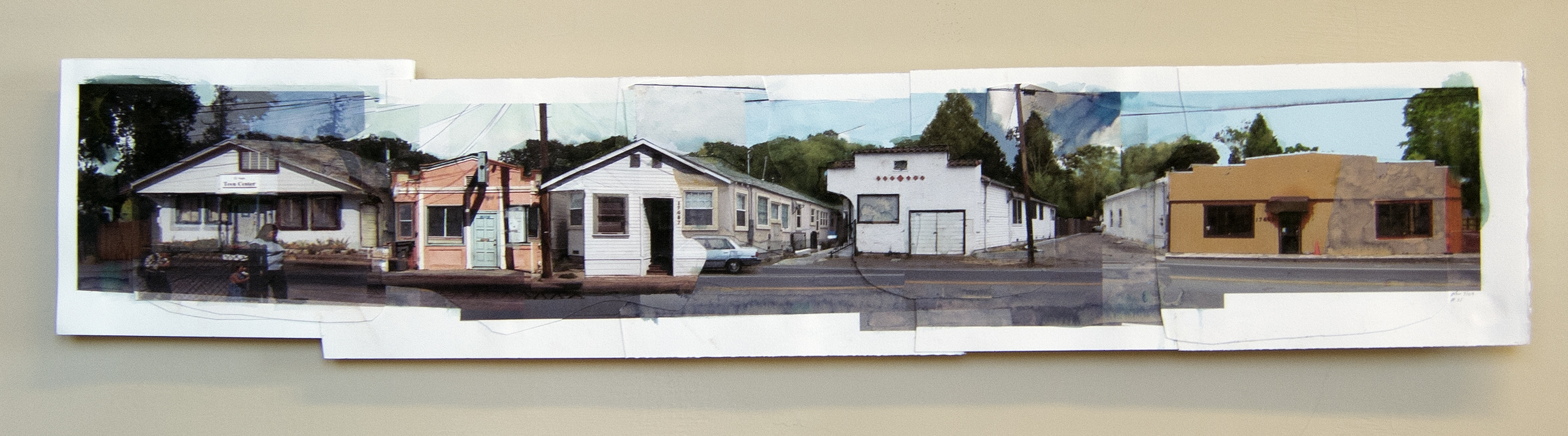
In 2008 I created the Valley of the Moon Main Stem Photo Archive in order to preserve for future artists and historians and folk in general, a snapshot of what the two-mile stretch of highway looked like. It contains over 400 photographs. I donated a copy to the Sonoma County Library and the Sonoma Valley Historical Society, in digital form and on paper.
August 29, 2024From the Valley of the Moon Main Stem photo collage series. Painted photo collage on watercolor paper. 40″x9″. Michael Acker 2009
Index Tribune, first photo, and Historic Resource Reports courtesy of the Sonoma Valley Hisotrical Society. Many thanks to Joan Lounibos for research.
UPDATE! Historian and writer Joan Lounbous contributes this essay detailing more about the Cazes and Prohibition in the Valley. Thank you Joan for the wonderful research and writing:
JEAN MARIE CAZES (1867-1941) –Resort Owner and Bootlegger
Jean Marie CAZES was a wine loving Frenchman who wasn’t going to let a few raids get in between he and his wine glass!
In October 1925, Jean Marie Cazes’ Maison Doree resort in Fetters Springs, just north of Boyes Hot Springs and our El Verano, was raided by the Feds—again: “57 Varieties—Not Pickles—Raid’s Loot. ”If you don’t see what you want, ask for it,” was apparently the slogan of Cazes, resort owner of Sonoma Valley, according to County Detective E W Westphall. Cazes’ bar contained the 57 varieties, more of less, according to Westphall—and he didn’t mean pickles, though it might be called a pickling stock. The detective, leading a squad of county officers, gave out the following list of assorted liquors seized in a raid yesterday: 21 gallons of White Wine, 10 quarts of Red Wine, 2 quarts of Port Wine, 1 quart of Sherry Wine, 1 quart of Vermouth, 2 quarts of Berry Cordial, 1 quart of Creme de Menthe, 1 quart of good Scotch, 1.5 quarts of Jackass. The liquor, which was contained in 30 kegs of various sizes, was hidden all over Cazes’ little resort building, opposite the site of the former Fetters clubhouse, according to Westphall. Cazes will be arrested Monday and is to appear before the local justice court. “ [The Press Democrat Sun, Oct 18, 1925 ·Page 4]
Jean Marie CAZES was born on 16 APR 1867 in Nestier, Bordeaux, France and died on 28 Feb 1941 in Fetters Springs, Sonoma, Valley. He and his wife, —Genevieve Batistine BÉGUÉ m CAZES. (1878–1970) who was born on 8 June 1878 in Hèches (Section de Rebouc), Hautes-Pyrénées, France and died in 1 June 1970 in Fetters Hot Springs, Sonoma Valley, California, —had arrived in the Valley about 1915—just as the our Aunt Annie Lounibos Chauvet (1872-1960) and her brother, our grandfather, Jean Baptiste Lounibos (1873-1929) were losing their own vintner family. (Germain Charles (1870-1913), Jean-Pierre (1840-1917) and Paul Emile (1876-192). Tuberculosis took the brothers, while some say their father died from the shock of Prohibition looming over their heritage.). Our Grandfather Jean Baptiste did not test the Feds, especially since he had a large family to support, and by 1919 he had already closed the Pioneer Liquor Store on Main Street in Petaluma, and opened the IXL Hatchery located on Baker Street, behind their 519 Upham Street home. But he did always keep a keg of Brandy in his cellar.
It is difficult to imagine what Prohibition did to a place like our Valley of the Moon, but Jean Marie Cazes’ story gives us a glimpse into how the wretched Volstead Act played out in a region whose heritage and primary industry had always been the cultivation of the vines—all thanks to a hint from historian Mike Acker of the Springs Museum which proved to open that glimpse into The Valley through those long years of Prohibition. Jean Marie and many of his fellow Frenchmen and neighbors in the valley did not let Prohibition stopped them in their lifestyle. And through the 1920s the Federal agents of the county visited them at least annually. By 1922, the Resort owners of The Springs were already labeled as “notorious” in their operations. [The Prohibition era Jan 17, 1920 – Dec 5, 1933 was the period when the United States prohibited the production, importation, transportation, and sale of alcoholic beverages.]
As the Turks were attempting to re-gain their foothold in Europe by pushing into Constantinople, on the World front, the San Francisco Journal and Daily Journal of Commerce announced in adjacent headlines that the “Police Campaign Against Bootleg Liquor Is Begun.” Their aim was to raid and close several well-known spots in the City flagrantly violating the Prohibition laws, but also notorious bootleg resorts in Sonoma Valley: Deputy Director C H Wheeler began the investigation into the case of a blind and partially paralyzed man who was found wandering in the neighborhood of San Francisco Hospital. When discovered, he had on his person twenty-four small bottles of wood alcohol whisky which he is believed to have been drinking. (Wood alcohol whisky will cause blindness.). Twelve others were also arrested on this day. Also ordered was the destruction of 625 quarts of “home brew” seized at the Phoenix Bottling Works in Guerrero Street since the bottles were exploding in the government warehouse. Another fellow was arrested for transporting liquor in his automobile. He was fined $150 and his machine was confiscated. By the time they got to the Valley resorts, George Darling of Darling’s resort in Boyes Springs, E Peters of Cabinot resort in Boyes Springs, our Jean Marie Cazes of Maison Doree in Fetters Springs, and J Moore of Shamrock Sun resort in Fetters Springs—were also arrested. [Sep 16, 1922]
The following year, we see that “a fine of $250 was paid by Jean Cazes of Fetters Springs when he appeared in the justice court at Glen Ellen—charge of violating the county Liquor ordinance. ALSO, B Mori–same. [Santa Rosa Republican Feb 14, 1923]
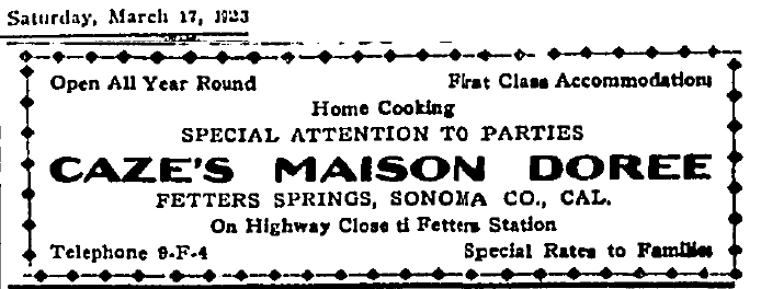
The following year in February 1924, it appears that Jean Marie Cazes was ready to throw in the towel. He is selling lots in Agua Caliente Park, and The Maison Doree is advertised For Sale as well. “Spend your vacations in Sonoma Valley. Two blocks’ walk to station, baths and all amusements. Meet parties at station by appt. Excellent home cooking. Rates $14 per week. JEAN CAZES Prop. Phone 4-F-3 Fetters Spring, CAL.” [Oakland Tribune Jun 22, 1924] But it was only a lease he obtained: “Mr and Mrs Jean M CAZES proprietors of the French resort near Agua Caliente, have leased the property to Domingo Rovigna of South San Francisco, for two years with an option to buy—for $13,000 during lease.” But again, while the two men were celebrating their new transaction at the resort, “the Feds dropped by to pay their respects.” Domingo Rovigna, who purchased Maison Doree, Fetters, last week from Jean Cazes, was charged $300. [Press Democrat Mar 13, 1924 and Petaluma Argus-Courier Mar 28, 1924]
Remarkably, Jean Marie Cazes is also filing papers for his Naturalization (Citizenship) at the same time. Two days later, he is again raided at his resort: 57 Varieties–Not Pickles–Raid’s Loot. “If you don’t see what you want, ask for it,” was Cazes slogan in the bar. Confiscated from stash holes throughout the resort were: 21 gal White Wine, 10 gal Red Wine, 2 qts Port, 1 qt Sherry, 1 qt Vermouth, 2 qts Berry Cordial. 1 qt Creme de Menthe, 1 qt Good Scotch, 1.5 qts Jackass. [ Press Democrat Oct 18, 1925 ]. His fine, this time, was $250 paid four days later when he appeared before M T Vaughan in Santa Rosa.
In 1928, the “Drys again attempted to clean up the Valley, raiding six resorts: Joe/Rose Udvic-Our Resort-El Verano; Jean Cazes–Maison Doree-Fetters, Matthew Bock-Quick Meal Lunch Counter-Fetters; Roy Burchane-Stone House; Carl Steffan-Caliente Villa-; Mrs E Johnson-Italian American Hotel-all Aqua Caliente [Santa Rosa Republican May 7, 1928]. Three of them (the Sonoma Rum Trio) were hauled off to San Francisco to the US Commissioner, Francis Kroll, for selling illicit liquor. This time the fine was a bit steeper: arrested 5 May: Jean Cazes, Matt Bock, and Eva Johnson–$1000 each. All posted the fine. [The Press Democrat May 10, 1928 ]. And so it continued—Arrested last night was John Cazes, 62; he pleaded guilty to possession of small quantities beer, wine and Jackass Brandy $250–along with three others–including Louis Dueret, 28. [Santa Rosa Republican. Sat, Aug 03, 1929]
Jean Marie Cazes died on 28 February 1941, in Fetters Springs, at the age of 73, the beloved husband of Genevieve Cazes and father of Marguerite Cazes. His daughter Marguerite, by then, was married to Jess Reinking, the manager of Spreckles Golf Course, and they lived next door to her parents in Fetters.
One would like to imagine that Jean Marie Cazes’ wife, Genevieve Batistine BÉGUÉ, was removed from the bootlegging activities pf her husband—but that was not quite the case, it seems. In 1928, when Genevieve attempted to apply for citizenship, it was found that her character witness for citizenship, and their neighbor with the Quick Meals Lunch Counter in Fetters, was in jail —for bootlegging. Matt Bock was a regular associate of her husband Jean Marie, at several of their arrests for bootlegging. —“Witness for Naturalization Hearing in Jail—Matt Bock, witness for Genevieve Baistine Cazes of Fetters Springs, was recently arrested for Liquor Possession and his case is pending in the federal courts; her application was continued pending the outcome of Bock’s case.” [Santa Rosa Republican. May 24, 1928]. Due to Bock, May Have to File Anew. If Bock is convicted–Genevieve would have to file a new naturalization application (after maybe a five year wait.). On 24 Jan 1929. She again “Loses Citizenship Application—Bootlegger Bock as Witness. Her application was dismissed without prejudice. She must now wait five years to begin application process again–due to character witness Matt Bock who was found guilty of liquor possession.” [Santa Rosa Republican. Thu, Jan 24, 1929 ·Page 8]
Even after the repeal of Prohibition, Genevieve was getting herself into trouble. “Complaint charging Genevieve B Cazes, who operates a beer parlor at Fetters Springs, had distilled spirits “with intent to sell.” Only has a beer license. ALSO–Four more stills seized in Valley. [Santa Rosa Republican. Tue, Feb 18, 1936 ·Page 5]
Three years later, when she again tried to apply for citizenship (Naturalization) she drew the ire of Judge Comstock: “Widely known Sonoma Valley woman, Genevieve Cazes of Fetters Springs, wife of a resort owner—was insistent she had never run afoul of the law. Her false statements were confronted by Judge Comstock with evidence—of two arrests. Application was continued. [Petaluma Argus-Courier Jan 19, 1939]. Eighteen months later she applied again and was confronted, again,—this time by Judge Geary: “Judge Geary denied application for citizenship by Genevieve Cazes due to false information on her application that she had never been arrested. She was warned to tell the truth when she fills out new application next year. Geary warned her that “the truth is one of the first requisites of citizenship.” She may file again next year. [Santa Rosa Republican. May 11-12, 1939]. Genevieve was finally admitted to citizenship in Nov 1942 by Judge Geary.
Four years later, Genevieve re-married, on 7 May 1946. “Justin Coulier, 59, of Sonoma, and Genevieve Bastistine Cazes, 63, of Fetters Springs.” “Widely known residents of Sonoma Valley are Mrs Genevieve B Cazes, Fetters Springs, and Justin Coulier, Sonoma, who has operated a resort near Sonoma. The bride, a widow, is conducting a cafe and resort once conducted by her former husband. [Press Democrat May 8, 1946]
Justin Coulier had been a Hotel Keeper (Hotel Arno and Hotel Idora) in San Francisco prior to his move to Sonoma in about 1923 with his first wife Marie Delbruc (1886-1942) They had purchased the old Maurel Villa (formerly owned by the late John Maurel.) In 1933, we see them developing an artesian well on the property which was located on a lane opposite Sonoma Valley High School. The well was said “to have sulphur qualities.“ The new proprietor, Justin Coulier, says the artesian well has wonderful flow—like the waters of The Springs section of Sonoma Valley. Fountains, pools, and bathing are contemplated. [Petaluma Argus-Courier Feb 09, 1933 from Index-Tribune]
Justin lists his profession as Farmer in the June 1940 Census, but in August 1940, we read: “Brandy Still Seized at Sonoma, when the Feds raided the ranch of Justin Coulier on a lane opposite Sonoma Valley High School, south of Sonoma. They discovered there a 5 gal still and untaxed brandy. Pleaded guilty-$100 fine or 50 days jail. [Petaluma Argus-Courier Thu, Aug 15, 1940]
So—when Genevieve Batistine BÉGUÉ w’d CAZES married Justin COULIER in 1946, we see that she was continuing on with her numerous bootlegging associations. Justin did not last long though, dying in Sonoma on 10 Jan 1950 at the age of 62. Genevieve lived on for another twenty years, still working at her Cazes’ Maison Doree Restaurant (French and Italian Dinners) in Fetters Springs. She died at her home at 95 Mountain Avenue on 1 June 1970, at the age of 89 years. She had lived in The Valley for 58 years and had been owner of Cazes Maison Doree restaurant for 55 years. (Curiously, also listed near her obituary is one for Rosa Kruschwitz, 86, also of 95 Mountain Avenue in Fetters Springs. A native of Germany, with one daughter Freida Hagan. Rosa had lived in Sonoma Valley for 49 years. Living at the same address with Genevieve, Rosa had died the day before Genevieve.) [JAL Sept 2024—with special thanks to Michael Acker, Artist and Director of the Springs Museum in Sonoma Valley. Mike has written further information of Jean Marie Cazes, especially regarding his earlier life, in a biography posted in August 2024 on The Springs website]
This is not meant to be an exhaustive survey of everybody who ever photographed in Sonoma Valley. (Here I’m focusing on the resort towns of Boyes Hot Springs, Fetters Hot Springs, Agua Caliente, and El Verano.) That will have to come when we mount an exhibition on the topic at the Sonoma Valley History Museum in Depot Park.
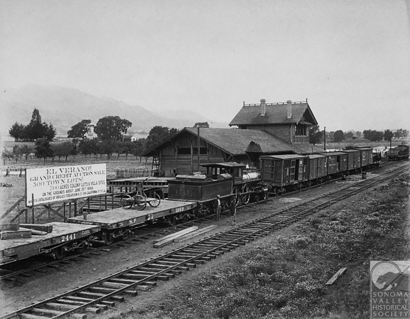
“Grand Credit Auction Sale, 500 Town Lots!, 700 Acres Colony Lots and Villa Sites” says the sign.
Carleton Watkins
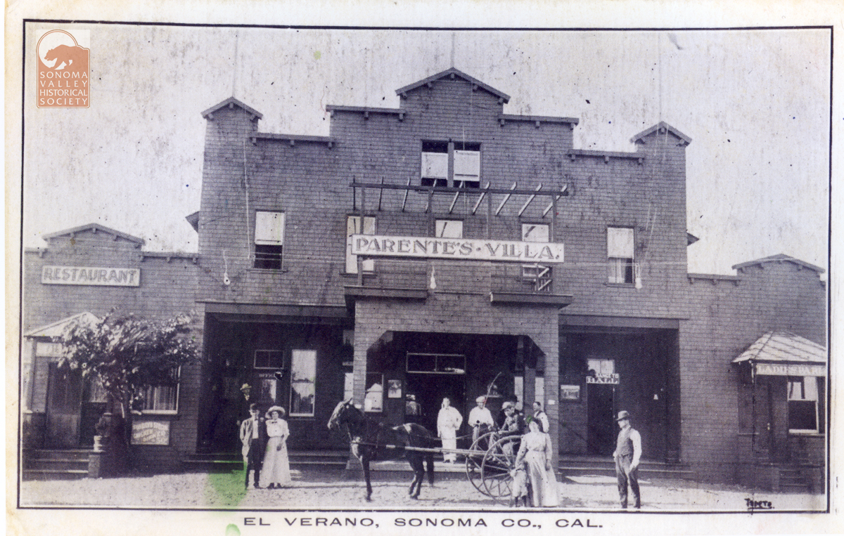
Probably the most noted photographer to document a part of the Valley was Carleton Watkins (1829-1916), who was engaged in 1887 by George Maxwell to make a portfolio of images as a tool to help sell land in El Verano. A great deal of hubbub was created touting this tract. Free trains excursions from San Francisco were offered to potential buyers. Streets were platted and an elaborate map was issued. The land boom collapsed, however; money was lost, and only a few streets remained, until El Verano pulled itself up by its bootstraps again. There was almost nothing there but fields, oak trees and a few farms when Watkins visited El Verano. The railroad was the most important thing happening. See the El Verano Historical Society for more images.
Postcard Photographers
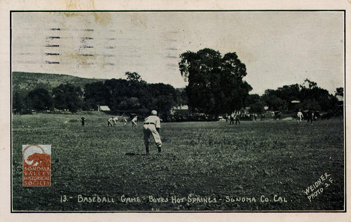
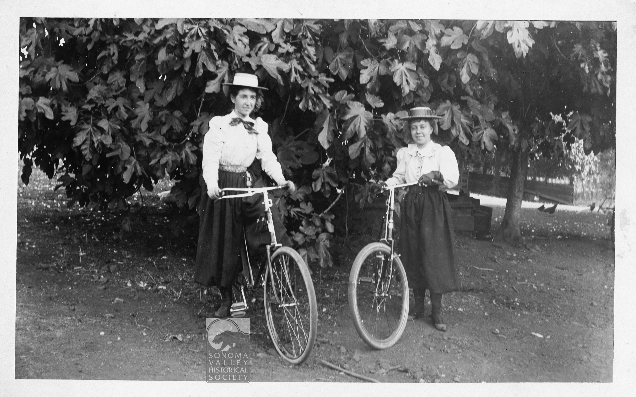
Agua Caliente, Boyes Hot Springs, and El Verano, sometimes known as The Springs, in the unincorporated part of the Valley of the Moon, California ( adjacent to Sonoma), has been a resort destination since the 1880s. People went there (and still do) on vacation, to take the waters and bath in the sun. Tourists like to have photographic memories of their joyous time, so many photographers published postcards of the resorts and people enjoying them.
The names of the photographers are mostly known. The stories behind the names are known for some and some are obscure (as of this writing.)
The production of resort postcards got going in earnest in the early 20th century. The prominent photographers were Charles Weidner, C. A. Payne (also publishing as Art-Ray), Peck, Topete, and Alexander (Zan) Stark. We have a lot of biographical information on Weidner and Stark, thanks to Frank Sternad of the San Francisco Bay Area Post Card Club. The others are more mysterious.
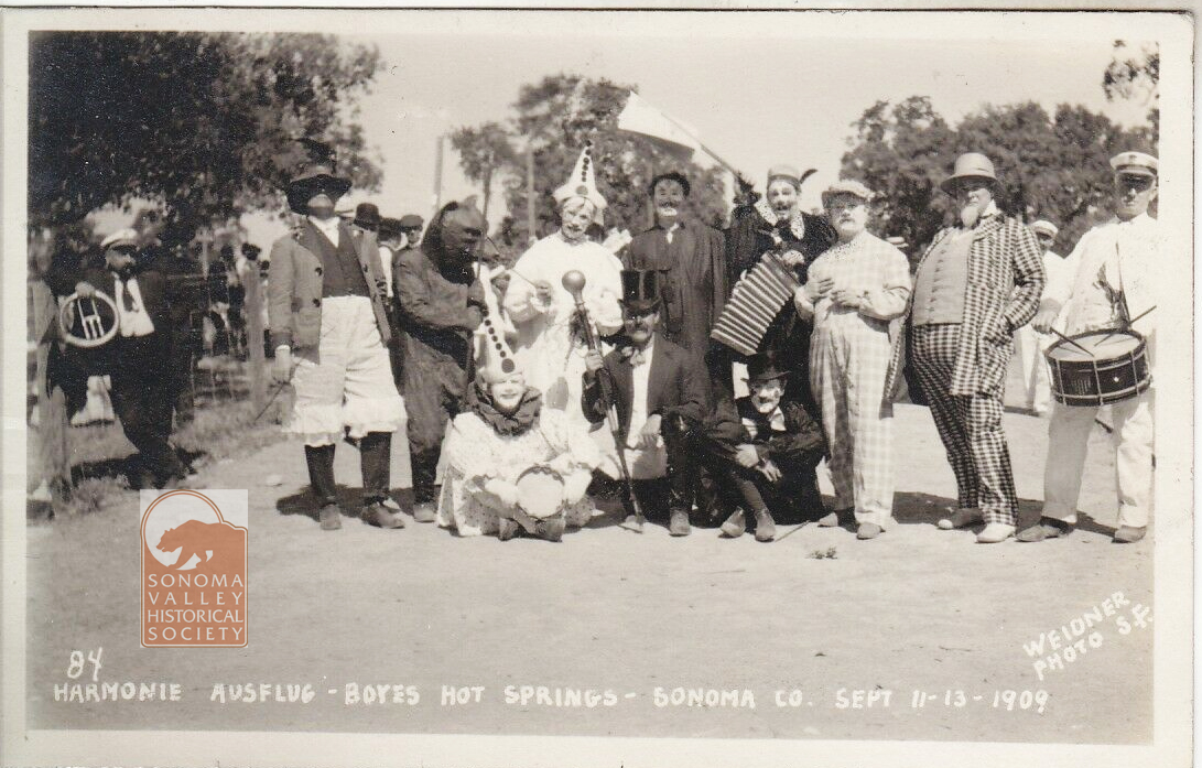
Charles Weidner was born in Germany in 1867, came to the United States in 1888. By 1891 he had made his way to California. Around then he took up photography in earnest, establishing his postcard company in San Francisco in 1902. He was well known for his photos of San Francisco after the earthquake and fire of 1906, and those of Yosemite Valley. He traveled widely in Northern California, spending time in The Springs in the years before WW1. One of his main subject was the Harmonie Ausflug, a group of Germans in the Bay Area who made tourist excursions together, and had a jolly time from the looks of it!
Weidner retired in the mid 1930s, having produced hundreds of postcards covering many locations and subjects in the Bay Area and beyond.
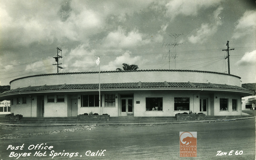
Alexander (Zan) Stark came to San Francisco from Ohio in 1914, investing in a small photo studio on Market Street. After serving in WW1, he came back to the City to resume operation of the Alta Slide and Photo Company. Alta was notable for producing photo booklets of nudes of young women, for “artistic” purposes. Several of his models were well-known silent film stars. Despite the Depression, Stark was doing well enough that in 1929 he could buy a house in Mill Valley. Inspired by his daily ferry commute to SF, he began photographing the wonders of the Bay Area, and being business man, realized he could print these as post cards and make some money. He soon began traveling farther afield, eventually making cards in most of Northern California, southern Oregon, and parts of Nevada.
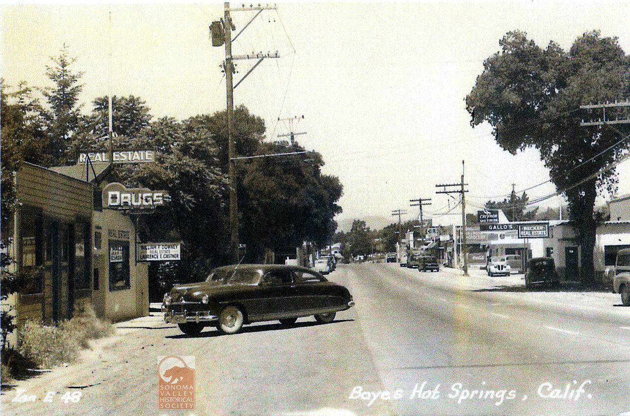
He moved to Boyes Hot Springs in 1952, to which we owe the outstanding documentation of the resorts, businesses, and landscape of The Springs, numbering at least 65 postcards.
Stark’s archive is housed at Stanford University Library Special Collections.
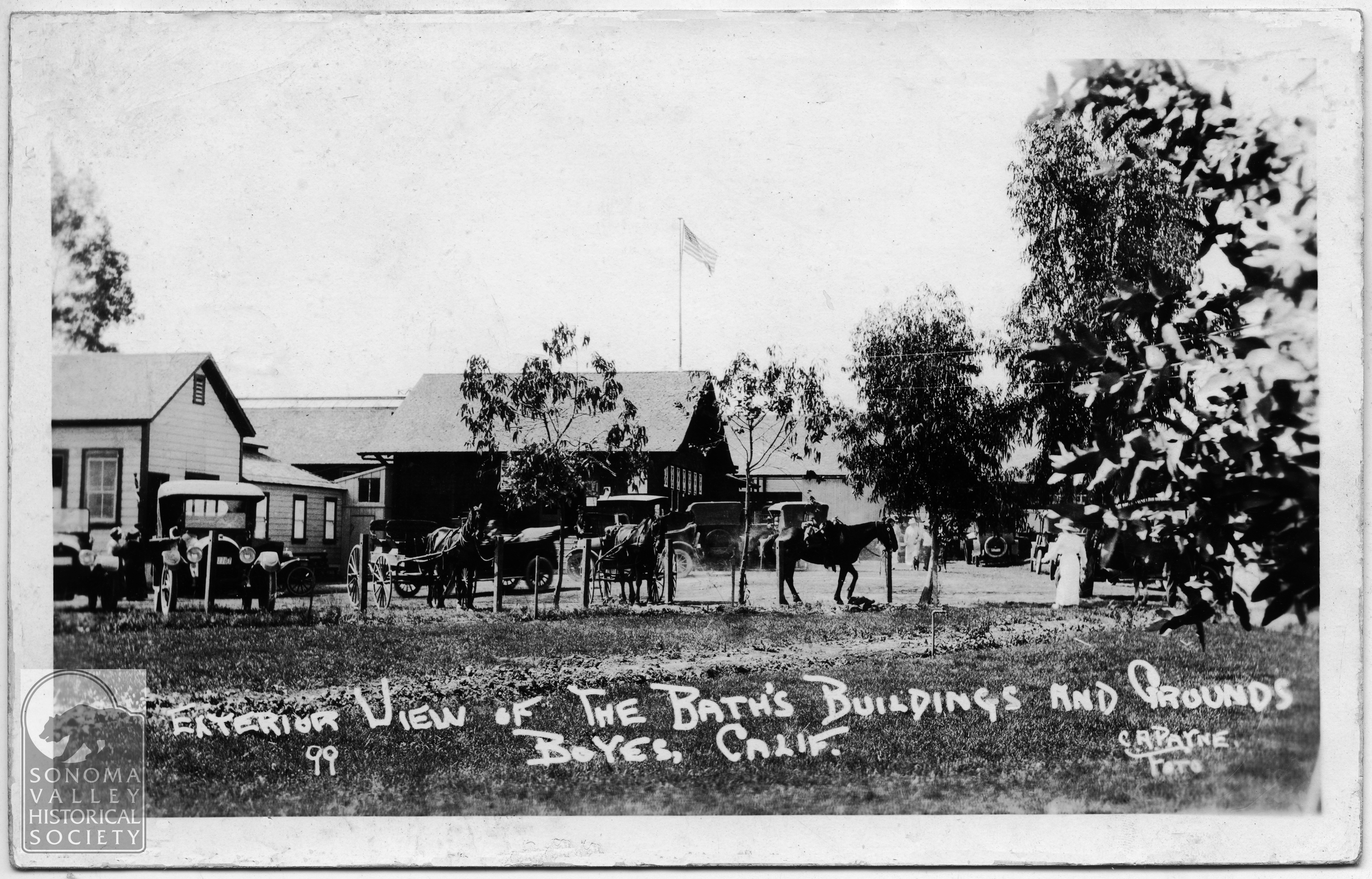
Charles and Frank Payne published under the names Art-Ray and C.A. Payne. Their home base was Crescent City, California and they covered mainly that part of the state, venturing as far south as Boyes Hot Springs, producing cards from circa 1915 to 1921.
Peck: circa 1940’s-no information
Topete-circa 1906-1912
Anonymous Snapshots
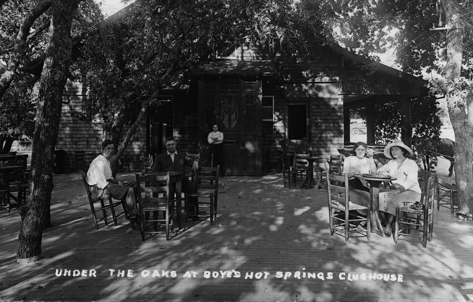
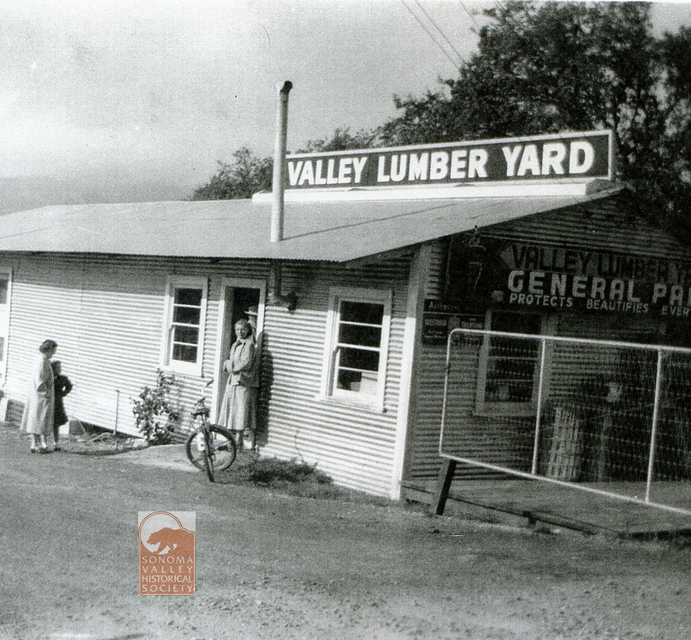
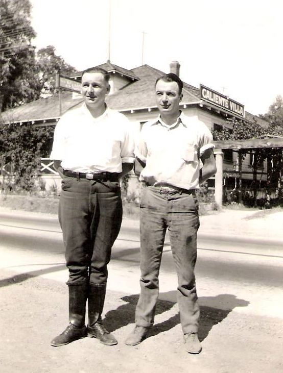
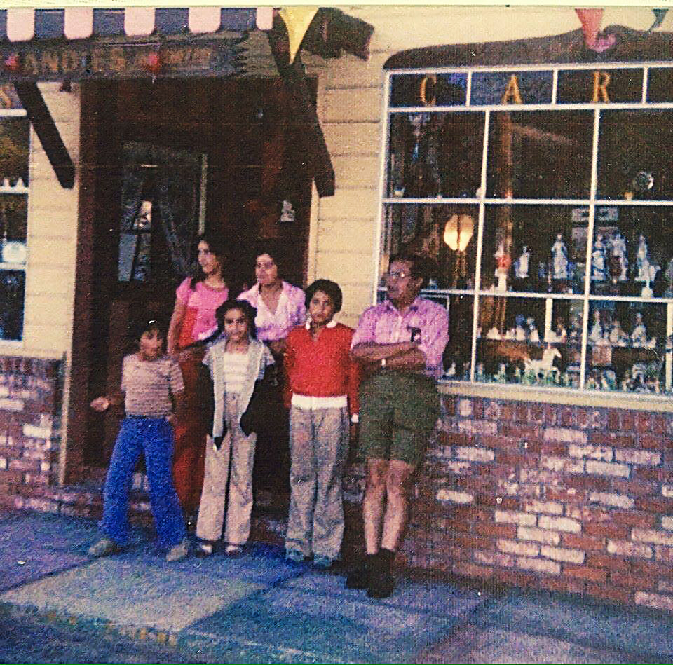
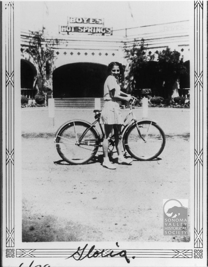
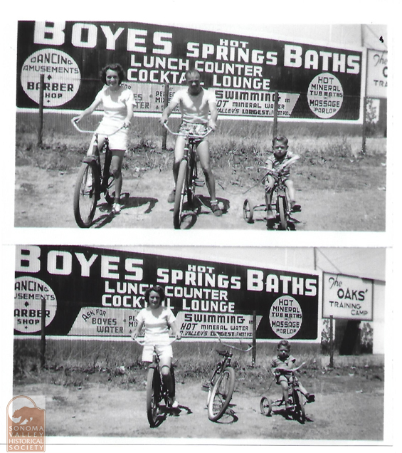
There is something precious about the random snapshots of “just folks”. The professional photographer composes, frames, and considerer the information he wants to convey. Your average person just picks up the camera and shoots, or poses family in front of interesting backgrounds. Even out of focus and out of level, these photographs are charming and are important documents.
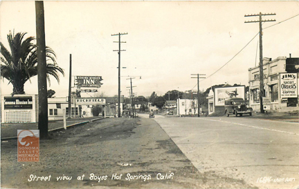
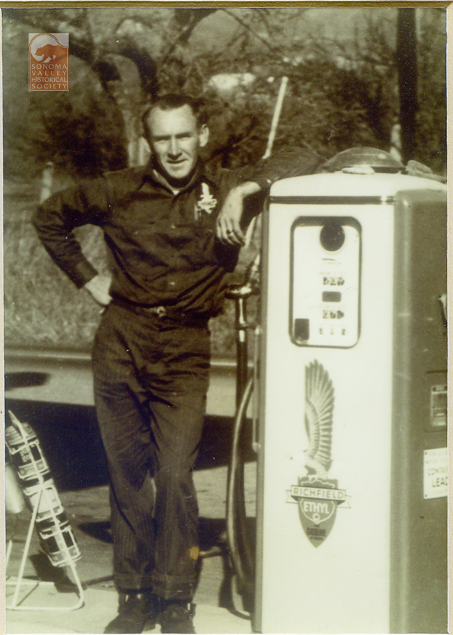
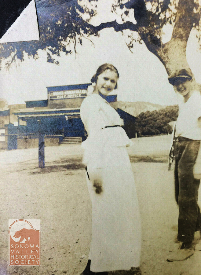
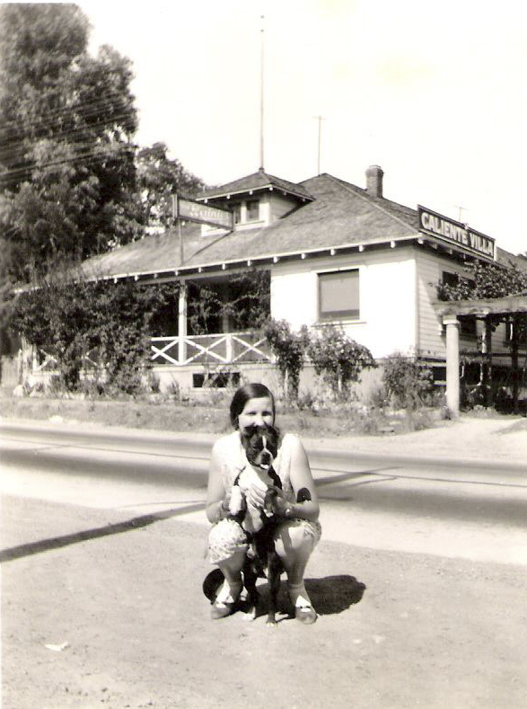
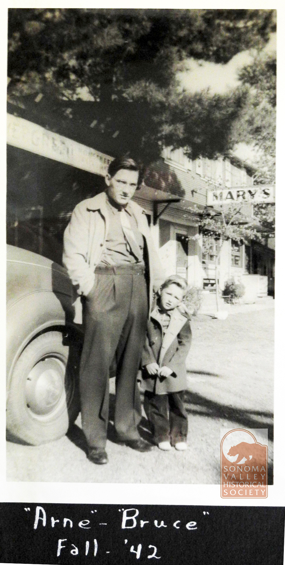
Parson’s Lumber and Hardware, 1952Jeff Gilbert’s Great Uncle Joe Costa and Great Uncle SFPD Officer Joe O’Rourke – Early 1930’s. Caliente Villa behind them-Jeff Gilbert via FacebookThe Nasso Family at their gift shop near Flowery School, circa 1960s. Via Facebook.Inscribed on the back: El Verano, 1894Carl Luhr, Nancy West’s father, at his Richfield station in Boyes, 1960’s? From Nancy, Grange membercirca 1912. Graham’s Store in background. First location of Boyes post officeJeff Gilbert via FacebookOn Pine Ave. in front of Mary’s Cottages. From Bruce Griewe.Interior of the Resort Club, 1950. Probably by Oscar Larson.1944- Dave Chiotti
Don Meachum was a commercial photographer in Santa Rosa between 1943 and 1984. His archive is at the Sonoma County Library
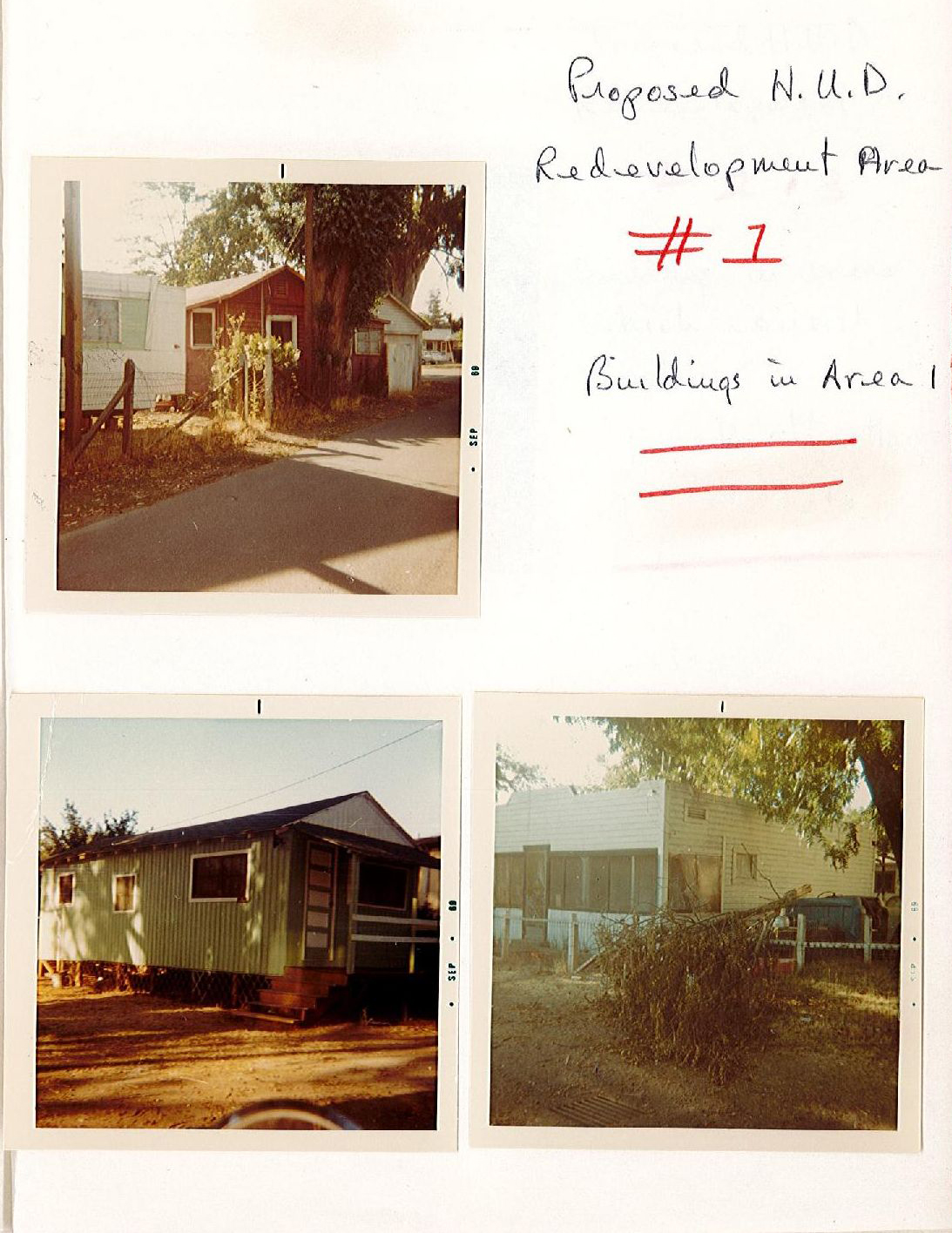
Rancho Vista Mobile Home Park, Fetters Springs, 1971
Newspaper Photographers
The area has, of course, been photographed thousands of times for stories in the Index Tribune.
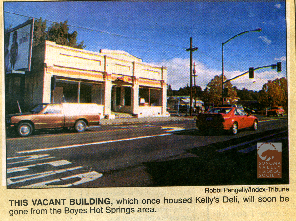
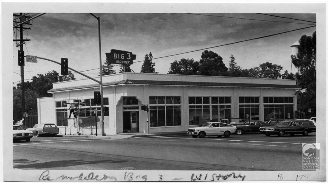
Fetters Hotel during the tenure of Juanita Musson.At the corner of Hwy 12 and Vallejo Ave, 1992. The lot became employee parking for the Sonoma Mission Inn. Everybody knows Robbi!Big Three Market, 1980. Corner of Boyes Blvd. and Hwy 12.
Miscellaneous Sources
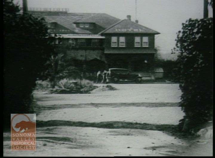
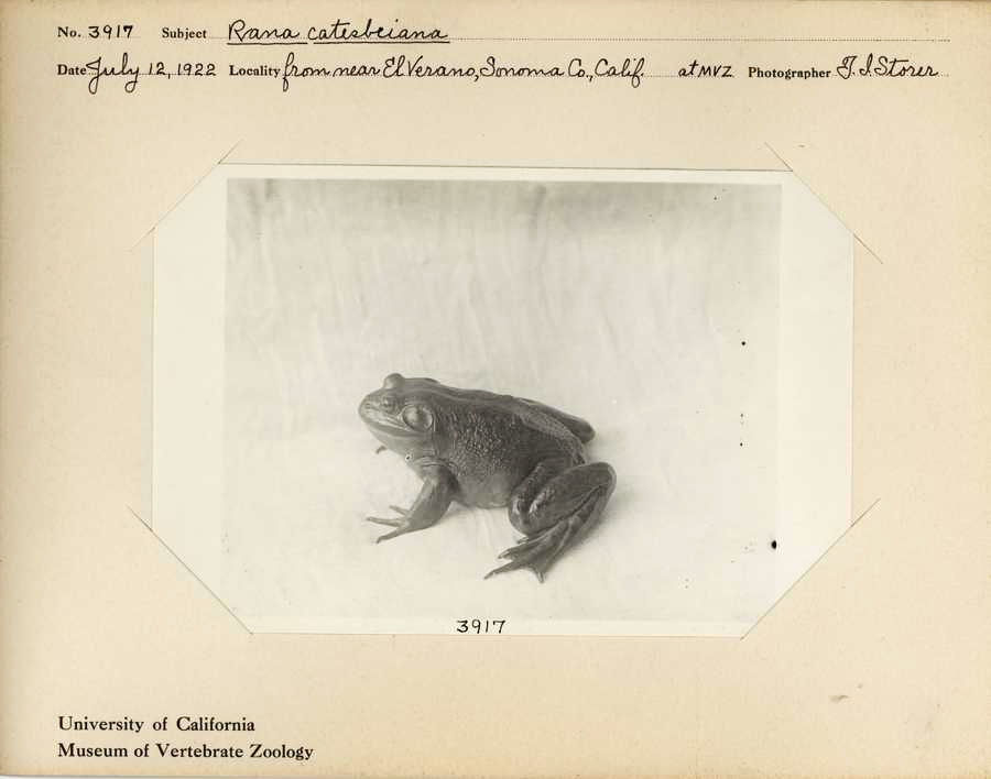
Pine Ave. County Redevelopment, circa 1986.Still from the film “Account of the No Account Count,” directed by Josh Binney, 1923, showing the Fetters Springs Hotel.You just have to imagine Storer poking around down by the creek in El Verano. In his notes he tells of coming upon two young boys selling frogs along the roadside. Biologist T. I. Storer, 1922
MIchael Acker
When I started looking for historic photos I also started photographing the same locations. What with the pace of change, it soon became apparent to me that my photos were also historic documents. And so are yours!
Public art grows in fits and starts hereabouts but we are starting to build up a nice stock of murals. Here we look at four of them.
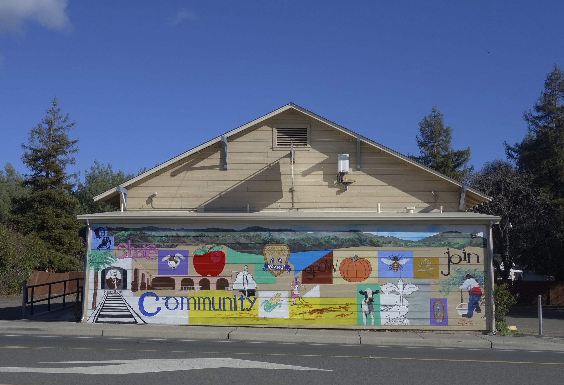
The mural on the front of the Sonoma Valley Grange building, located at 18627 Sonoma Highway. The Grange has owned the building, which was probably originally a dance hall, since 1934. See (https://springsmuseum.org/2022/06/28/the-sonoma-valley-grange-traditionchange-and-renewal/) for more about the Grange. Through the Redevelopment Façade Improvement project, the Grange got funding for the mural in 2010. It was designed by Michael Acker and painted in collaboration with Randy Sue Collins. It depicts a bit of Boyes Hot Springs and Grange history. It being on the west facing wall, it takes a terrific beating from the sun, and has been restored twice.
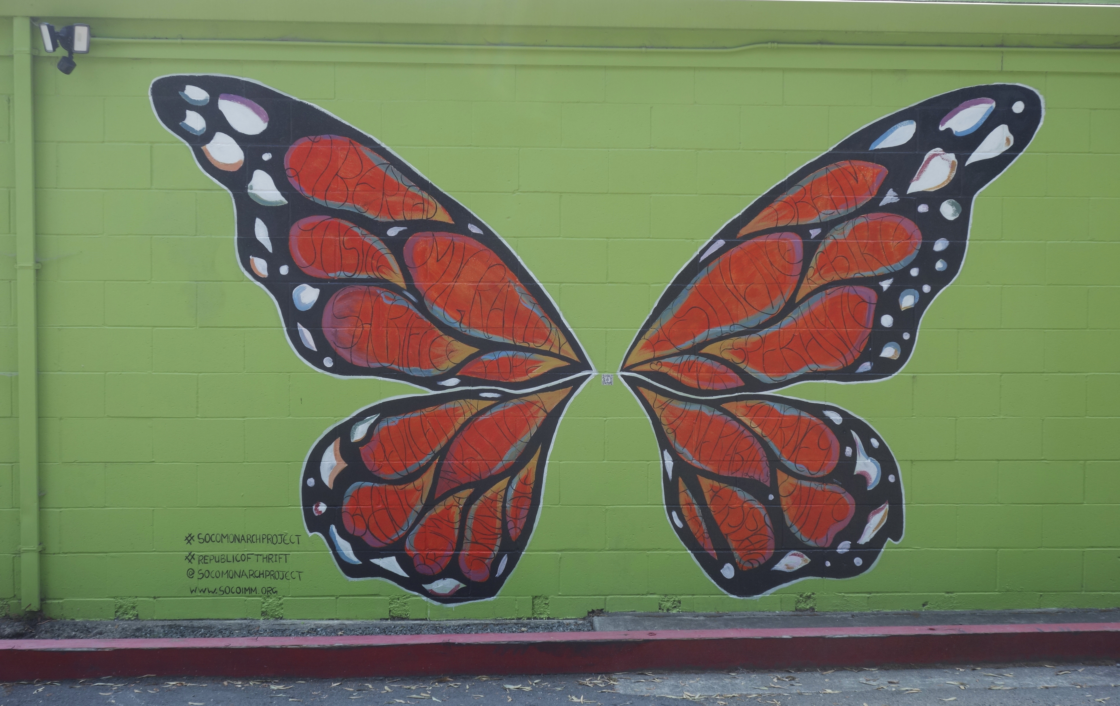
The Republic of Thrift building at 17496 Sonoma Highway has two murals sponsored by the Monarch Project (https://www.socoimm.org/) along with others. On the west facing wall is the giant Monarch butterfly, completed in June 2020. According to the Index Tribune, “Artist Rima Makaryan, just 17 years old, painted a Monarch butterfly as part of “The Monarch Project,” a Sonoma County nonprofit organization working to tell the stories of immigrants and empower the community.” “We are working to have a conversation about immigration through art,” said Makaryan. “Oftentimes immigrants are labeled aliens or talked about negatively. The goal of the Monarch Project is to find beauty in the subject.” The mural, painted on the west-facing wall of the thrift store, features a Monarch butterfly filled with words describing the immigrant experience, such as resilience, hope, amor, sacrifice and fear. Makaryan noted, “The words are meant to embody the journey and diversity of all migrants. It’s all about the beauty of the topic, good and bad.”
On the east wall a fantastical spray-paint mural by the artist Chor Boogie (https://chorboogie.com/), along with a crew of high school students was painted in 2018. the Led by Sonoma Valley Museum of Art, community partners were Artescape and La luz Center. Co-sponsors were the California Arts Council, the NEA, and the Bank of Marin.
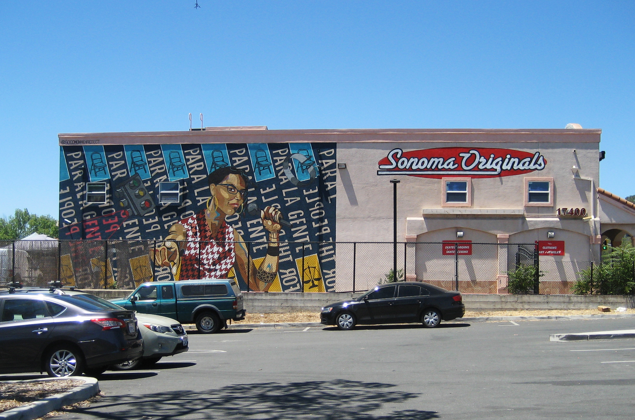
The building at 17400 Sonoma Highway displays yet another Monarch Project mural. Completed in June 2021, it features an image of Dmitra Smith, “…a powerful force fighting against racism in Sonoma County,” according to their website. “Ms. Smith is the former Chair of the Sonoma County Commission on Human Rights, and was the program manager for the Junior Commission, having mentored over 100 Sonoma County students between 2013- 2020. Smith is a co-founder of the essential workers’ mutual aid collective Food for All – Comida para Todos.”
At the time the mural was painted, the building was the home of Sonoma Originals skate shop. Sadly, it is now empty.
We actually have a lot of art in the Springs, some of it “official,” as the above are, some harder to find, personal expressions, often ephemeral, but worth noting, as we will do in future posts
Index Tribune courtesy of the Sonoma Valley Historical Society
Temporary, informal, unsanctioned, cryptic. Personal expression, job related. Faded, half-obscured.
Ephemeral and permanent.
Highway 12 through Boyes Hot Springs, Fetters Hot Springs, and Agua Caliente, California, though a heavily used commercial and residential street, had almost no sidewalks until 2009/2010. Dirt shoulders for walking was not a problem when traffic was light. Even at the height of the resort era (1950s), people would ride horses down the middle of the highway. That’s how quiet it could be.
Starting in the 1980s, locals started to agitate for a safer road. They wanted sidewalks and streetlights. Along came Redevelopment to provide the funds. Part of the project was completed by 2010 (a good twenty five years after agitation began). Redevelopment was abolished by dear old Jerry Brown. Thanks Jerry! The project languished. Finally, the Sonoma County Board of Supervisors came through with the money to finish. Thanks Susan Gorin!
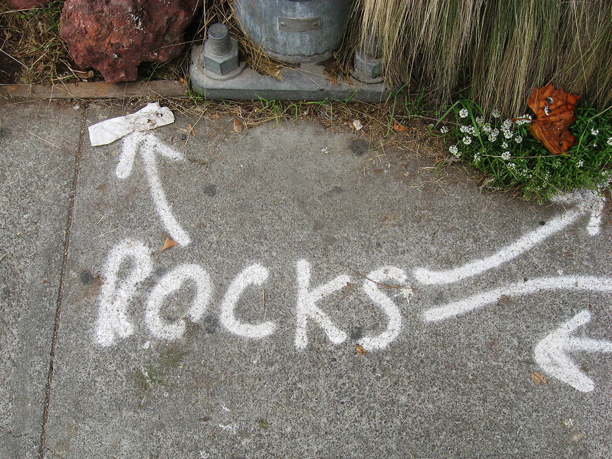
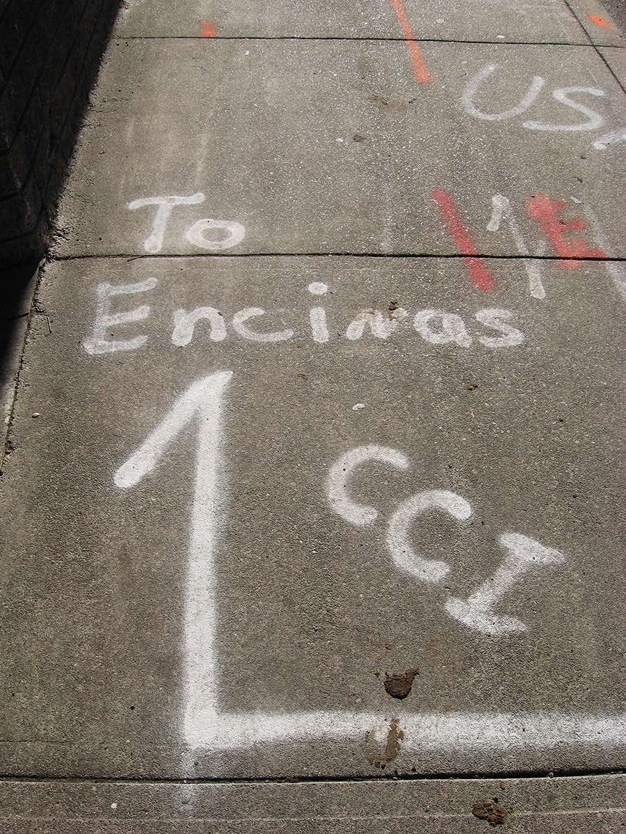
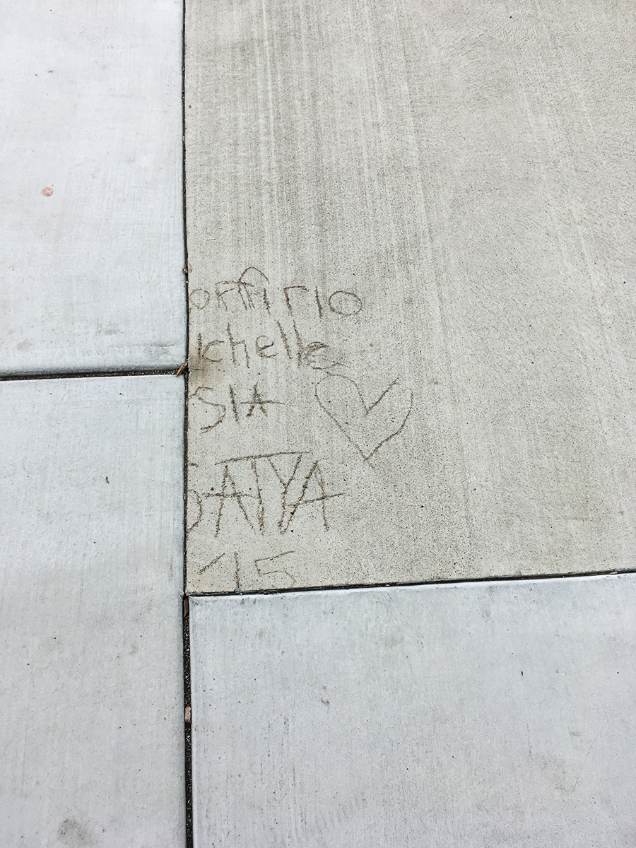
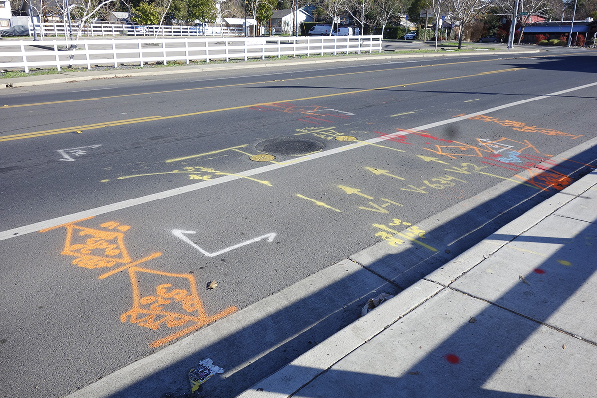
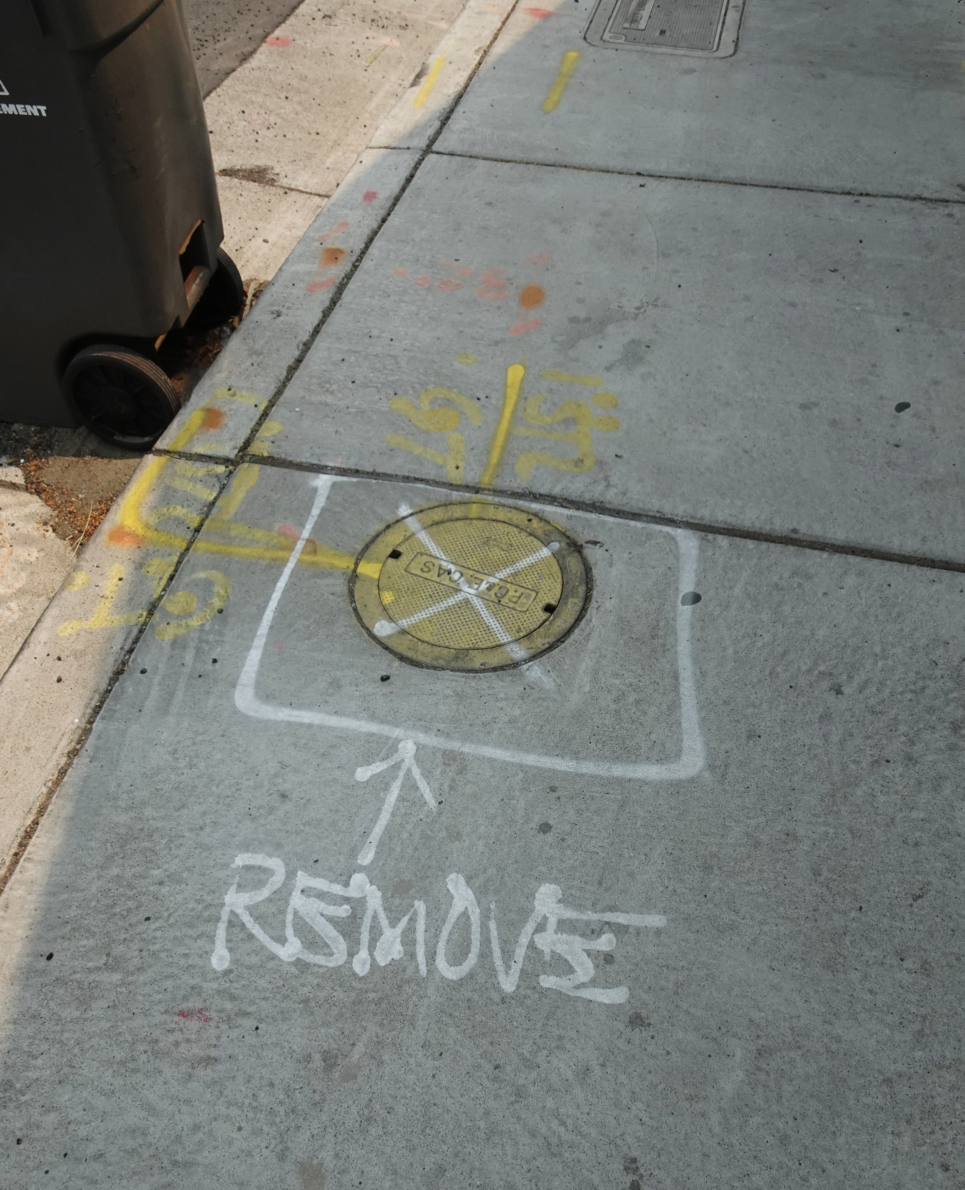
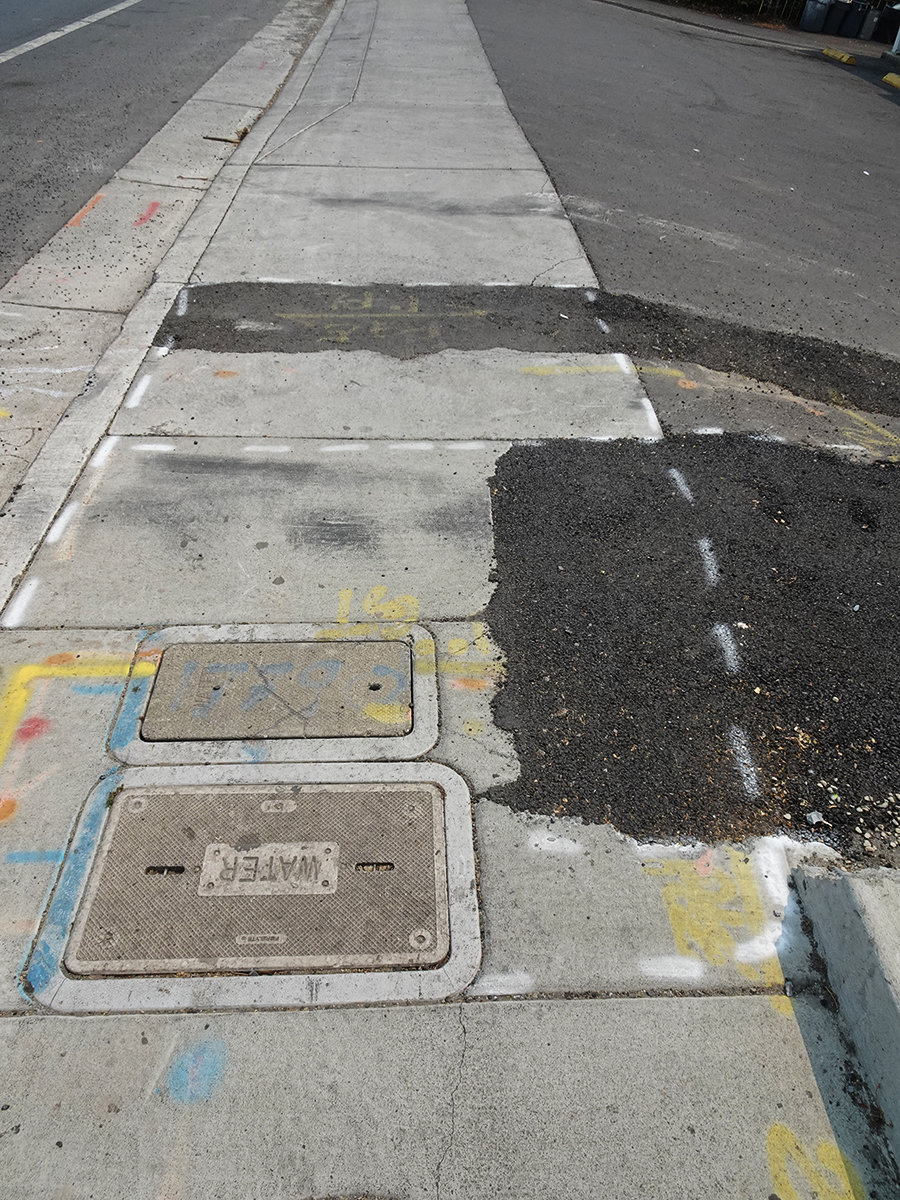
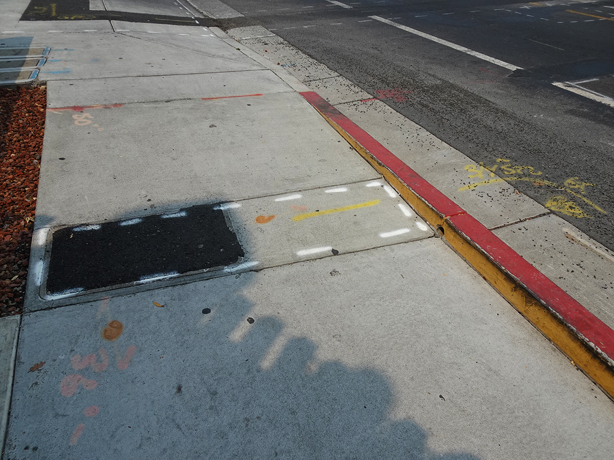
The following is a collection of street markings from before during and after sidewalks were installed. Some are the ephemeral spray paint graphics of the contractors, which can be interesting. The more enduring marks are by the people who happened to walk by when the concrete was wet. These are also interesting, even poetic at times. One example is pure nature.
2008-Before demolition started a lot of marks went down. Why was it necessary to point out the rocks?
2009. Underground Service Alert (USA) finds all the pipes and wires and marks the surface. Not sure what “CCI” stands for.
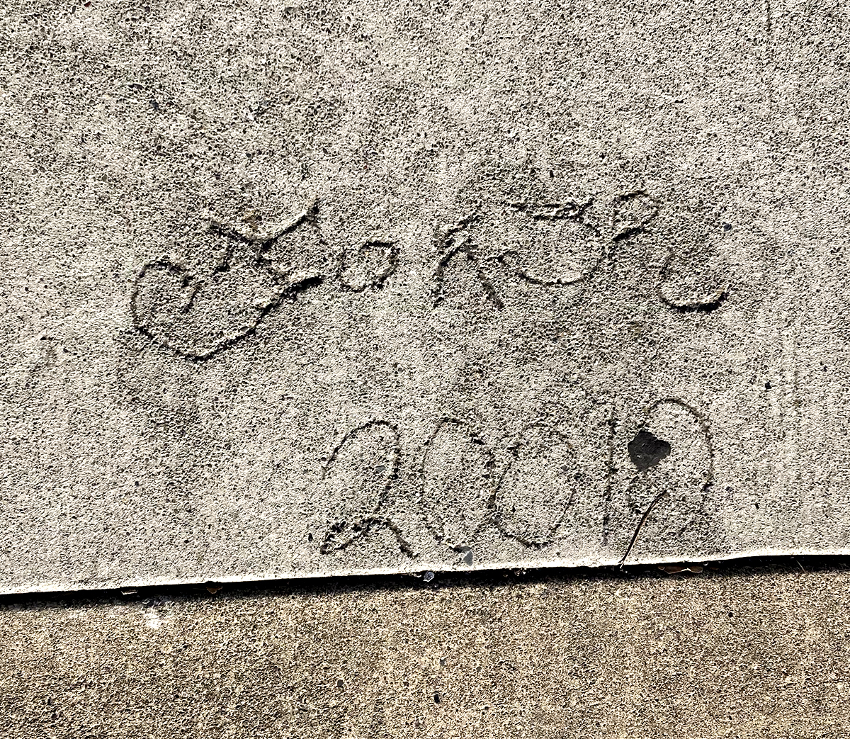
2010 or “20010”. Our first folk marks! It’s an ornate tag that is hard to read.
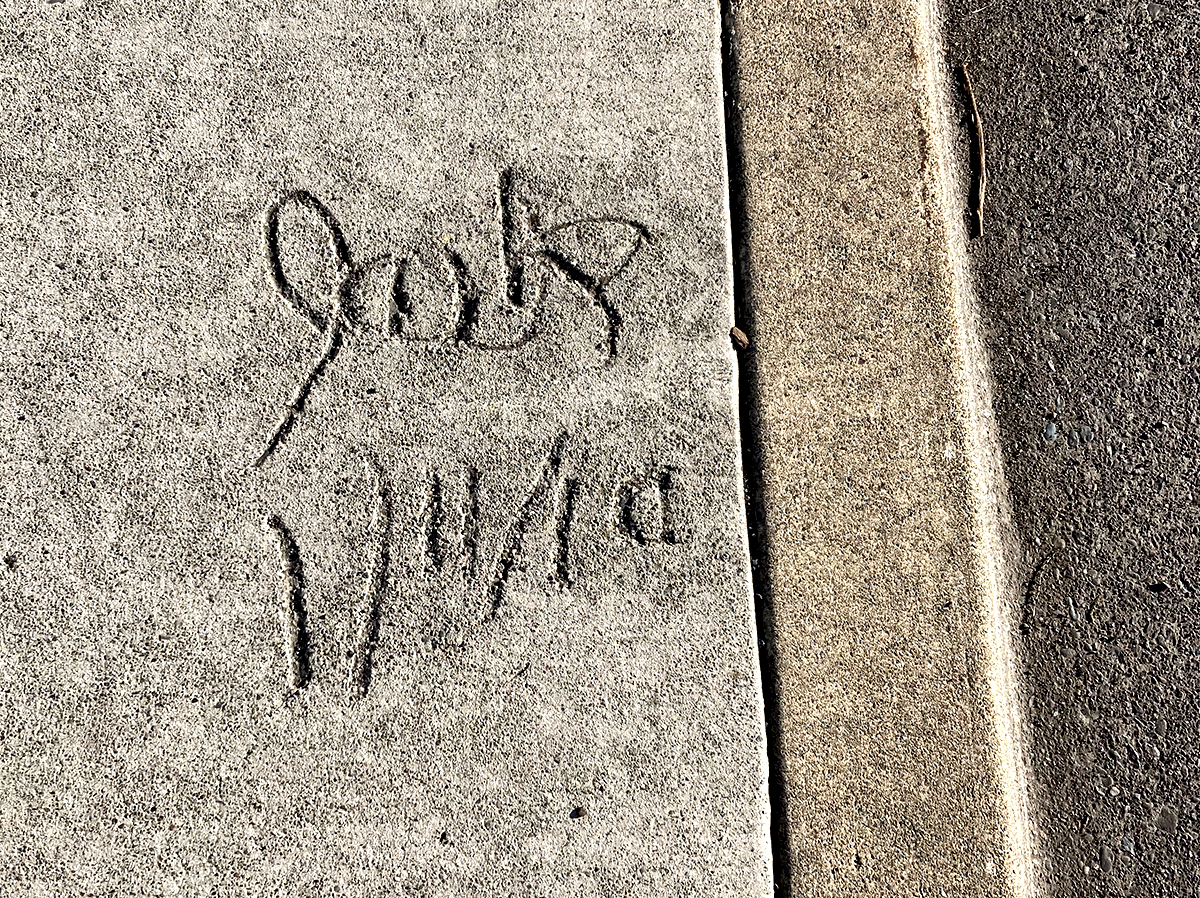
Jack has helpfully given us the day, month and year. I hope he went on to a career as an archivist.
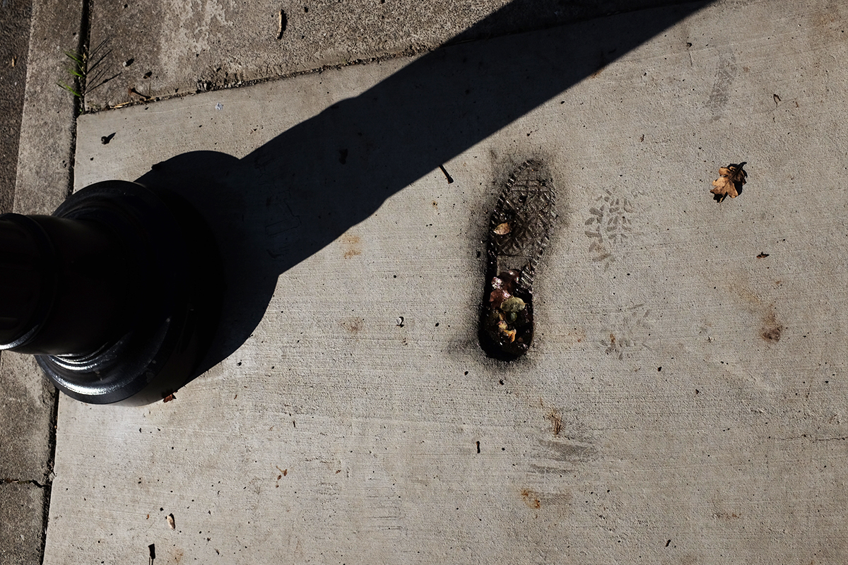
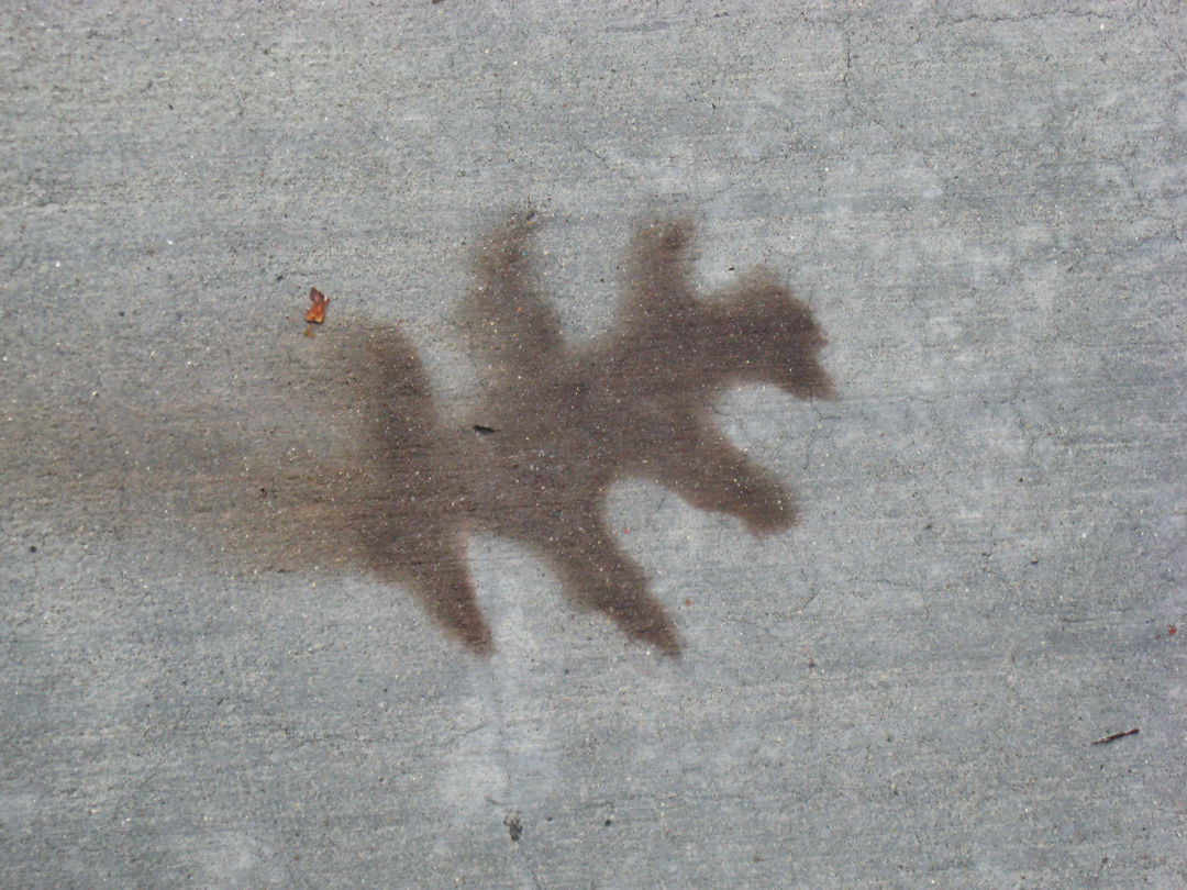
2016. Phase Two. The only actual footprint, gracefully holding leaves and water.
Year of mark unknown, but Phase Two. Someone is trying very hard with the use of a stencil. Is he offering free samples of tagging? Do people pay for tagging?
2019. Right after Phase Two was completed, some corrections that necessitated new concrete were needed. It looks like the left portion of this group of signifying friends was cut off.
In 2021 PGE had some business under the pavement. This tells you all about it, if you could only read it.
2021/ Nobody’s perfect!
2021. This one and the next two offer lush compositions of black and gray featuring inscribed and spray-painted lines and hard and soft textures.
2021. The lines, the colors, the textures, and, the shadows!
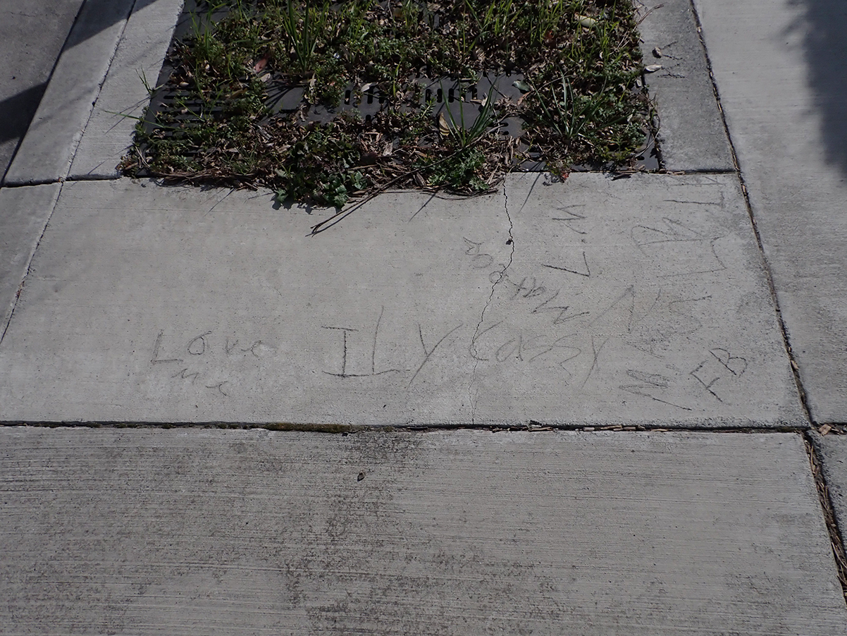
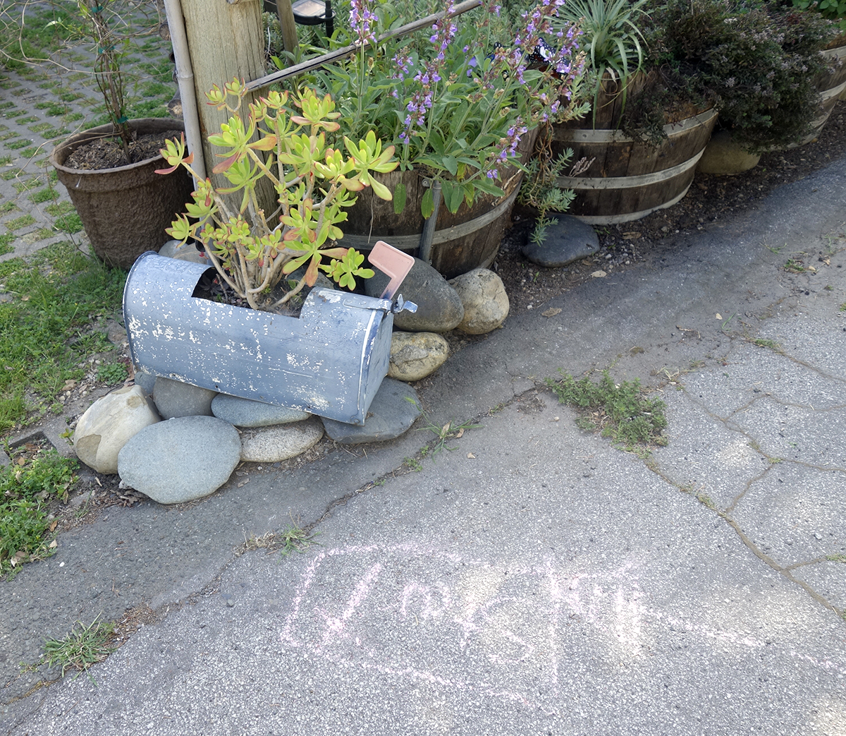
Photographed in 2023, actual date unknown, but Phase Two. “Love me.” “ILY Cazzy.” “Mateo.” “FB, LM”
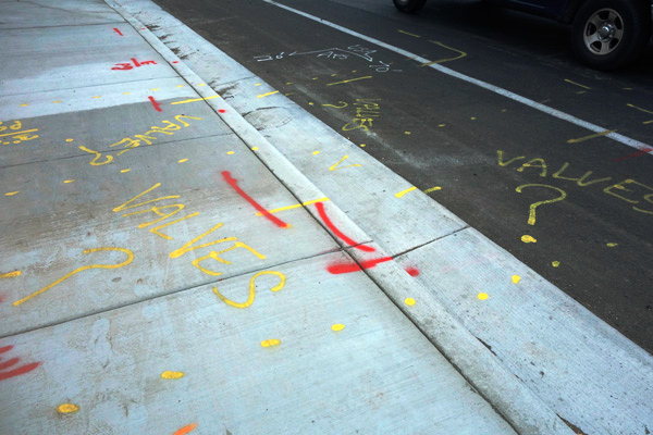
2021. Dude! Where’s my valves!
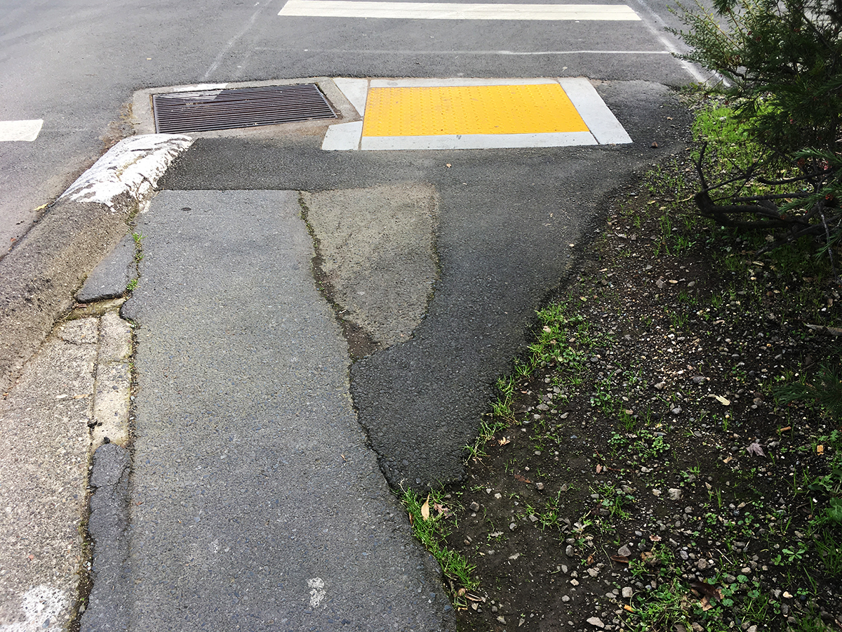
A bit off the highway, but such a lovely composition!
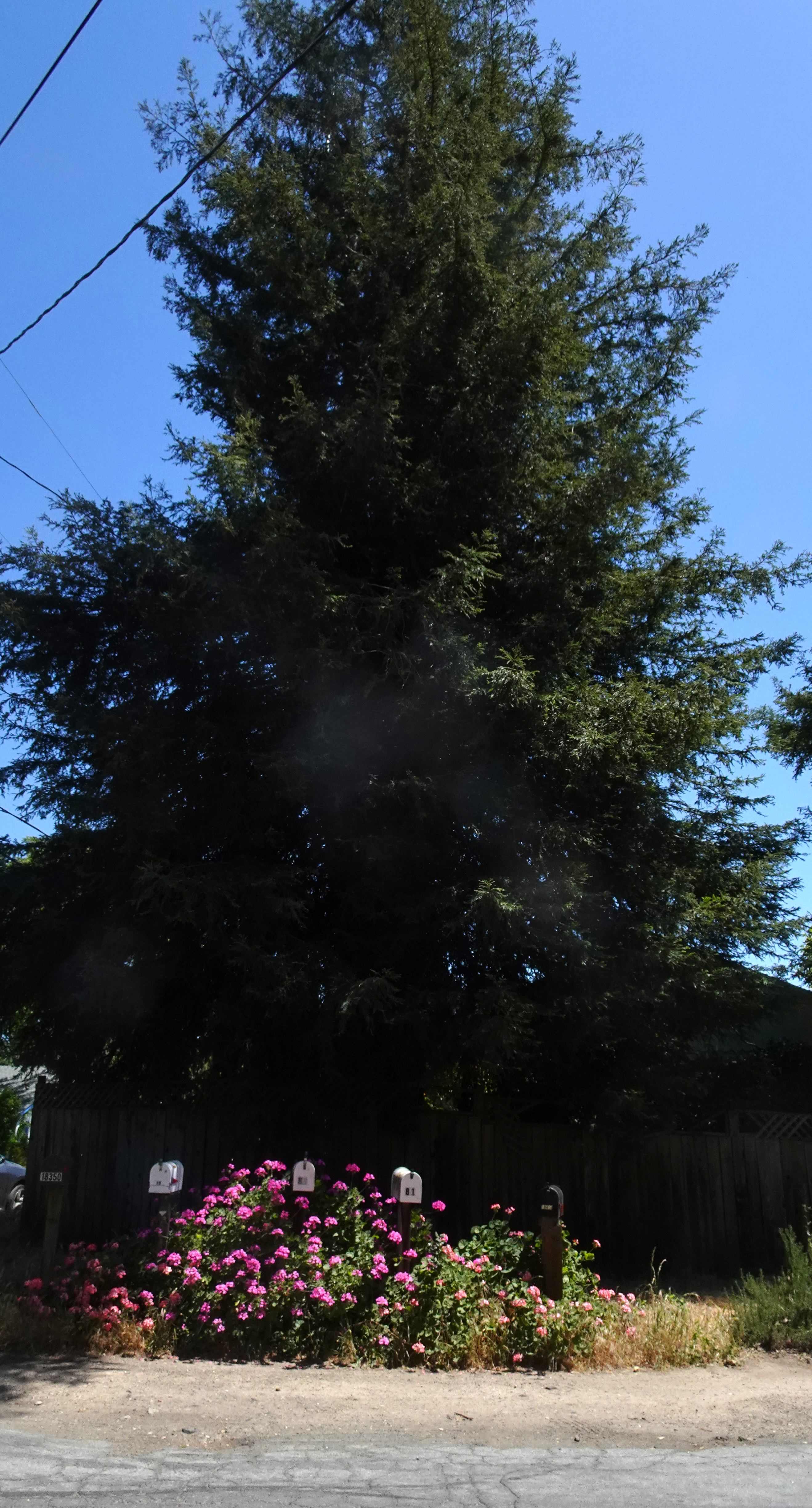
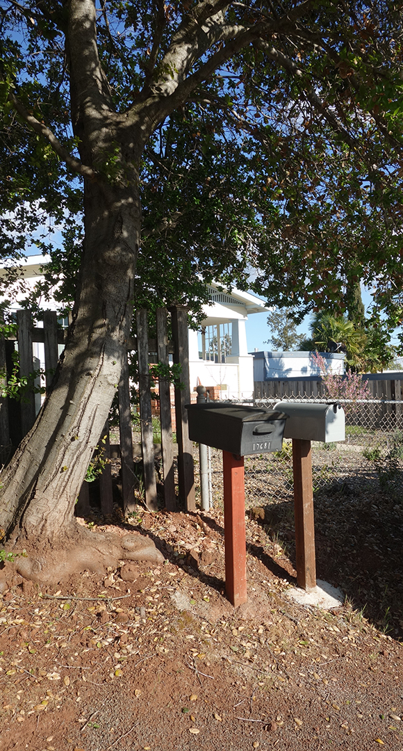
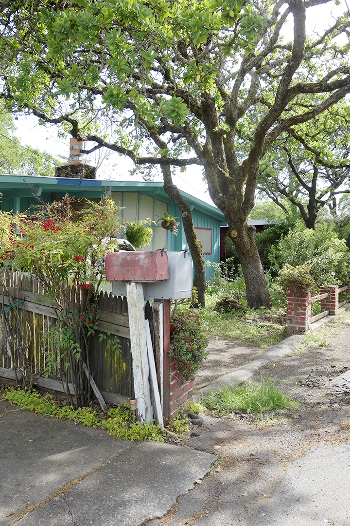
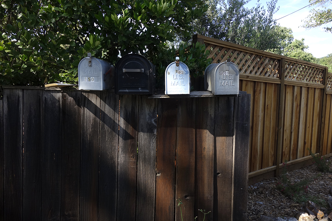
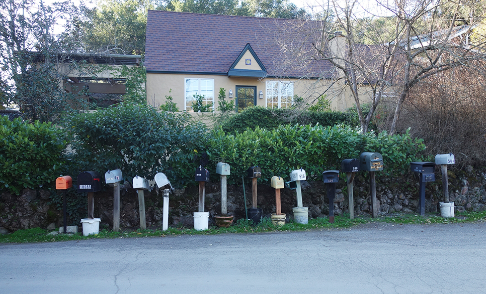
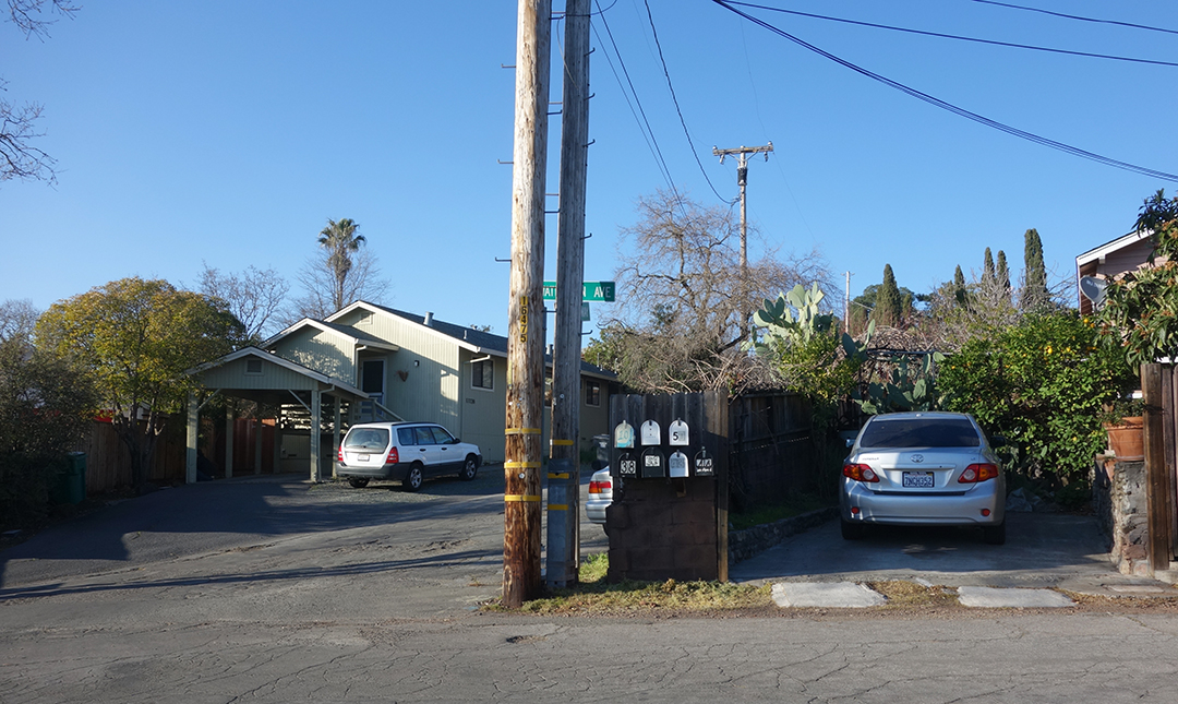
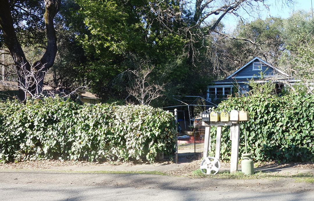
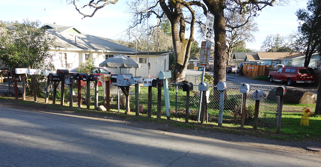
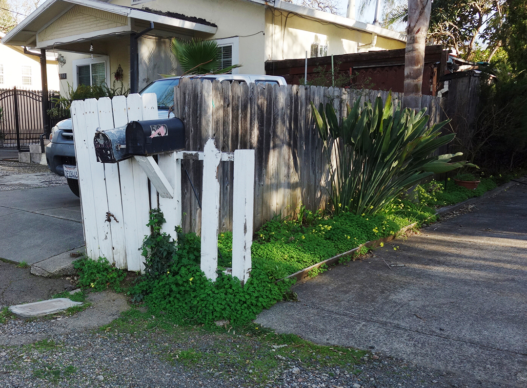
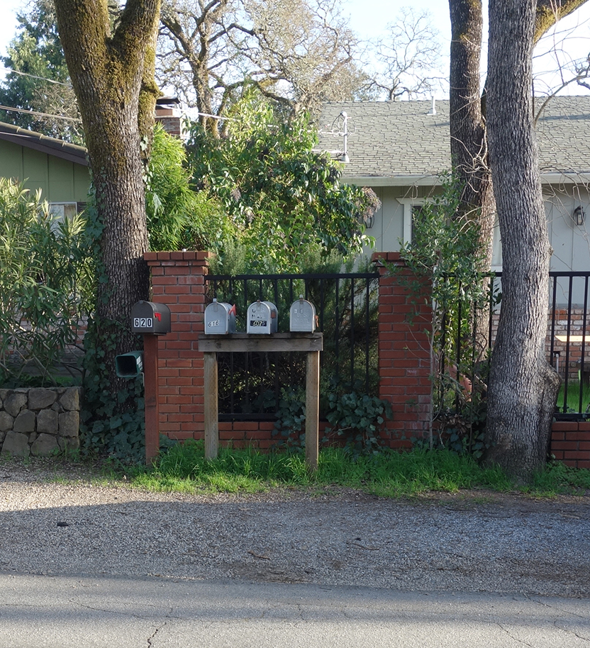
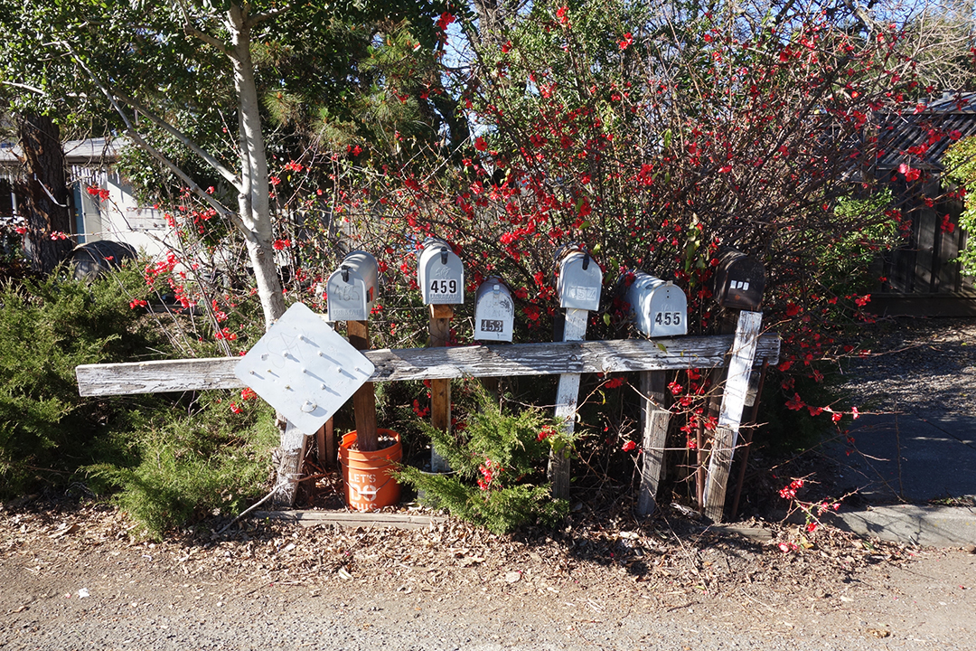
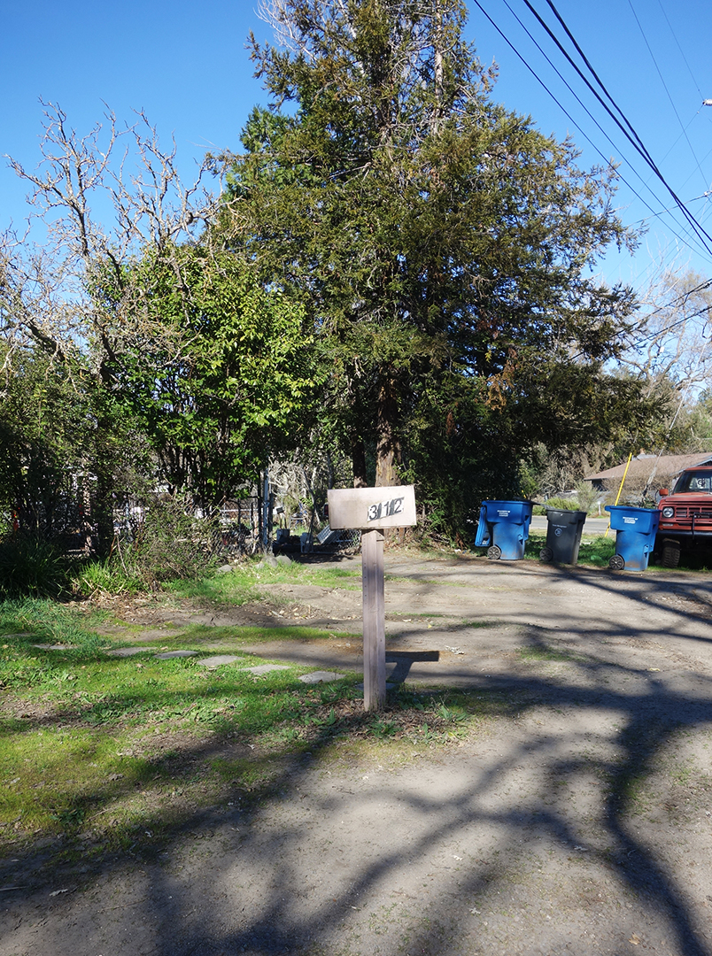
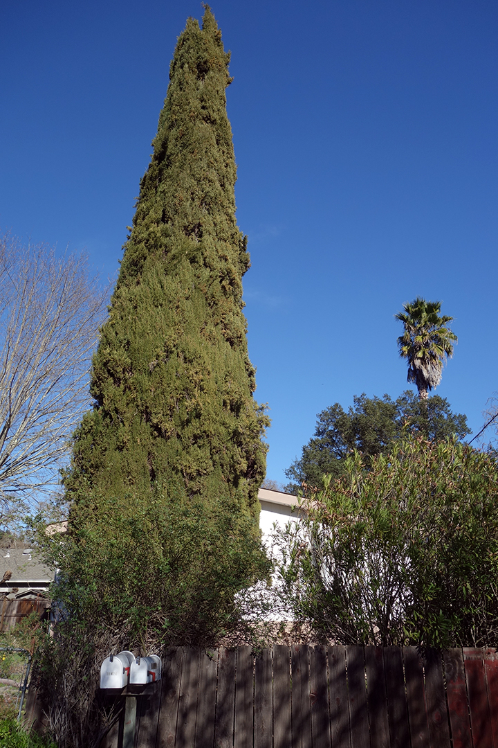
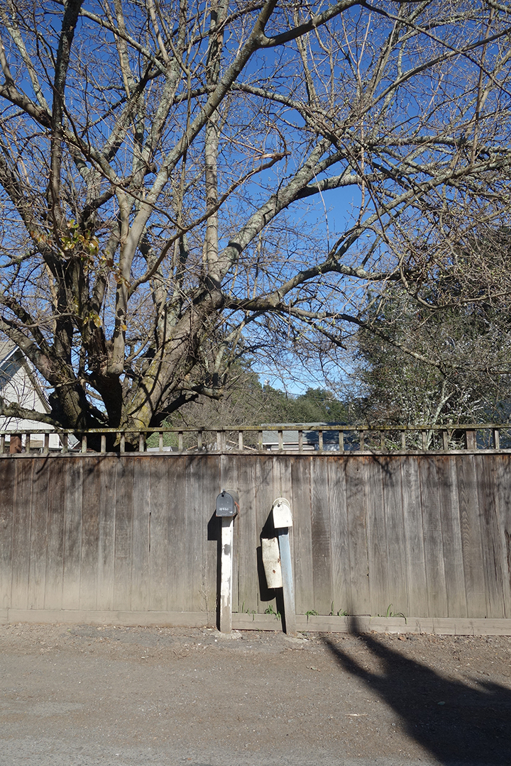
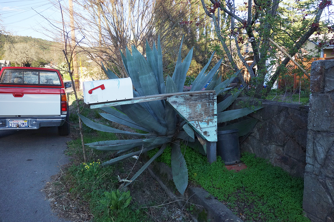
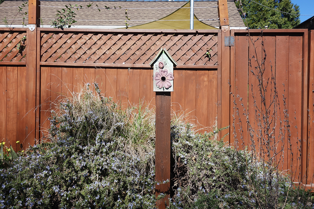
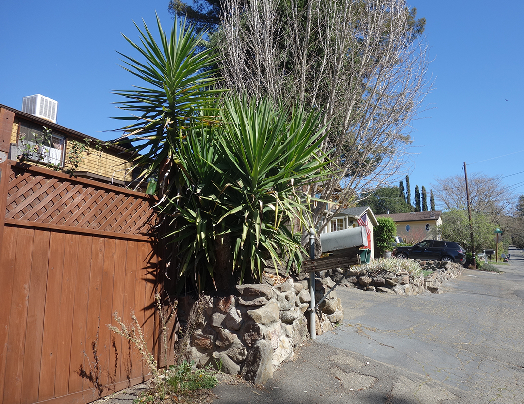
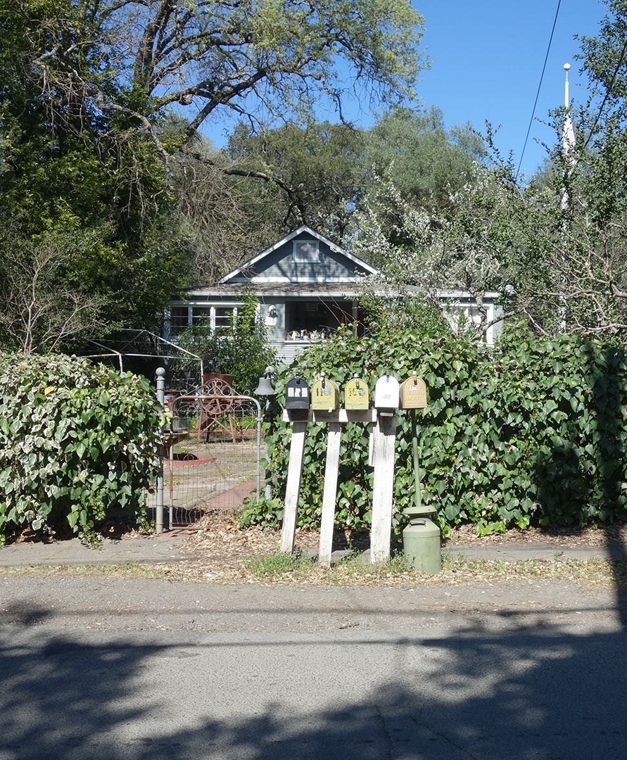
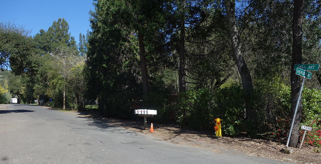
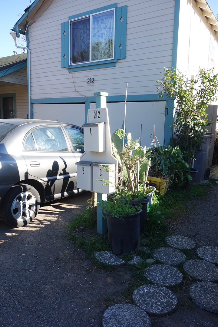
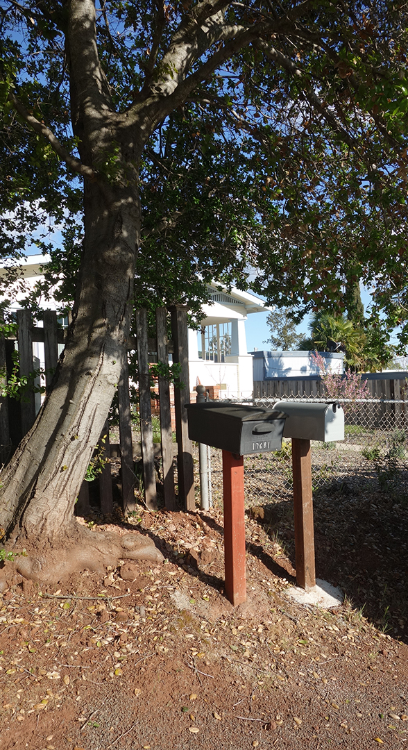
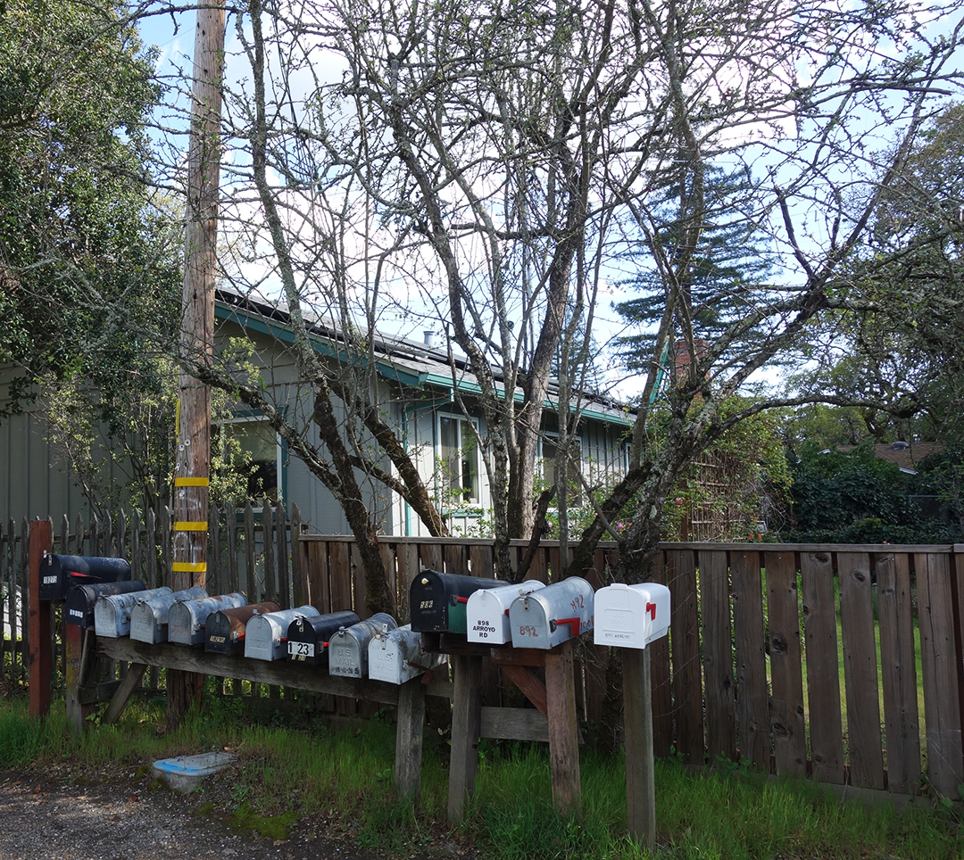
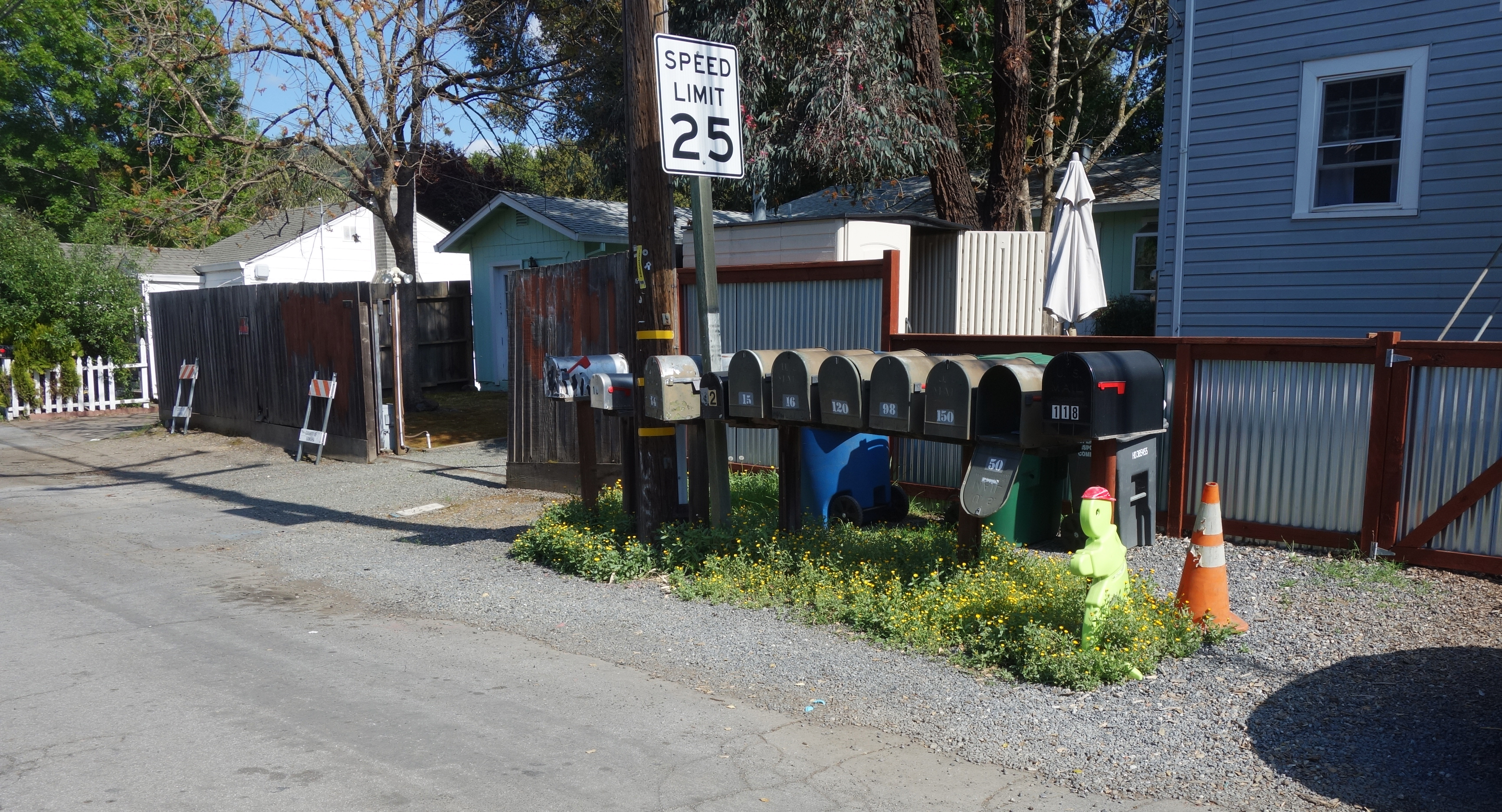
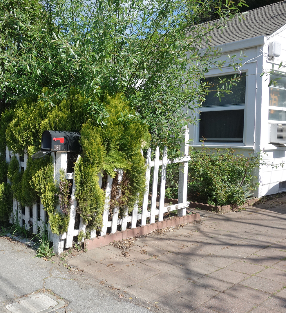
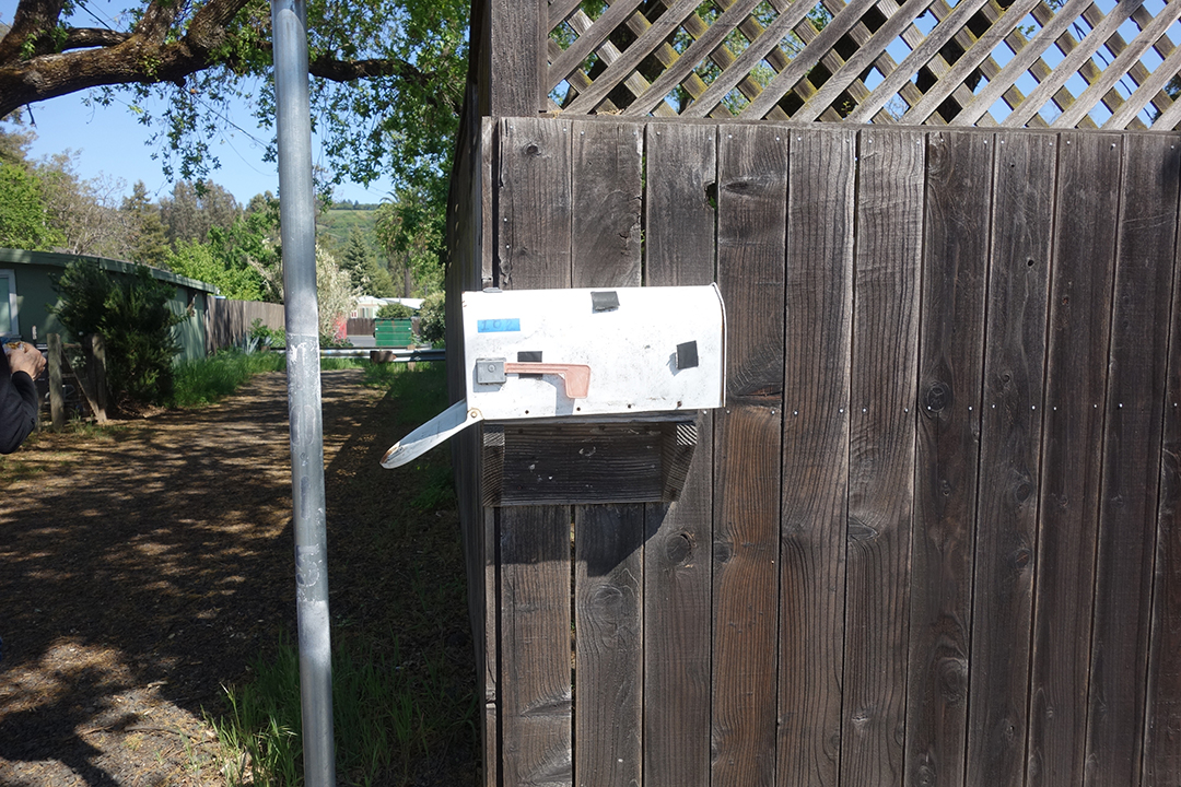
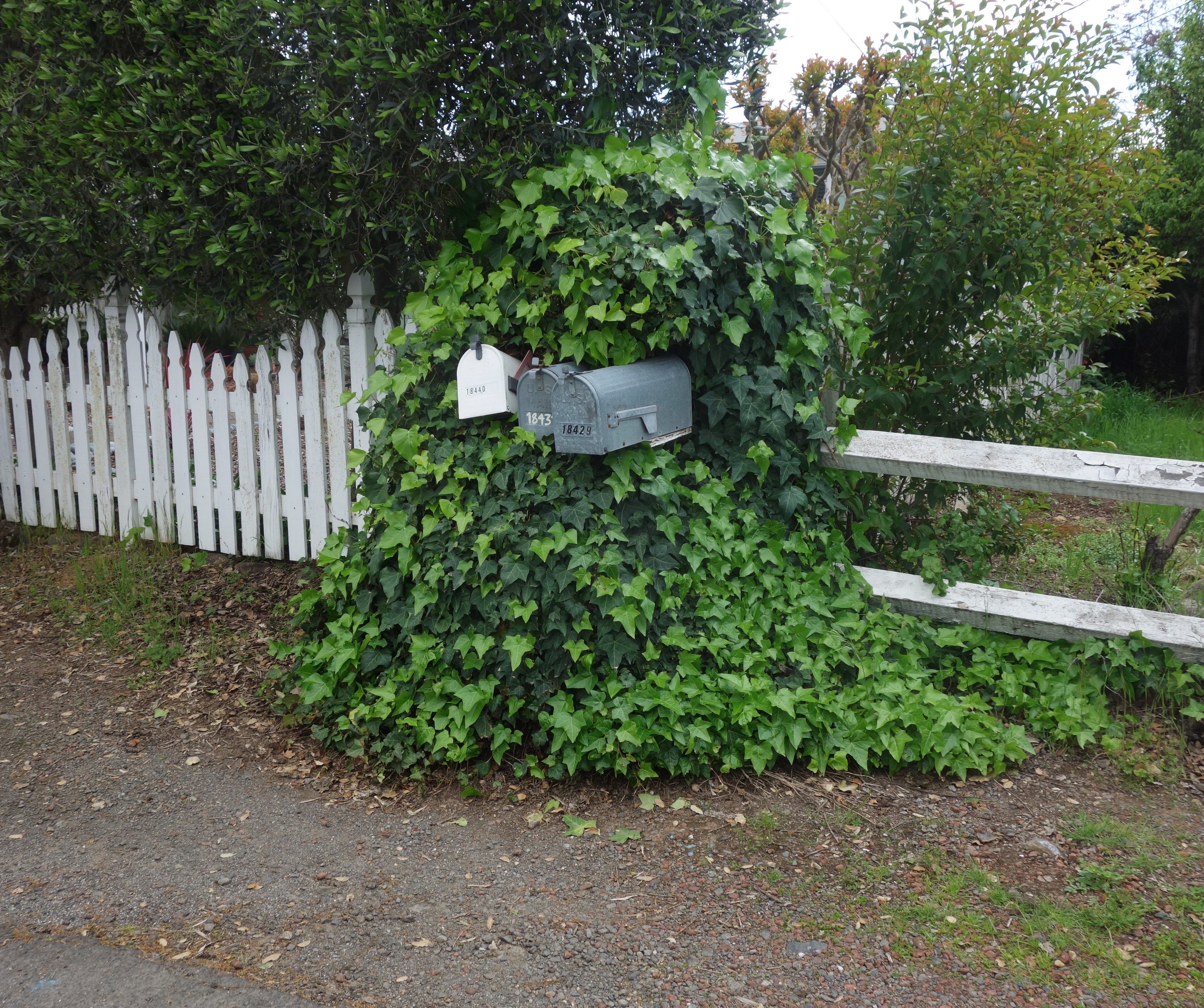
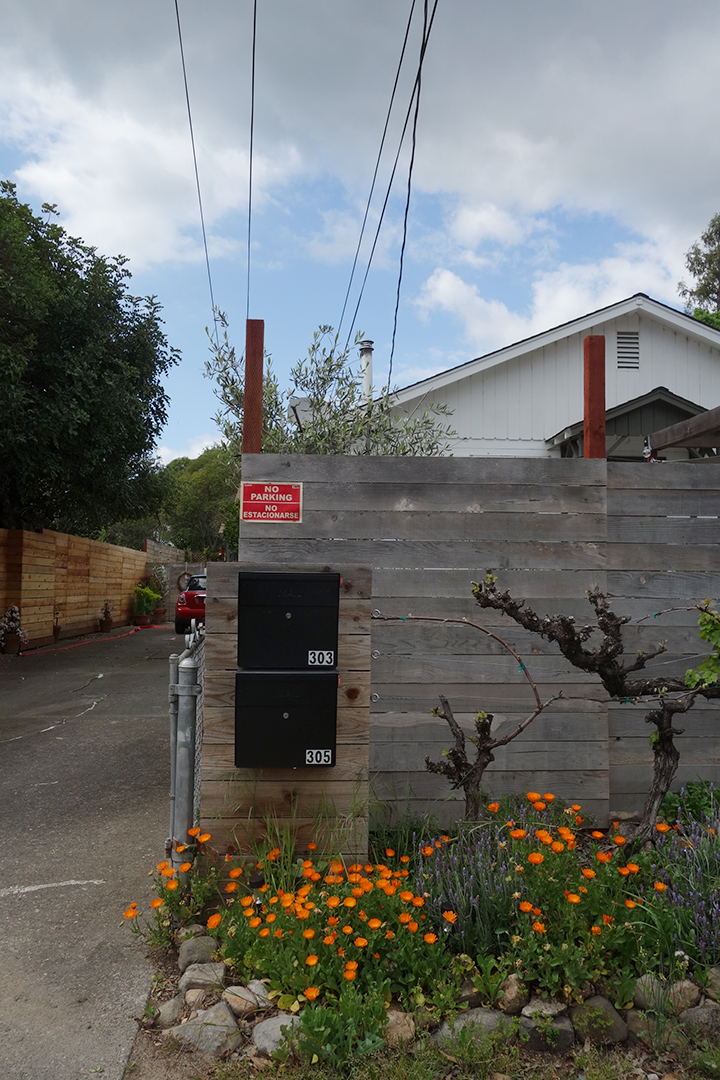
The United States Postal Service does not deliver mail to many houses in Boyes Hot Springs, Fetters Hot Springs, Agua Caliente, and El Verano, so people put mailboxes out on the street. Over time, these boxes, singly and in groups, take on personalities.