I covered this in a previous post, but I thought it was worth a new look.
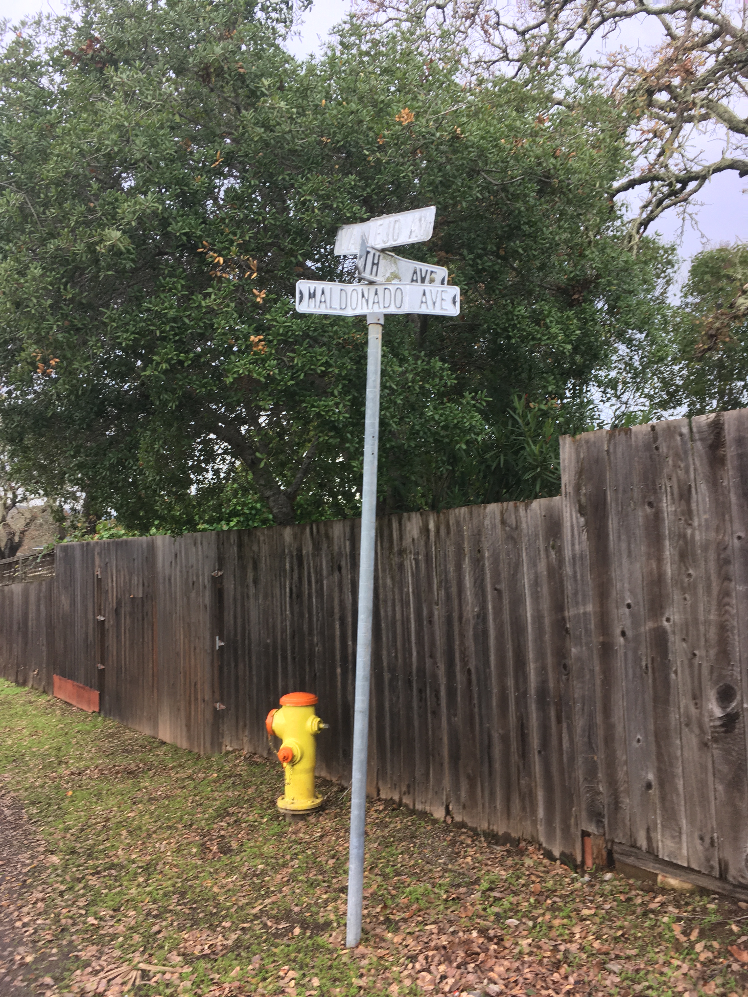
The intersection of Vallejo, Fourth, and Maldanodo showing the wonderfully distressed first generation sign, which has been replaced. If I had thougt faster, I could have gotten County Roads to give me the old sign. Alas, it was junked.
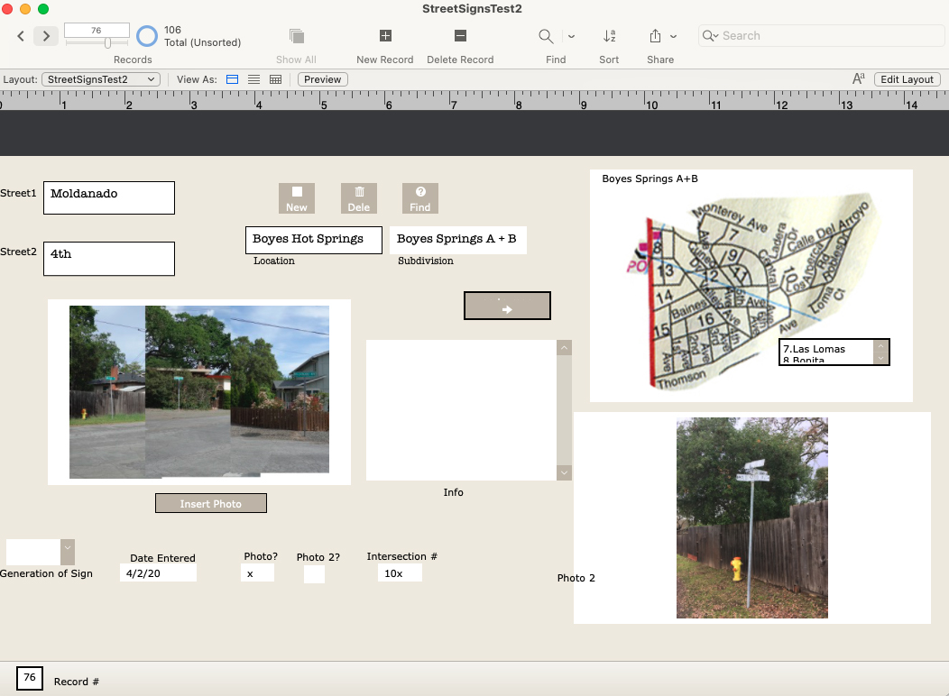
In 2020 I started photographing every every street sign in my immediate neighborhood with the intention of creating a database of intersections. Why? Obsessiveness. Completeness. The desire to record and collect (see website introduction.) Future use. It’s history. Because it might all burn down, and no one would remember what it looked like. And, I really like databases and consider them an art medium. I have also included photographs of the Neighborhood Phenomena in the vicinity of the intersections.
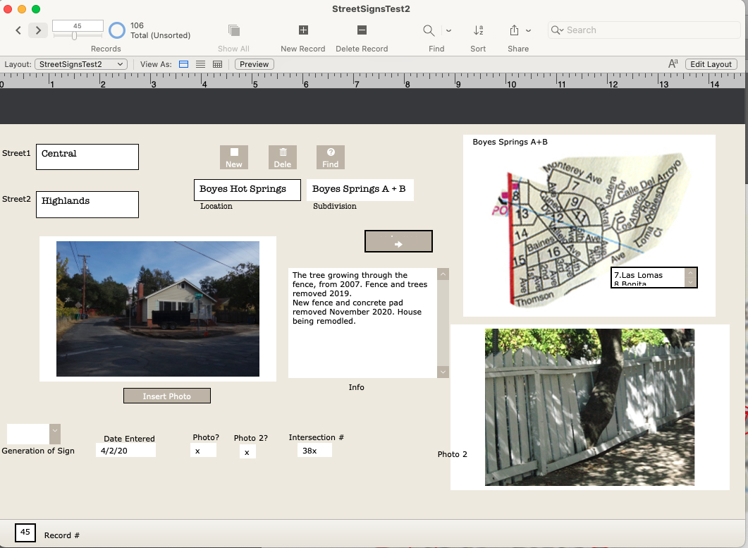
A record form the data base, under construction.
In addition to my photographs, I have included older (“historic”) ones, where they exist, newspaper clippings, and other ephemera. I know of no older photographs of intersections other than the ones at Highway 12, which were made primarily for commercial purposes.
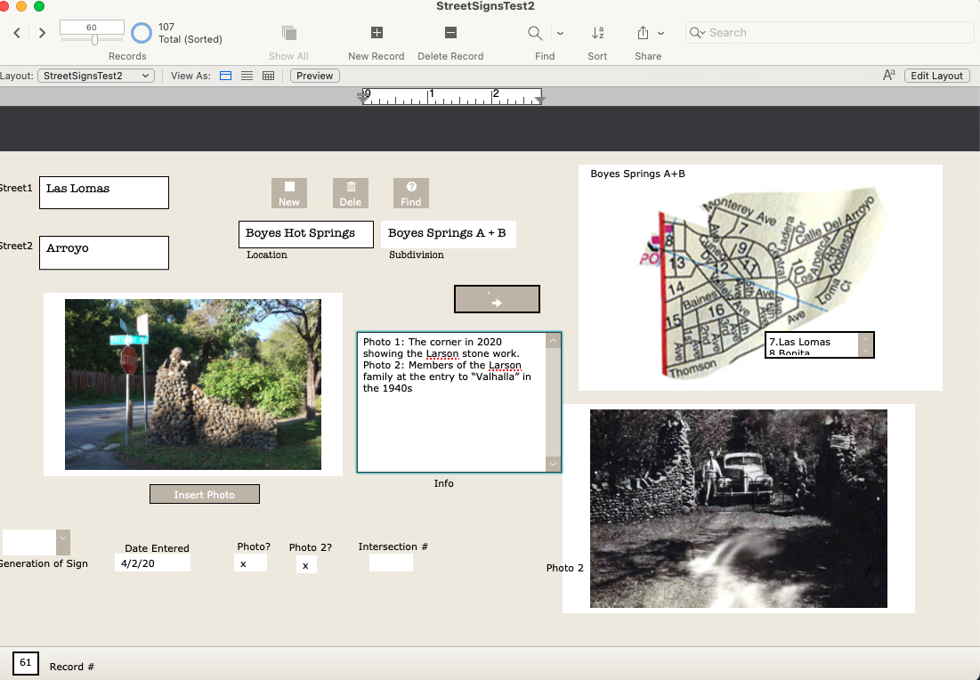
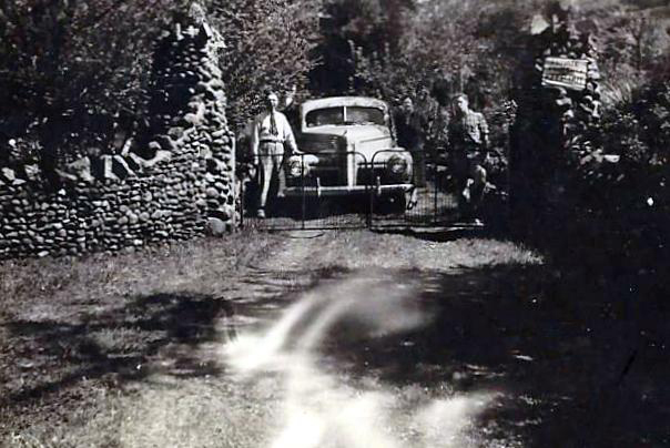
Las Lomas and Arroyo, featuring the stone walls built by the Larson family.1942. The entrance to the Larson family compound.
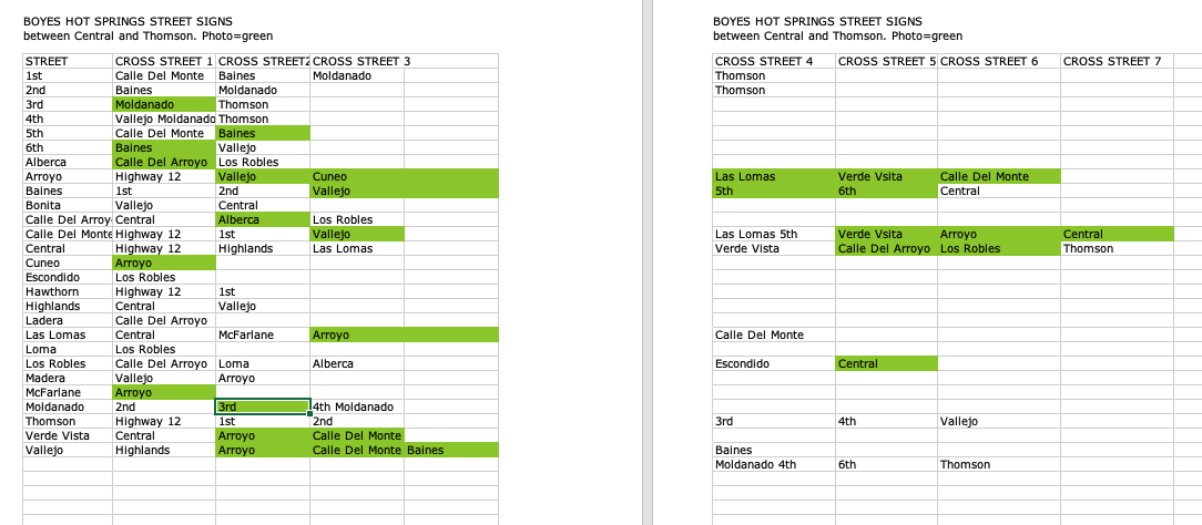
There are 107 records in the database (I probably missed some), one for each intersection in the Boyes Springs A and B subdivisions. The fields include “Generation of Sign” because three distinct styles of sign exist.Time permitting, the database would be expanded to include the surrounding subdivisions (link to post) Sonoma Highlands, Woodleaf Park, etc.Each record contains two photos or other images (sometimes newspaper clippings, other documents), and the map, which is still under development (ie, my Filemaker skills need improving.)
Samplle page of the database as an Excel fileAnother example of a Filemaker Pro record
Of course, the only constant is change, which means hours of fun for me updating the database.
The Sonoma Valley Redevelopment area was established by the board of Supervisors of Sonoma County in 1984. The area comprised a strip along Highway 12 from Agua Caliente Blvd. in the north to Verano Ave. at the south end, and parts of major intersecting streets.The main goals of the project were to remediate “blight”, to encourage commercial activity, and to facilitate construction of low-income housing. Major storm drain work and electrical undergrounding were done at the very beginning.
The wheels turned slowly, to say the least. By 1992 the final plan for the highway, a crucial element, hadn’t been decided. At that time Caltrans wanted to make it eight lanes!
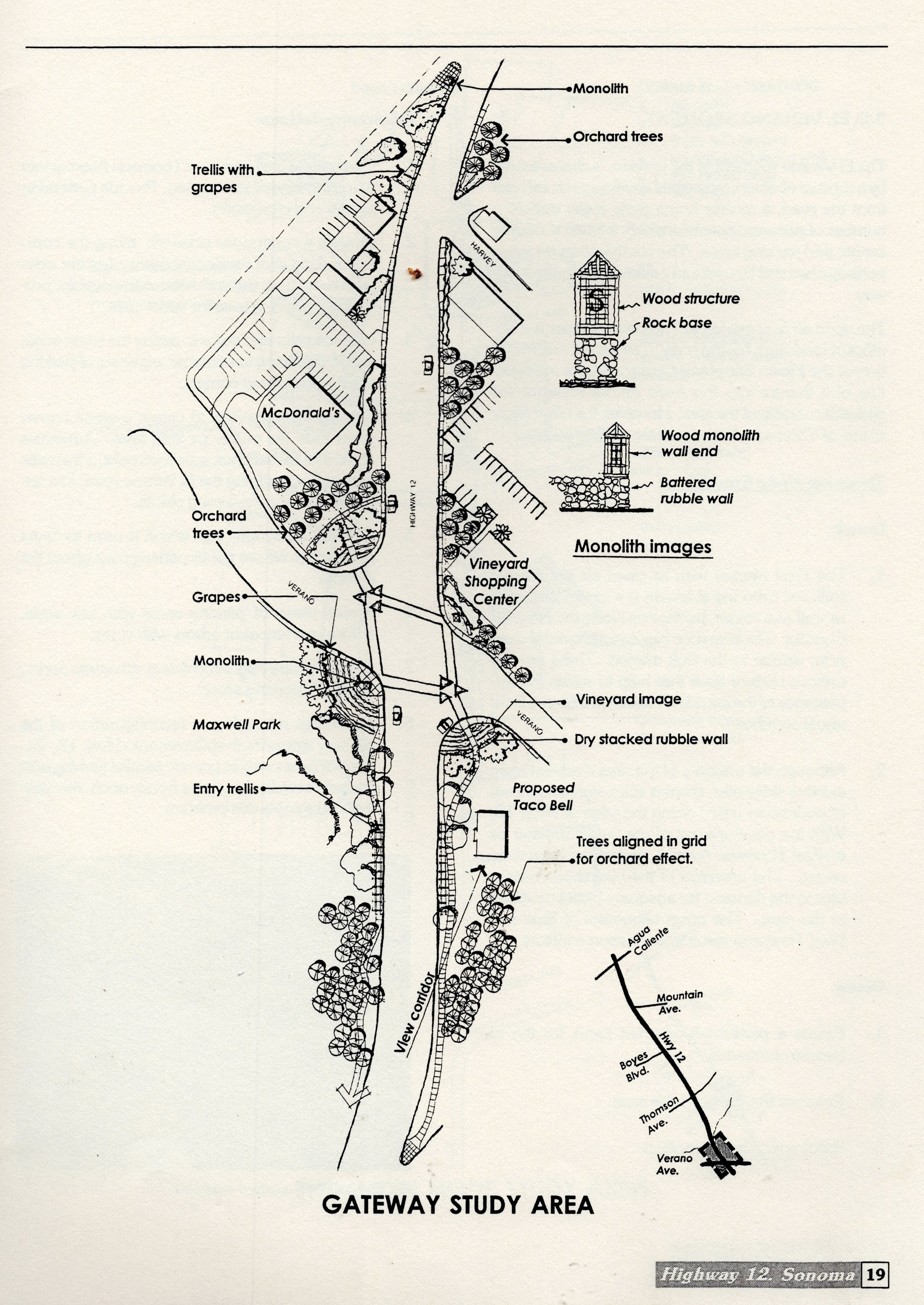
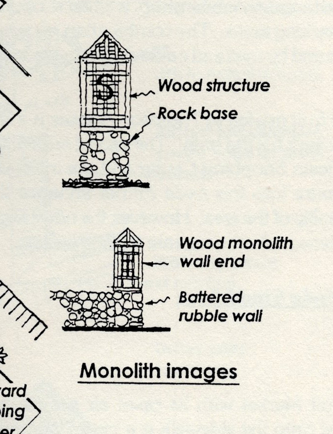
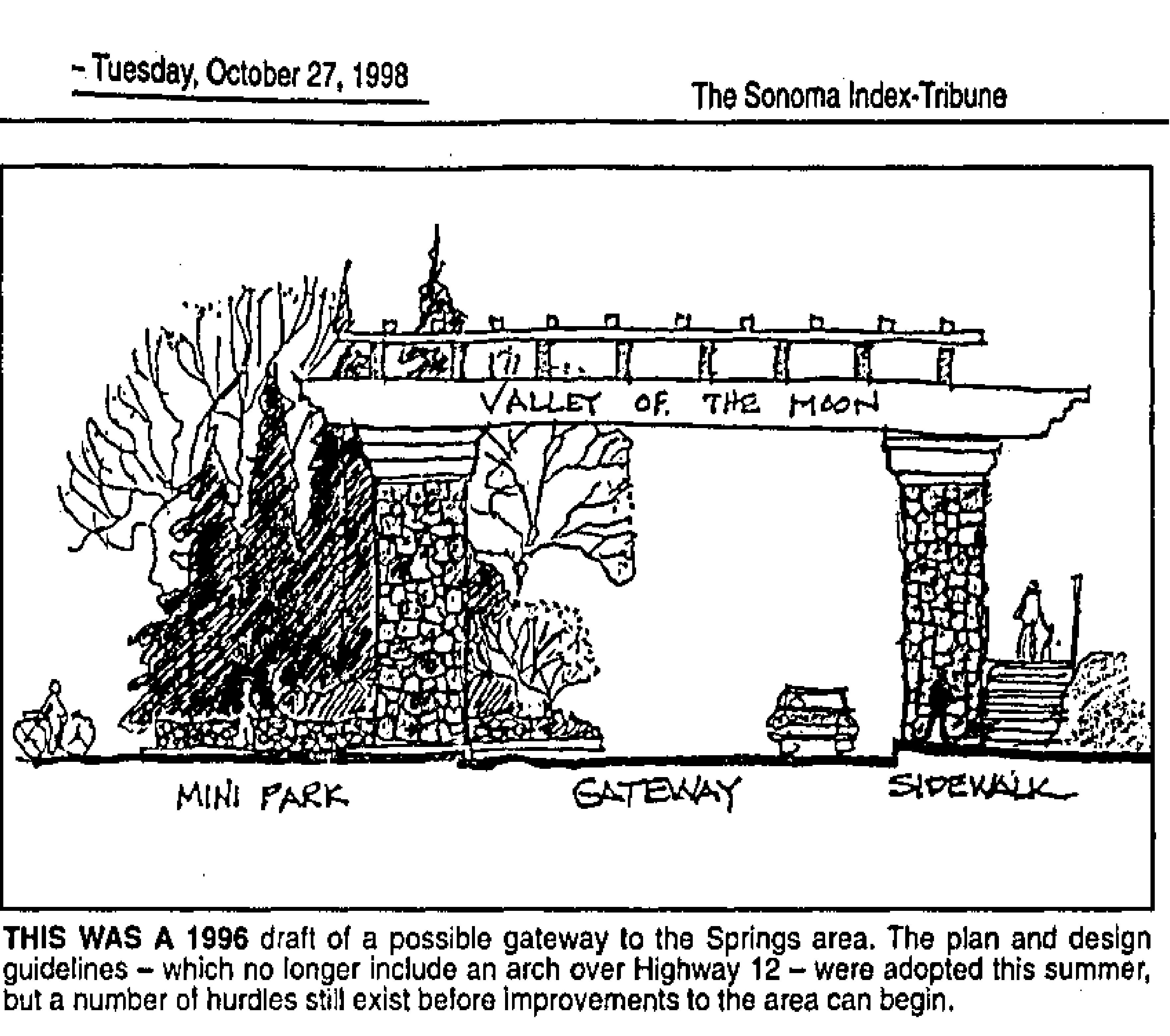
In 1994 an extensive set of design guidelines were issued. Under “Corridor Desing Concept, Southern Gateway Segment,” there is a study area map showing a “monolith” on the highway at the approximate present location of the arch (see map.) A small elevation of the monolith shows a wood trellis like structure atop a stone base. Trellises and dry-stacked walls, along with trees planted in grids to mimic orchards, are also included. These were all intended to be part of the symbolic entryway to the Springs. The last of the Recommendations in the guideline’s states “Develop further detailed design studies by retaining a consultant or by holding design competitions.”
A draft of the Redevelopment plan was issued in 1996. The Pilot Project was announced. “The plans call for a pilot project to the southern gateway. It includes closing a portion of Main Street, which cuts from Highway 12 to Verano Avenue behind the McDonalds restaurant; an archway or other gateway concept, trees and light fixtures,” we learn from the Index Tribune. Landscape Architect Ron Wellander was hired to manage. “A gateway gives definition between one community and another,” explained Robert Behrens, a site-specific sculptor who worked on the planning stages of the program.” Behrens is best known in Sonoma as designer of the Veterans Memorial Park.
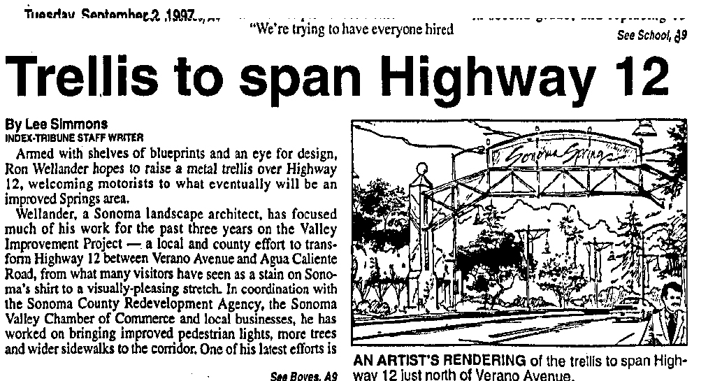
In July of 1997 the Index Tribune announced that “ Among the many improvements for Highway 12 between Boyes Blvd. and Agua Caliente Road will be a metal archway…the archway will consist of two posts, one at either side of the road near Boyes Boulevard, with a metal trellis extending over the road showing a welcome to drivers heading north. It was felt by the consultant (Wellander) that we need something that would announce dramatically the entrance to the springs,” (This is confusing. First, the Redevelopment area starts at Verano Ave, second, the pilot project is nowhere near Boyes Blvd.) The cost was estimated at $200,000.
In September of 1997, Caltrans informed the County that “We do not allow these type of structures to be built over highways.” End (of this part ) of the story.
Construction still had not been started by early 1999. “…the $700,000 first phase of the project…has suffered a number of setbacks. The most widely publicized of these was the proposal to buil a 20-foot-high metal trellis spanning the state highway just north of Verano Avenue (not Boyes Bldv!) While a relatively minor part of the project as a whole, the arch was widely criticized as unsightly and unnecessary.” Index Triune Feb 2, 1999. To complicate matters more, landscape architect Wellander filed for bankruptcy.
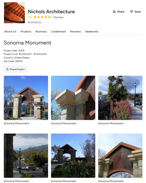
Our current gateway arch was built sometime between 2003 and 2005. The architect was Dan Nichols. According to the Houzz website, the year is 2005 and the budget was “1,000,000-1,500,000,” which seems a bit high. The budget for the entire pilot project was only $700,000. A friend who attended public meetings at the time remembers the cost as being $611,000. I have not been able to make contact with Mr. Nichols.
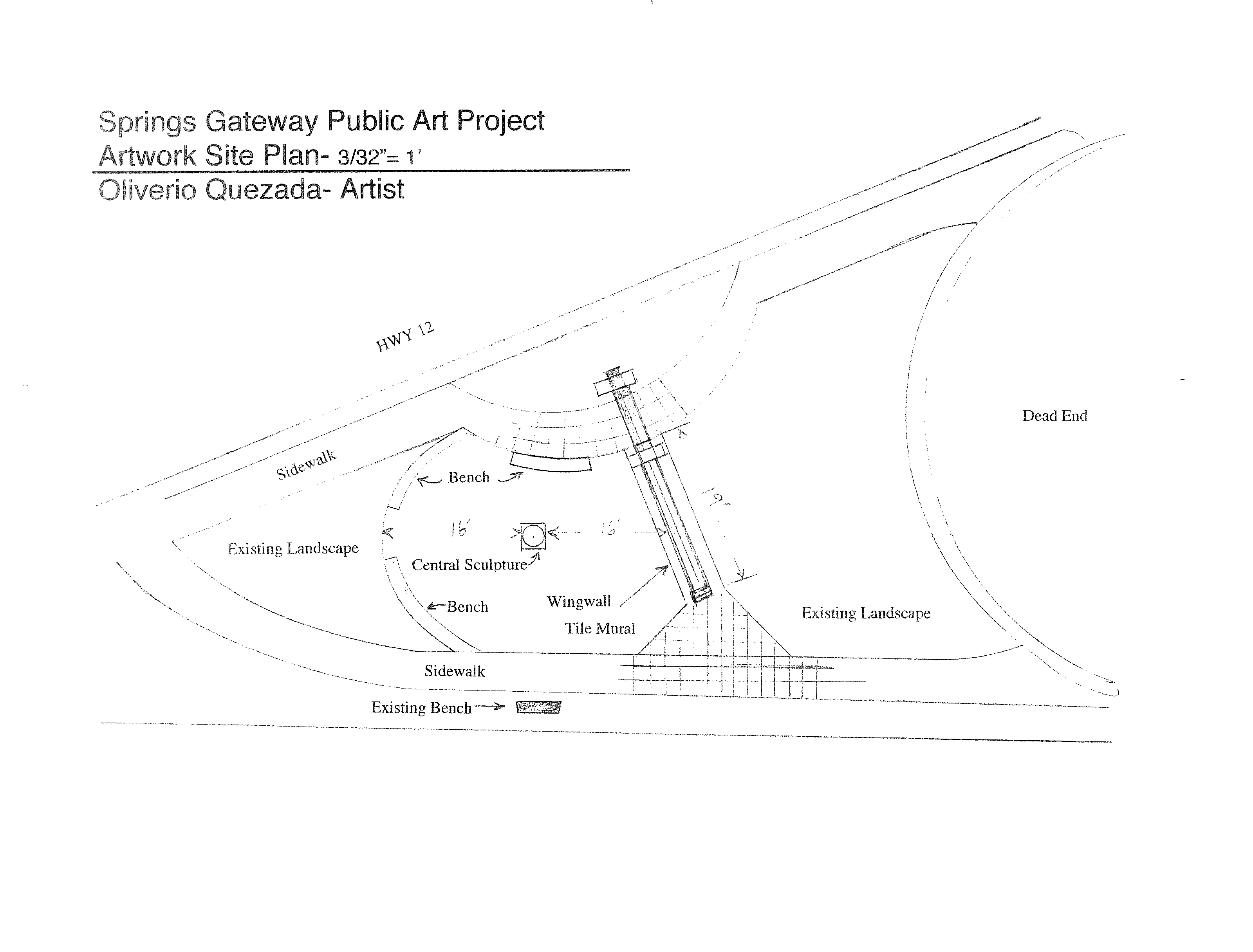
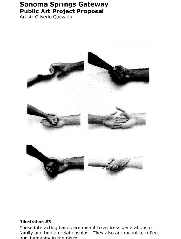
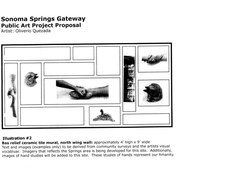
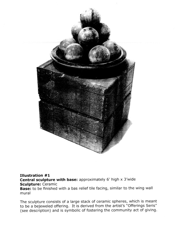
The original intention was to have art placed on the concrete posts and wall, which were left bare for that purpose. In 2007, ceramic artist Oliverio Quezada was “hired” to propose art. It’s unclear how he was chosen. On July 25, 2007, the Board approved redevelopment grant funds up to $35,000 to approve a Special Services Agreement between Quezada and CDC to design, manufacture, create and install an original artwork at the gateway. His proposal includes a concrete bench, a central sculpture, tile artwork on the wall, and a welcoming sign designed with the help of local school children.Images from artist’s proposal
However, the Advisory Committee of the Springs Redevelopment the RAC) had some questions. The tile were to be covered in text. “”I want the text and imagery to be as pure and beautiful as possible, incorporating the best of everything existing in the Spring Area’s past, present and future,” Quezada said in his written proposal, but the RAC wanted to see all of it before they would OK the total art project. However again, these objections seem to have faded away, with a new problem arising in 2008: money for maintenance of the artwork. The CDC could fund it but could not to maintain it. Other agencies like Public Works or Parks, didn’t have the money for the (continuing) job. “Kathleen Kane, executive director of the county’s Community Development Commission, told the local panel that maintenance questions and funding need to be resolved before the project can continue. “Kane said that the project could be in danger of fading away. “If we can’t get it settled to the satisfaction of public works, it could die,” she said.” Fade away it did.
Soon after, the rusticated stone cladding was applied to the bare concrete pillars.
Now we have an essentially meaningless public art work with a wine-centered advertising slogan on the steel upper part, installed by persons unknown. Inquiries have been made. None of the powers that be have an answer.
Mu contention is that the Gateway Arch could still be transformed into a real symbol of our community. We have plenty of creative talent. All we need is money. HA!
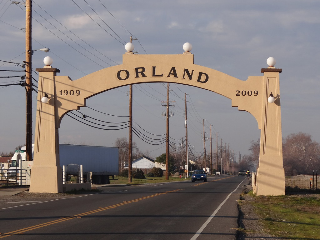
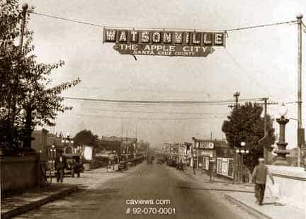
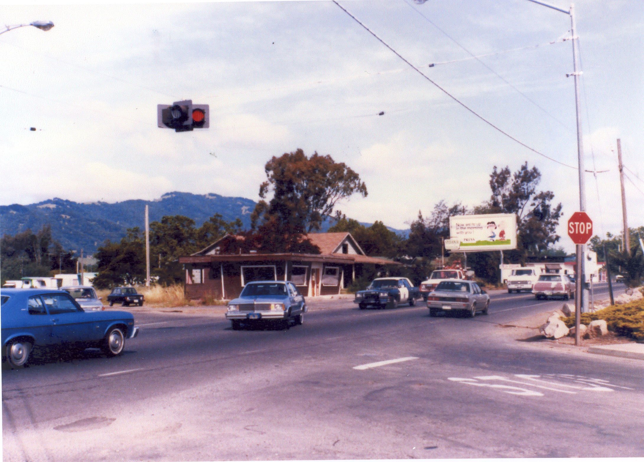
The Orland and Watsonville arches predated Caltrans. The upper right image is the corner of Verano Avenue and Highway 12 in the 1970s(?) Caltrans had no problem with hanging a traffic signal over the road.
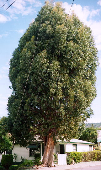
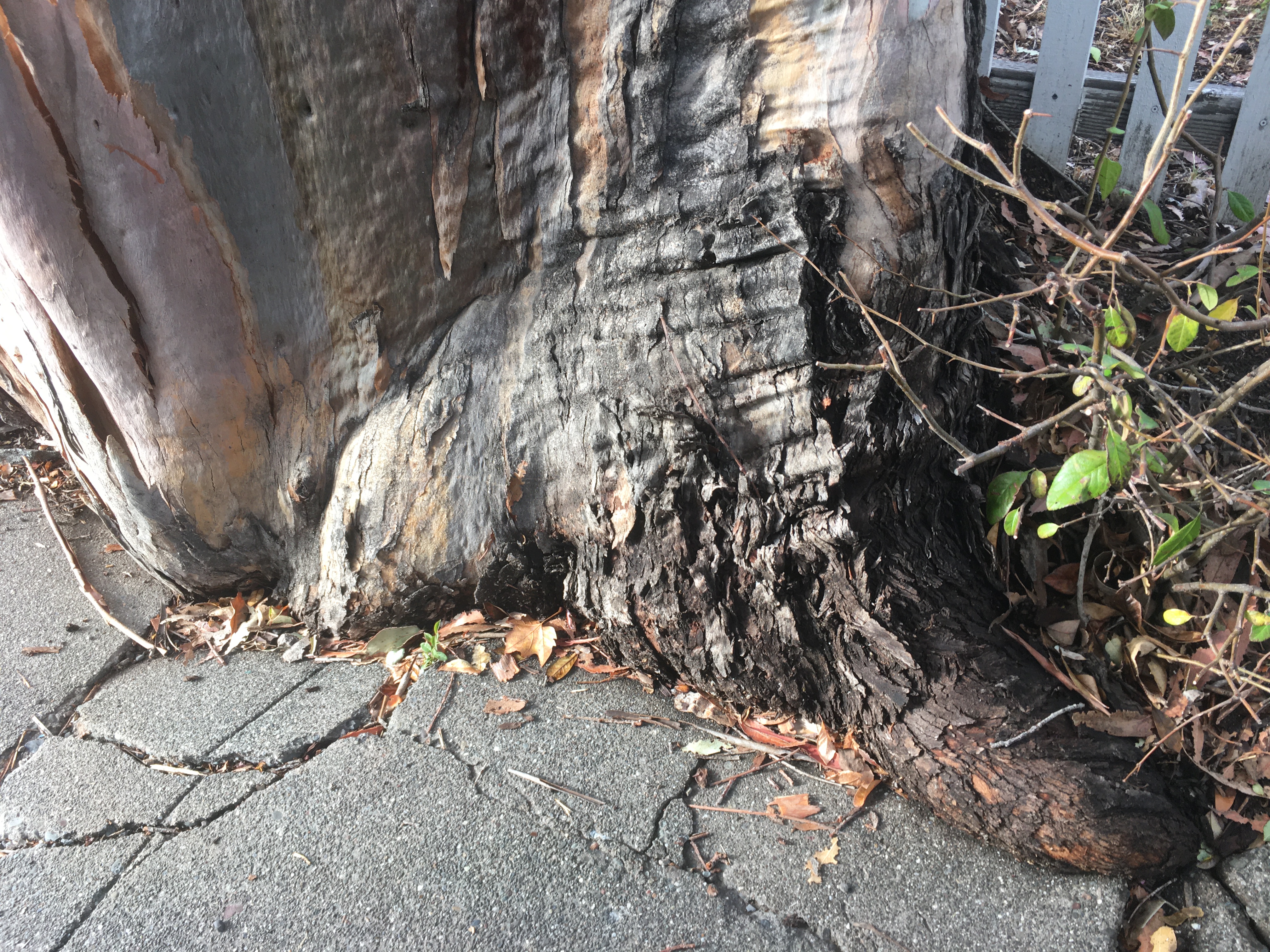
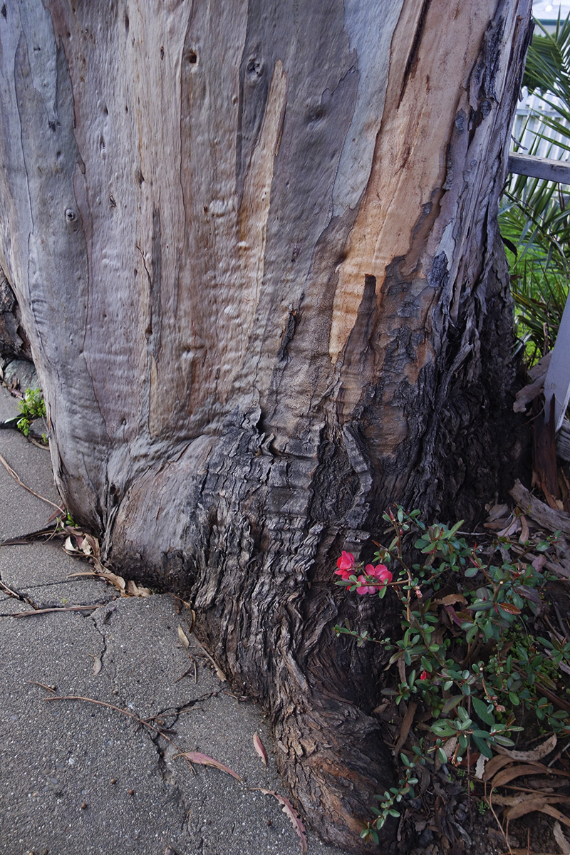
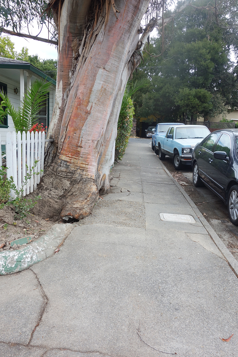
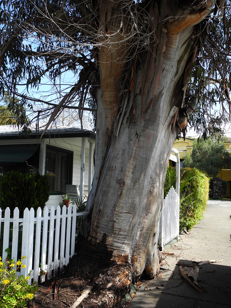
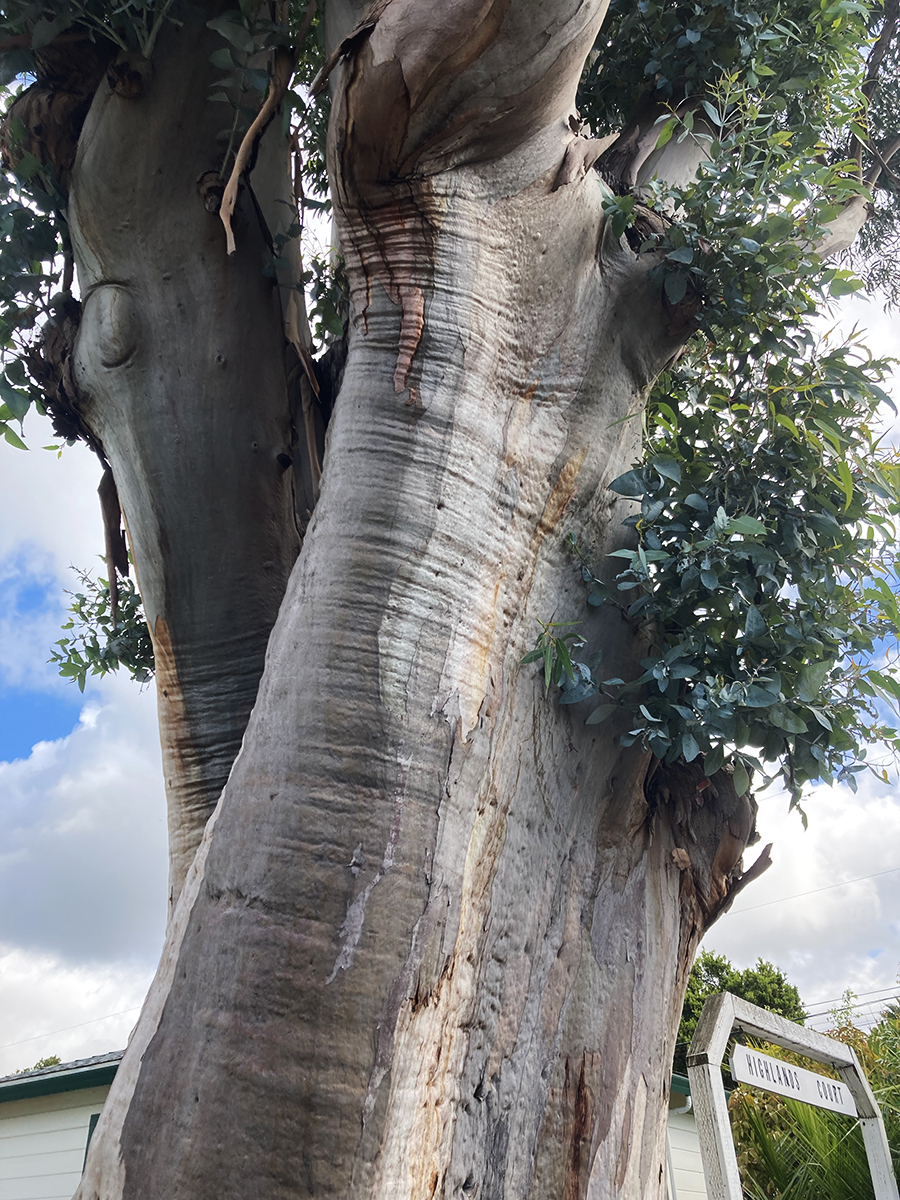
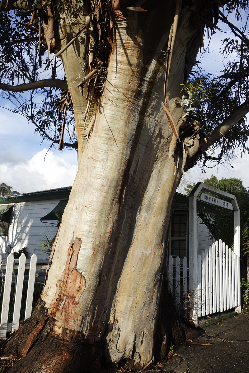
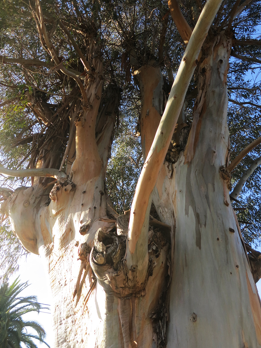
It’s always sad when we lose a tree. I called it “the Big Euc.”
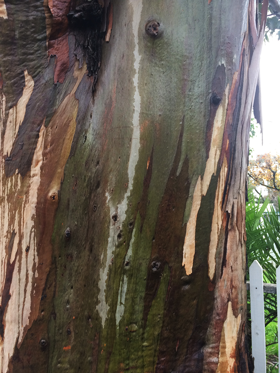
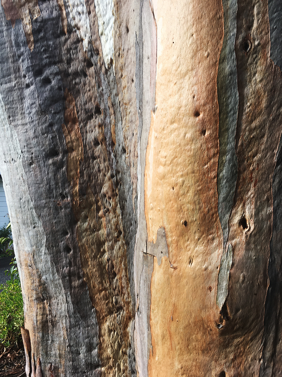
I know eucalyptus are exotic, invasive, and sometimes dangerous (they are highly flammable and may have other impacts, but the story is not only negative: see https://ucanr.edu/site/igors-urban-website/eucalyptus-california) .But they are, by now naturalized in California and in our minds. We have grown up with them. Their fragrance is embedded in our olfactory cortexes. The beauty of their variegated bark delights.
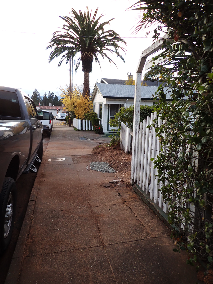
This friend grew on Vallejo Ave. near Highlands Blvd. in Boyes Hot Springs. Probably a volunteer, it may have sprouted around the time the motor court behind it was built, possible just after the 1923 fire. https://springsmuseum.org/2017/11/01/fire/
2007
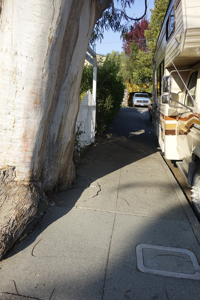
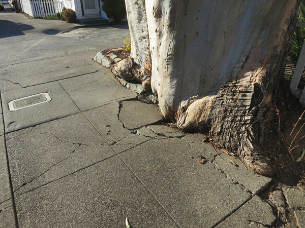
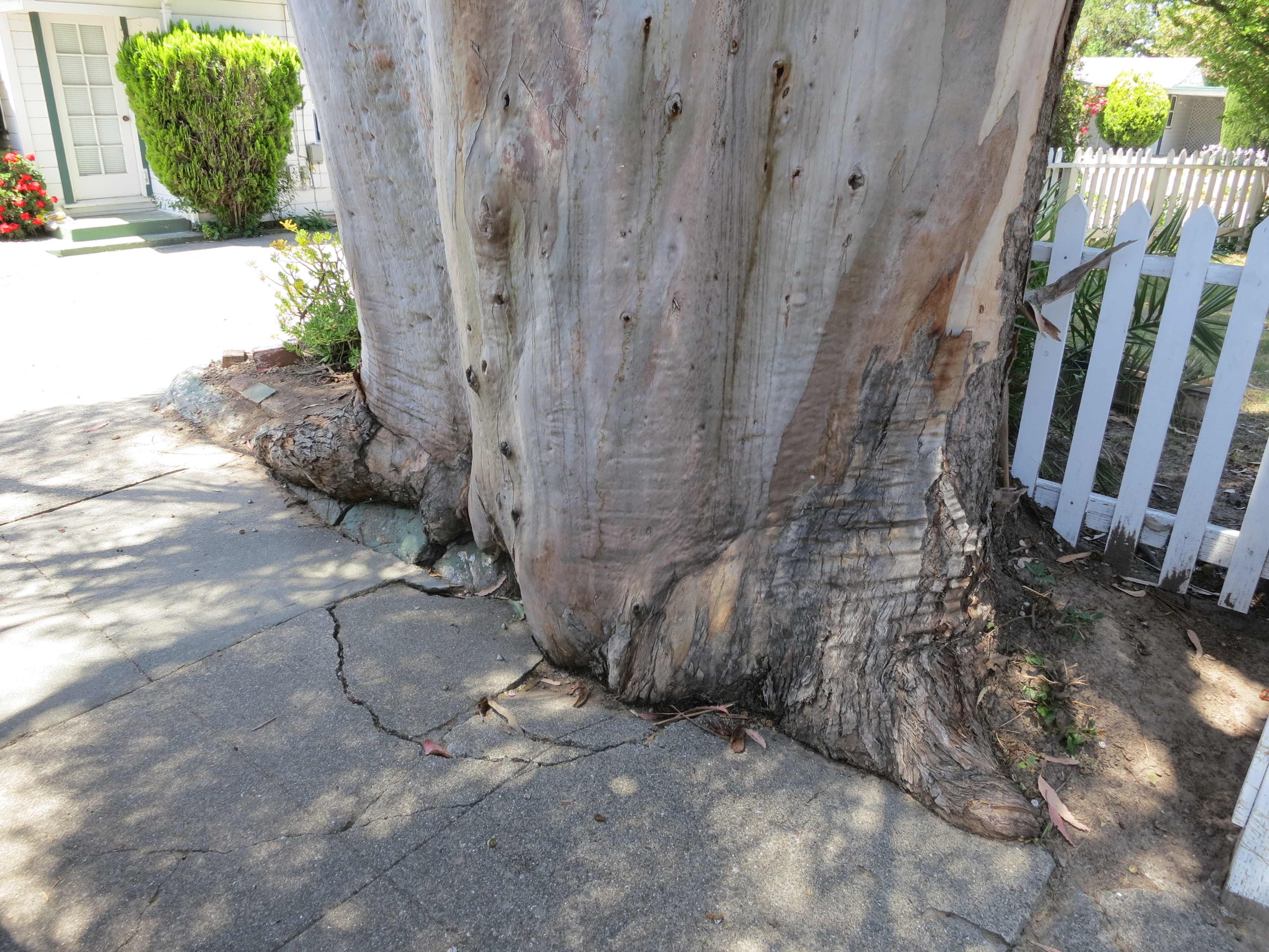
I actually liked the way this tree was grinding up the concrete sidewalk, like a very slow motion wave of living wood. I have special place in my heart for the interaction of trees and the built environment.
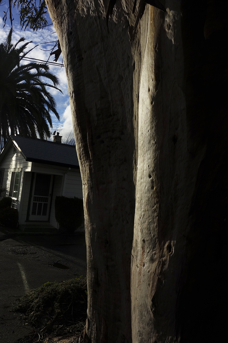
Makes beautiful shadows.
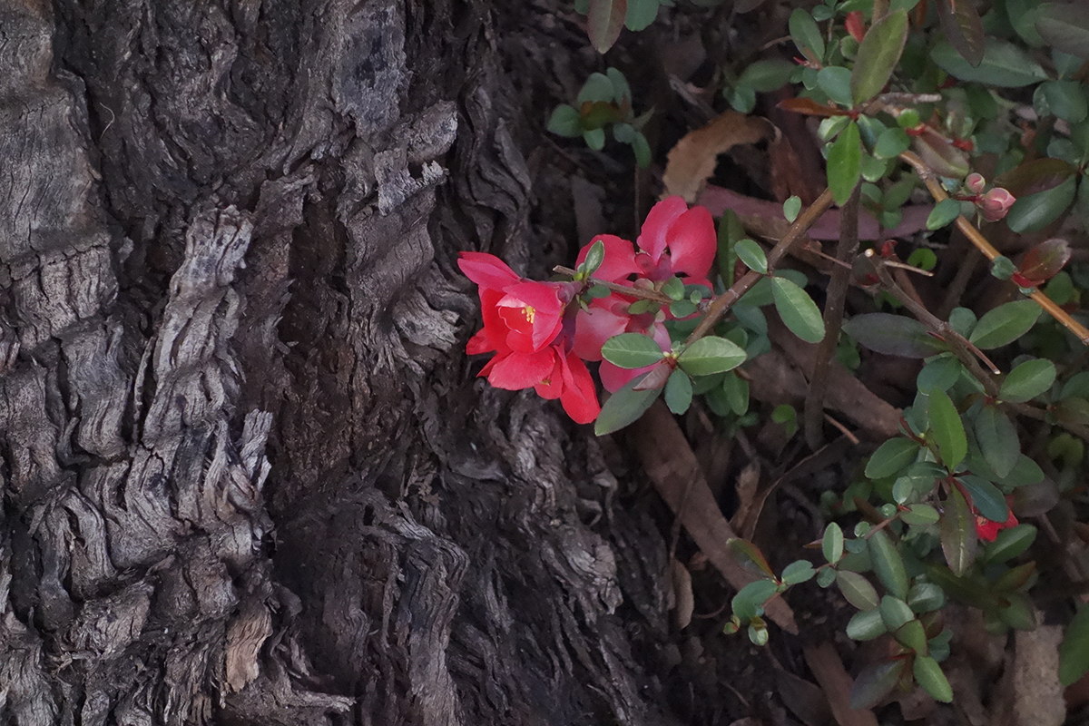
This quince volunteer bloomed every February for Lunar New Year.
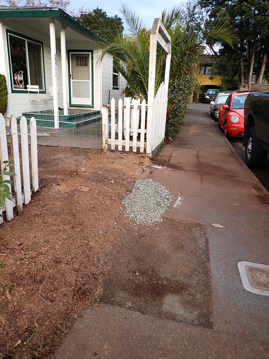
Eventually a piece of the concrete was removed for some underground plumbing repair and replaced with crushed rock.
The green concrete curb continues to be submerged in tree.
Some beauty shots.
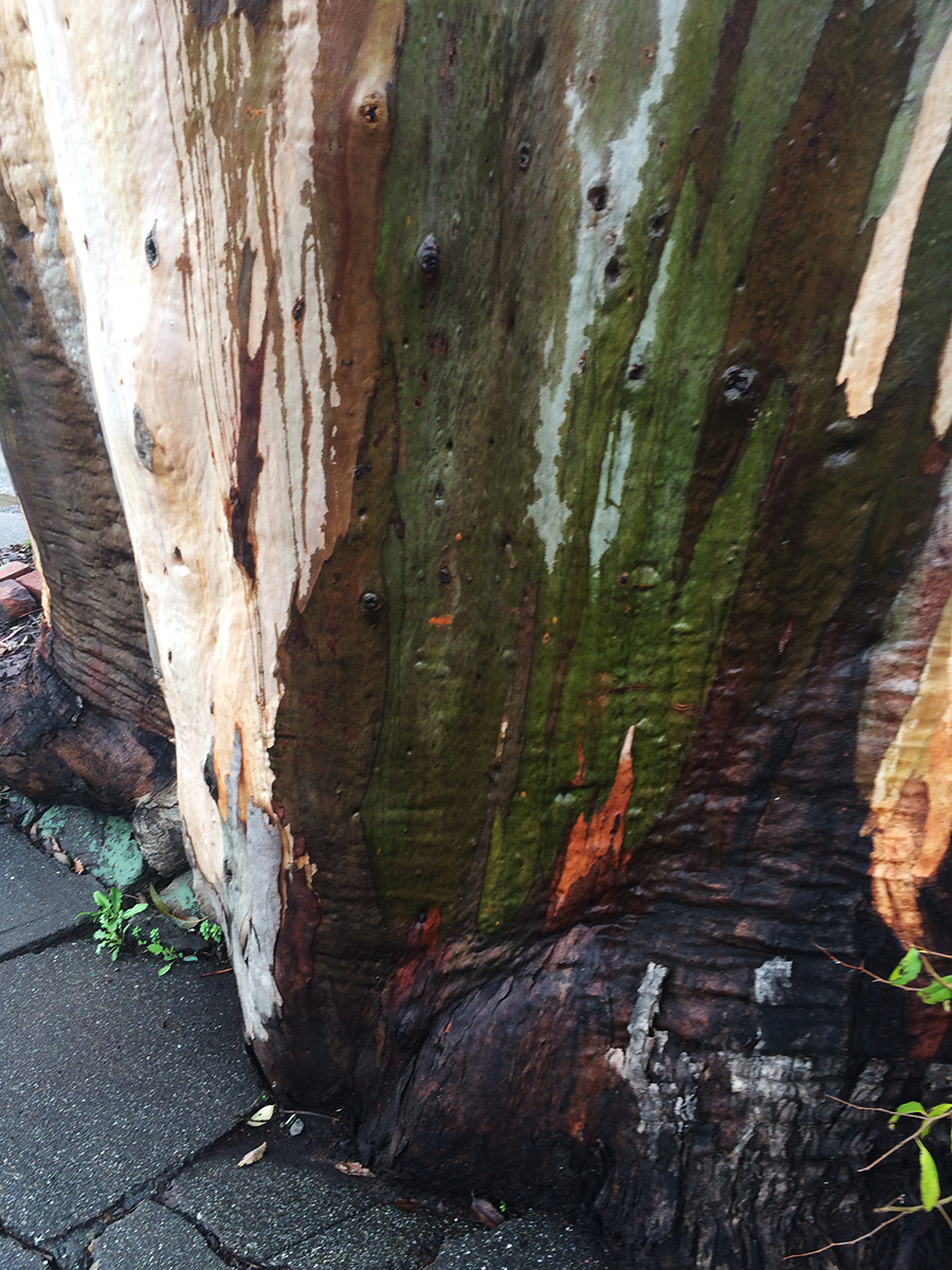
The wet bark is even more beautiful, and the fragrance intensifies.
So limb-like, sensuous.
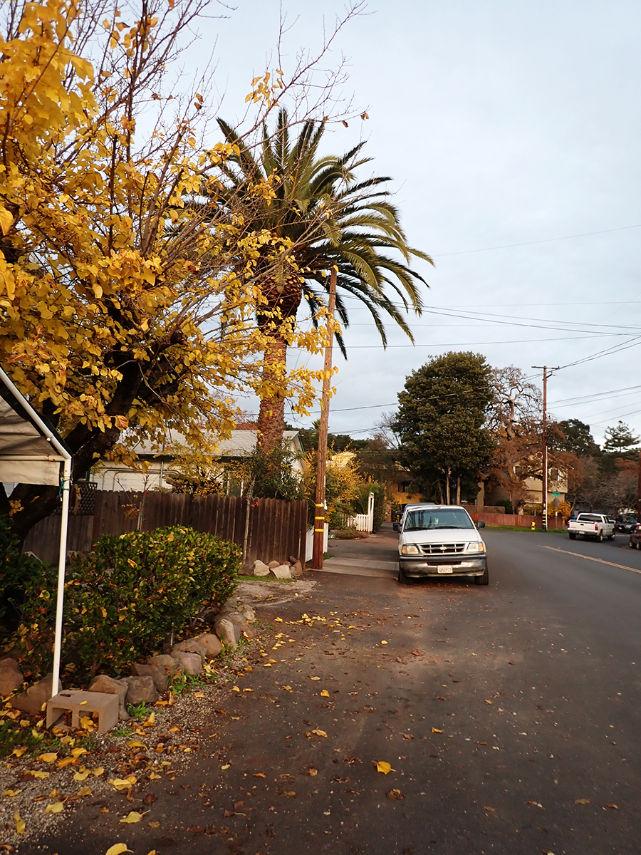
December 2025
Just a memory
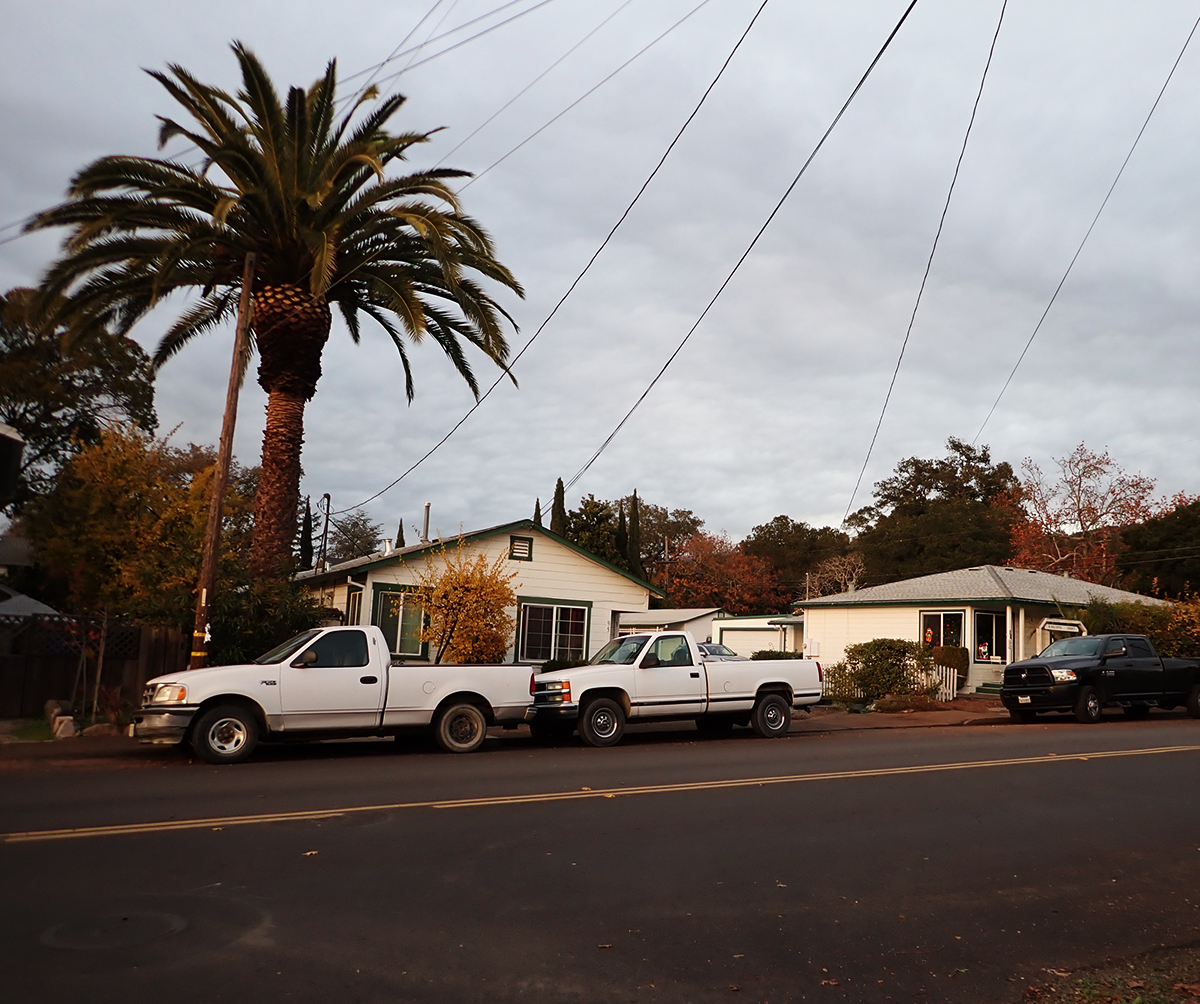
The palm stands alone
“Bark and Bite.” Painted photo collage circa 20″x30″. 2019. Michael Acker
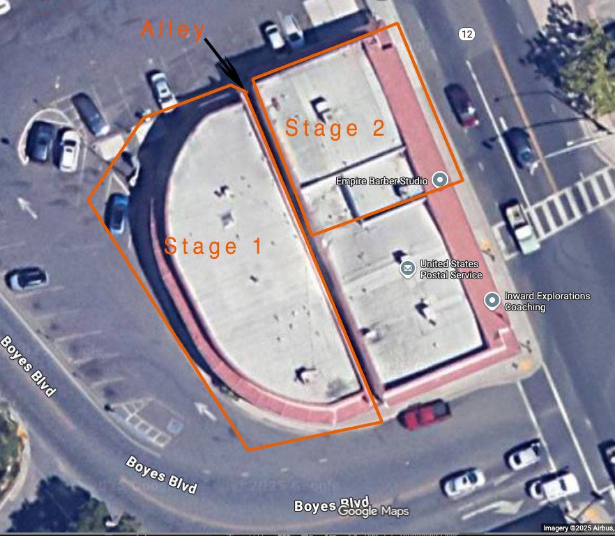
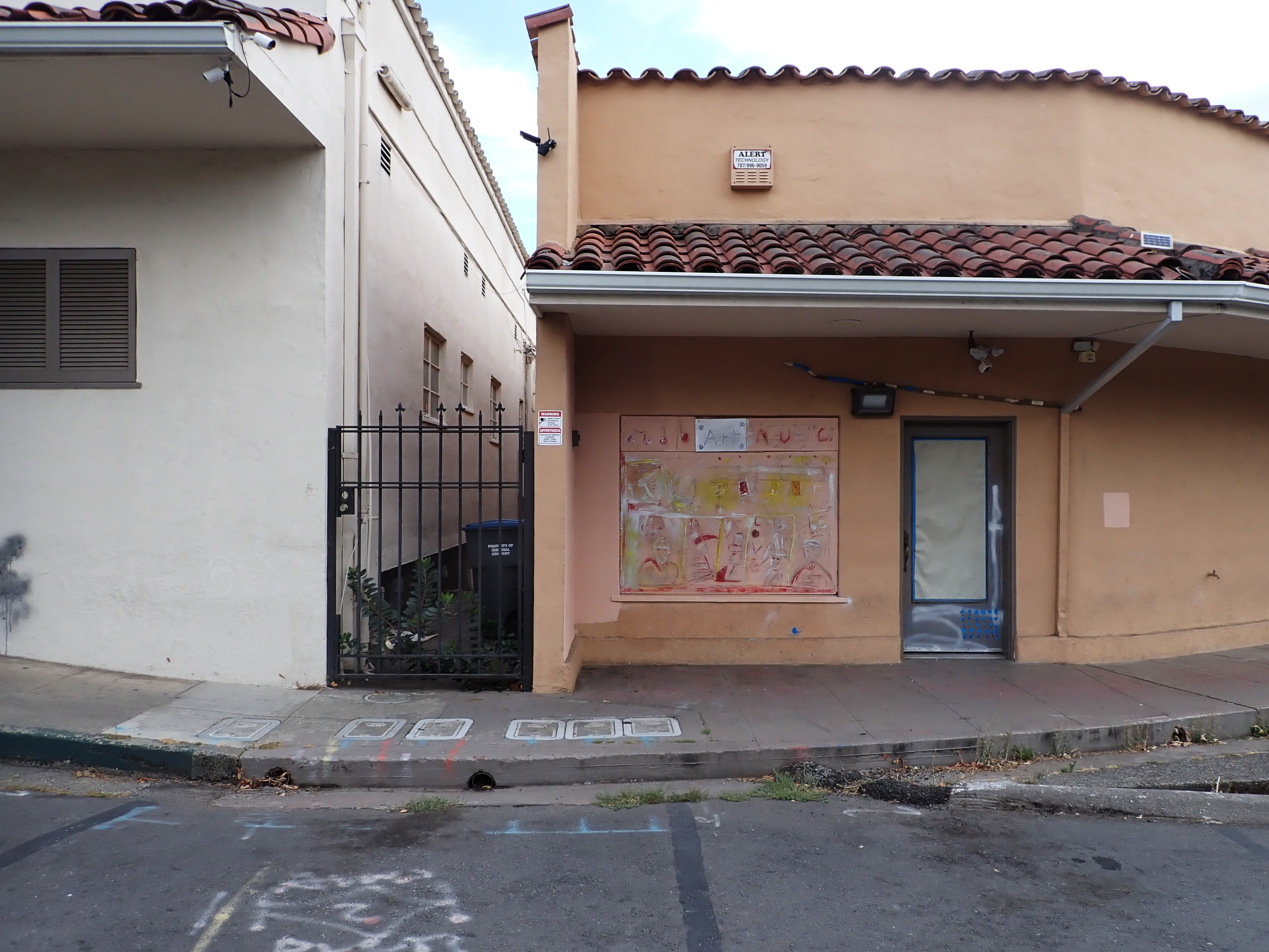
The Plaza Center Building was built in stages between 1951 and 1958. The first stage was built with the graceful curve which followed the property line. The second fronted Highway 12 next to the first one. They were separated by a narrow alleyway. (The third stage was the building occupied by the Post Office today.)
Screenshot
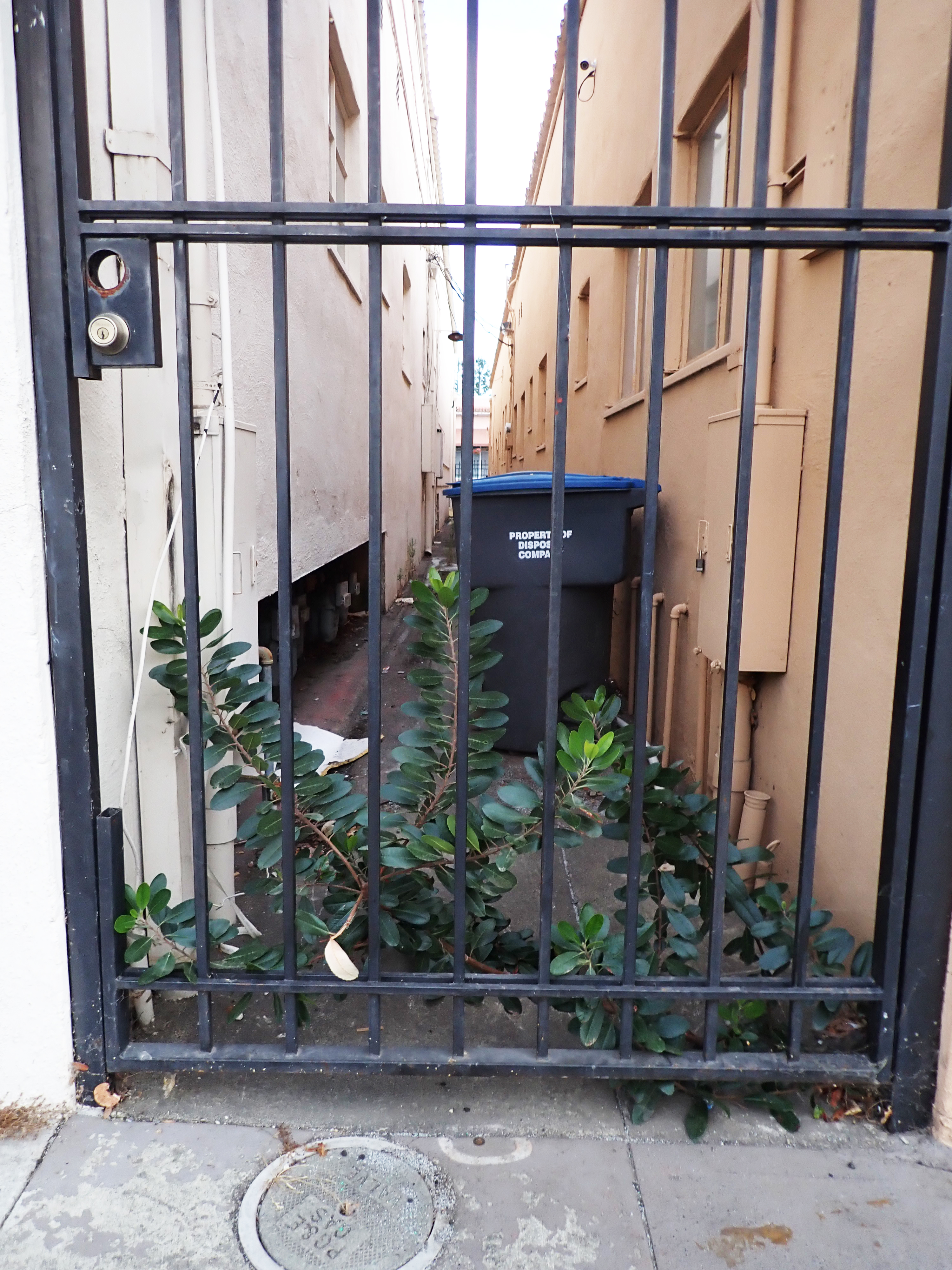
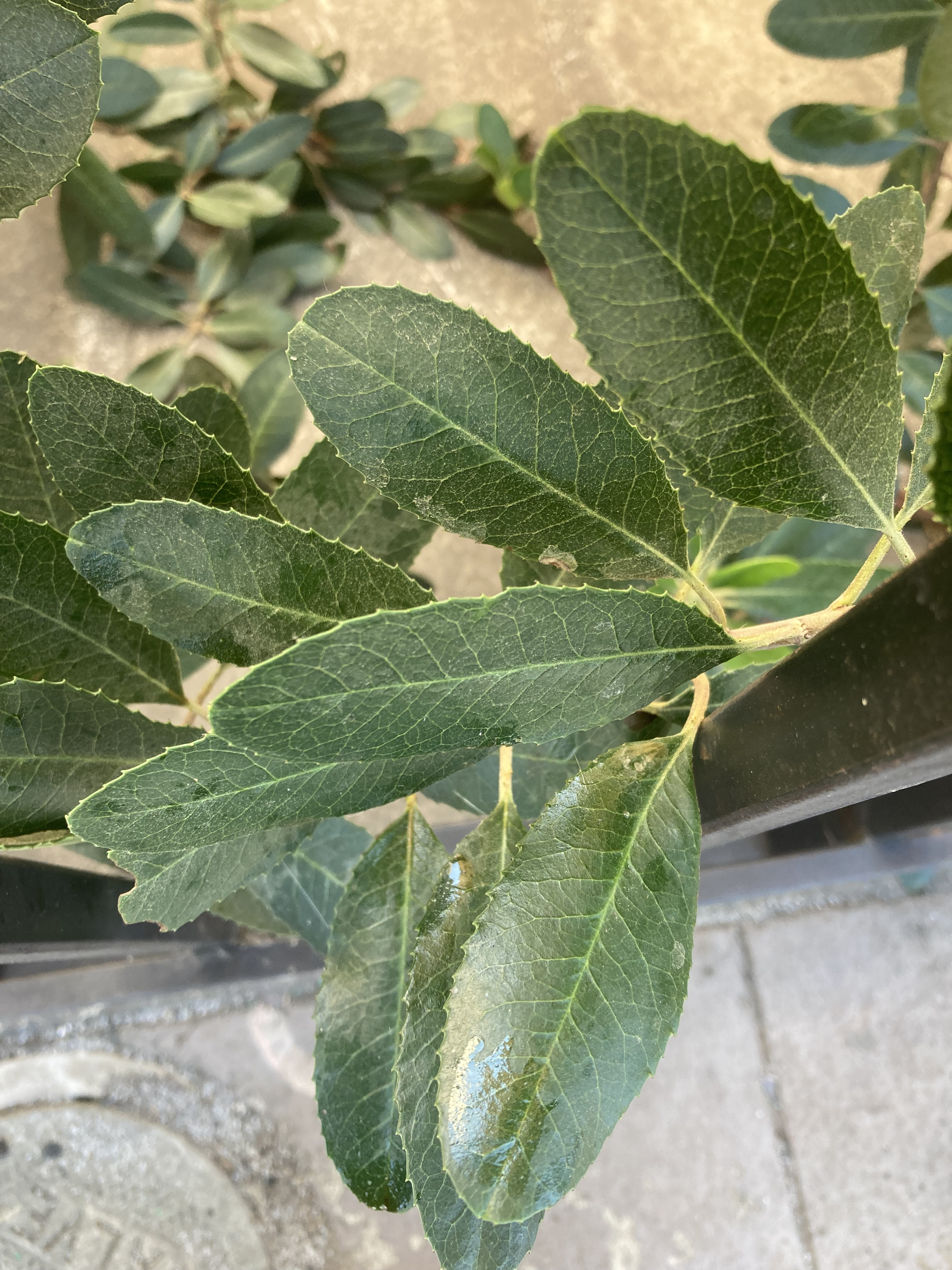
At the north end of this alley we find a healthy looking toyon (heteromeles arbutifolia), a native plant. According toCalscape “Toyon is a prominent component of the Coastal Sage Scrub plant community, and is a part of drought-adapted Chaparral, Mixed Evergreen Forest and Oak Woodland habitats.” Also “The flowers attract butterflies and other pollinators. The berries are eaten by many birds, including Mockingbirds, American Robins, and Cedar Waxwings. Mammals including coyotes and bears also eat and disperse the berries. For humans, the berries are edible after cooking, or drying and crushing, in order to break down the small amounts of cyanogenic glycosides. Indigenous People use the berries to make cider, and a granular sugar.”
A Neighborhood Phenomenon for sure. Waste space occupied by a native plant, and one that was important to the Indigenous people of California. Located just a few feet from the original geothermal water source, probably used by local Indians, it’s healing properties well known to them, it is a link to that 10,000 year-long pre-contact history of the area. Also, anything that’s good for Cedar Waxwings is OK by me!
Immediately adjacent, some spontaneous street art, which should serve as a strong suggestion for what to do with the rest of that building, which is currently more than half empty.
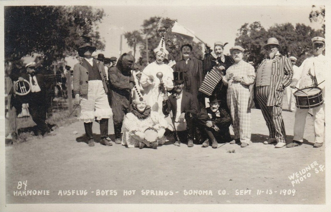
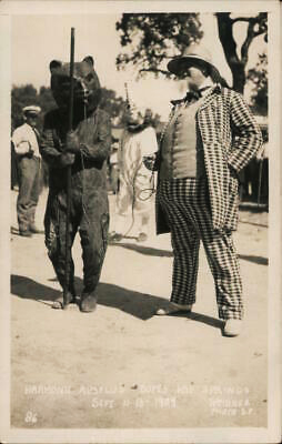
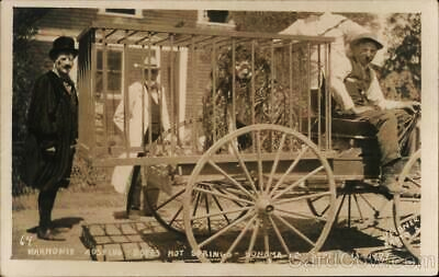
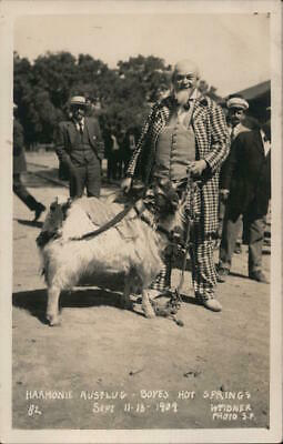
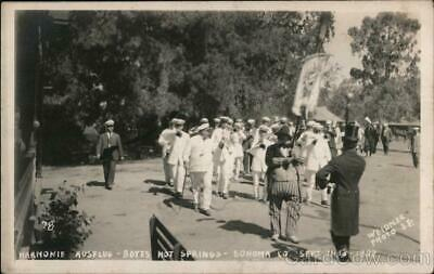
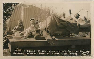
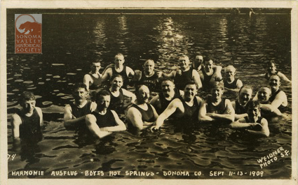
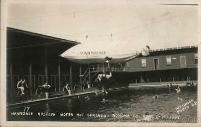
A curiosity of early 20th century postcards from the Boyes Hot Springs resort are labeled “Harmonie Ausflug.” “Harmonie Ausflug” is not the name of a specific society but of the activity: the Harmonie (singing society, choral group,) takes an outing.
“In Europe’s German-speaking states…male choir organizations started popping up around 1810 and grew in number and prominence over the next half-century. Most were open to people of different social classes and focused on the idea of educating people and spreading middle-class values-though, by the 1860s, some were specifically “workers choirs,” affiliated with socialist and labor movements.
However, for many regular German Americans, this wasn’t really the point of the festivals. They showed up to enjoy romantic or humorous folk songs, eat childhood foods, drink beer, and reminisce about the old country.” and,
“German American singing festivals included both highbrow and lowbrow features.”
The Harmonie Ausflug post cards clearly represent the choristers indulging in the “lowbrow features.”
Animal costumes were favored. Dated 1909 on front.
An actual animal.
Not just singers, but a marching band!
“My wife’s husband has gone to the country “but oh you Kid!”
Taking the waters at Boyes.
A zeppelin (invented by Ferdinand von Zeppelin, don’t ya know)? Seems to be hanging from a cable over the pool.
All photos, dated 1909, are by the prolific Charles Weidner.
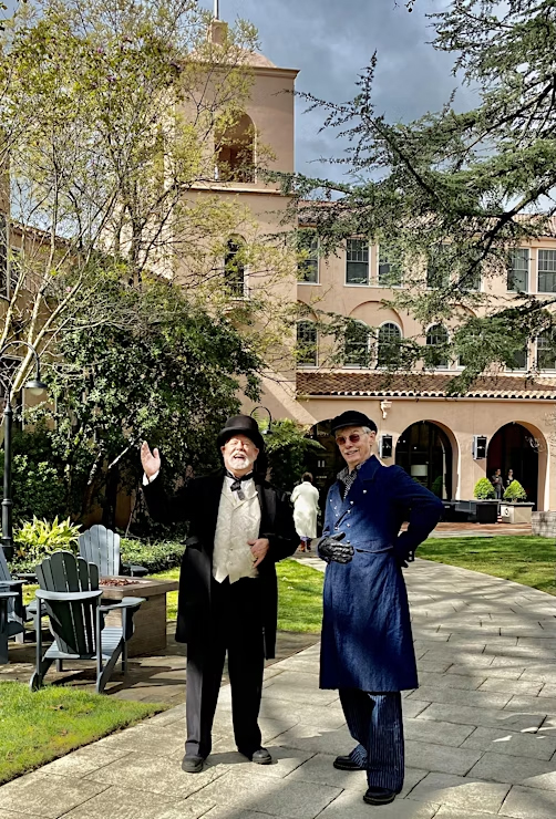
“You may have heard that I am starting a new historic walking tour in your neighborhood. It is called the Agua Rica Tour. I was asked to create such a tour…that will take place solely on the grounds of the Sonoma Mission Inn….by the new general Manager Karim Ikrimah last year.
Since then, CW Bayer and I have delved deeply into the historical record….and am now good friends with Reverend Leavenworth, Capt. Boyes, and Rudy Lichtenberg. Well…except for Thaddeus Minor Leavenworth….no one could be actual friends with him….”
George and CW are well-known actors, historians and radio personalities (yes, we still have radio!) in Sonoma Valley. The tour is an absolute blast! Our history is full of great characters, and these guys really bring them to life.
The tour runs Friday through Monday, starts at 10AM, and adult admission is $25, kids free.
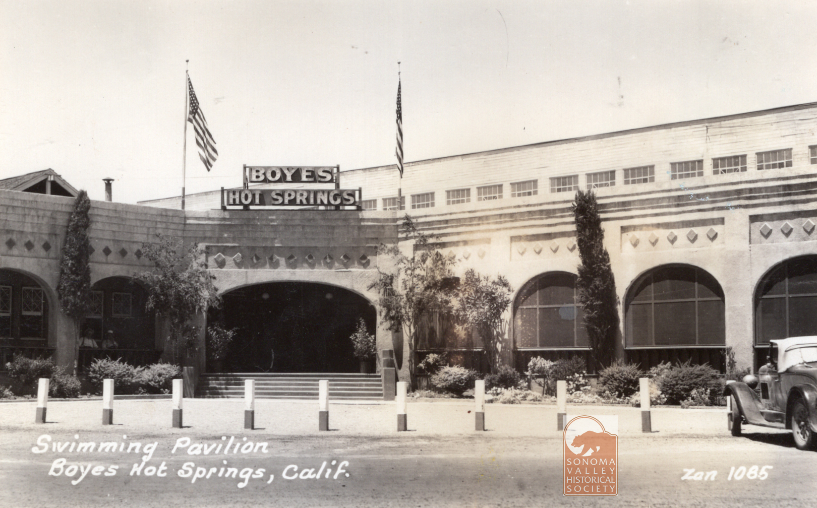
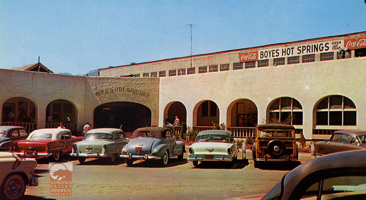
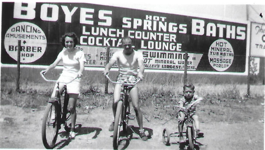
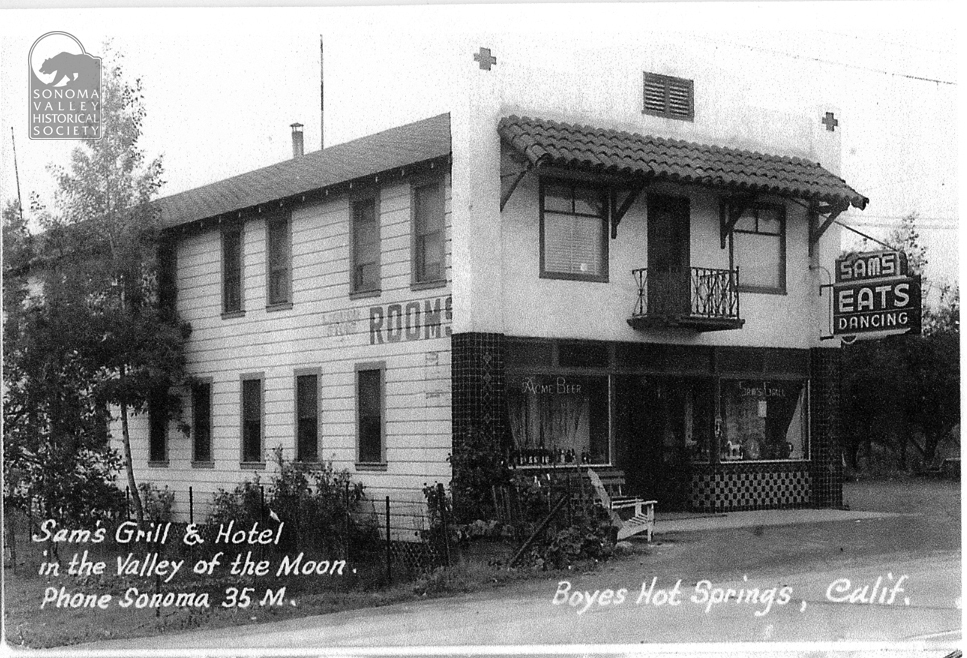
The Boyes Bath House entertained thousands of happy customers from the 1890s through April 17, 1969, when it burned to the ground. Many locals have fond memories of summers spent swimming in its gigantic pool. The entrance in the 1930s, above, and the 1950s, below.
This large billboard style sign pretty much lays out all the amenities offered at the Bath House in 1944. Photo courtesy of Dave Chioti.
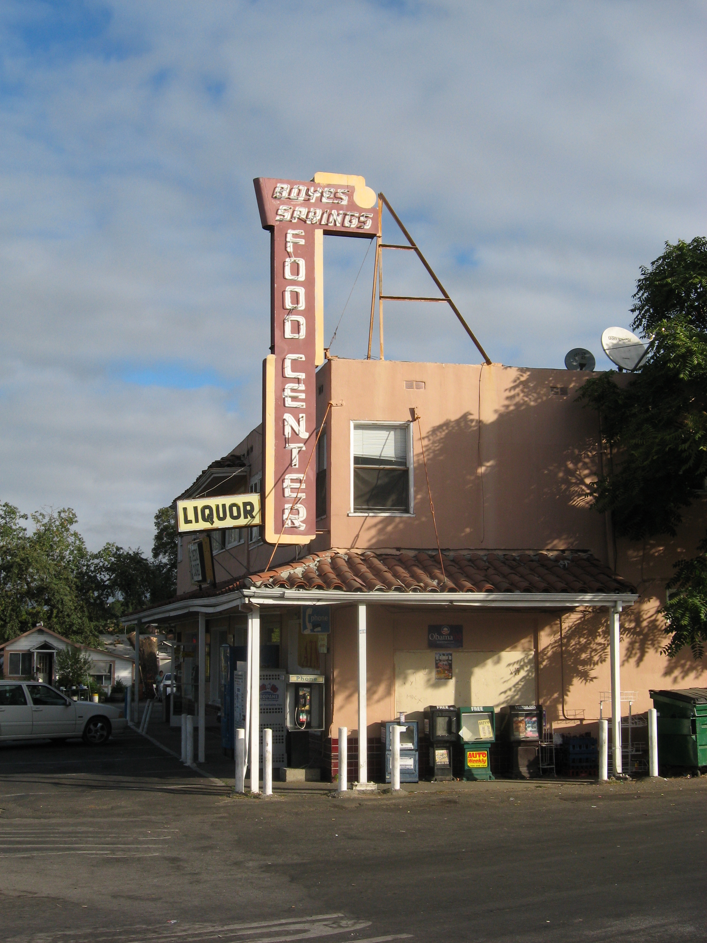
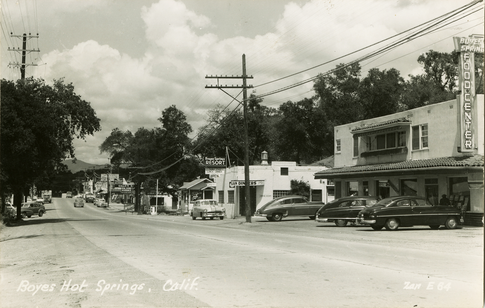
Boyes Food Center in 2009. It was constructed in 1949. The tiled awning was torn off sometime in the 2000s.
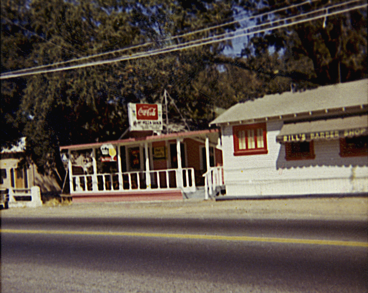
1949, looking north on the highway. Beyond the Food Center is the Boyes Springs Resort, now a parking lot. Beyond that, the original Mary’s Pizza.
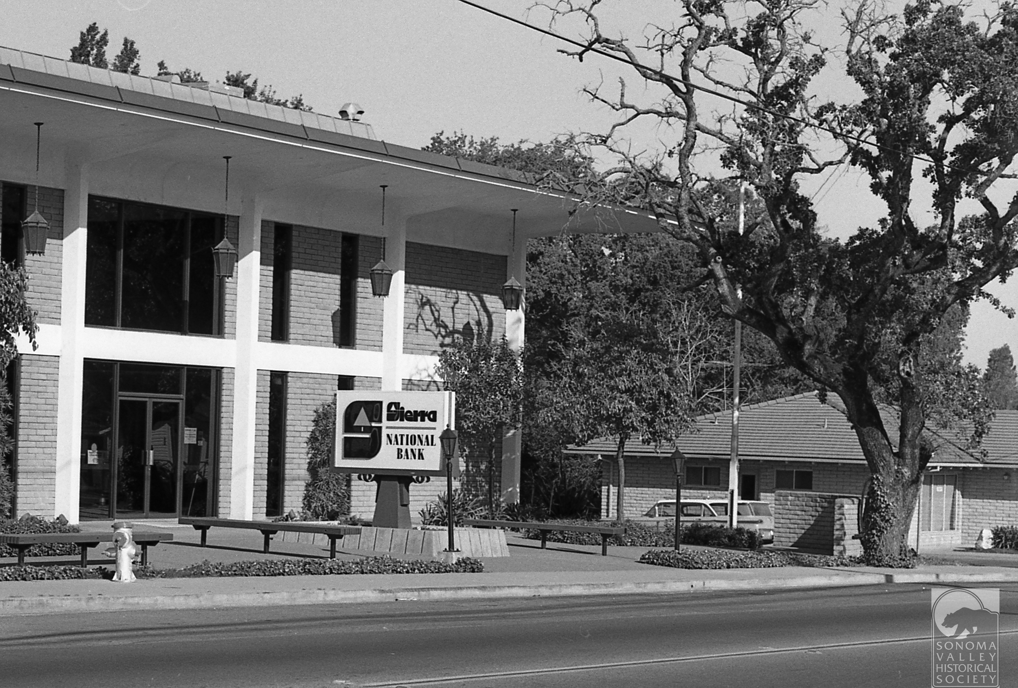
Across the highway from the Food Center, the Sierra Bank building was constructed in 1966. It now houses the offices onf Ross, Drulis, Cusenberry architects. The cross street at the corner was once called Meinke Road, but was renamed Sierra when the building was built.
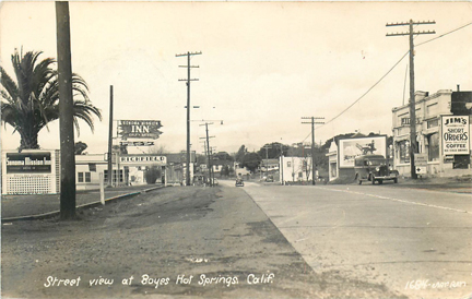
The corner of Boyes Blvd. and Highway 12, known then as the Santa Rosa road, 1930s. Sonoma Mission Inn sign at left mounted on a lattice-work in the Boyes Plaza. the palm tree was in the center of the plaza. Richfield gas station sign beyond that. On the right, Jim’s Cafe “Short Orders!” The building was built after the 1923 fire of ceramic brick, by Bob Liaros, a local barber. It stood until the early 1990s.
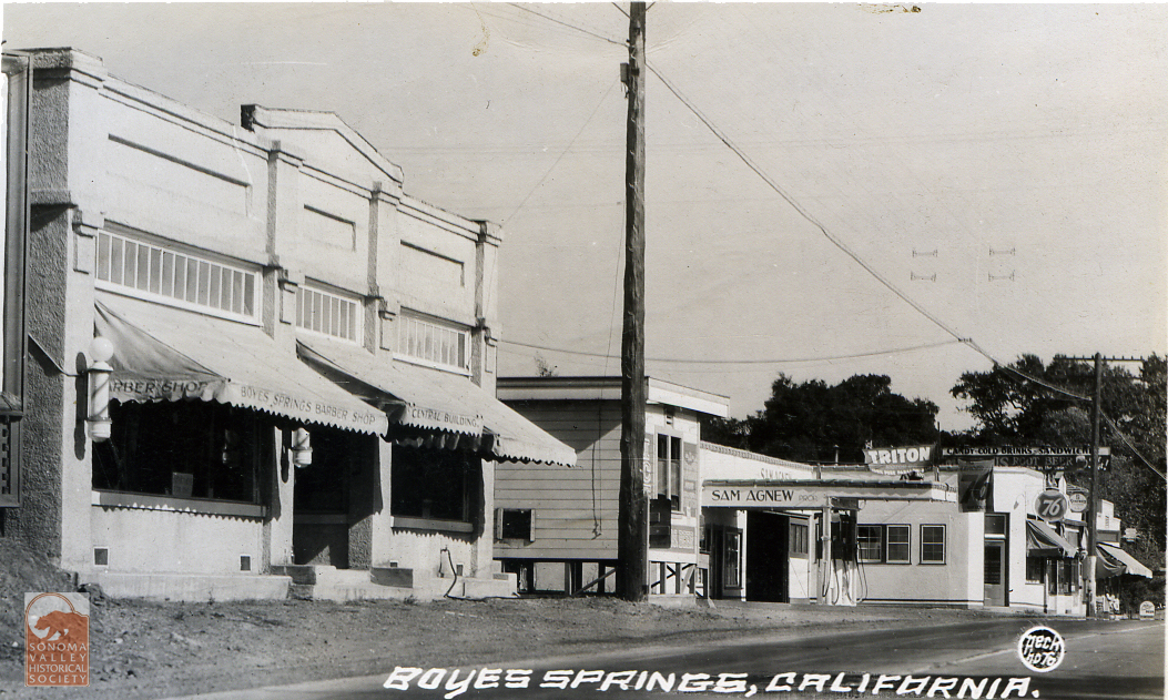
The Liaros building, looking the opposite direction on the highway. Past the Ice House on the corner of Vallejo Ave., is Sam Agnew’s service station, now the Sonoma Eats parking lot. Agnew was a famous major league baseball player who retired to Boyes Hot Springs in the 1940s.
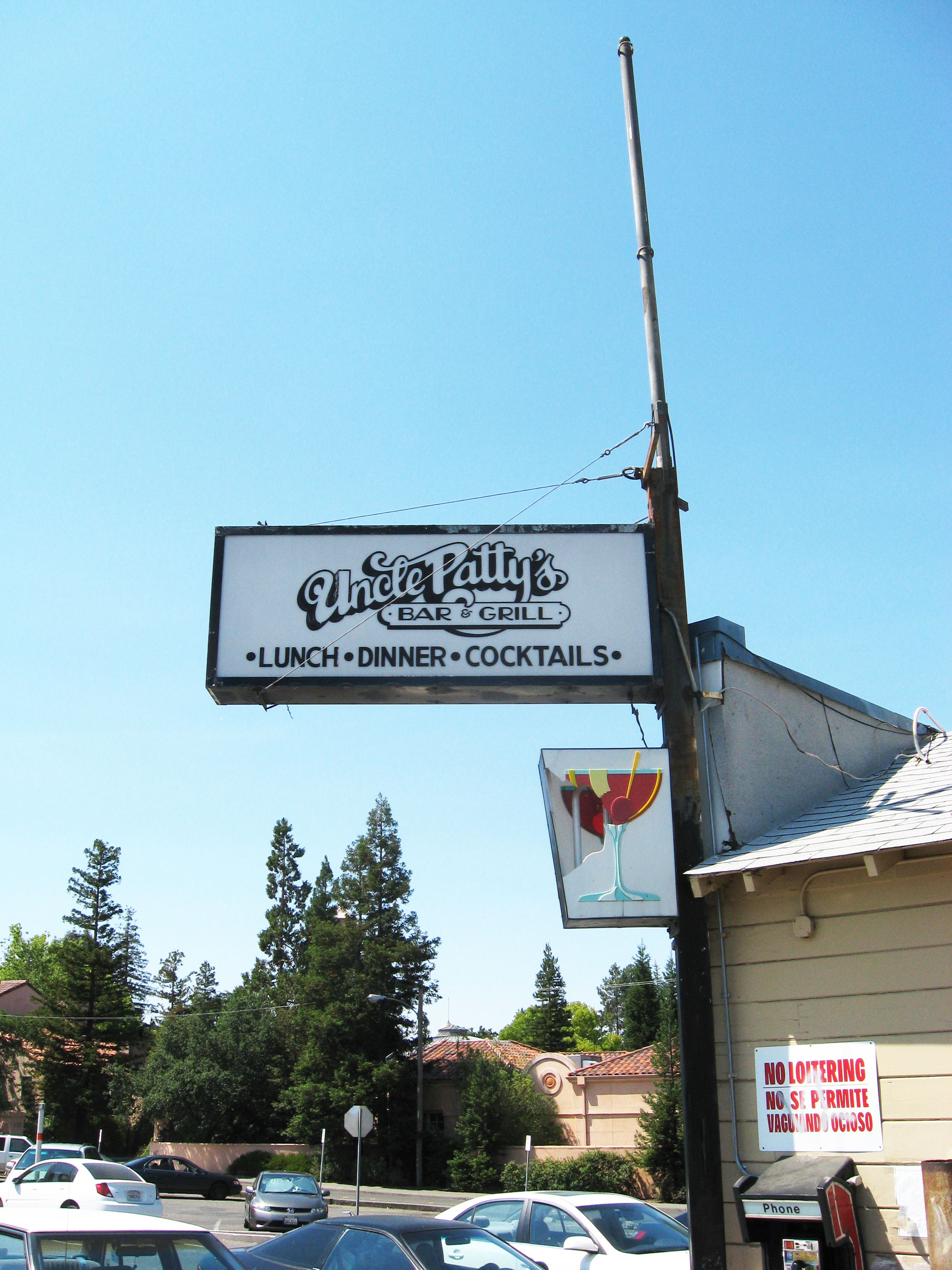
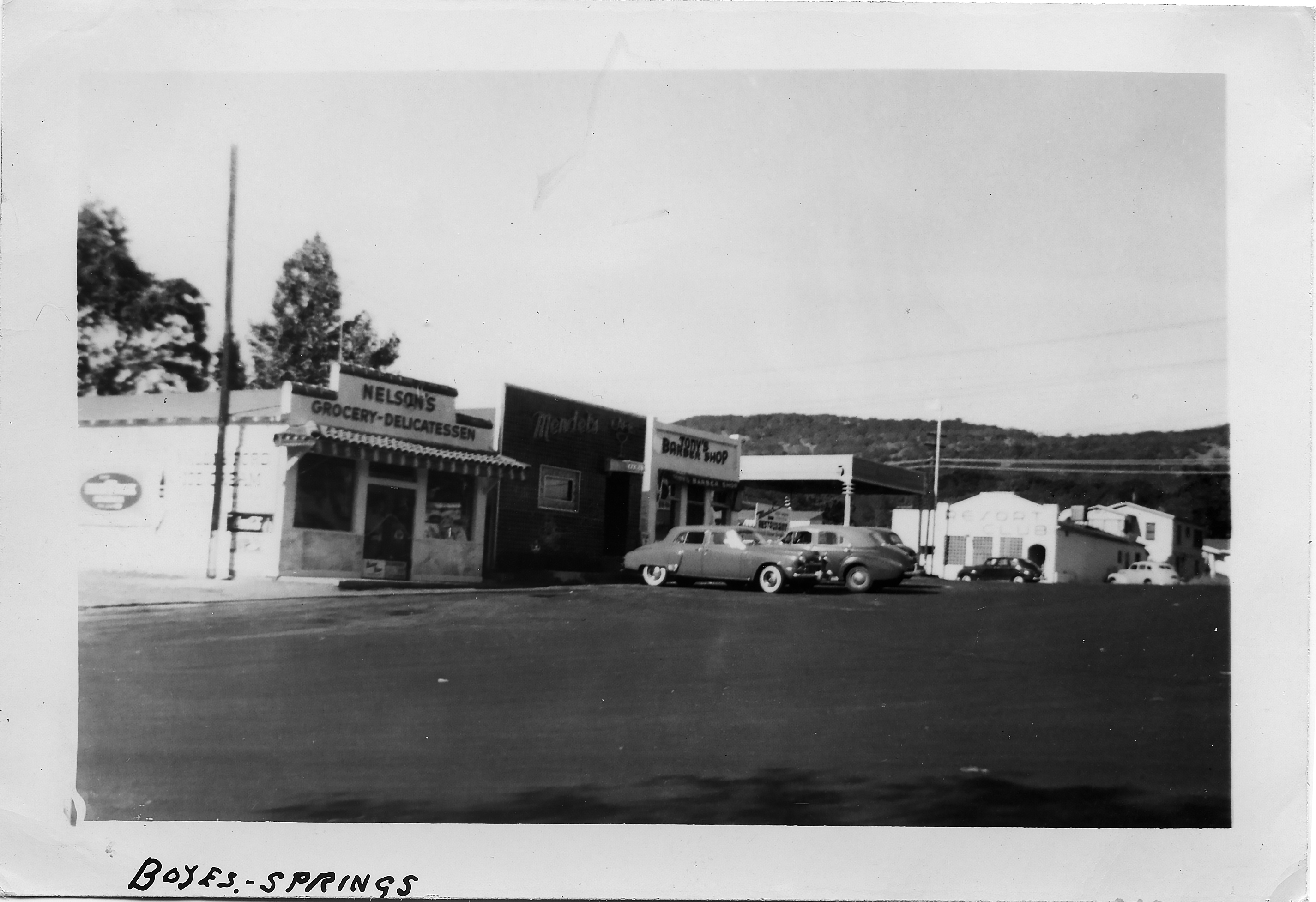
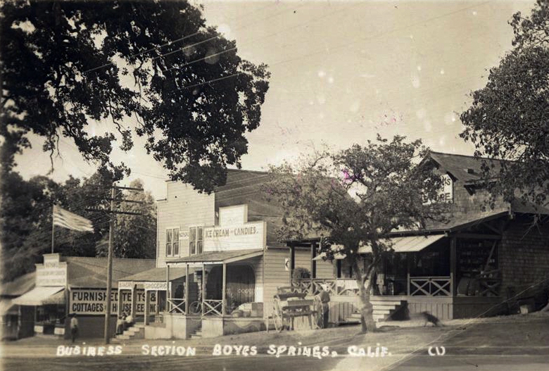
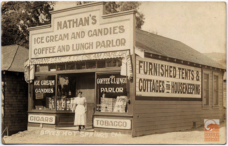
Along side what was once a spur street between Boyes Blvd. and the highway, stood a row of buildings dating from the 1910s or before. Uncle Patty’s was the last resident business before they were torn down in the 2000s. Below are those buildings, or some of them, in the 1950s, featuring Mendel’s Cafe and Nelson’s Deli, and a barber shop. Nathan’s Ice Cream was one of the original businesses on that row, which was called “the business section,” in the very early days.
Circa 1912. At right, behind the oak, is Graham’s Store, the original site of the Boyes Hot Springs post office.
Nathan’s is the building at far left in the photo above.
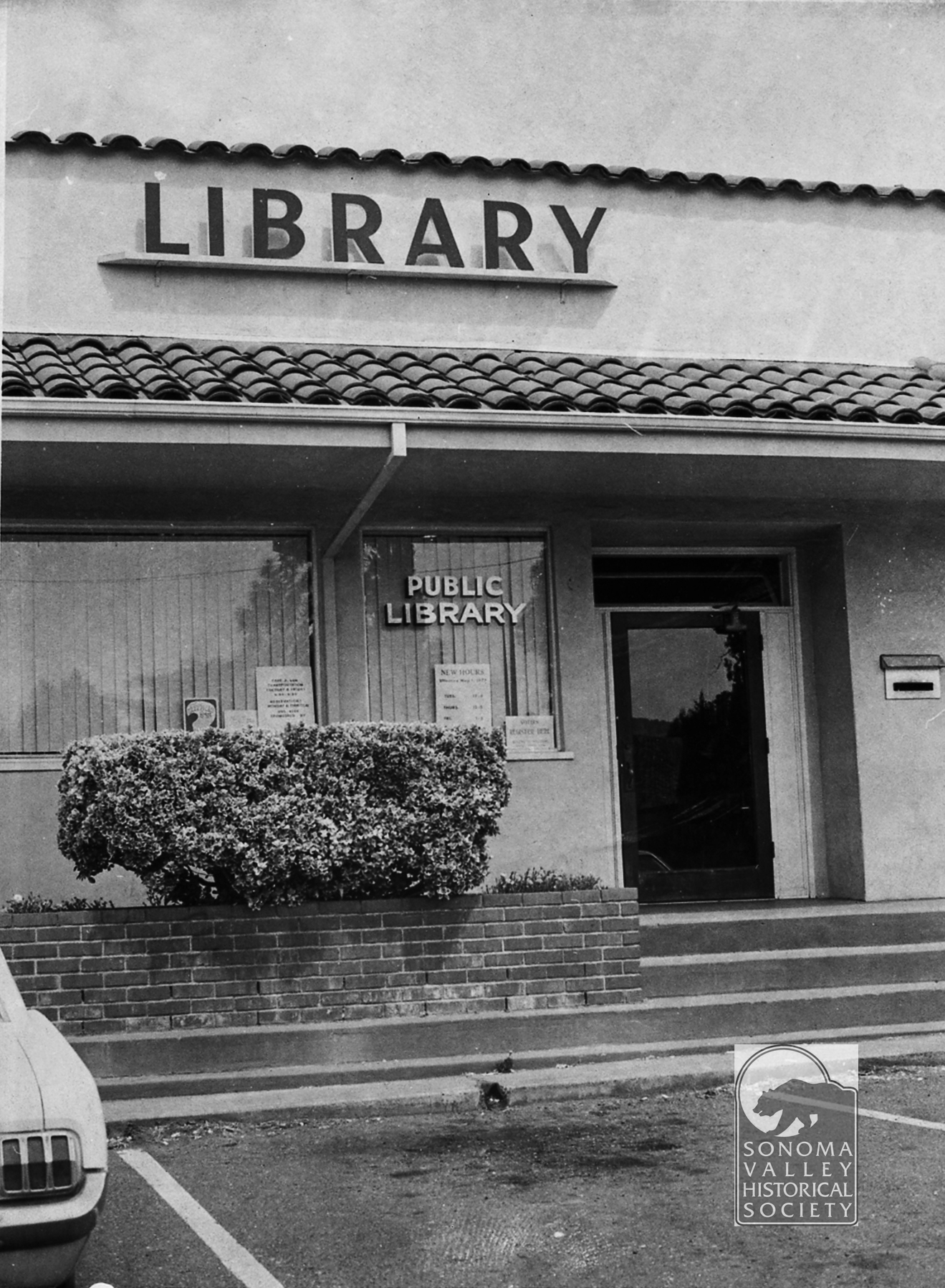
Yes, there was a branch library in the Plaza Center building in the 1970s.
Sam Ganos was prominent business man in the 1940s and 50s. The building, much modified, now hosues La Hacienda Mexican Restaurant.
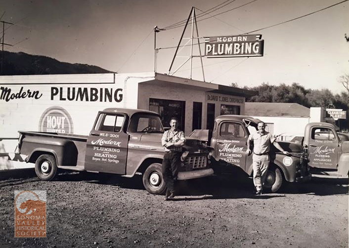
Modern Plumbing was founded in Boyes Hot Springs by Ted Riboni and Ed Feranndo in the 1950s. The building still stands, on the west side of the highway, opposite Bernhard Ave.
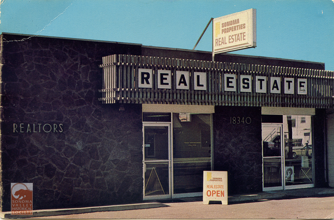
The Greengrass Building. A pretty ordinary building with an interesting history. Clidk the link to find out!
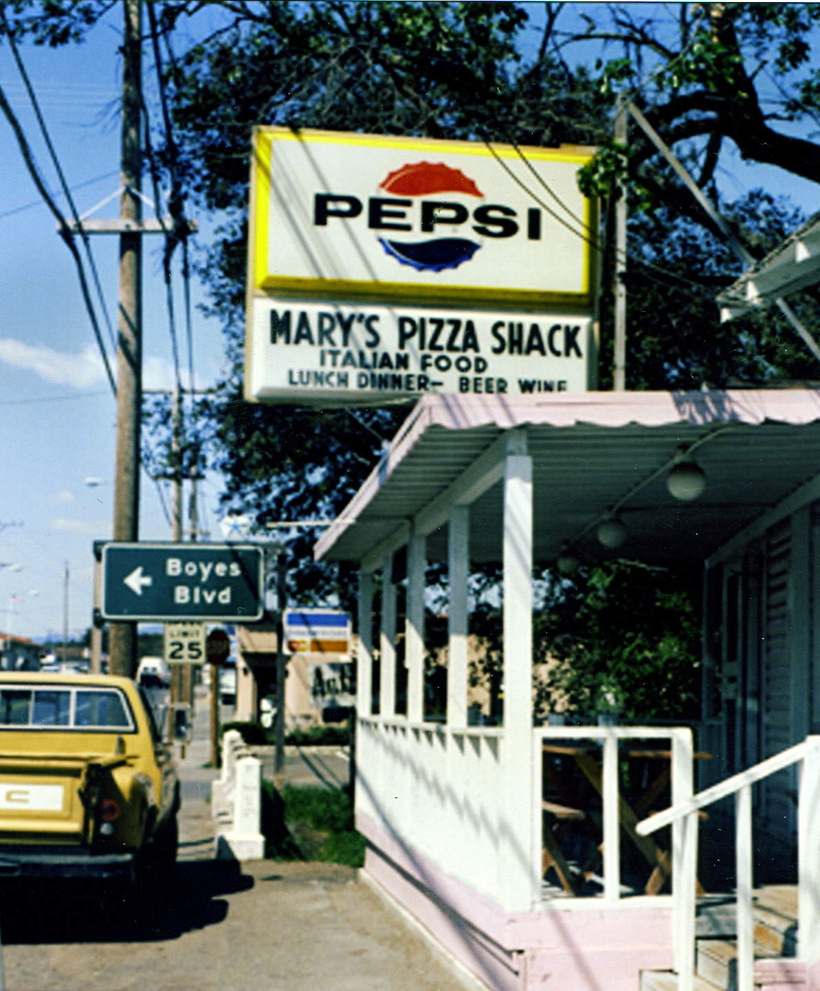
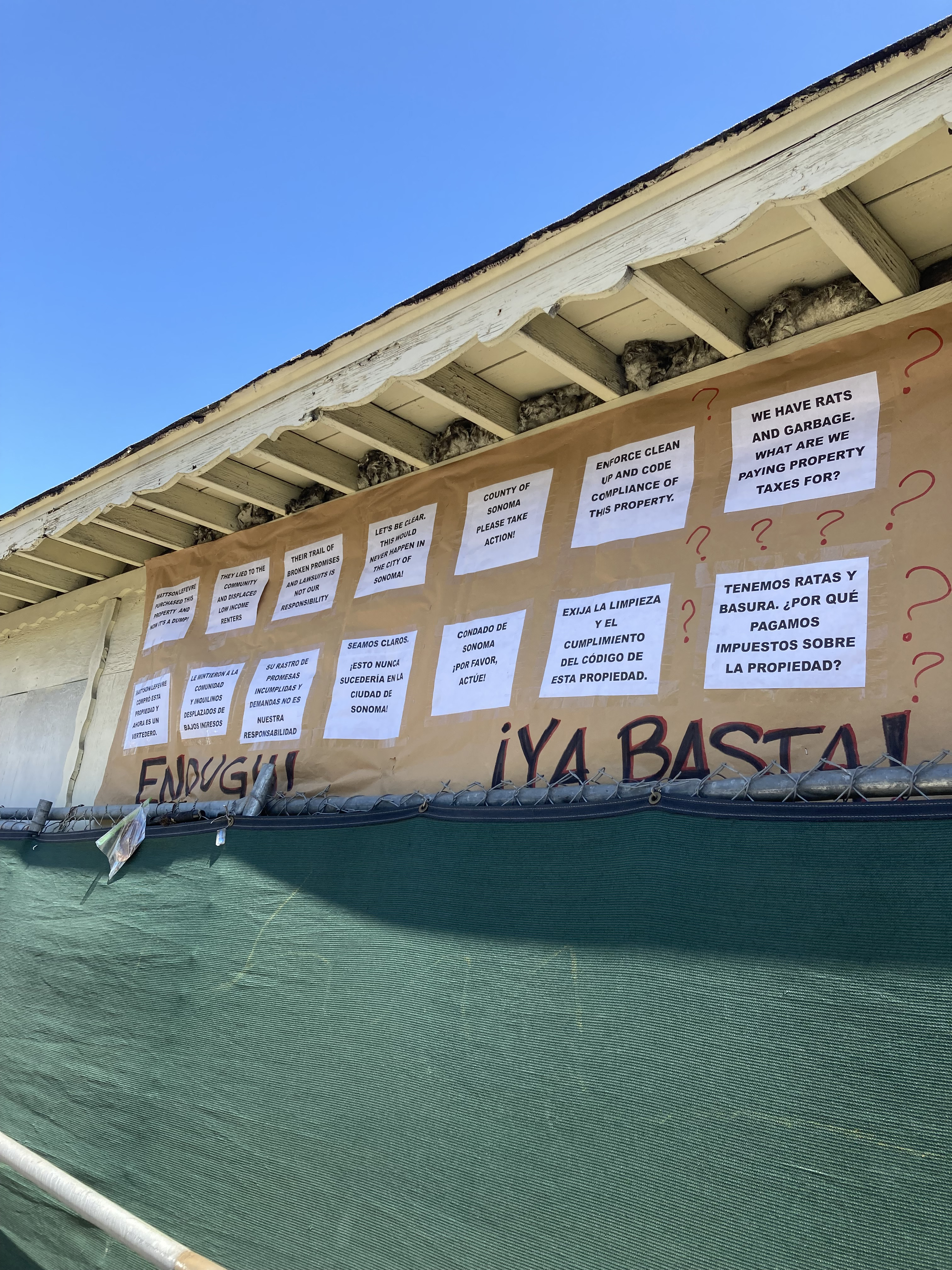
The original location of Mary’s Pizza Shack, now a large local chain, was in this small building at the end of Arroyo Road, at the highway. Mary Fazio opened her restaurant in 1959. The rest is history, as they say. Thanks to the Albano family for the photos.
Flash forward to 2025. The unfortunate deterioration of the property continues. Neighbors are concerned enough to put up this sign on the front of the original shack. The current owner is under suspicion of fraud. We await remediation, but the wheels of County agencies turn slowly.
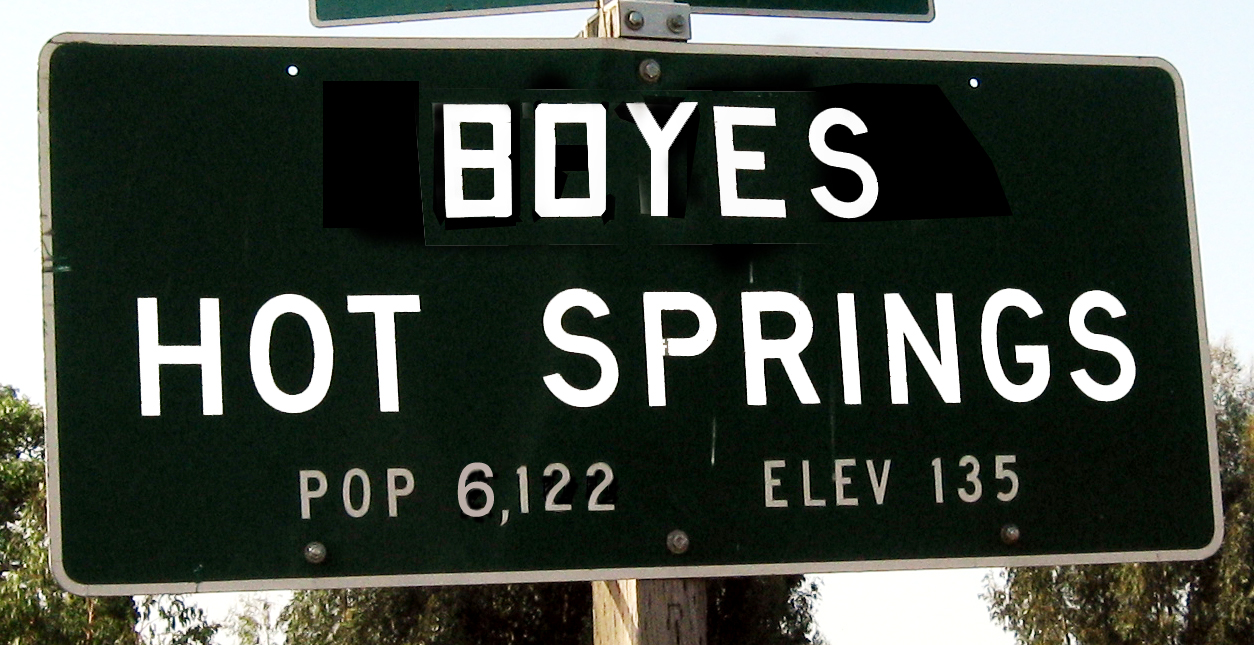
Both Agua Caliente and Fetters Hot Springs, just up the road, have official Caltrans place-name signs, but Boyes Hot Springs does not. Why? Who knows. The one above is my creation.
Photos by the author. Index Tribune and other photos courtesy of the Sonoma Valley Historical Society
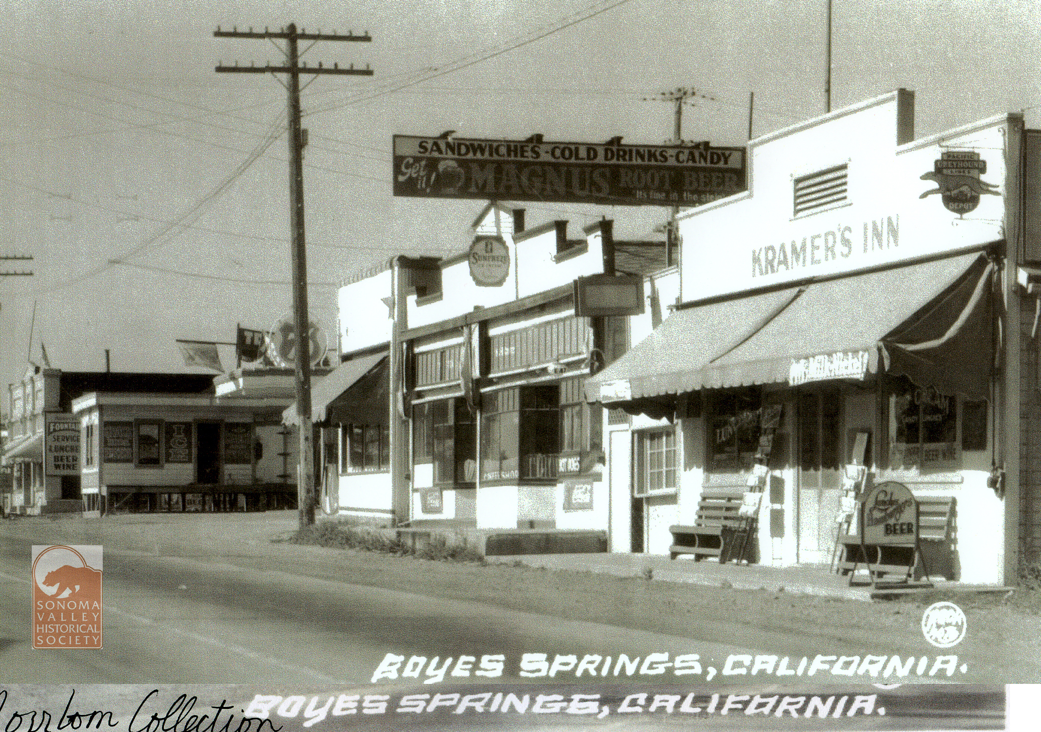
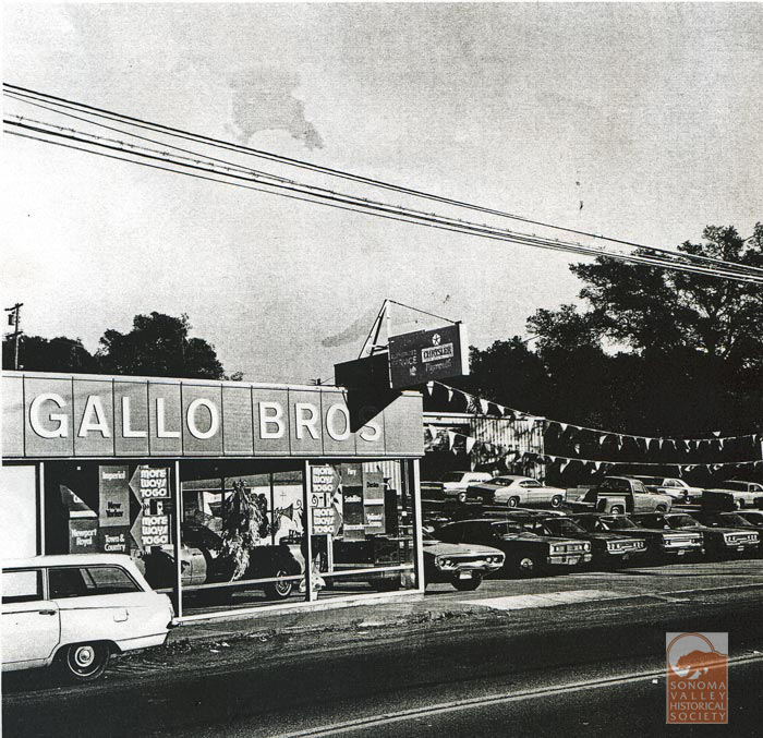
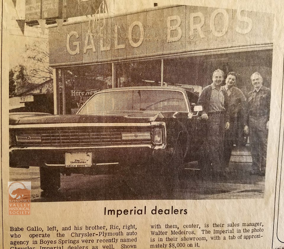
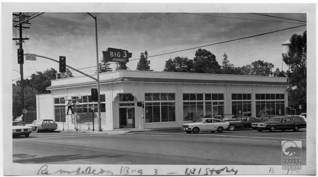
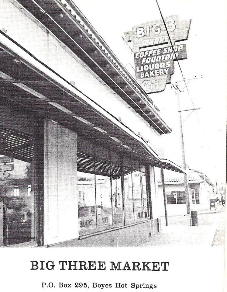
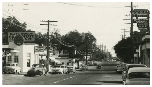
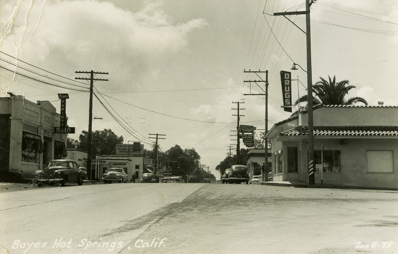
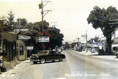
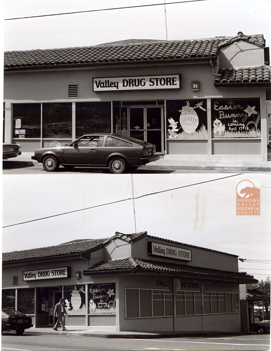
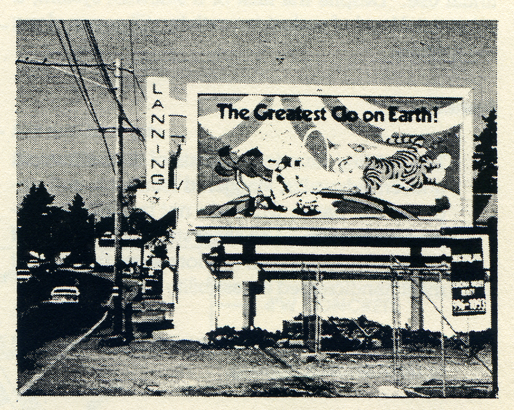
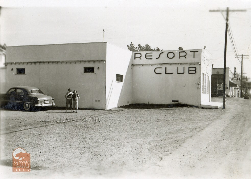
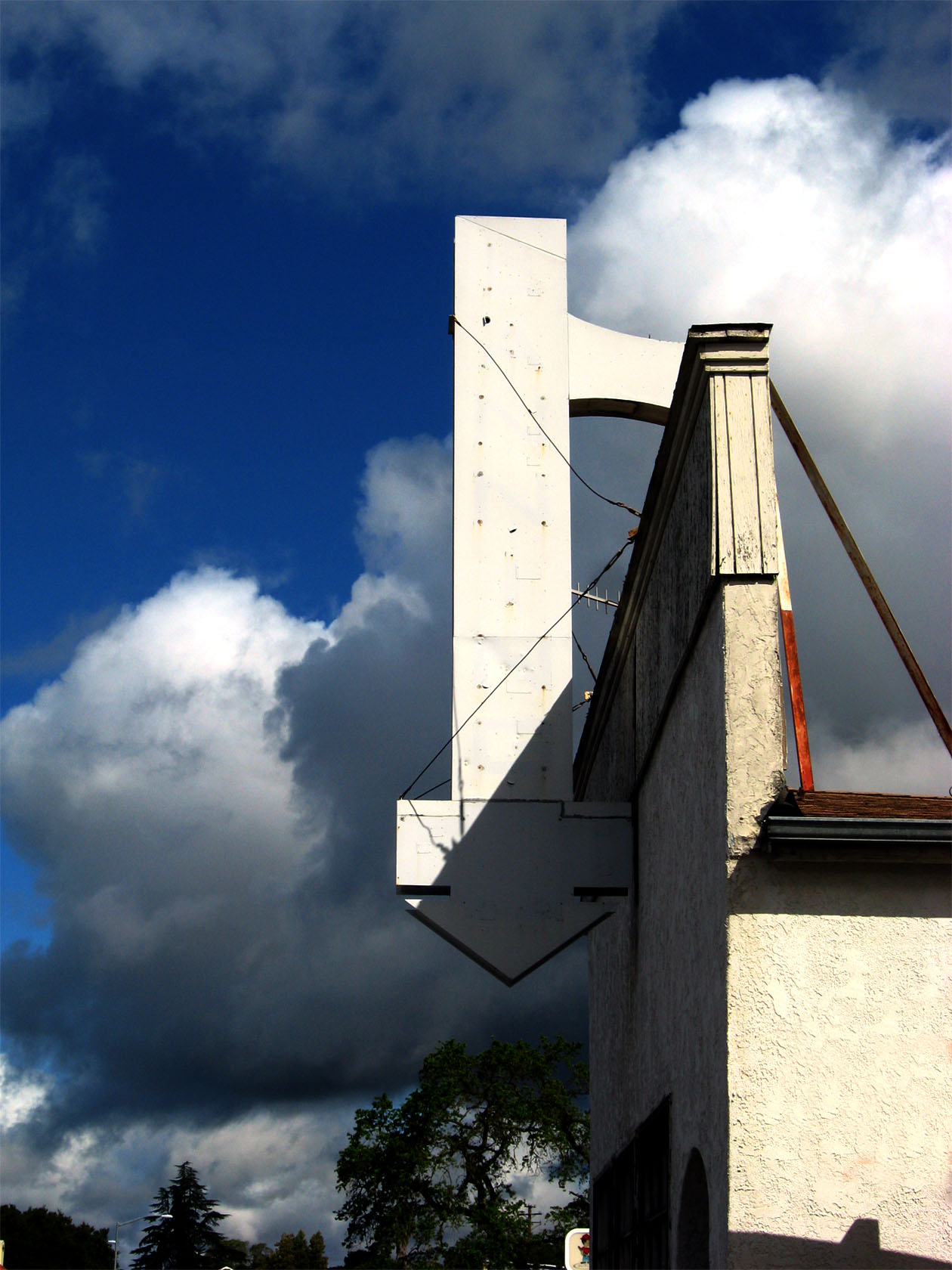
Commercial buildings on either side of the eastern part of Boyes Blvd. 1930s. The Kramer’S Inn building is seen in the next two photos, from 2008 and 2025.Circa 20082025The Gallo brothers ran a service station and car dealership from 1949 into the 1970s. The building, immediately south of Kramer’s, is now Golden West Glass.Southwest corner of Boyes Blvd. and Highway 12, 1980s. The Big Three, as it was then known. Now part of the Sonoma Mission Inn, but no longer a public building.Earlier, taller version of the sign.The wonderful Woodleaf sign, upper right. Zan Stark photo.1950s. Before it was the Big Three, the building was the Woodleaf Store. At left is the building that had previously held Jim’s Cafe. More in Part 2. The palm tree peeking over the rooftop at right is situated in Boyes Springs Plaza, as once was. Pine Wagner’s Valley Drug was in the building at right center. Pine Wagner was perhaps the first woman to be a licensed pharmacist in California. She operated her store from 1946 until 1962. Zan Stark photo.Pine Wagner’s first location, on the highway, in Bud Castner’s building, opposite Arroyo Road. Zan Stark photo.Easter! 1970s? This commercial space was later the Church Mouse Thrift Store. Currently empty, alas.1960s. Looking north at the Boyes/Highway 12 intersection can be seen, far upper right, the Melody Club sign.Later, the old Lanning’s Resort Club/Melody Club became the offices of Lanning Construction.The Resort Club, 1951. pictured are Carla Robinson (L), and Helen Lanning (R). Photo courtesy of Lorrie Baetge Fuller, who is Carla Robinson’s daughter.The Melody Club sign circa 2009.
Photographs courtesy of the Sonoma Valley Historical Society, Stanford University Library Special Collections, and the author.
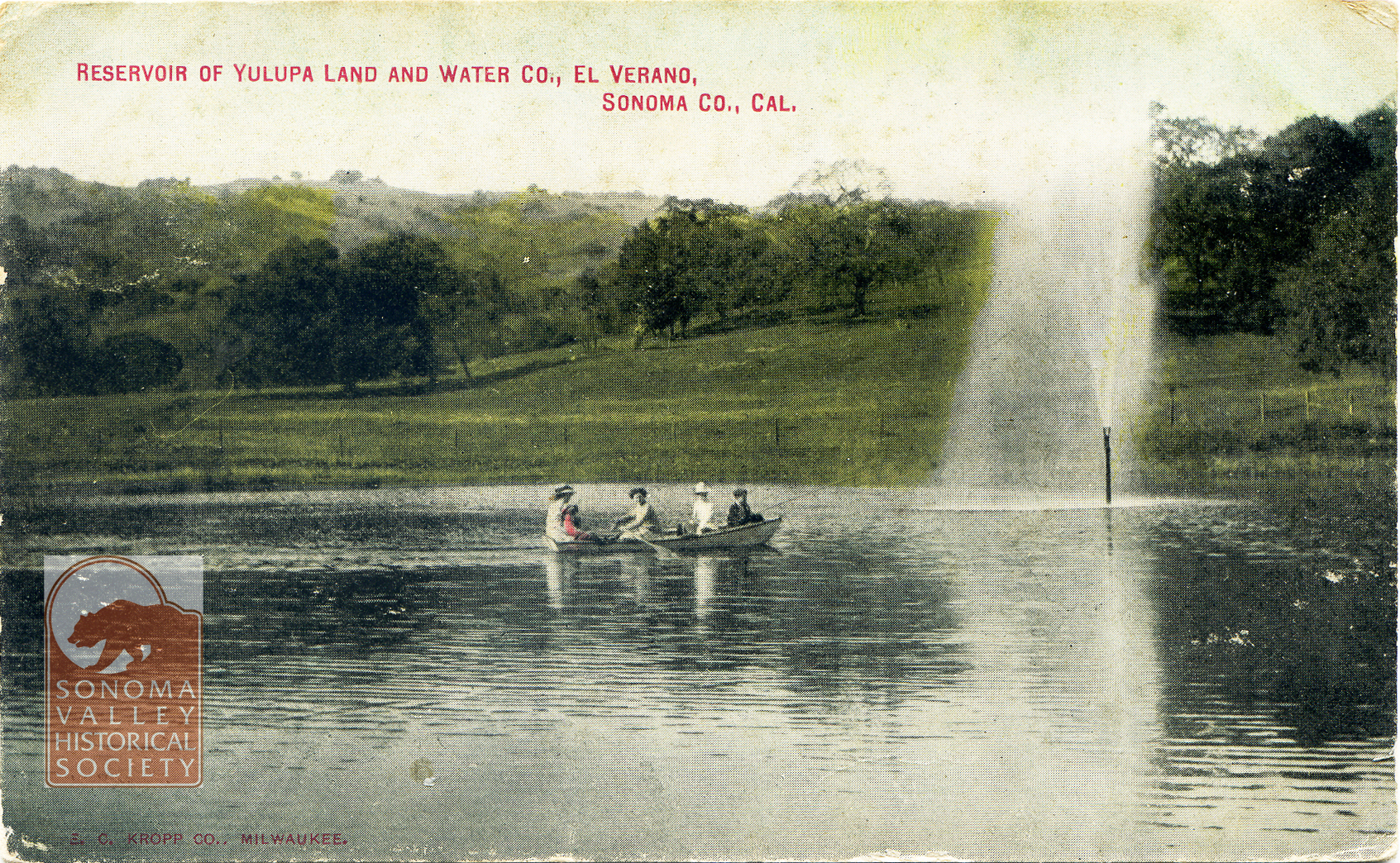
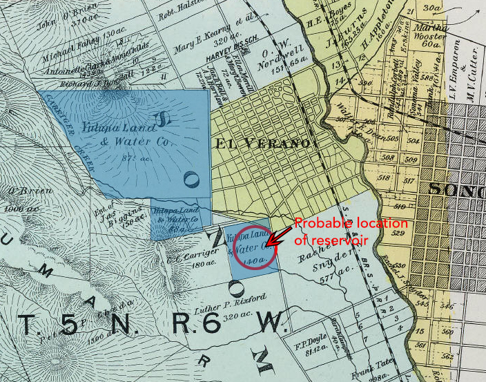
Post marked 1910. The Yulupa Land and Water Company holdings appear on an 1898 Reynolds and Proctor map (Rumsey Collection).
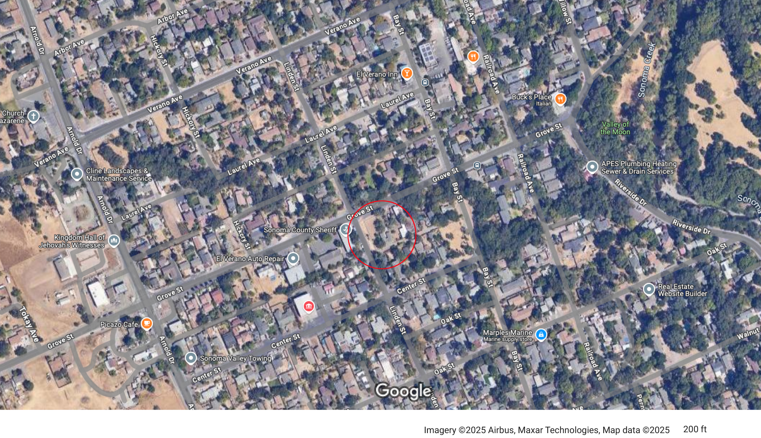
Judging by the hills in the background in the post card, the reservoir was probably located near the corner of Grove and Linden Streets.
In 1910, the Sonoma Valley Water, Light and Power Company acquired the Yulupa Land and Water Company.
1913- “J.A. Dinsella, the enterprising plumber of this city, has secured a contract from Sonoma Vista Land Co. near this city, to build its pipeline of 4-inch mains and 2-inch laterals.”
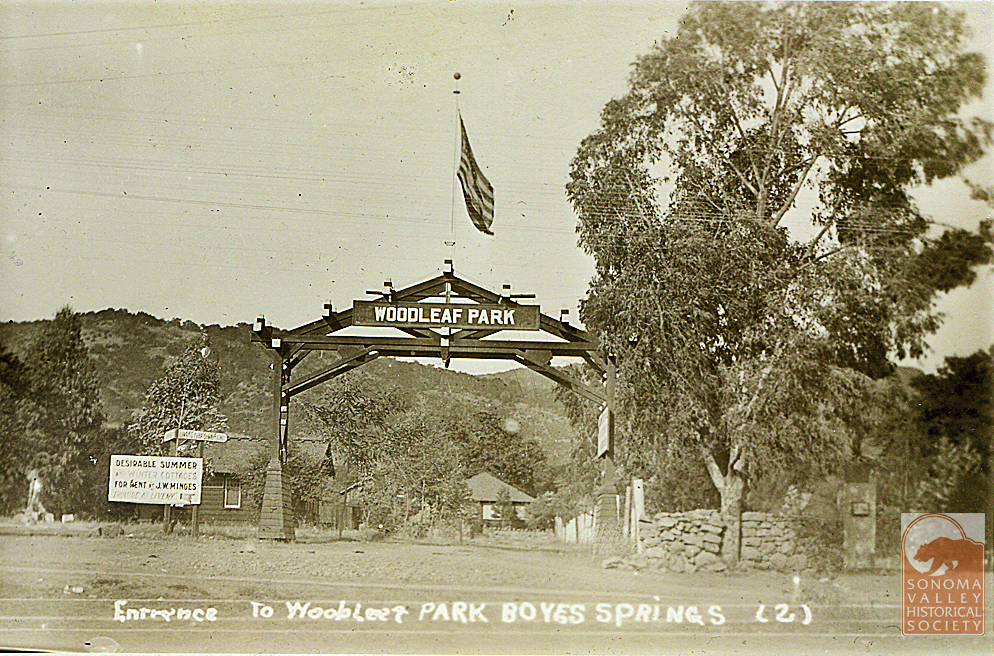
In 1923 J.W. Minges sold his Boyes Springs Water System, which mainly served Woodleaf Park, to N.M. Peterson, proprietor of the Mountain Water Avenue system. The merger “will enable the operating company to give better service…” even then that was the rationale!
J.W. Minges was known as the “mayor” of Boyes Hot Springs.
“Another company at Boyes Springs which has supplied many customers in the vicinity of the hotel and Boyes Springs Park is owned and operated by James Baines.” of Baines St.
1958-Mountain Ave. Water Co. was sold to Mr. and Mrs Peterson Jr. whose parents had bought from Minges. The Petersons’ company served Boyes Hot Springs for 35 years. Improvements included an office building at 18640 Highland (An address that cannot exist, apparently, as the street ends at 18075), and a new tank at the top of Mountain Ave. An existing tank is located above Highland, circa 2025.
From the Valley of the Moon Water District website: “In 1957, the Valley of the Moon Fire District was evaluated by the Pacific Fire Board which at that time noticed the lack of a dependable water supply source. Subsequent inquiries of Fire District Board members, J. Udvic. T. Polidori and F. Serres, revealed that many wells in the area were failing due to drops in the groundwater levels in the Valley. Early attempts to have Sonoma County build an aqueduct from Santa Rosa to the Sonoma Water and Irrigation Company failed due to the inability of the latter to deposit a $25,000 cash bond with the County.”
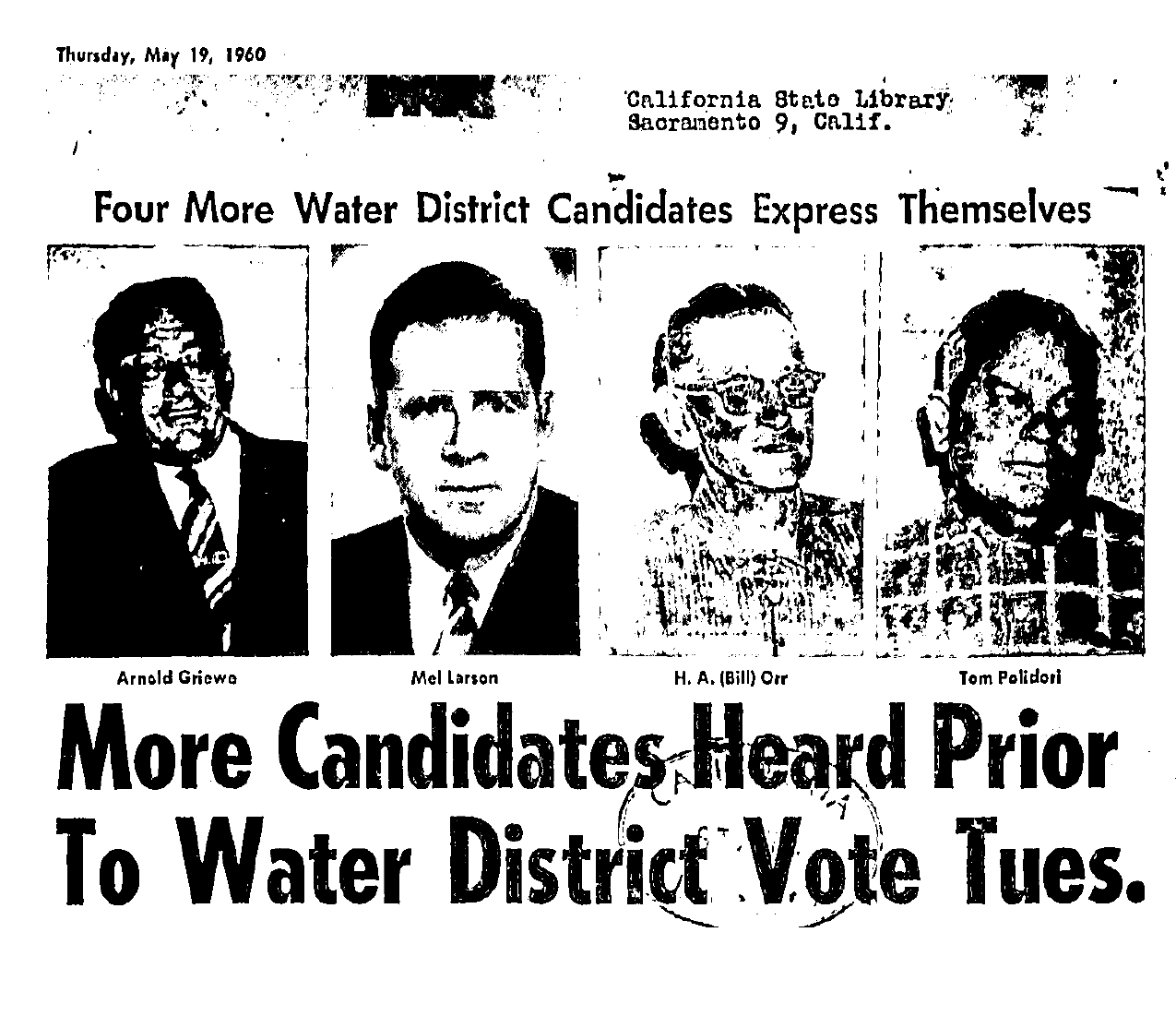
In 1960 voters authorized the establishment of a water district. Candidates for directors at that time were Arnold Griewe, Mel Larson, Bill Orr ,Tom Polidori,Col R. C. Buell, Marin Carlson, A. L. Ford and Nino Vailetti.
“Acquisition of the Sonoma Water and Irrigation Company and the Mountain Avenue Water System was completed in early 1962 and the Valley of the Moon County Water District started management and operation of the systems on June 1, 1962.” VOMD website.
1963-Sonoma Aqueduct dedicated, bringing Coyote Dam water to the valley.
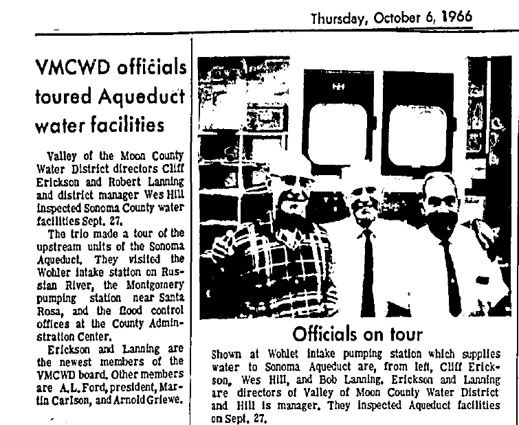
The Water District had new directors Robert Lanning and Cliff Erickson in 1966.
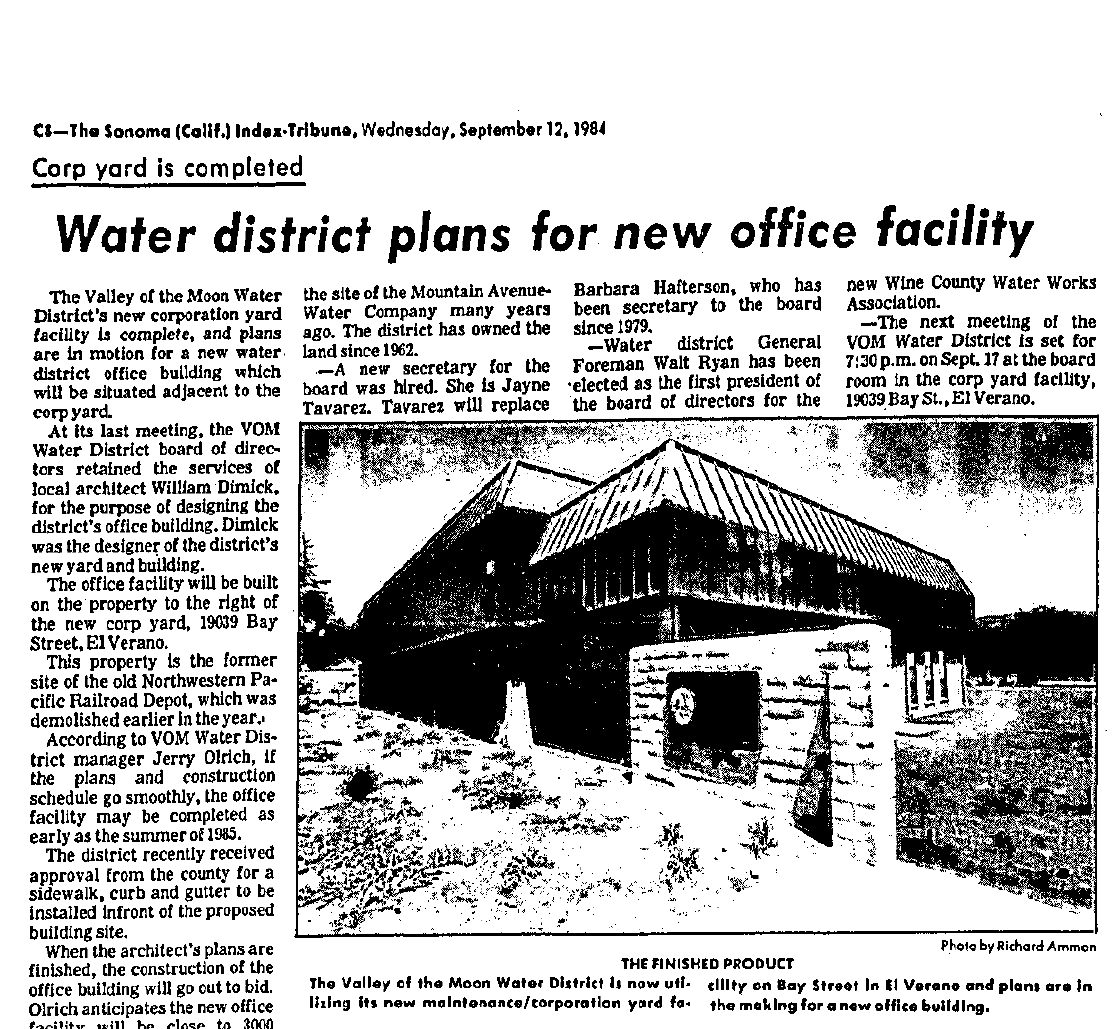
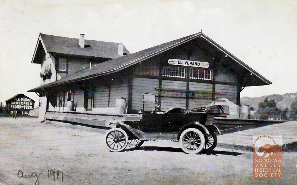
In 1984 a new office building was planned, to be built on the site of the El Verano railroad depot.
Alas!
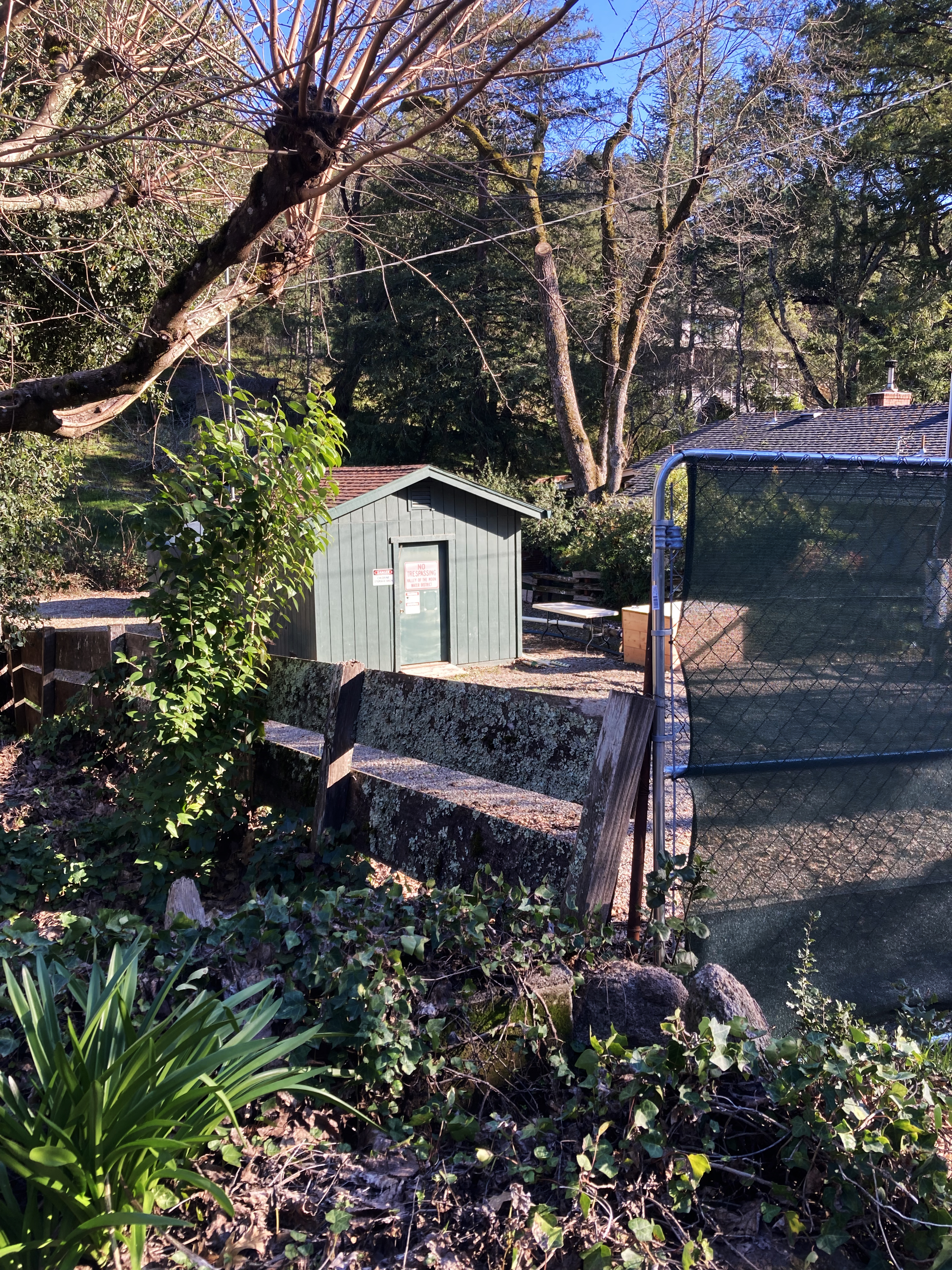
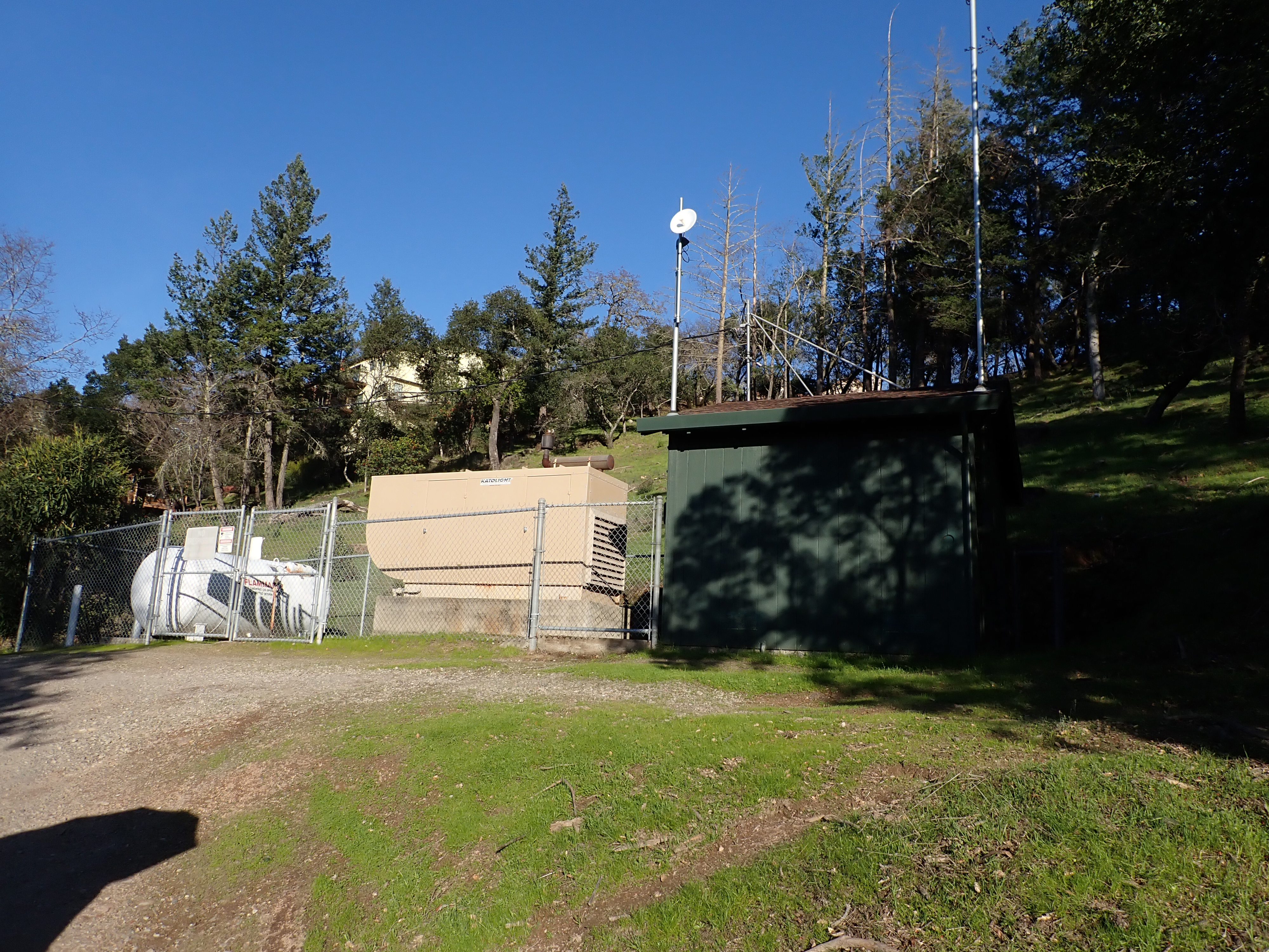
The District still has wells in the Valley.
Park Avenue well.Kearney Street well.One comes across many interesting things when looking at old newspapers. Things not relevant to the subject at hand, nonetheless important. This front-page description of a Klan meeting in the Napa Valley is vivid and disturbing, and rings bells that are still reverberating today.
Index Tribune courtesy of the sonoma Valley Historical Society.