I covered this in a previous post, but I thought it was worth a new look.
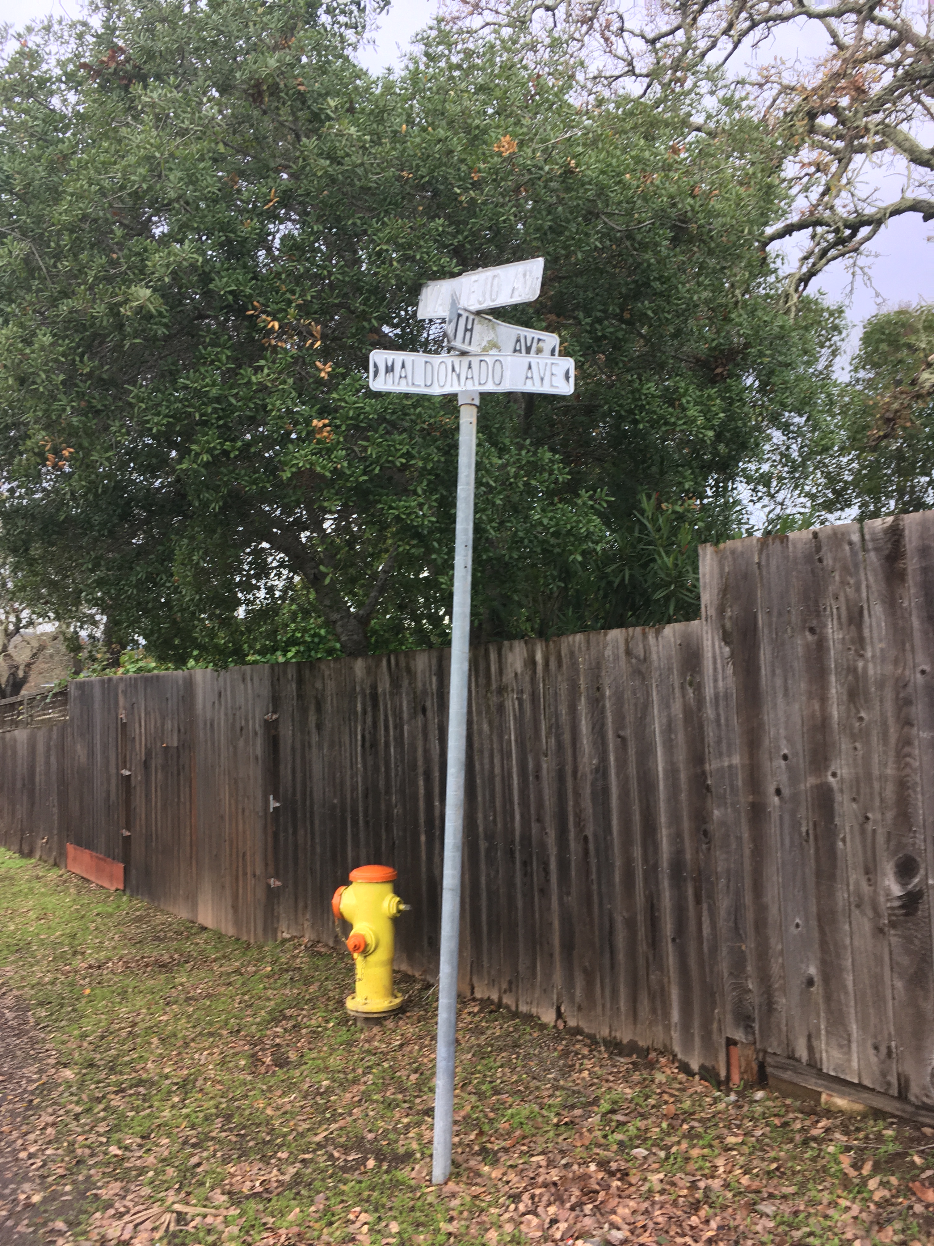
The intersection of Vallejo, Fourth, and Maldanodo showing the wonderfully distressed first generation sign, which has been replaced. If I had thougt faster, I could have gotten County Roads to give me the old sign. Alas, it was junked.
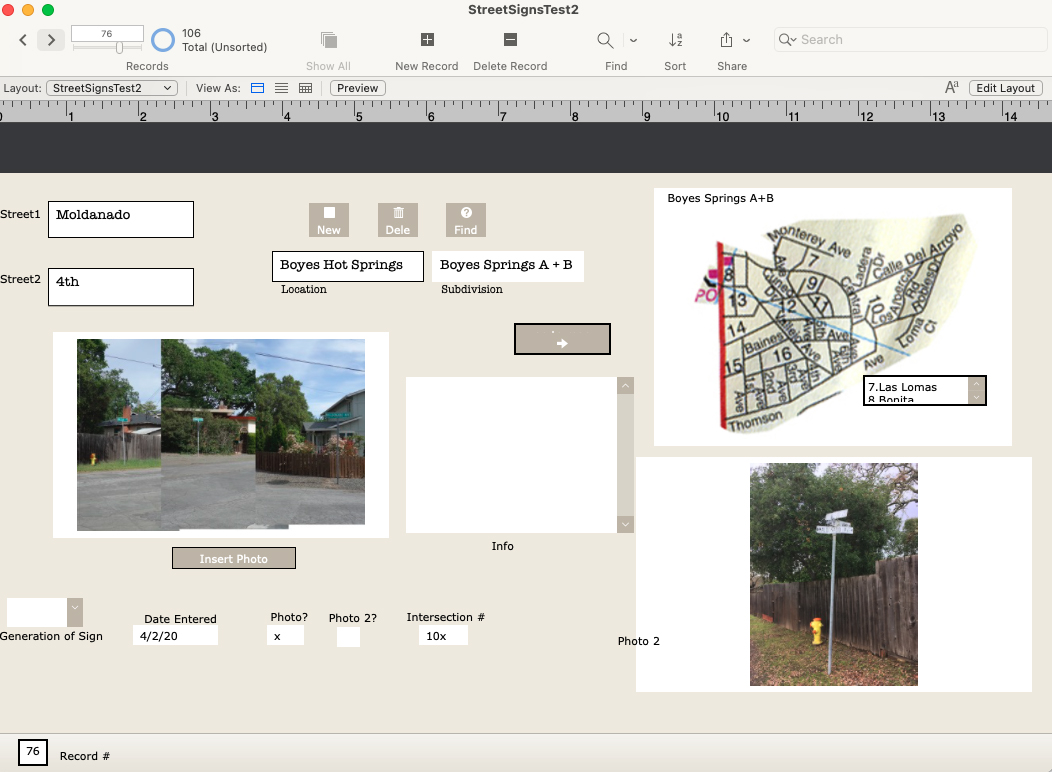
In 2020 I started photographing every every street sign in my immediate neighborhood with the intention of creating a database of intersections. Why? Obsessiveness. Completeness. The desire to record and collect (see website introduction.) Future use. It’s history. Because it might all burn down, and no one would remember what it looked like. And, I really like databases and consider them an art medium. I have also included photographs of the Neighborhood Phenomena in the vicinity of the intersections.
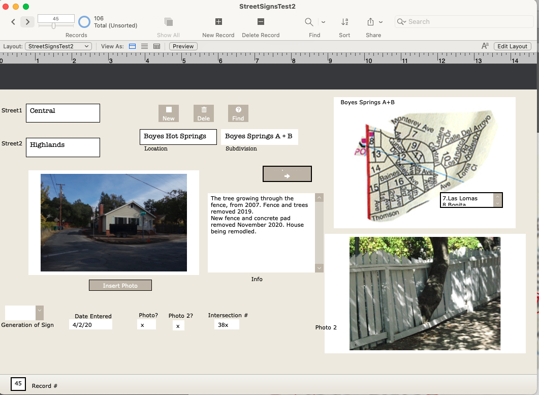
A record form the data base, under construction.
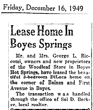
In addition to my photographs, I have included older (“historic”) ones, where they exist, newspaper clippings, and other ephemera. I know of no older photographs of intersections other than the ones at Highway 12, which were made primarily for commercial purposes.
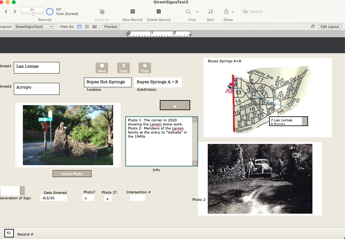
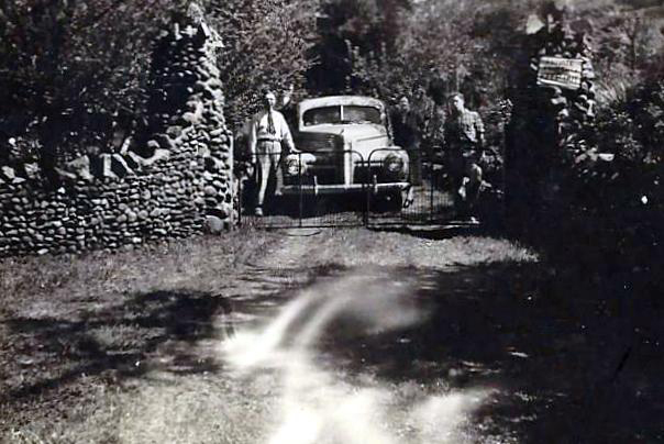
Las Lomas and Arroyo, featuring the stone walls built by the Larson family.1942. The entrance to the Larson family compound.
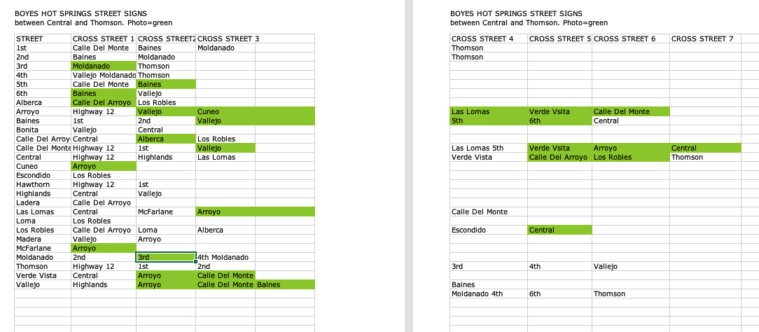
There are 107 records in the database (I probably missed some), one for each intersection in the Boyes Springs A and B subdivisions. The fields include “Generation of Sign” because three distinct styles of sign exist.Time permitting, the database would be expanded to include the surrounding subdivisions (link to post) Sonoma Highlands, Woodleaf Park, etc.Each record contains two photos or other images (sometimes newspaper clippings, other documents), and the map, which is still under development (ie, my Filemaker skills need improving.)
Samplle page of the database as an Excel fileAnother example of a Filemaker Pro record
Of course, the only constant is change, which means hours of fun for me updating the database.
The Sonoma Valley Redevelopment area was established by the board of Supervisors of Sonoma County in 1984. The area comprised a strip along Highway 12 from Agua Caliente Blvd. in the north to Verano Ave. at the south end, and parts of major intersecting streets.The main goals of the project were to remediate “blight”, to encourage commercial activity, and to facilitate construction of low-income housing. Major storm drain work and electrical undergrounding were done at the very beginning.
The wheels turned slowly, to say the least. By 1992 the final plan for the highway, a crucial element, hadn’t been decided. At that time Caltrans wanted to make it eight lanes!
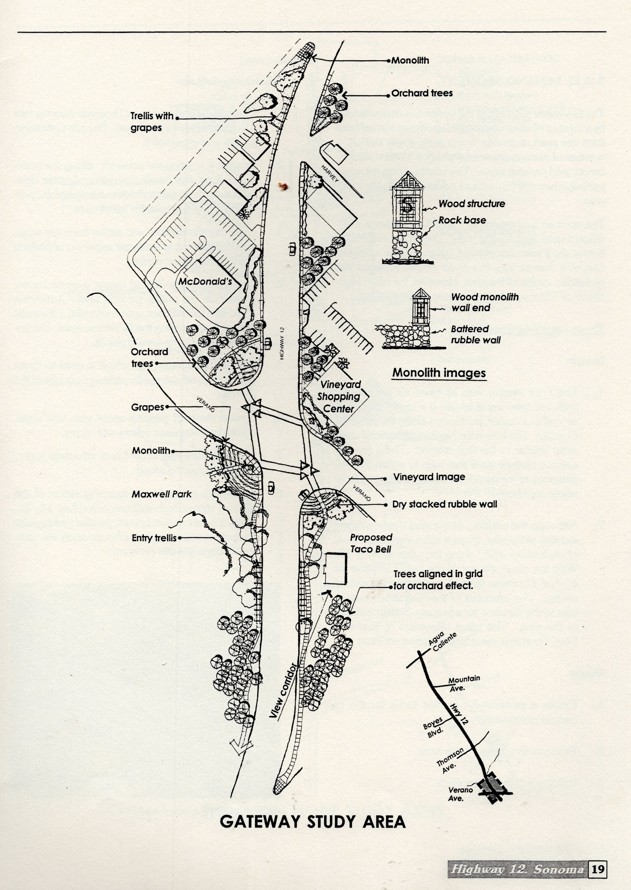
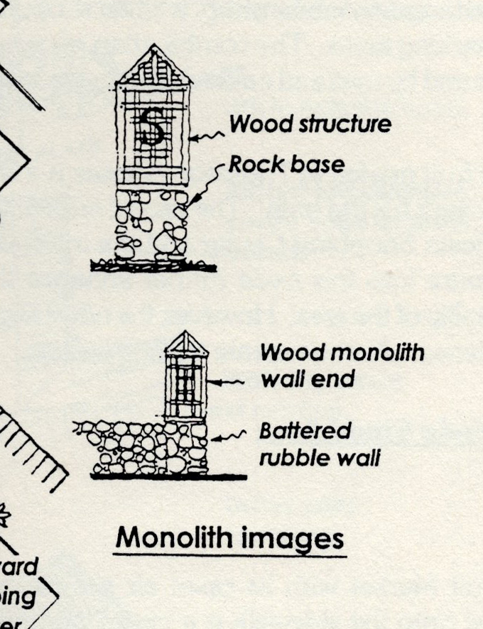
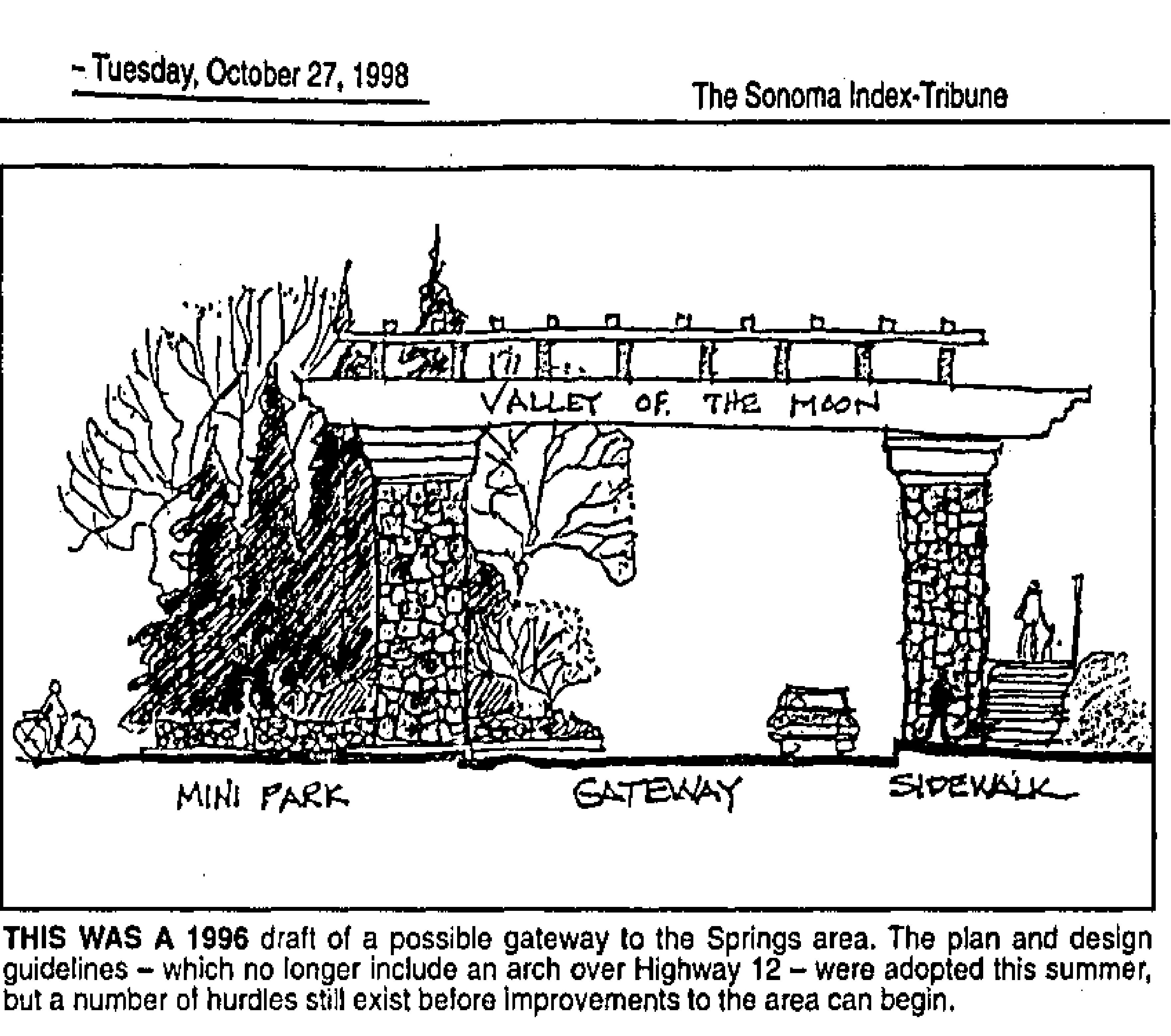
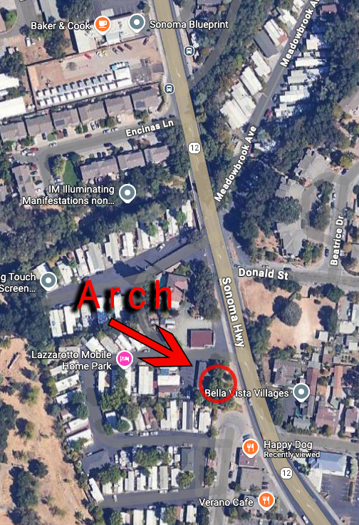
In 1994 an extensive set of design guidelines were issued. Under “Corridor Desing Concept, Southern Gateway Segment,” there is a study area map showing a “monolith” on the highway at the approximate present location of the arch (see map.) A small elevation of the monolith shows a wood trellis like structure atop a stone base. Trellises and dry-stacked walls, along with trees planted in grids to mimic orchards, are also included. These were all intended to be part of the symbolic entryway to the Springs. The last of the Recommendations in the guideline’s states “Develop further detailed design studies by retaining a consultant or by holding design competitions.”
A draft of the Redevelopment plan was issued in 1996. The Pilot Project was announced. “The plans call for a pilot project to the southern gateway. It includes closing a portion of Main Street, which cuts from Highway 12 to Verano Avenue behind the McDonalds restaurant; an archway or other gateway concept, trees and light fixtures,” we learn from the Index Tribune. Landscape Architect Ron Wellander was hired to manage. “A gateway gives definition between one community and another,” explained Robert Behrens, a site-specific sculptor who worked on the planning stages of the program.” Behrens is best known in Sonoma as designer of the Veterans Memorial Park.
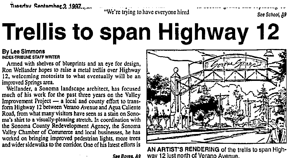
In July of 1997 the Index Tribune announced that “ Among the many improvements for Highway 12 between Boyes Blvd. and Agua Caliente Road will be a metal archway…the archway will consist of two posts, one at either side of the road near Boyes Boulevard, with a metal trellis extending over the road showing a welcome to drivers heading north. It was felt by the consultant (Wellander) that we need something that would announce dramatically the entrance to the springs,” (This is confusing. First, the Redevelopment area starts at Verano Ave, second, the pilot project is nowhere near Boyes Blvd.) The cost was estimated at $200,000.
In September of 1997, Caltrans informed the County that “We do not allow these type of structures to be built over highways.” End (of this part ) of the story.
Construction still had not been started by early 1999. “…the $700,000 first phase of the project…has suffered a number of setbacks. The most widely publicized of these was the proposal to buil a 20-foot-high metal trellis spanning the state highway just north of Verano Avenue (not Boyes Bldv!) While a relatively minor part of the project as a whole, the arch was widely criticized as unsightly and unnecessary.” Index Triune Feb 2, 1999. To complicate matters more, landscape architect Wellander filed for bankruptcy.
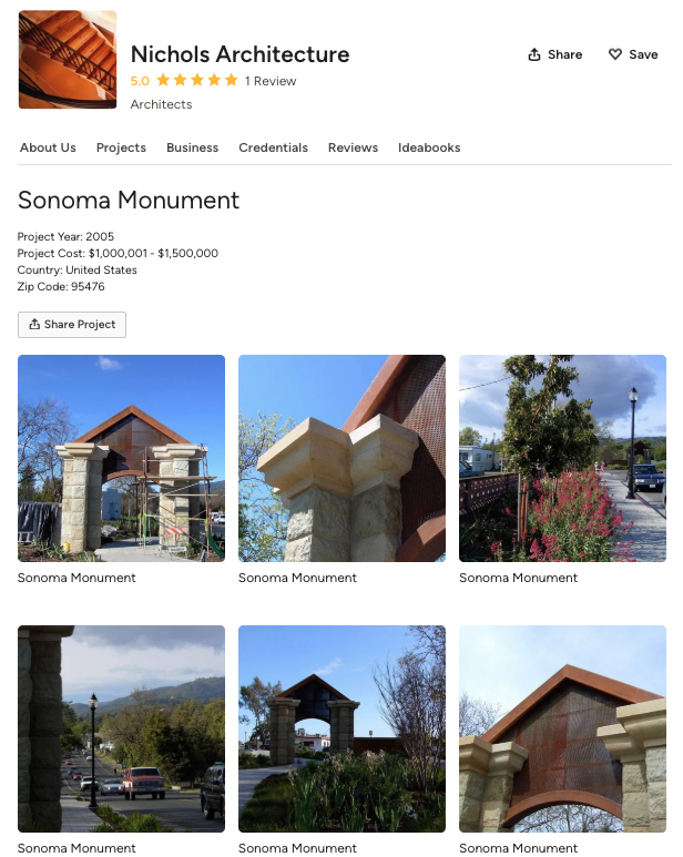
Our current gateway arch was built sometime between 2003 and 2005. The architect was Dan Nichols. According to the Houzz website, the year is 2005 and the budget was “1,000,000-1,500,000,” which seems a bit high. The budget for the entire pilot project was only $700,000. A friend who attended public meetings at the time remembers the cost as being $611,000. I have not been able to make contact with Mr. Nichols.
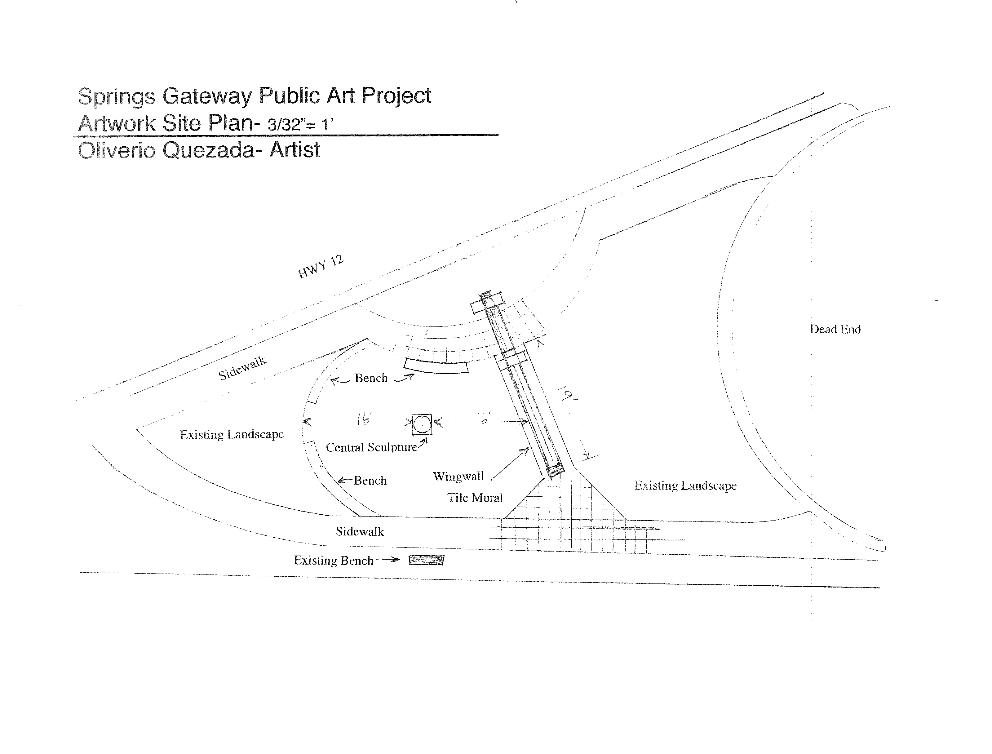
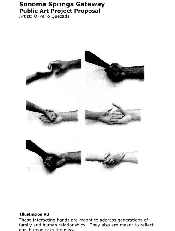
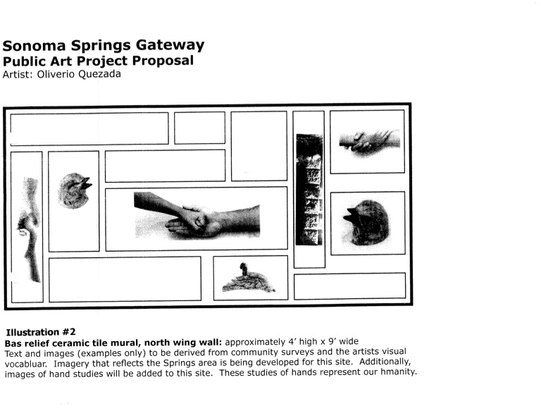
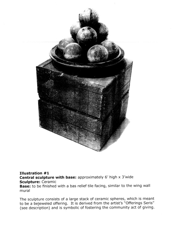
The original intention was to have art placed on the concrete posts and wall, which were left bare for that purpose. In 2007, ceramic artist Oliverio Quezada was “hired” to propose art. It’s unclear how he was chosen. On July 25, 2007, the Board approved redevelopment grant funds up to $35,000 to approve a Special Services Agreement between Quezada and CDC to design, manufacture, create and install an original artwork at the gateway. His proposal includes a concrete bench, a central sculpture, tile artwork on the wall, and a welcoming sign designed with the help of local school children.Images from artist’s proposal
However, the Advisory Committee of the Springs Redevelopment the RAC) had some questions. The tile were to be covered in text. “”I want the text and imagery to be as pure and beautiful as possible, incorporating the best of everything existing in the Spring Area’s past, present and future,” Quezada said in his written proposal, but the RAC wanted to see all of it before they would OK the total art project. However again, these objections seem to have faded away, with a new problem arising in 2008: money for maintenance of the artwork. The CDC could fund it but could not to maintain it. Other agencies like Public Works or Parks, didn’t have the money for the (continuing) job. “Kathleen Kane, executive director of the county’s Community Development Commission, told the local panel that maintenance questions and funding need to be resolved before the project can continue. “Kane said that the project could be in danger of fading away. “If we can’t get it settled to the satisfaction of public works, it could die,” she said.” Fade away it did.
Soon after, the rusticated stone cladding was applied to the bare concrete pillars.
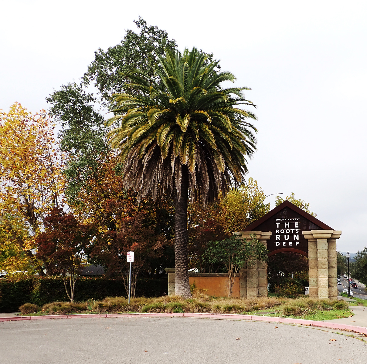
Now we have an essentially meaningless public art work with a wine-centered advertising slogan on the steel upper part, installed by persons unknown. Inquiries have been made. None of the powers that be have an answer.
Mu contention is that the Gateway Arch could still be transformed into a real symbol of our community. We have plenty of creative talent. All we need is money. HA!
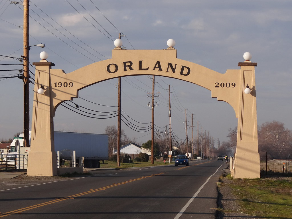
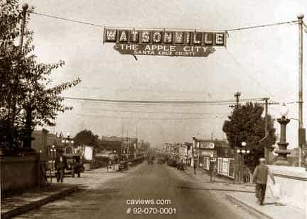
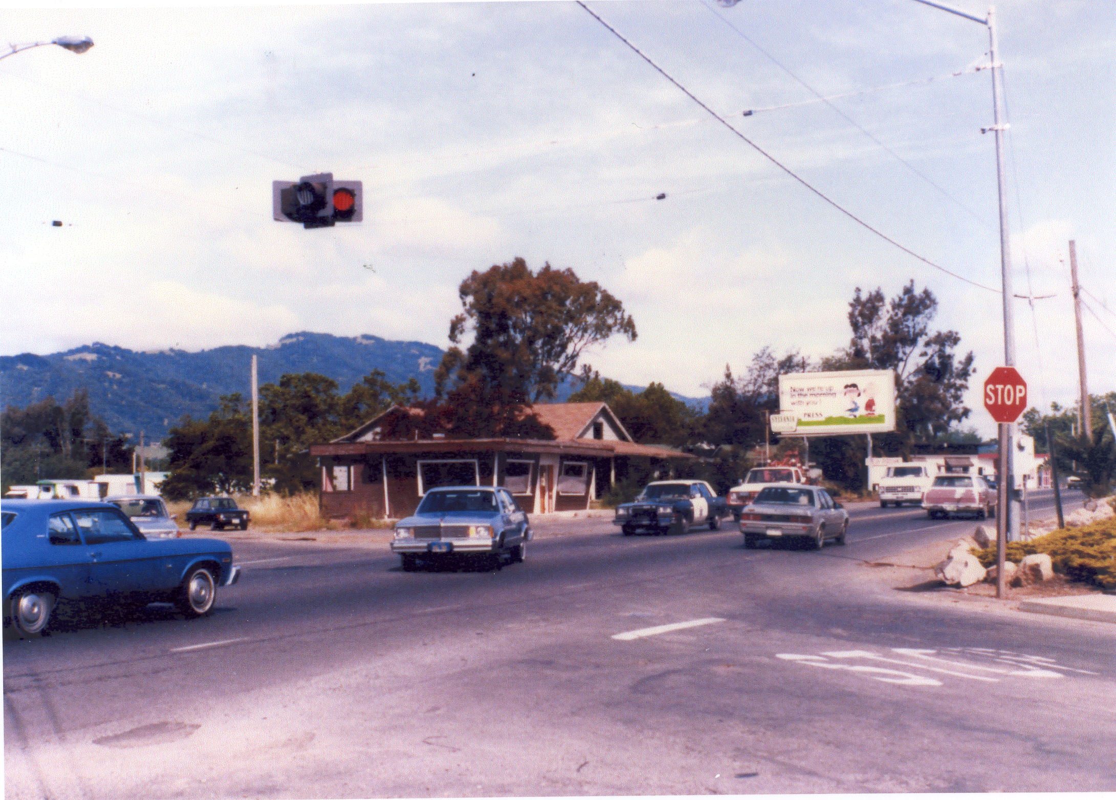
The Orland and Watsonville arches predated Caltrans. The upper right image is the corner of Verano Avenue and Highway 12 in the 1970s(?) Caltrans had no problem with hanging a traffic signal over the road.
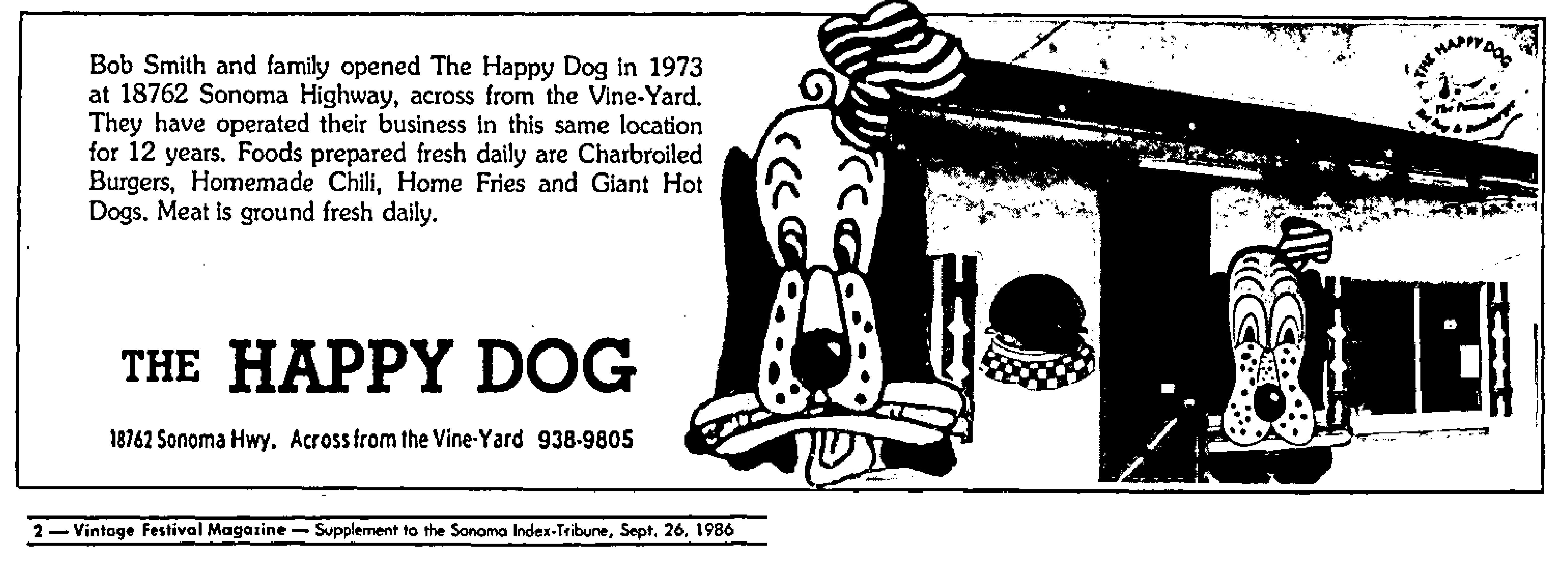
I’ve been working for some time on a couple of posts about the Happy Dog and the Gateway Arch, both on Highway 12 near Verano Ave. Obviously, you can’t talk about one without talking about the other. (Well, not so obvious to me until I started thinking bout the nature of human made landmarks). As usual, there is a lot more to know than I originally expected. I found it necessary to include Moosetta’s Deli and other buildings in the post. Progress was slow, and then, as they say, life happened. Everyone is fine, but some hospital time was experienced. So, I did not finish either post.
Next month!
Here is a teaser.
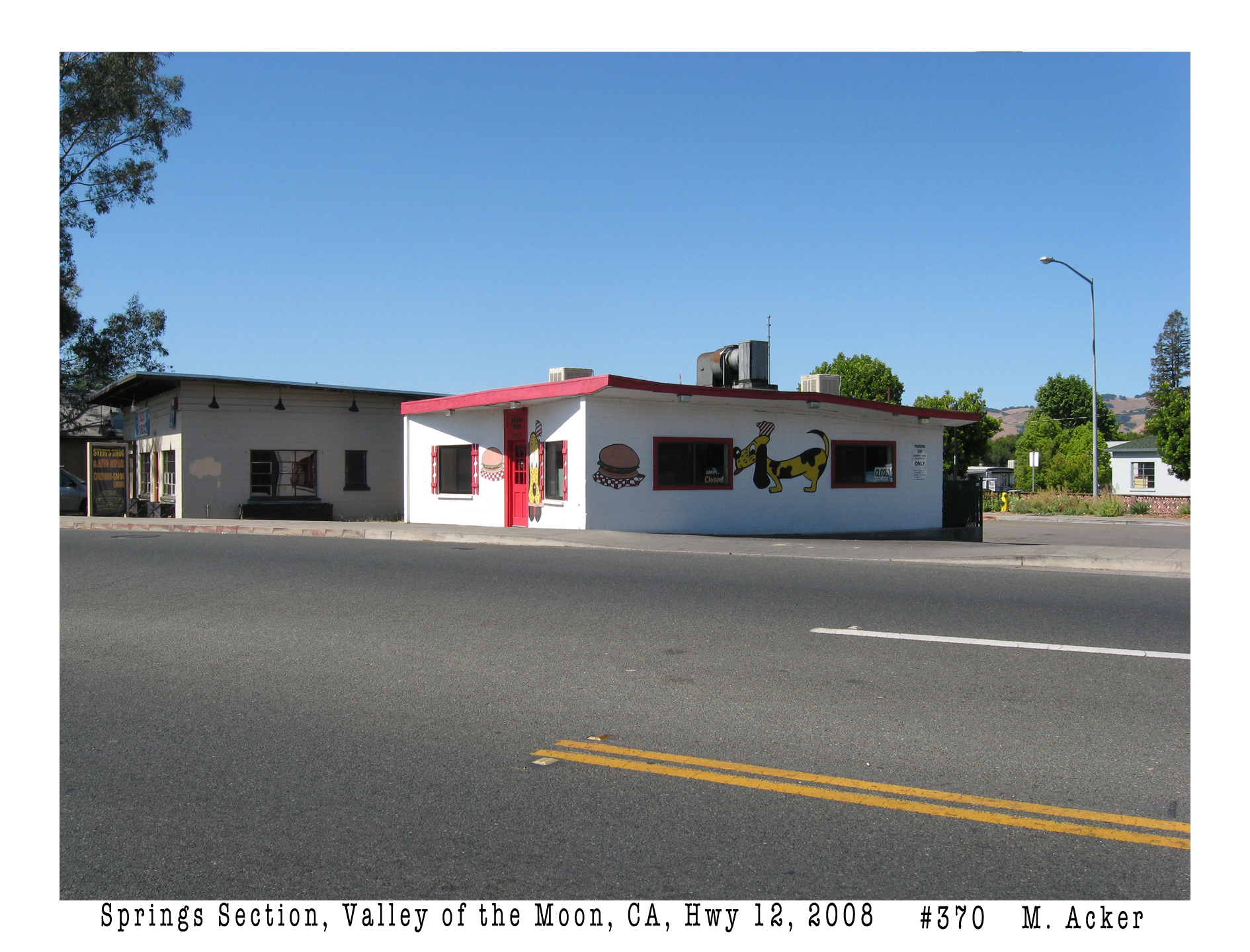
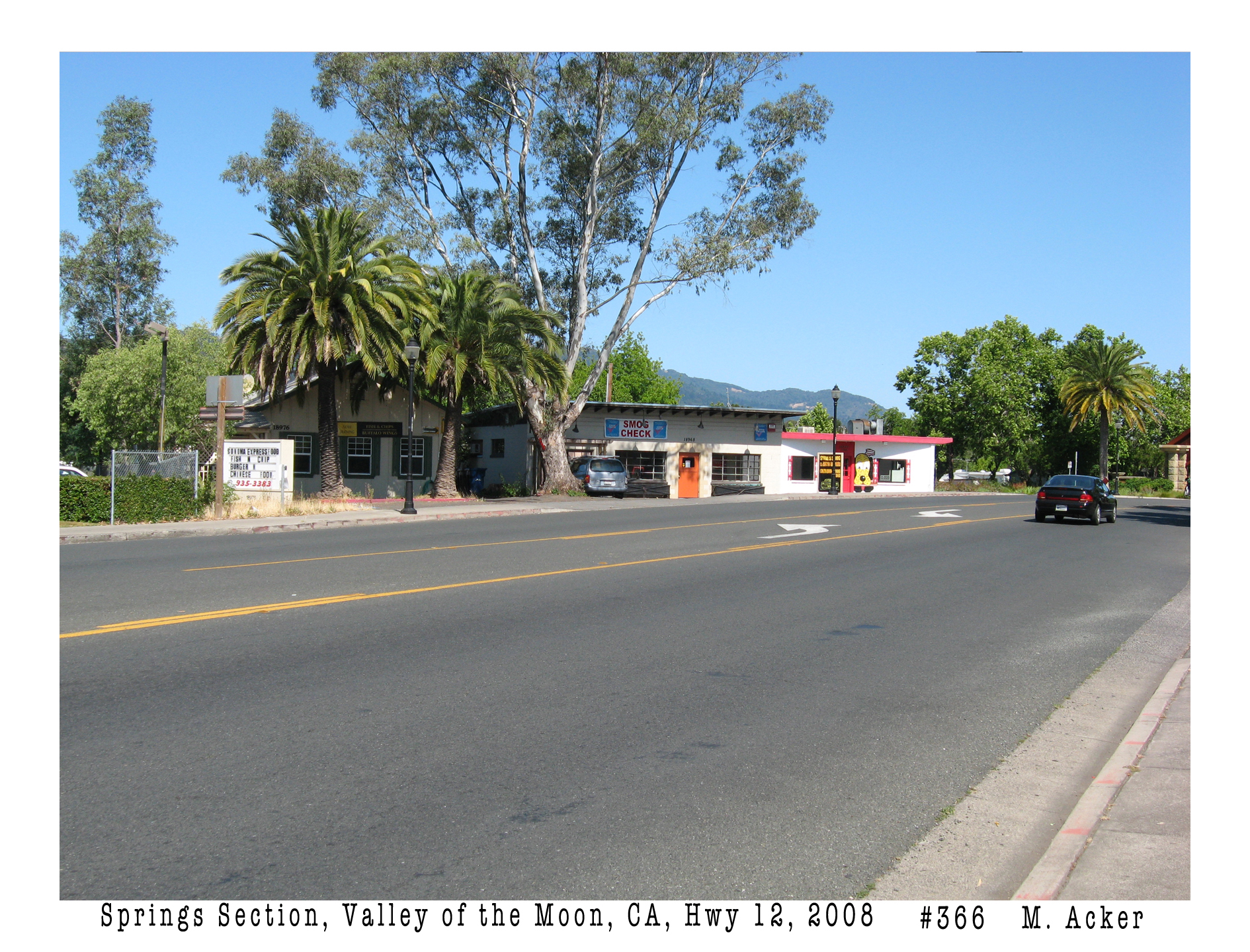
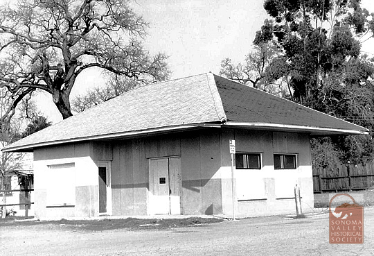
Above is from the archive of photos I created in 2008. I printed two copies of all 477 images and gave one to the Sonoma County Library and the other to the Sonoma Valley Historical Society.The Arch in 2025, with the new advertising.Left to right, what is today the Verano Cafe, the Steve’s Auto building, and the Happy Dog. Moosetta’s was located in the first building, the Art Store in the second. Moosetta’s had at least three locations.
Hey! Why don’t you click over here and shoot some rasbuckniks to the Springs Museum? Er..donate, that is, please!
Index Tribune courtesy of the Sonoma Valley Historical Society.
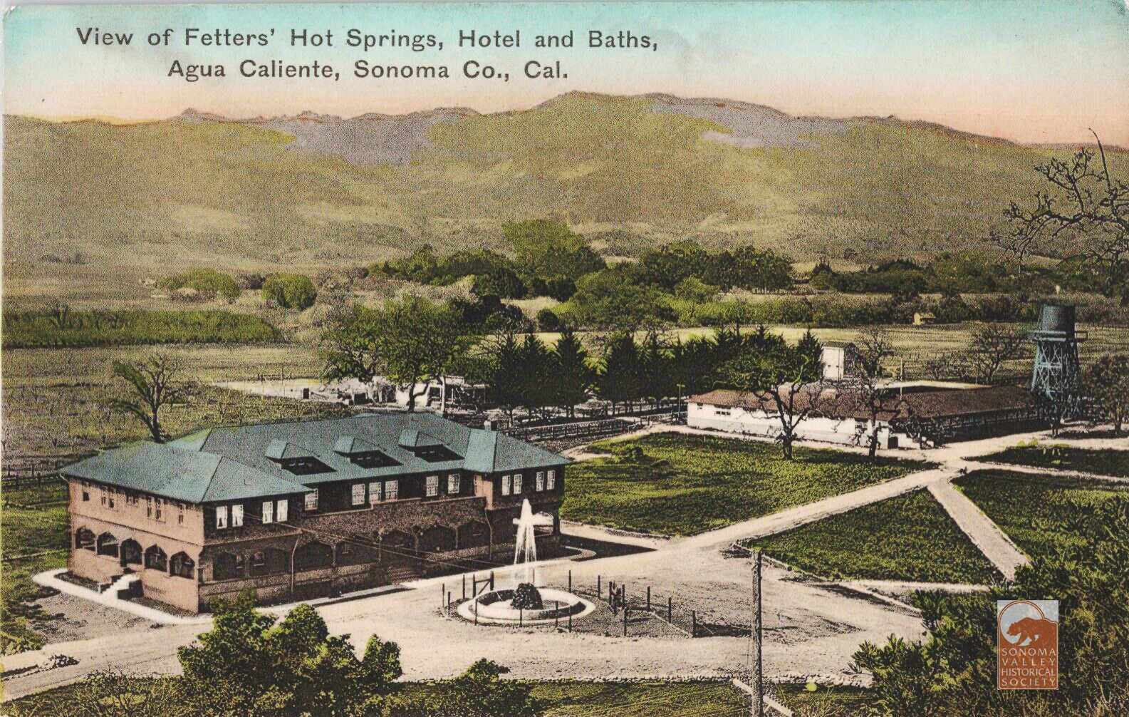
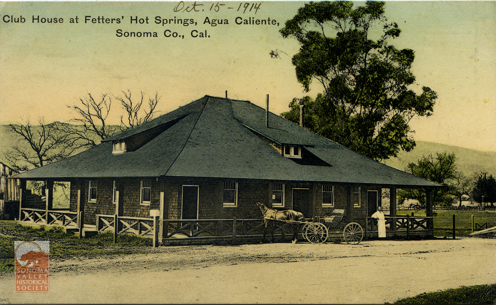
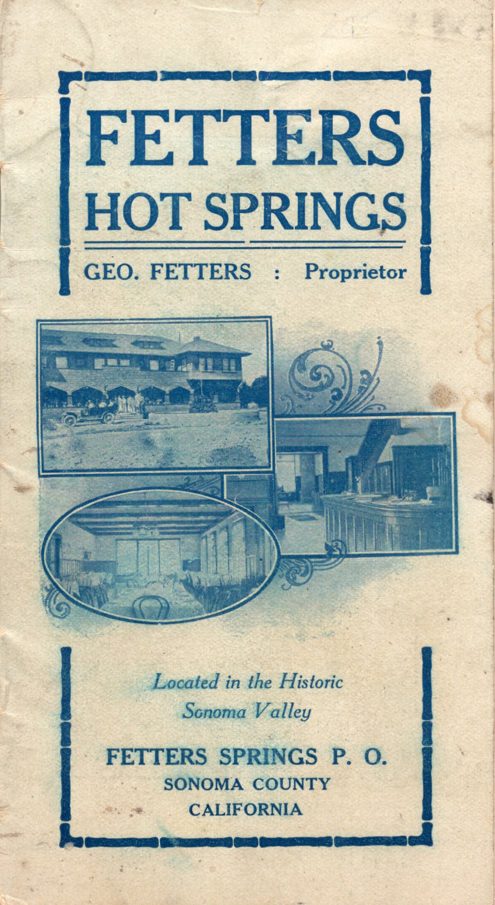
The success of the resort founded by Henry and Antoinette Boyes proved to be an example to others. In 1907, a couple from Pittsburg (Emma was originally from Austria) by way of San Francisco, George and Emma Fetters, bought the old Halstead ranch just a mile north of the Boyes’ property. Robert Halstead (“a wealthy sugar planter from Hawaii” according to the Index Tribune) had bought the property from E.P. Thomson, who planted olive trees on it in the 1880s. Many of those now large trees are still there.
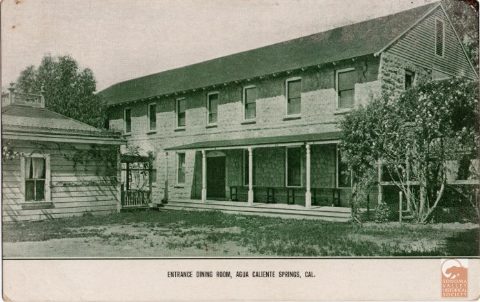
The Halstead property crossed the Northwest Pacific railway line and Sonoma Creek, just south of Agua Caliente. Some early post cards identify its location as Agua Caliente. The boundaries were flexible. Map courtesy of the Rumsey Collection.Courtesy Dennis O’ Rourke
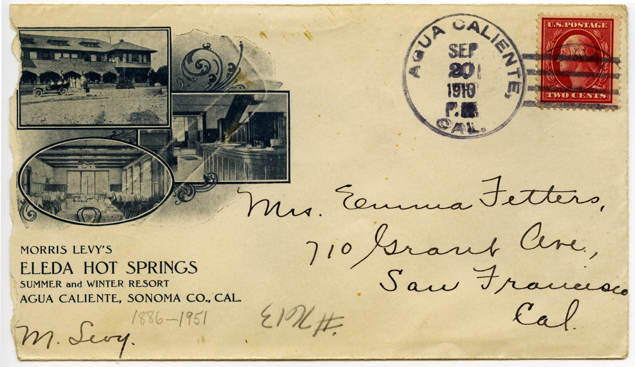
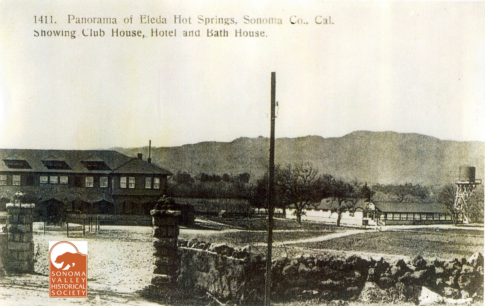
George had been in the hotel business in Pittsburg. The money for the land and the ambition to open a resort were mostly Emma’s. The next year they opened Fetters Hot Springs Resort. Soon after, they leased their resort to Morris Levy, a prize fight promoter from San Francisco, who renamed it Eleda Hot Springs.
1907
The Fetters took over operation again in 1911. In 1913, apparently bearing a grudge over losing the lease to the resort, Levy testified in opposition to a liquor license being granted to Fetters. They received the license, but this would not be the first time the Fetters got into legal trouble over liquor. In 1918 they were tried for the offense of providing liquor to enlisted men (a crime under the War Emergency Act.)
Testifying in their defense were “Fred Boyngton, the well known lumber yard man, E.G. Koenig of Boyes Springs, and Lillian the “entertainer,” among others.” Despite Lillian, both Fetters were convicted, but George’s conviction was overturned on appeal. Emma’s sentence was later commuted. Both George and Emma were in and out of court many times, being sued for damages by resort guests, and once for libel.
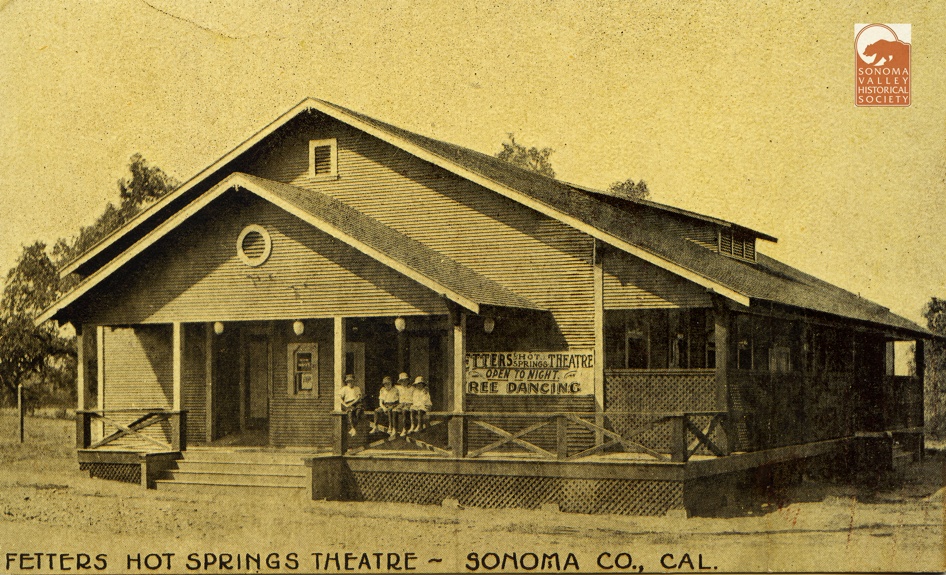
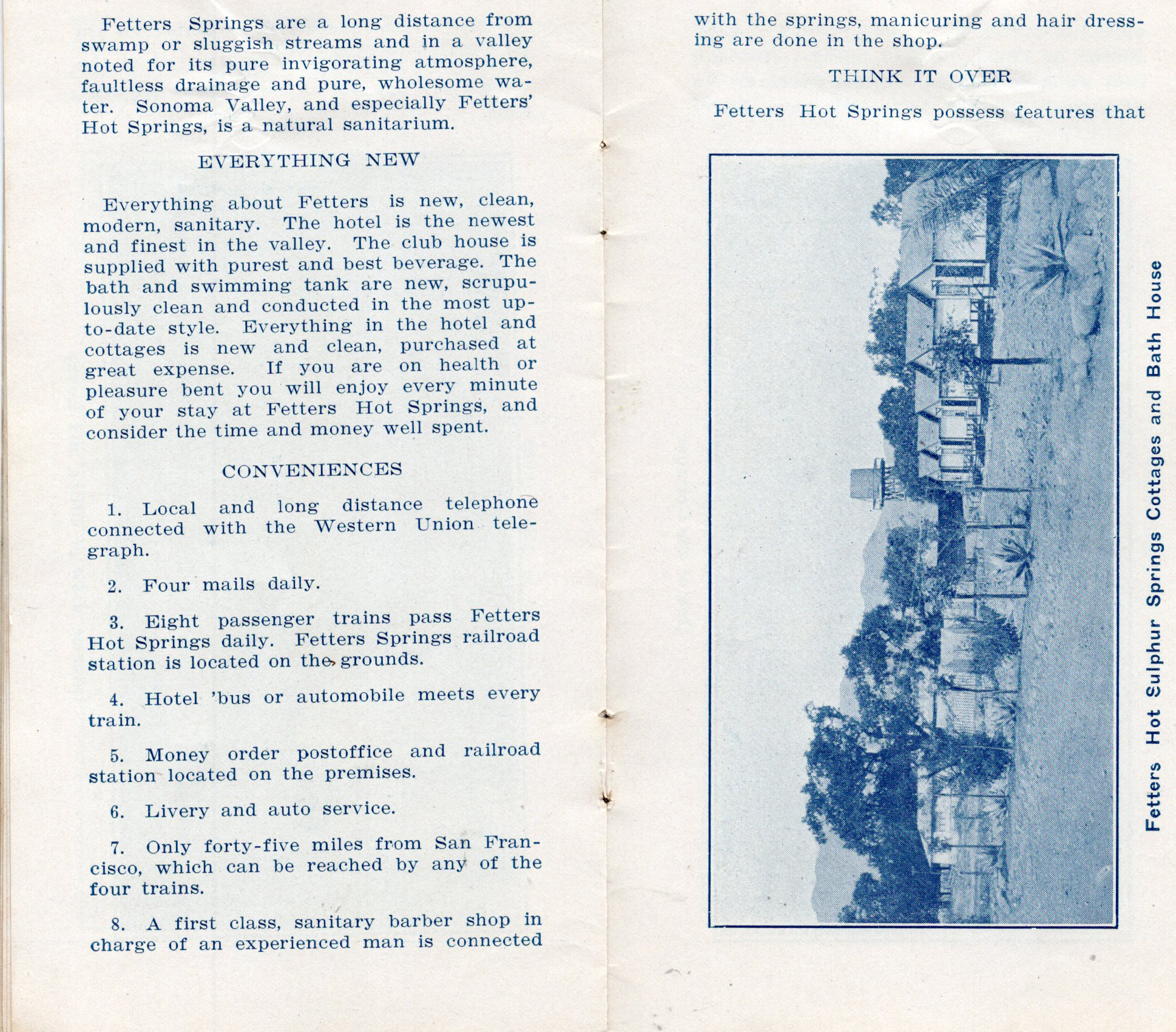
The Fetters were constantly improving the resort, bringing in moving pictures in 1923, sidewalks in 1924,and a new dance hall in 1925. George donated the land for the Boyes Springs ball field, and at its dedication in 1940, he threw out the first ball.
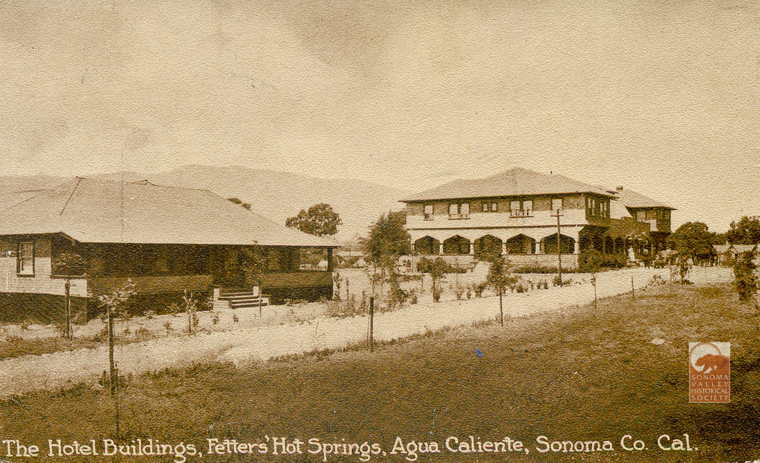
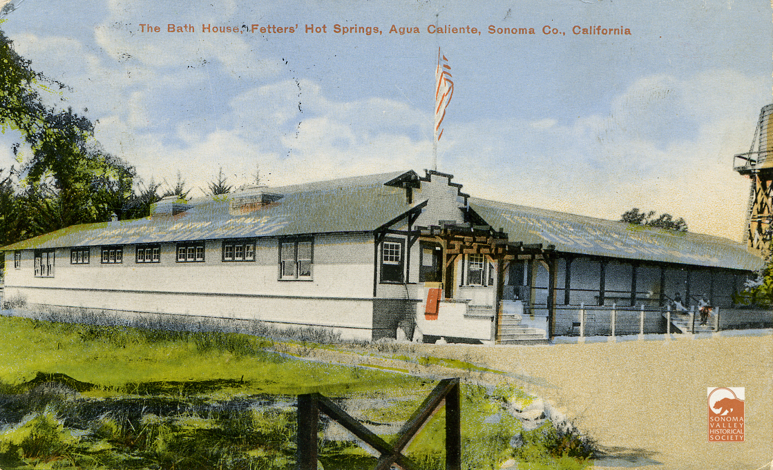
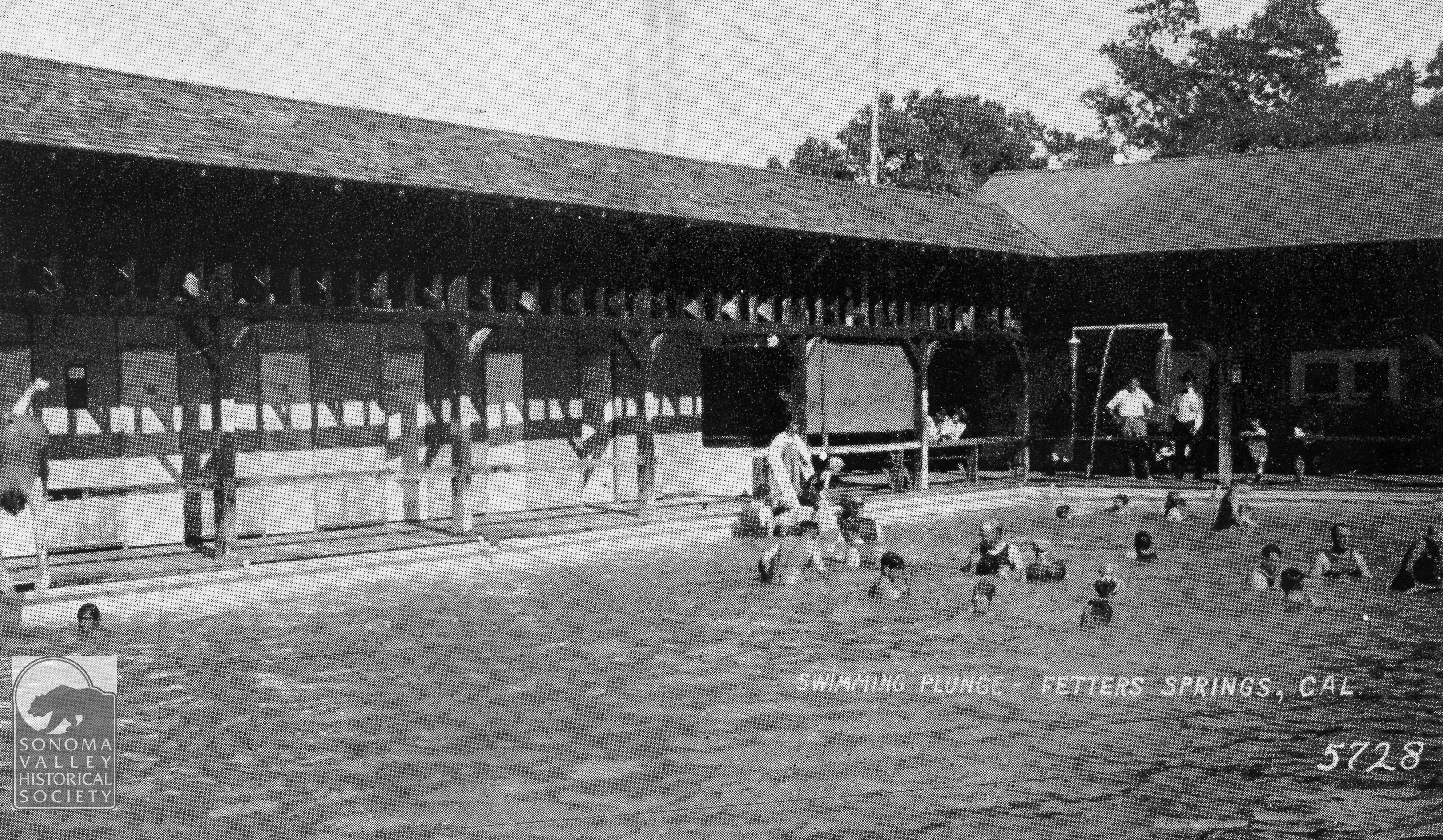
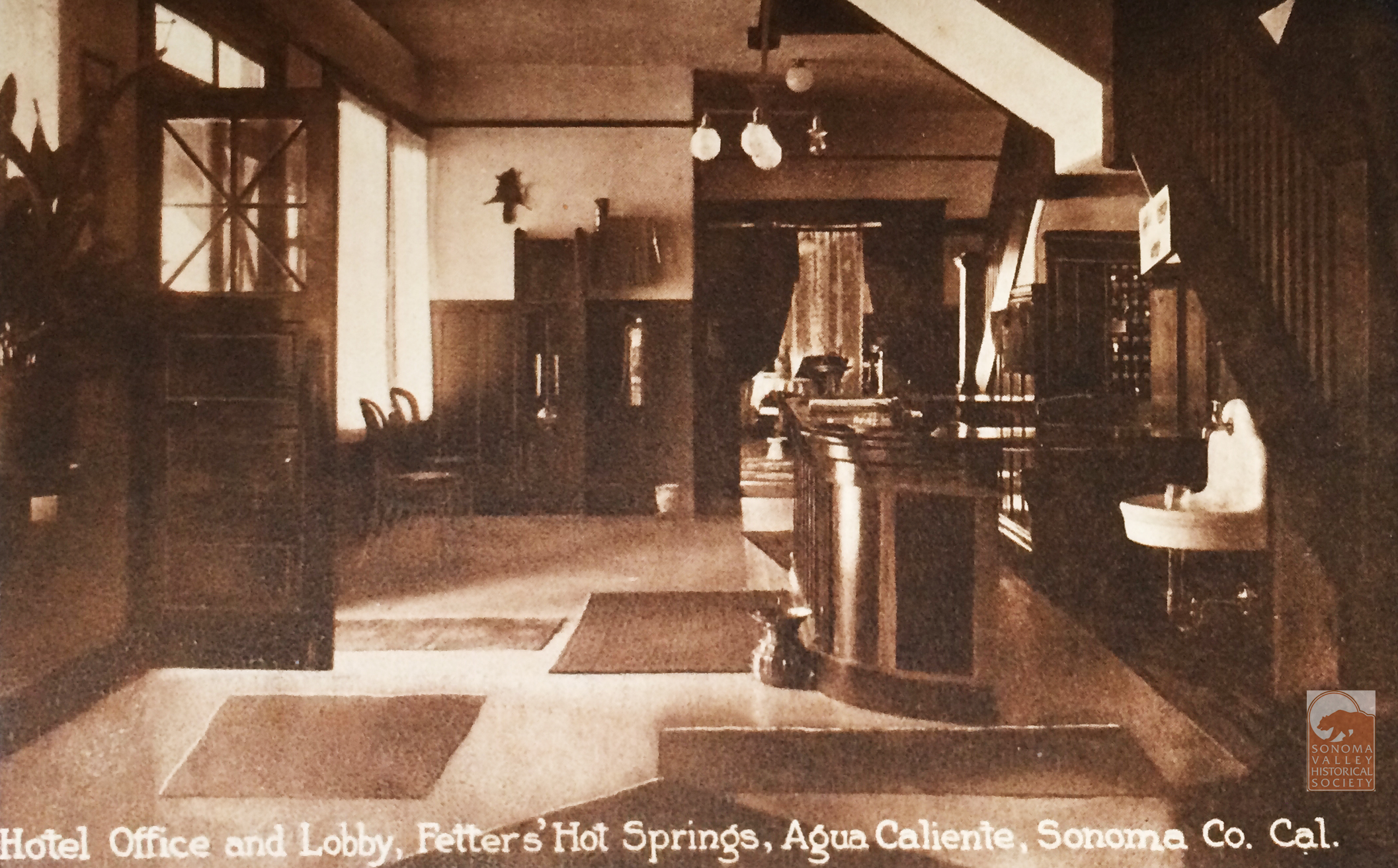
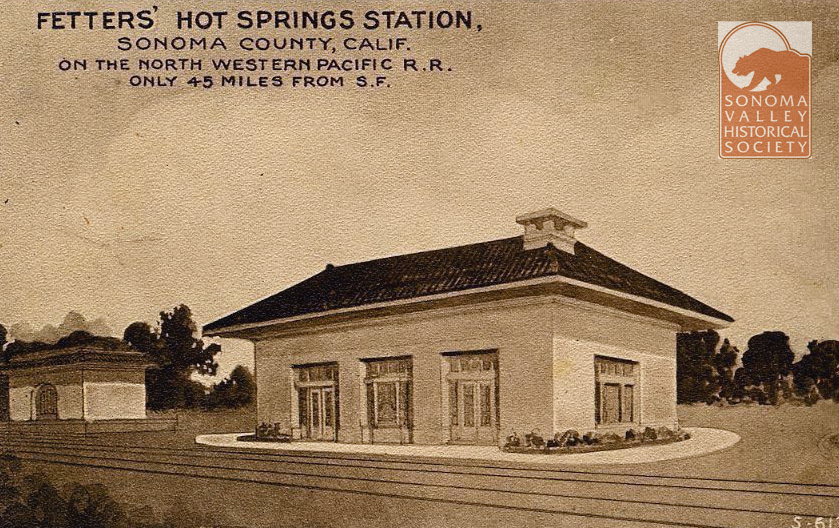
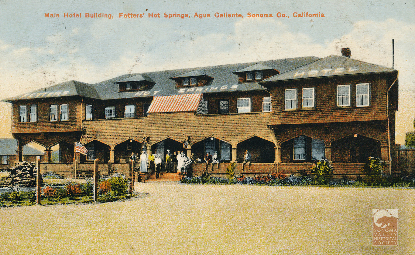
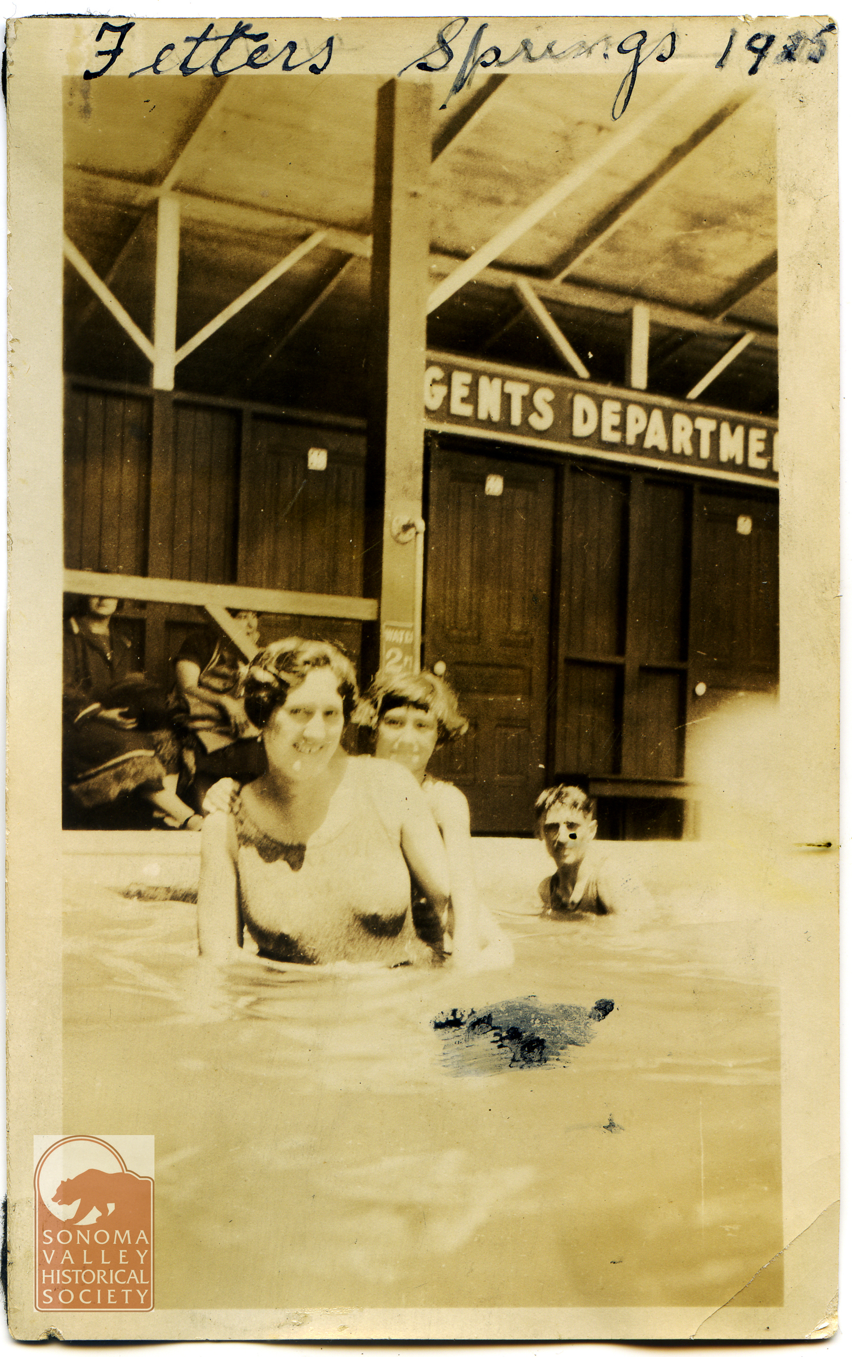
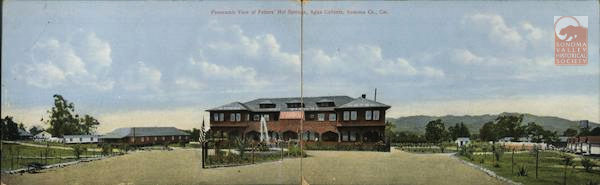
According to the Index Tribune, Emma Fetters was “an energetic woman of wealth and enterprise.” The Fetters built not only the resort, with its hotel, swimming pavilion and theater, but the Fetters Depot of the Northwest Pacific Railroad. Mrs. Fetters also owned much real estate in the area, and once owned the Chauvet Hotel in Glen Ellen.
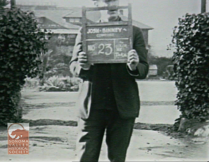
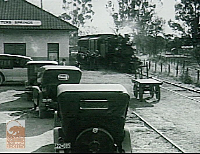
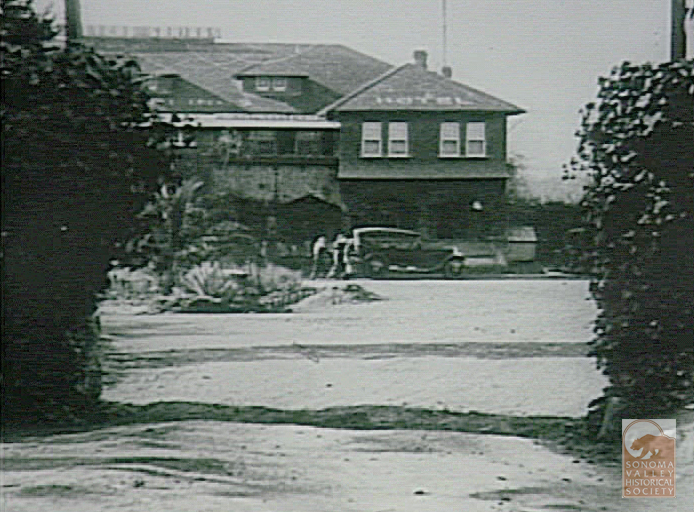
In 1923 a movie company came to town and shot some scenes in and around Fetters Resort (and that’a another story!)
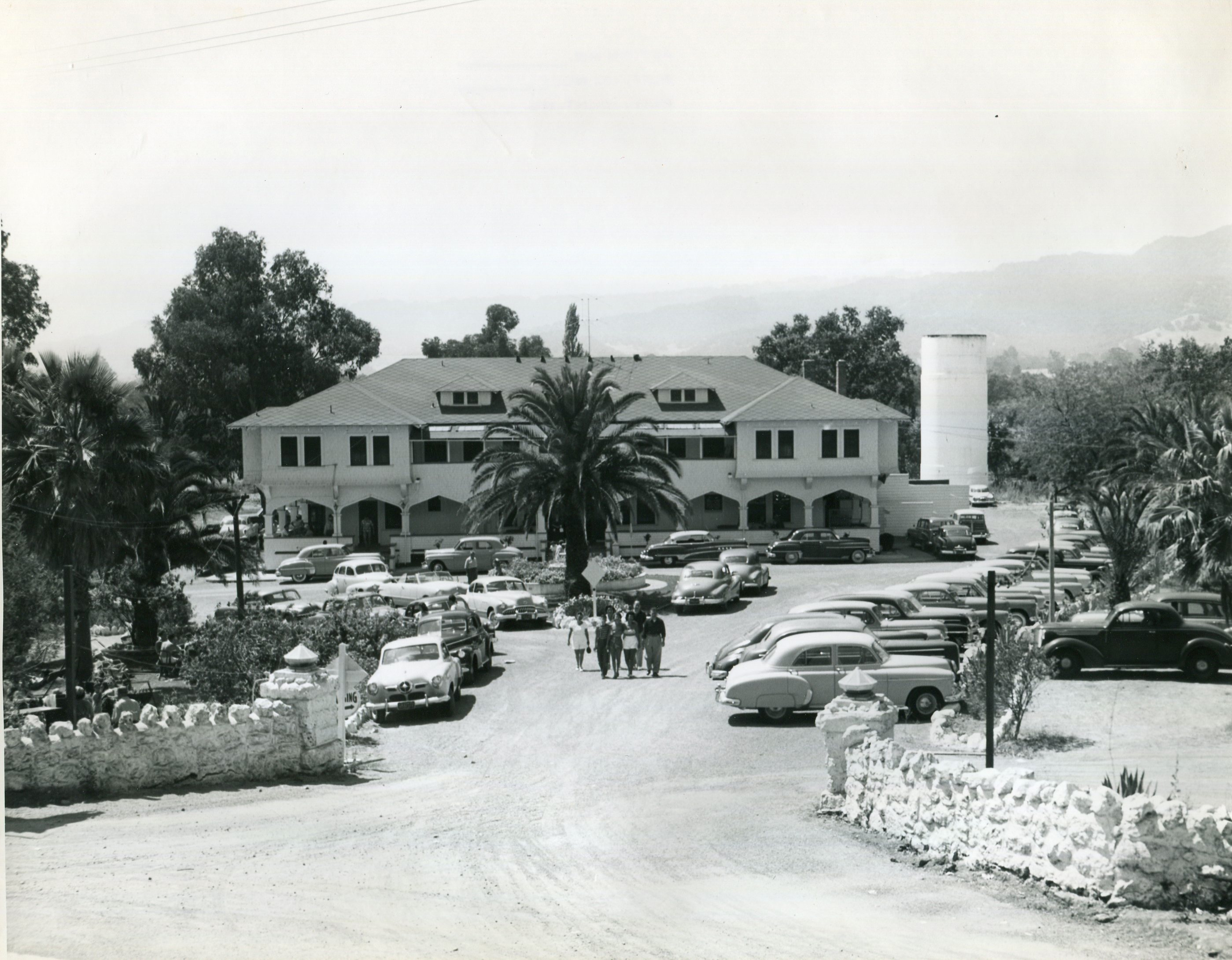
The resort era continued into the 1950s and beyond. Photo courtesy of Sonoma County Library.
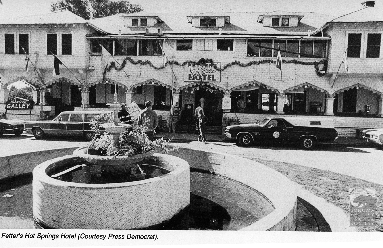
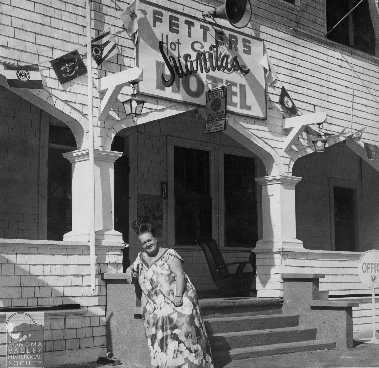
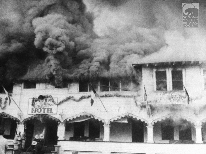
The notorious and beloved, by some, Juanita Musson operated her restaraunt in the hotel from 1969 to 1975. I havn’t written a post soley devoted to Juanita, yet, but more here.
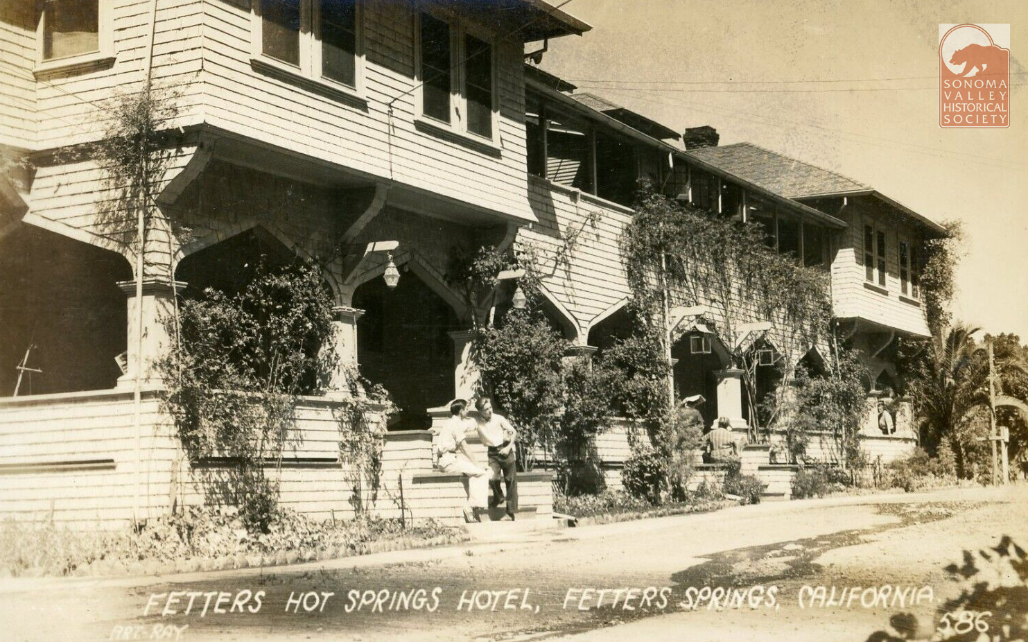
The hotel burned down in 1975.
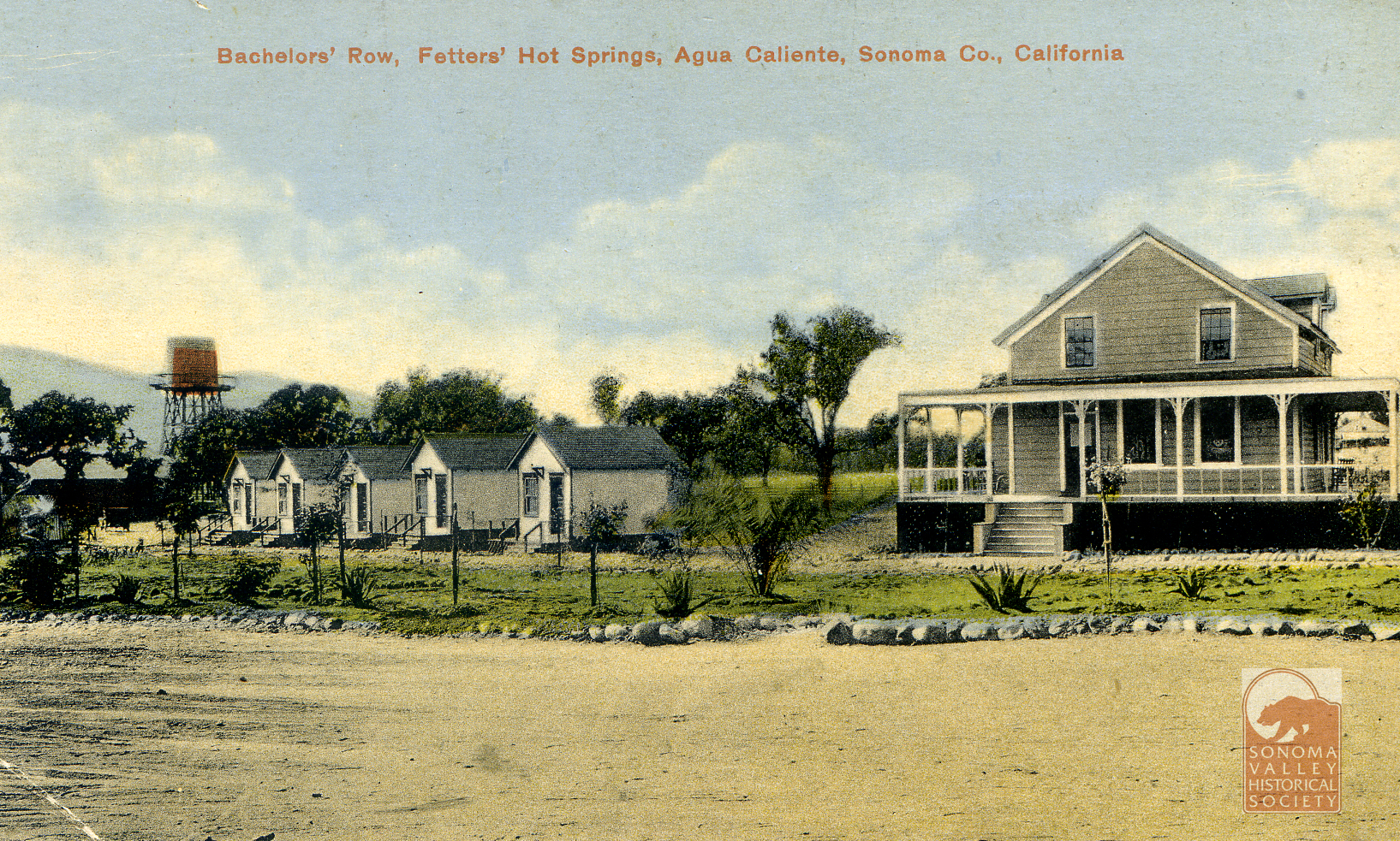
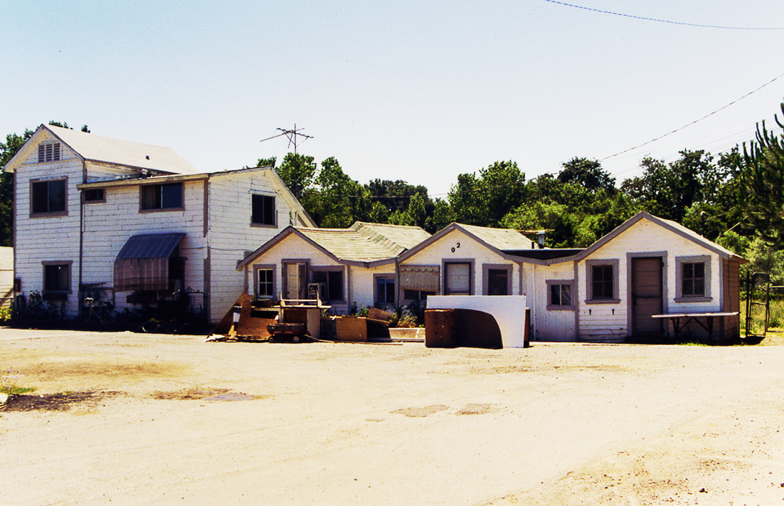
In 2009 this was all that was left of Fetters Resort. It appears to be “Bachelors Row,” shown above. I met Juanita when she lived in one of these cabins. Authors photo.
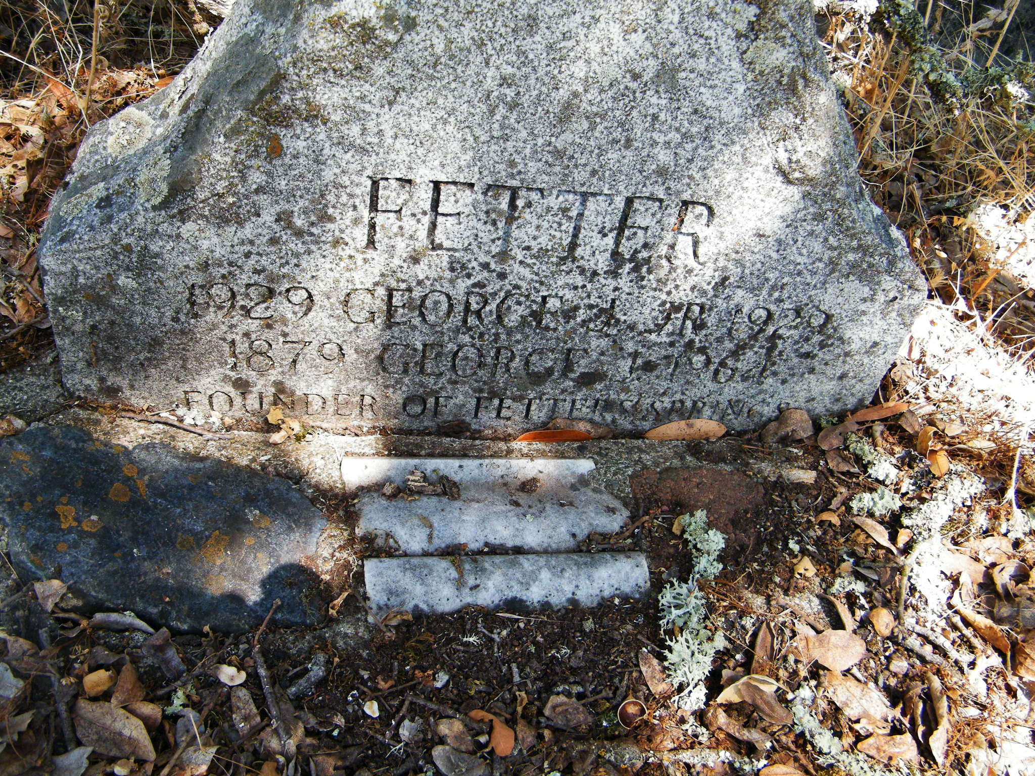
Emma Fetters died in 1922, of pneumonia. George was a prominent member of the community and continued to run the resort until he sold in 1944. He died in 1964. Interesting that the gravestone omits the S at the end of the name.
Fetters Resort is well photo-documented. A few bonus images below.
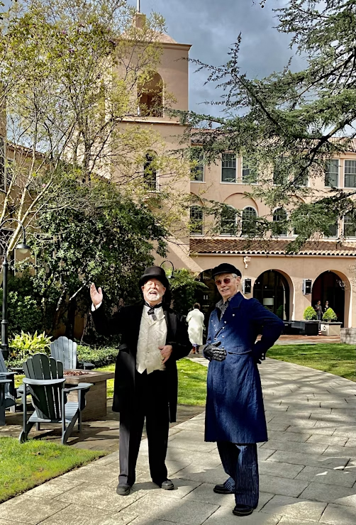
“You may have heard that I am starting a new historic walking tour in your neighborhood. It is called the Agua Rica Tour. I was asked to create such a tour…that will take place solely on the grounds of the Sonoma Mission Inn….by the new general Manager Karim Ikrimah last year.
Since then, CW Bayer and I have delved deeply into the historical record….and am now good friends with Reverend Leavenworth, Capt. Boyes, and Rudy Lichtenberg. Well…except for Thaddeus Minor Leavenworth….no one could be actual friends with him….”
George and CW are well-known actors, historians and radio personalities (yes, we still have radio!) in Sonoma Valley. The tour is an absolute blast! Our history is full of great characters, and these guys really bring them to life.
The tour runs Friday through Monday, starts at 10AM, and adult admission is $25, kids free.
Martin Kellog Cady was born in New London Connecticut in 1847. From the History of New London County, Connecticut (1882), a biographical sketch of the elder Martin K. Cady, who was a prominent businessman in New London in the mid 19th century, listing his children, says “Martin Kellog, eldest son, is assistant coiner at the United States Mint at San Francisco, and has been for some years. He married Jeannie B. daughter of Hon. Charles Gorham, of Marysville, CA.” The book was published in 1882 but must have been written earlier because our M K Cady had left the Mint and settled in Sonoma Valley by 1881.
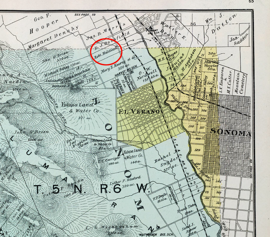
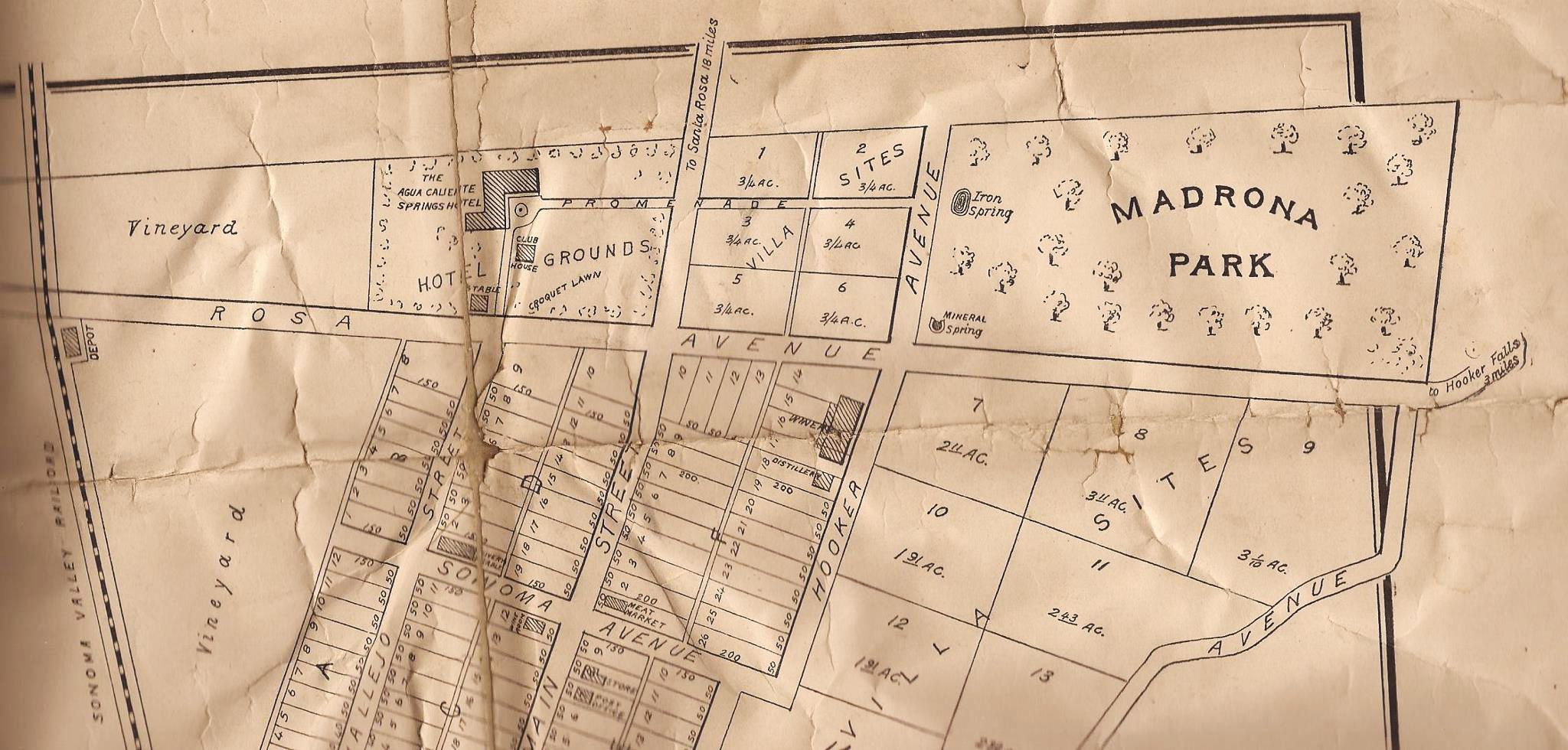
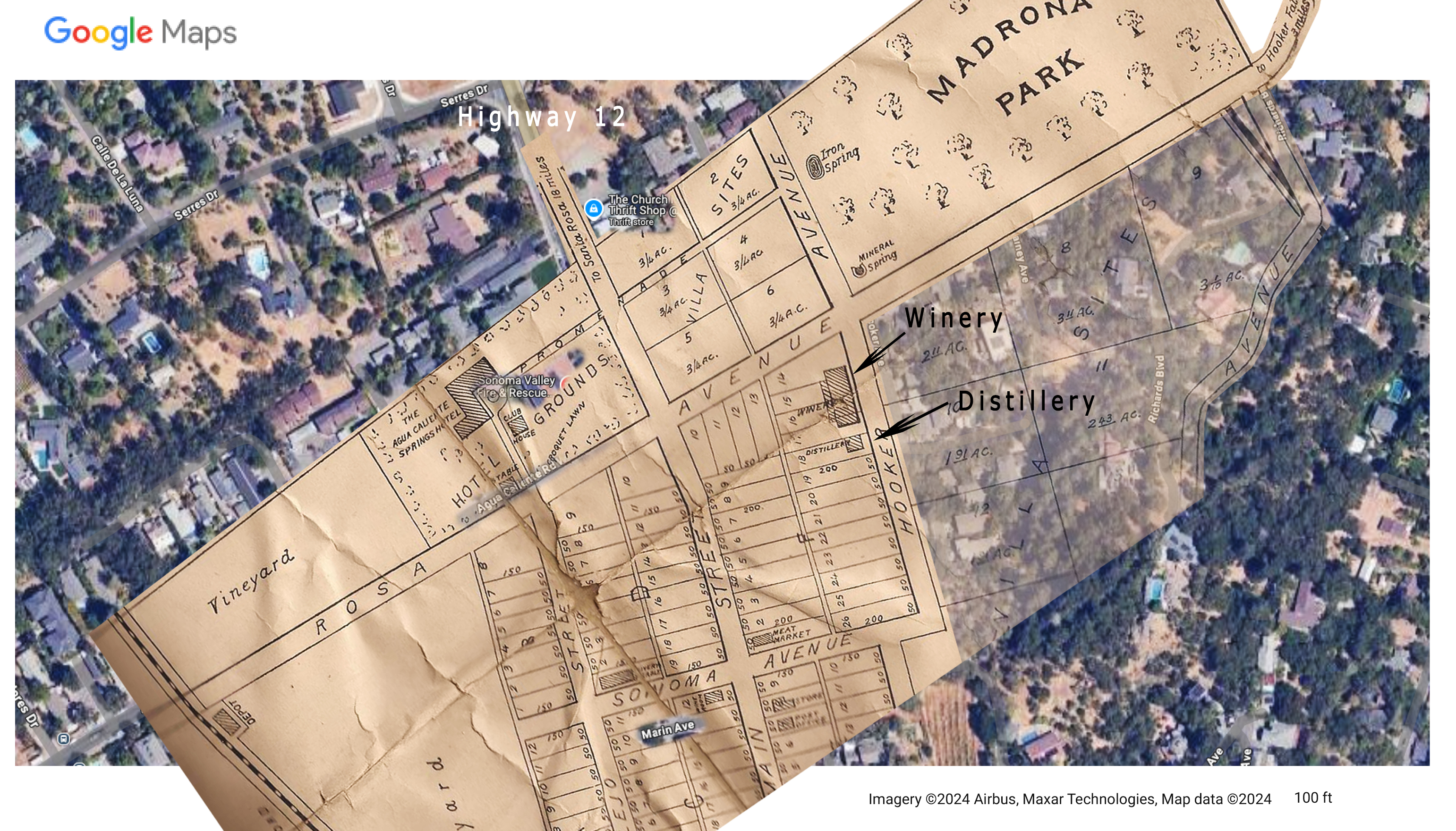
In that year the Index Tribune tells us, “M.K. Cady, formerly of the San Francisco mint, buys Alexander farm,” and that it is “Located on the Santa Rosa and Sonoma road, about three miles from the pioneer city.(Sonoma)” Also in 1882, Cady established a distillery and wine cellar (see map), built of stone from a “quarry on his own farm in the “Flowery” district.”
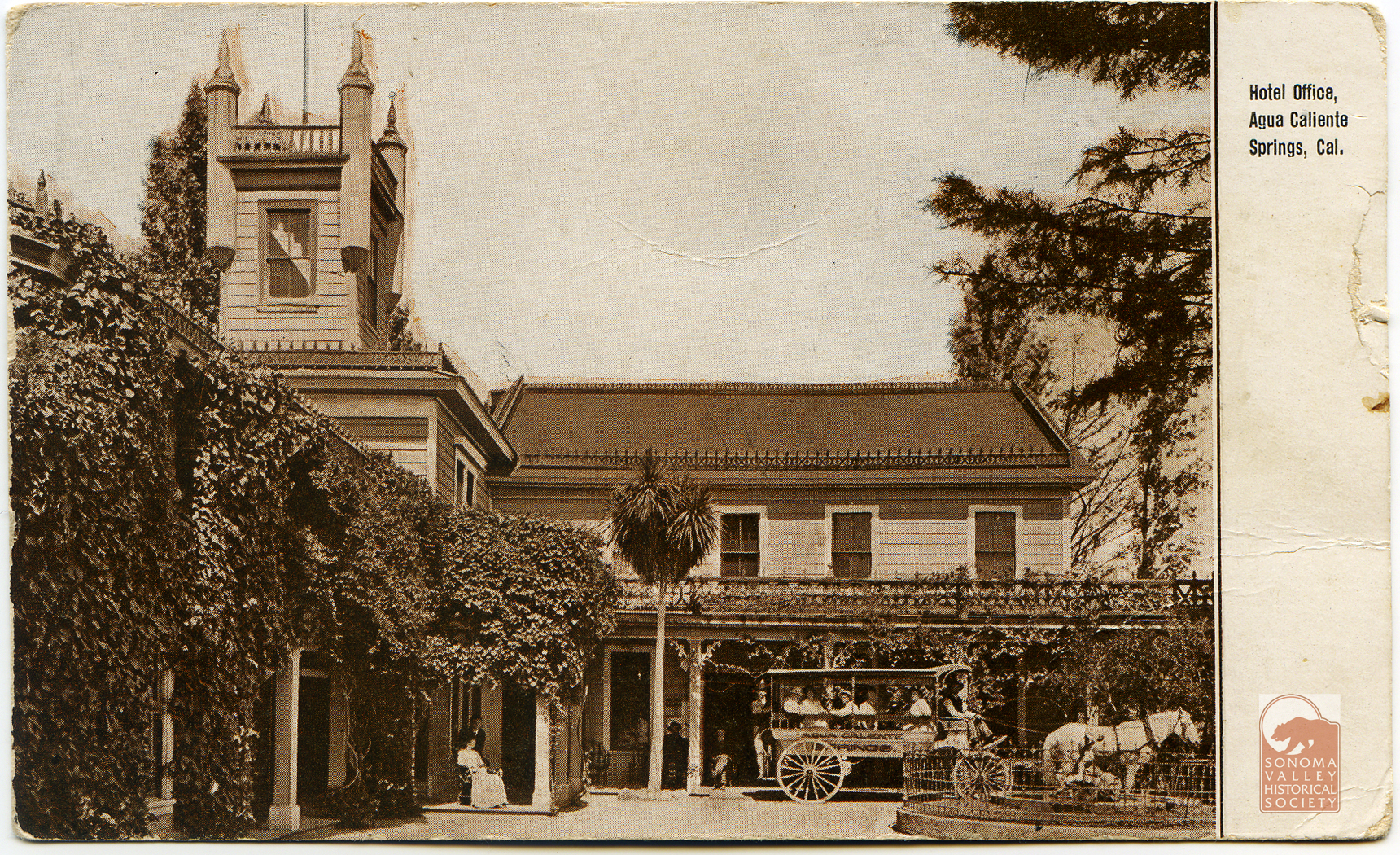
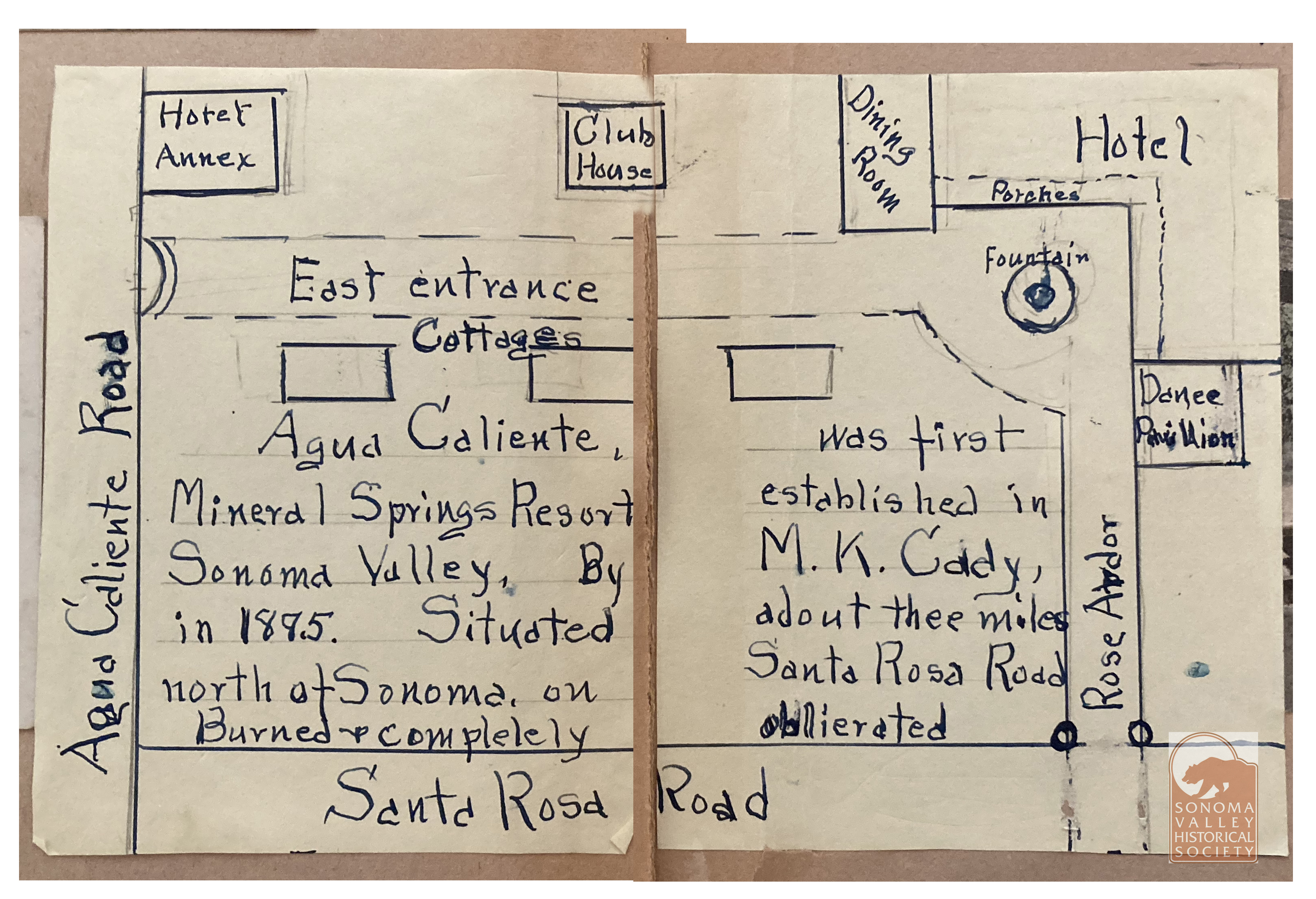
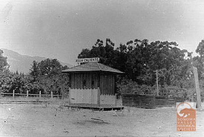
Map from Jeff Gilbert’s collection.Jeff’s map superimposed on the Google map. The resort was located at the intersection of the current Highway 12 and Agua Caliente Road, then called Santa Rosa Avenue. The winery and distillery were on Hooker Avenue, named for General Joseph Hooker, of Civil War fame, who was an early land owner in the area. The Agua Caliente Resort site was later known as Hooker Oaks. Today, the Sonoma Valley Fire Department station is there. The road at upper right is labeled “To Hooker Falls, 3 miles.” Click to enlarge.From a scrapbook at the Marcy House archives, date and author unknown.
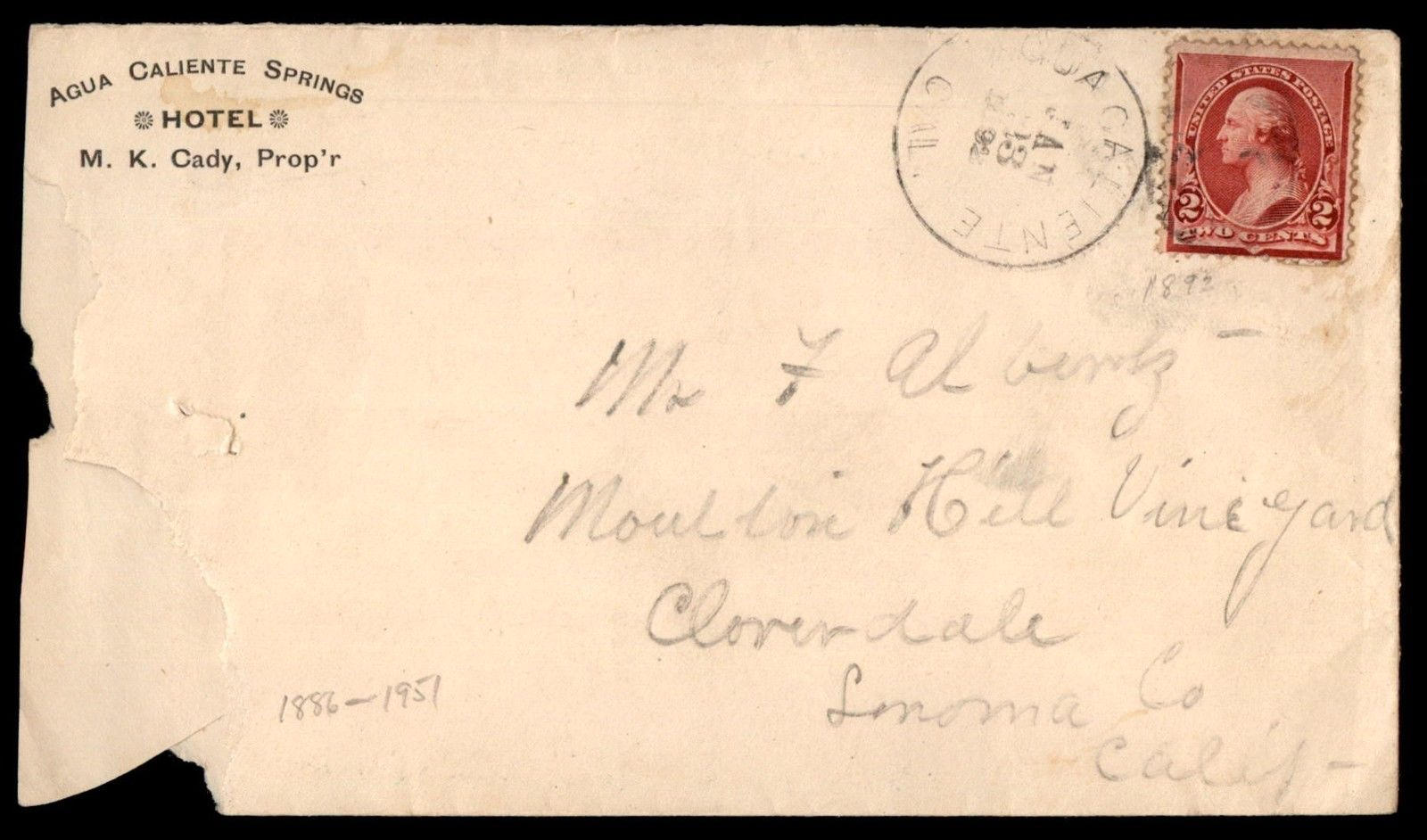
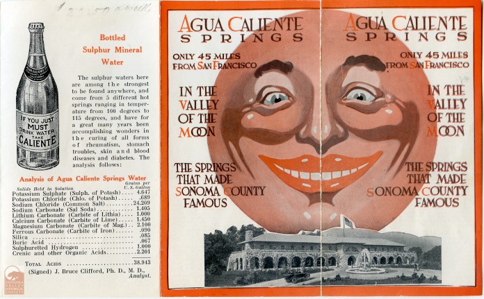
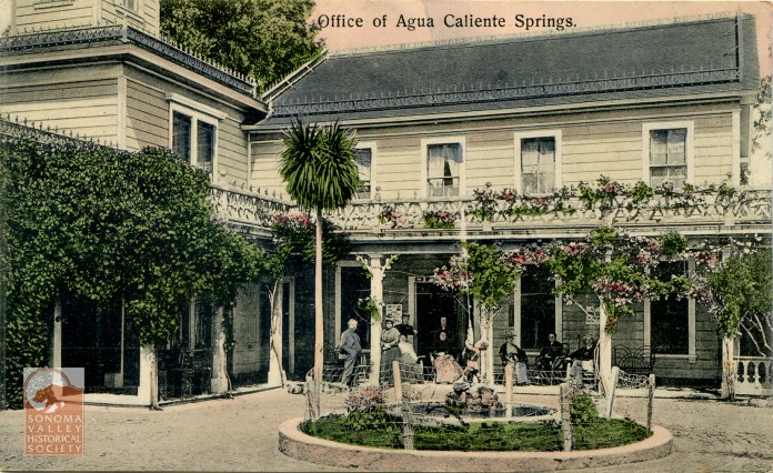
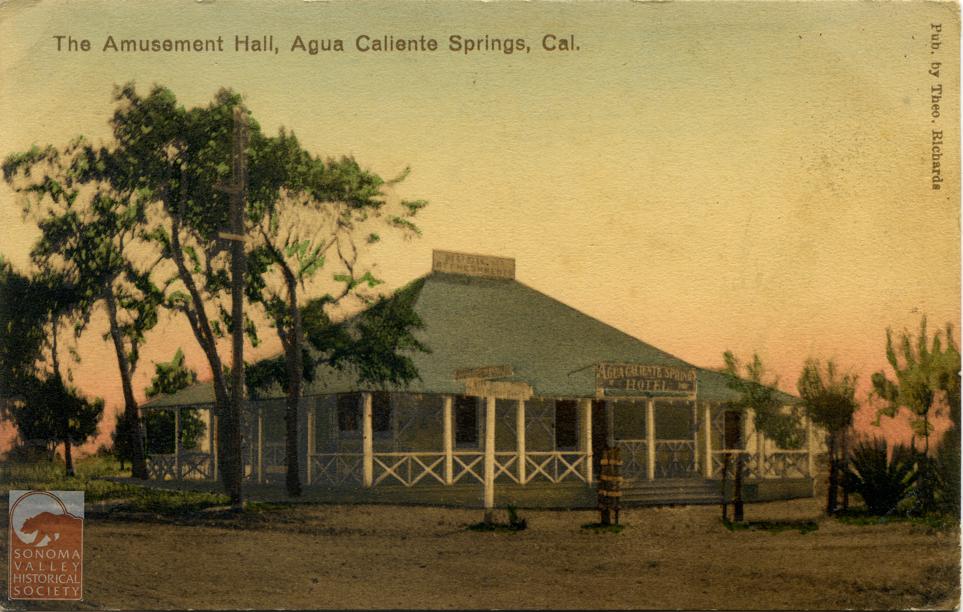
An advertisement in the Index Tribune in June of 1885 informs that the Agua Caliente Hotel, under the proprietorship of M. K. Cady will be opening in June of that year, so the resort was founded between 1881 and 1885.
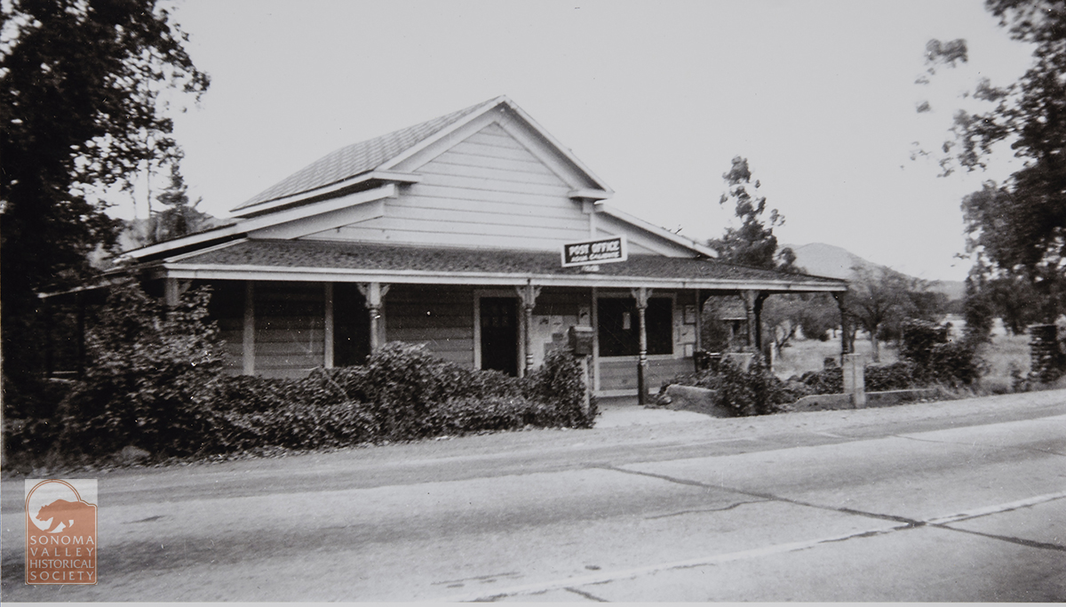
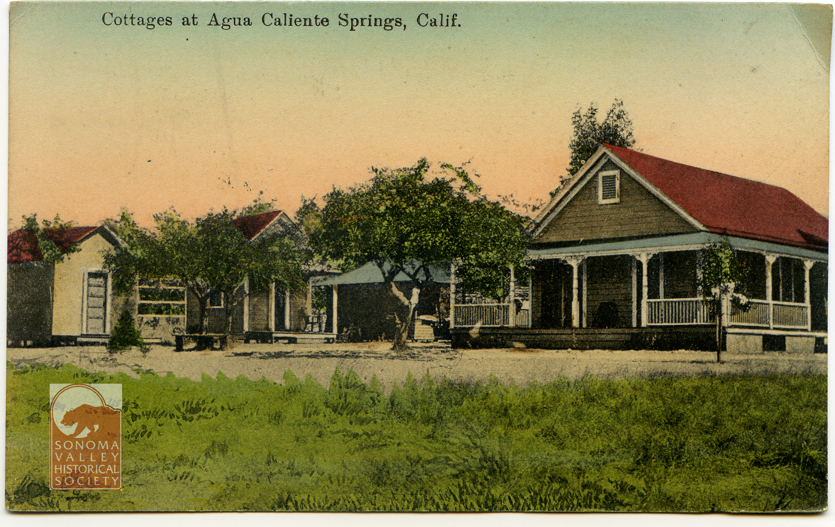
An puff piece in an 1889 issue of the Index Tribune read, in part, “the famous health-giving springs, delightful location and basalt block interests of this progressive little village is destined at no distant day to make it a place of considerable importance. The town was laid out a little over a year ago (incorrect!) by M.K. Cady, one of Sonoma Valley’s most energetic and public-spirited men. The railroad runs through the place which boasts of an express office, post office, schoolhouse, hotel general merchandising store, butcher shop, and a blacksmiths shop. During the spring and summer months the Agua Caliente Springs Hotel is crowded with health and pleasure seekers who come to lave in its health restoring water and bask in never failing sunshine and balmy breezes. An Episcopal Church will be erected a Agua Caliente this summer.”
In 1888 Cady sells to the Verano Land Company: “M.K. Cady of Agua Caliente has sold his hotel property and villa sites in that town to the Verano Land Company. Mr. Cady retains his winery and some forty acres of choice vineyard and will build a residence on the heights overlooking the wine cellar.” (This could be the site that became Keaton’s Shack.) After six months, Cady takes the property back. It seems, it has been closed the entire time “owing to a disagreement among the directors, who have been fighting like cats and dogs…” The Verano Land Company developed the “towns” of Verano and El Verano. Their brochure touting the developments is priceless early 20th century hype.
In 1888 Cady runs for county supervisor and is elected. The Index Triubne says “Mr. Cady is the right man in the right place and the people of Sonoma and Vallejo Townships ought to congratulate themselves on having so able a man to look after their affairs at the county seat”
New road leading to the new bridge over Sonoma Creek at Verano.
Also in 1888 “A petition was received from citizens of Sonoma road district praying for a new road from the iron bridge across Sonoma creek at Sonoma to the town of El Verano, and for the abandonment of the old road from the old bridge to where the same connects with Petaluma Avenue. On motion of Mr. Coulter, the same was received and placed on file, the accompanying bond approved and W. K. Nichols, M.K. Cady and G. C. P. Sears were appointed to view and lay out said proposed new road and report at the next meeting.” Please see The Arroyo of Arroyo Road
Interestingly, in 1891 the IT opined “(Cady’s) hotel is located in one of the most picturesque spots in California, and is destined at no distant day to be to this State what Saratoga is to New York.” However, they weren’t reckoning with Calistoga, which was so named because it was deemed the Saratoga of California.
All was not smooth sailing for Mr. Cady. In a September 1893 article in the IT headlined ”Agua Caliente Post Office Squabble. Cady and Morris on Top-Postmaster John Austin Down and in Jail,” we learn that Austin was the owner of a general store in Agua Caliente, which housed the post office. He also ran a bar that competed with Cady’s. Morris was the “mail Messenger” responsible for carrying the mail from the railroad depot to the Post Office. Morris and Austin had bad blood between them stemming from a fist fight the previous July. Morris and Cady wanted to get the Post Office moved to Cady’s’ resort. They accused Austin of opening their mail, and Austin was arrested and taken to jail in San Francisco. Austin claimed he was framed in order get the post office away from him.
That November, Cady was indeed appointed by President Cleveland to be post master of Agua Caliente, “a little old one-horse affair, the salary amounting to from $3 to $5 per month.” In October the story took a strange turn as Austin, having written to his wife in Agua Caliente that he would be home the next day, disappeared. Then, on April 7, 1894: “The Santa Rosa Republican is authority for the statement that John Austin, ex Postmaster of Agua Caliente, near this place, recently fell from a scaffold in a town in South America and sustained injuries that resulted in his death.”
Circa 1930
Apparently Cady defaulted on his mortgage in 1895. “A Mr. Dean of San Francisco took possession this week of the Agua Caliente Springs ranch to satisfy a mortgage of $25,000 executed by the former owner, M,K. Cady, who has been in possession of the property for over fifteen years {making Cady’s arrival in the valley no later than 1879}. The Hotel, swimming baths, wine cellar and hotel grounds have been disposed of by Mr. Dean to Dr. Nordin of Alameda, who will improve the hotel and grounds and conduct the same as a first class summer resort and sanitarium. Mr. Cady has leased for the present the handsome cottage which was erected near the wine cellar a few years ago by Mr. McGrew of San Francisco.”
However, Doctor and Mrs. Nordin did not see eye-to-eye. Shortly after he purchased the resort and investing $30,000 of her money in refurbishing it, Mrs. Nordin sued her husband, whom she says took her money under false pretenses and she wanted it back.
The Index Tribune, after saying that Mr. Cady “ran the resort into the ground,” informs us that Cady was appointed receiver of the property during the law suit!
“The bondsmen for M. K. Cady, who was appointed receiver of the Agua Caliente Springs by Judge Crawford, are J. B. Moris and Horace Appleton. Each swears he was worth $3000 over and above his just debts and qualified for $6,000 double the amount of the bond.”
The story continues. September 1895, “The Nordin case, which is the all absorbing topic of conversation in this valley, was resumed in the Superior Court last Monday. It will be recollected that last week Judge Crawford put and injunction on the Agua Caliente springs Resort, appointed M. K. Cady receiver of the property, and accepted as his bondsmen H.B. Morris and Horace Appleton.
Later court action: “The proceedings Monday was devoted to filing a motion to dissolve the injunction….” Nordin alleges that Cady is insolvent, and “that…during the greater portion of the time since his appointment as receiver (has been) under the influence of intoxicants.”
Nordin continues to allege that Cady has fired all the staff and put his wife, daughter, niece on the payroll, and “that the Cady tribe has taken up their abode on the promises.”
Additionally “The affidavit says the order appointing Cady as receiver covers all the personal property on the premised and that some of the guests at the hotel wish to leave, and that Mr. Cady has refused to let them have their trunks and wearing apparel”!
November 9, 1895-The Nordin suit was continued. “The property is still in the hands of Trustee Cady. Dr. Nordin is residing in San Francisco and Mrs. Nordin is the guest of Alameda friends.”
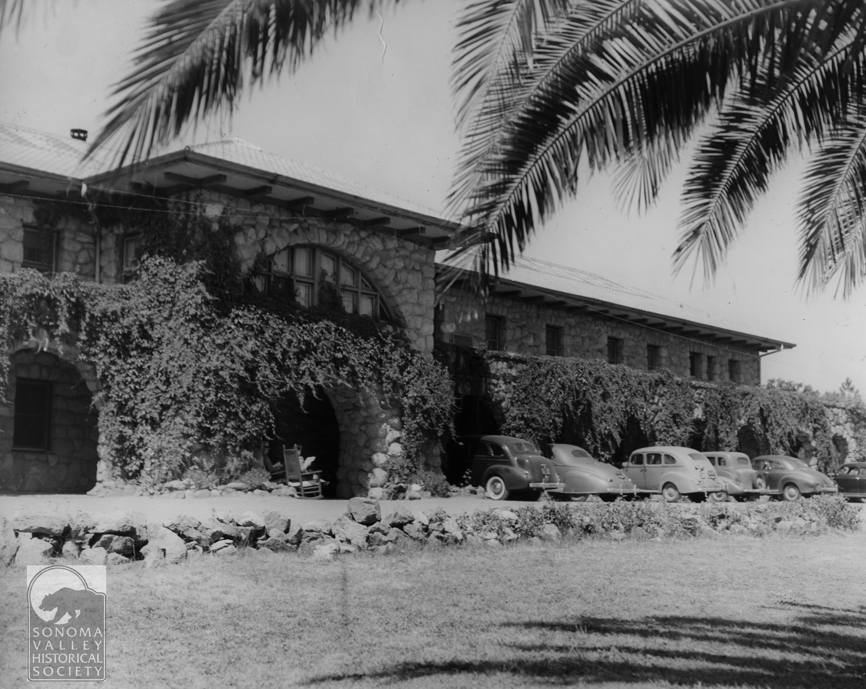
April 11, 1896, the suit is settled with Dr. Nordin getting $1000 and Mrs. Nordin getting the property, but no word of what happened to the “Cady Tribe.” Mrs. Nordin continued running the resort. Details are in short supply. The magnificent hotel burned some time before 1916, when the new, stone building was built.
The “new” Agua Caiente Hotel, built in 1916, still stands in 2024
Martin Kellog Cady died November 18, 1903, in San Francisco.
All quotes are from the Sonoma Index Tribune unless otherwise noted.
Sonoma Index Tribune and many images courtesy of the Sonoma Valley Historical Society
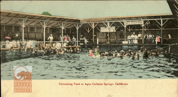
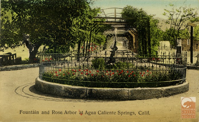
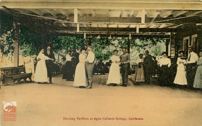
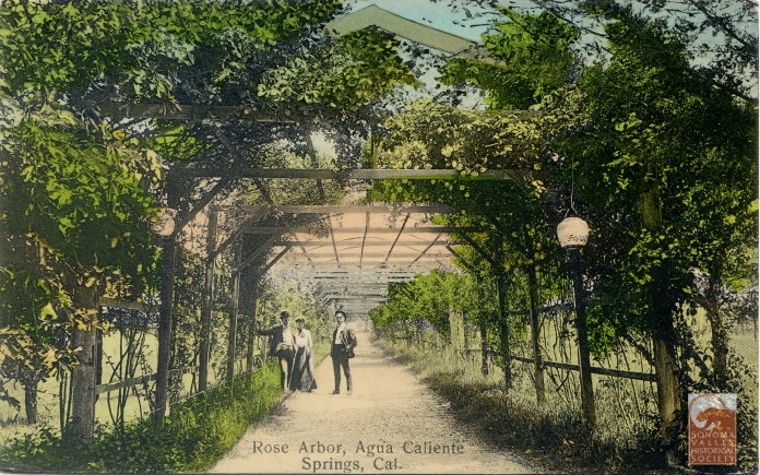
The Agua Caliente Resort, and vicinity, was well documented by photographers. The following is a slide show of some of those photos and post cards.
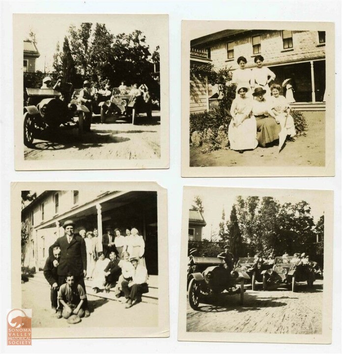
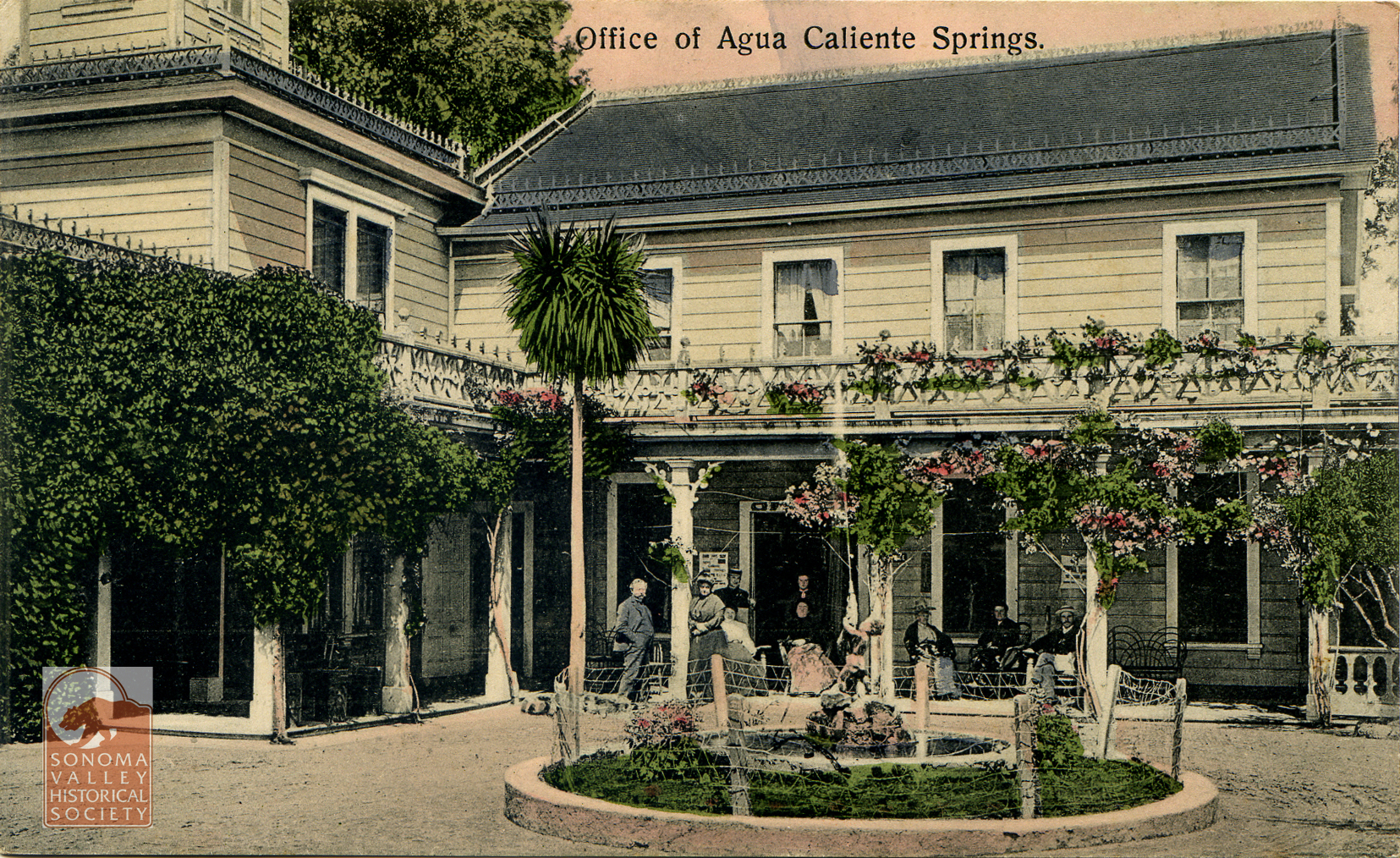
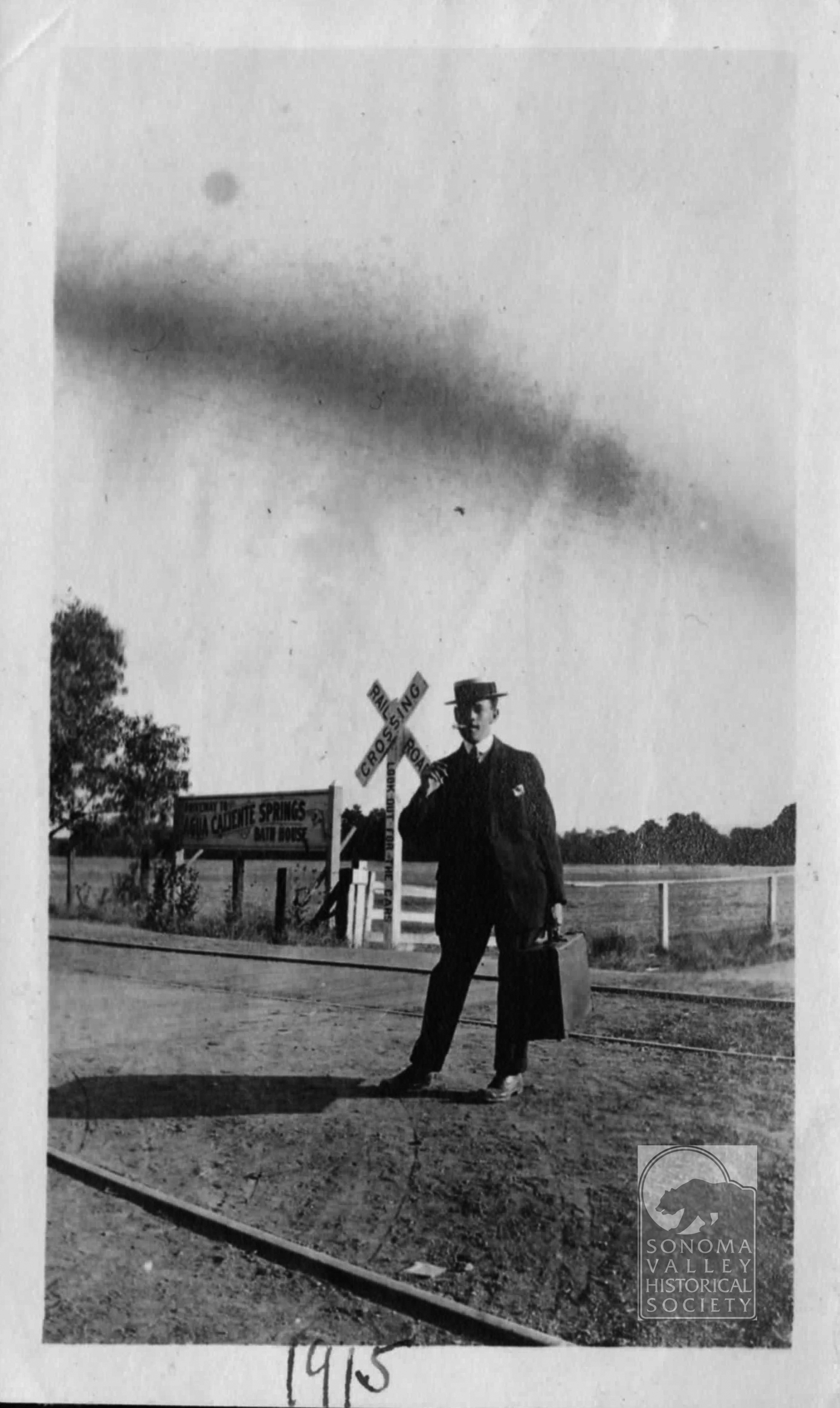
I started posting on this website in July 2014. I have striven to post every month, and I’m close to that goal. Ten years and nearly six months in, I’m still enthusiastic and have many more topics to investigate. I’m currently working on an article about M.K. Cady, the founder of Agua Caliente, and his resort, but it won’t be done this month. In the meantime, enjoy some of the images I have collected. All are from 1912-1915.
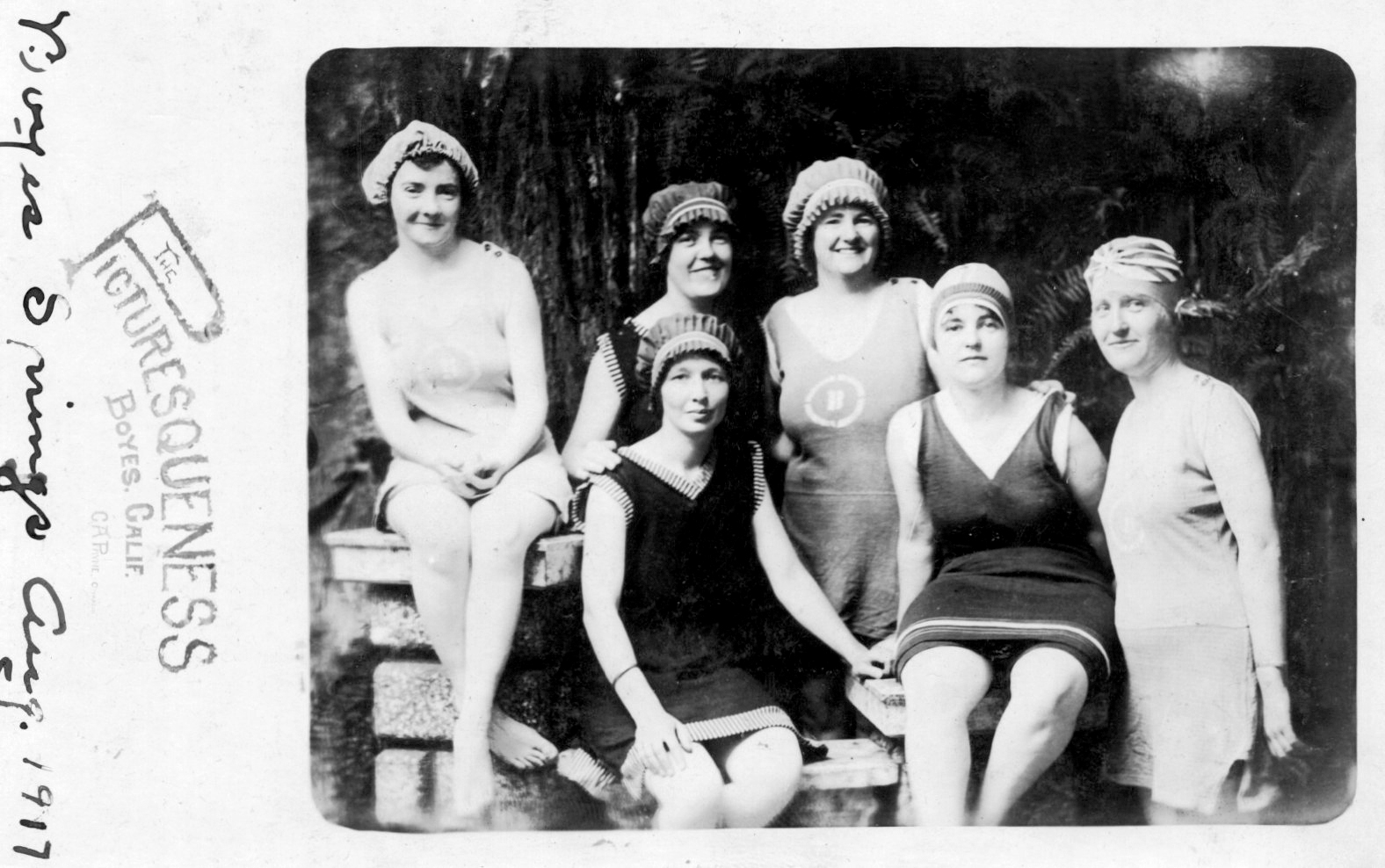
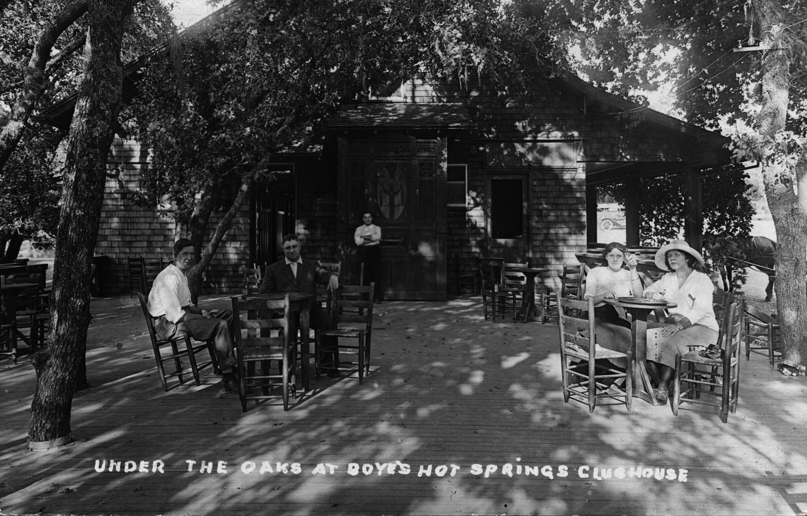
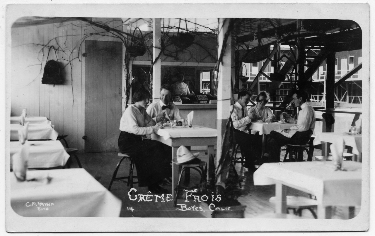
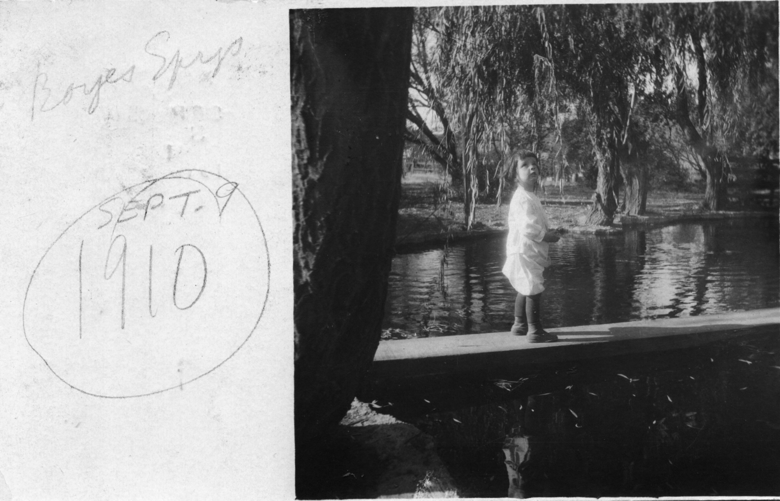
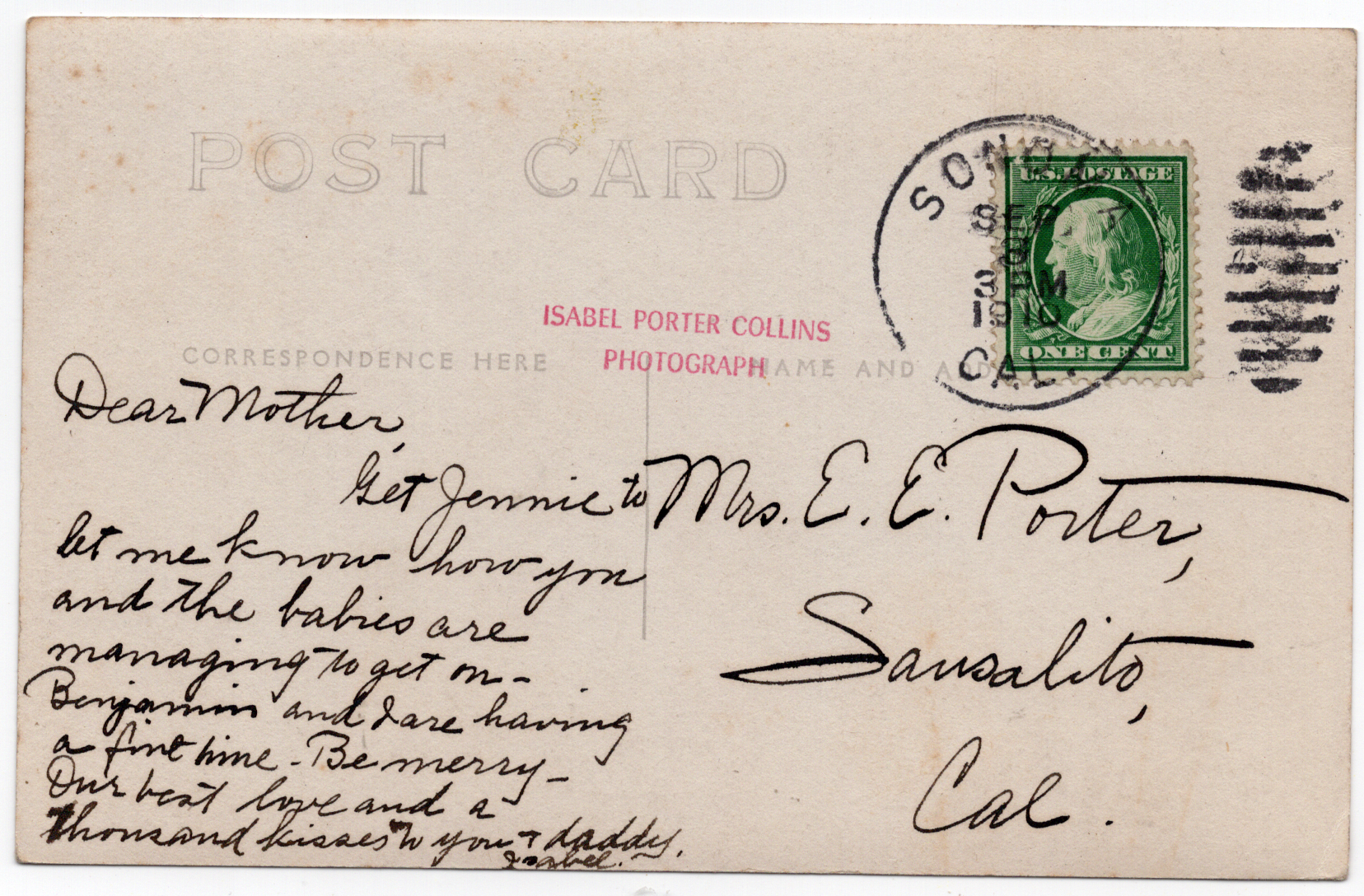
Bathers at Boyes Hot Springs, 1917Circa 1910sLooks like the Fetters Resort pool. Quite a genteel setting! C.A. Payne is the photographer. Thanks to Dennis O’Rorke for the photo.Front and back of a card, photo by Isabel Porter Collins, born in Petaluma, 1875, died 1954. Artist, photographer, jewelry designer, teacher. Extensively documented Bay Area places and people in the first half of the 20th century.
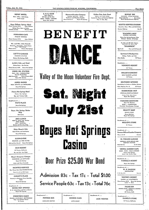
The Depot Hotel, not the one on First Street West in Sonoma, was located on Agua Caliente Road and Lake Street in Agua Caliente. It was probably preceded by Annie’s Resort at the same location, which David Luzzi listed in his liquor application in 1939. Luzzi was listed as the proprietor of the Hotel in an ad in the IT in 1945.
This is the only image I have. I received it from Laura Rondou, a Luzzi descendant.These full page ads listing the sponsors of charitable (usually) events are invaluable lists of local businesses. The Depot Hotel is upper left.
Annie’s had gained some ink in the Index Tribune as far back as 1932, when two men, one of whom, Joaquin “Duke” Faber, know as “The Sheppard of the Hills,” was arrested there for the alleged molestation of girls from the Sonoma State Home (later known as the Sonoma Developmental Center.) According to the IT two of the ”victims, decided Monday to pay a visit to “their Shepherd” and stole away from home under cover of darkness. They reached the home in the hills shortly before midnight, following the railroad tracks from the home, using a map furnished them by another inmate who had visited the ”temple of the Shepherd” on previous occasions.”!
The girls later confessed to their transgression. The two accused men denied any involvement with the girls. “When the men were arrested at Annie’s Resort, near Agua Caliente, the officers were surrounded by a group of Mexicans and Indians who demanded the reasons for the arrest of their two pals. Officers rushed the men into awaiting automobiles and brought them to the county jail.” As we used to say, this story is “one for the screenplay!”
Faber’s trial date was set for later in 1932. The outcome is unknown as of this writing, however he was sentenced to 90 days for stealing chickens in 1941.
In 2017, Robert Singleton shared this on Facebook: “A little history of the OK corral on Agua Caliente. and Lake St. Originally the Depot Hotel. In or about 1948 (actually 1942) the trains stopped running and it sat abandoned until 1951 when my Dad and Mom bought the old hotel and about 4 acres. My older brother built or remodeled a house under the water tower and lived there. In 1961. Or 62. Jim Doyle and Eddie Hadem rented the Depot hotel and stated the OK Corral. my Mother sold the buildings to Mr.and Mrs Bates. They owned the place for about 10 years. End of my recall.”
The only mention of the OK Corral I found is of the building being for sale in 1966. The ad called it “roomy and historical.”
David Luzzi died in april of 1955 in Ukaih. His wife Cecilia, co-proprietor of the Hotel, had died in 1954 in Sonoma.
Index Tribune courtesy of the Sonoma Valley Historical Society.