Historic footage of Nino Vailetti and his resort. https://www.youtube.com/watch?v=_0D_OT-4iCE&feature=youtu.be&fbclid=IwAR3RiYqbf7zri4NzQdh5Bzjf0av7NwqrNDRlOLdglDEhDxiPs9j_BOwJSIQ

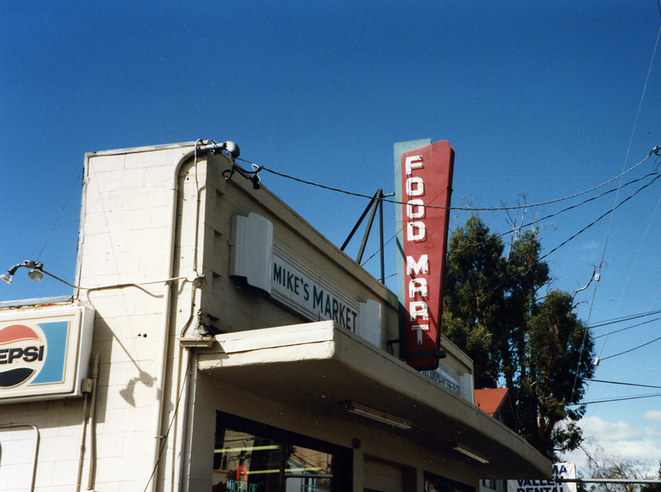
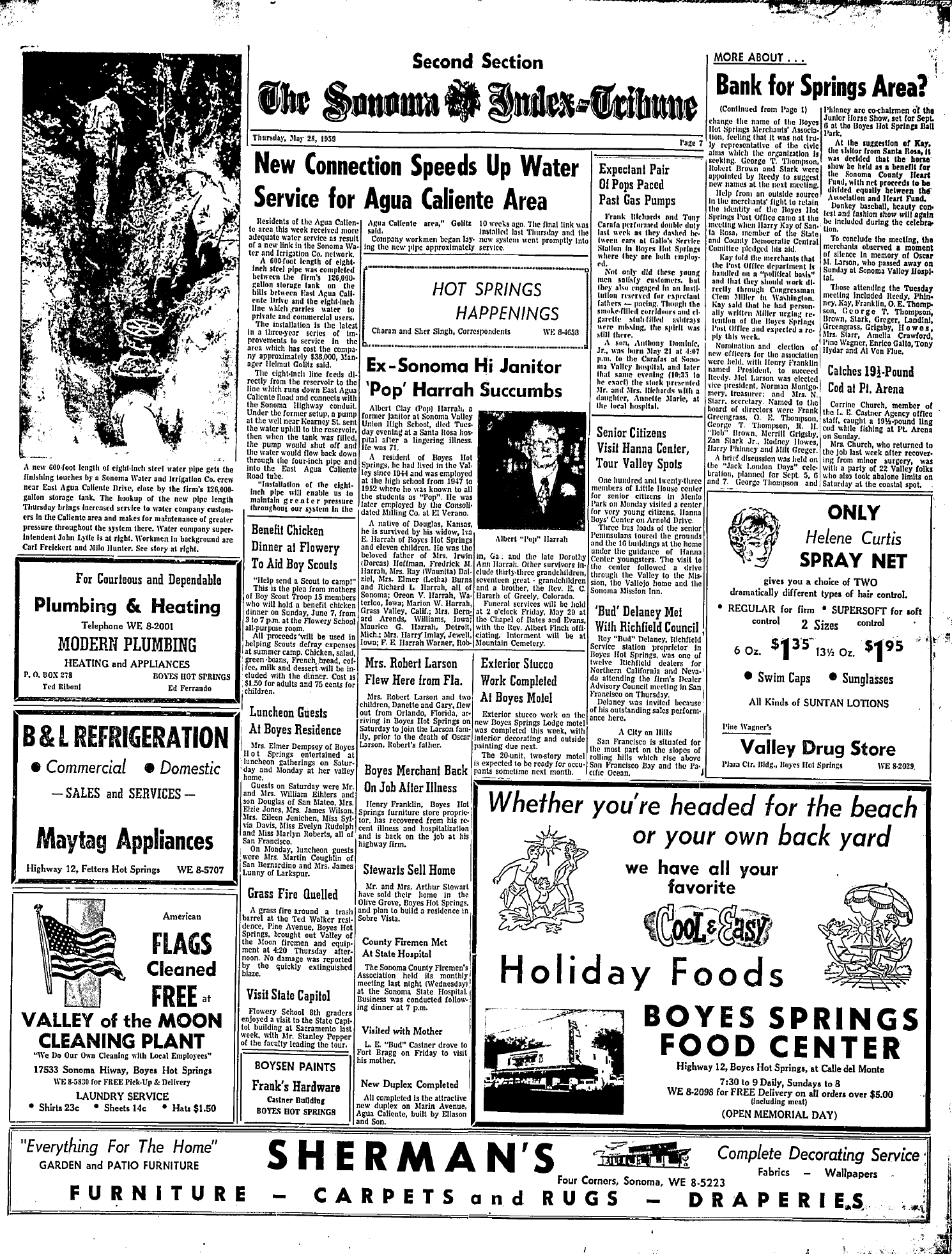
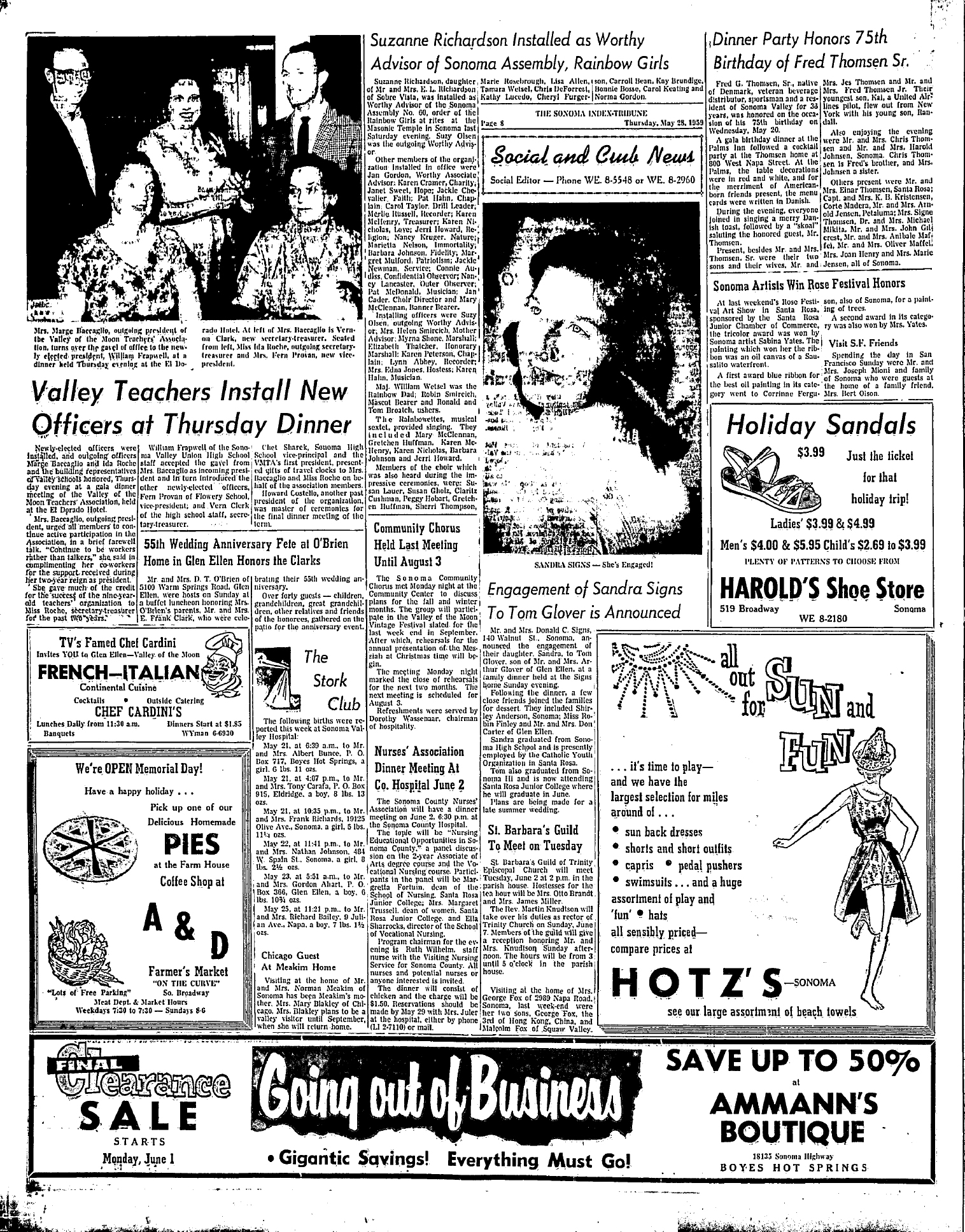
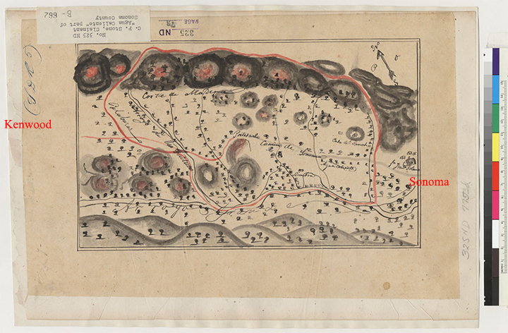
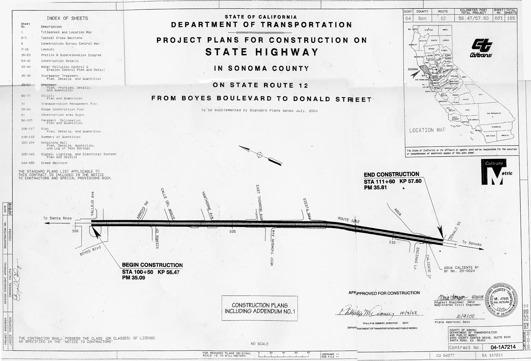
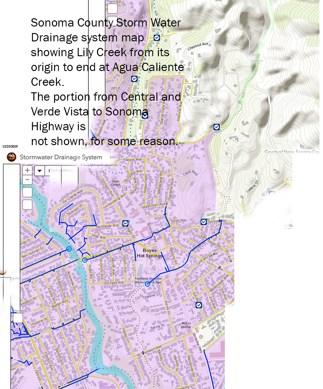
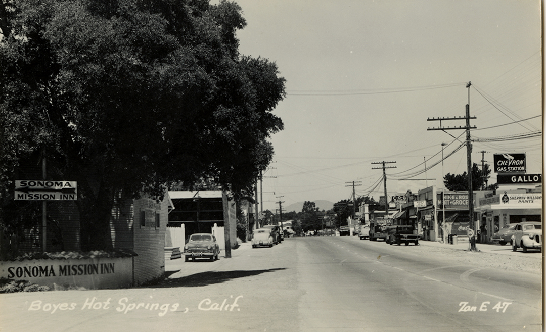
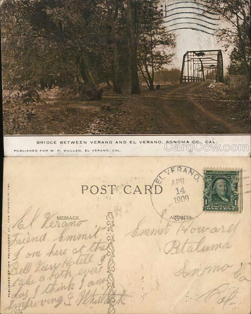
Pine Avenue is shown on a County recorder’s map “Hotel Grounds Subdivision” which dates to before 1923. On that map there is a canal, starting near the hotel, crossing Boyes Blvd., and running down Pine Avenue. It ends in a large pond adjacent to the entrance of the Bath House. The canal did not exist long, if at all. Photos of the Bath House entrance from the 1920s show no pond.


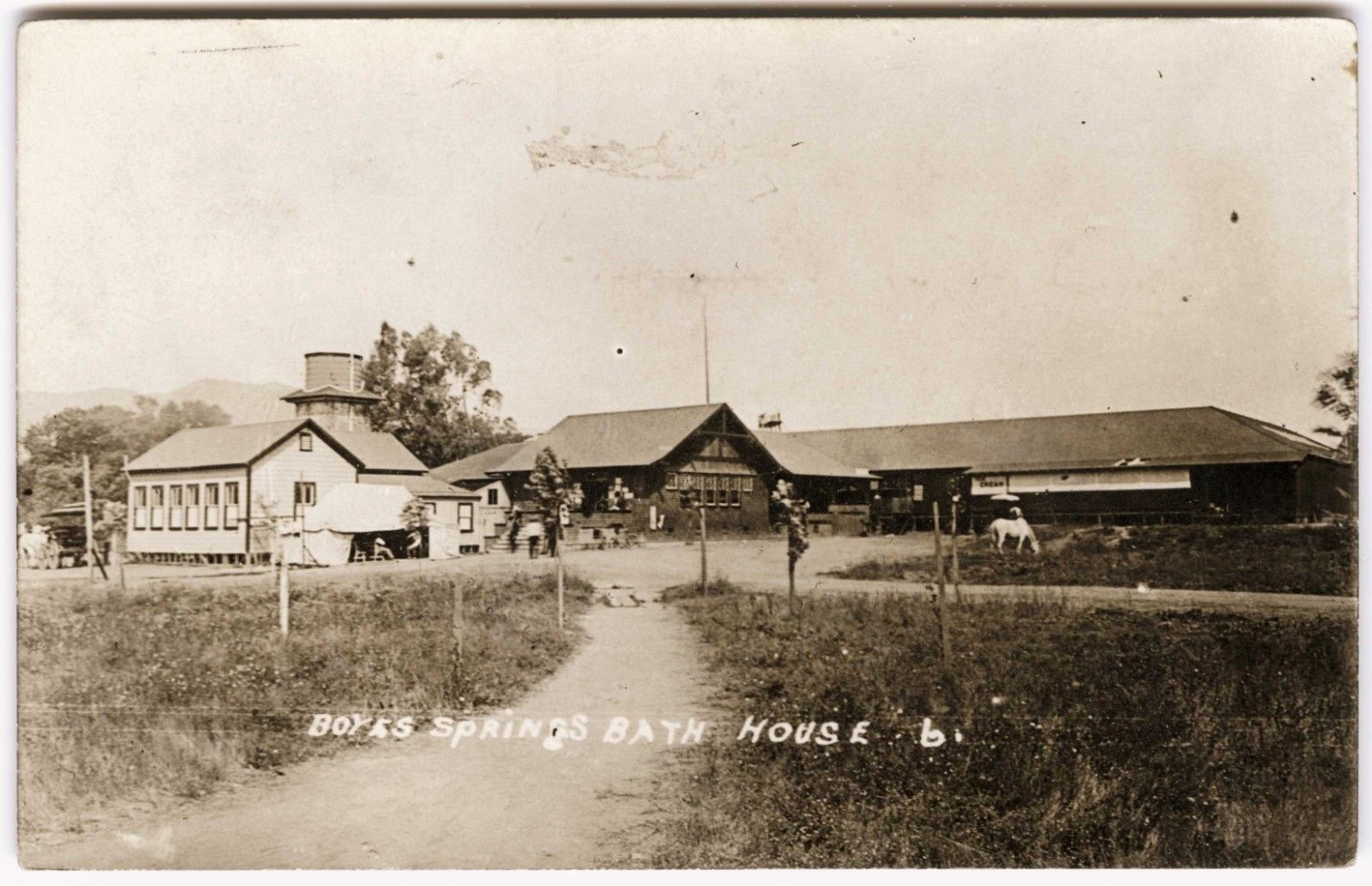
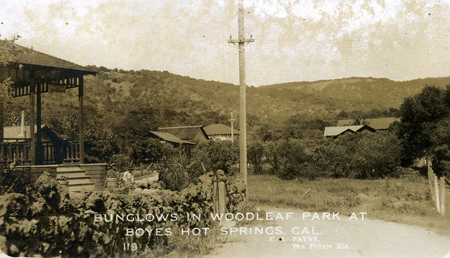
The Boyes Bath House in 1910. The end of the canal would have been somehwere at the right. The entrance to the Bath House was on Pine Avenue.

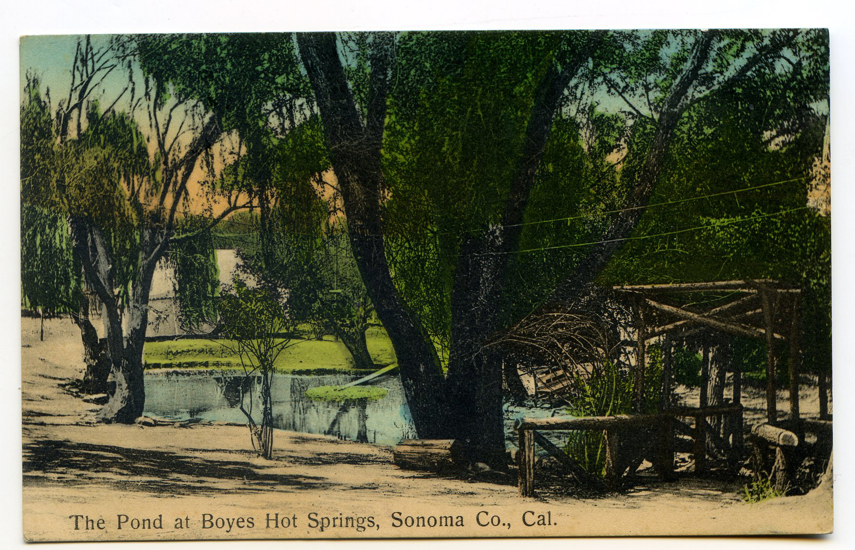
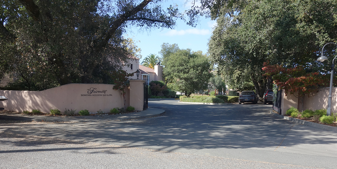
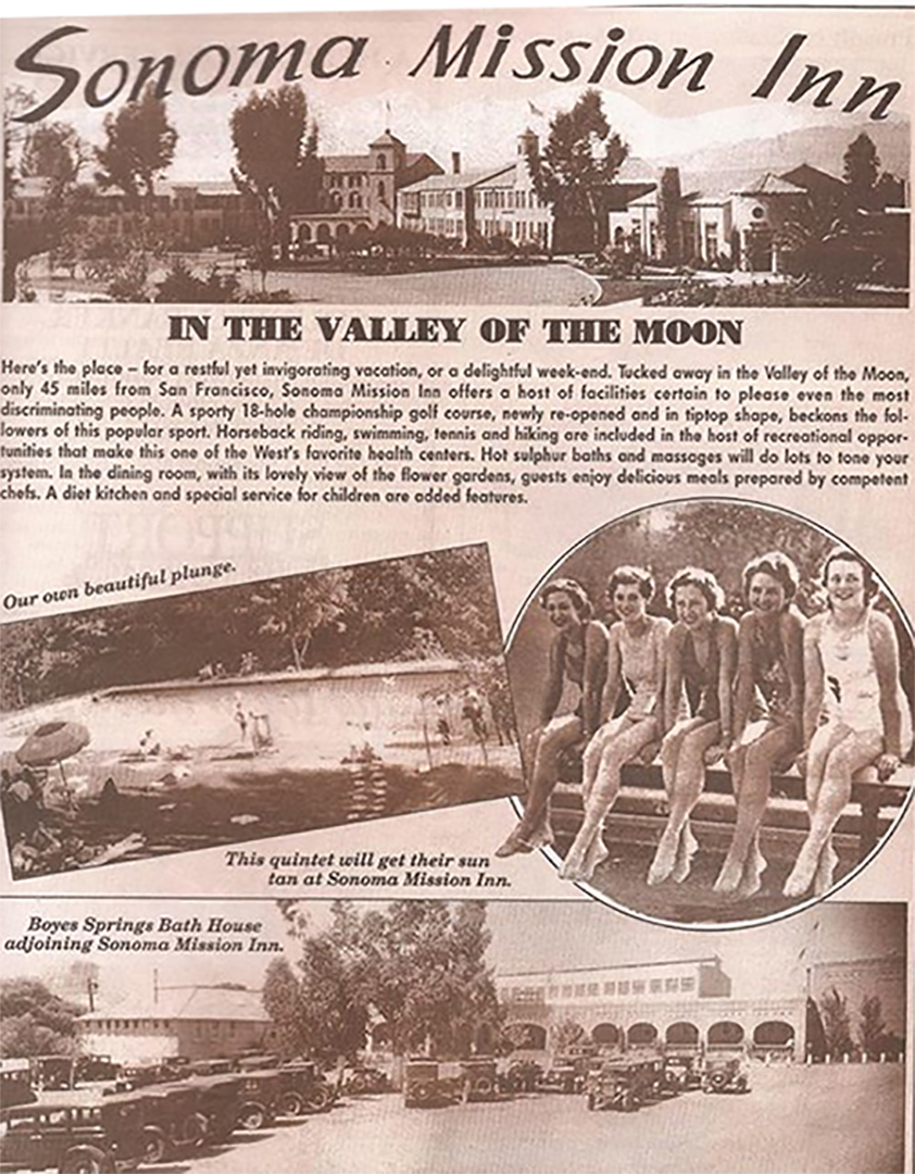
This pond was in front of the “Old Hotel,” which was located where the Sonoma Mission Inn is today. Possibly the origin of the Pine Avenue canal.
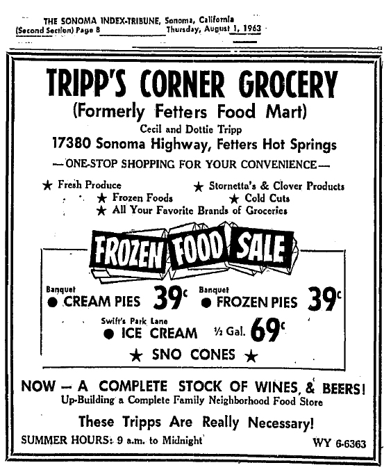
On the fourth of August, 1916, the Boyes Hot Springs corporation, which owned all the land around the hotel which is now the Sonoma Mission Inn, sold lot numbers 155 and 156 (actually on Northside St., parallet to Pine) of the Hotel Grounds subdivision to Mary O. Cookson. She was enjoined by the boiler plate language of the “indenture” (deed) not to drill for water and, in the overt racism typical of the day, not to allow the occupation of the property by “Asiatics or negroes.”

The signers of the deed for the Corporation were Henry Trevor and R. G. Lichtenberg. Lichtenberg became a proprietor of the Boyes Bath House, and a street is named for him in that vicinity.


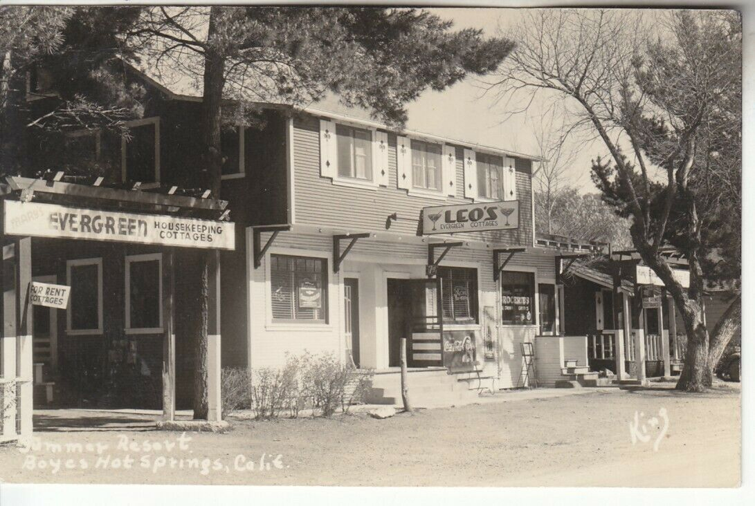
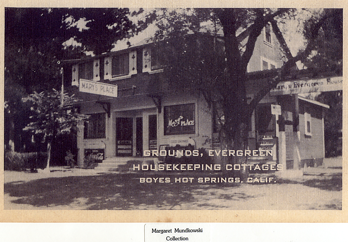
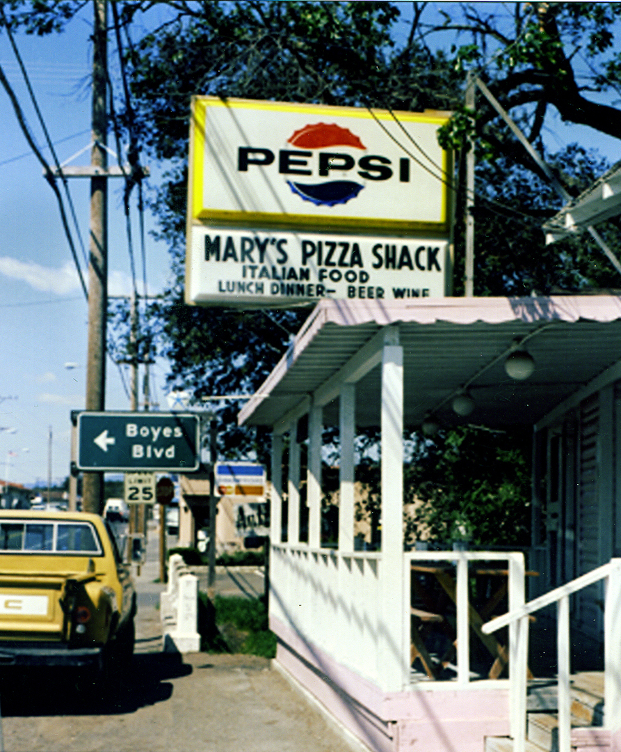
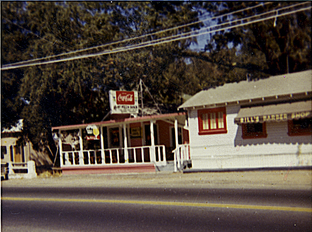
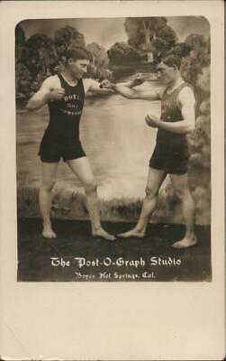
The principle resort on Pine Avenue was the Evergreen Cottages, which dates from the early 1920s. The main building, housing a bar know variously as Mary’s or Leo’s was on Pine, but the resort extended to Northside St. In the center of the cottages was an open area said to have been a boxing ring. This is plausible as the training of fighters was common in the Springs in the era before WWII. Louis Parente was well known for hosting workouts at his place in El Verano.

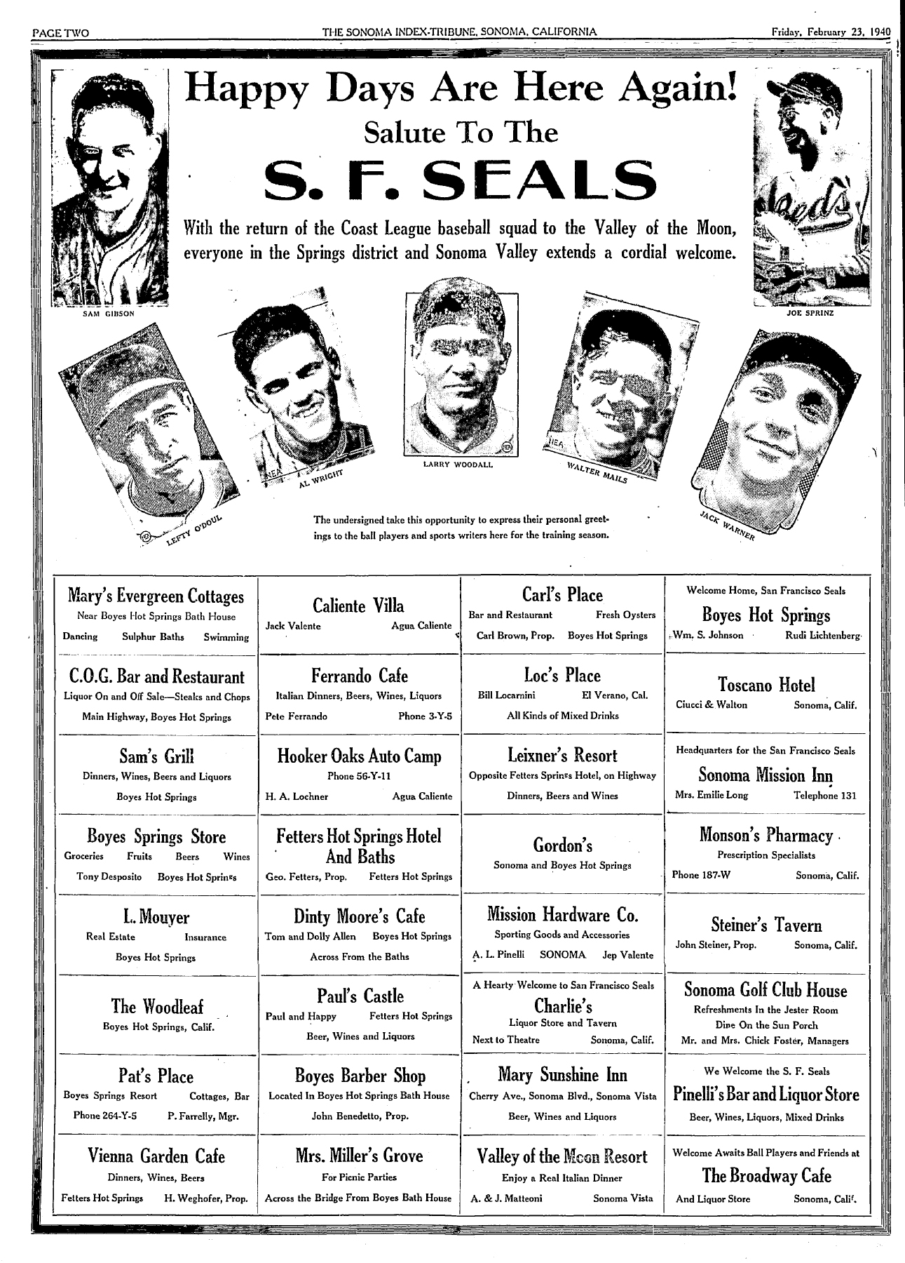
In February of 1940 the Index Tribune and dozens of local businesses welcome the San Francisco Seals to the baseball grounds at Boyes Hot Springs for spring training. Among them was Mary’s Evergreen Cottages. Their boxed ad boasted “dancing, sulphur baths swimming.” The baths and swimming were courtesy of the Boyes Bath House at the end of Pine Avenue, and dancing might have been in the large square area in the center of the cottage cluster.

On September 16, 1949, William Johnson and Milton Gregor, proprietors of the Boyes Bath House, leased Leo’s Evergreen to Thomas Mayhew and Celanire Mayhew. The Mayhews gave notice, the same day, that they would engage in the sale of alcoholic beverages at the Evergreen.
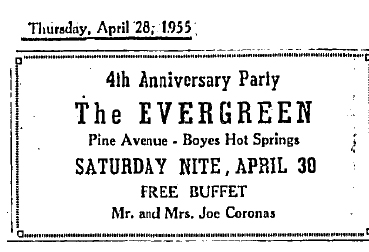
In April of 1951, Ruby Coronas bought the Evergreen Resort from Johnson and Greger.In 1955 she celebrated the fourth anniversary with an ad in the IT.
. 
Joe, a native of Spain, died in Sonoma in 1971. Ruby died the same year, in Colusa.
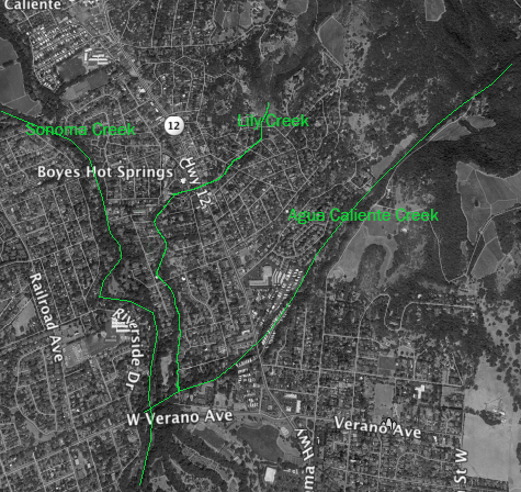
In May of 1954, the Jack London Lodge of the American Legion hosted a candidates night at the Evergreen Resort. “Post commander Ed Reedy said that all candidates for federal, state, and county offices had been invited to be present, and that “most of them” had signified they will attend…” According to a June 3rd article in the IT, some of the candidates were Charles E. Greenfield, for state senator, 12th district, Oscar Larson for a Republican central committee post, and James J. Manning, of Boyes Hot Springs, unopposed for constable in the Sonoma judicial district. (Do we still have a constable?) Interestingly, among the polling places was Perkin’s Memorial Hall on Agua Caliente Rd., location unknown today. The Verano East polling place is listed as the Grange Hall on Highway 12, showing how notions of the boundaries between communities shifted over time as the (former) Grange Hall is now considered to be in Boyes Hot Springs. Archaic places names that had polling places included Cooper, Eaton, and San Luis.
The resort was for sale in 1996 for $449,000. It was said to be in “part of the up and coming area of Boyes Hot Springs.”
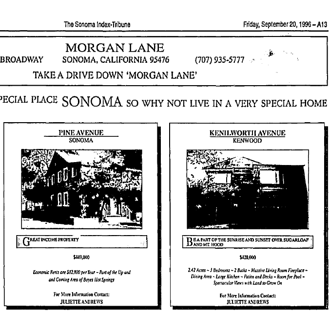
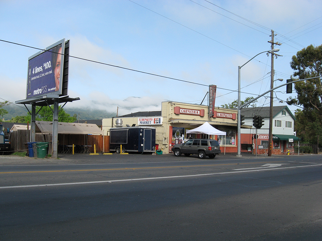
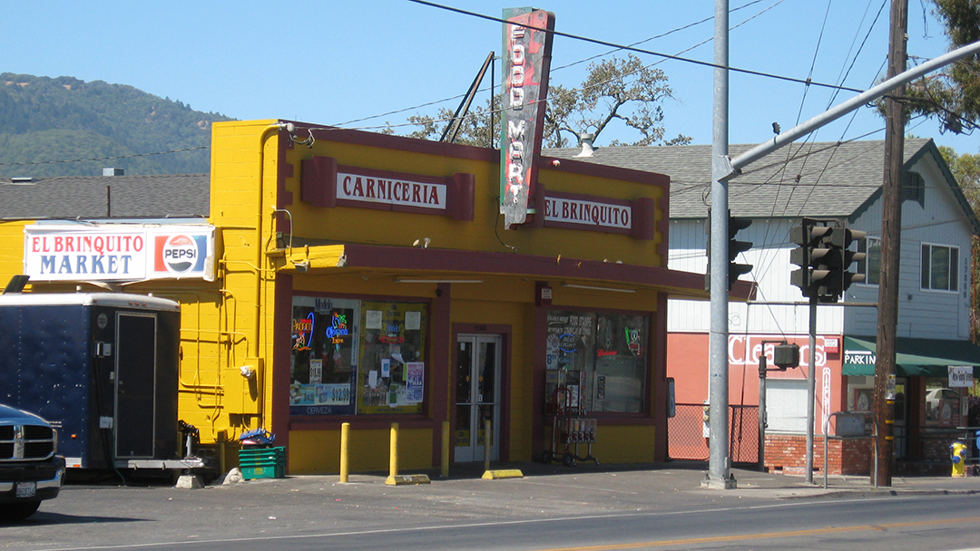
Another resort on Pine was the Golden Oaks, which was on the corner of Pine and Northside, or Pine and Gregor, depending on which source you chose. In a 1968 article the Index Tribune gave the address as 130 Pine, which would put it at the Gregor end.
The first mention of the resort in the IT is in 1932. From 1938 to 1950 a Mr. and Mrs. Zinkulsen owned and operated it. In 1950 they sold to Bertha I. Donnelson. In the notice of the transaction the Golden Oaks was said to consist of eleven cottages and an owner’s residence.
Crime on Pine
Apparently Pine Avenue was a rough place in 1950. Around 11PM on September 8 of that year a street brawl broke out between seven young men, according to the IT headline. However, in the story it turned out that twelve youths were arrested and three were in the hospital, one with his “belly cut open.” He survived.
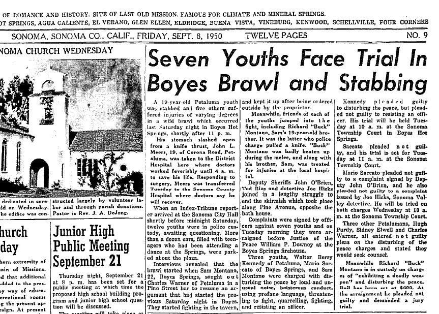
16 Pine Avenue was an interesting looking building. Apparently a store, it was in use as a residence up to 2009. It was boarded up in 2010 and demolished in 2019. In 1969, the federal Office of Housing and Urban Development was contacted by Boyes Springs Resort owner Luis Vela about a redevelopment program for the Springs. According to the IT, “Vela said he had conferred with HUD officials and others from San Francisco on the Boyes redevelopment plan. Preliminary proposals set this up on a three-stage basis. The first area to be upgraded under such a pilot project, said Vela, might be the section between the creek and Highway 12…”

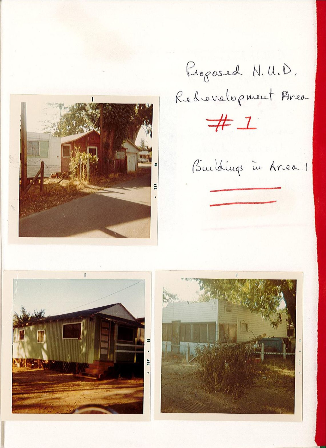
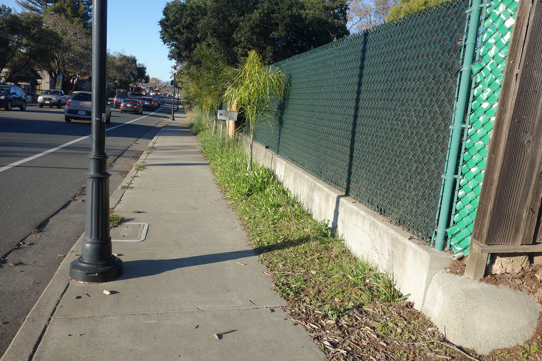
These photos, courtesy of Sonoma County Library, show an area, Pine Avenue, that could be included in the project. 16 Pine Avenue is shown. Redevelopment did no start in earnest until the late 1990s. We got sidewalks and street lights and some improvements to commercial buildings before Jerry Brown abolished redevelopment statewide in 2011. The sidewalk project was completed with county funds in 2016.
In 2004 a new development was built at Pine and Gregor. It consists of nine, small, two story homes plus an older home that was remodeled. Four of the units were meant to be “affordable.” John Bonfini was the developer. I believe the Bonfini development was built on the Golden Oaks site. Photo of the “older home,” possibly the Golden Oaks owner’s residence.

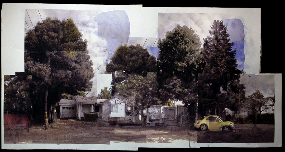
Photo collage watercolor by Michael Acker of a section of Pine Ave.
Index Tribune courtesy of the Sonma Valley Historical Society. Photographs and maps from the author’s collection.
James Baldwin, in his essay “Fifth Avenue Uptown: A Letter From Harlem,” 1960, said “It is a terrible, an inexorable, law that one cannot deny the humanity of another without diminishing one’s own: in the face of one’s victim, one sees oneself.”
And, in “East River, Downtown: Postscript to a Letter From Harlem,” 1961, “What is demanded now, and at once, is not that Negroes continue to adjust themselves to the cruel racial pressures of life in the United States but that the United States readjust itself to the facts of life in the present world.”
Now, and At Once. In 1961. Sixty-nine years ago. Ninety-six years after the adoption of the Thirteenth Amendment.
In 2020 we have new hope that a real movement for change has begun. It is the responsibility of white people to change themselves and our society. We, the Springs Museum along with many others, are in the process of becoming better educated about racism, white privilege, and white supremacy. Education and action must proceed together. We humbly expect to discover, in the coming months and years, what that can mean.
This day, sixty one years ago. Eighteen pages in the issue. What happened that day? Things small and large, meaningful and trivial. Presented with just a few comments and notes.

Valley Mourns Oscar Larson-See page 14 for an editorial appreciation of this important figure in mid-twentieth century Boyes Hot Springs.
Incorporation, Bank sought at Boyes –“’A committee to form a committee’” to work for incorporation of Boyes Hot Springs as a full-fledged city, was appointed Tuesday at noon meeting of the Boyes Hot Springs Merchants Association, held at Sonoma Mission Inn.” Zan Stark Jr., Harry Phinney and Milton Greger were appointed to “establish a “citizens committee” to “sell” the incorporation plan in the area.”
Page 2
More about Oscar Larson. Dr. Ronald Scott fished in Oregon. Big News! (Oregon keeps coming up in this issue.)
Page 3
You could get a permit to burn things.
Page 4
“Never used anything like it,” say users of Berlou mothspray, odorless, stainless, and guaranteed to stop moths for five whole years. Simmons Pharmacy, WE 8-2039.
Page 5
“Bob Fouts, sportscaster for the San Francisco 49ers and other athletic events of both radio and television, plans to spend the summer in the Valley of the Moon, the Index Tribune learned this week. Fouts, his wife and five children will reside in the Bel Aire development near the Sonoma golf Course, where they will temporarily rent a home during the summer months.” Just a few years later, Dan Fouts would be starring at quarterback for the University of Oregon, which is mentioned page 17.
Page 6

Mary’s opens!
Page 7
Merchants meeting continued:
“Help from an outside source in the merchants’ fight to retain the identity of the Boyes Hot Springs Post office came at the meeting when Harry Kay of Santa Rosa, member of the State and County Democratic Central committee pledged his aid.”
Page 8
Page 9
“The El Verano Improvement club members will meet on June 12 at the clubhouse on Riverside Drive.”
Page 10
“Key figures in Valley of the Moon Little League…Gene Morreton, August Sebastiani, J. Bettencourt, C.M. Marsh, Carl Ellason, Betty Thomas, Thelma Ashley, Paul Marcucci Sr., Bud Butts…”
Page 11
“New Safeway Store to be Discussed By City Planners”, “No Setting Aside of Prunes This Year.”
Page 12
Page 13
Mario Ciampi is recognized in Life Magazine for design of Sassarini Elementary School.
Page 14
Oscar Larson remembered. A letter to the editor about Valley Unification.
Page 15
Page 16
Justin Murray Combo at the Palms Inn!
Page 17
“Dr. and Mrs. Michael Mikita of Sobre Vista returned home recently after spending five days in Eugene, Oregon, visiting their son, Michael who is a freshman at the University of Oregon.”
Page 18
Index Tribune courtesy of the Sonoma Valley Historical Society
UPDATE at the end of the post.
Highway 12 is thought by Breck Parkman, retired State Parks archeologist, to have originally been a mammoth trail from the valley that is now the Bay out to the Russian River.

The Diseño is a hand-drawn map showing the boundaries of a land grant, used in Alta California during the Mexican period. Several were drawn for the Rancho Agua Caliente, which encompassed the Springs area. Ecological historian Arthur Dawson interprets it this way:
“The mission is on the far right, Hwy 12 route is marked ‘camino de sonoma’–For some reason it changes from grey to red just west of ‘Portuzuelo’, which means a pass or a gap and I would bet refers to the area around the CalFire station by the Regional Park. In a car it’s not very noticeable, but on foot or horseback it does qualify as a pass. Also notice the Casa de Rancho, somewhere near Fiesta Market; Agua Caliente; and ‘siembra’ which means ‘plowed field. Arroyo Grande is Sonoma Creek. Corte de Madera is the neighborhood of Atwood Ranch. ‘Arroyo de los Guilucos’ =Nunn’s Canyon. Outline of the ranch is in red as is part of the road, which is a little confusing. But once you know that it makes sense.”
California State Highway 12, know as Sonoma Highway from the Town of Sonoma to Santa Rosa, once referred to as the Santa Rosa Road, is the main street of the old resort area of Sonoma Valley, including Boyes Hot Springs, Fetters Hot Springs, and Agua Caliente. Only a little west of the Highway is El Verano, the fourth settlement in the resort quartet. The entire road runs from Sebastopol in the west, to the town of San Andreas in the Gold Country to the east. In Napa County it runs through the Carneros region. It was there that photographer Charles O’Rear snapped the picture that was to become “Bliss,” the Microsoft screen saver that some claim is the most viewed photograph in history (see note.)

Sonoma Highway at Spain St. in Sonoma
According to Californiahighways.org (a massive resource!):
“Historically, this route is close to the original “El Camino Real” (The Kings Road). A portion of this route has officially been designated as part of “El Camino Real.
The portion of this route running through Sonoma County is called the “Valley of the Moon Scenic Route“. “Valley of the Moon” was the name Jack London, resident of Glen Ellen, coined for this area. The first such sign with this name is when the Farmers Lane portion ends in Santa Rosa.
South of the town of Sonoma, Route 12 is called Broadway until it intersects Route 121 near Schellville. Route 12/Route 121 to Napa County is called alternately “Fremont Drive” or “Carneros Highway.” The latter term continues into Napa County.“https://www.cahighways.org/009-016.html#012

At Calistoga Rd. in Santa Rosa.

P.L. McGill, Road Overseer of the township, in addition to the improvements on the Napa road, mention of which was made a few weeks ago, has just finished repairing the Petaluma road from Agnew’s Lane to the dividing line between Sonoma and Vallejo townships. This piece of road, which has been a terror to wagon spokes and horse flesh in times past, is now in fine traveling condition. Mr. McGill at present is engaged in grading from Gibson’s to Drummond’s on the Santa Rosa road and eventually expects to have every bad road in his township in a through state of repair.

In 1917, arguing for highway improvements, the IT states “There were beaten paths to the hot springs a century ago and as far back as 1850, the Sonoma Bulletin began the plea for a better connecting link through the Sonoma Valley to Santa Rosa.”
On these maps of Agua Caliente from 1888, the road from Sonoma to Santa Rosa is called Main Street.


In 1938 Bessie L. Mantifel applied for a liquor license for her Hollywood Inn, located on W. S. State Highway #12, El Verano, Sonoma County.


Promotional match book covers and brochures had maps inside.
Before the 1964 renumbering, this route was signed as Sign Route 12 for most of its length. However, SR 12 was designated as Legislative Route 51 (LR 51) from SR 116 to SR 121.

1940 Census map.
Note on “Bliss”:
In January 1996 former National Geographic photographer Charles O’Rear was on his way from his home in St. Helena, California, in the Napa Valley north of San Francisco, to visit his girlfriend, Daphne Irwin (whom he later married), in the city, as he did every Friday afternoon. He was working with Irwin on a book about the wine country. He was particularly alert for a photo opportunity that day, since a storm had just passed over and other recent winter rains had left the area especially green.[4] Driving along the Sonoma Highway (California State Route 12 and 121) he saw the hill, free of the vineyards that normally covered the area; they had been pulled out a few years earlier following a phylloxera infestation.[5] “There it was! My God, the grass is perfect! It’s green! The sun is out; there’s some clouds,” he remembered thinking. He stopped somewhere near the Napa–Sonomacounty line and pulled off the road to set his Mamiya RZ67 medium-format camera on a tripod, choosing Fujifilm‘s Velvia, a film often used among nature photographers and known to saturate some colors.[1][6] O’Rear credits that combination of camera and film for the success of the image. “It made the difference and, I think, helped the ‘Bliss’ photograph stand out even more,” he said. “I think that if I had shot it with 35 mm, it would not have nearly the same effect.”[7] While he was setting up his camera, he said it was possible that the clouds in the picture came in. “Everything was changing so quickly at that time.” He took four shots and got back into his truck.[4][8] According to O’Rear, the image was not digitally enhanced or manipulated in any way. [9
Over the next decade it has been claimed to be the most viewed photograph in the world during that time.[3] Other photographers have attempted to recreate the image, some of which have been included in art exhibitions. Wikipeidia
Paste copy of cease and desist order from Microsoft here.
Index Tribune courtesy of the Sonoma Valley Historical Society
Diseño courtesy Bancroft Library
2nd Agua Caliente map courtesy Jeff Gilbert
In 1924 we celebrated the opening of the newly paved highway. It was quite a grand event! Chairman of the State Highway Commission Harvey Toy is mentioned. There is a Toy Lane in Boyes Hot Springs.

Just like the houses, the garages of the Springs show an amazing variety.

In 2008 final construction drawings for “Phase 2 Stage 1” of the Highway 12 sidewalk project were issued. The drawings are detailed and very specific, as they would be. Everything is spelled out, down to the design of the hardware used to hold up mail boxes, sign details, and the depth of fence posts.


One thing that was not thought about is the space created, or delineated between the edge of the sidewalk and buildings, fences and walls along the highway. Formerly just part of the shoulder of the road, these unpaved spaces became the chaotic province of weeds and trash, unclaimed and untended by anybody.

Layout of the Hawthorne-Thomson stretch
This 300’ strip on the east side of the highway between Hawthorne and Thomson is a good example.

October 2009, soon after construction was finished. Broadcast wildflower seeds are just sprouting.

November 2016. Weeds and exotic grasses grow mixed with a few California poppies surviving from 2009.

2019. Property owners have planted palm trees.
Other examples of wasted space.
The new sidewalks, streetlights, and other amenities provided by the project are much appreciated in the community. It’s a shame that the interstices of the design were not dealt with originally, but they now represent an opportunity for creativity and community engagement. Let a hundred fledgling landscape architects bloom!
How old does something have to be to be considered “historic?”

Index Tribune courtesy of the Sonoma Valley Historical Society
The modern commercial building, with housing in back, was built in 1960 by real estate agent W. A. McFarlane. McFarlane practiced his profession through the 1960s, possibly at other locations. He died in 1975.
The gap in this story is a long one; between the 1960s and 2000, when Nola Lum Hsu filed her Fictitious Business Name statement for the Golden Garden Restaurant. It’s also during this period that the brick-faced addition appeared.

Thailand Thai took over from Golden Garden in 2008.

The building was vacant in 2010 but Norm Owens was getting ready to open his Hot Box Grill that year.

According to Sonoma Magazine
Former Cafe La Haye chef Norman Owens has opened Hot Box Grill in Sonoma — technically Boyes Hot Springs — in what’s fast becoming a gourmet gulch. The Aqua (SF) and Canlis (Seattle) alum garnered serious cred while in the Sonoma kitchen before leaving.

Chef Rob Larman opened Cochan Volant in 2016, complete with the flying pig sculpture by Brian Tedrick, on the roof. In 2020, it continues to pump out fragrances that stimulate the salivary glands.
Please comment if you can fill in the gaps in the story of this building.
Hot Box Grill photo courtesy of Sonoma Magazine.
Update at the end of post
“As Ellen Dissanayake has observed, the function of art is to “make special”; as such, it can raise the “special” qualities of place embedded in everyday life, restoring them to those who created them…”
“Psychologist Tony Hiss asks us to measure our closeness to neighbors and community and suggests ways to develop an “experiential watchfulness” over our regional ‘sweet spots,” or favorite places. Seeing how they change at different times of day, week and year can stimulate local activism.”
From The Lure of the Local, by Lucy Lippard.
It’s all about paying attention.
Susan Sontag


“Open water” is represented by the dotted brown line. The dark blue is the storm sewer which starts at Central and Verde Vista and ends in the Sonoma Mission Inn grounds. Map courtesy of Sonoma County.
The course of the seasonal Lily Creek starts somewhere in the open space above Monterey Ave. (in the “Mountain Avenue Canyon”), goes under the street at Central and Verde Vista, travels below ground along Verde Vista, pops up at the corner of Verde Vista and Arroyo, ducks under again then is visible curling around the foundation of a house on Las Lomas, then parallels Arroyo Rd. traveling through back yards.

In the open space, looking towards Mountain Avenue.

Looking northeast from the corner of Central and Monterey towards the top of the drainage, circa 1910.

At Central Verde Vista, a complicated bit of engineering.

After the rains, December 2019


The creek runs under Verde Vista and pops up briefly at Arroyo Road

The majestic stone work of the old Larson Villa guards the creek’s appearance at the corner of Arroyo Rd. and Verde Vista


On Las Lomas.

In 2009 a property owner put the section of creek through the lot near Vallejo and Arroyo underground. Although this was engineered and done with county permits, the work constricted the watercourse and provided a place at its head for brush and debris to pile up, blocking flow. This has remained a problem.

Flooding, February 2019

July 2019

February 2019

West of Vallejo St, the bed goes through the yards of three houses, and then dives under Highway 12 at Arroyo.


The original Mary’s pizza Shack at Arroyo Rd. and Highway 12. The creek was undergrounded here in the 1980s. The old concrete guardrail at the creek can be seen in both photos.


Entrance to the Sonoma Mission Inn, 2019

Entrance to the Sonoma Mission Inn, circa 1950. Photo by Zan Stark.

On the other side of the highway it enters the grounds of the Sonoma Mission Inn. It is first seen there where a large grate covers the entrance. This was put into place, so it’s said, to keep miscreants from crawling through the culvert and into the grounds. It daylights briefly near the swimming pool, then disappears into the brush.


Just west of the SMI it takes a turn to the south, paralleling Happy Lane and Sonoma Creek. It crosses West Thomson near Happy Lane, behind the Ratto place, skirts the end of Academy Lane and then Fairview Lane, and enters Agua Caliente Creek near the Finnish American Heritage Association (Old Maple St.)

Lilly Creek behind the Ratto place, where it goes under West Thomson.
It’s curious that what is essentially an east-west water course would turn south very close to Sonoma Creek.

Behind FAHA, near Sonoma Creek.

Sonoma Creek near its confluence with Agua Caliente Creek and Lily Creek and the bridge between Verano and El Verano.


I like to think that the bullfrog photographed in 1922, “near El Verano,” was found somewhere under the “Bridge between Verano and El Verano.”
Addendum
Addendum 2

Courtesy Wikipediahttps://en.wikipedia.org/w/index.php?curid=46299918
Tracy Irwin Storer was a biologist, not an artist or a poet or a historian, but a trained observer nonetheless. He thought it was worthwhile to note, in 1922, that “the French bullfrogs for sale,” he found near Boyes Hot Springs, “had been caught locally, along the creek, by two small boys.” Posterity thanks him for that evocative snapshot.

Thanks to Dan Levitis for showing me how to find field notes from the Museum of Vertebrate Zoology.
Addendum 3, December 20, 2019
Photos from author’s collection. Index Tribune courtesy of Sonoma Valley Historical Society.
December 2021 Update: Lily Creek with water!


Ovoid object of cast iron, heavily rusted, weight about 9 lbs, found, sometime in 2010, in the soil at the southeast corner of lot # 6 block 12 of the Boyes Springs Sudvivison A, which was platted in October of 1913. It appears to have been attached to a shaft, of which there is a broken stub. It’s too big and heavy to be doorknob: Possibly a surveyor’s corner marker.