Photographs

New to the Springs Historic Photo Database


1942Aerial1web

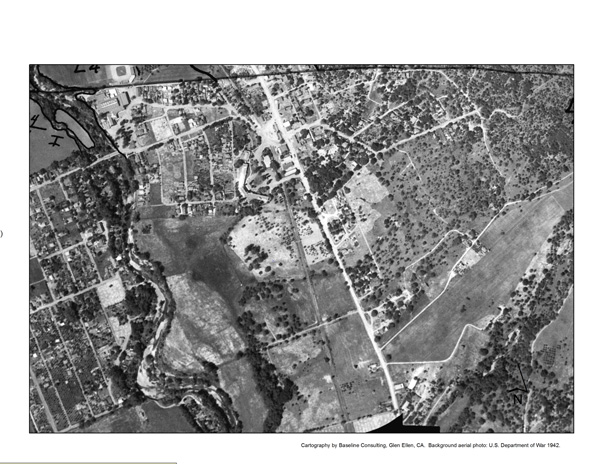
1942 War Department aerial photograph of Boyes Hot Springs. The Sonoma Mission Inn is clearly visible. (In the upper left hand corner you can see the Boyes Bath House complex and the baseball field.) There is not much building on Highway 12 south of The Inn. Is this because of the fire of 1923, or was this area just not developed by 1942?

Thanks to Arthur Dawson for this fascinating photo/map.


Standard

Leave a Reply

Fill in your details below or click an icon to log in:

WordPress.com Logo

You are commenting using your WordPress.com account. Log Out /  Change )

Facebook photo

You are commenting using your Facebook account. Log Out /  Change )

Connecting to %s

This site uses Akismet to reduce spam. Learn how your comment data is processed.