The Olive Grove Tract: Where was it? What is the history of the trees? And where did the church go?
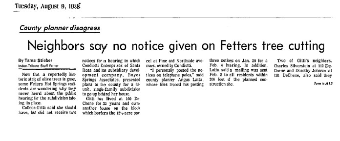
According to a Santa Rosa Press Democrat article from 1942, “Edwin P. Thomson, who many years ago owned the site of Fetters Springs…in 1887, planted the olive grove that now borders the highway between Fetters and Boyes Springs.” In 1946, the PD tells us that “Twenty-five acres of olive grove property fronting the state highway in Boyes Hot Springs and extending down to the ballpark, will soon be made available as an exclusive business and residential subdivision…” the owners were Bill Johnson and Rudy Lichtenberg, who also owned and managed the Boyes Bath House. Both men have streets named after them in that area.
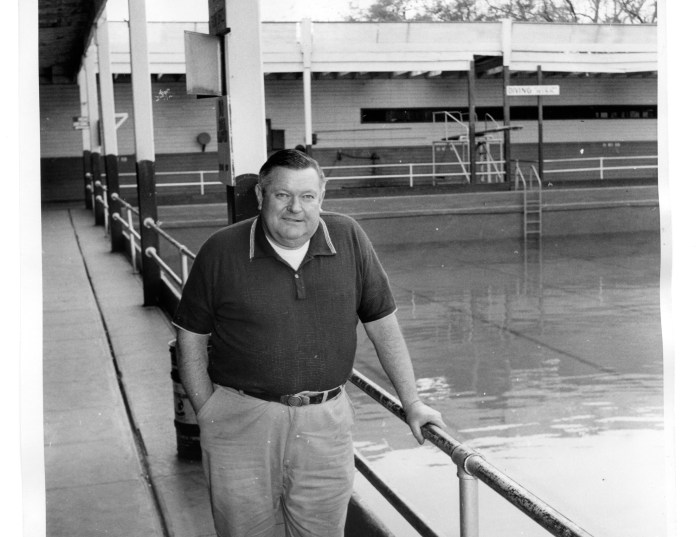
Bill Johnson at the Boyes Bath House
(Courtesy of the Sonoma Valley Historical Society)
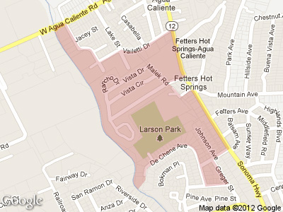
This map, from the website 321 Houses.com, shows an area which they call “Olive Grove.”
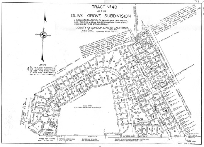
UPDATE: Below is the Recorder/Assessor map of the subdivision. It is dated 1947.
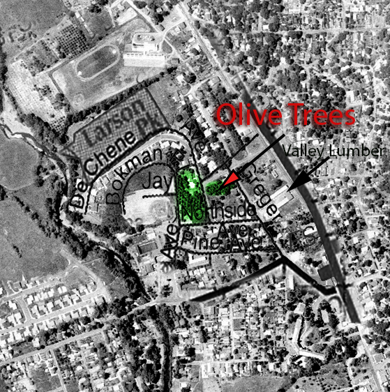
This is part of an aerial photograph from 1961, with a few street names superimposed. At that time, Bokman Avenue did not exist. Bokman approximately follows the outfield fence of the Boyes Springs Ball Park, which can be seen left center of the photo.
According to an IT article from 1988, the trees covered an area of 12.5 acres at that time. The trees were bulldozed in 1988, much to the dismay of local residents. See below.
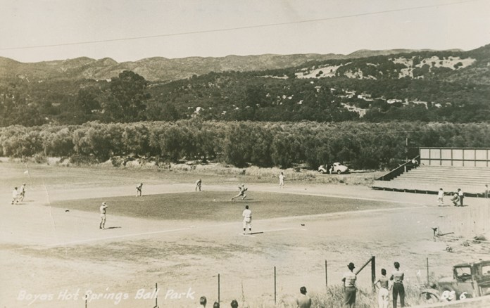
Zan Stark photo showing olive grove behind the ball park (to the east.) Courtesy, Stanford University Library, Special Collections.
At various times, various people have made the claim that the trees in the Olive Grove tract were planted by M. G. Vallejo. This was asserted and denied in 1988 when the trees were removed. Real estate agents and B + B proprietors still use this “information.”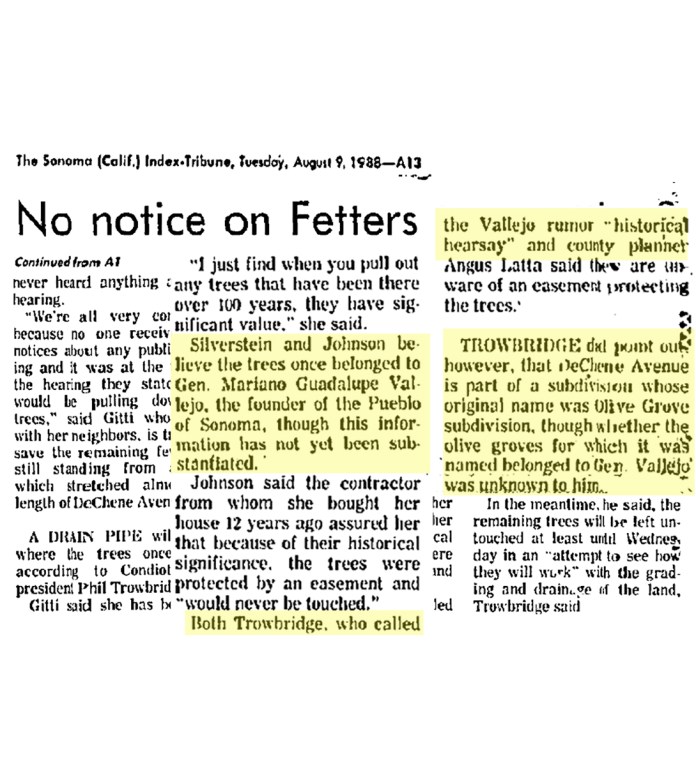
(Copy from online advertisment, below)
Property Details for 17600 Johnson Ave
This property is no longer available to rent or buy. This description is from May 03, 2010
Experience this darling 1949 Turn-Key home in the heart of the Wine Country! This meticulous 2 bedroom, 1 bath home features a spacious vintage kitchen, and a light and bright living room. The private back yard is a gardener’s delight that includes a patio, a deck and plenty of shade provided by two mighty olive trees that were once part of General Vallejo’s olive grove. Minutes from the Sonoma Plaza, restaurants and wineries.
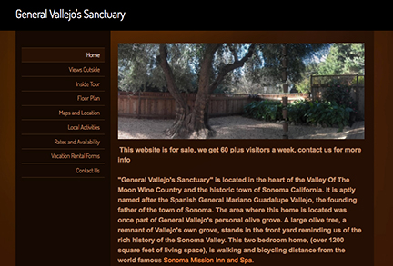
”The area where this home is located was once part of General Vallejo’s personal olive grove.”
As mentioned above, the remaining trees were removed in 1988.


Olive trees on DeChene Ave. in 2017. (Author’s photos) Many of the existing trees in the area seem very old. They could be survivors from Thomson’s orchard.
The Valley of the Moon Community Church.
The Valley of the Moon Community Church was located in the Olive Grove tract.
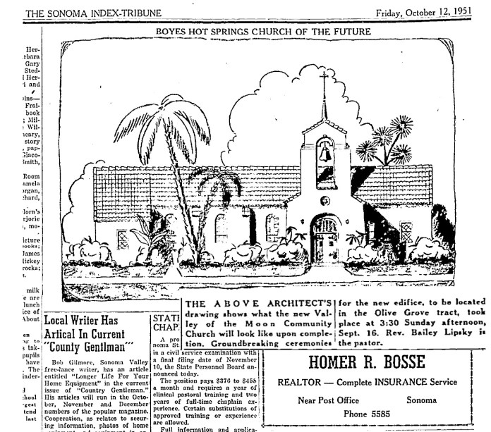
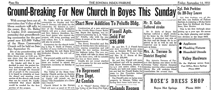
In September of 1951, the foundations were poured. Fourteen months later, “The handsome church building is slowly but surely nearing completion.” In August of 1953, the church building was in use.


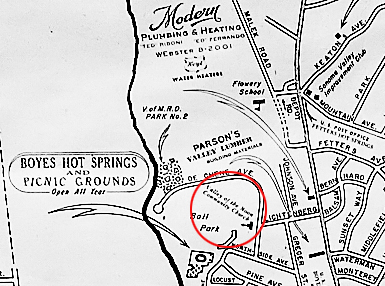
This Chamber of Commerce map, courtesy of the Sonoma Valley Historical Society, from the 1955 shows the VOM Community church approximately where Lichtenberg St. comes into DeChene Ave.
This is the last mention of the Church in the IT. What happened to the congregation? What happened to the church building?
Many thanks to Joanna Kolosov of the Sonoma County History and Genealogy Library for information from the Press Democrat and other sources.
Regrettably, we have lost track of the name of the gentleman who loaned the 1961 aerial photograph. The photograph was provided to him by Sonoma County.
