I covered this in a previous post, but I thought it was worth a new look.
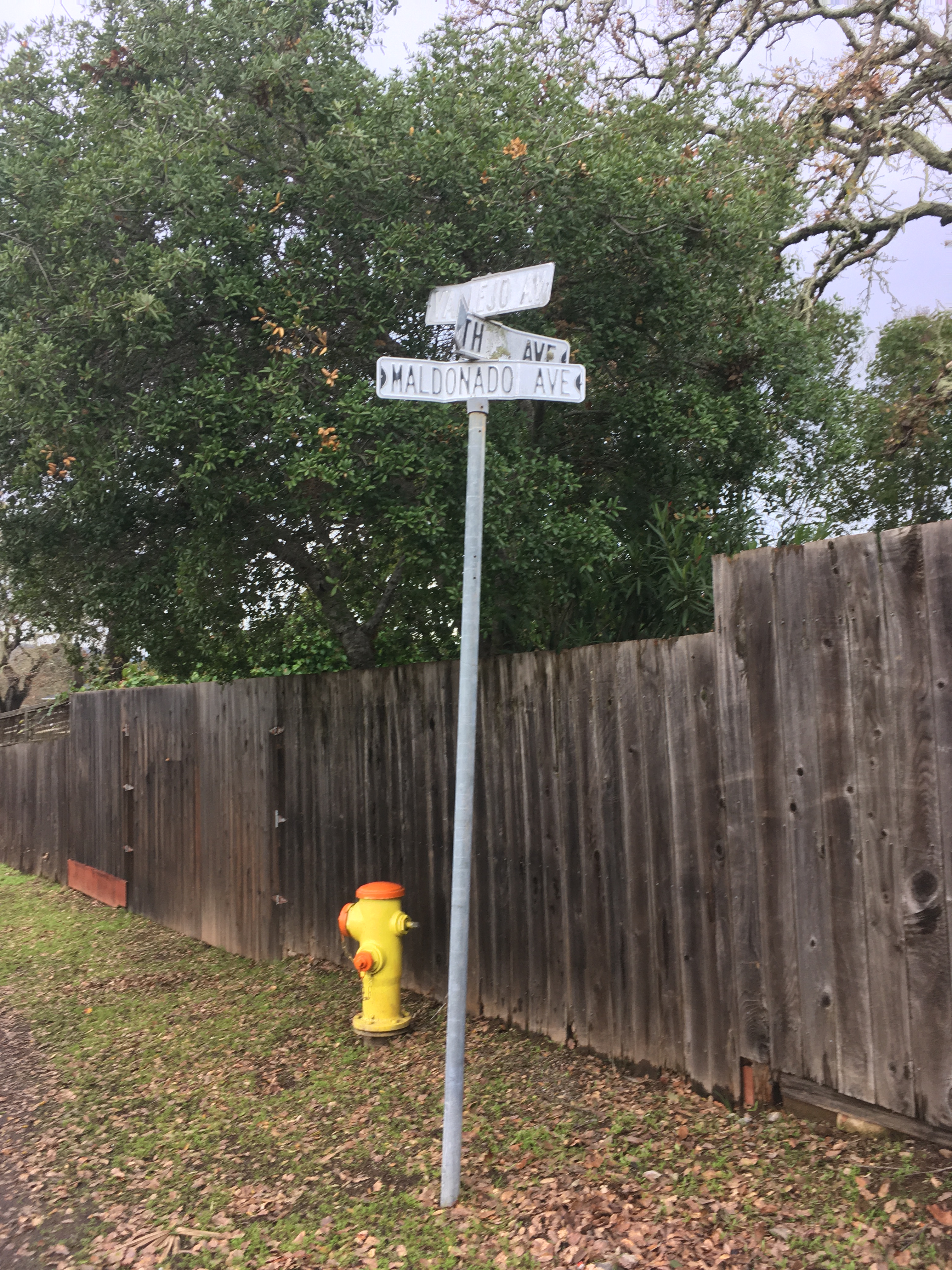
The intersection of Vallejo, Fourth, and Maldanodo showing the wonderfully distressed first generation sign, which has been replaced. If I had thougt faster, I could have gotten County Roads to give me the old sign. Alas, it was junked.
In 2020 I started photographing every every street sign in my immediate neighborhood with the intention of creating a database of intersections. Why? Obsessiveness. Completeness. The desire to record and collect (see website introduction.) Future use. It’s history. Because it might all burn down, and no one would remember what it looked like. And, I really like databases and consider them an art medium. I have also included photographs of the Neighborhood Phenomena in the vicinity of the intersections.
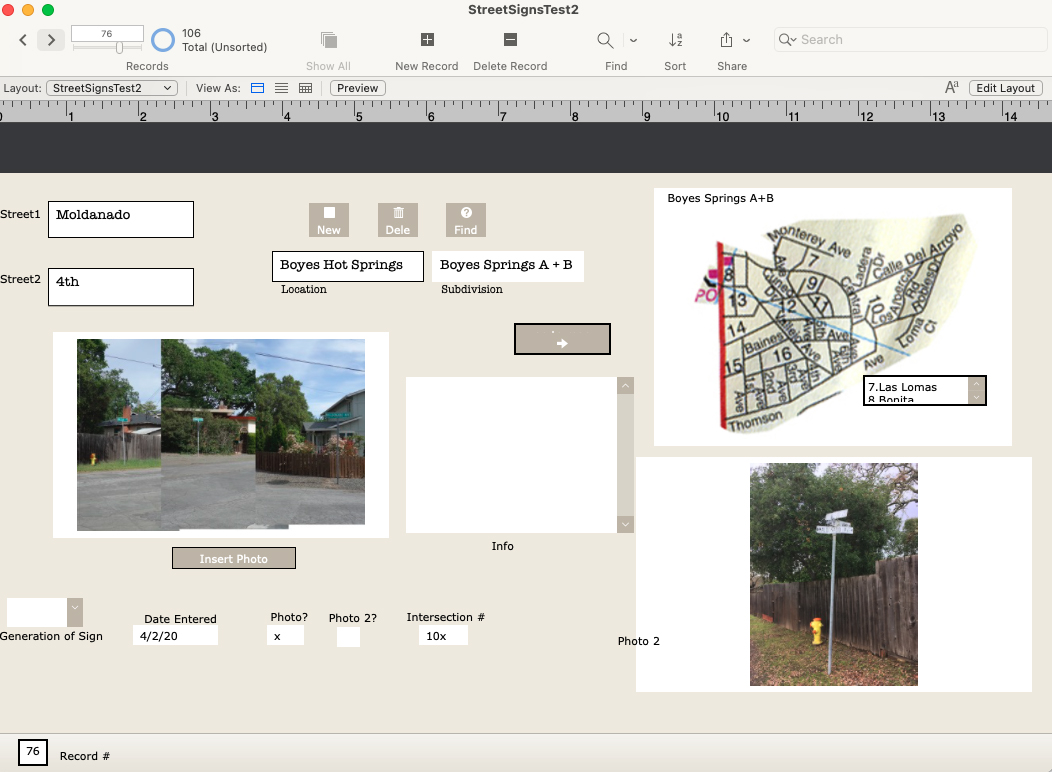
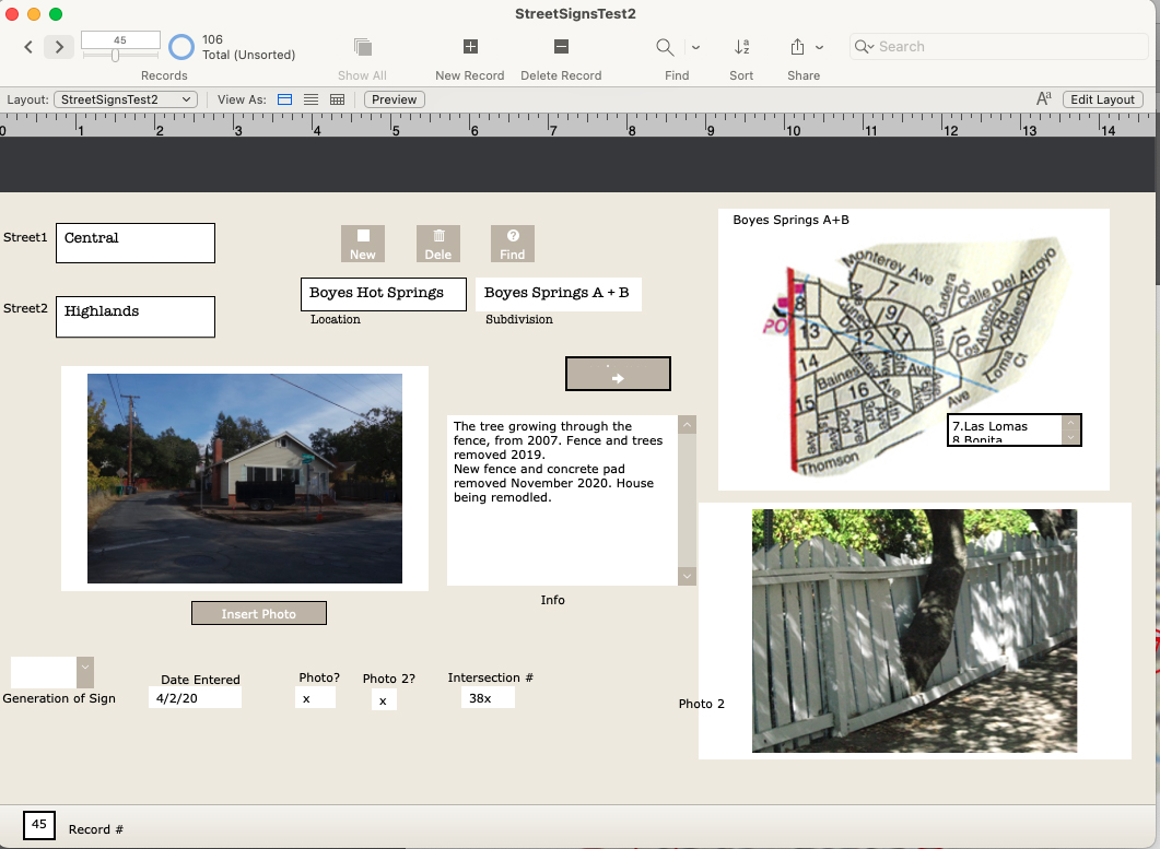
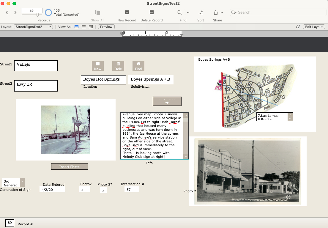
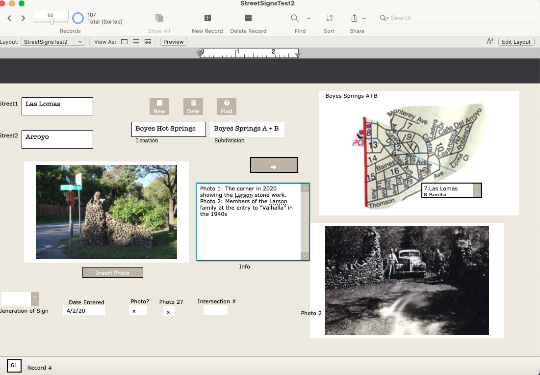
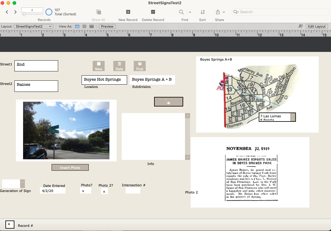
A record form the data base, under construction.
In addition to my photographs, I have included older (“historic”) ones, where they exist, newspaper clippings, and other ephemera. I know of no older photographs of intersections other than the ones at Highway 12, which were made primarily for commercial purposes.
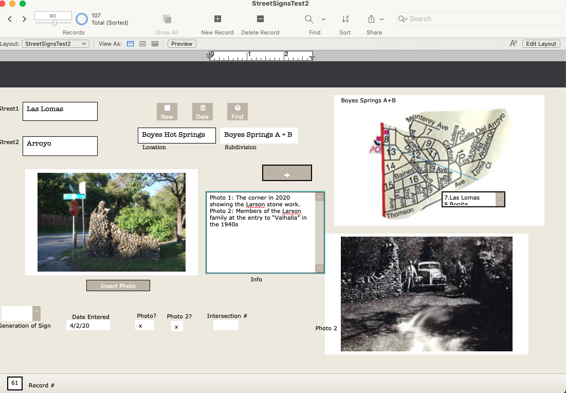
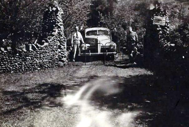
Las Lomas and Arroyo, featuring the stone walls built by the Larson family.1942. The entrance to the Larson family compound.
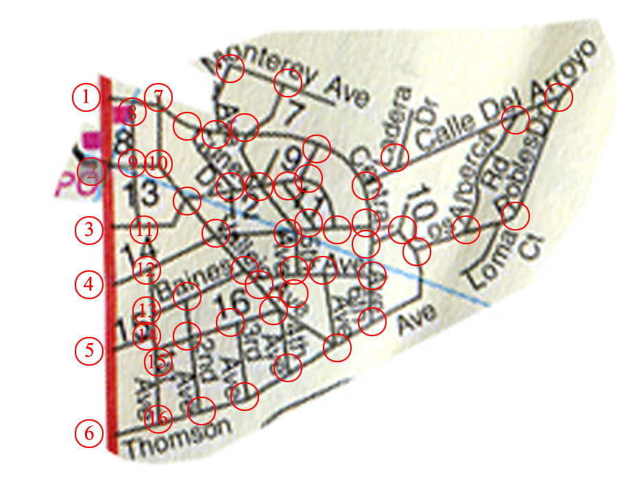
There are 107 records in the database (I probably missed some), one for each intersection in the Boyes Springs A and B subdivisions. The fields include “Generation of Sign” because three distinct styles of sign exist.Time permitting, the database would be expanded to include the surrounding subdivisions (link to post) Sonoma Highlands, Woodleaf Park, etc.Each record contains two photos or other images (sometimes newspaper clippings, other documents), and the map, which is still under development (ie, my Filemaker skills need improving.)
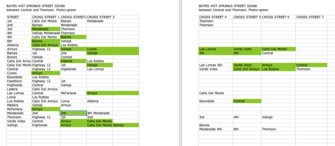
Samplle page of the database as an Excel fileAnother example of a Filemaker Pro record
Of course, the only constant is change, which means hours of fun for me updating the database.
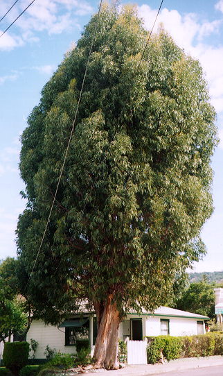
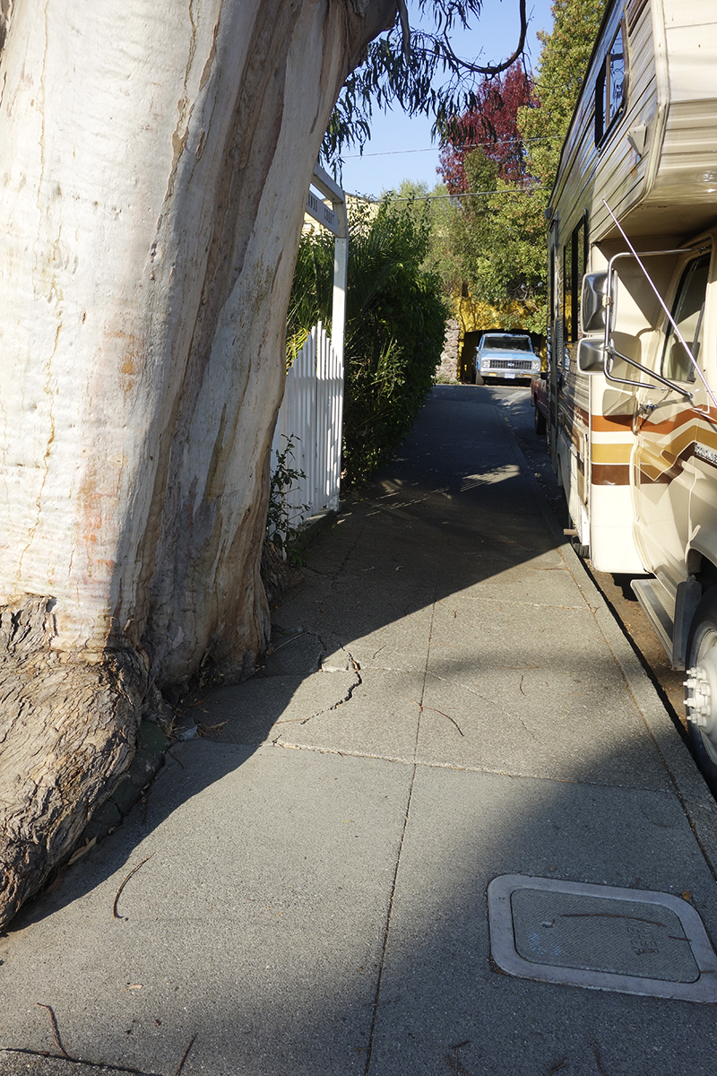
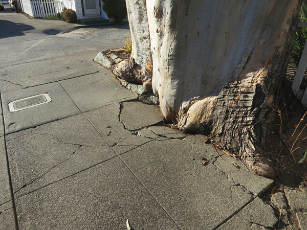
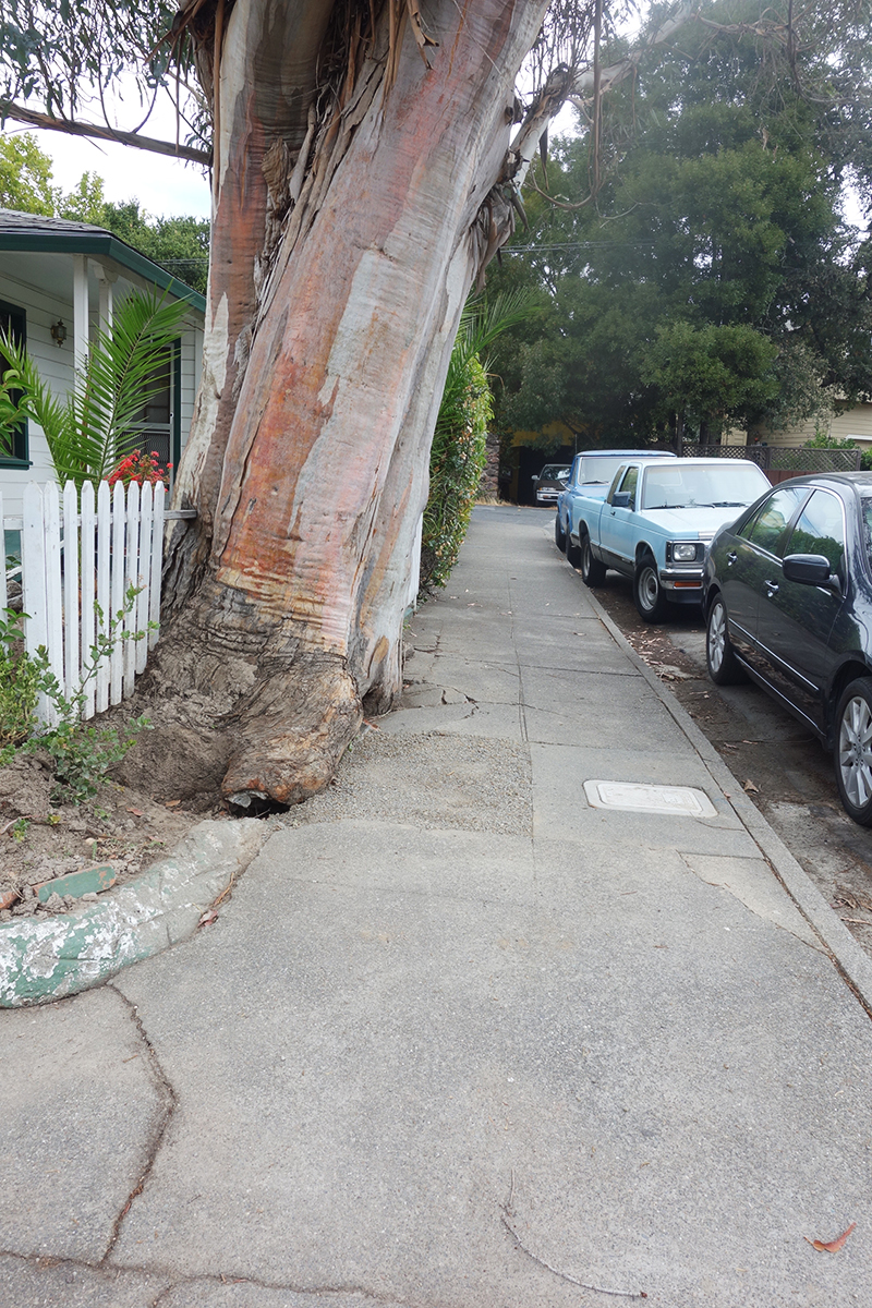
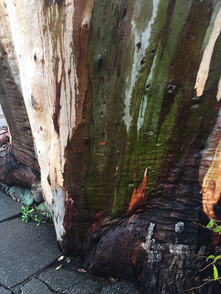
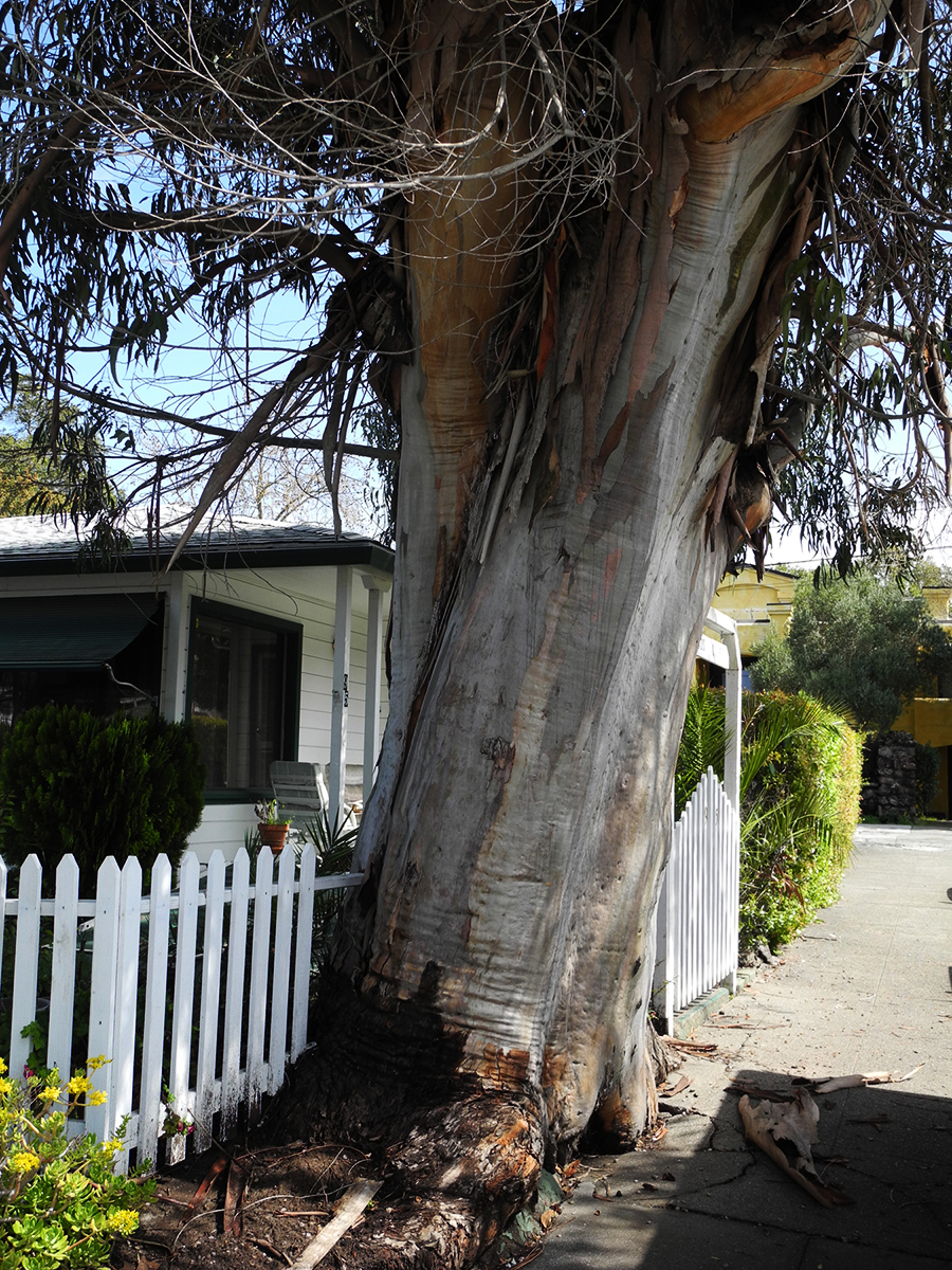
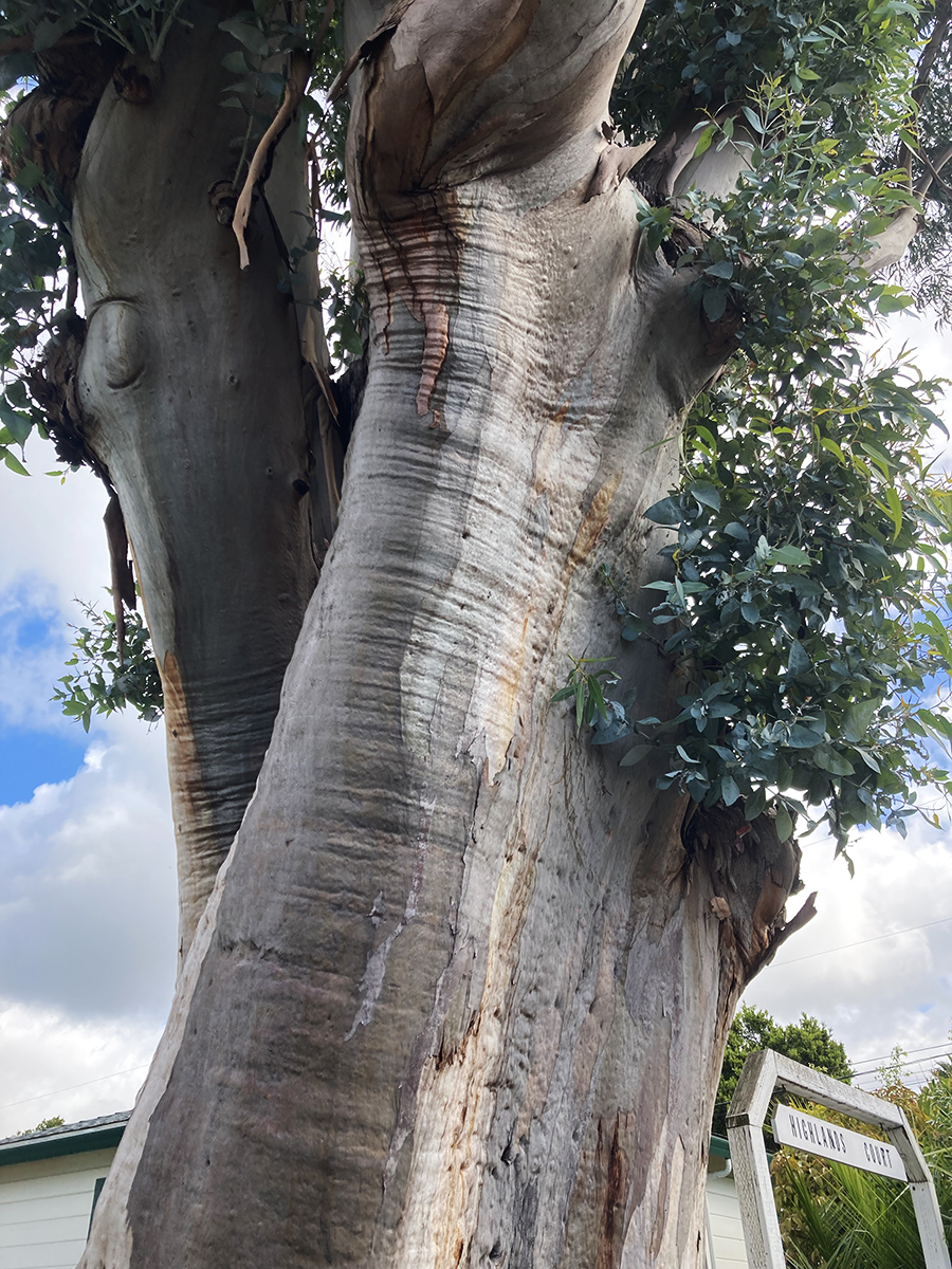
It’s always sad when we lose a tree. I called it “the Big Euc.”
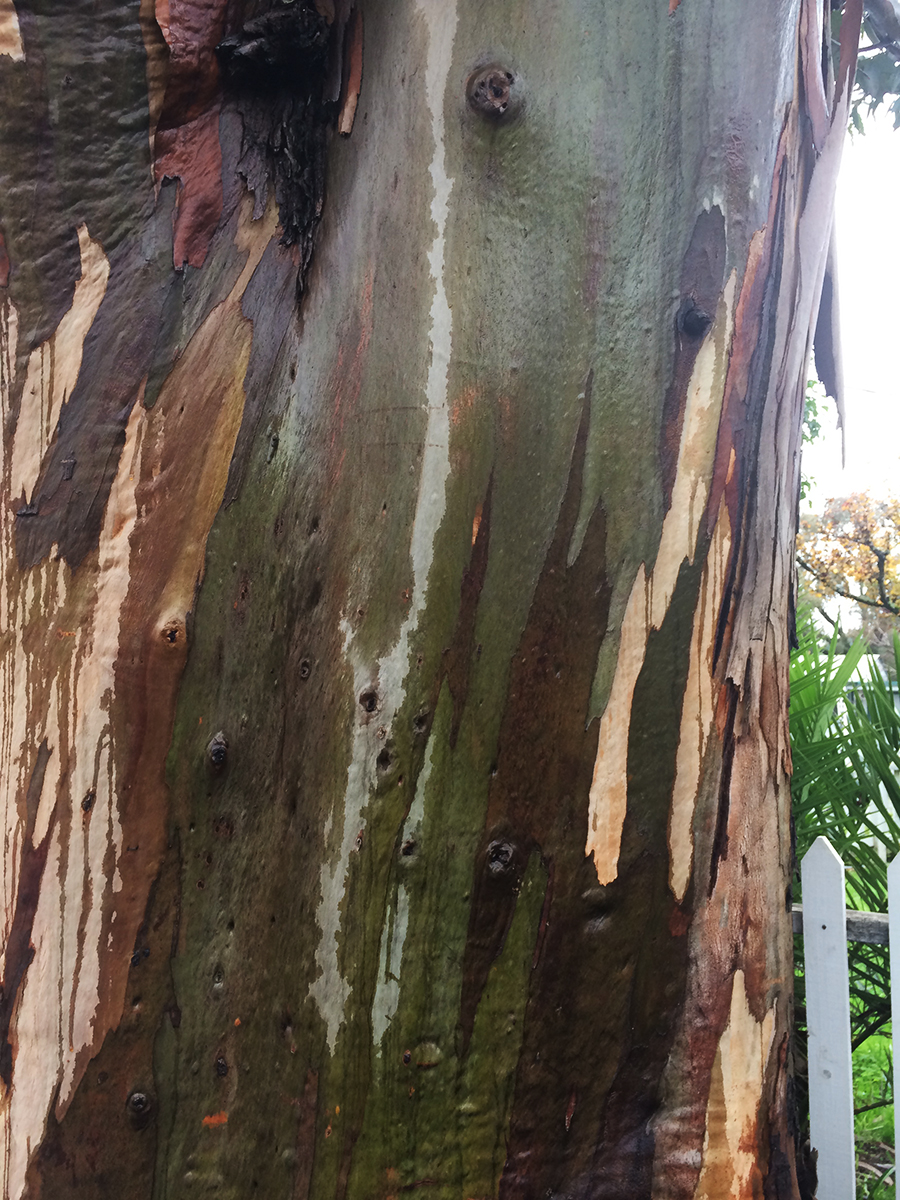
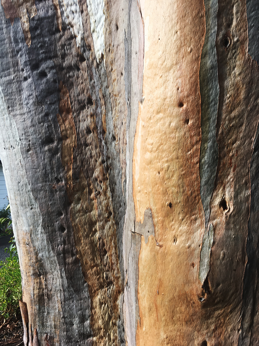
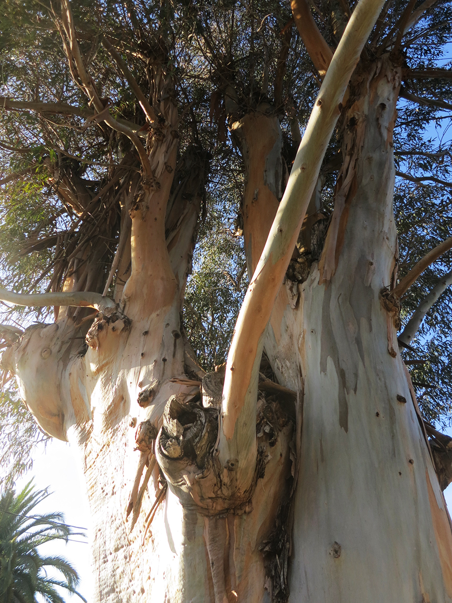
I know eucalyptus are exotic, invasive, and sometimes dangerous (they are highly flammable and may have other impacts, but the story is not only negative: see https://ucanr.edu/site/igors-urban-website/eucalyptus-california) .But they are, by now naturalized in California and in our minds. We have grown up with them. Their fragrance is embedded in our olfactory cortexes. The beauty of their variegated bark delights.
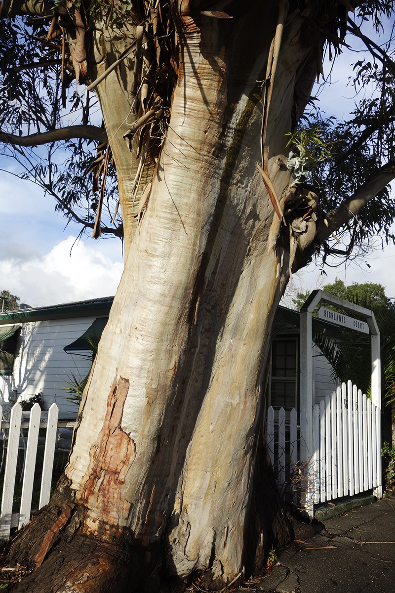
This friend grew on Vallejo Ave. near Highlands Blvd. in Boyes Hot Springs. Probably a volunteer, it may have sprouted around the time the motor court behind it was built, possible just after the 1923 fire. https://springsmuseum.org/2017/11/01/fire/
2007
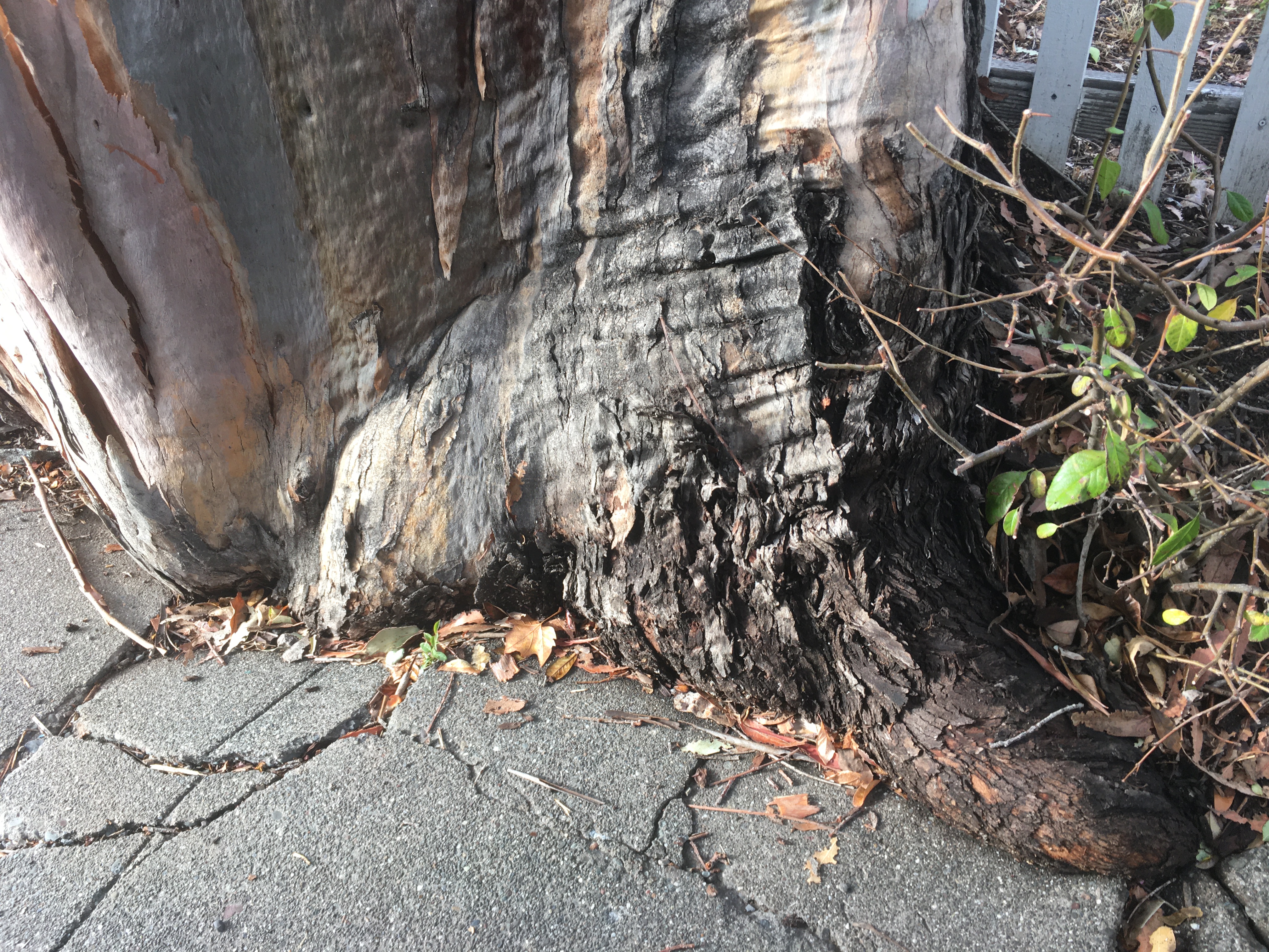
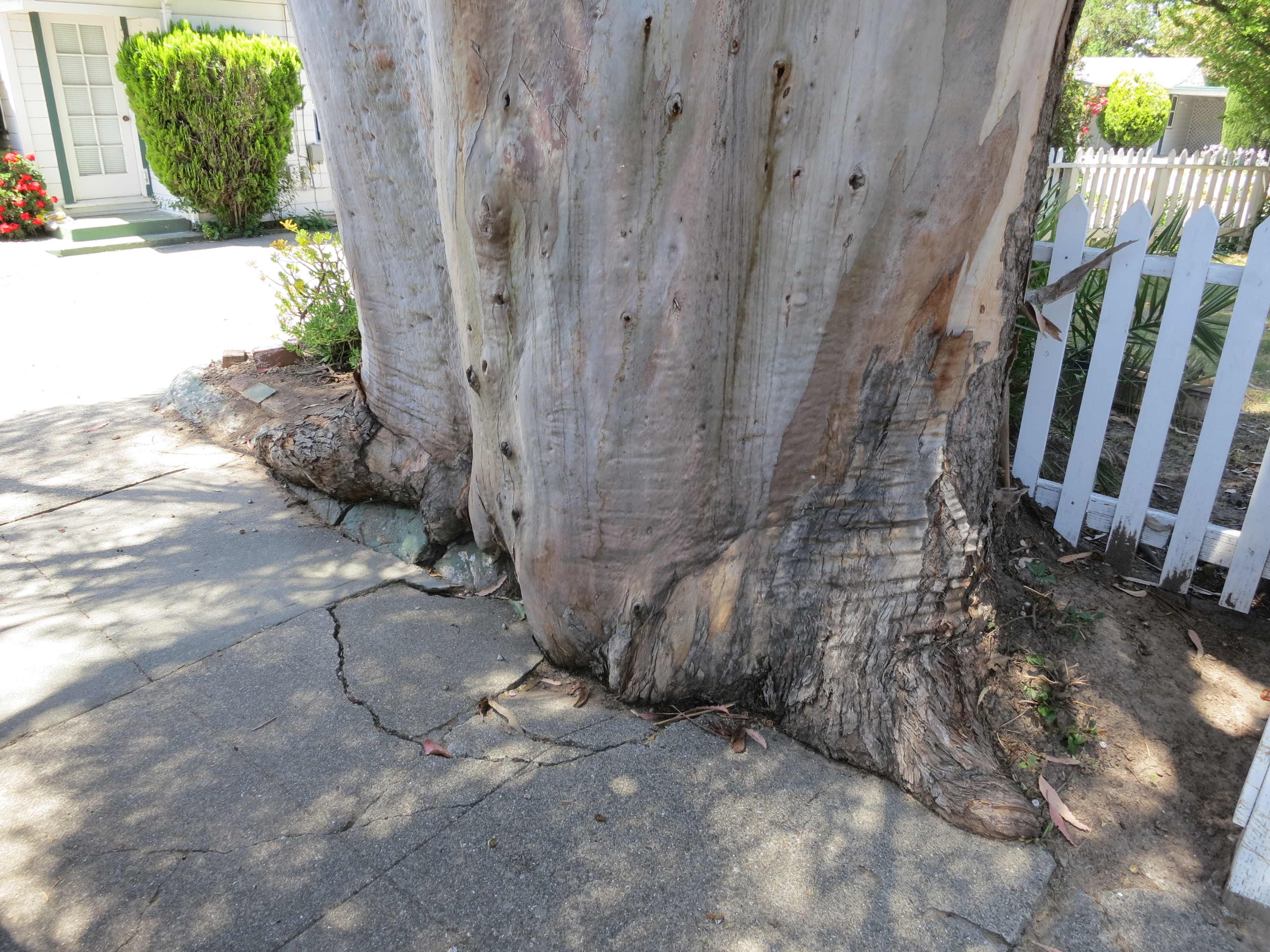
I actually liked the way this tree was grinding up the concrete sidewalk, like a very slow motion wave of living wood. I have special place in my heart for the interaction of trees and the built environment.
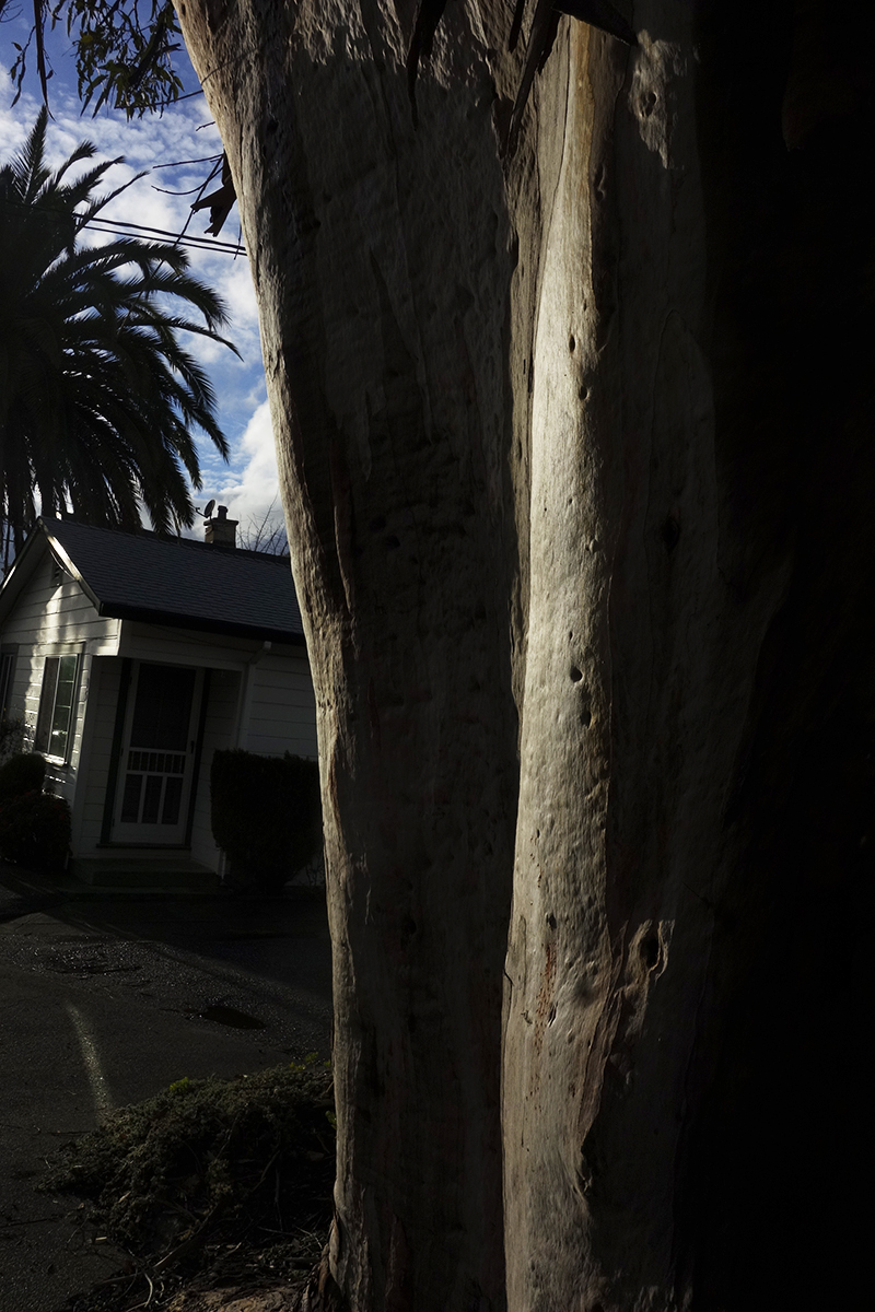
Makes beautiful shadows.
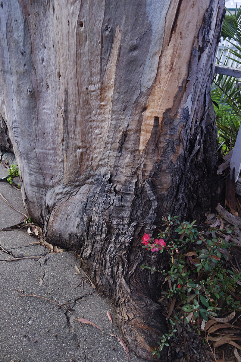
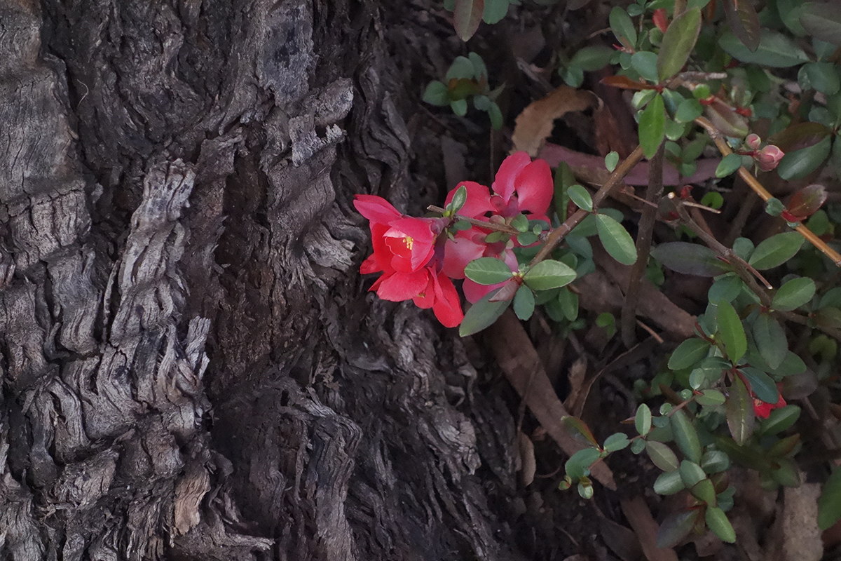
This quince volunteer bloomed every February for Lunar New Year.
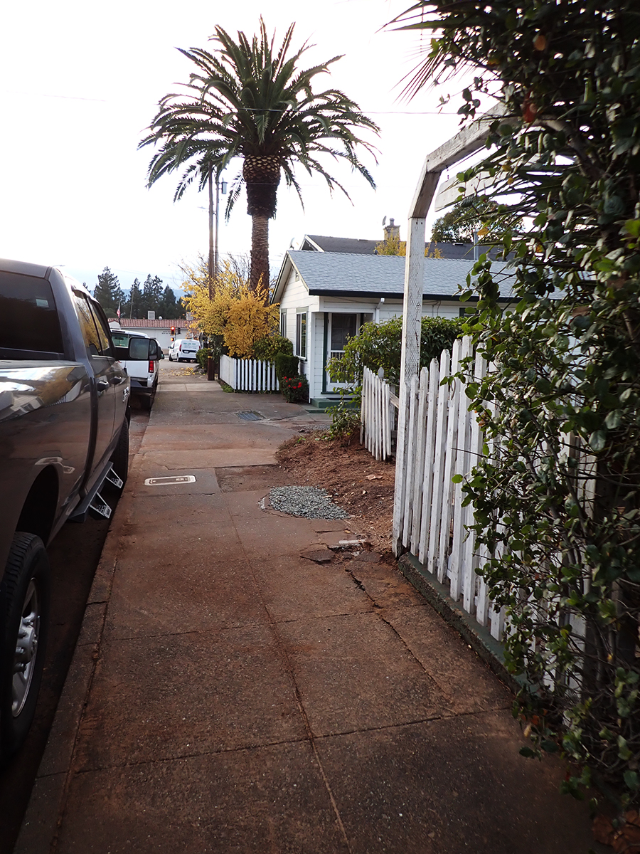
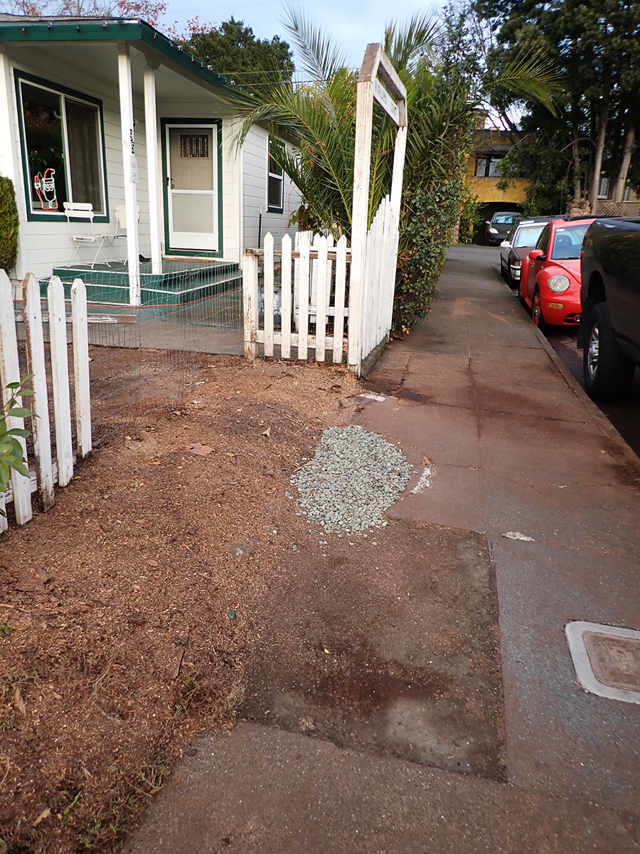
Eventually a piece of the concrete was removed for some underground plumbing repair and replaced with crushed rock.
The green concrete curb continues to be submerged in tree.
Some beauty shots.
The wet bark is even more beautiful, and the fragrance intensifies.
So limb-like, sensuous.
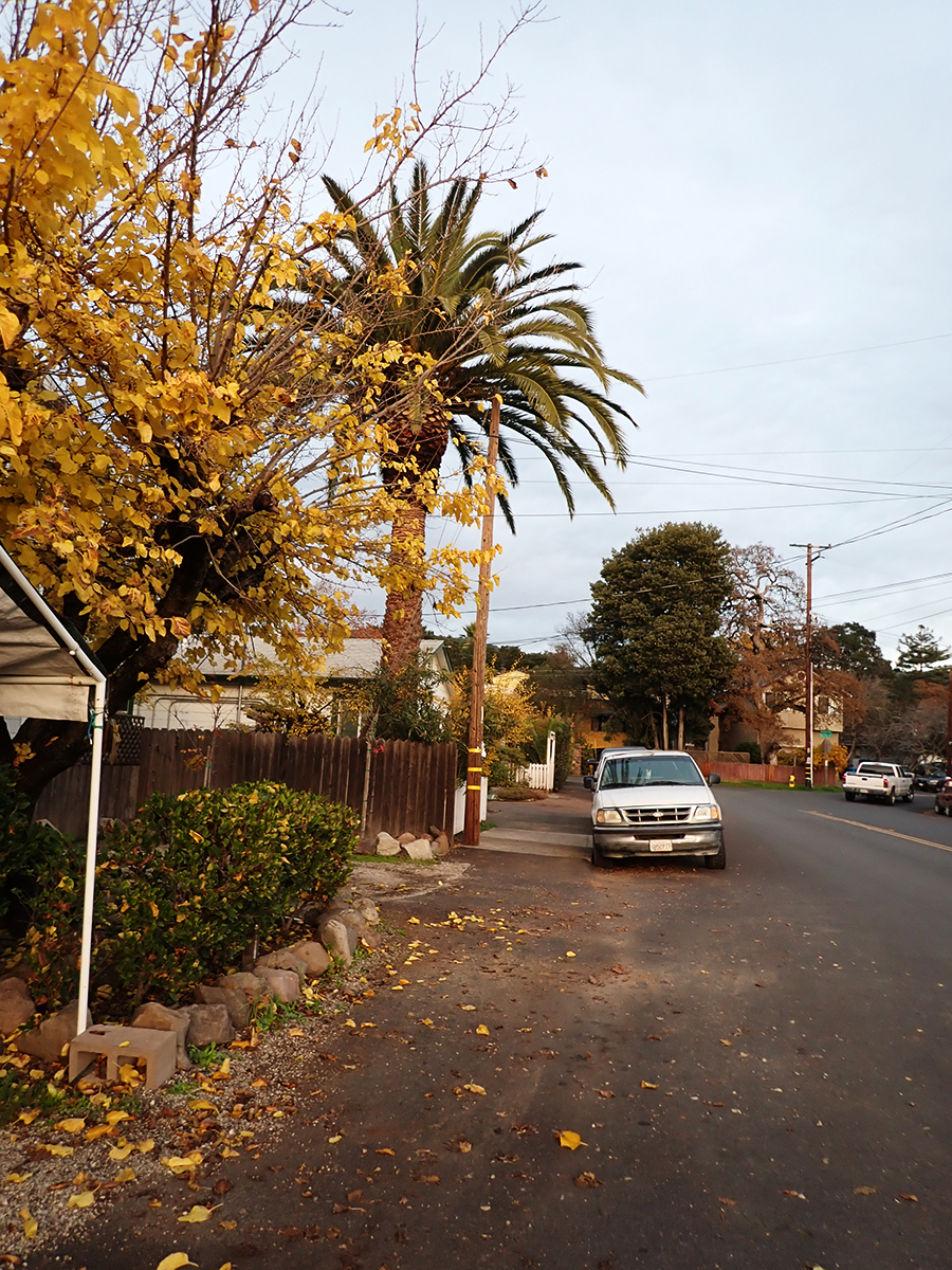
December 2025
Just a memory
The palm stands alone
“Bark and Bite.” Painted photo collage circa 20″x30″. 2019. Michael Acker
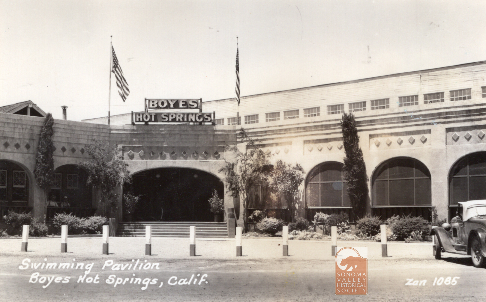
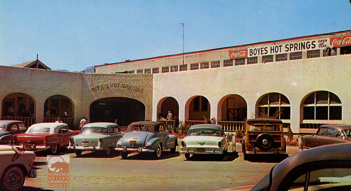
The Boyes Bath House entertained thousands of happy customers from the 1890s through April 17, 1969, when it burned to the ground. Many locals have fond memories of summers spent swimming in its gigantic pool. The entrance in the 1930s, above, and the 1950s, below.
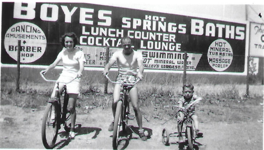
This large billboard style sign pretty much lays out all the amenities offered at the Bath House in 1944. Photo courtesy of Dave Chioti.
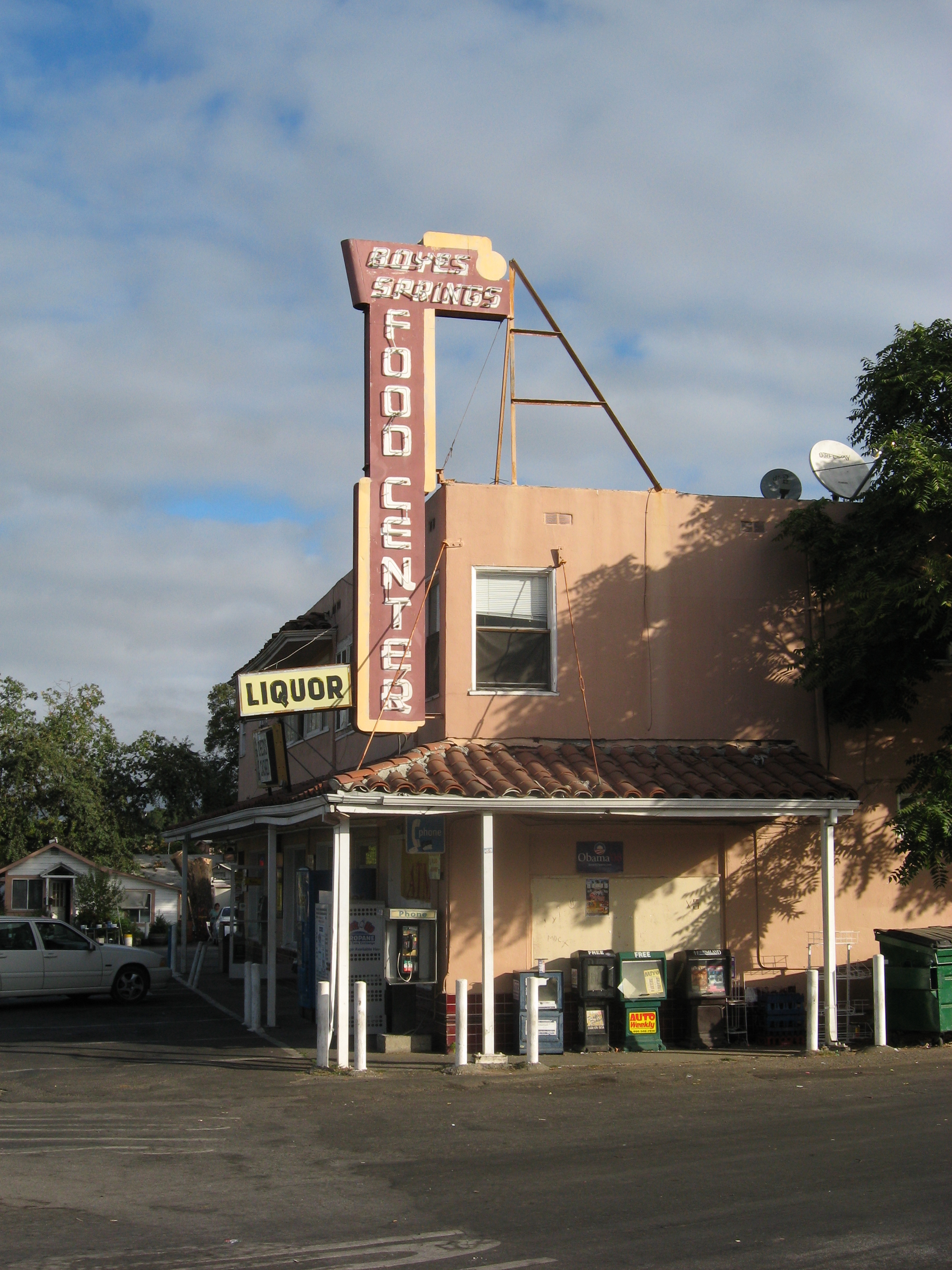
Boyes Food Center in 2009. It was constructed in 1949. The tiled awning was torn off sometime in the 2000s.
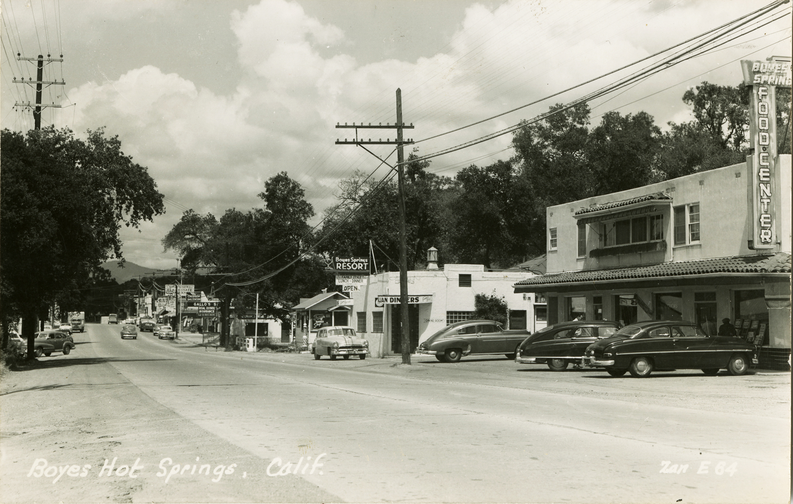
1949, looking north on the highway. Beyond the Food Center is the Boyes Springs Resort, now a parking lot. Beyond that, the original Mary’s Pizza.
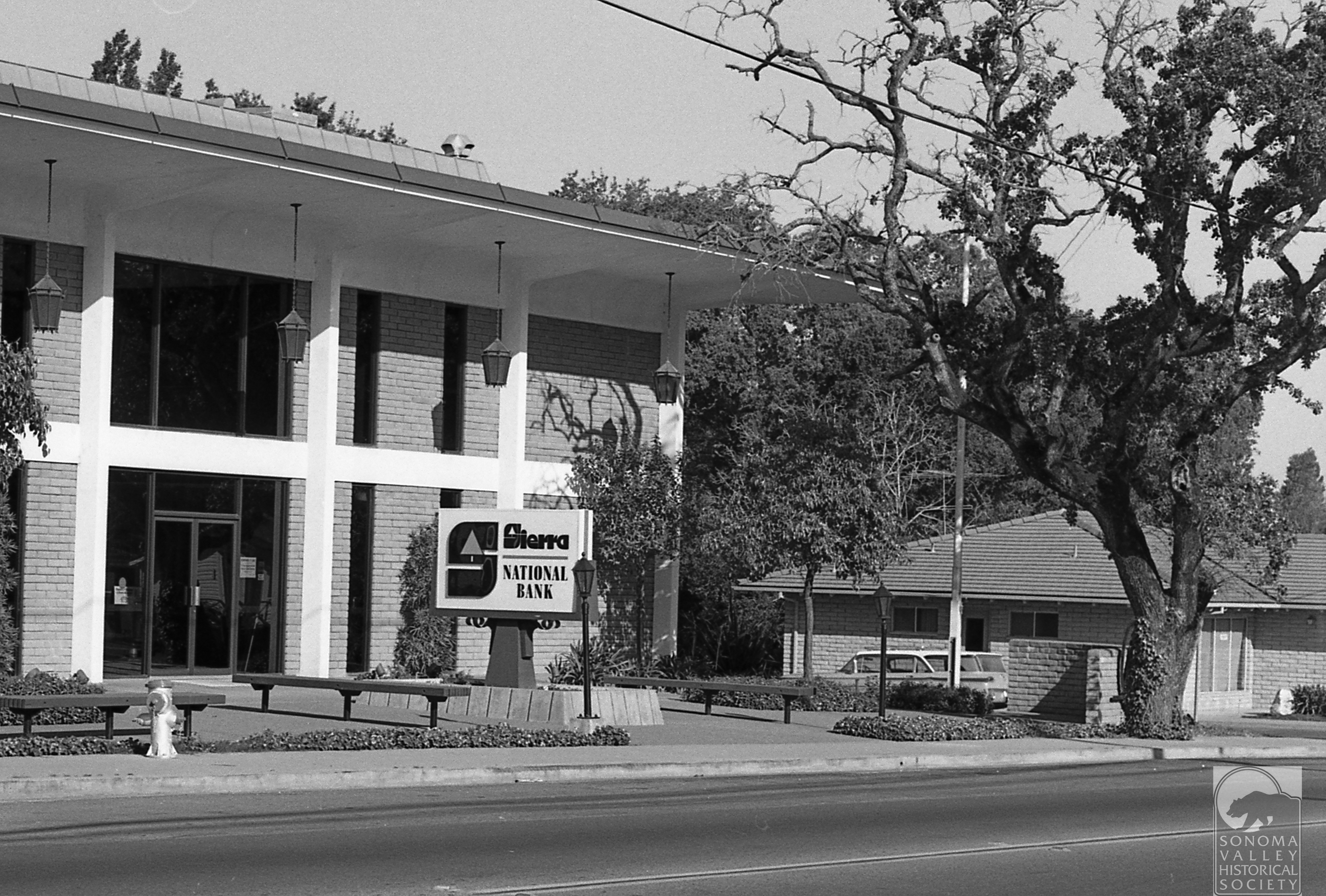
Across the highway from the Food Center, the Sierra Bank building was constructed in 1966. It now houses the offices onf Ross, Drulis, Cusenberry architects. The cross street at the corner was once called Meinke Road, but was renamed Sierra when the building was built.
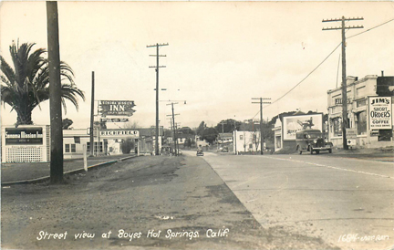
The corner of Boyes Blvd. and Highway 12, known then as the Santa Rosa road, 1930s. Sonoma Mission Inn sign at left mounted on a lattice-work in the Boyes Plaza. the palm tree was in the center of the plaza. Richfield gas station sign beyond that. On the right, Jim’s Cafe “Short Orders!” The building was built after the 1923 fire of ceramic brick, by Bob Liaros, a local barber. It stood until the early 1990s.
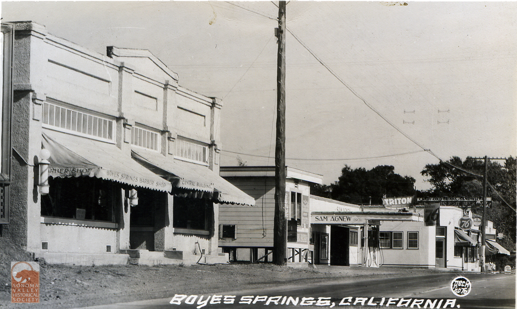
The Liaros building, looking the opposite direction on the highway. Past the Ice House on the corner of Vallejo Ave., is Sam Agnew’s service station, now the Sonoma Eats parking lot. Agnew was a famous major league baseball player who retired to Boyes Hot Springs in the 1940s.
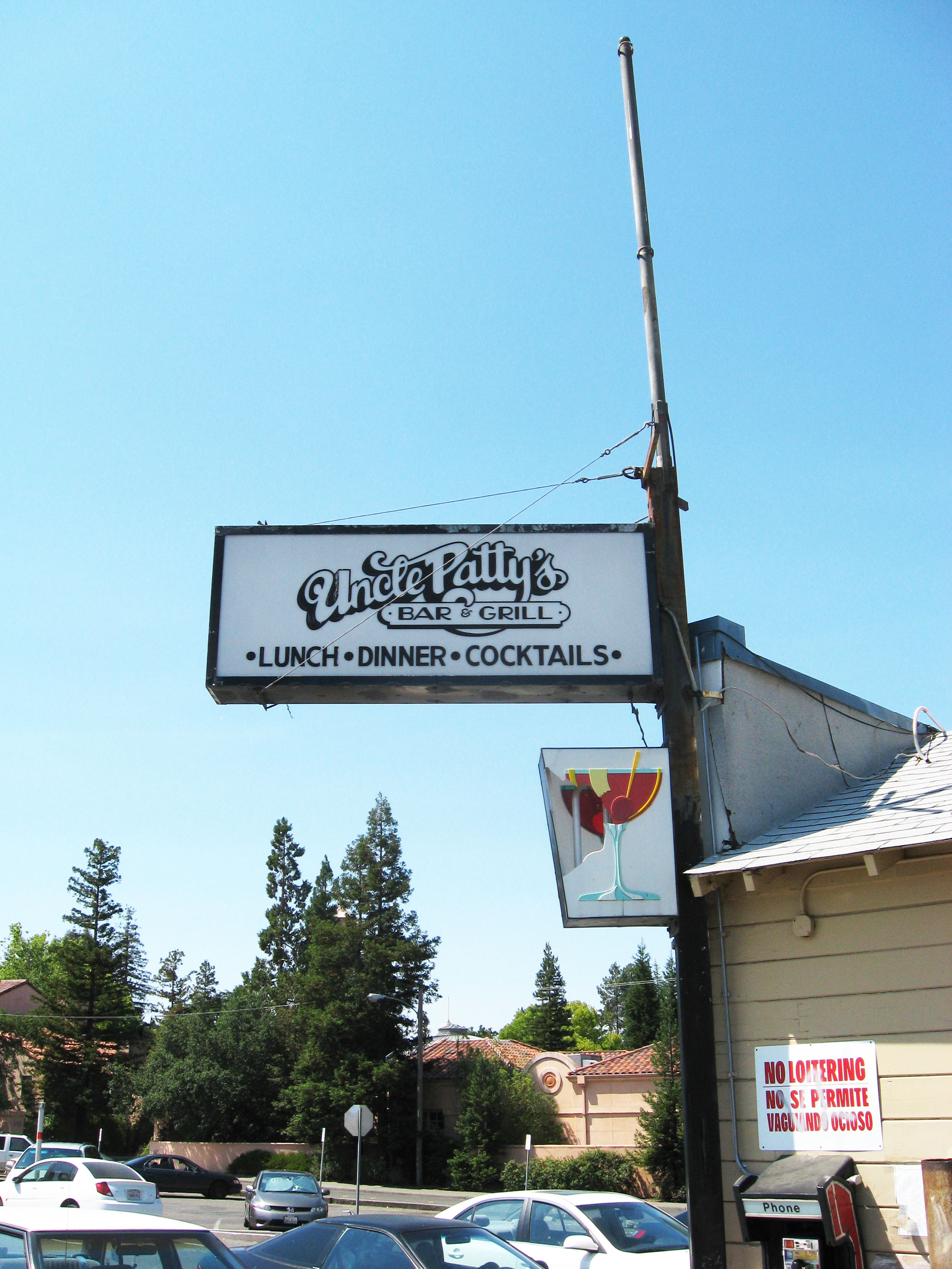
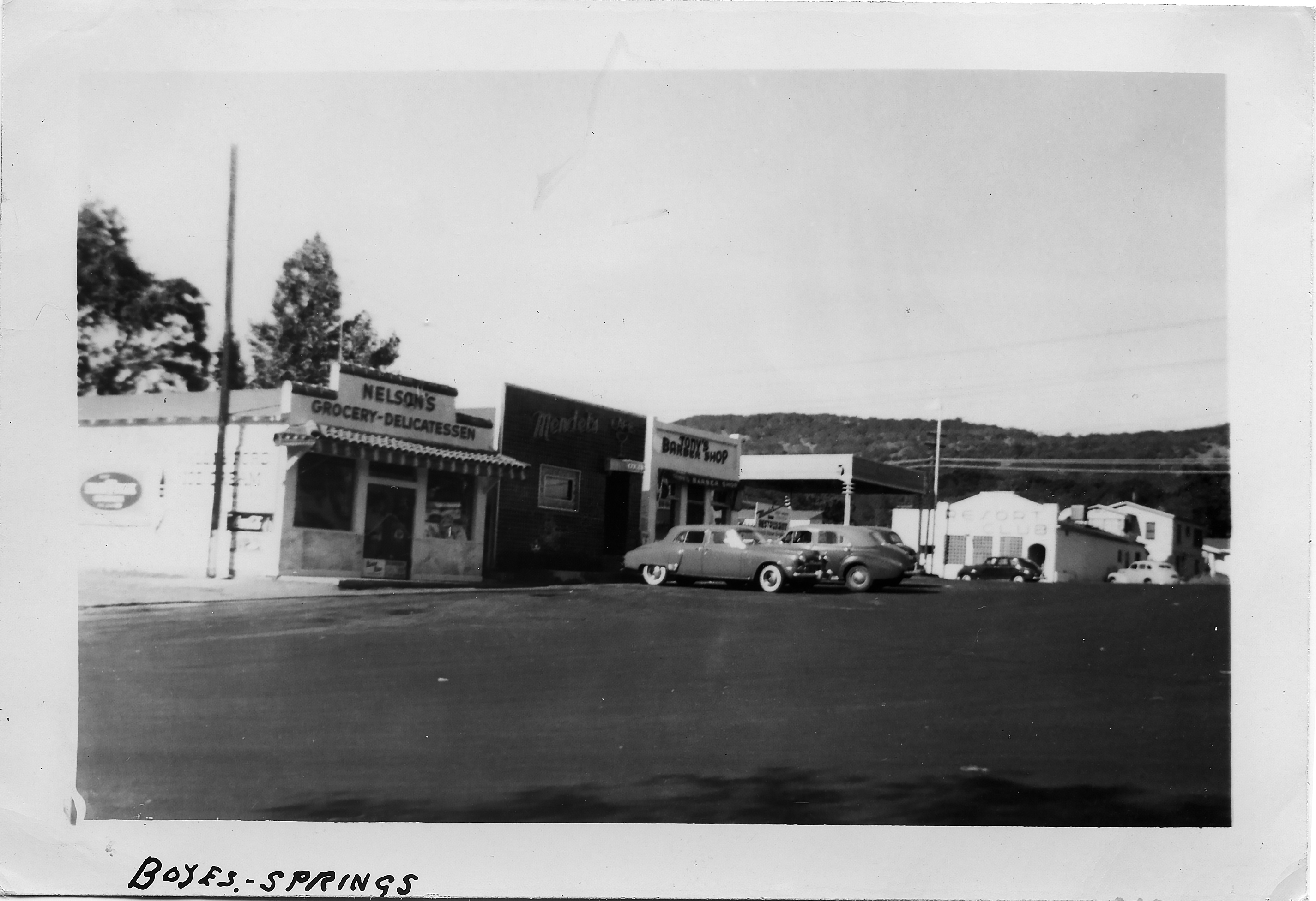
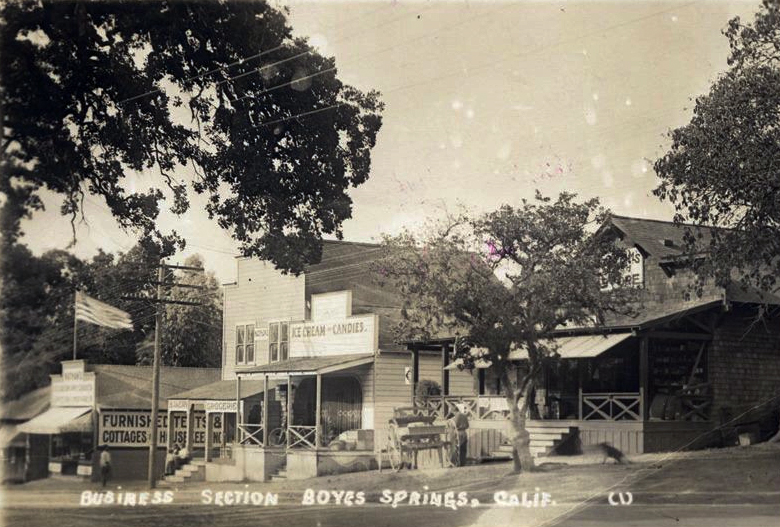
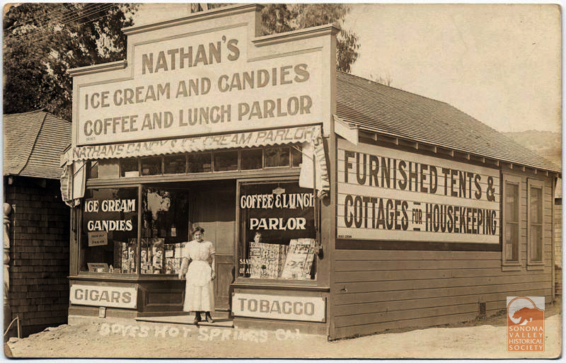
Along side what was once a spur street between Boyes Blvd. and the highway, stood a row of buildings dating from the 1910s or before. Uncle Patty’s was the last resident business before they were torn down in the 2000s. Below are those buildings, or some of them, in the 1950s, featuring Mendel’s Cafe and Nelson’s Deli, and a barber shop. Nathan’s Ice Cream was one of the original businesses on that row, which was called “the business section,” in the very early days.
Circa 1912. At right, behind the oak, is Graham’s Store, the original site of the Boyes Hot Springs post office.
Nathan’s is the building at far left in the photo above.
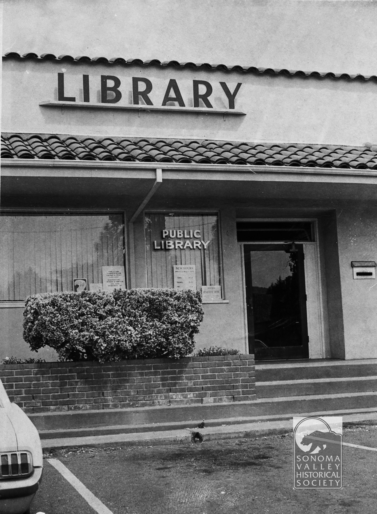
Yes, there was a branch library in the Plaza Center building in the 1970s.
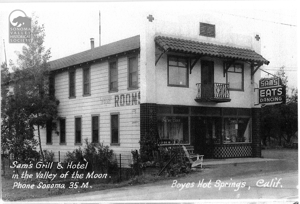
Sam Ganos was prominent business man in the 1940s and 50s. The building, much modified, now hosues La Hacienda Mexican Restaurant.
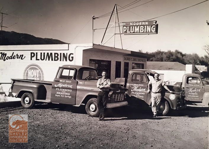
Modern Plumbing was founded in Boyes Hot Springs by Ted Riboni and Ed Feranndo in the 1950s. The building still stands, on the west side of the highway, opposite Bernhard Ave.
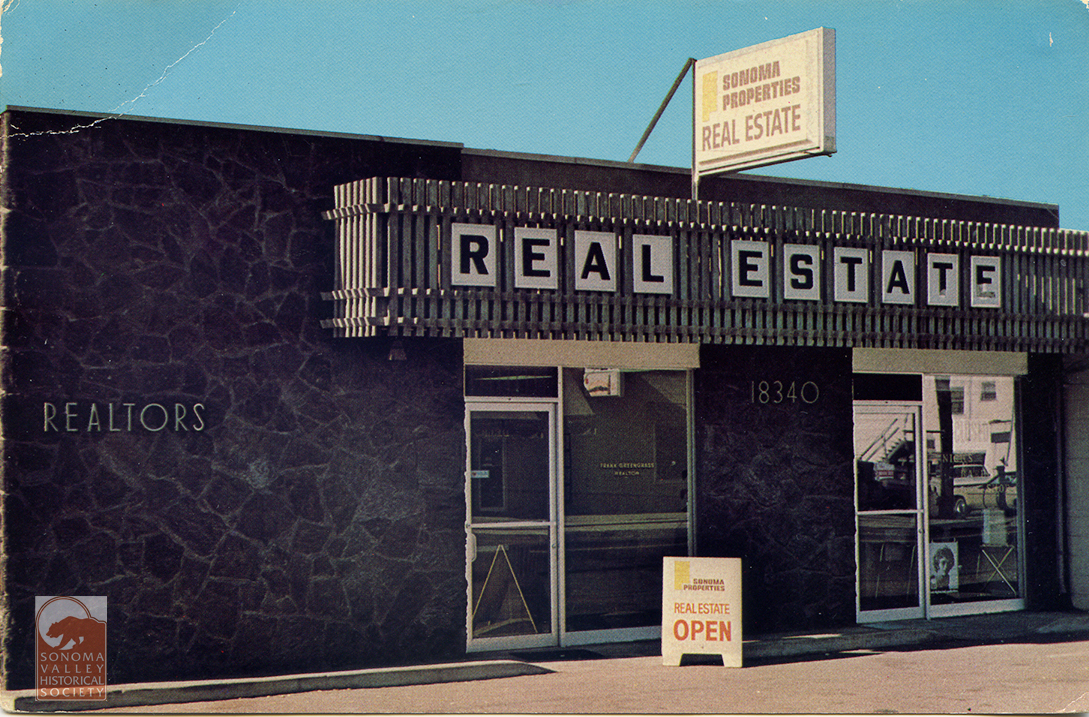
The Greengrass Building. A pretty ordinary building with an interesting history. Clidk the link to find out!
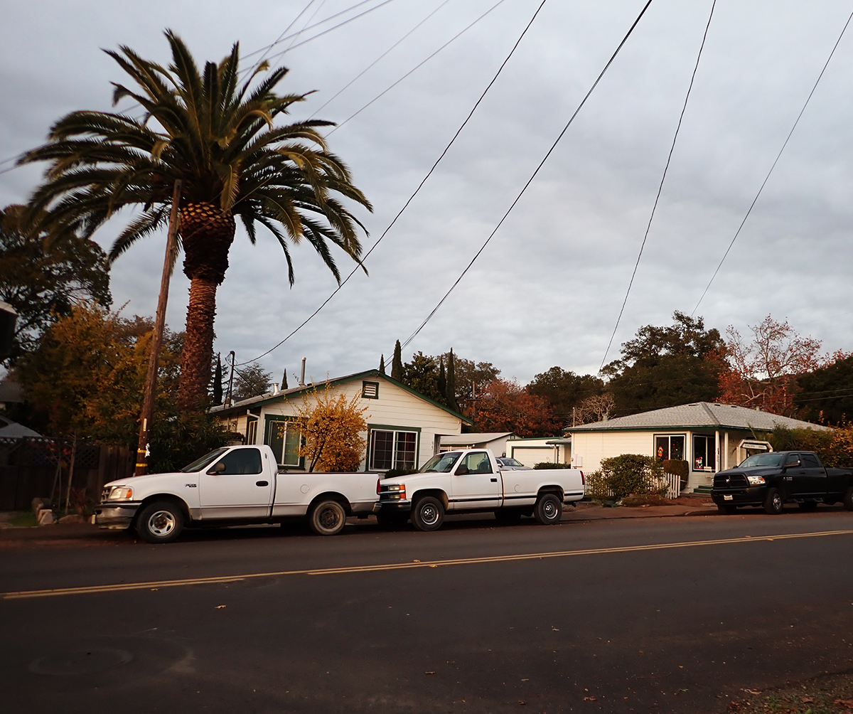
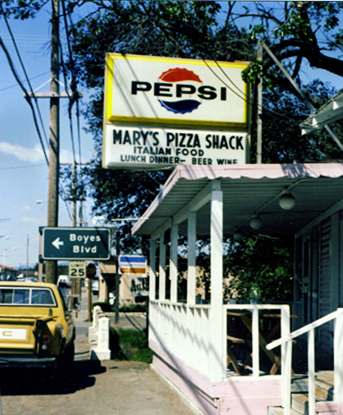
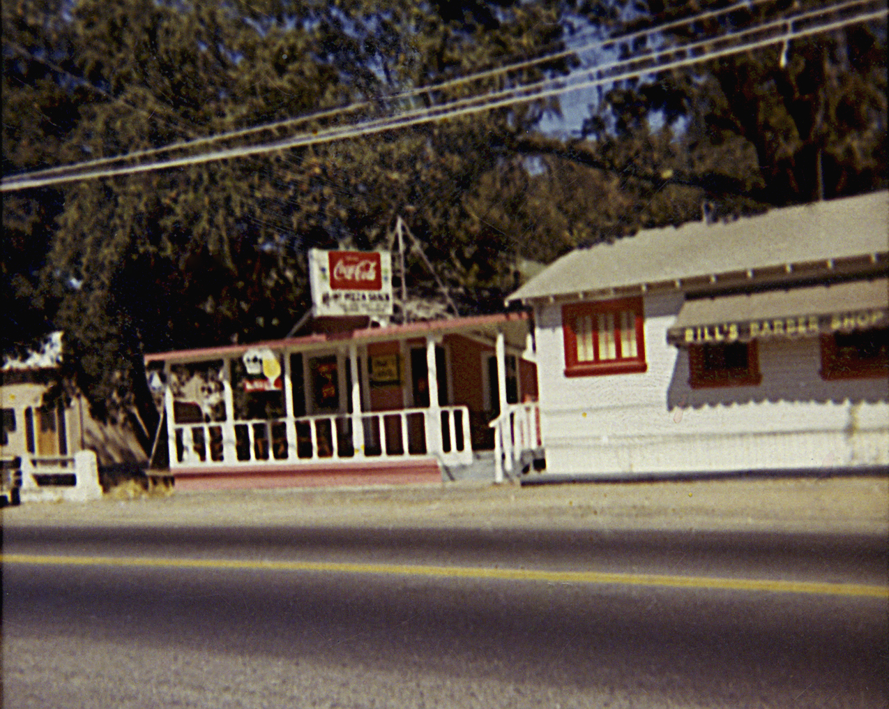
The original location of Mary’s Pizza Shack, now a large local chain, was in this small building at the end of Arroyo Road, at the highway. Mary Fazio opened her restaurant in 1959. The rest is history, as they say. Thanks to the Albano family for the photos.
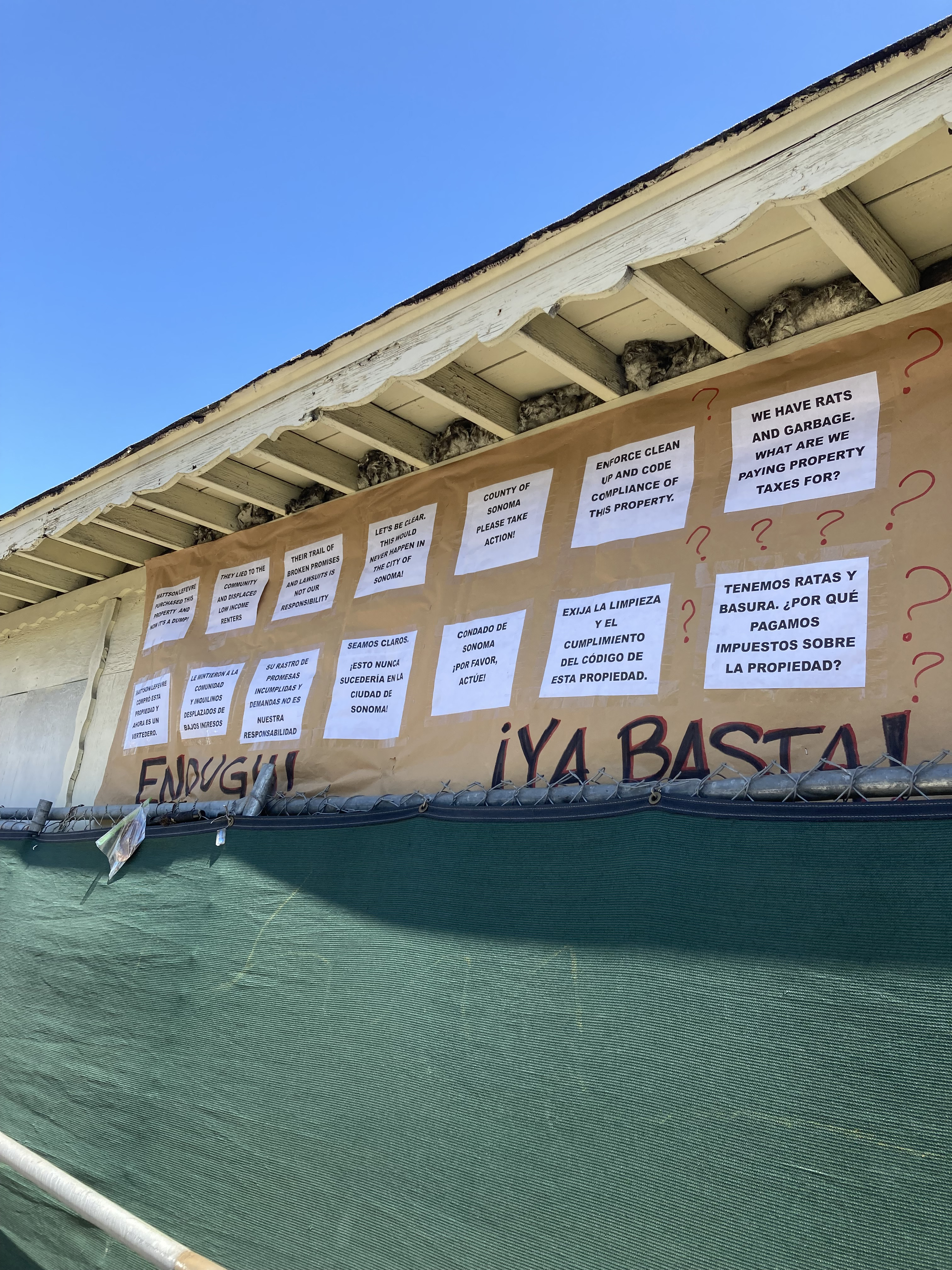
Flash forward to 2025. The unfortunate deterioration of the property continues. Neighbors are concerned enough to put up this sign on the front of the original shack. The current owner is under suspicion of fraud. We await remediation, but the wheels of County agencies turn slowly.
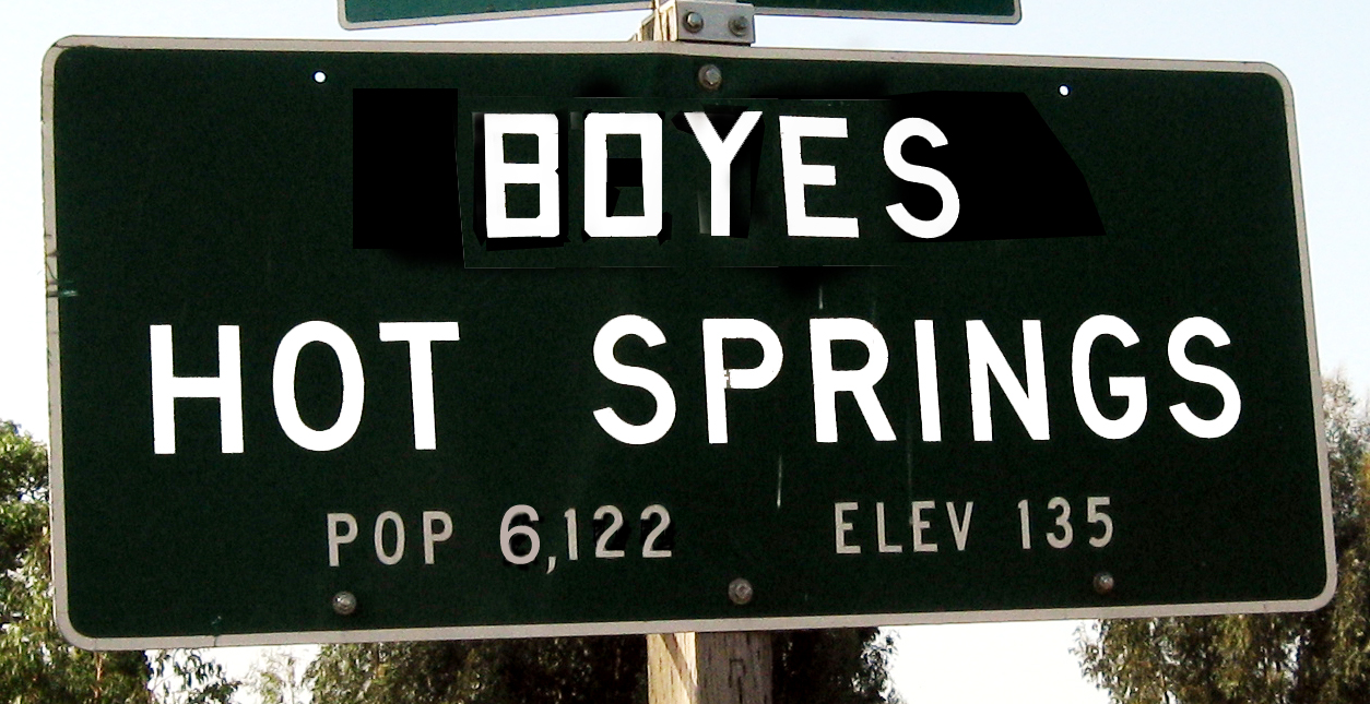
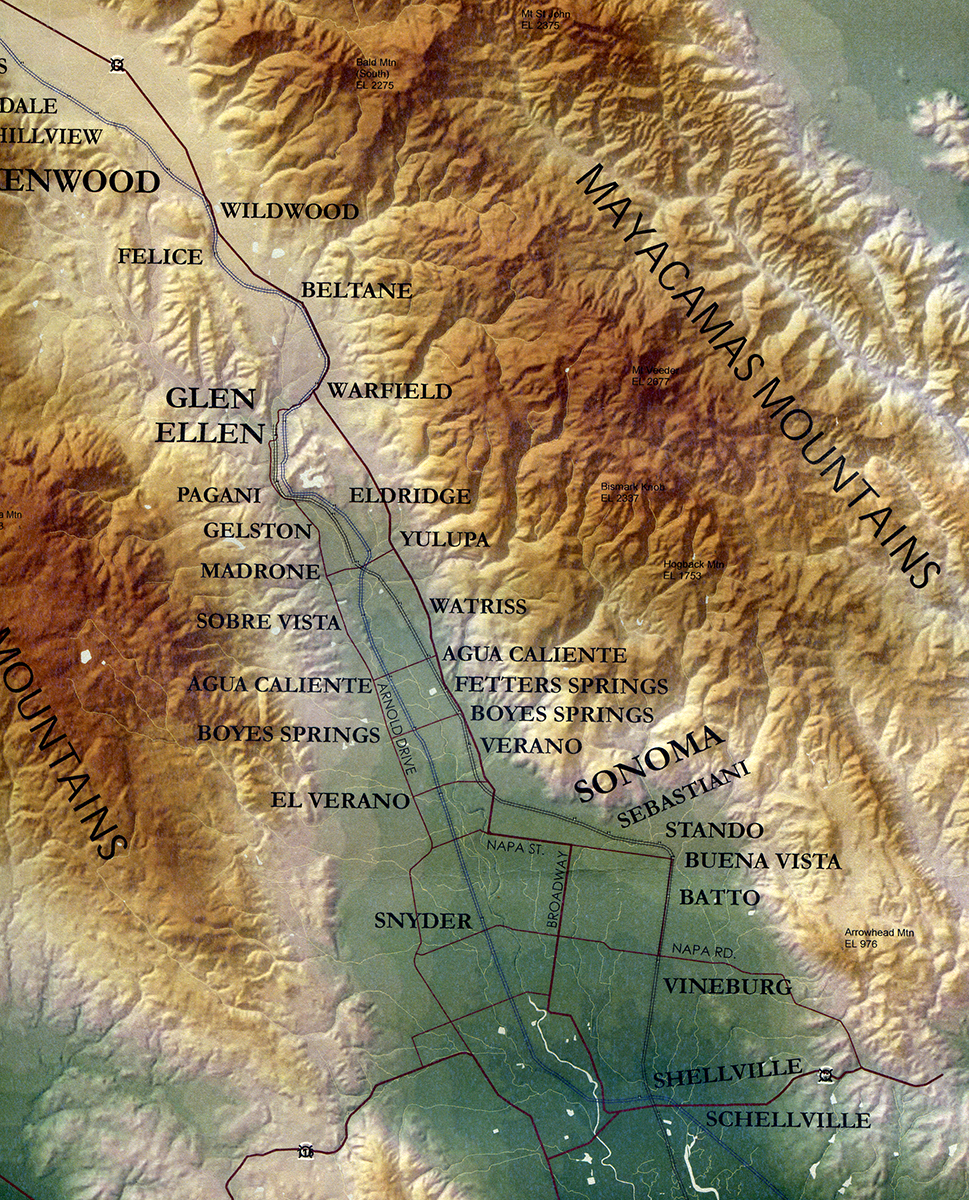
Both Agua Caliente and Fetters Hot Springs, just up the road, have official Caltrans place-name signs, but Boyes Hot Springs does not. Why? Who knows. The one above is my creation.
Photos by the author. Index Tribune and other photos courtesy of the Sonoma Valley Historical Society
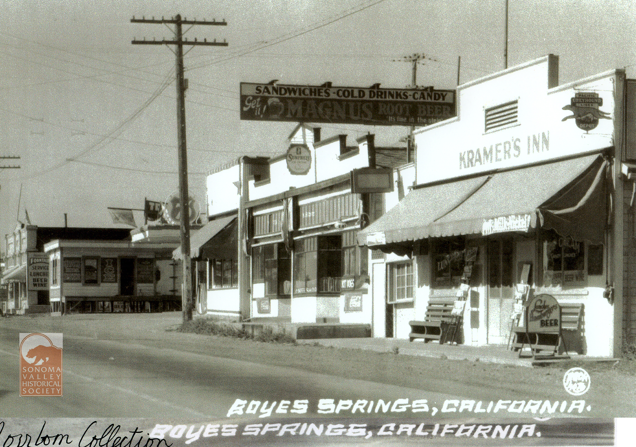
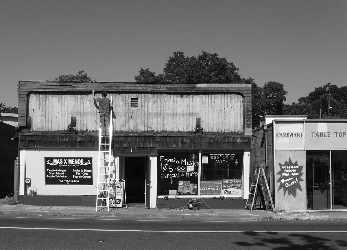
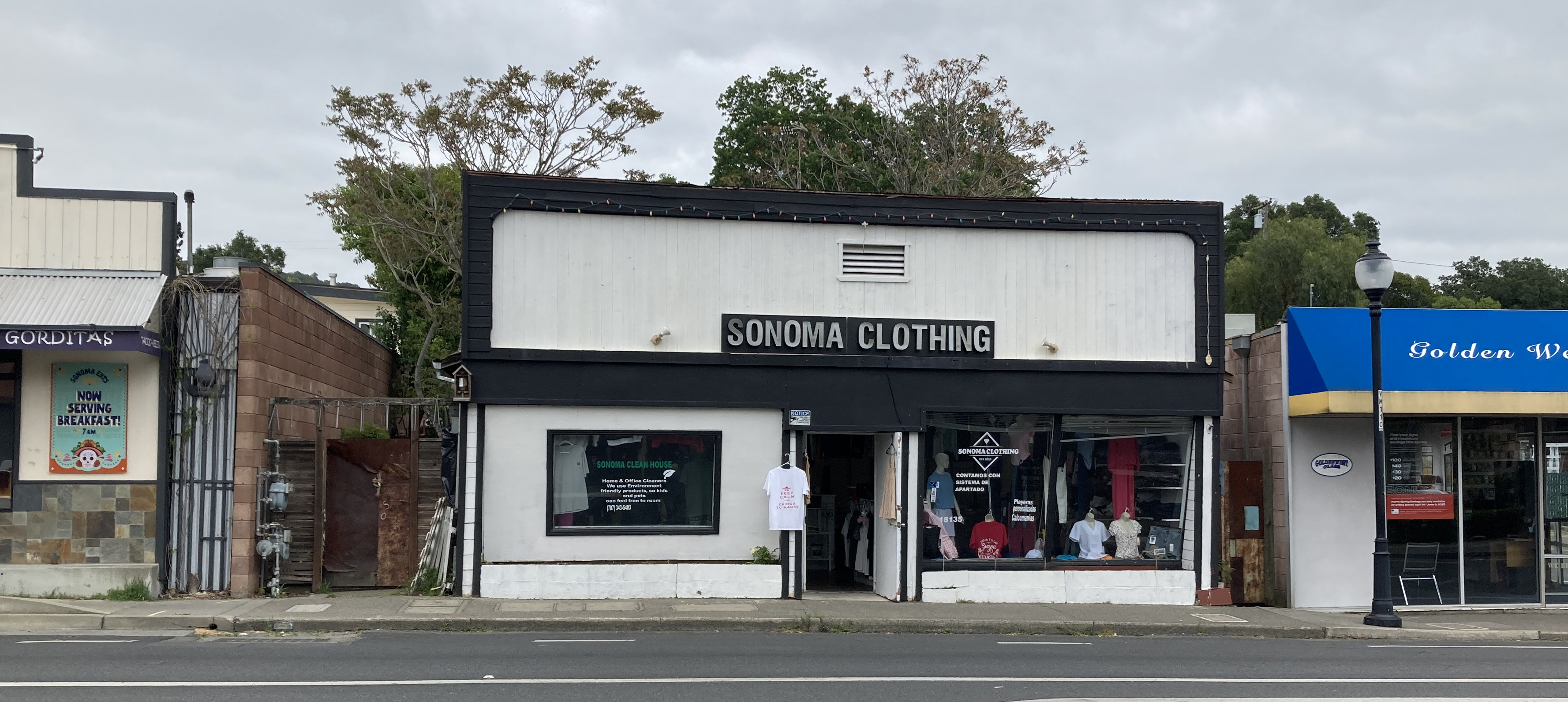
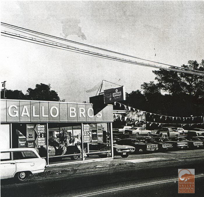
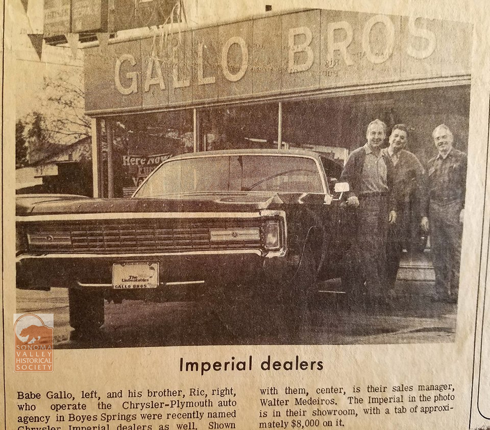
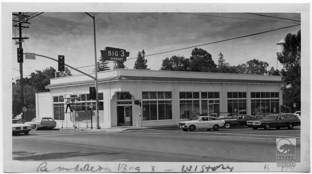
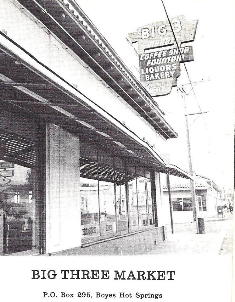
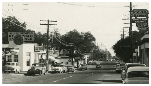
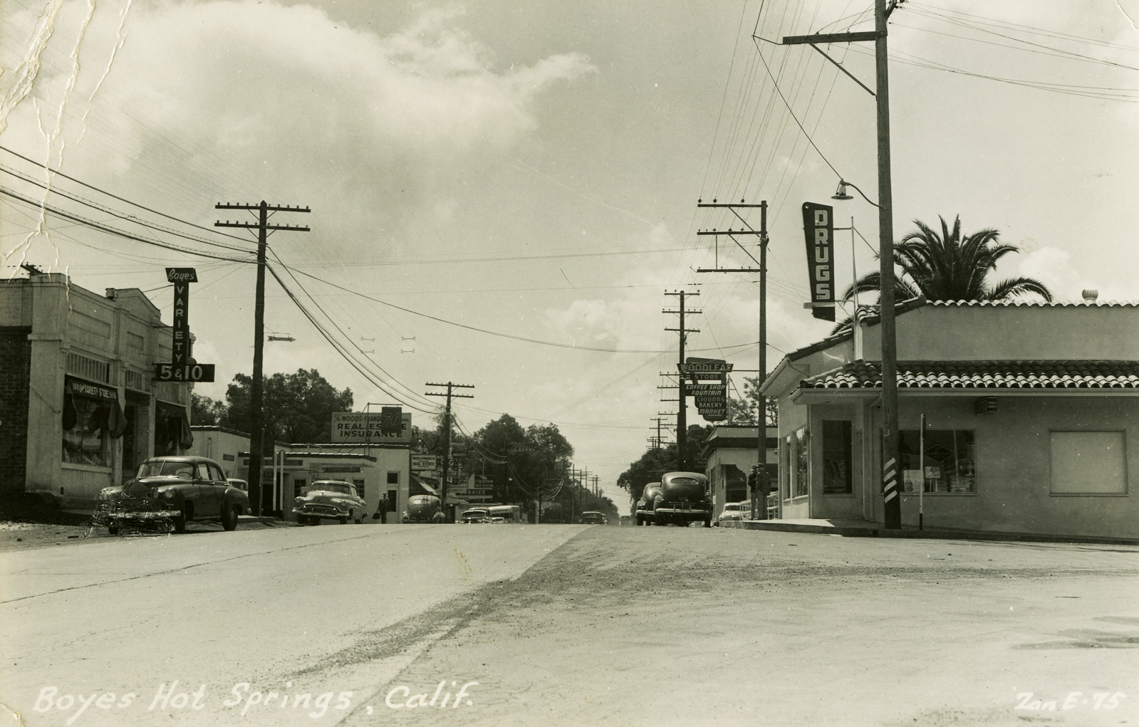
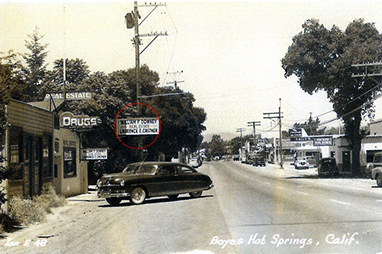
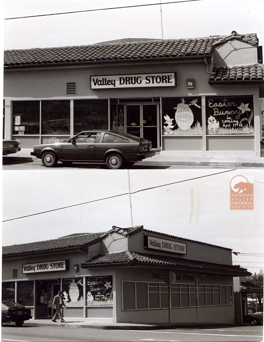
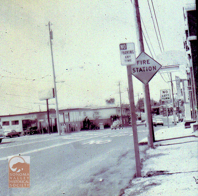
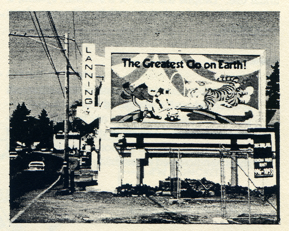
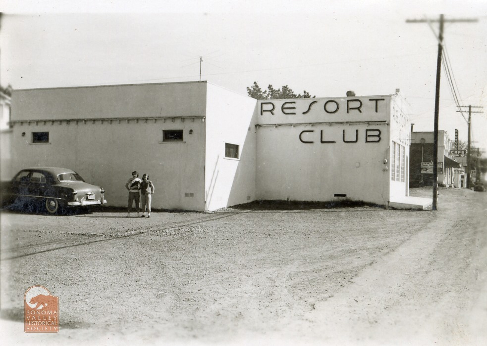
Commercial buildings on either side of the eastern part of Boyes Blvd. 1930s. The Kramer’S Inn building is seen in the next two photos, from 2008 and 2025.Circa 20082025The Gallo brothers ran a service station and car dealership from 1949 into the 1970s. The building, immediately south of Kramer’s, is now Golden West Glass.Southwest corner of Boyes Blvd. and Highway 12, 1980s. The Big Three, as it was then known. Now part of the Sonoma Mission Inn, but no longer a public building.Earlier, taller version of the sign.The wonderful Woodleaf sign, upper right. Zan Stark photo.1950s. Before it was the Big Three, the building was the Woodleaf Store. At left is the building that had previously held Jim’s Cafe. More in Part 2. The palm tree peeking over the rooftop at right is situated in Boyes Springs Plaza, as once was. Pine Wagner’s Valley Drug was in the building at right center. Pine Wagner was perhaps the first woman to be a licensed pharmacist in California. She operated her store from 1946 until 1962. Zan Stark photo.Pine Wagner’s first location, on the highway, in Bud Castner’s building, opposite Arroyo Road. Zan Stark photo.Easter! 1970s? This commercial space was later the Church Mouse Thrift Store. Currently empty, alas.1960s. Looking north at the Boyes/Highway 12 intersection can be seen, far upper right, the Melody Club sign.Later, the old Lanning’s Resort Club/Melody Club became the offices of Lanning Construction.The Resort Club, 1951. pictured are Carla Robinson (L), and Helen Lanning (R). Photo courtesy of Lorrie Baetge Fuller, who is Carla Robinson’s daughter.The Melody Club sign circa 2009.
Photographs courtesy of the Sonoma Valley Historical Society, Stanford University Library Special Collections, and the author.
We have been here posting monthly for over ten years. Please support our continued existence. There is a button on the Home page
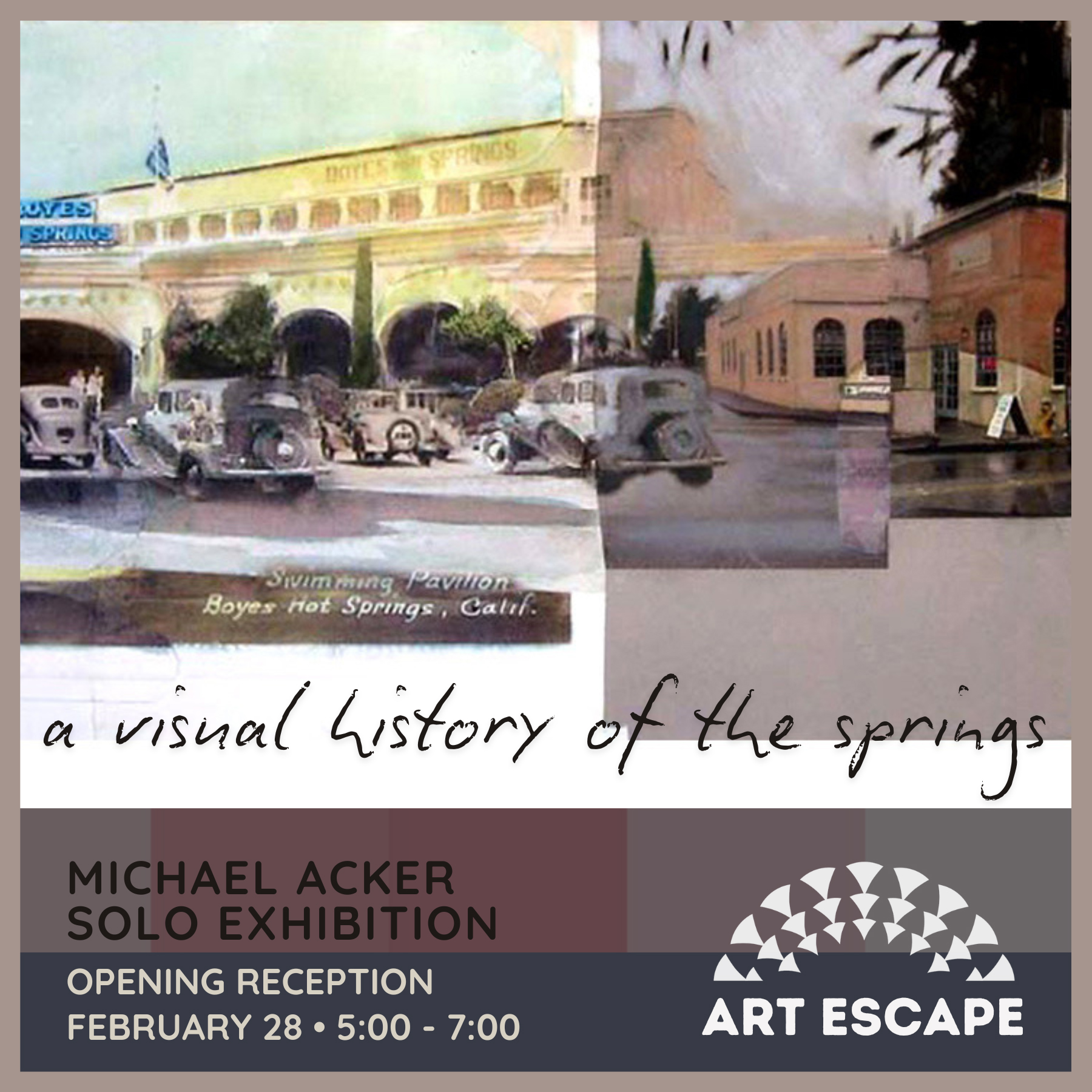
And while I have your attention: A show of Springs history themed art by Michael Acker is opening at Art Escape this Friday, February 28, at 5pm. SEE YOU THERE?!
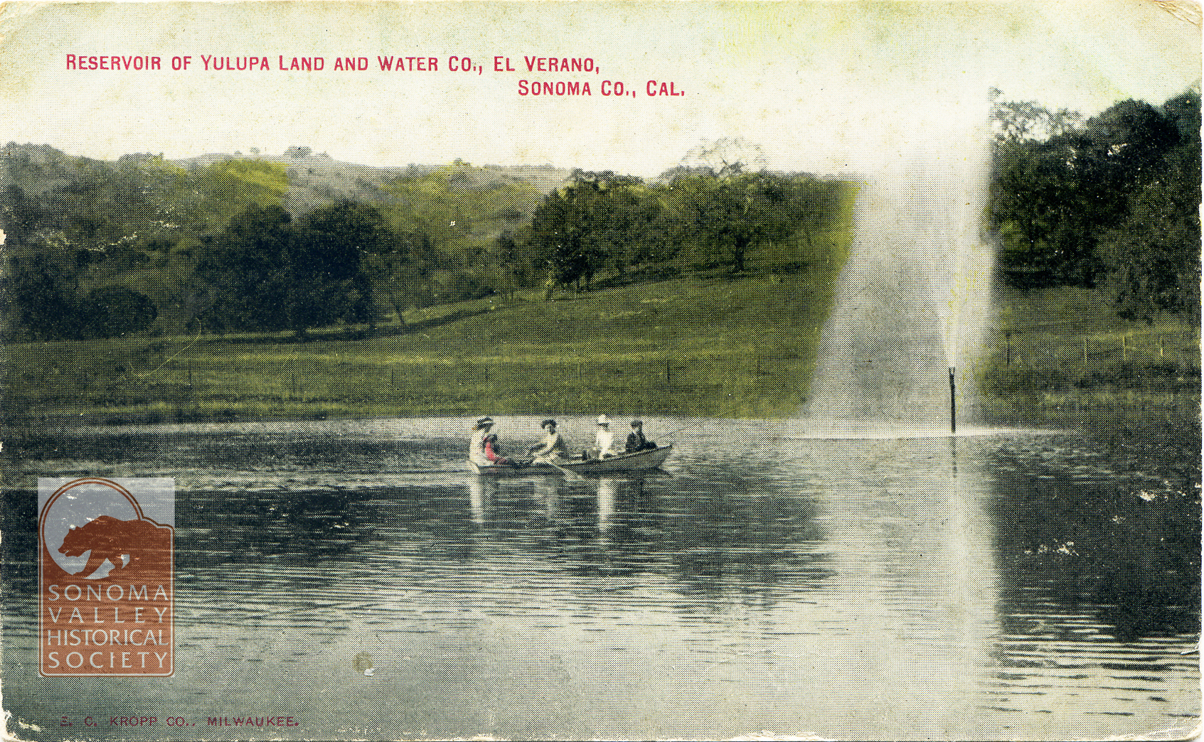
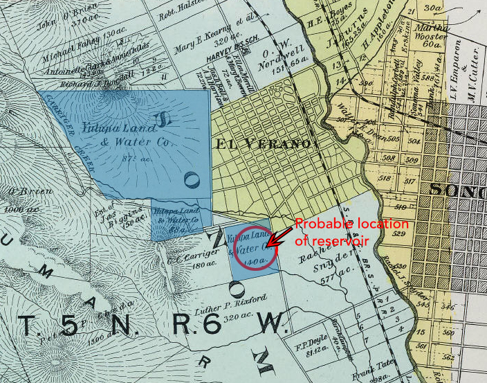
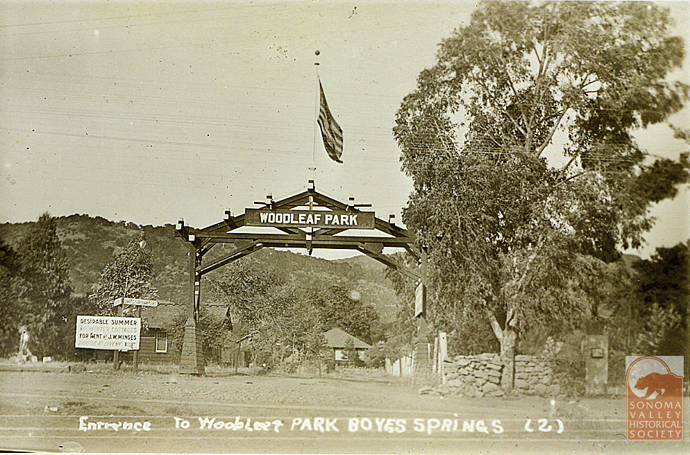
Post marked 1910. The Yulupa Land and Water Company holdings appear on an 1898 Reynolds and Proctor map (Rumsey Collection).
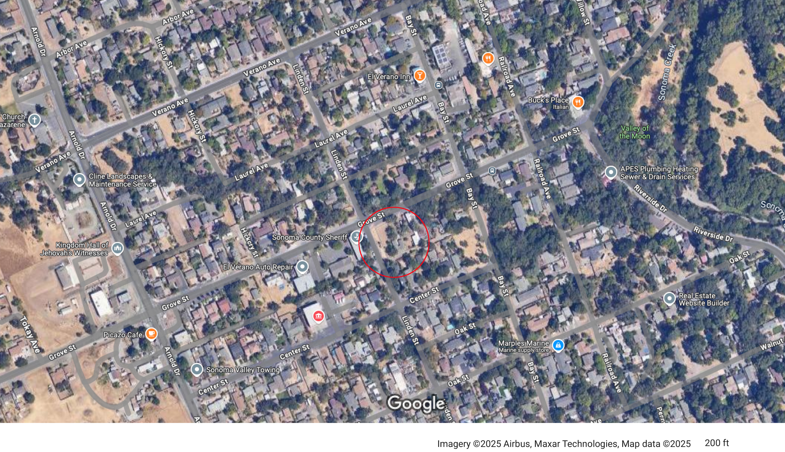
Judging by the hills in the background in the post card, the reservoir was probably located near the corner of Grove and Linden Streets.
In 1910, the Sonoma Valley Water, Light and Power Company acquired the Yulupa Land and Water Company.
1913- “J.A. Dinsella, the enterprising plumber of this city, has secured a contract from Sonoma Vista Land Co. near this city, to build its pipeline of 4-inch mains and 2-inch laterals.”
In 1923 J.W. Minges sold his Boyes Springs Water System, which mainly served Woodleaf Park, to N.M. Peterson, proprietor of the Mountain Water Avenue system. The merger “will enable the operating company to give better service…” even then that was the rationale!
J.W. Minges was known as the “mayor” of Boyes Hot Springs.
“Another company at Boyes Springs which has supplied many customers in the vicinity of the hotel and Boyes Springs Park is owned and operated by James Baines.” of Baines St.
1958-Mountain Ave. Water Co. was sold to Mr. and Mrs Peterson Jr. whose parents had bought from Minges. The Petersons’ company served Boyes Hot Springs for 35 years. Improvements included an office building at 18640 Highland (An address that cannot exist, apparently, as the street ends at 18075), and a new tank at the top of Mountain Ave. An existing tank is located above Highland, circa 2025.
From the Valley of the Moon Water District website: “In 1957, the Valley of the Moon Fire District was evaluated by the Pacific Fire Board which at that time noticed the lack of a dependable water supply source. Subsequent inquiries of Fire District Board members, J. Udvic. T. Polidori and F. Serres, revealed that many wells in the area were failing due to drops in the groundwater levels in the Valley. Early attempts to have Sonoma County build an aqueduct from Santa Rosa to the Sonoma Water and Irrigation Company failed due to the inability of the latter to deposit a $25,000 cash bond with the County.”
In 1960 voters authorized the establishment of a water district. Candidates for directors at that time were Arnold Griewe, Mel Larson, Bill Orr ,Tom Polidori,Col R. C. Buell, Marin Carlson, A. L. Ford and Nino Vailetti.
“Acquisition of the Sonoma Water and Irrigation Company and the Mountain Avenue Water System was completed in early 1962 and the Valley of the Moon County Water District started management and operation of the systems on June 1, 1962.” VOMD website.
1963-Sonoma Aqueduct dedicated, bringing Coyote Dam water to the valley.
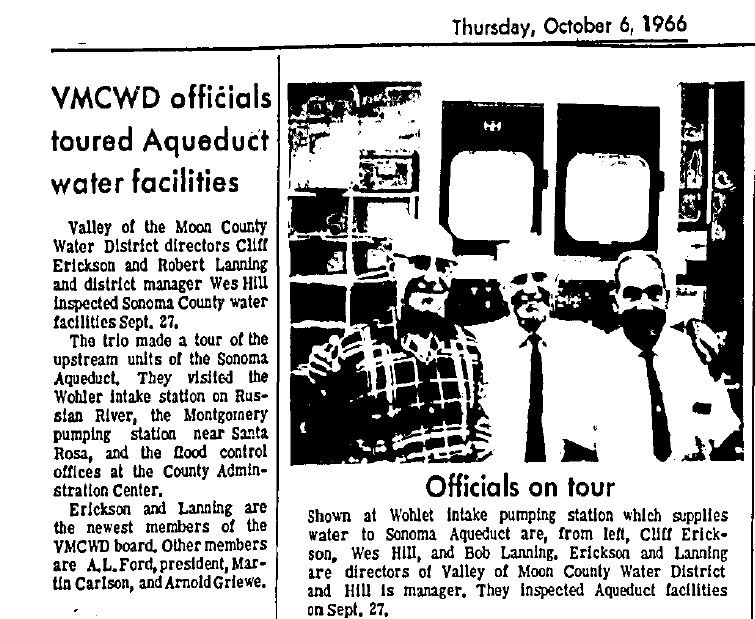
The Water District had new directors Robert Lanning and Cliff Erickson in 1966.
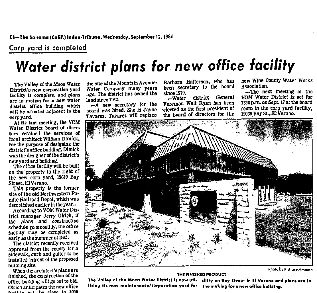
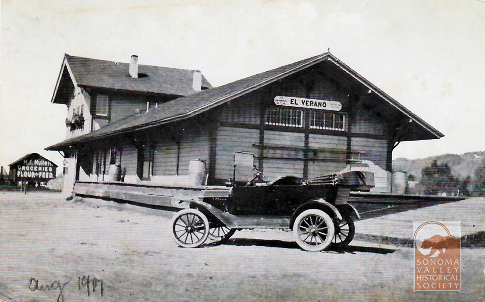
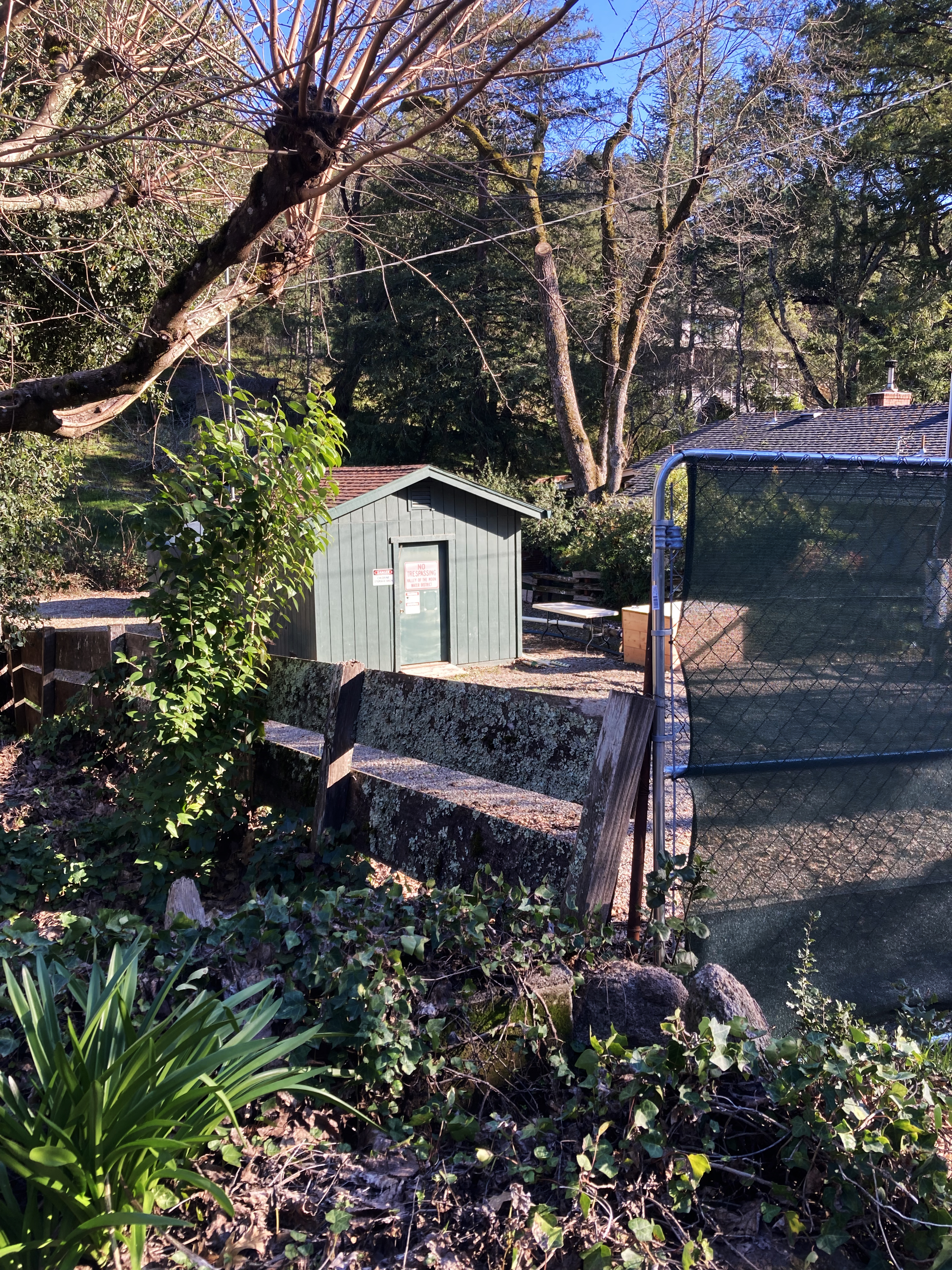
In 1984 a new office building was planned, to be built on the site of the El Verano railroad depot.
Alas!
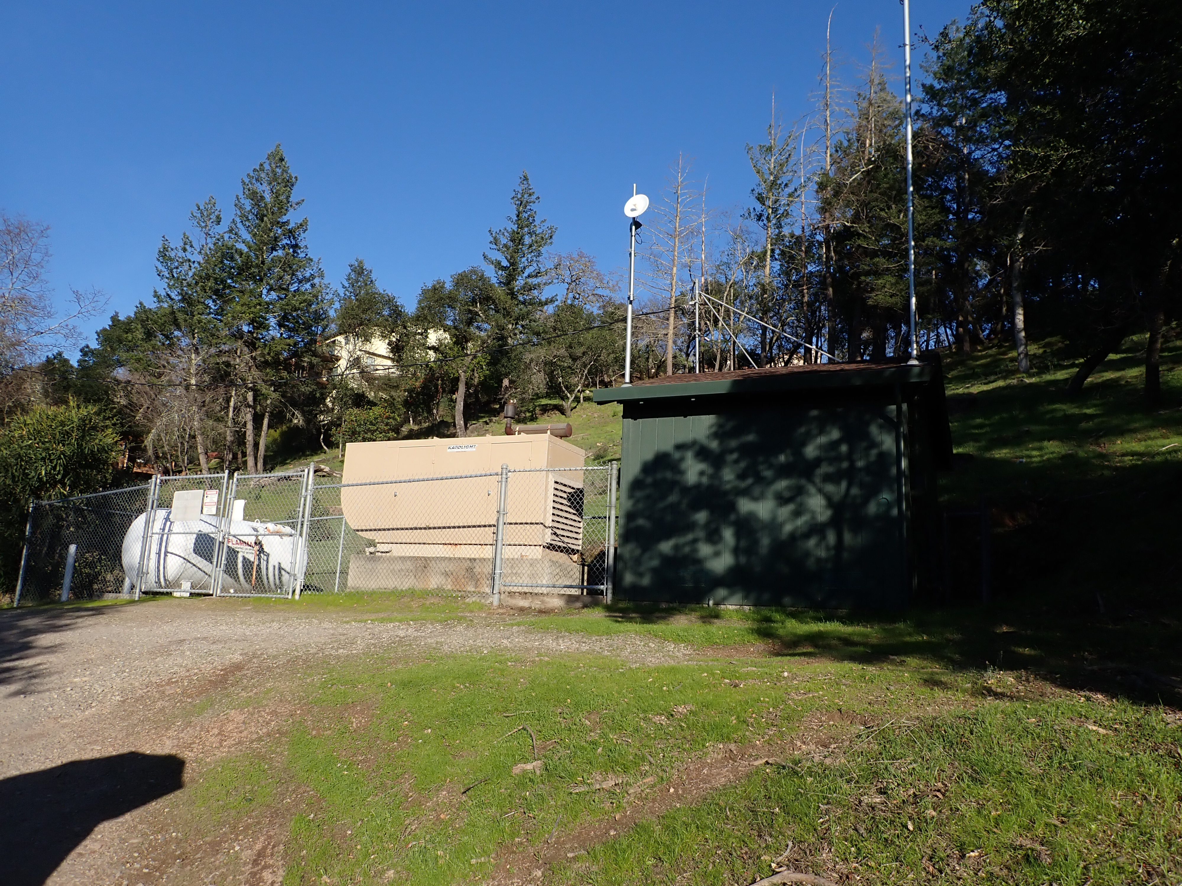
The District still has wells in the Valley.
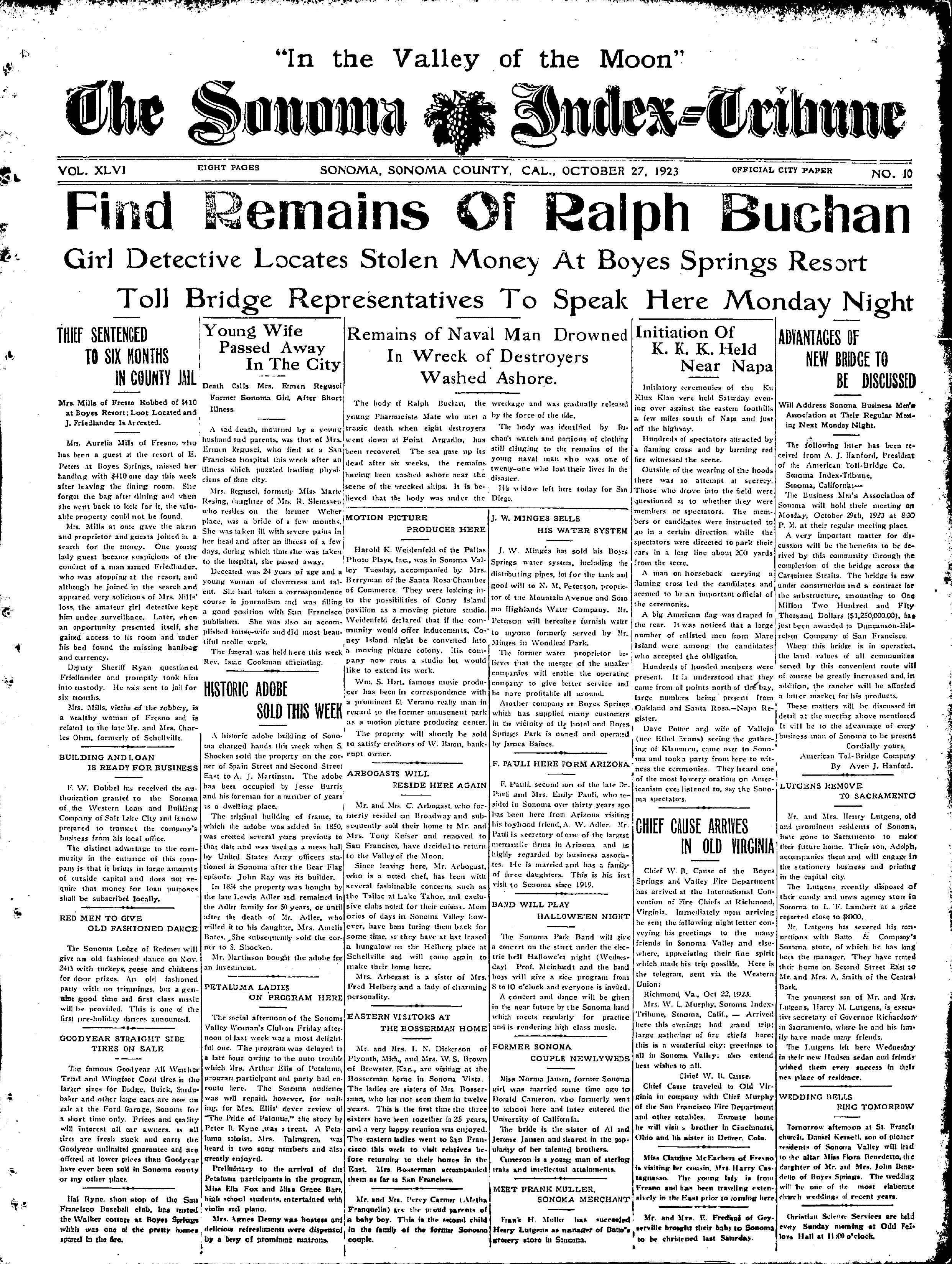
Park Avenue well.Kearney Street well.One comes across many interesting things when looking at old newspapers. Things not relevant to the subject at hand, nonetheless important. This front-page description of a Klan meeting in the Napa Valley is vivid and disturbing, and rings bells that are still reverberating today.
Index Tribune courtesy of the sonoma Valley Historical Society.
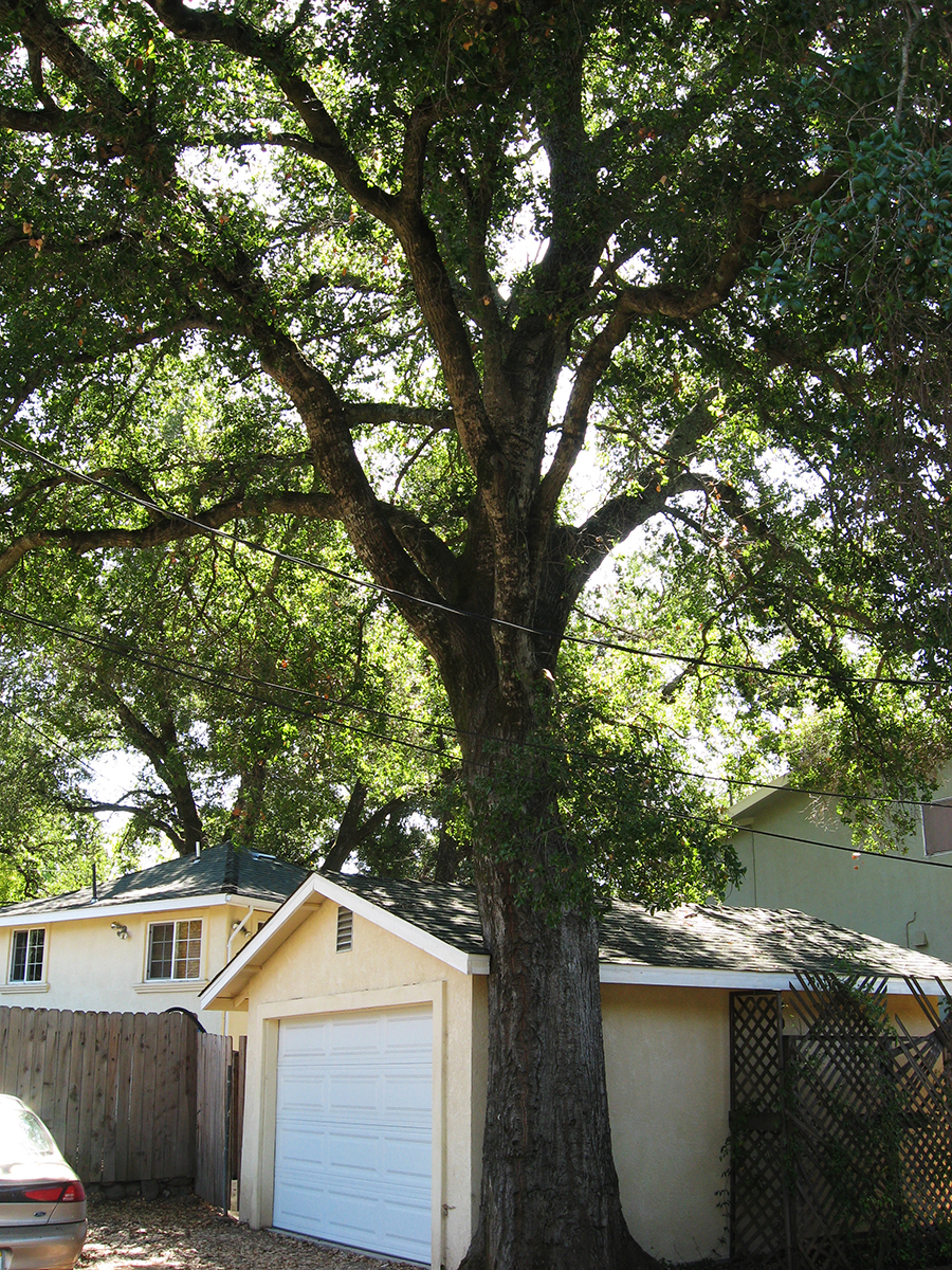
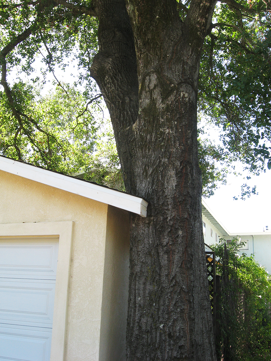
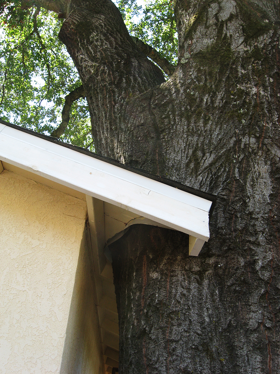
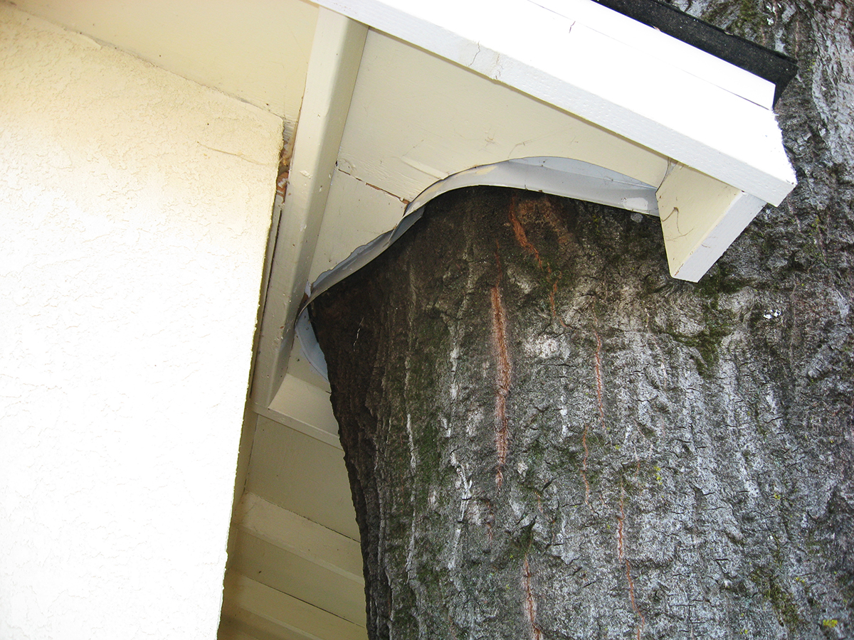
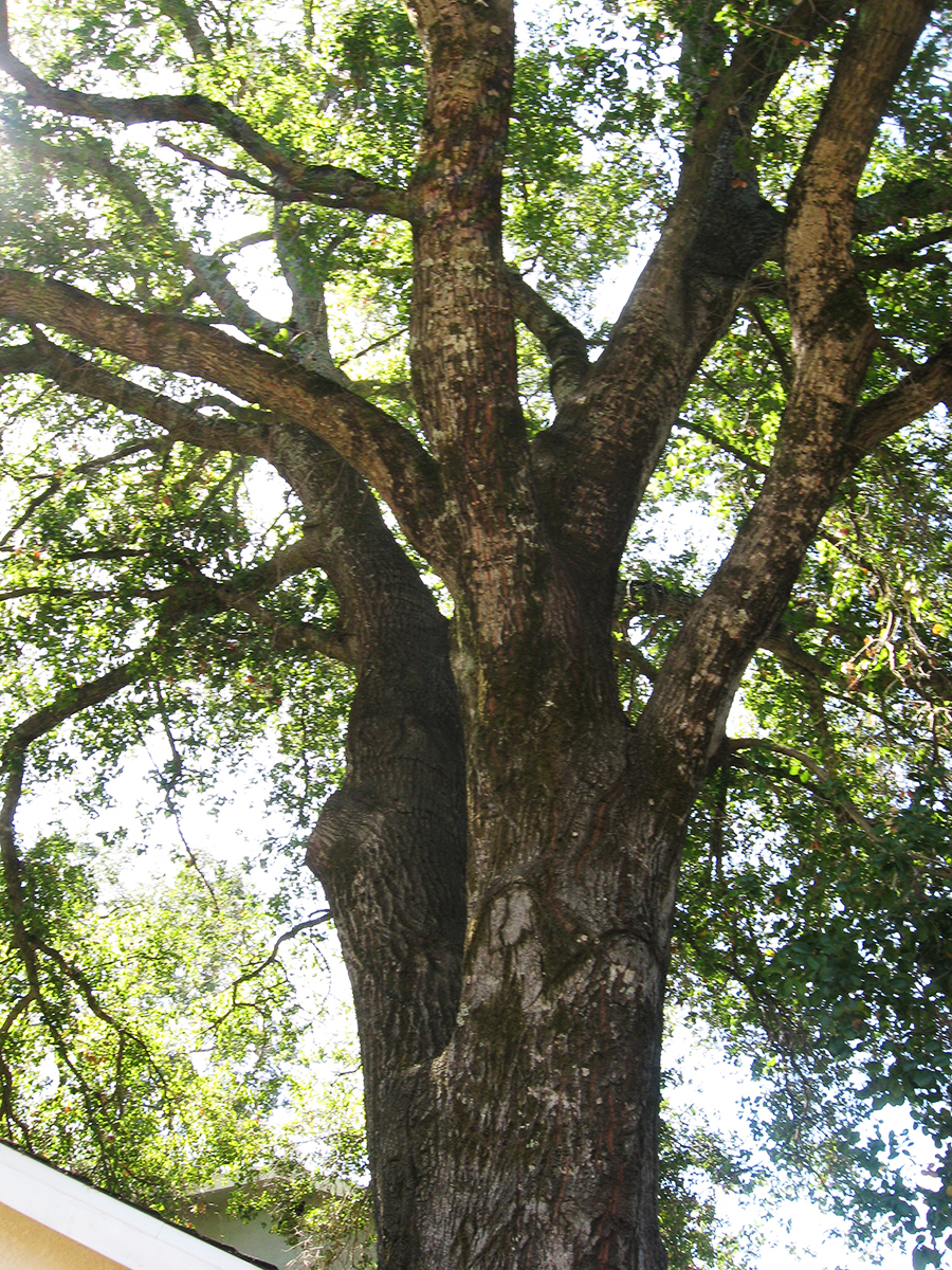
On Vallejo Ave. near the corner of Calle del Monte, in Boyes Hot Springs, there stood a prime example of the ongoing interaction between trees and the built environment: A garage was built next to an oak, the oak grew, humans adapted the structure to accommodate the native tree. This was a lovely thing to see.
Prior to 2009 when I first photographed it, the structure had been so dilapidated that I was sure they were going to tear it down. But they restored it and did a neat job of cutting the roof overhang around the mighty Quercus.
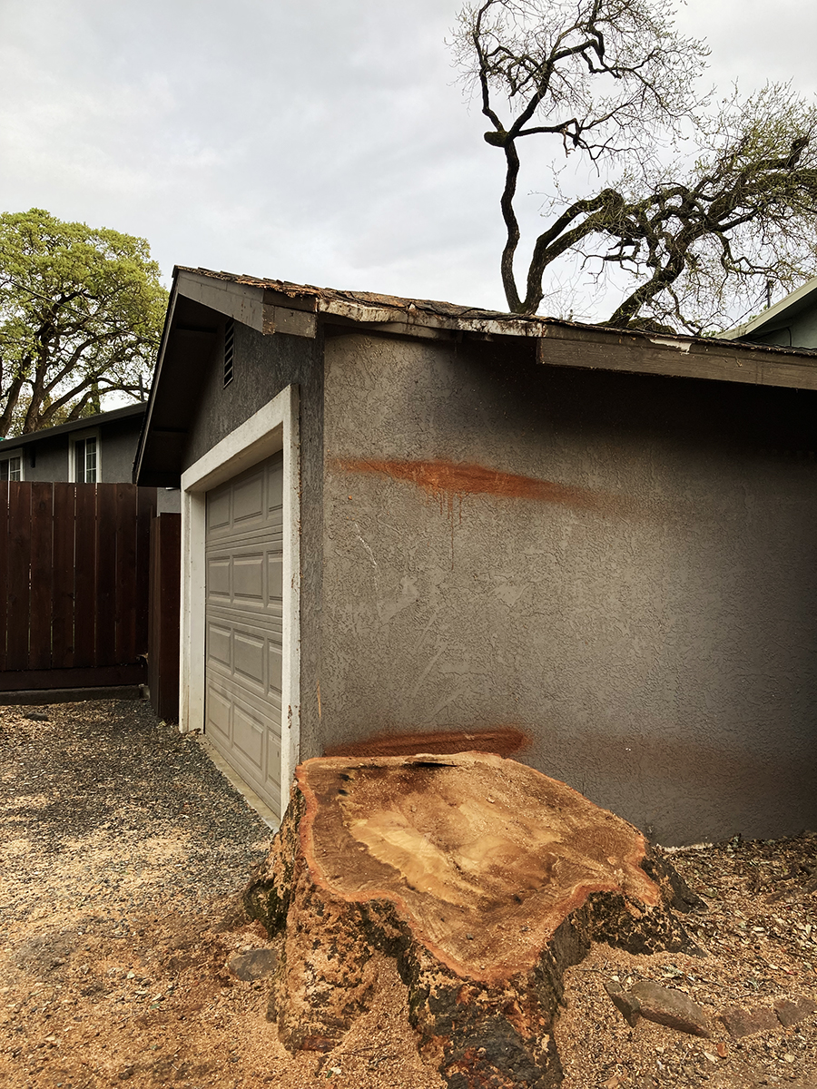
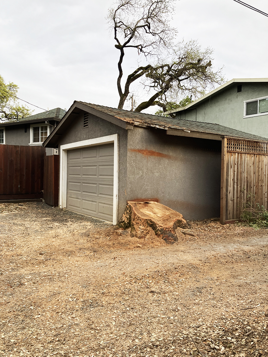
Flash forward to 2024. The tree is gone, its pleasant pool of shade just a memory. In the last two photos you can see that another tree, in the background, has also been removed (see the first photo), for fire safety, they say. Whether necessary or not, we always mourn the loss of a tree.
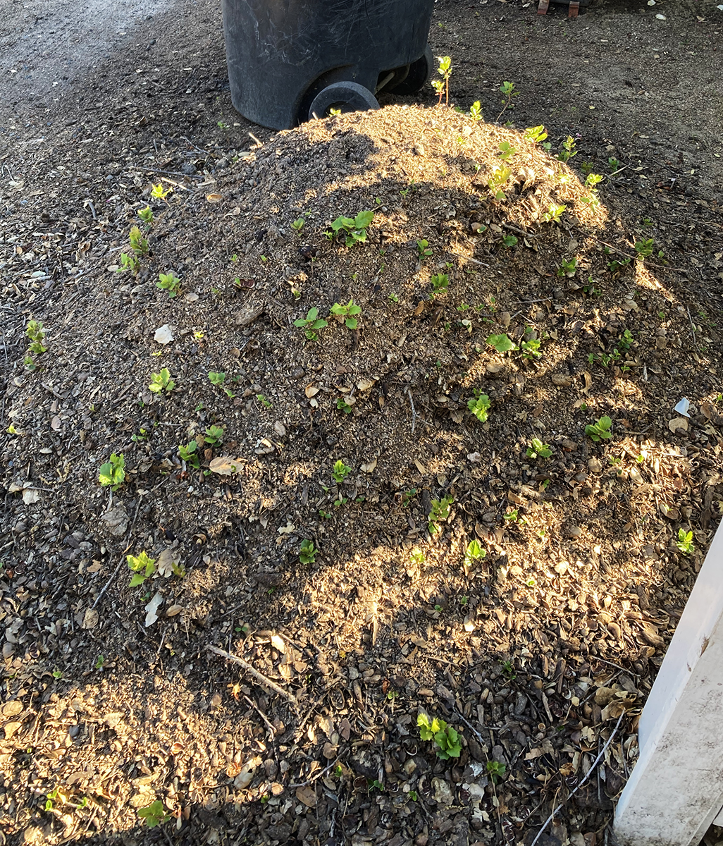
Below are photos of a mound of earth and wood chips next to the stump. It is absolutely covered in oak seedlings. Nature continues!
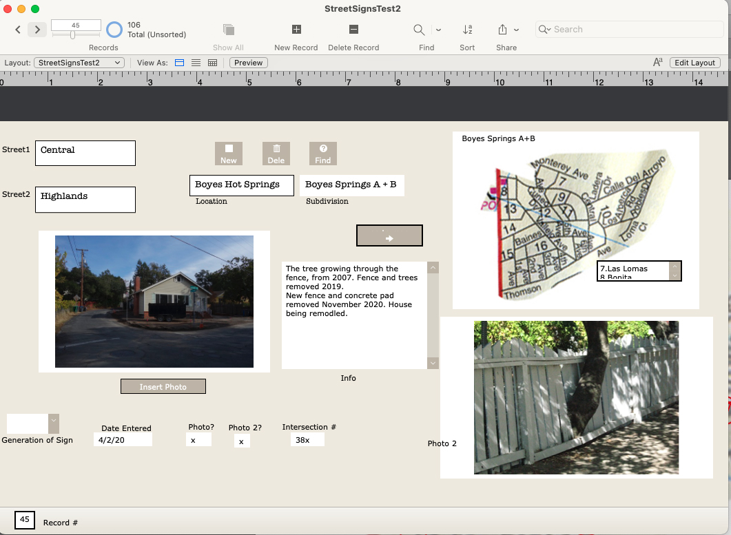
In 2020 I photographed every street sign in my immediate neighborhood with the intention of creating a database of intersections. Why? Obsessiveness. Completeness. The desire to record and collect (see website introduction.) Future use. It’s history. Because it might all burn down, and no one would remember what it looked like. (And, I really like databases and consider them an art medium.) I have also included photographs of the Neighborhood Phenomena in the vicinity of the intersections, such as, the tree growing through the fence above.
In addition to my photographs, I have included older (“historic”) ones, where they exist, newspaper clippings, and other ephemera. I know of no older photographs of intersections other than the ones at Highway 12, which were made primarily for commercial purposes.
There are 107 records in the database (I probably missed some), one for each intersection in the Boyes Springs A and B subdivisions. The fields include “Generation of Sign” because three distinct styles of sign exist. Time permitting, the database would be expanded to include the surrounding subdivisions (more here) Sonoma Highlands, Woodleaf Park, etc.
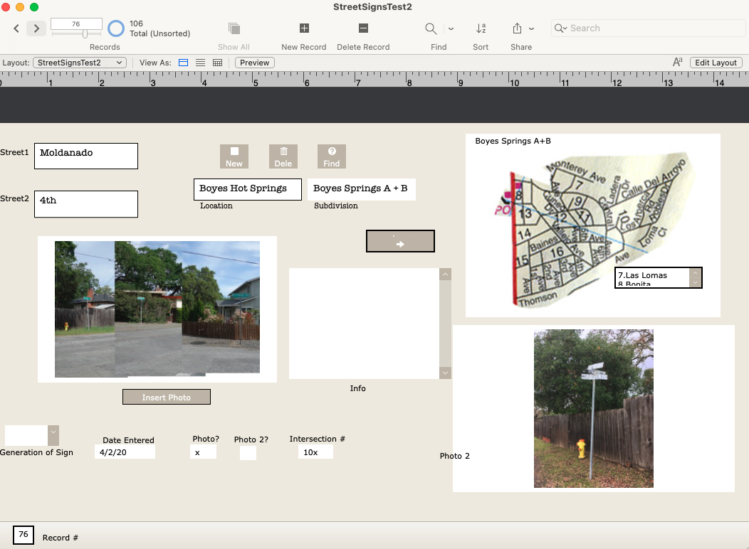
The corner of Maldonado, 4th, and Vallejo had three of the oldest style signs on one pole until recently. I realize I misspelled Maldonado in the db.
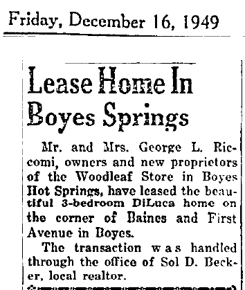
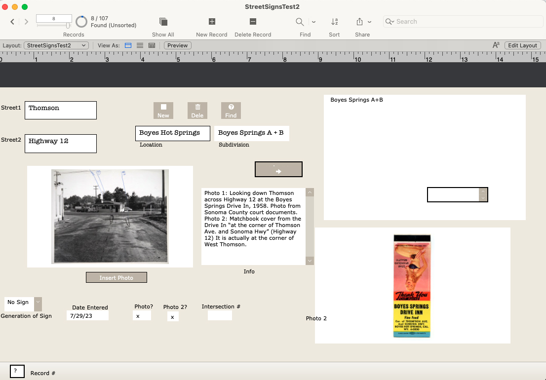
The Thomson and Highway 12 entry features a photo from 1958 and a matchbook cover.
Las Lomas and Arroyo shows the stonework built by the Larson family, in 2020 and the 1940s, with family members.
The map is still under development (ie, my Filemaker skills need improving.)
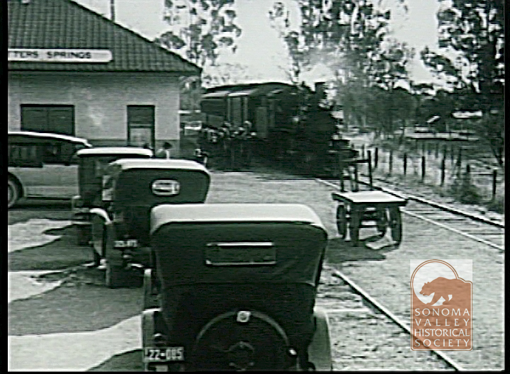
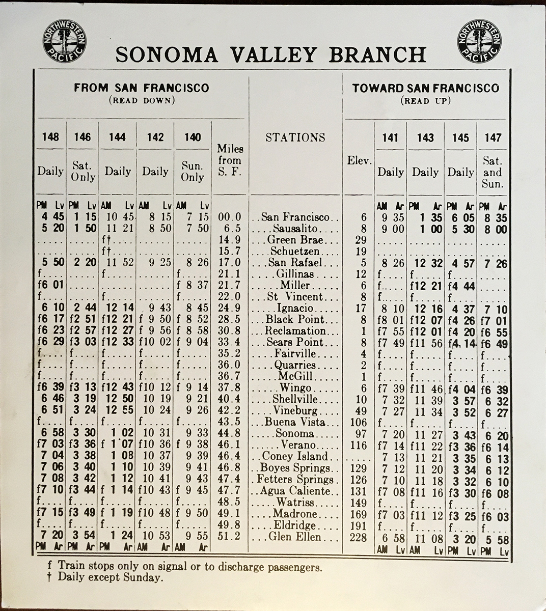
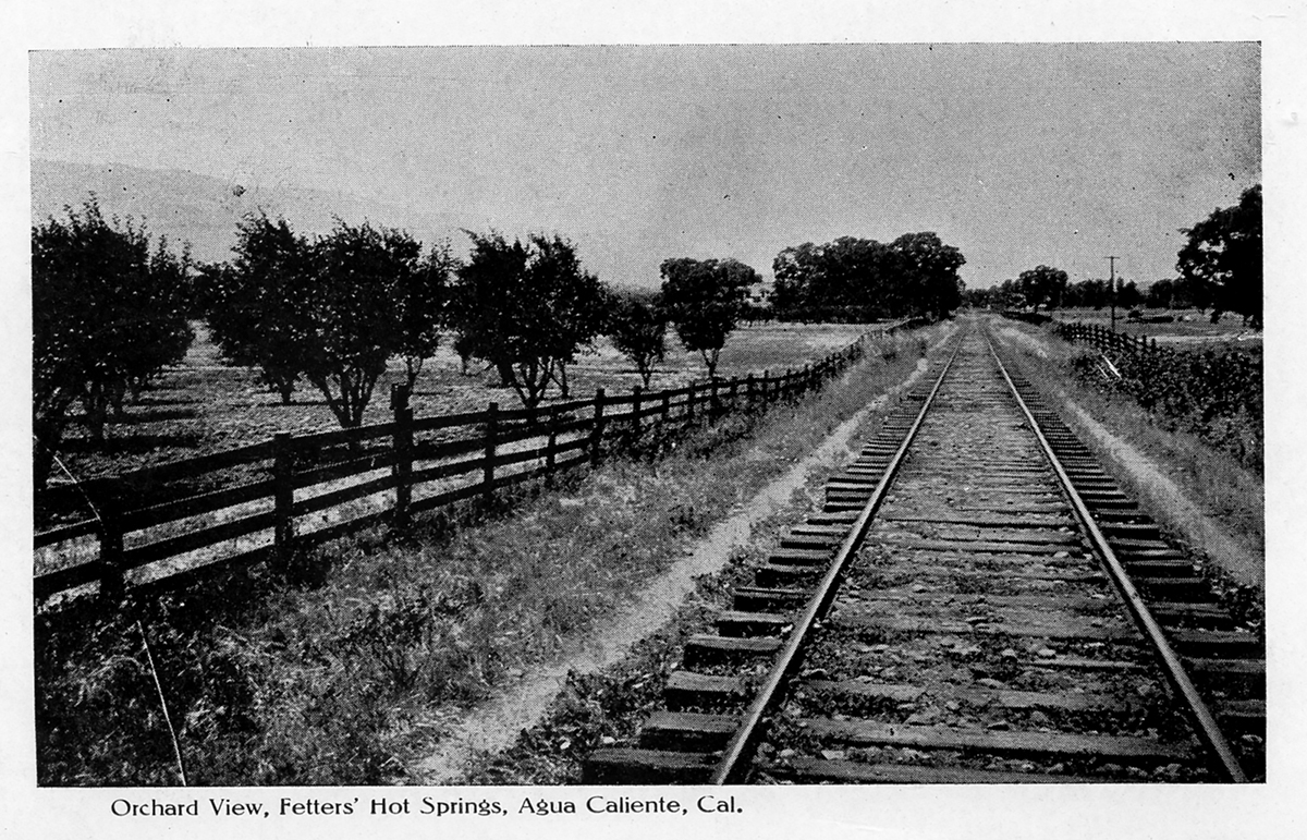
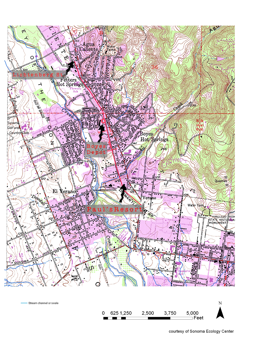
The last year of operation for the Northwest Pacific Railroad in Sonoma Valley, which ran on the east side of Sonoma Creek, was 1942. That year freight service ended, and the tracks were torn up for steel for the war effort. Traces of the right-of-way can be seen in several places in El Verano, Boyes Hot Springs, Fetters Hot Springs, and Agua Caliente.
From El Verano going north:
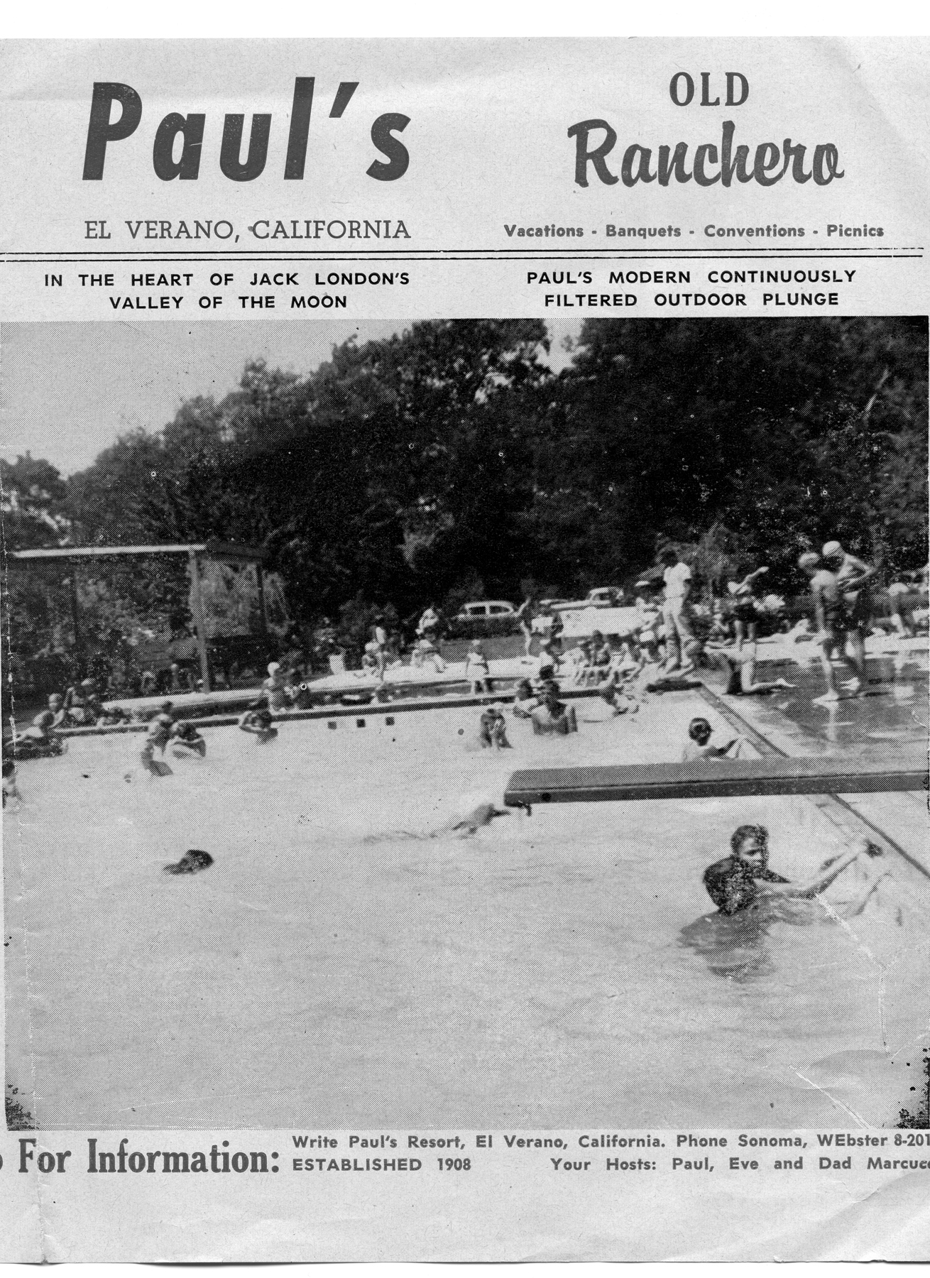
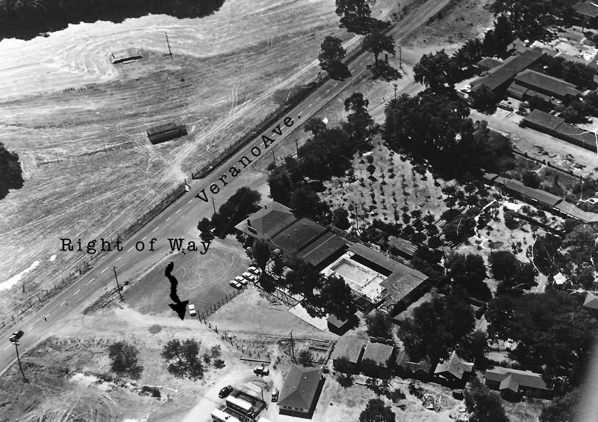
In El Verano the tracks run through the Paul’s Resort property, where the Verano (not El Verano) depot was located.
Paul’s Resort, 1960s
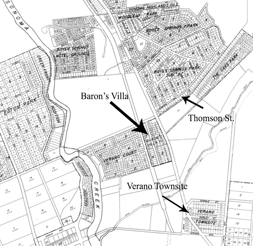
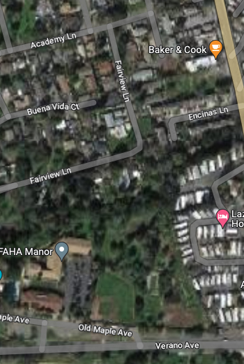
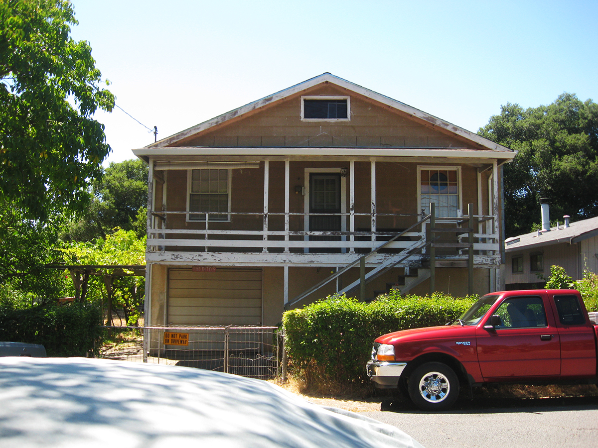
From there it parallels Fairview Ln. (which may have been right-of-way) until it gets to Thompson, where Sierra Dr., formerly Meinke Ave., takes over the roadbed. (More about Sierra and Mienke.) Manzanita St. might have been a spur. It features several buildings that look as if they could have been built by the railroad.
House on Manzanita near Academy Lane
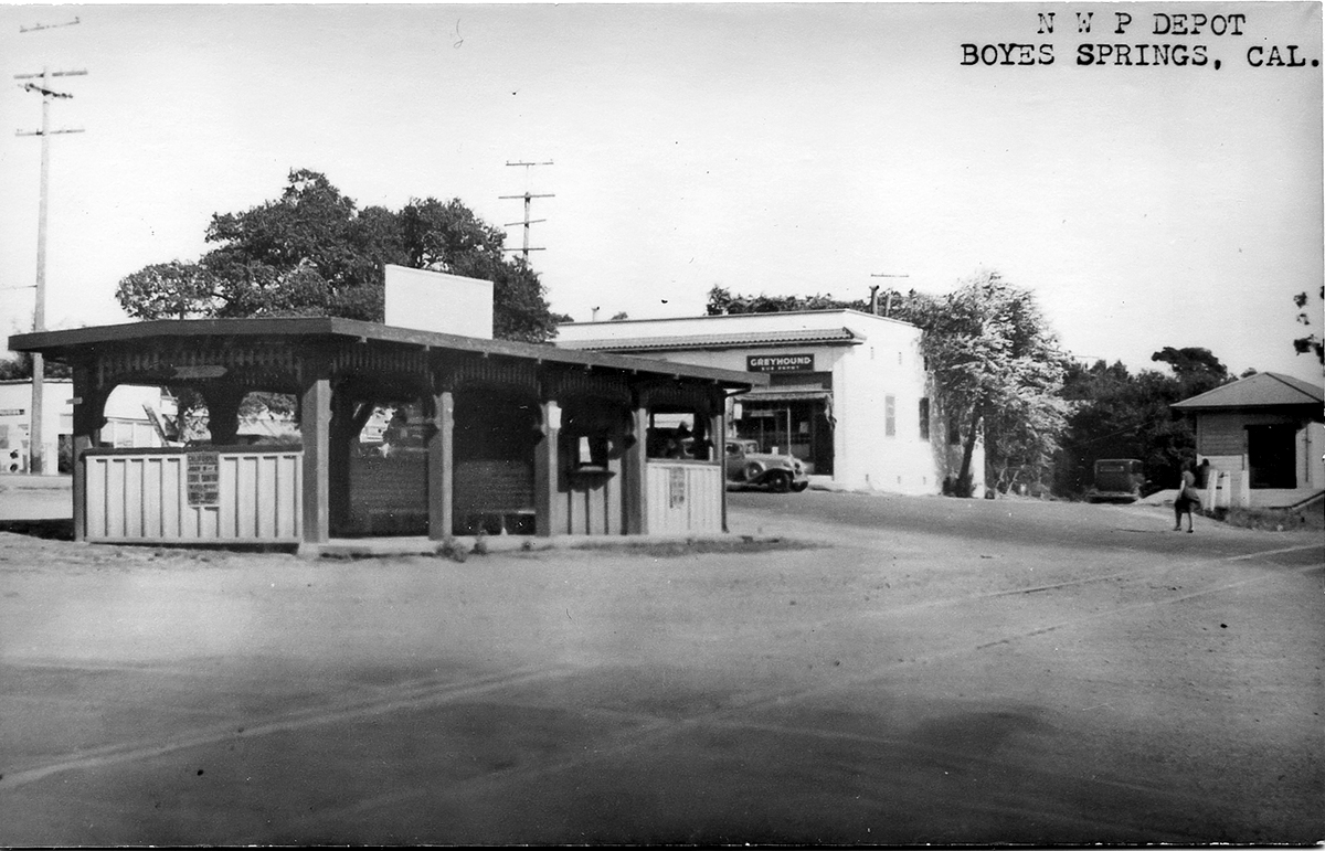
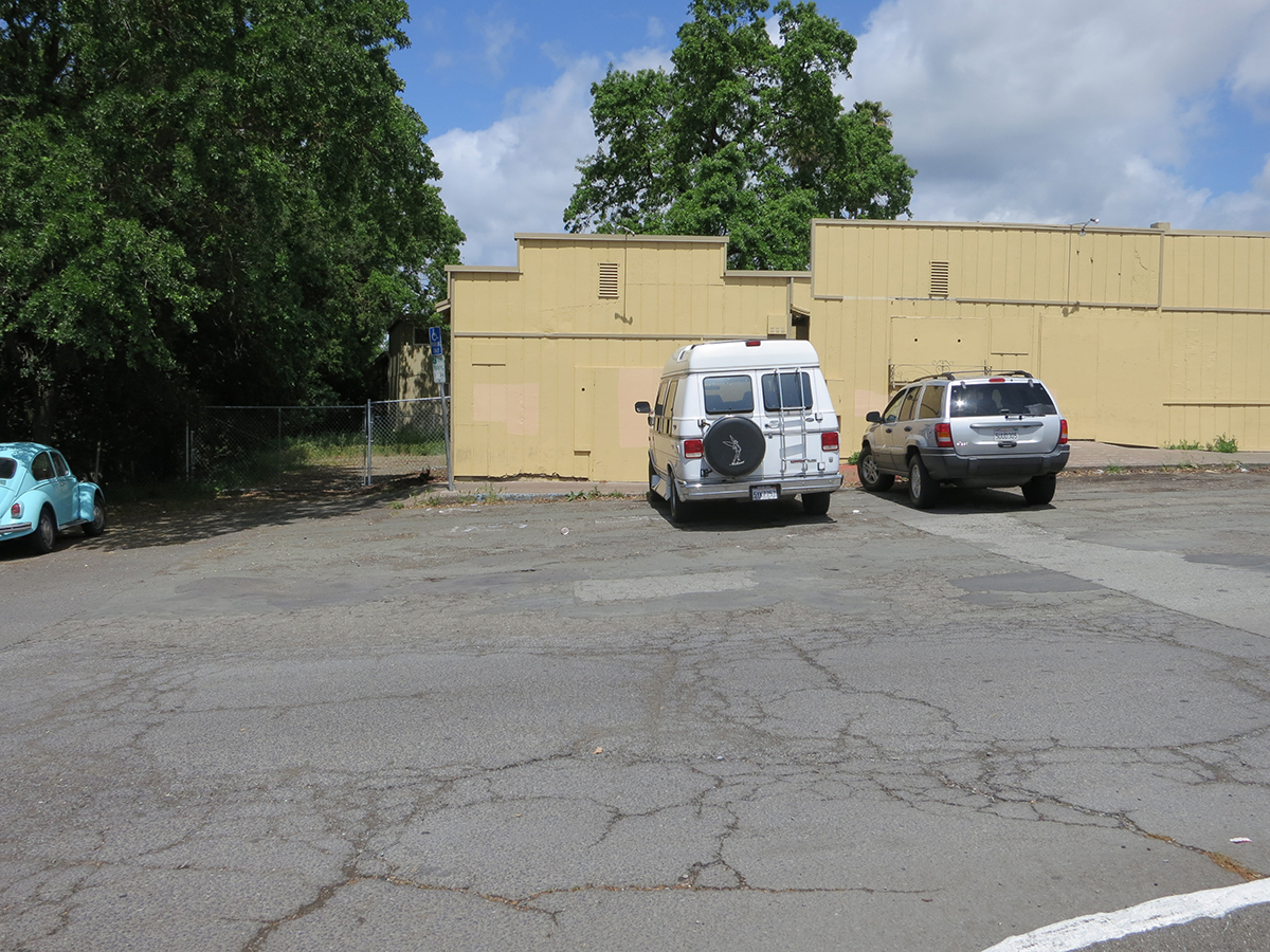
Where Sierra turns east to the Highway the right of way continues north through the Sonoma Mission Inn (originally the Boyes Hot Springs Resort) grounds and past the BHS depot, which land is now the parking lot for the Plaza Center building (More here).
Boyes Depot 1942
Right-of-way next to old commercial buildings at Boyes Plaza, which were demolished in 2018. Photo taken from the apporxiamte location of the Boyes Depot.
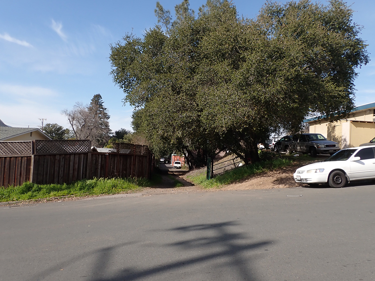
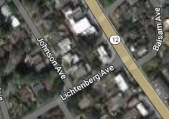
Continuing north it parallels the Highway and can be seen crossing Lichtenberg Ave, parallel to Johnson Ave.
At Lichtenberg.
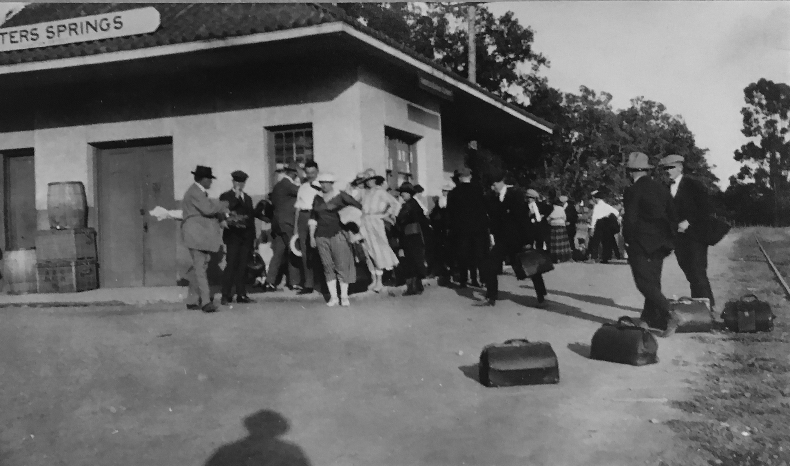
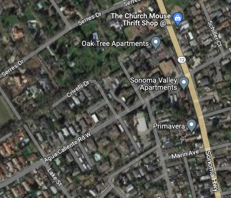
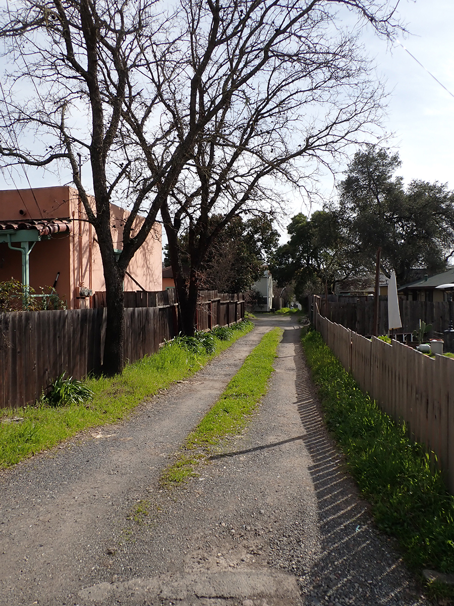
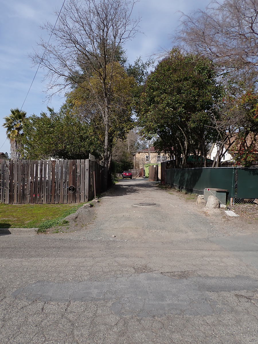
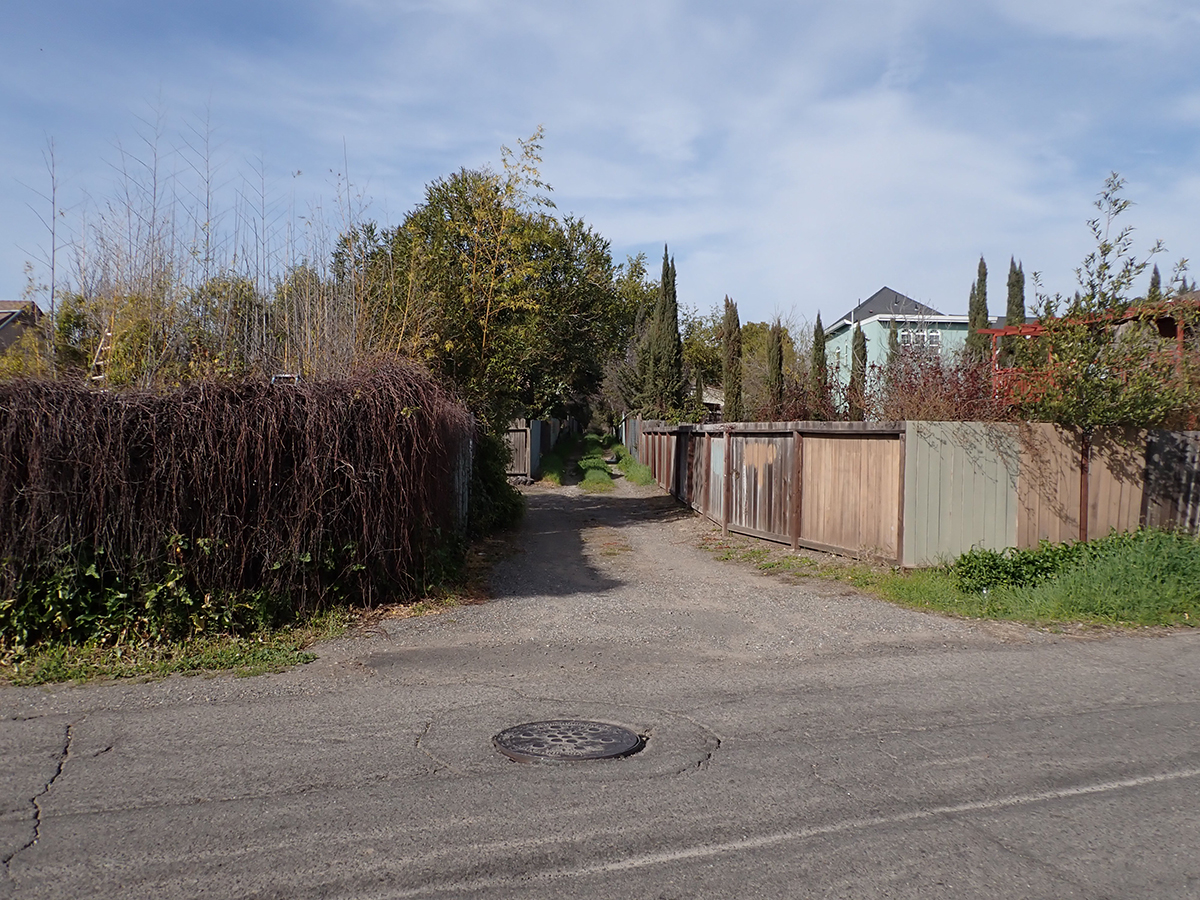
The next trace is the old Fetters Depot building on Depot Rd in front of Flowery School. It crosses the Fetters Apartments and Charter School properties and is seen again at Vialetti Dr. The old roadbed has become the alley the runs from Vailetti to Marin Ave. That is the last appearance of the right-of-way in the area.
Fetters Depot 1910s
1910s
At Marin Ave. looking south.
At Marin Ave. looking north.
At Vailetti Rd. looking north
Maps and photographs courtesy of the sonoma Valley Historical Society unless noted otherwise.
In a sense, this exhibit is a follow-up to Michael Acker’s book “The Springs, Resort Towns of Sonoma Valley,” (Arcadia Publishing, 2017) with many more photographs and ephemera, and in color. Here is a small preview.
Thanks to the Sonoma Valley Historical Societyfor assistance, especially Lorrie Baetge Fulton, Patricia Cullinan, Kate Shertz, Peter Meyerhoff, Roy Tennant, and Lynn Downey, and for images, and access to the Index Tribune archive.
Thanks also to the many community members who have shared their memories and photographs with the author.