Michael Acker’s series of panoramic photo-collages of Highway 12 in the Springs are now available at https://www.valleyofthemoonmainstemproject.org/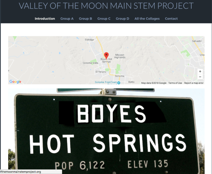
Yearly Archives: 2018
Palm versus post

Palm wins…
Wallflower


Courage in the plant kingdom. Highlands Blvd, May, 2018.
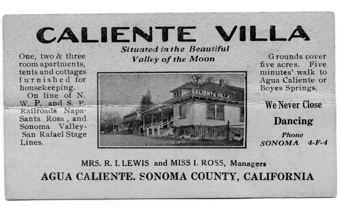
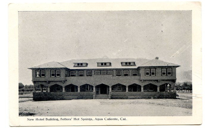
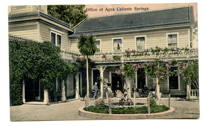
Caliente Villa
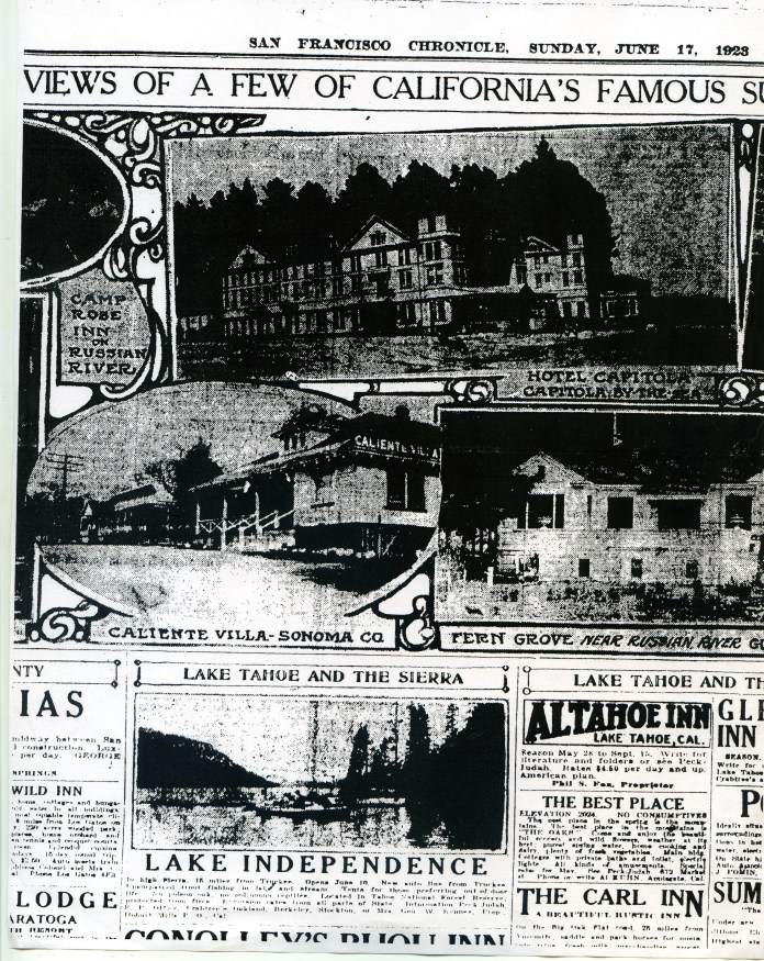
Courtesy Robert Palmelee
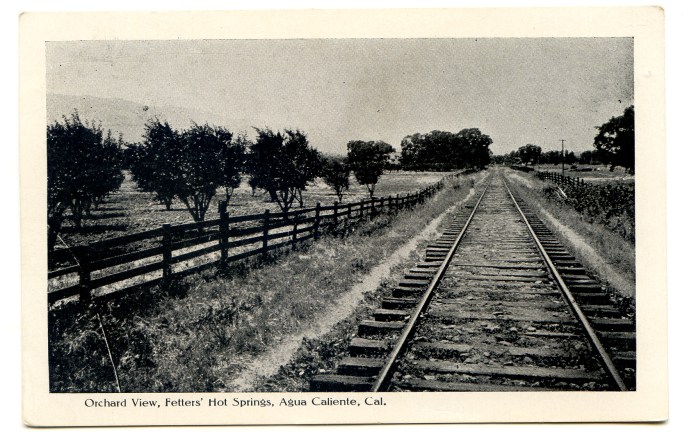
The resort was located on the east side of Sonoma Highway, near the corner of what was then known as Sonoma Avenue, now Marin Avenue. The Agua Caliente post office was reportedly located in one of the resort buildings.
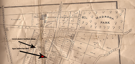
Map courtesy of Jeff Gilbert
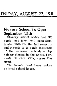
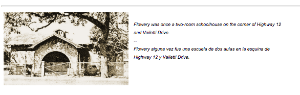
In a 1941 article, the Index Tribune located the resort across the road from (the old) Flowery School, which was at the corner of Vailetti Drive.
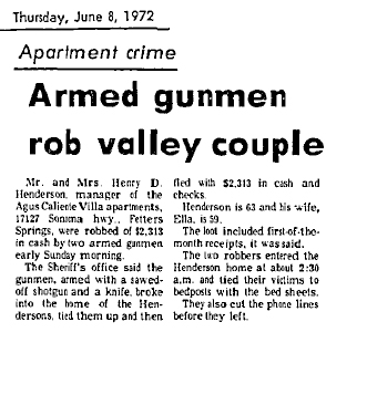
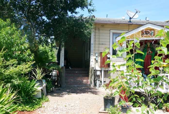
In this alarming article from 1972, the address is listed as 17127 Sonoma Highway.
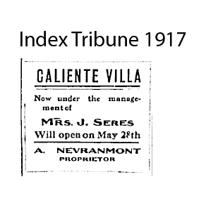
The founders of Caliente Villa in Agua Caliente are not known, but we do know the resort was owned by A. Nevraumont by 1917. Nevraumont was an early resort owner in El Verano, having established El Verano Villa before the turn of the 20th century.
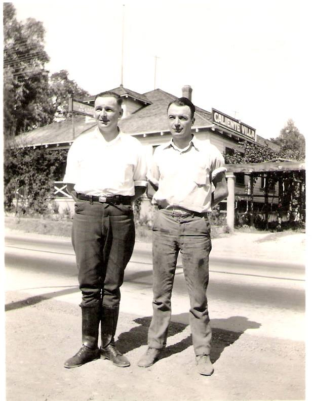
”My Great Uncle Joe Costa and My Great Uncle SFPD Officer Joe O’Rourke – Early 1930’s…Great Shot of Caliente Villa – Behind Them.” Jeff Gilbert via Facebook.
In 1923 the buildings changed hands.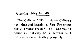
 Courtesy Lynn Downey
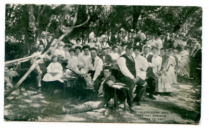
In fact, the Villa went through many owners and managers. In 1920 Mrs. Lewis and Miss Ross were in charge. They…”have leased the (resort) and will conduct the popular springs resort on the apartment plan…” Along with “modern conveniences and comforts,” the new proprietors would provide “a long distance phone” and a “classy jazz orchestra!”
That same year, Lewis and Ross entertained “twenty four members of the Salt Lake City baseball team…Mrs. Lewis and Miss Ross were assisted by a number of young ladies…There was dancing, music and card playing…” and “everything was complimentary, including the smokes, and the boys report a swell time.”
Courtesy California State Library
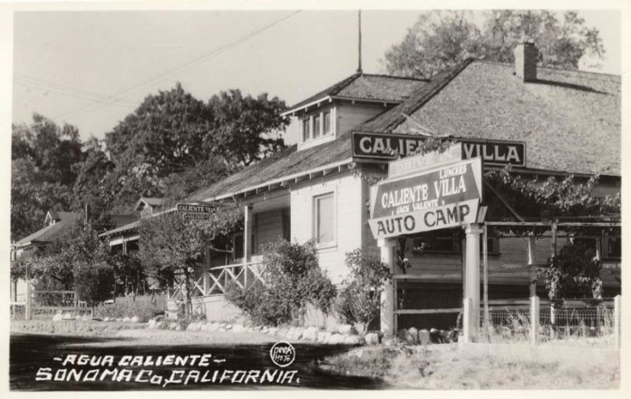
Jack Valente (his name is seen under Caliente Villa in the sign) ran the resort as of 1940. The term “auto camp,” however, was in use at least from the early 1920s. Automobile tourism in Sonoma Valley started before the opening of the Golden Gate Bridge.
Note the dormers on the three buildings shown in the photo.
Several of the buildings were in existence in 1984 when Dan Peterson made his Historic Resource report for Redevelopment.
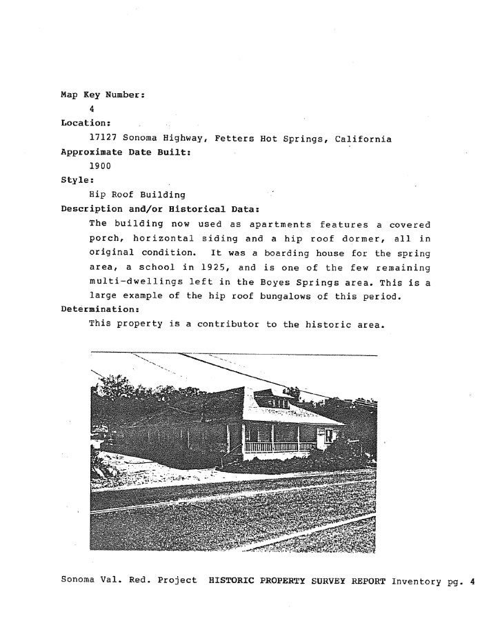
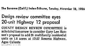
The development proposal in 1986 probably resulted in the demolition of 17127, and it looks like the 20 multifamily units were indeed built.
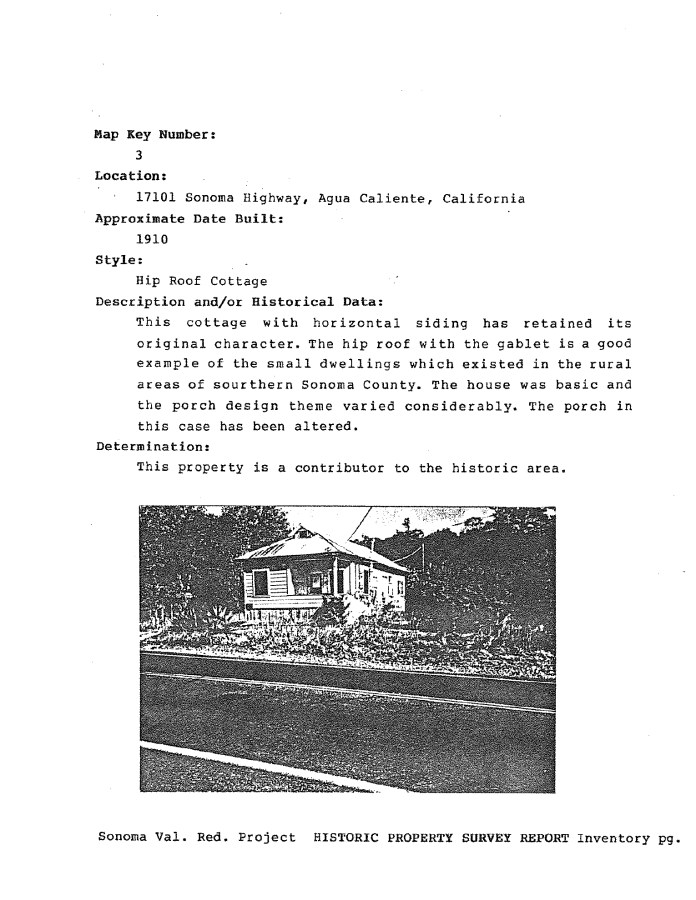
17101 was still there in 2008.
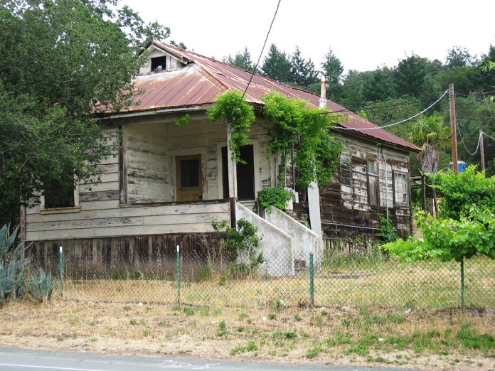
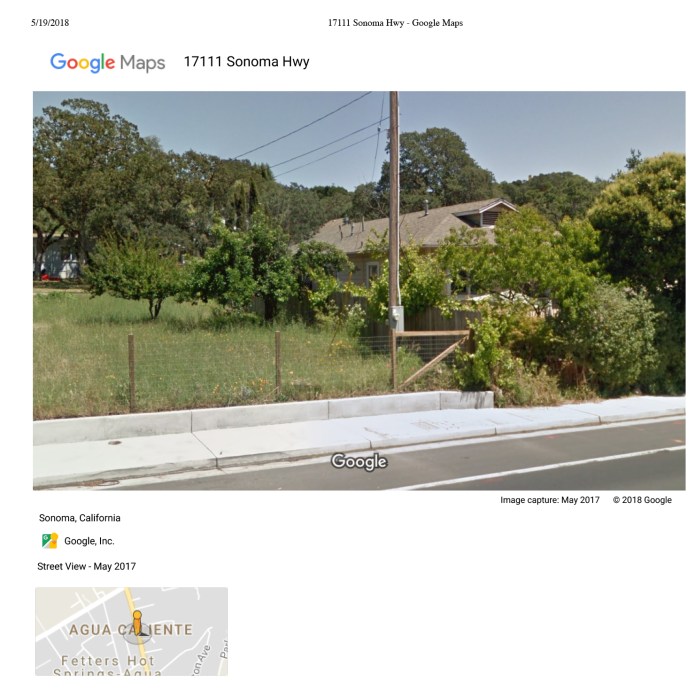
In 2018 only one survives (17123).
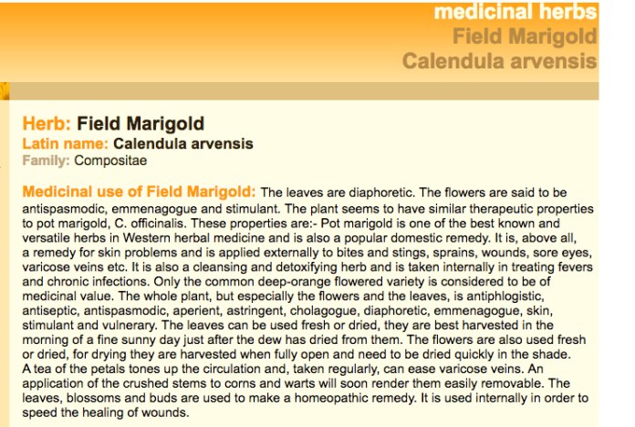
Calendula
UPDATE!

Medicinal Calendula has hit the mainstream (Rite Aid.)
Very early spring 2018, the little calendula are filling many of the open spaces in Sonoma Valley. Some folks think it’s a weed, others love it.
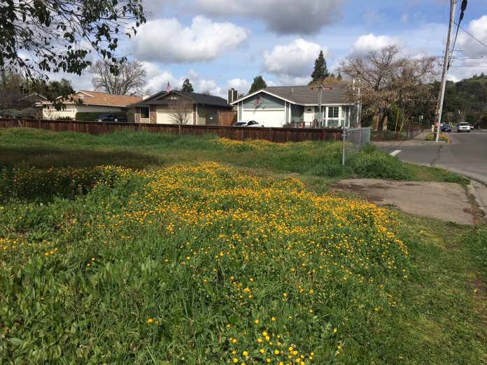
Fifth Street West, Sonoma

Central Ave. Boyes Hot Springs

Central Ave. Boyes Hot Springs

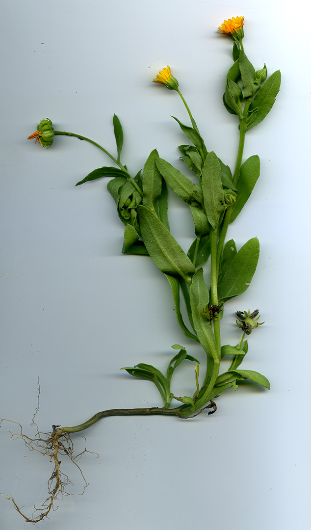
Photo by author
Is it a weed?
“Calendula (probably arvensis, but there is a larger flowered officianalis) is listed on Cal Flora as non-native to our area but not invasive. So it depends on your definition of a weed: any non-native, or the ones that most upset biodiversity? I don’t mind them; they’re pretty and have some medicinal uses. Since they tend to grow in disturbed and/or agricultural areas, no one knows for certain what grew there in the first place, so planting something else with the goal of restoration would involve some guesswork.” Hannah Aclufi via Facebook
According to Wikipedia:
A weed is a plant considered undesirable in a particular situation, “a plant in the wrong place”.
Examples commonly are plants unwanted in human-controlled settings, such as farm fields, gardens, lawns, and parks. Taxonomically, the term “weed” has no botanical significance, because a plant that is a weed in one context is not a weed when growing in a situation where it is in fact wanted, and where one species of plant is a valuable crop plant, another species in the same genus might be a serious weed, such as a wild bramble growing among cultivated loganberries. In the same way, volunteer crops (plants) are regarded as weeds in a subsequent crop.
Many plants that people widely regard as weeds also are intentionally grown in gardens and other cultivated settings, in which case they are sometimes called beneficial weeds.
These little plants tend to inhabit waste spaces, roadsides, and untended open fields. They will grow in gardens, but are easily removed and are not aggressively spreading, like oxalis or dandelions.
So there can be a differing of opinion.
The term weed also is applied to any plant that grows or reproduces aggressively, or is invasive outside its native habitat.[1] More broadly “weed” occasionally is applied pejoratively to species outside the plant kingdom, species that can survive in diverse environments and reproduce quickly; in this sense it has even been applied to humans.[2]
So, let’s not get up on our high horses when deciding what is a weed or what isn’t. Humans are a weed species, but there are some benefits to our existence!

Fifth Street West, Sonoma
Calendula have medicinal uses as a remedy for skin problems as well as an anti-inflammatory.
And, on a taxinomical note:

From the Integrated Taxonomic Information System on-line database, http://www.itis.gov
“There is a lot of magic in the naming of things. It is my contention that the more we know about nature’s secrets, the more we can enjoy it. Simply being able to call the elements of nature by their proper names helps us to experience them and allows their beauty to unfold…” Obi Kaufmann, The California Field Atlas.
“I find the Latin names for the plants as beautiful as the plants themselves … “ Wyethia Angustifolia (Hannah Aclufi) https://viridiplantae.com/about/
New to the Valley of the Moon Historic Photo Database
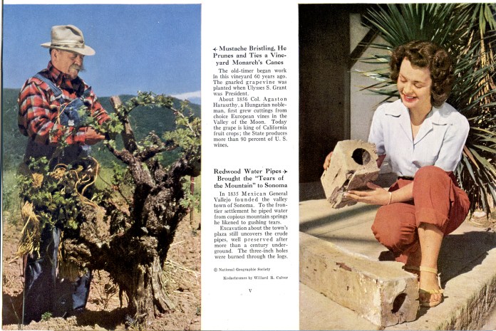
From the 1948 National Geographic article on “Hap Arnold’s Valley of the Moon.”


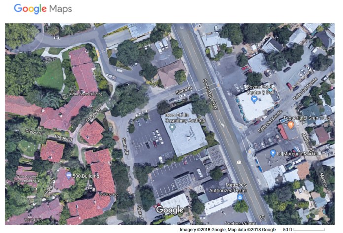
Sierra Drive/Meincke Road
At the corner of Highway 12 and Sierra Drive stands the building housing Ross Drulis Cusenberry Architects. The building was built in 1966 for Sierra National Bank. It seems that the street, originally known as Meincke Road, was probably renamed for the bank. The street also has the distinction of being on the former Northwest Pacific Railroad right-of-way.
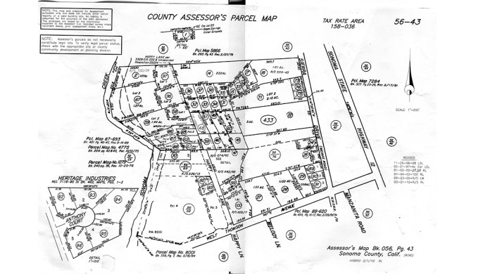
Assessor’s Parcel Map showing Meincke Road/Seirra Drive
On July 15, 1942, a hearing by the Interstate Commerce Commision in Santa Rosa pitted the War Department and the Southern Pacific Company against the Sonoma Valley Chanber of Commerce, Sonoma State Hospital, and the Sonoma Vista Improvement Club in a debate about whether the rail line between Sonoma and Glen Ellen should be abandoned (passenger service had ended in 1935). The Feds claimed that the line was not needed for the war effort as almost all frieght was brought into the valley by truck, and the SP pointed out that the line had lost money for years. However, Dr. Fred Bultler of the State Home said that his institution had been designated the main hospital for the region should a coastal evacuation be necessary. The Home had been mandated to provide 500 beds on two hours notice and that the rail connection would be required to supply this additional population. The Home had 3200 “inmates”, as he called them, and 450 employees at the time.
Southern Pacific prevailed, however, and by January of 1943, the rails were gone, freeing the stretch between the Mission Inn and West Thomson Ave. to become a road.
The street was probably originally named for George Meincke, a school bus driver, chauffer for the Spreckles family, fire commissioner, and local property owner. However, two other Meinckes were prominent enough in the Springs, midcentury and before, to also be the namesake: Charles Meincke and H. Meincke.
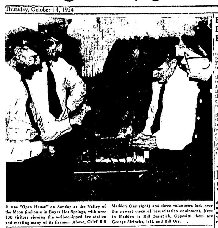
George Miencke with fellow Fire Commissioners at a fire station open house in 1954.
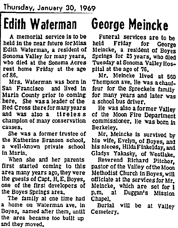
Interestingly, the obituaries for George Meincke and Edith Waterman appeared next to each other in the January 30, 1969 edition of the IT. Both had streets named for them, or their family in Ms. Waterman’s case. The Waterman family goes back a little farther than Miencke’s. Her obit notes that “When she and her parents first started coming to this area many years ago, they were guests of Capt. H. E. Boyes…”
The Boyes Hot Springs Company was incorporated in 1902, with August Waterman as one of the directors.
Sierra Bank
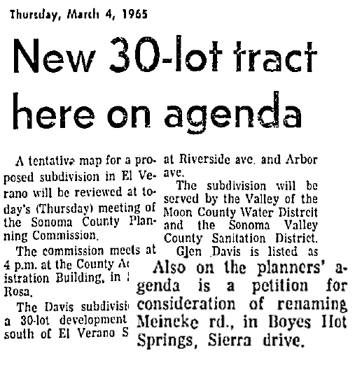
A very low key announcement of the proposed name change appeared in the IT in March of 1965.
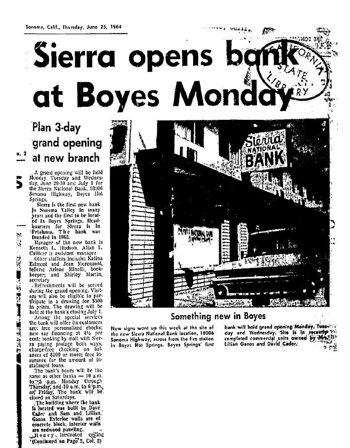
Sierra Bank first opened in a storefront on Highway 12 in 1964. The address was 18006, now a liquor store (2018). It was front-page news in the Index Tribune. This was the first bank to open in Sonoma Valley outside of the town of Sonoma.
The new bank building was also a major project for Boyes Hot Springs in 1965 when it was announced.
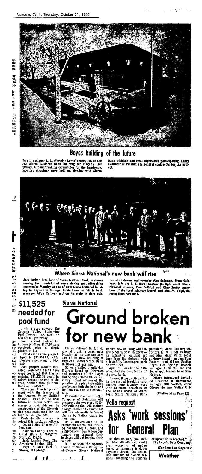
Among the luminaries attending the groundbreaking were Bud Castner, and Tom Polidori, prominent Springs businessmen. (Notice the article at bottom left. In 1965 they were fund raising for a new swimming pool.)
The Oak Tree at Sierra Drive
Just south of the Sonoma Mission Inn, on the west side of Highway 12, Sierra Drive intersects.
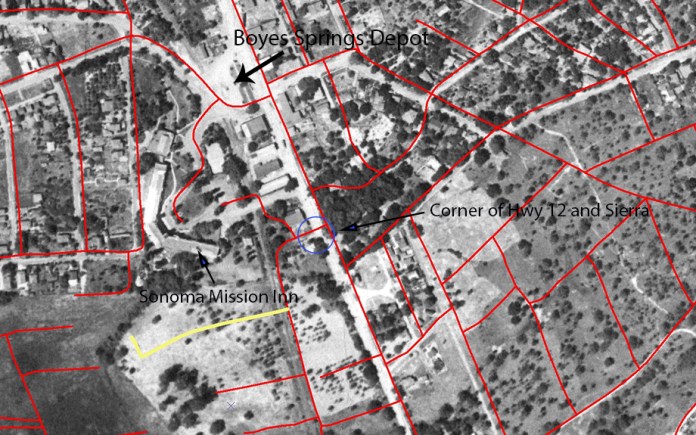
Aerial photo with streets courtesy of Arthur Dawson
At that corner stands one of our landmark oak trees. The tree is in front of the building that now houses Ross Drulis Cusenberry Architects. The building was built in 1966 for Sierra National Bank. It seems that the street, originally known as Meincke Road (more on that later), was renamed for the bank. The street also has the distinction of being on the former NWPRR right-of-way (the tracks were removed in 1942).
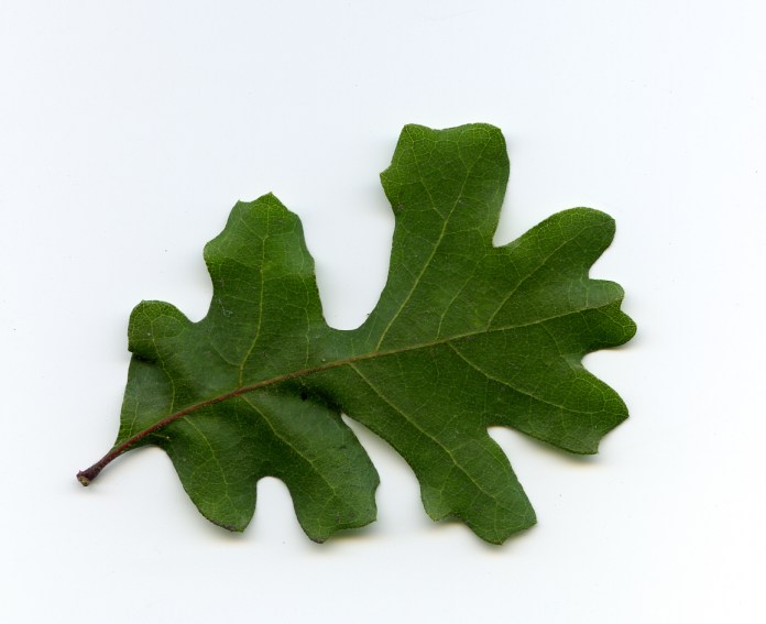
Our tree is a Valley Oak, Quercus lobata. According to the California Native Plant Society (http://calscape.org/), the Valley Oak ranges over the interior valleys of the State, and needs to be near a source of water (Lily Creek*, which flows down Arroyo Road, tunnels under the highway very near the tree.) It can grow to 100’ in height and live for as many as 500 years. The tree in question, which has three trunks, certainly could be 100 years old. We have a photograph of the tree (and building) from 1973, which shows it to be in pretty poor shape. In 2018 it appears to be much healthier.
*Thanks to Greg Larson for the creek name.
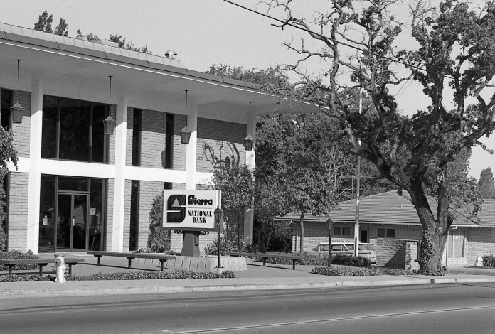
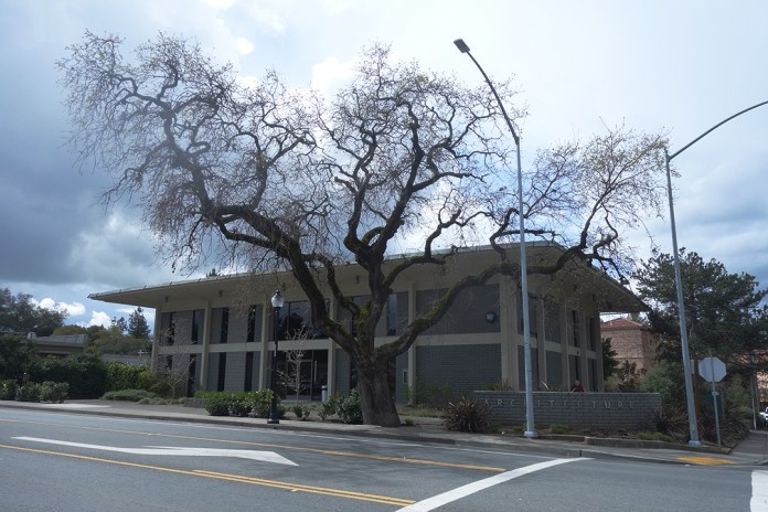
1973 top. 2018 bottom. Top photo courtesy of the Sonoma Valley Historical Society.
The tree may appear in some other historic photos.
Boyes Depot, 1930s, (approximately located in the parking lot behind the Plaza Center Building), looking north to Sonoma Mountain. The oak in the foreground is possibly the Sierra Drive tree.
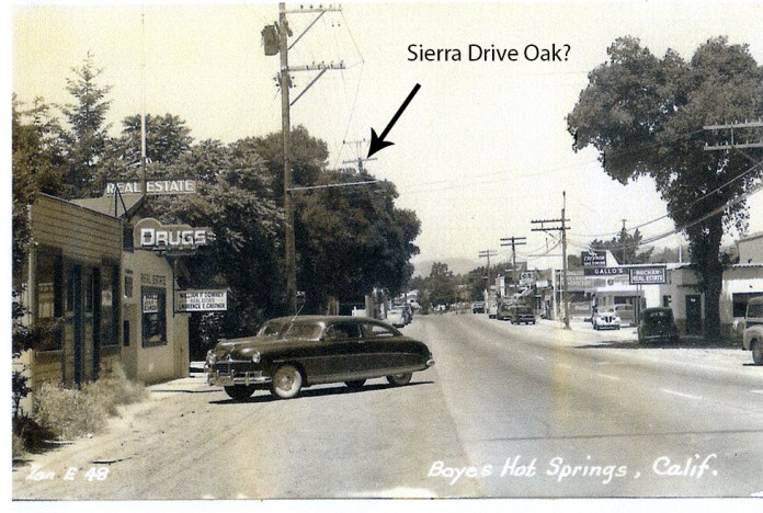
Photo by Zan Stark, 1950s. The location is opposite Arroyo Road on the Highway.
Oaks are never more beautiful than in winter.
Next post: About Sierra Drive/Meincke Road.
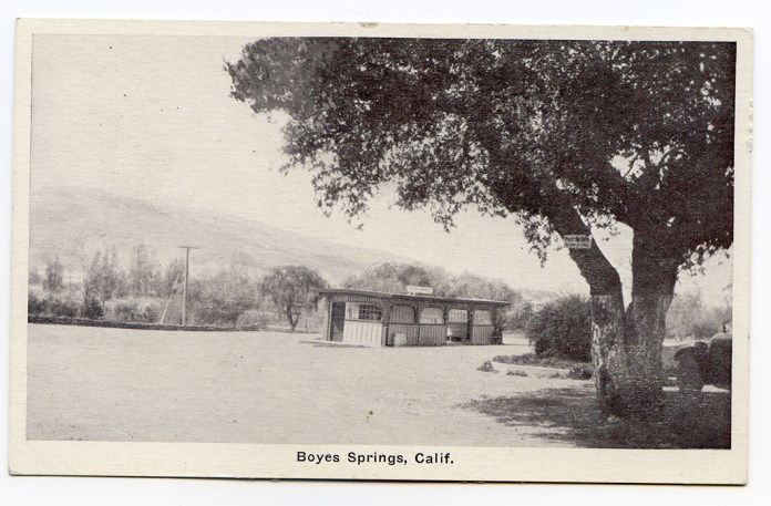
New to the Valley of The Moon Photo Database
 Postmarked 1908
 Postmarked 1909
The Olive Grove Tract
The Olive Grove Tract: Where was it? What is the history of the trees? And where did the church go?
According to a Santa Rosa Press Democrat article from 1942, “Edwin P. Thomson, who many years ago owned the site of Fetters Springs…in 1887, planted the olive grove that now borders the highway between Fetters and Boyes Springs.” In 1946, the PD tells us that “Twenty-five acres of olive grove property fronting the state highway in Boyes Hot Springs and extending down to the ballpark, will soon be made available as an exclusive business and residential subdivision…” the owners were Bill Johnson and Rudy Lichtenberg, who also owned and managed the Boyes Bath House. Both men have streets named after them in that area.
Bill Johnson at the Boyes Bath House
(Courtesy of the Sonoma Valley Historical Society)
This map, from the website 321 Houses.com, shows an area which they call “Olive Grove.”
UPDATE: Below is the Recorder/Assessor map of the subdivision. It is dated 1947.
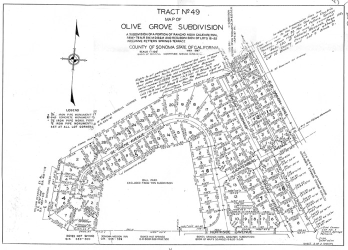
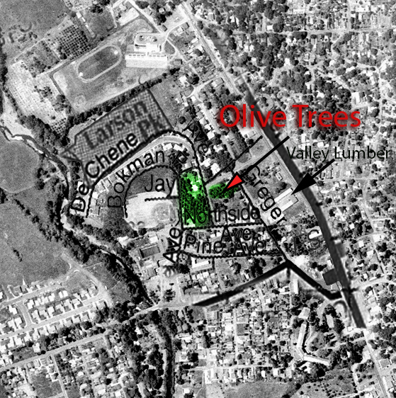
This is part of an aerial photograph from 1961, with a few street names superimposed. At that time, Bokman Avenue did not exist. Bokman approximately follows the outfield fence of the Boyes Springs Ball Park, which can be seen left center of the photo.
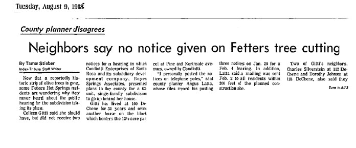
According to an IT article from 1988, the trees covered an area of 12.5 acres at that time. The trees were bulldozed in 1988, much to the dismay of local residents. See below.
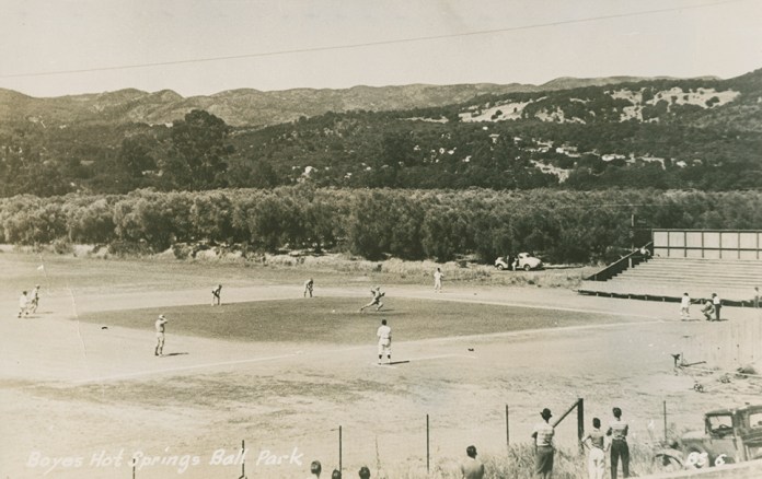
Zan Stark photo showing olive grove behind the ball park (to the east.) Courtesy, Stanford University Library, Special Collections.
At various times, various people have made the claim that the trees in the Olive Grove tract were planted by M. G. Vallejo. This was asserted and denied in 1988 when the trees were removed. Real estate agents and B + B proprietors still use this “information.”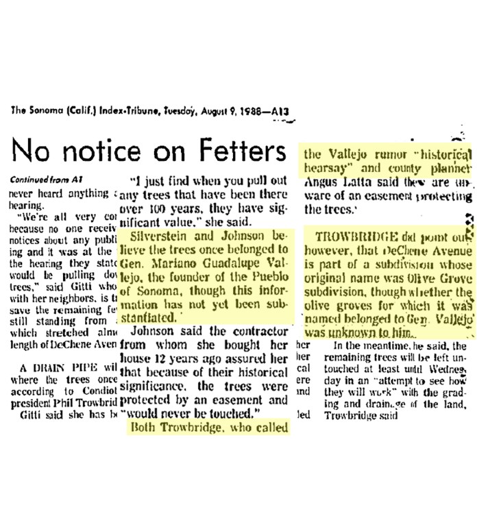
(Copy from online advertisment, below)
Property Details for 17600 Johnson Ave
This property is no longer available to rent or buy. This description is from May 03, 2010
Experience this darling 1949 Turn-Key home in the heart of the Wine Country! This meticulous 2 bedroom, 1 bath home features a spacious vintage kitchen, and a light and bright living room. The private back yard is a gardener’s delight that includes a patio, a deck and plenty of shade provided by two mighty olive trees that were once part of General Vallejo’s olive grove. Minutes from the Sonoma Plaza, restaurants and wineries.
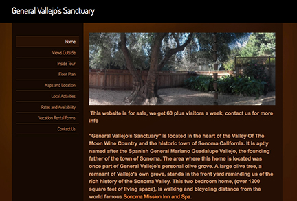
”The area where this home is located was once part of General Vallejo’s personal olive grove.”
As mentioned above, the remaining trees were removed in 1988.


Olive trees on DeChene Ave. in 2017. (Author’s photos) Many of the existing trees in the area seem very old. They could be survivors from Thomson’s orchard.
The Valley of the Moon Community Church.
The Valley of the Moon Community Church was located in the Olive Grove tract.
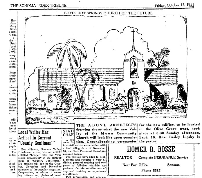
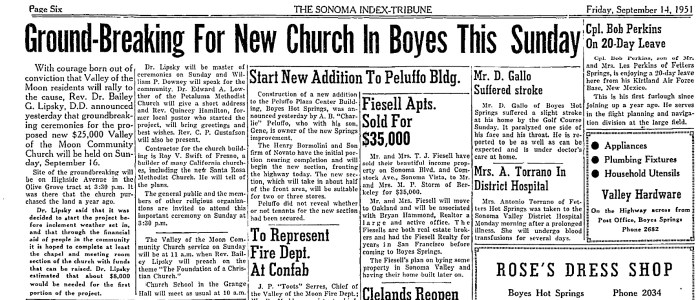
In September of 1951, the foundations were poured. Fourteen months later, “The handsome church building is slowly but surely nearing completion.” In August of 1953, the church building was in use.


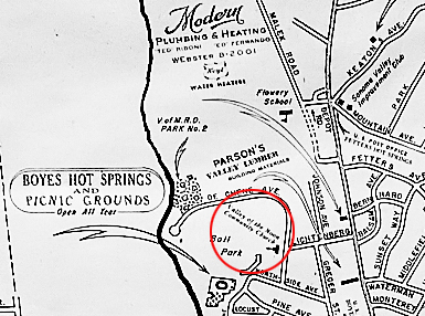
This Chamber of Commerce map, courtesy of the Sonoma Valley Historical Society, from the 1955 shows the VOM Community church approximately where Lichtenberg St. comes into DeChene Ave.
This is the last mention of the Church in the IT. What happened to the congregation? What happened to the church building?
Many thanks to Joanna Kolosov of the Sonoma County History and Genealogy Library for information from the Press Democrat and other sources.
Regrettably, we have lost track of the name of the gentleman who loaned the 1961 aerial photograph. The photograph was provided to him by Sonoma County.
