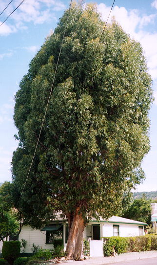
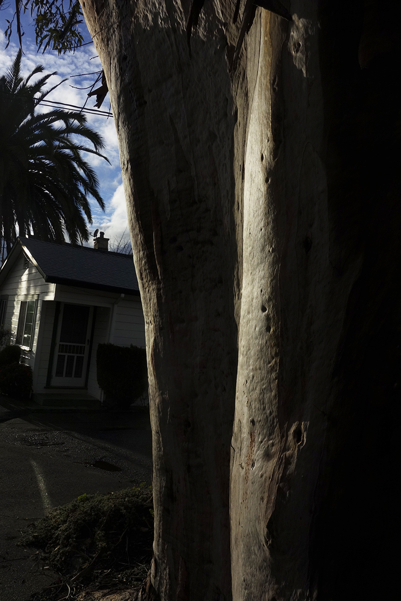
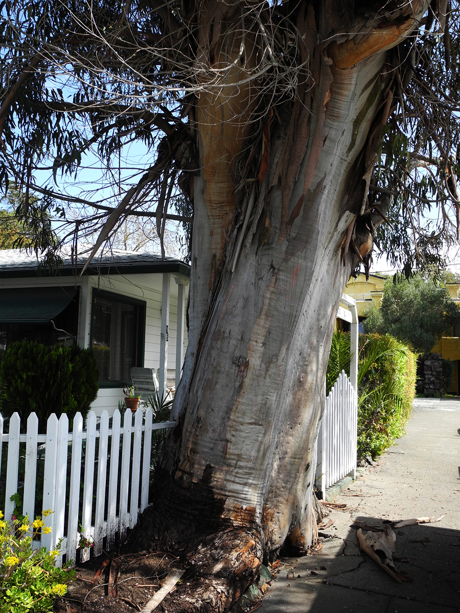
It’s always sad when we lose a tree. I called it “the Big Euc.”
I know eucalyptus are exotic, invasive, and sometimes dangerous (they are highly flammable and may have other impacts, but the story is not only negative: see https://ucanr.edu/site/igors-urban-website/eucalyptus-california) .But they are, by now naturalized in California and in our minds. We have grown up with them. Their fragrance is embedded in our olfactory cortexes. The beauty of their variegated bark delights.
This friend grew on Vallejo Ave. near Highlands Blvd. in Boyes Hot Springs. Probably a volunteer, it may have sprouted around the time the motor court behind it was built, possible just after the 1923 fire. https://springsmuseum.org/2017/11/01/fire/
2007
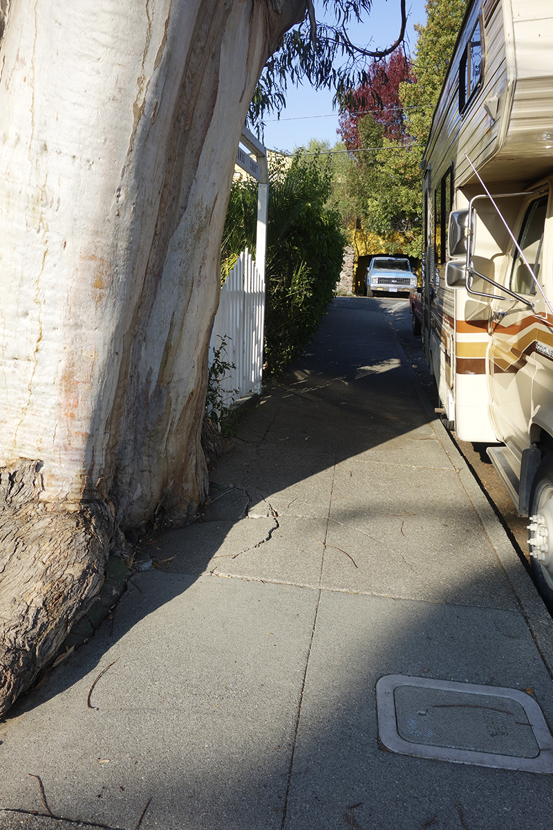
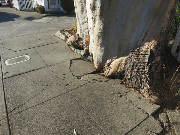
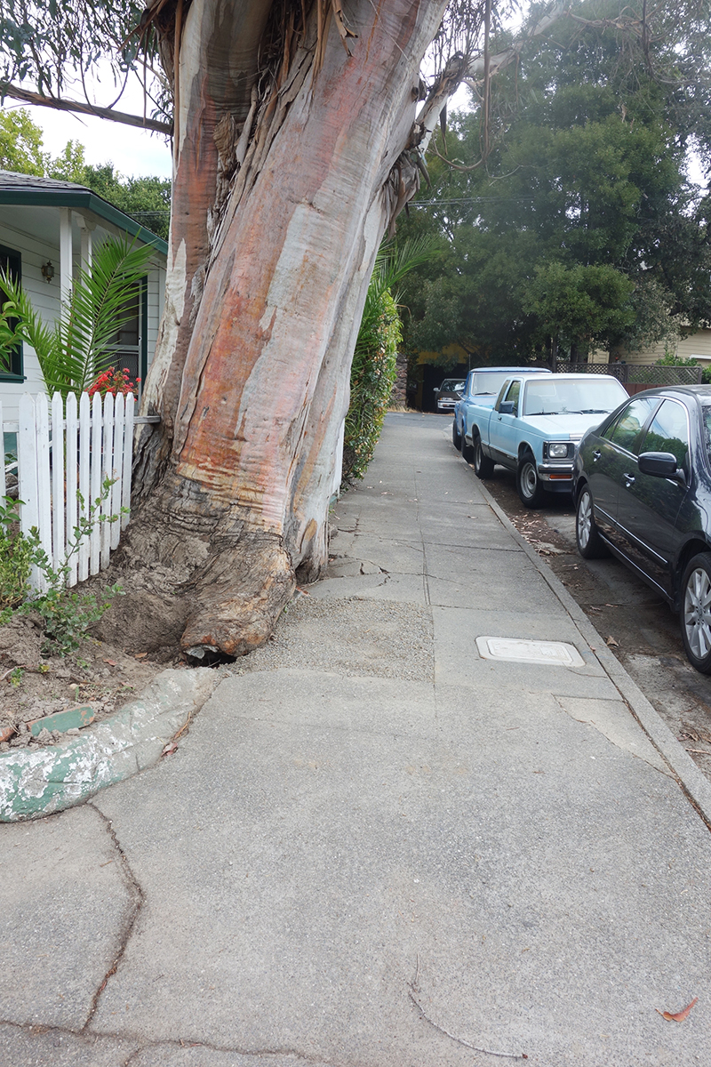
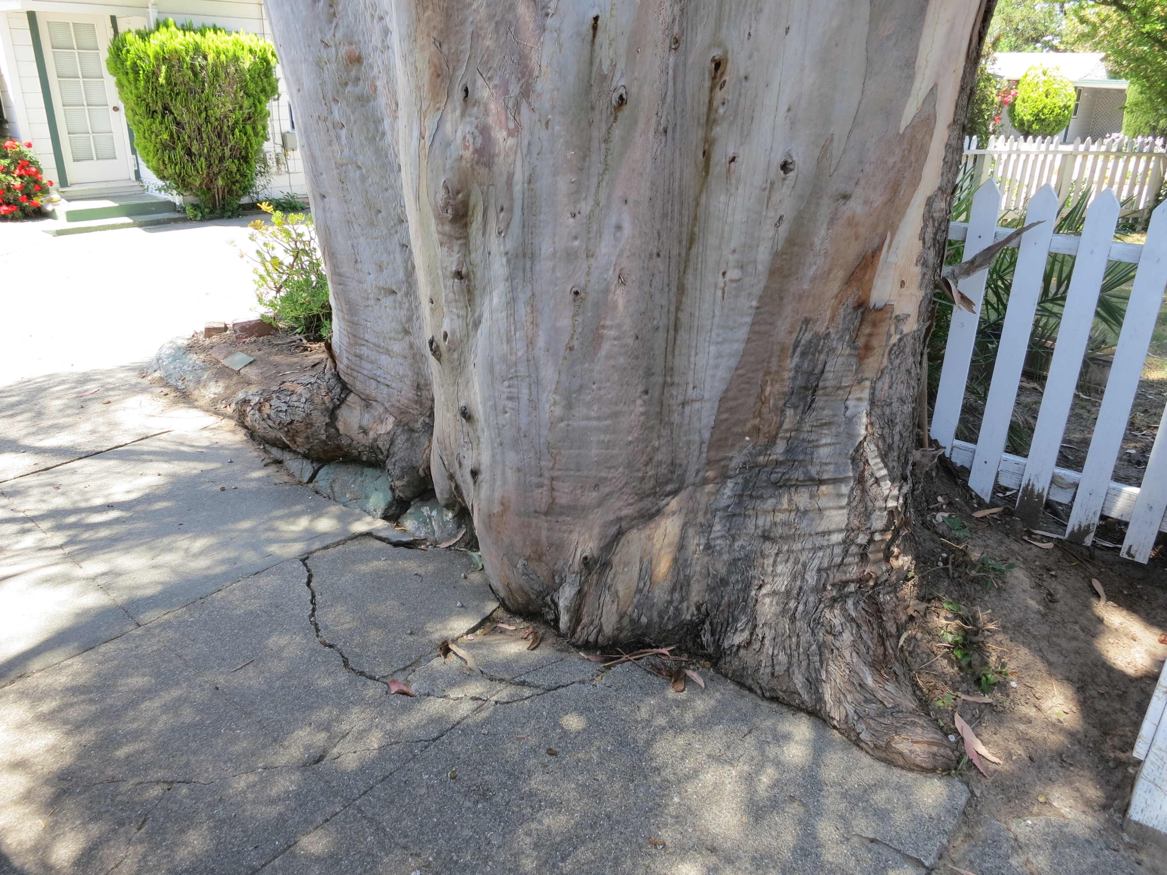
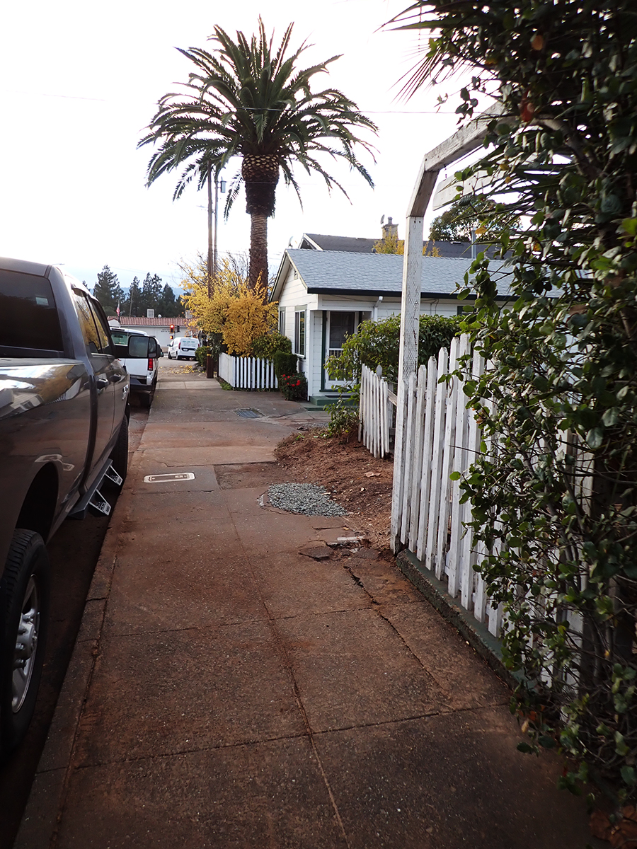
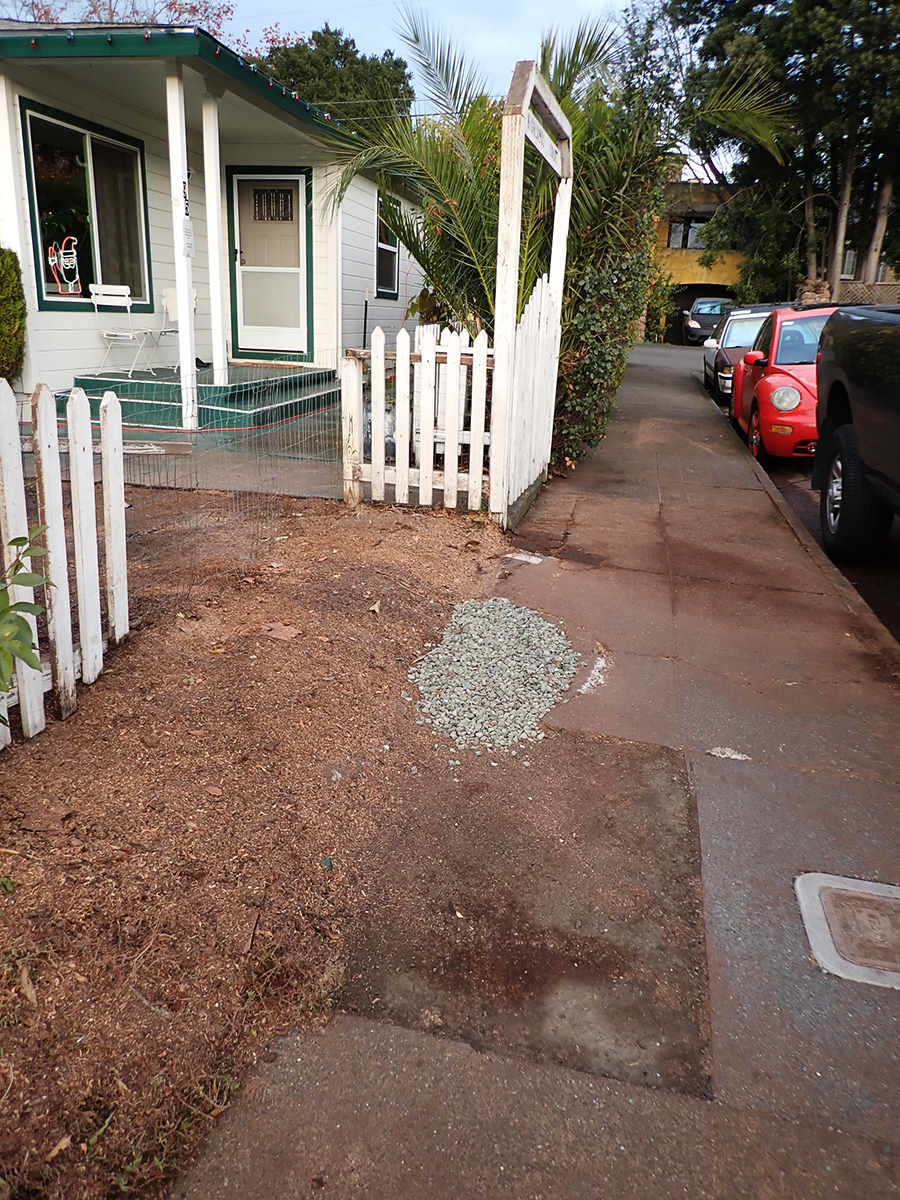
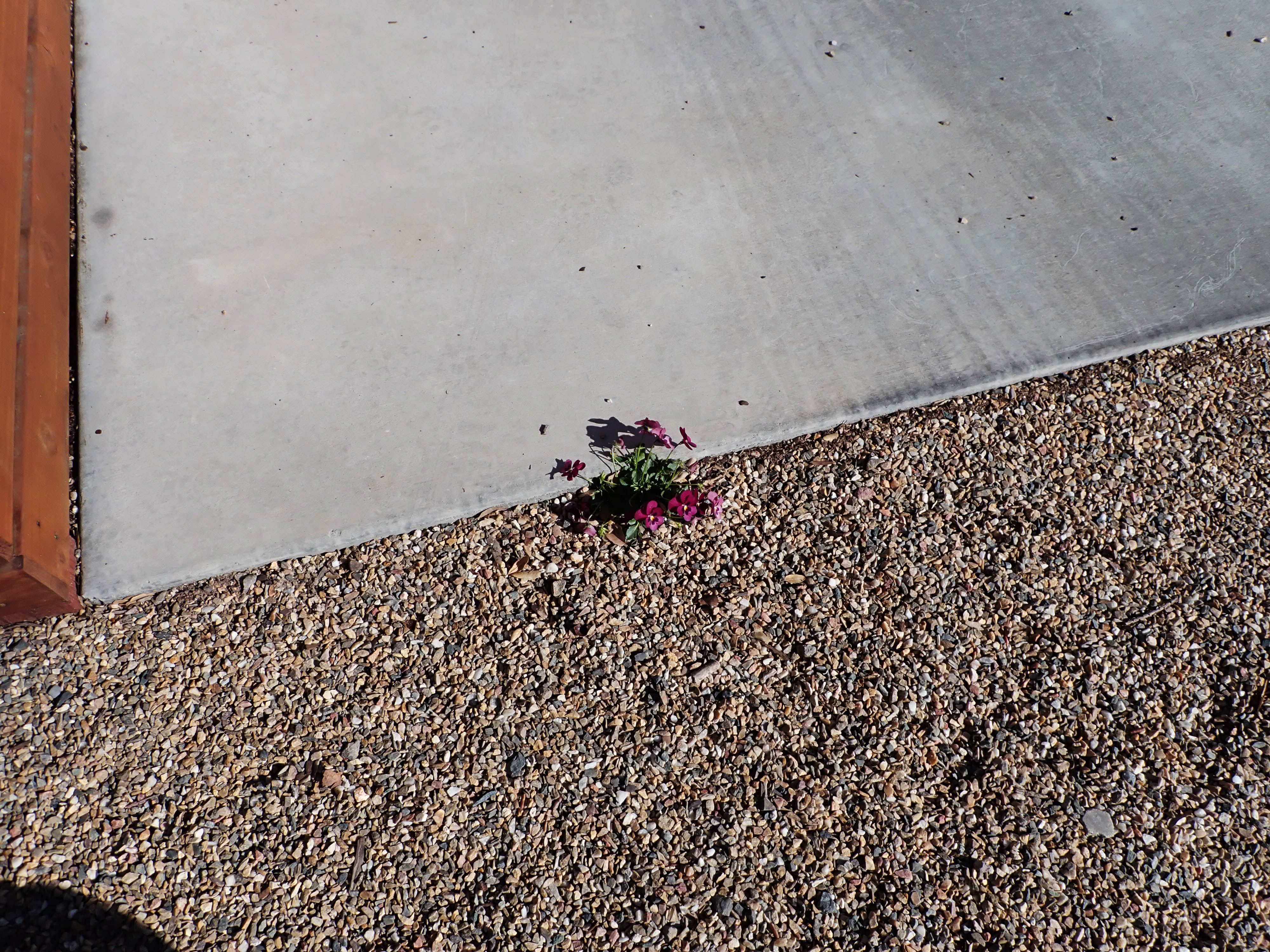
I actually liked the way this tree was grinding up the concrete sidewalk, like a very slow motion wave of living wood. I have special place in my heart for the interaction of trees and the built environment.
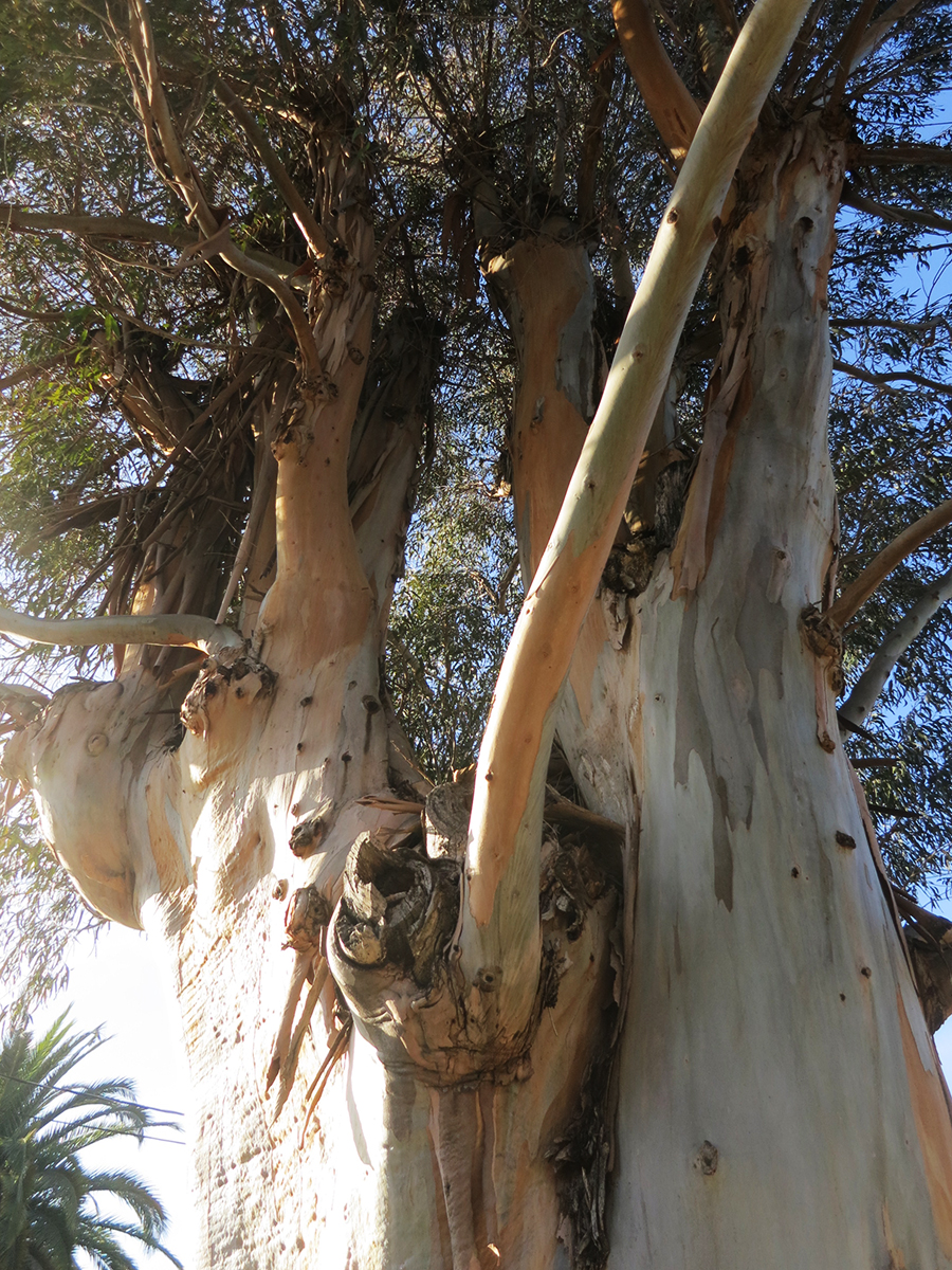
Makes beautiful shadows.
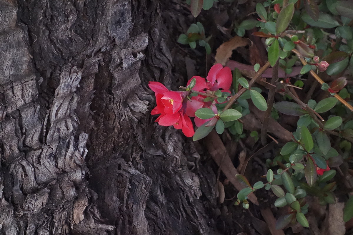
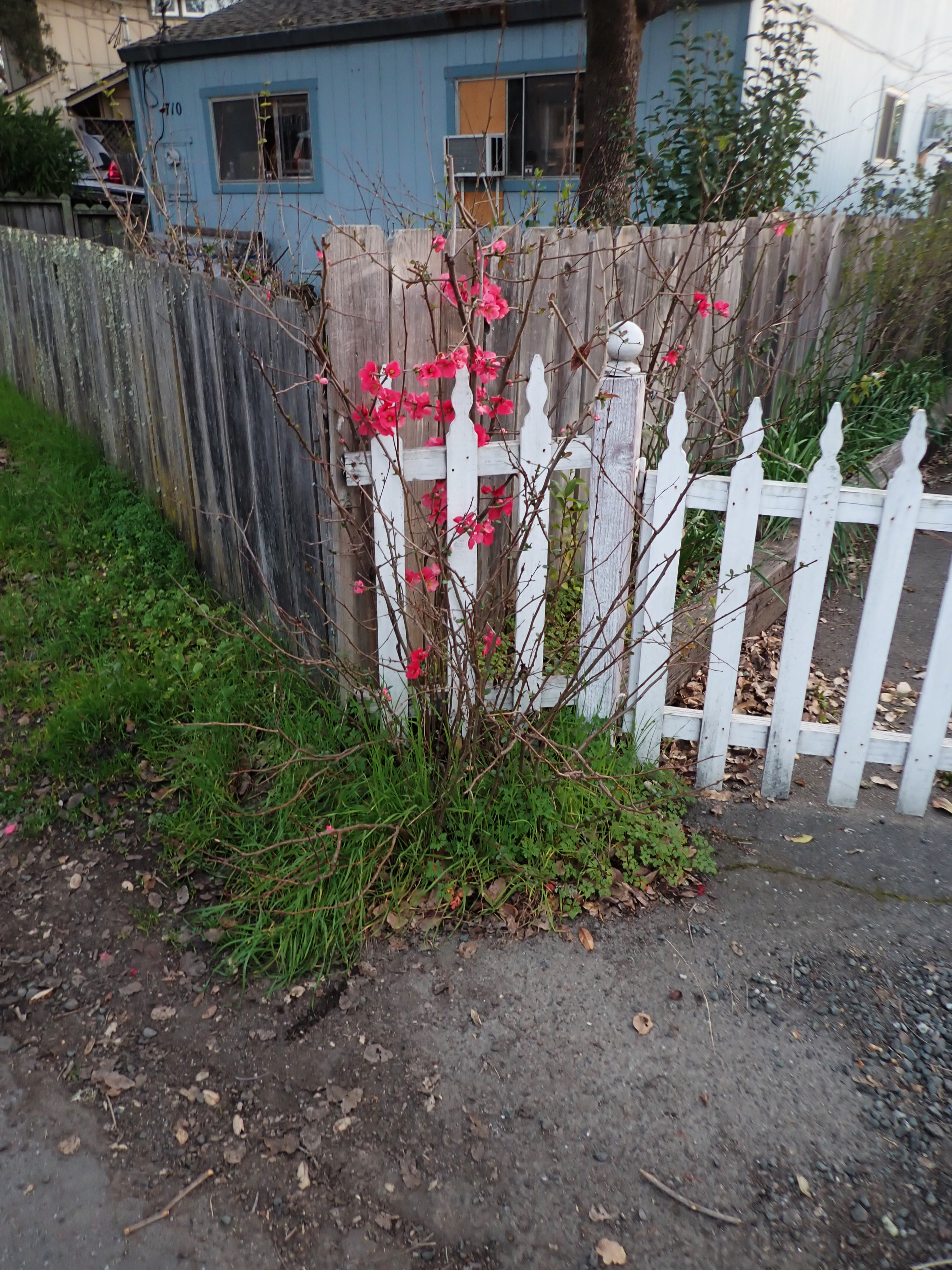
This quince volunteer bloomed every February for Lunar New Year.
Eventually a piece of the concrete was removed for some underground plumbing repair and replaced with crushed rock.
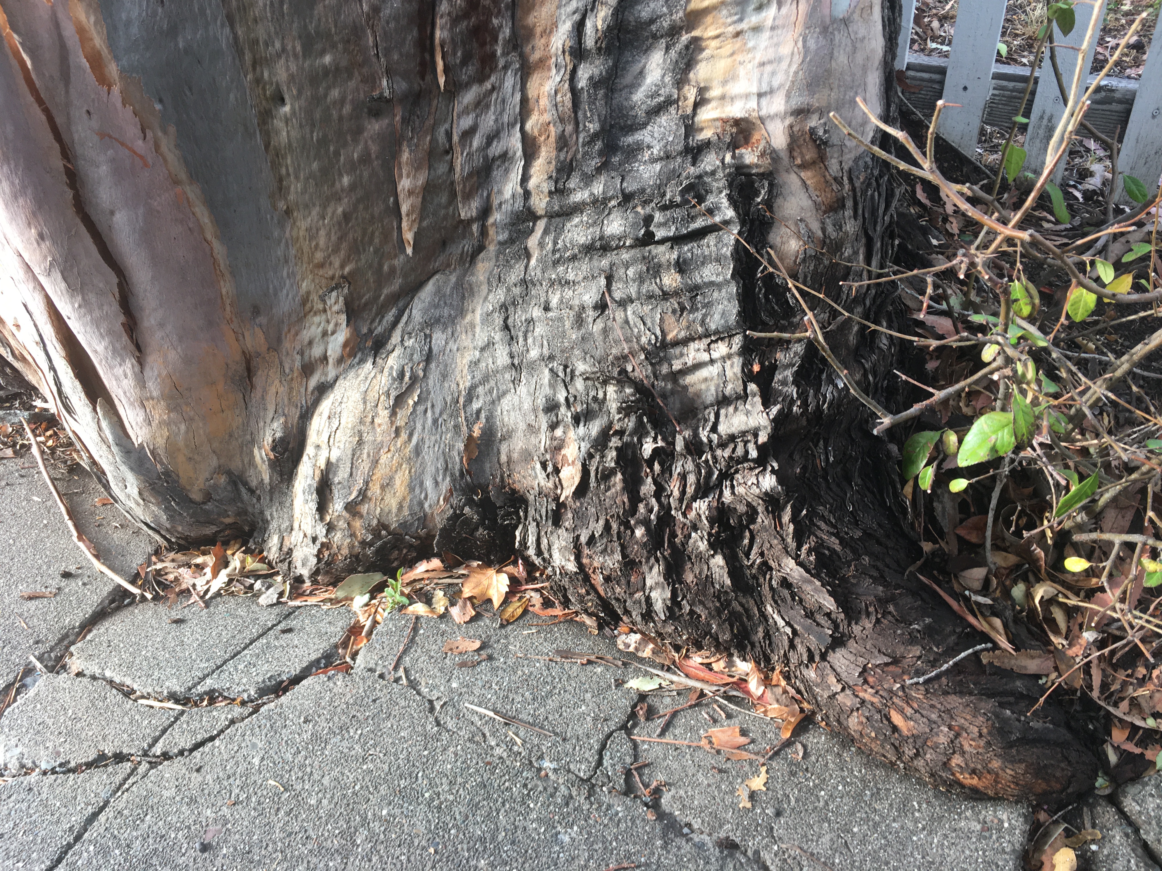
The green concrete curb continues to be submerged in tree.
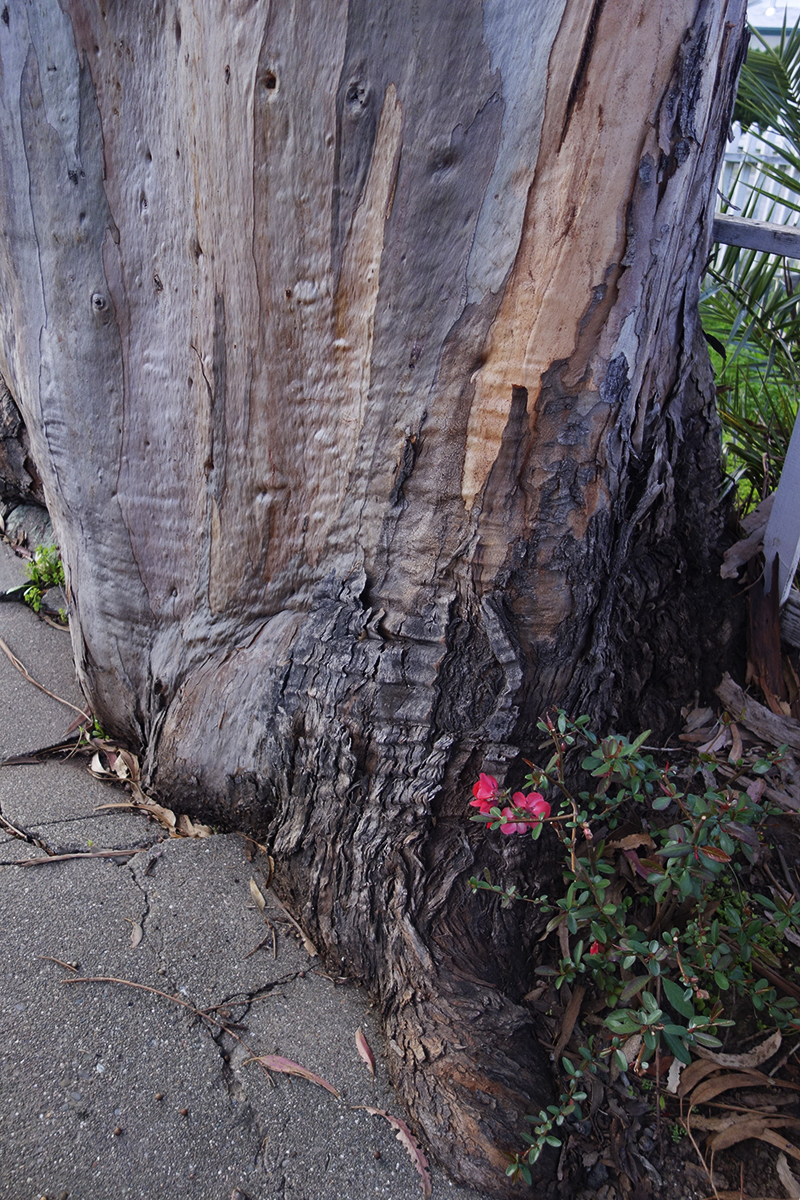
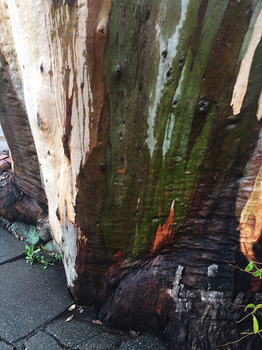
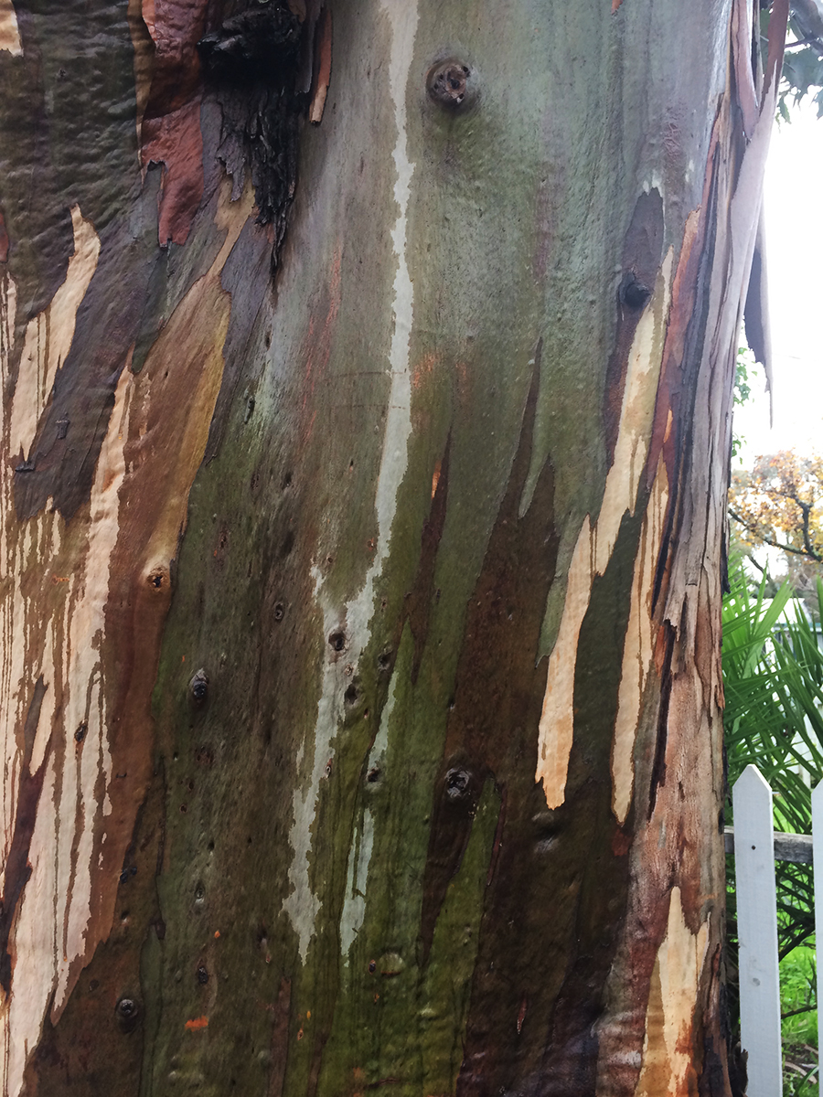
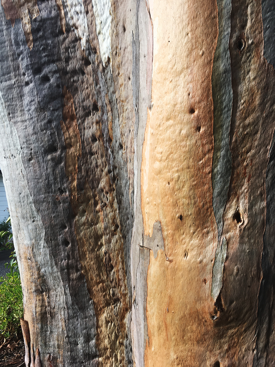
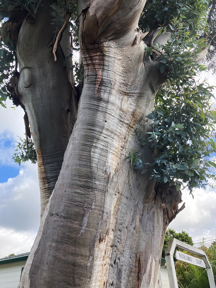
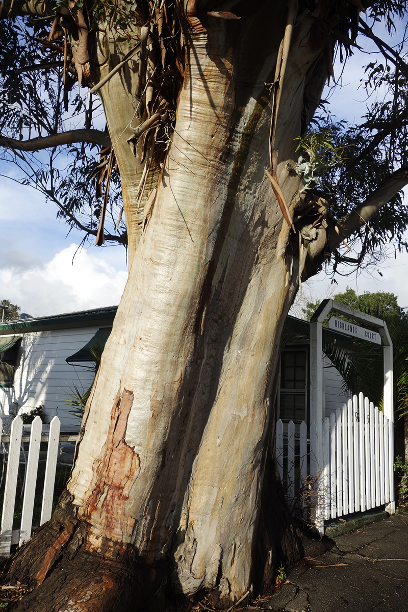
Some beauty shots.
The wet bark is even more beautiful, and the fragrance intensifies.
So limb-like, sensuous.
December 2025
Just a memory
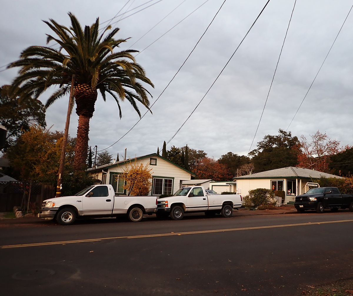
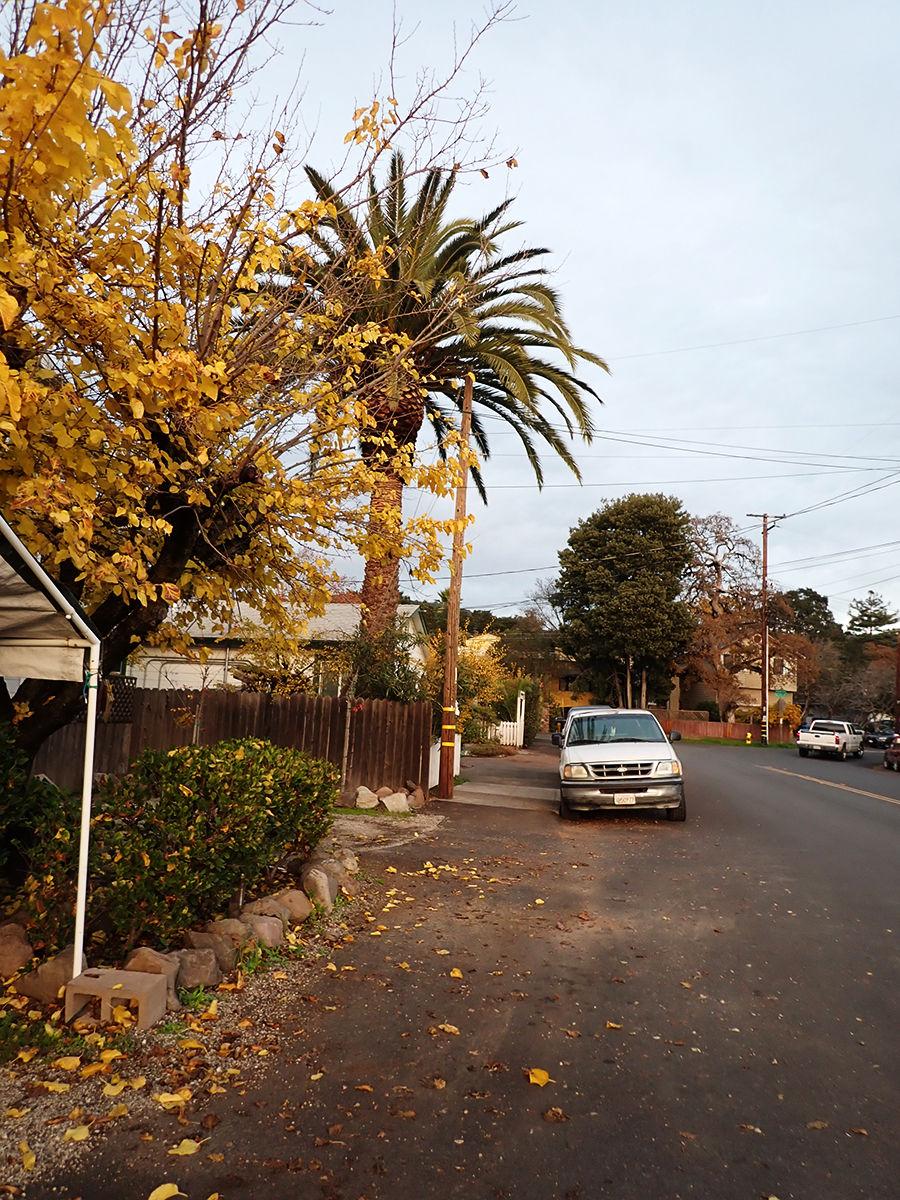
The palm stands alone
“Bark and Bite.” Painted photo collage circa 20″x30″. 2019. Michael Acker
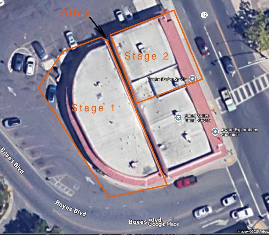
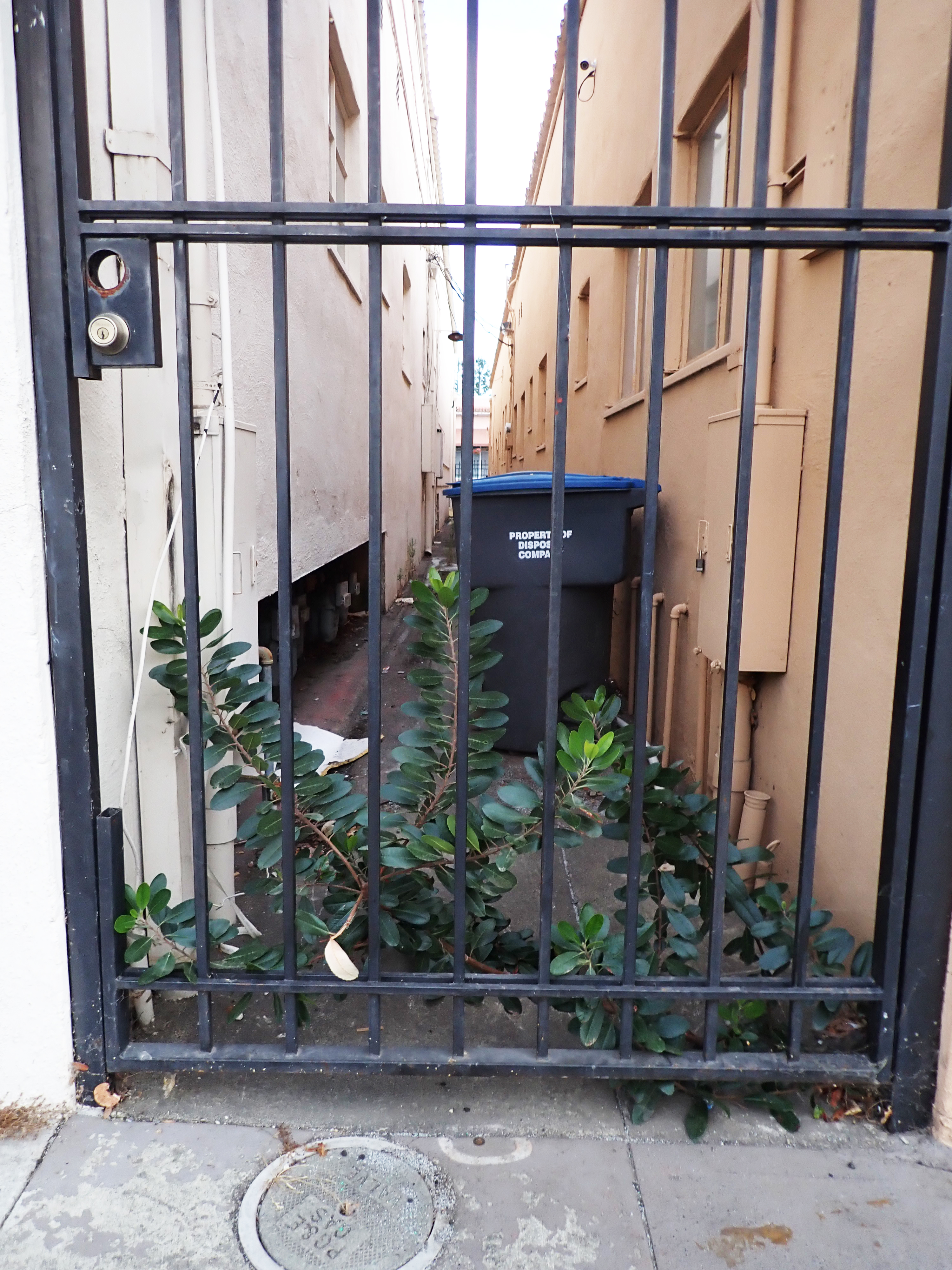
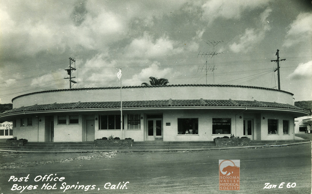
The Plaza Center Building was built in stages between 1951 and 1958. The first stage was built with the graceful curve which followed the property line. The second fronted Highway 12 next to the first one. They were separated by a narrow alleyway. (The third stage was the building occupied by the Post Office today.)
Screenshot
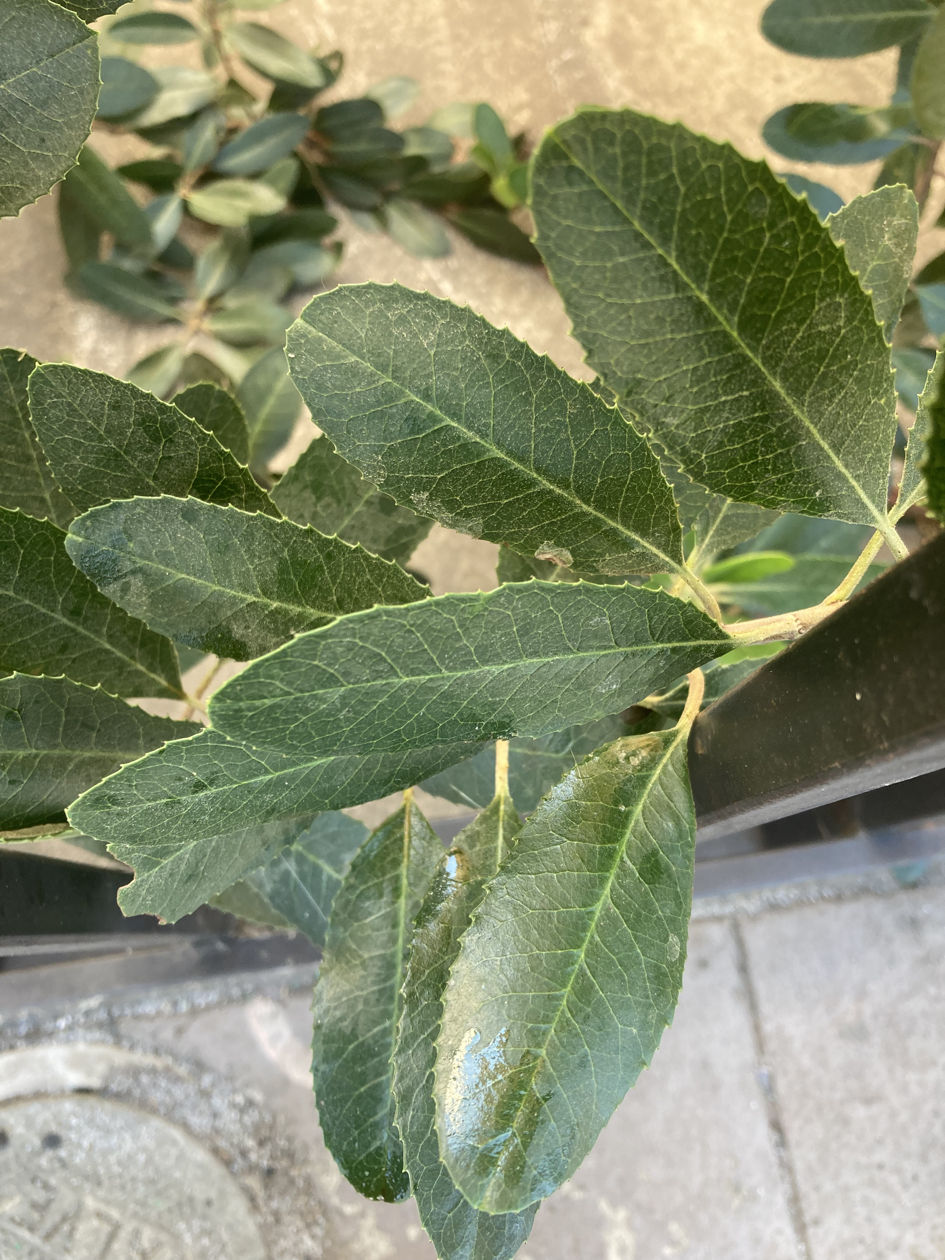
At the north end of this alley we find a healthy looking toyon (heteromeles arbutifolia), a native plant. According toCalscape “Toyon is a prominent component of the Coastal Sage Scrub plant community, and is a part of drought-adapted Chaparral, Mixed Evergreen Forest and Oak Woodland habitats.” Also “The flowers attract butterflies and other pollinators. The berries are eaten by many birds, including Mockingbirds, American Robins, and Cedar Waxwings. Mammals including coyotes and bears also eat and disperse the berries. For humans, the berries are edible after cooking, or drying and crushing, in order to break down the small amounts of cyanogenic glycosides. Indigenous People use the berries to make cider, and a granular sugar.”
A Neighborhood Phenomenon for sure. Waste space occupied by a native plant, and one that was important to the Indigenous people of California. Located just a few feet from the original geothermal water source, probably used by local Indians, it’s healing properties well known to them, it is a link to that 10,000 year-long pre-contact history of the area. Also, anything that’s good for Cedar Waxwings is OK by me!
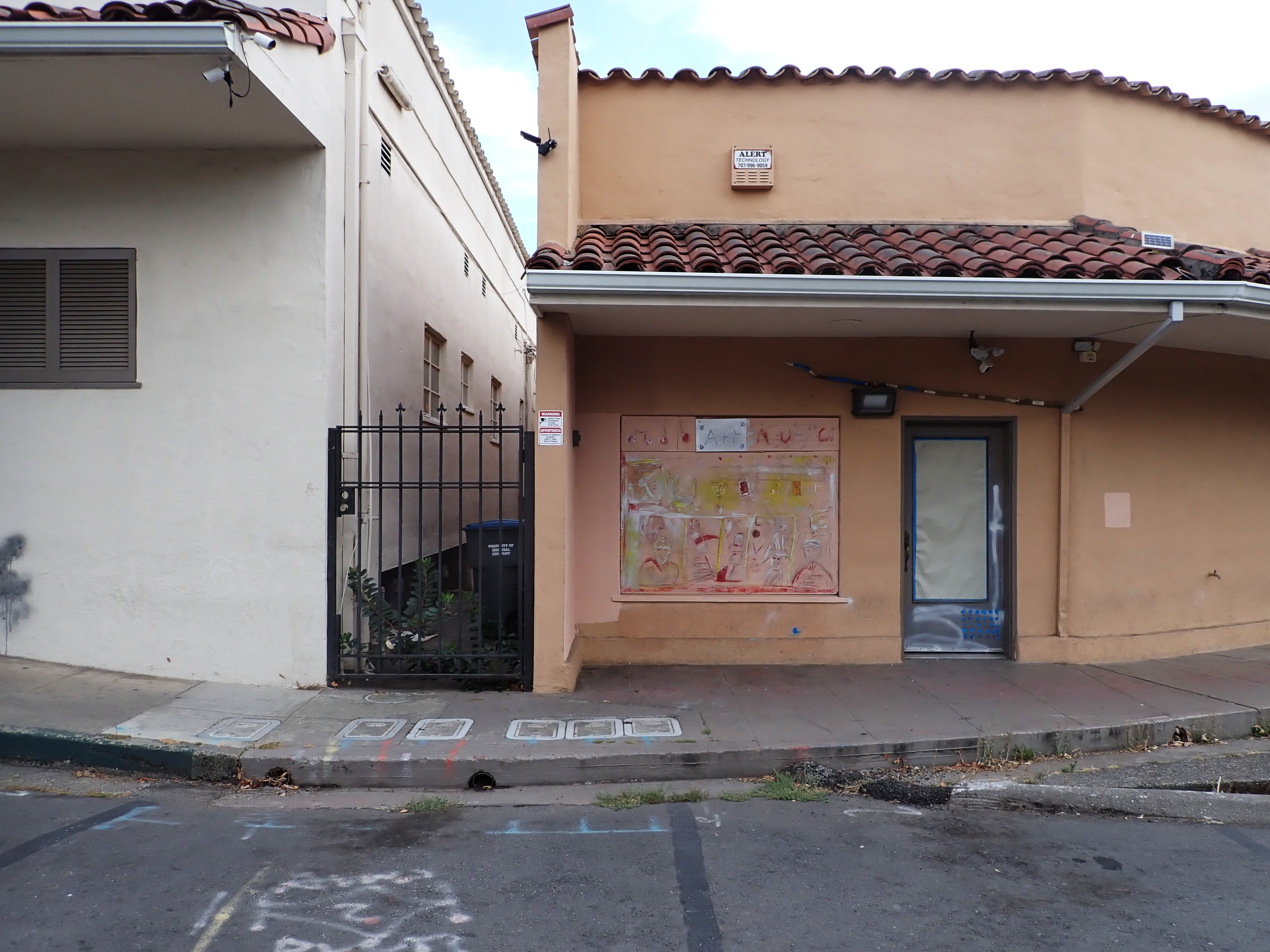
Immediately adjacent, some spontaneous street art, which should serve as a strong suggestion for what to do with the rest of that building, which is currently more than half empty.
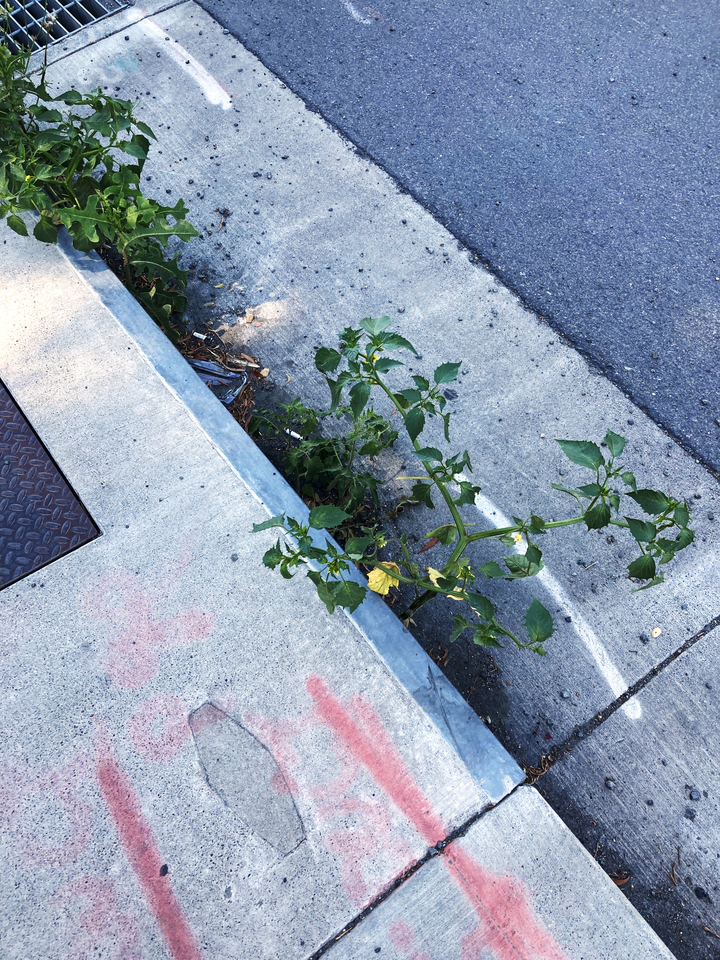
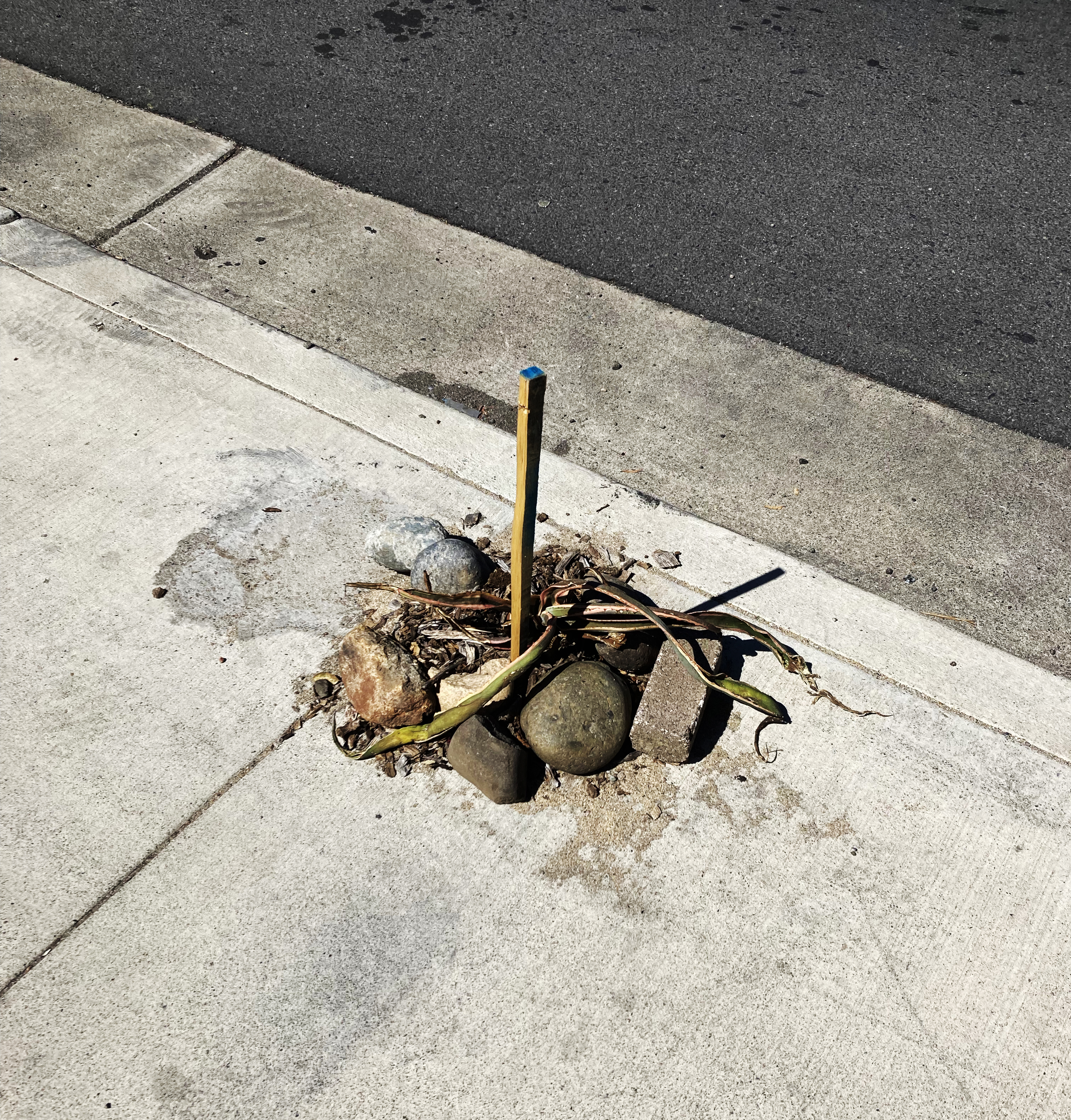
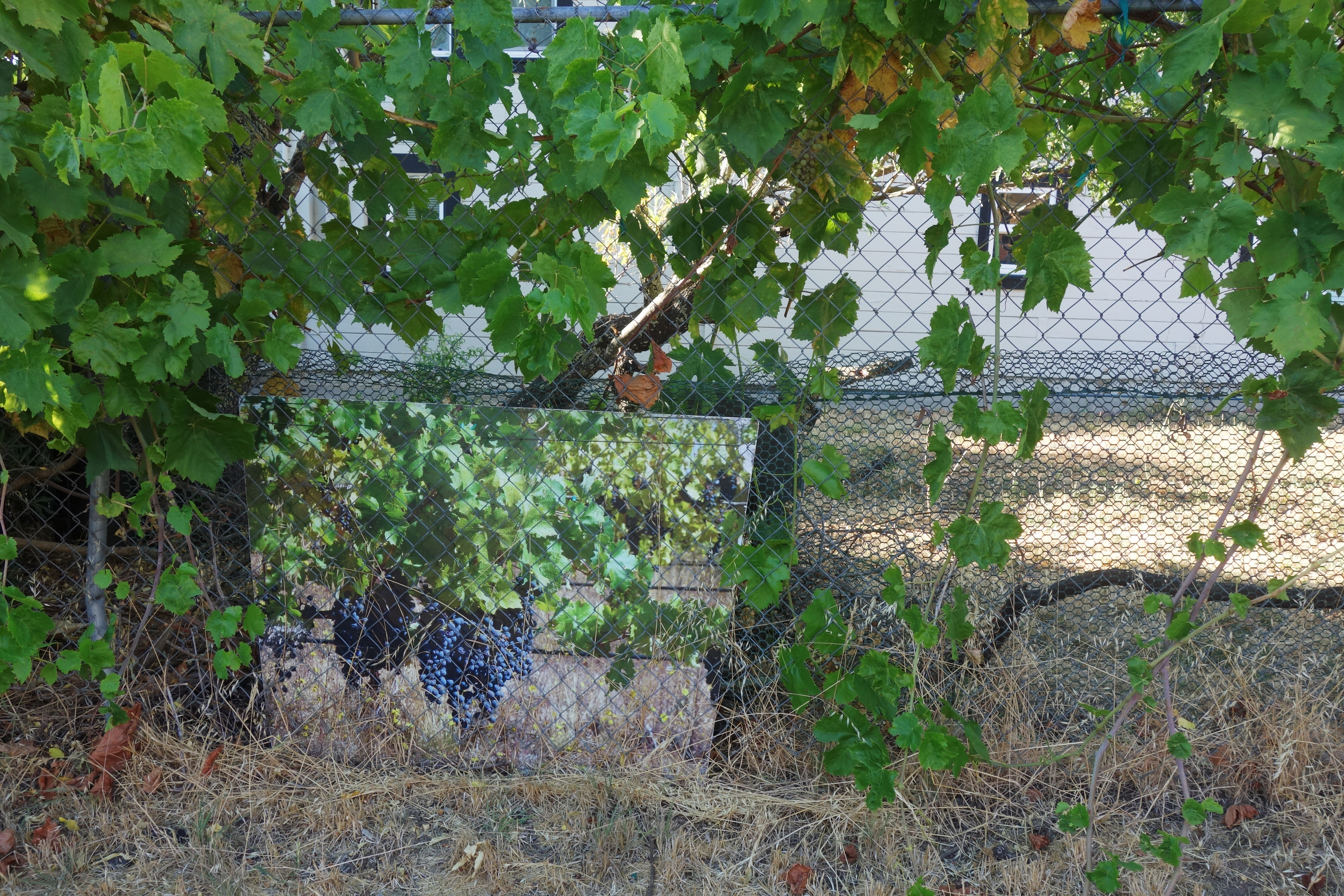
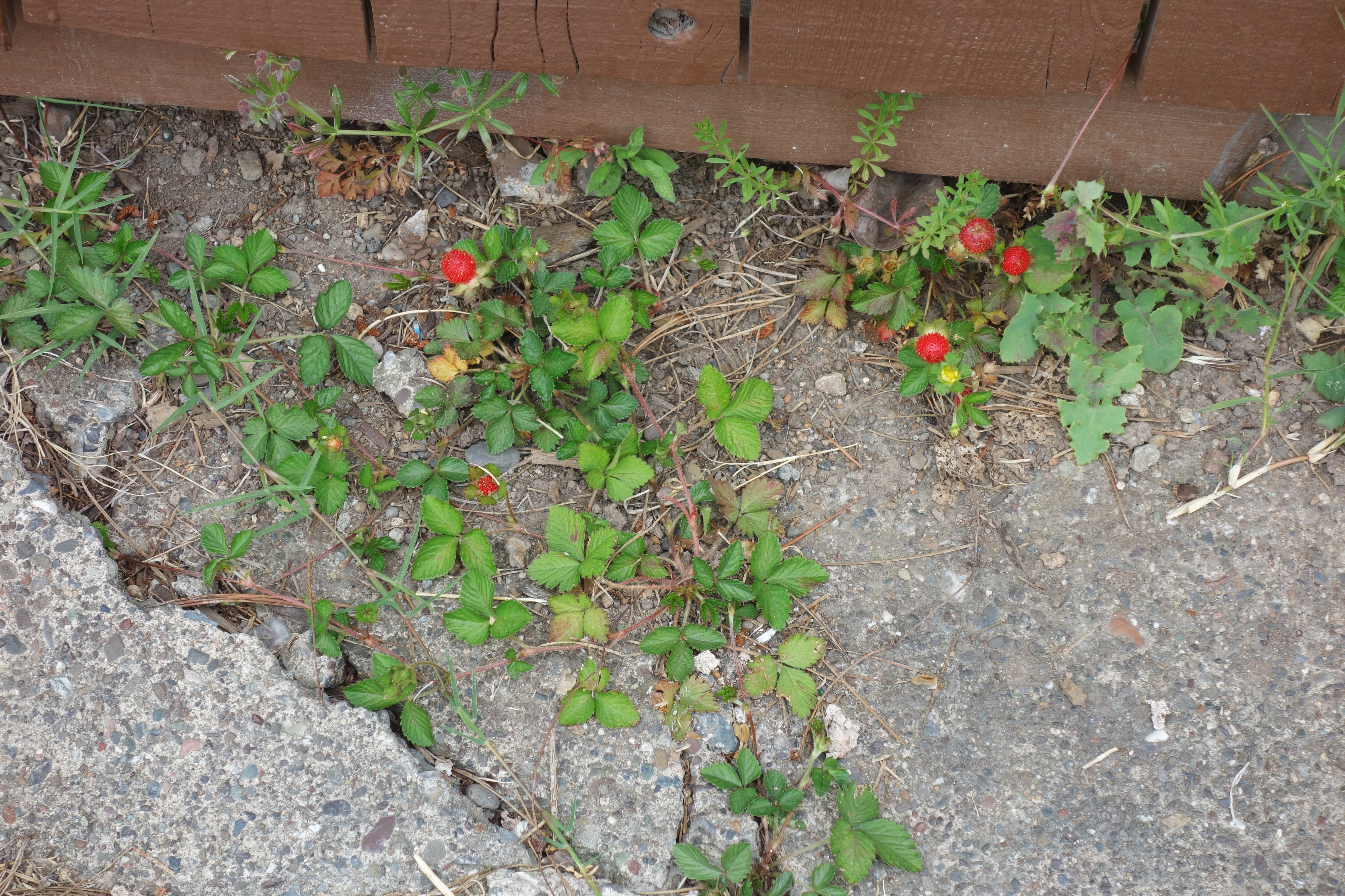
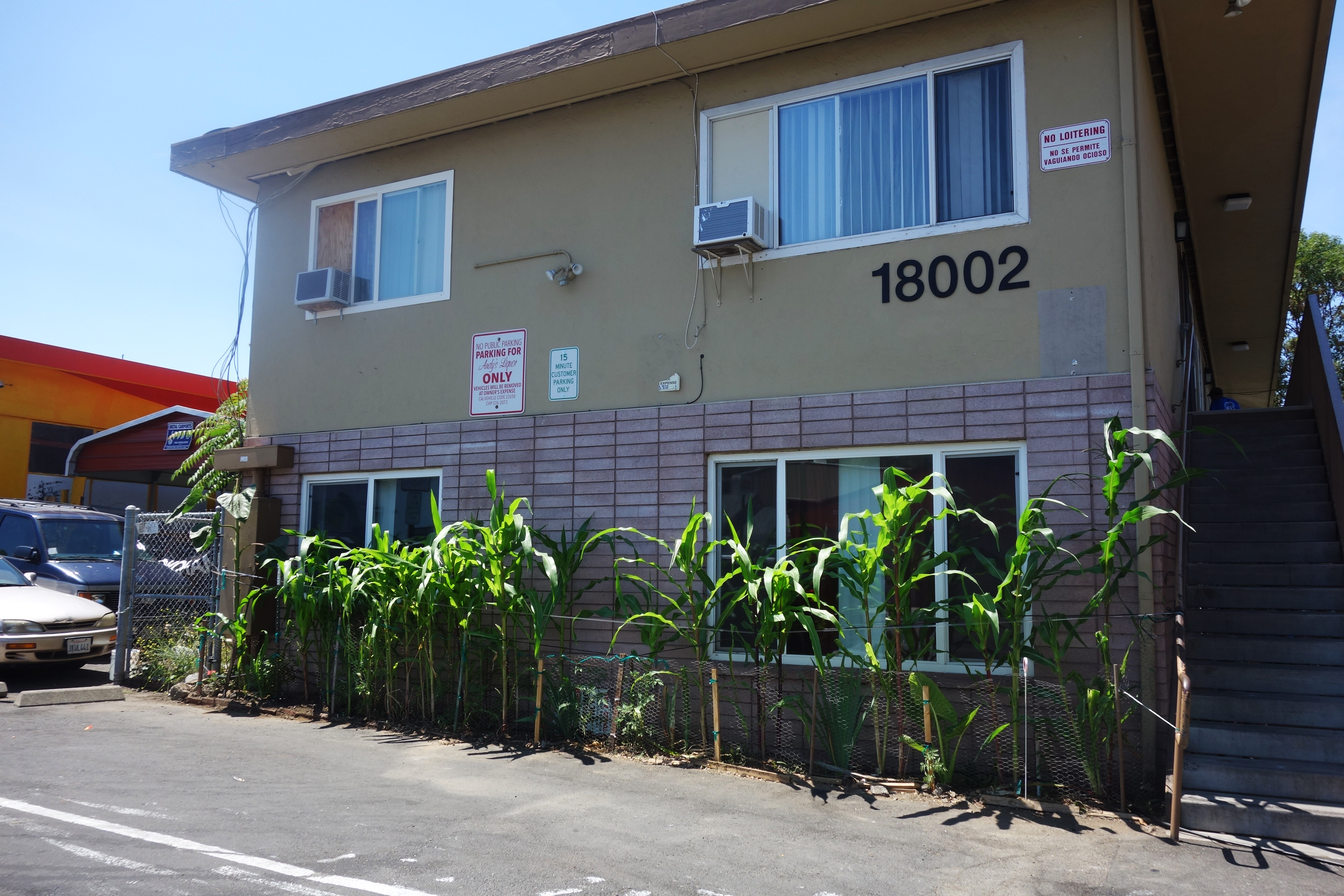
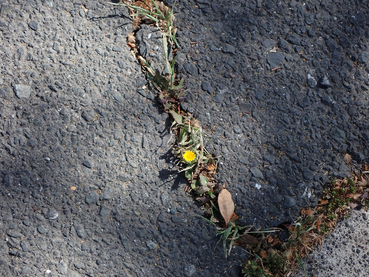
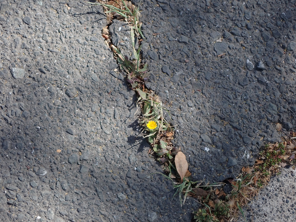
Only in Paradise: tomatoes growing from a sewer grate.Guerrilla landscaping?Grapes and “grapes.”Strawberries stake out their territory.Color escapesAgainst all odds. Standing out in a crowd.It’s Lunar New Year all over the neighborhood.Apartment dwellers find a way to grow cornCalifornia’s state flower insists on growing where it will.Tiny calendula growing from a crack in asphalt roadway.
This is not meant to be an exhaustive survey of everybody who ever photographed in Sonoma Valley. (Here I’m focusing on the resort towns of Boyes Hot Springs, Fetters Hot Springs, Agua Caliente, and El Verano.) That will have to come when we mount an exhibition on the topic at the Sonoma Valley History Museum in Depot Park.
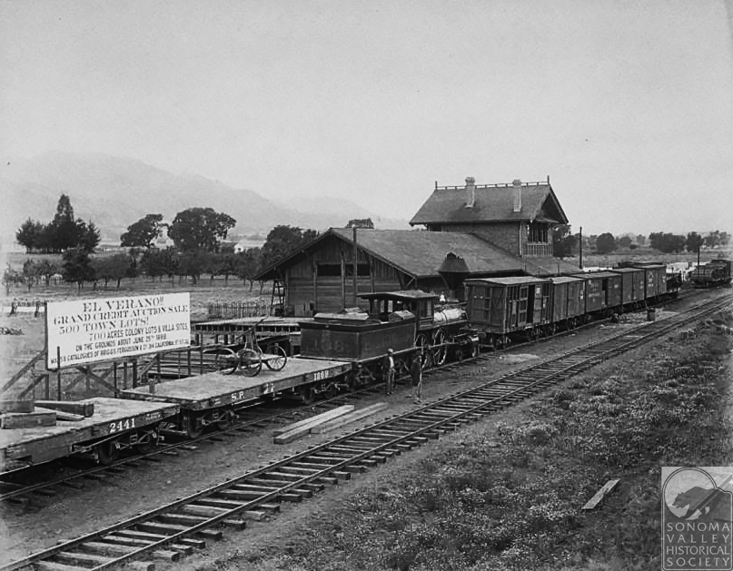
“Grand Credit Auction Sale, 500 Town Lots!, 700 Acres Colony Lots and Villa Sites” says the sign.
Carleton Watkins
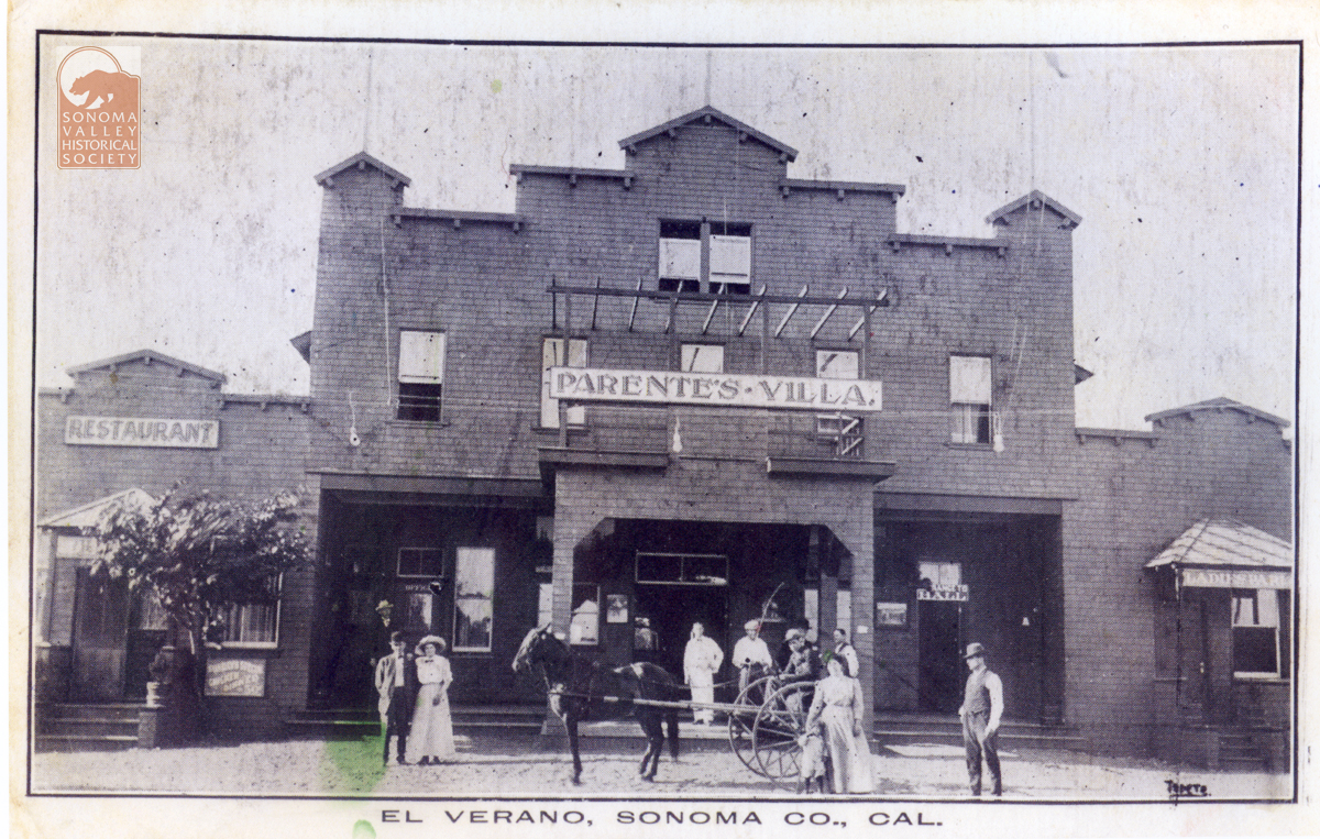
Probably the most noted photographer to document a part of the Valley was Carleton Watkins (1829-1916), who was engaged in 1887 by George Maxwell to make a portfolio of images as a tool to help sell land in El Verano. A great deal of hubbub was created touting this tract. Free trains excursions from San Francisco were offered to potential buyers. Streets were platted and an elaborate map was issued. The land boom collapsed, however; money was lost, and only a few streets remained, until El Verano pulled itself up by its bootstraps again. There was almost nothing there but fields, oak trees and a few farms when Watkins visited El Verano. The railroad was the most important thing happening. See the El Verano Historical Society for more images.
Postcard Photographers
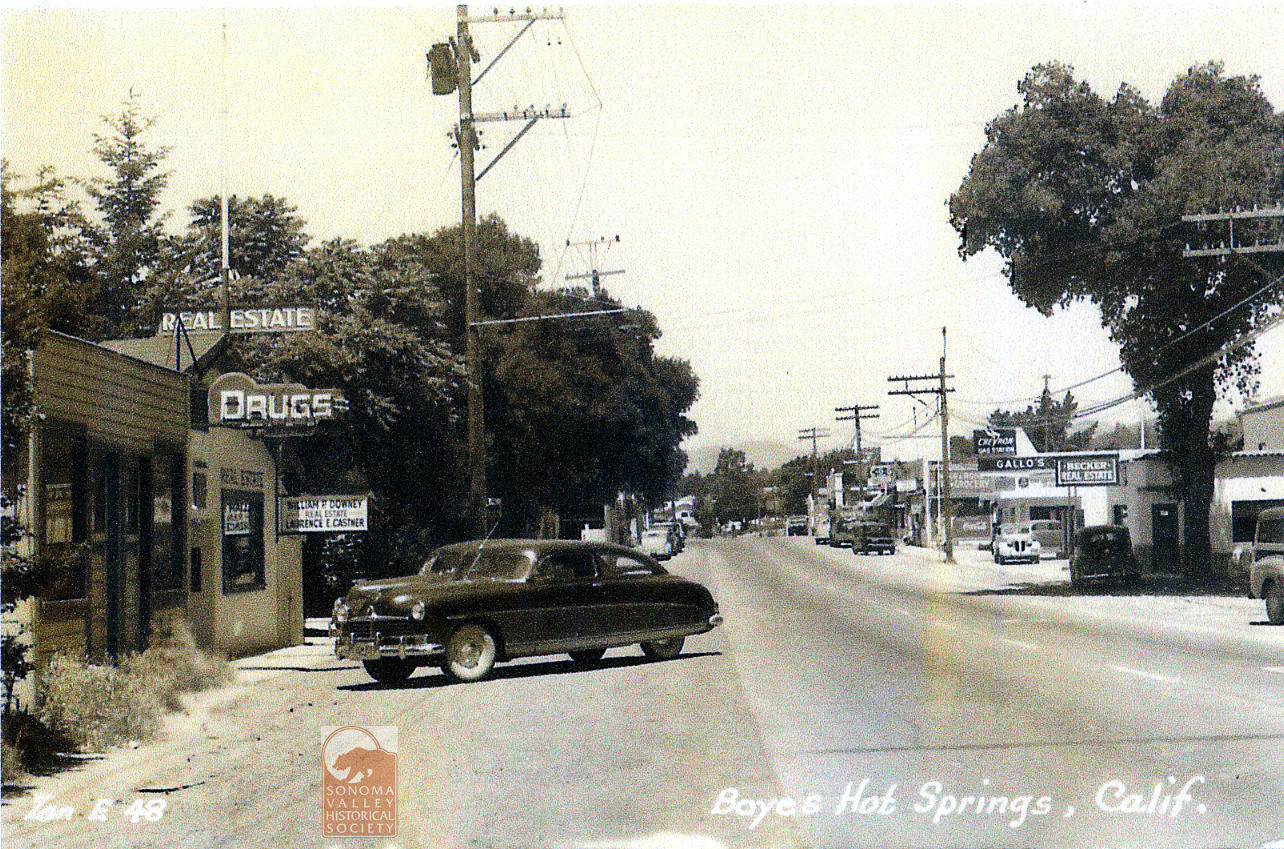
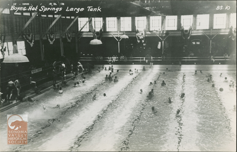
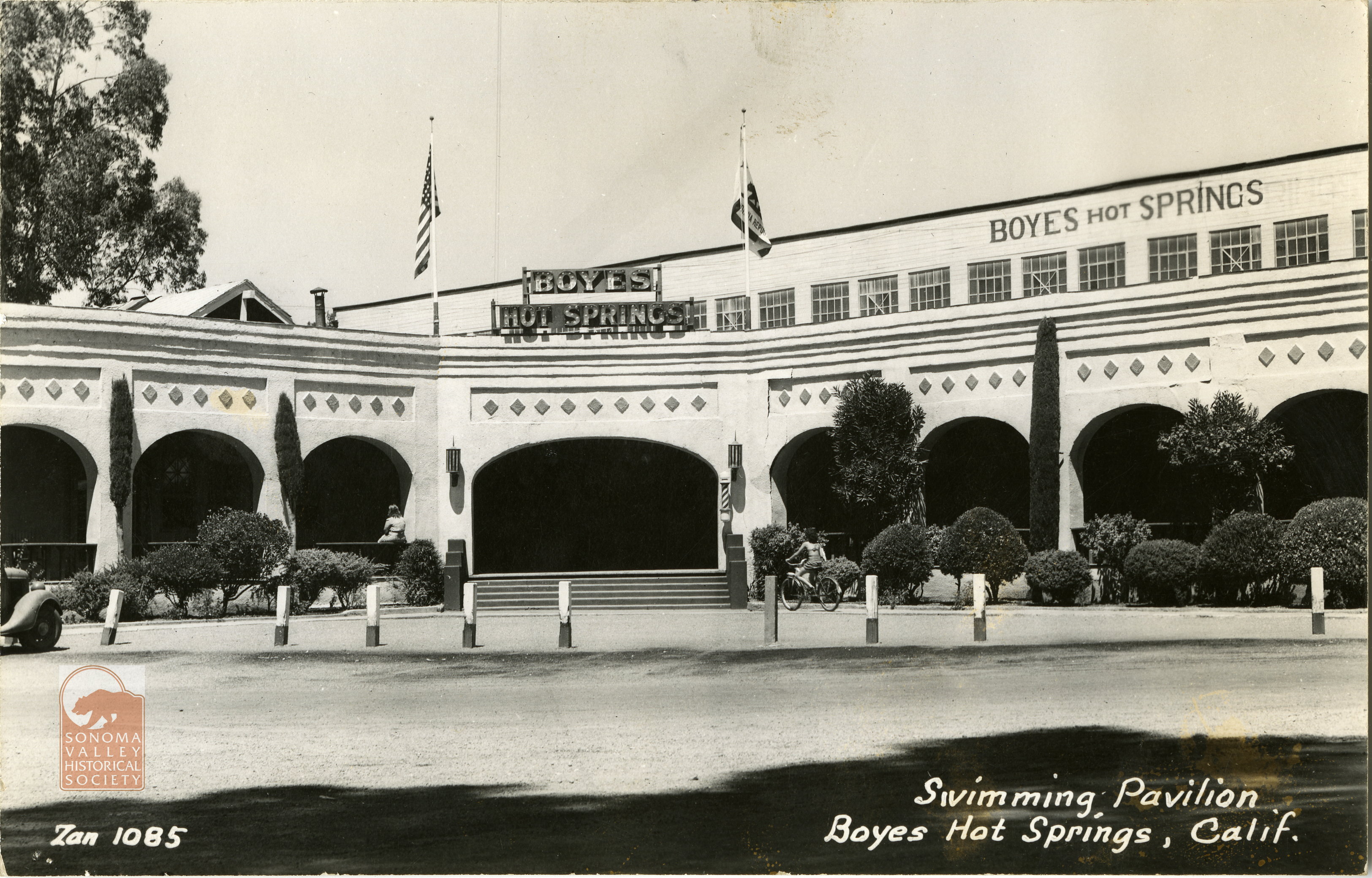
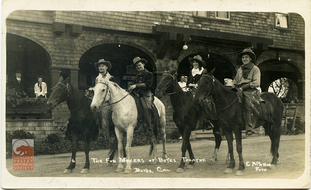
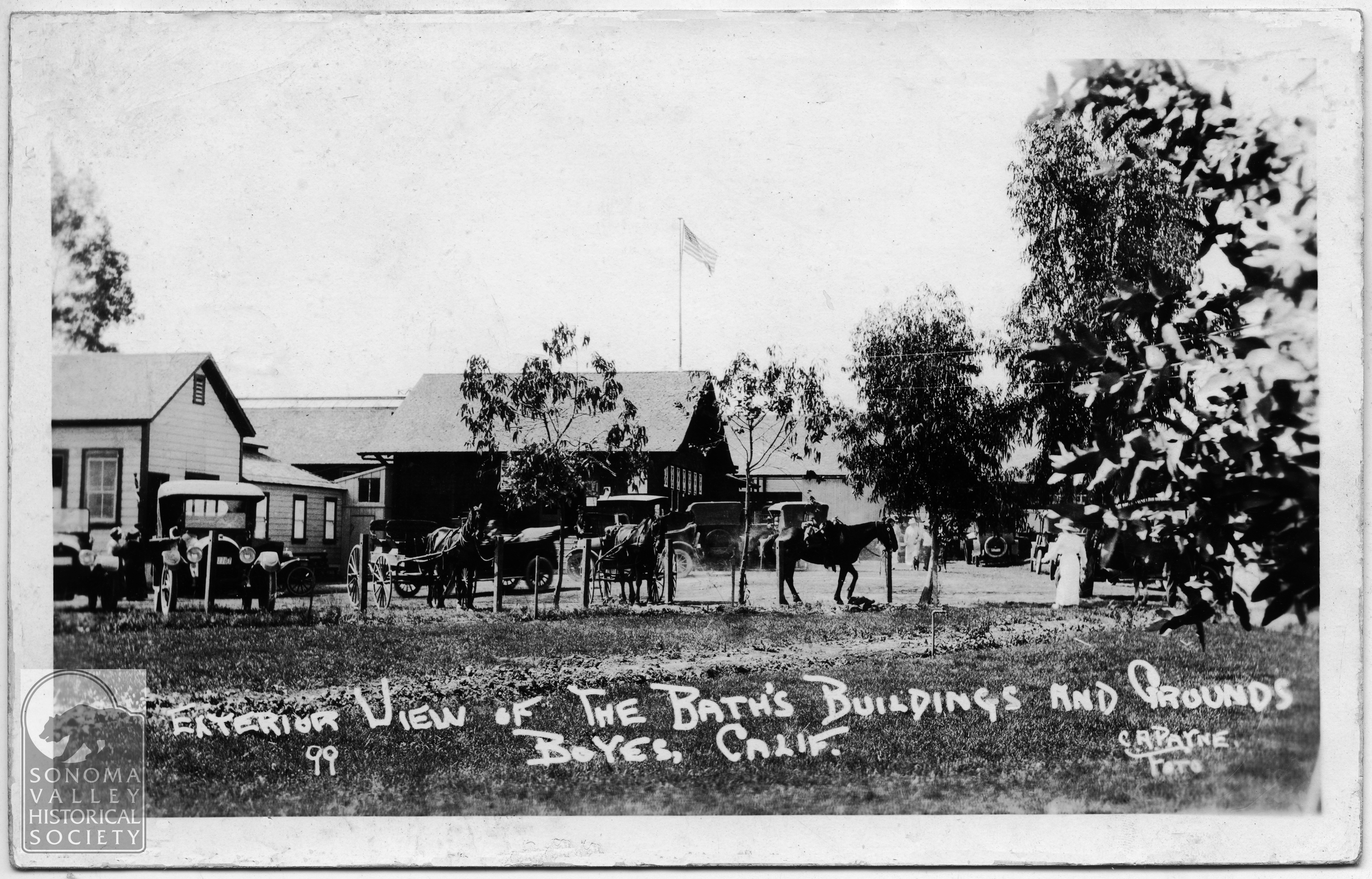
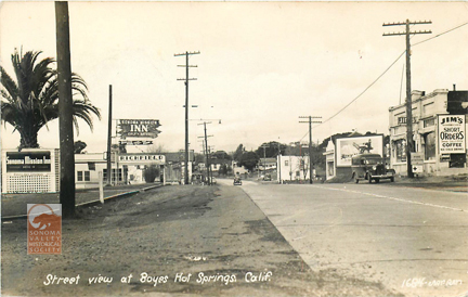
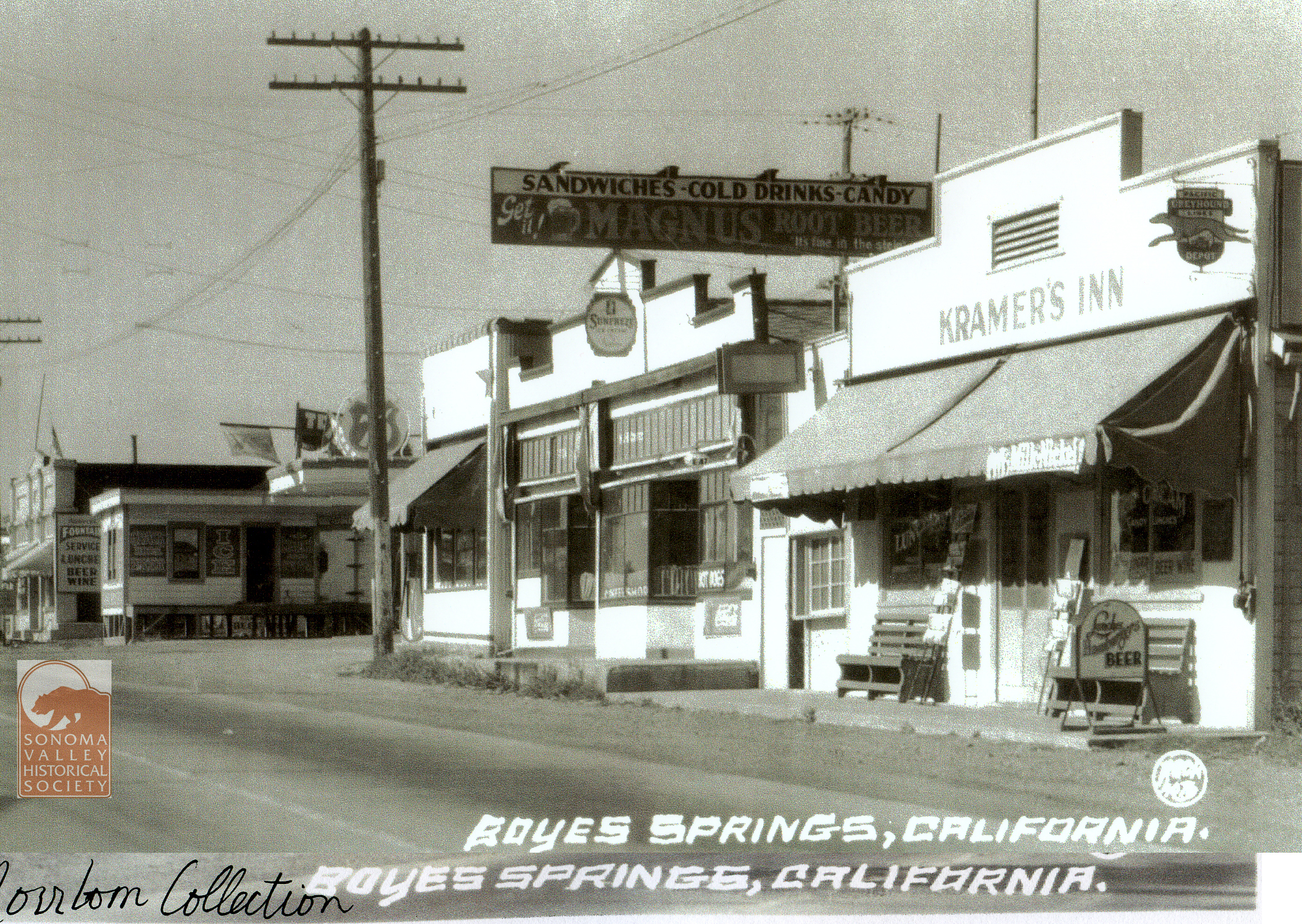
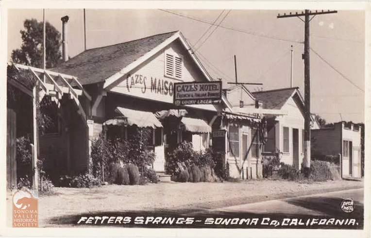
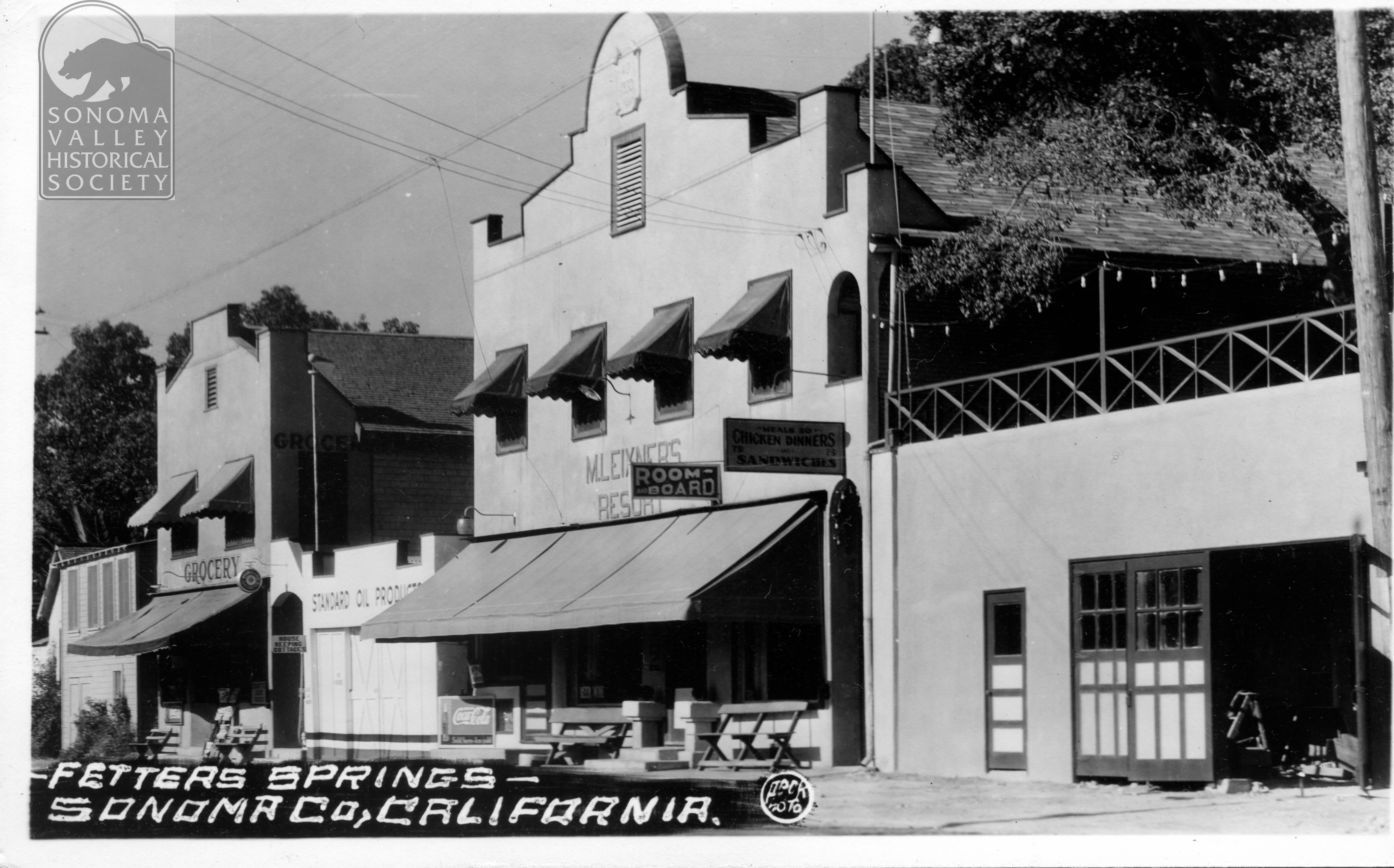
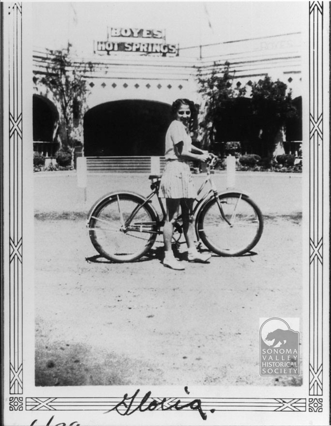
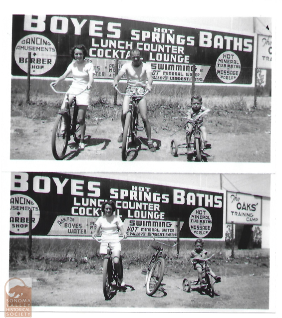
Agua Caliente, Boyes Hot Springs, and El Verano, sometimes known as The Springs, in the unincorporated part of the Valley of the Moon, California ( adjacent to Sonoma), has been a resort destination since the 1880s. People went there (and still do) on vacation, to take the waters and bath in the sun. Tourists like to have photographic memories of their joyous time, so many photographers published postcards of the resorts and people enjoying them.
The names of the photographers are mostly known. The stories behind the names are known for some and some are obscure (as of this writing.)
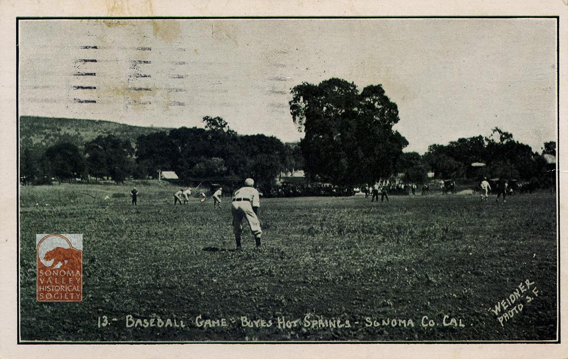
The production of resort postcards got going in earnest in the early 20th century. The prominent photographers were Charles Weidner, C. A. Payne (also publishing as Art-Ray), Peck, Topete, and Alexander (Zan) Stark. We have a lot of biographical information on Weidner and Stark, thanks to Frank Sternad of the San Francisco Bay Area Post Card Club. The others are more mysterious.
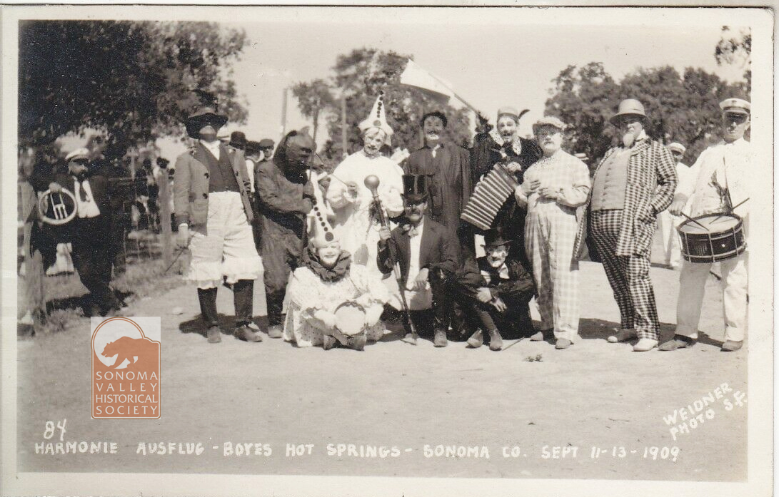
Charles Weidner was born in Germany in 1867, came to the United States in 1888. By 1891 he had made his way to California. Around then he took up photography in earnest, establishing his postcard company in San Francisco in 1902. He was well known for his photos of San Francisco after the earthquake and fire of 1906, and those of Yosemite Valley. He traveled widely in Northern California, spending time in The Springs in the years before WW1. One of his main subject was the Harmonie Ausflug, a group of Germans in the Bay Area who made tourist excursions together, and had a jolly time from the looks of it!
Weidner retired in the mid 1930s, having produced hundreds of postcards covering many locations and subjects in the Bay Area and beyond.
Alexander (Zan) Stark came to San Francisco from Ohio in 1914, investing in a small photo studio on Market Street. After serving in WW1, he came back to the City to resume operation of the Alta Slide and Photo Company. Alta was notable for producing photo booklets of nudes of young women, for “artistic” purposes. Several of his models were well-known silent film stars. Despite the Depression, Stark was doing well enough that in 1929 he could buy a house in Mill Valley. Inspired by his daily ferry commute to SF, he began photographing the wonders of the Bay Area, and being business man, realized he could print these as post cards and make some money. He soon began traveling farther afield, eventually making cards in most of Northern California, southern Oregon, and parts of Nevada.
He moved to Boyes Hot Springs in 1952, to which we owe the outstanding documentation of the resorts, businesses, and landscape of The Springs, numbering at least 65 postcards.
Stark’s archive is housed at Stanford University Library Special Collections.
Charles and Frank Payne published under the names Art-Ray and C.A. Payne. Their home base was Crescent City, California and they covered mainly that part of the state, venturing as far south as Boyes Hot Springs, producing cards from circa 1915 to 1921.
Peck: circa 1940’s-no information
Topete-circa 1906-1912
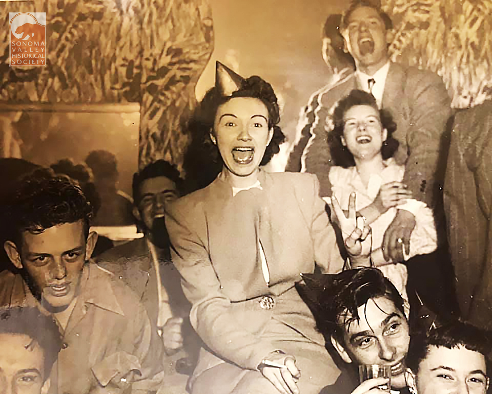
Anonymous Snapshots
There is something precious about the random snapshots of “just folks”. The professional photographer composes, frames, and considerer the information he wants to convey. Your average person just picks up the camera and shoots, or poses family in front of interesting backgrounds. Even out of focus and out of level, these photographs are charming and are important documents.
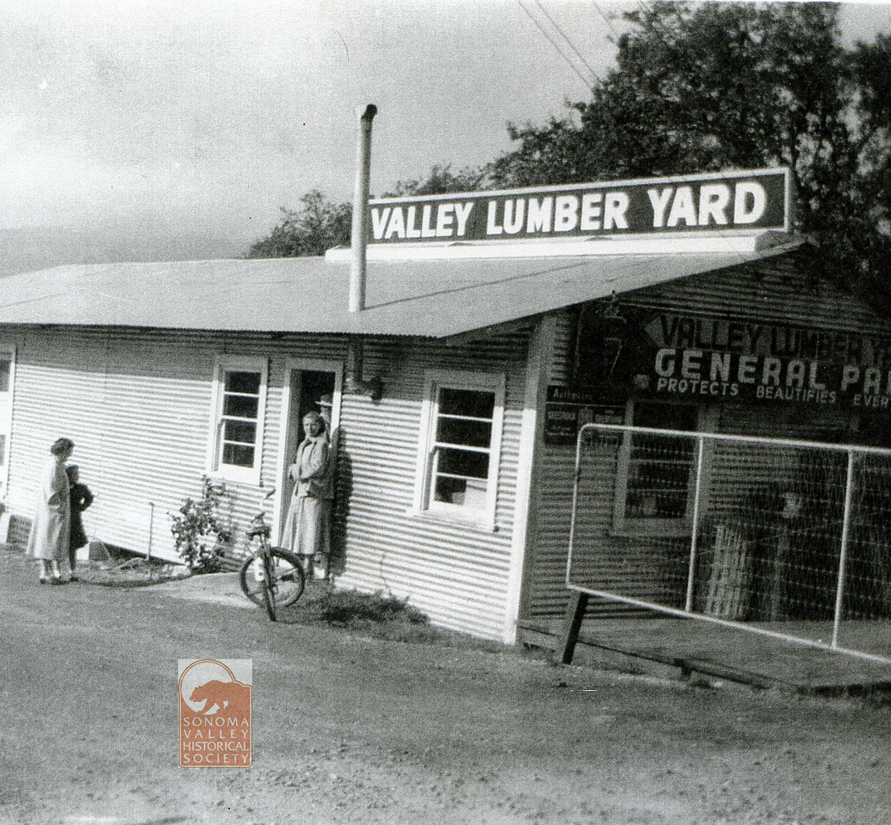
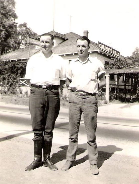
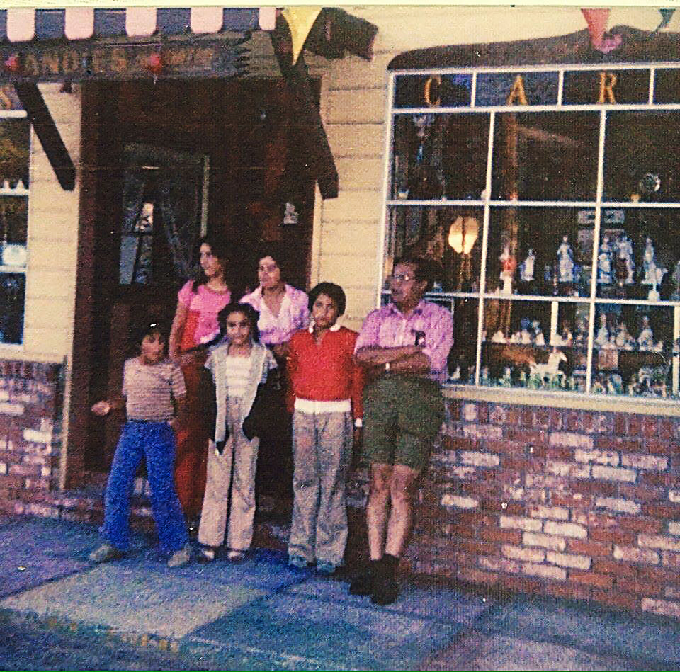
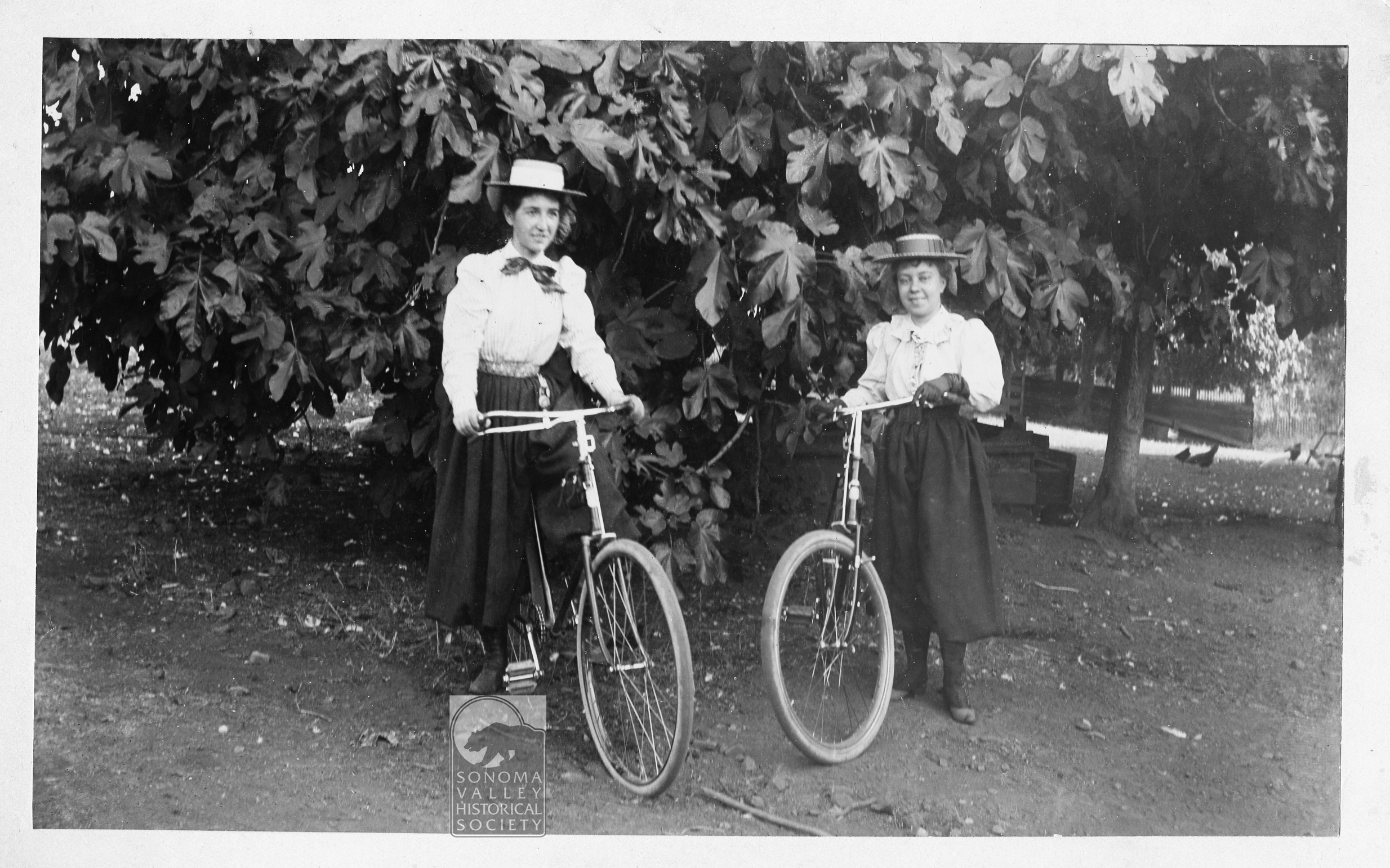
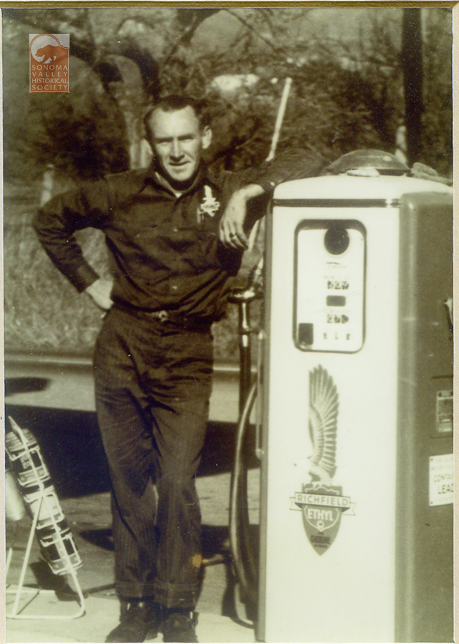
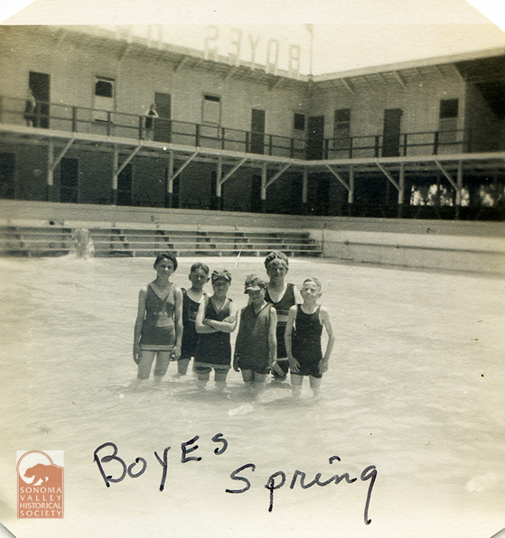
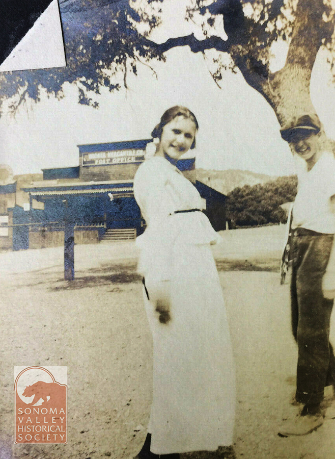
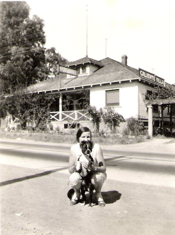
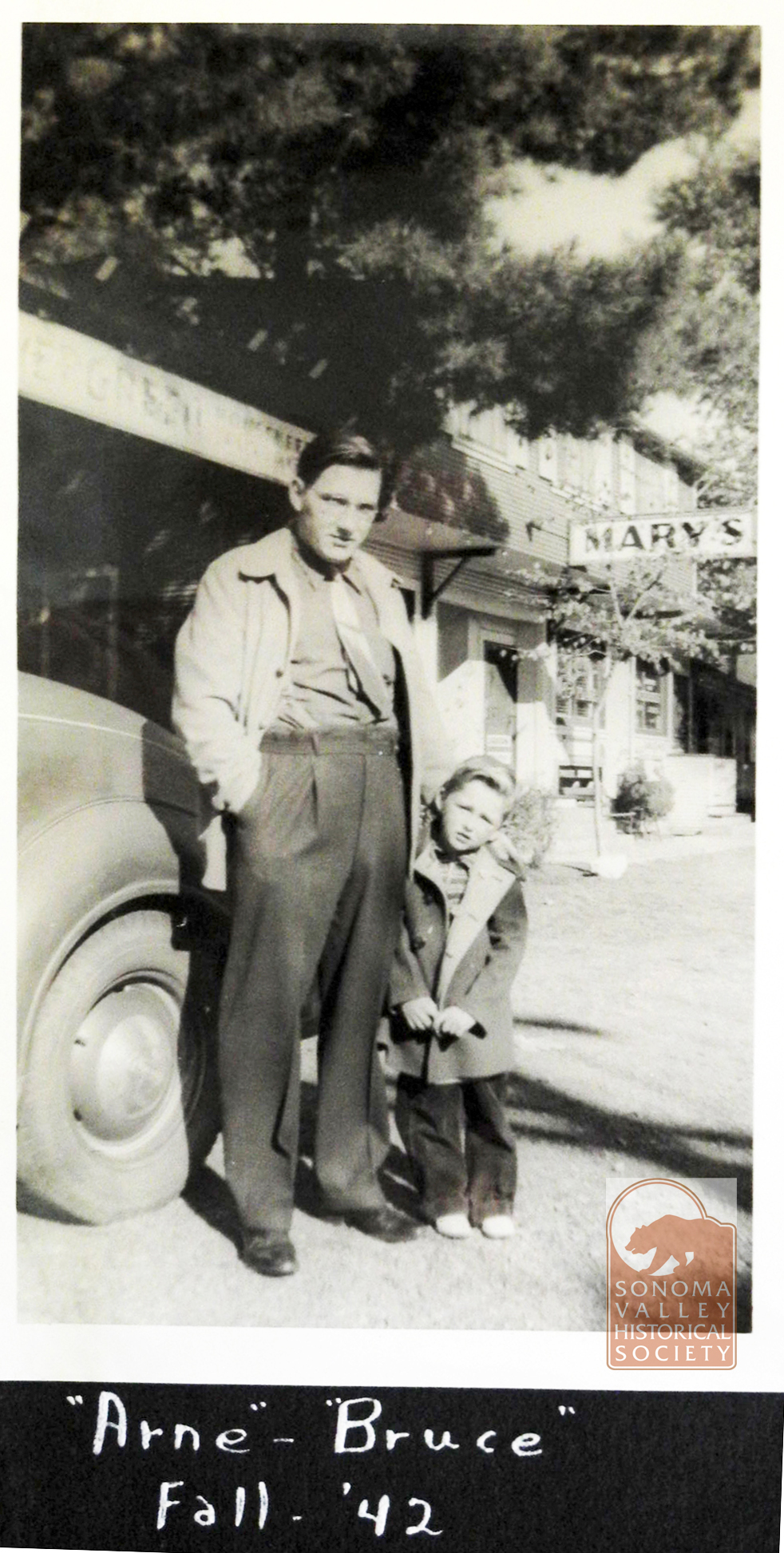
Parson’s Lumber and Hardware, 1952Jeff Gilbert’s Great Uncle Joe Costa and Great Uncle SFPD Officer Joe O’Rourke – Early 1930’s. Caliente Villa behind them-Jeff Gilbert via FacebookThe Nasso Family at their gift shop near Flowery School, circa 1960s. Via Facebook.Inscribed on the back: El Verano, 1894Carl Luhr, Nancy West’s father, at his Richfield station in Boyes, 1960’s? From Nancy, Grange membercirca 1912. Graham’s Store in background. First location of Boyes post officeJeff Gilbert via FacebookOn Pine Ave. in front of Mary’s Cottages. From Bruce Griewe.Interior of the Resort Club, 1950. Probably by Oscar Larson.1944- Dave Chiotti
Don Meachum was a commercial photographer in Santa Rosa between 1943 and 1984. His archive is at the Sonoma County Library
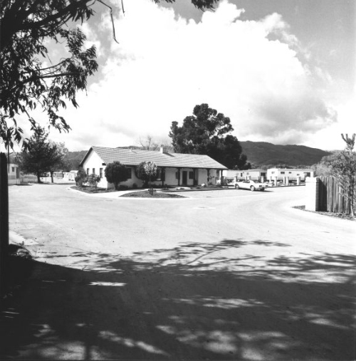
Rancho Vista Mobile Home Park, Fetters Springs, 1971
Newspaper Photographers
The area has, of course, been photographed thousands of times for stories in the Index Tribune.
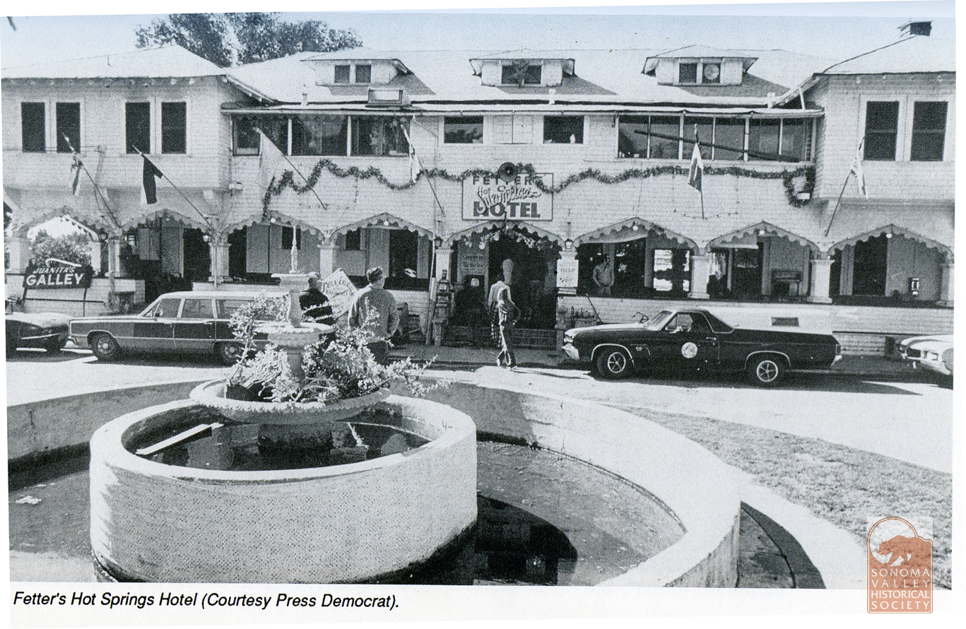
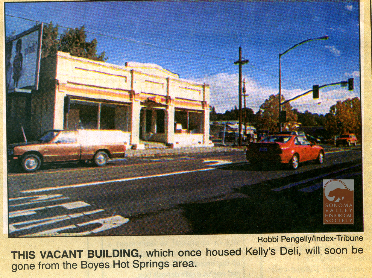
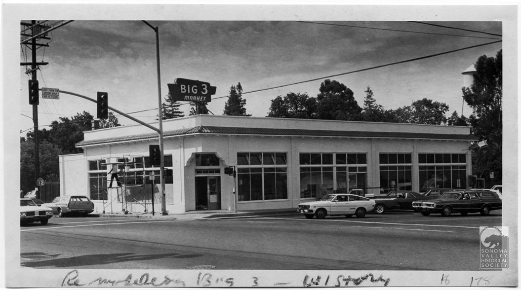
Fetters Hotel during the tenure of Juanita Musson.At the corner of Hwy 12 and Vallejo Ave, 1992. The lot became employee parking for the Sonoma Mission Inn. Everybody knows Robbi!Big Three Market, 1980. Corner of Boyes Blvd. and Hwy 12.
Miscellaneous Sources
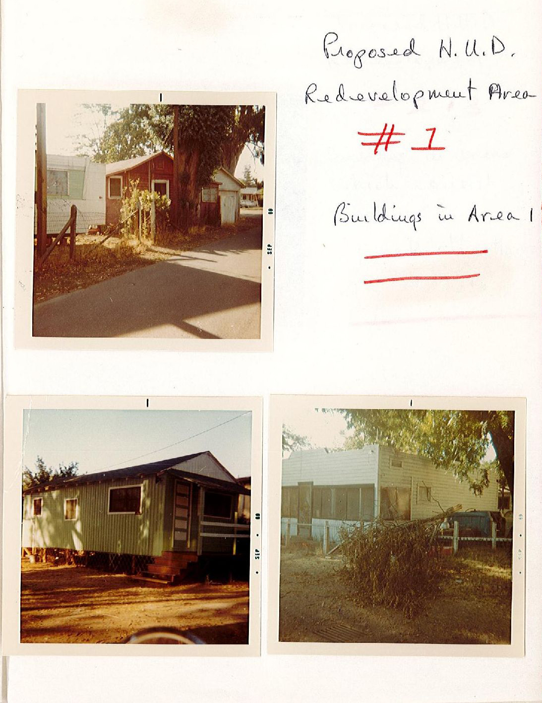
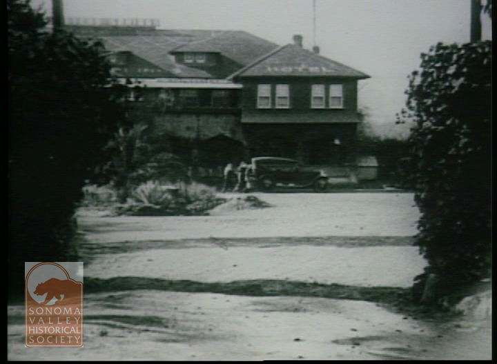
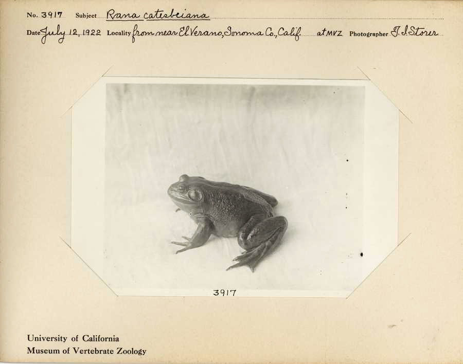
Pine Ave. County Redevelopment, circa 1986.Still from the film “Account of the No Account Count,” directed by Josh Binney, 1923, showing the Fetters Springs Hotel.You just have to imagine Storer poking around down by the creek in El Verano. In his notes he tells of coming upon two young boys selling frogs along the roadside. Biologist T. I. Storer, 1922
MIchael Acker
When I started looking for historic photos I also started photographing the same locations. What with the pace of change, it soon became apparent to me that my photos were also historic documents. And so are yours!
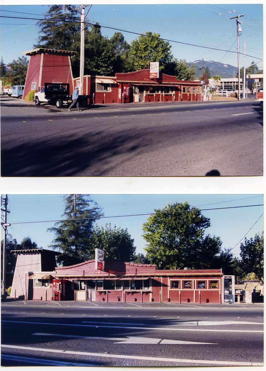
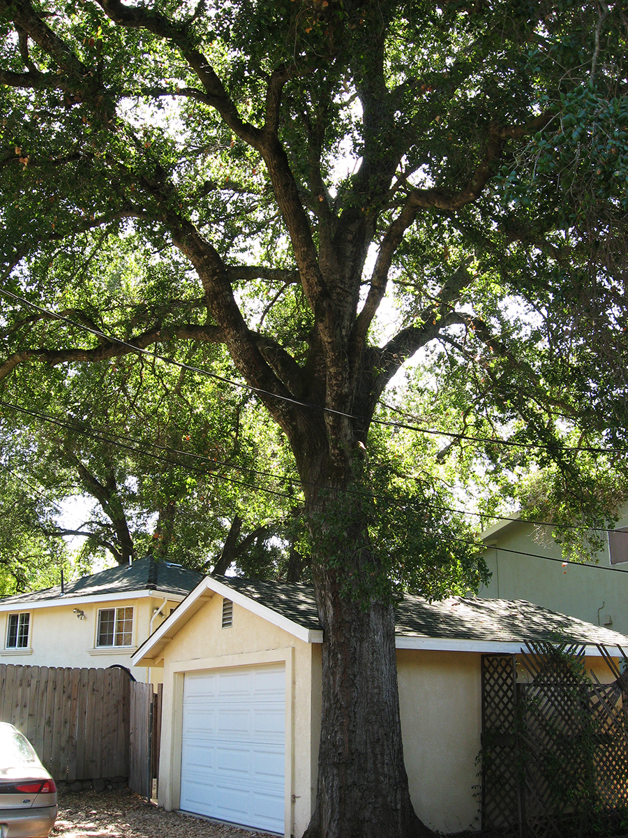
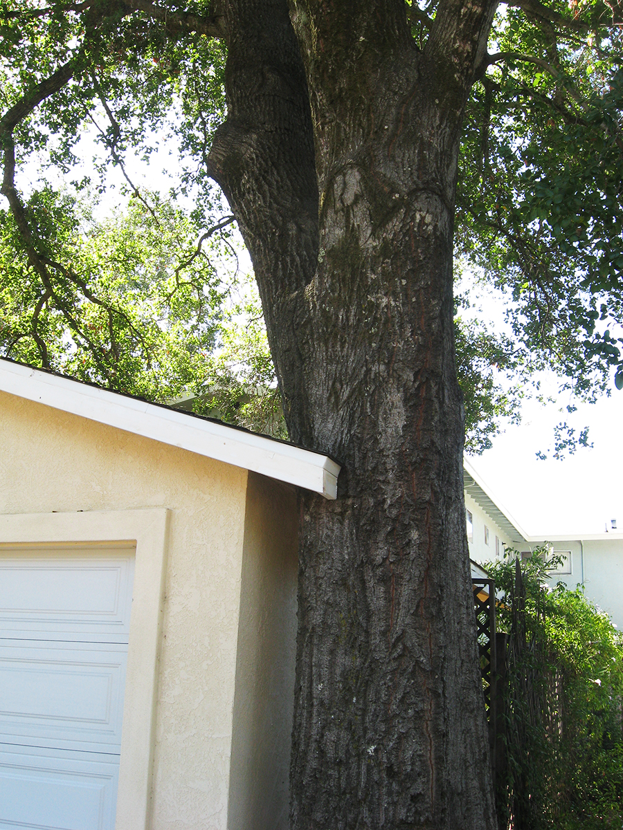
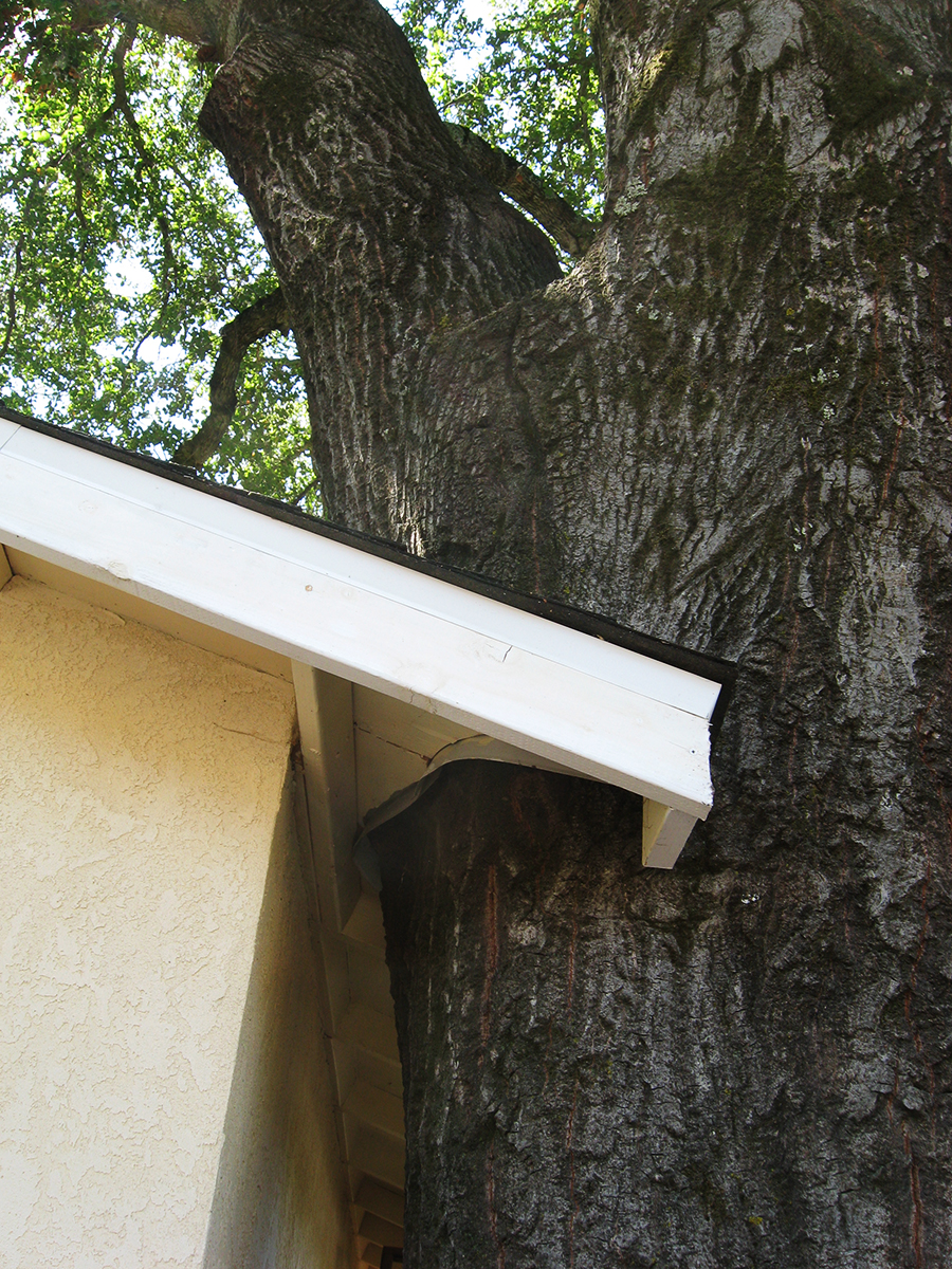
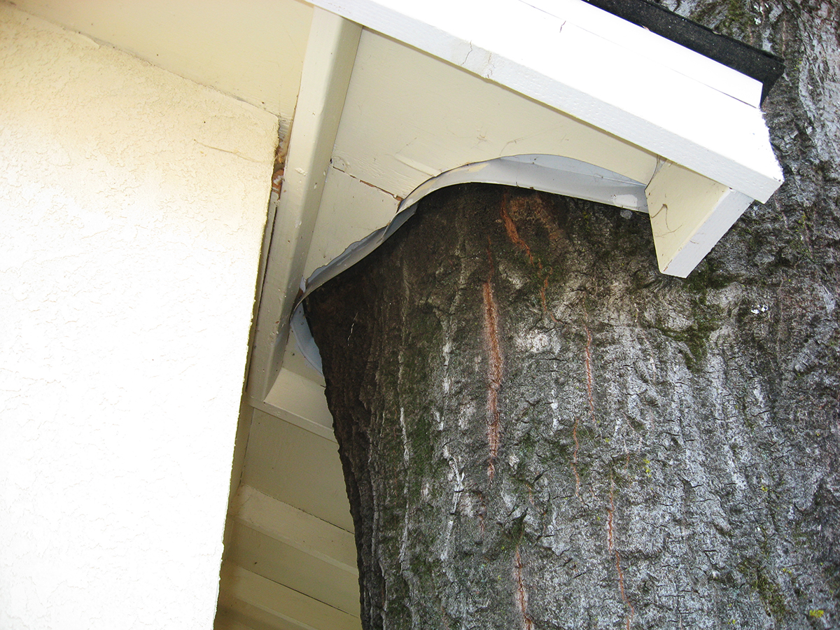
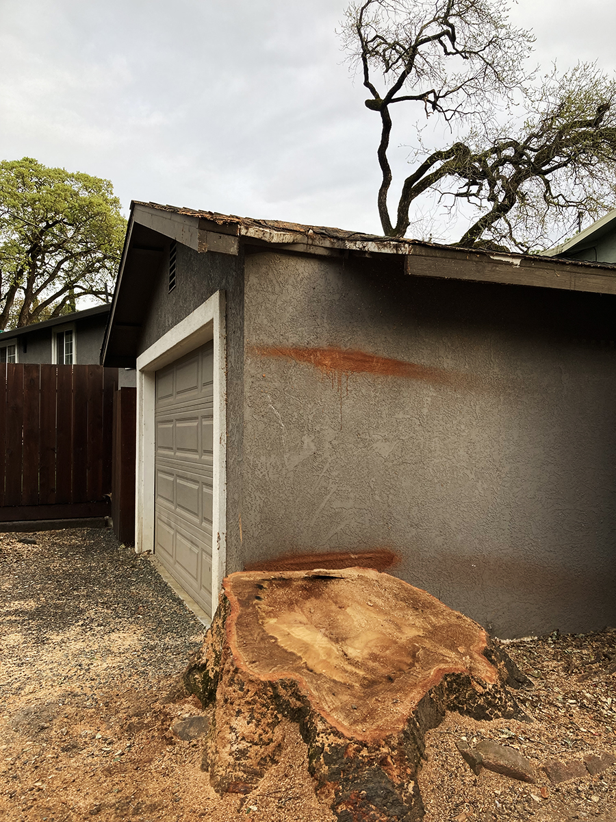
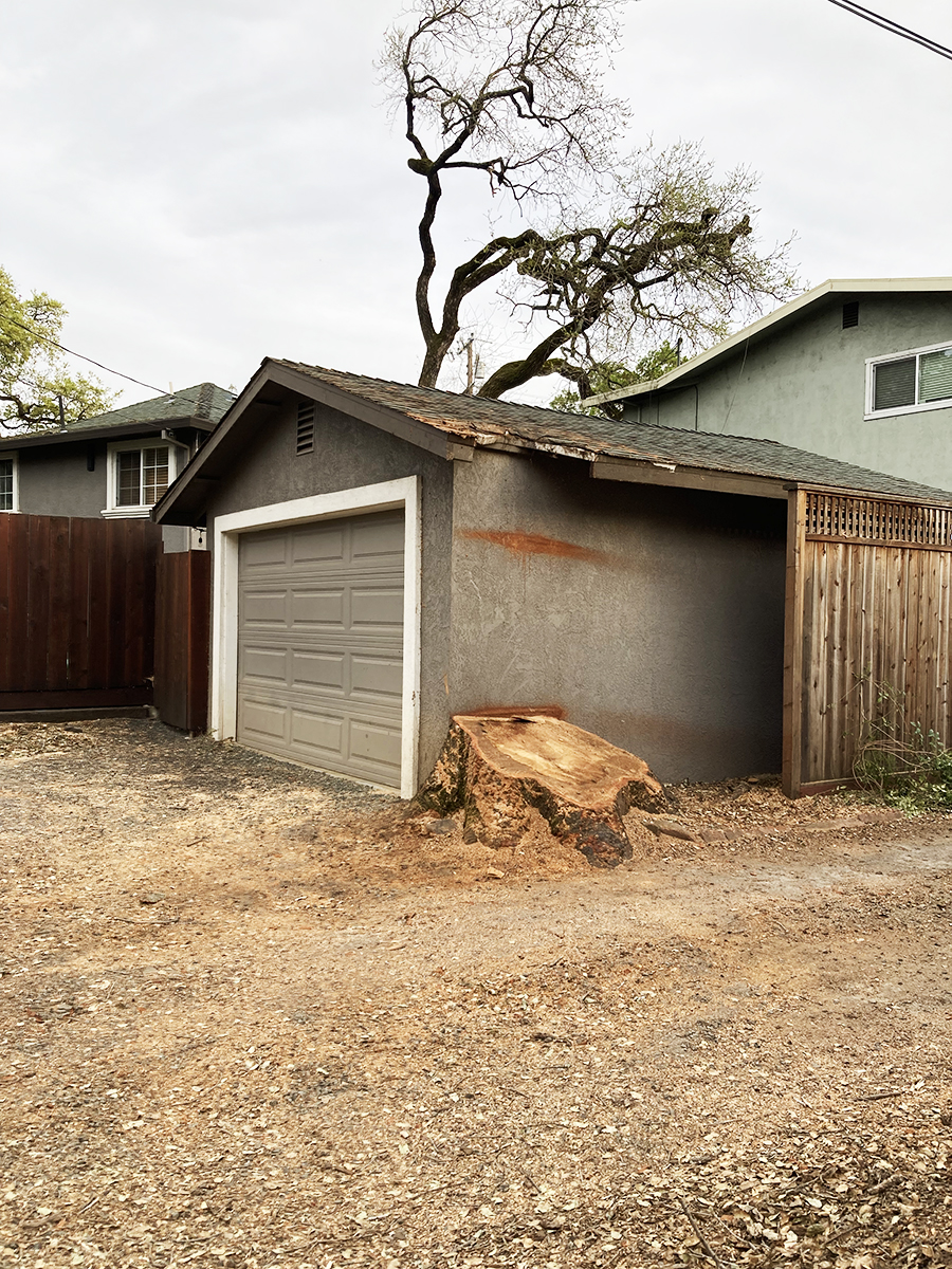
On Vallejo Ave. near the corner of Calle del Monte, in Boyes Hot Springs, there stood a prime example of the ongoing interaction between trees and the built environment: A garage was built next to an oak, the oak grew, humans adapted the structure to accommodate the native tree. This was a lovely thing to see.
Prior to 2009 when I first photographed it, the structure had been so dilapidated that I was sure they were going to tear it down. But they restored it and did a neat job of cutting the roof overhang around the mighty Quercus.
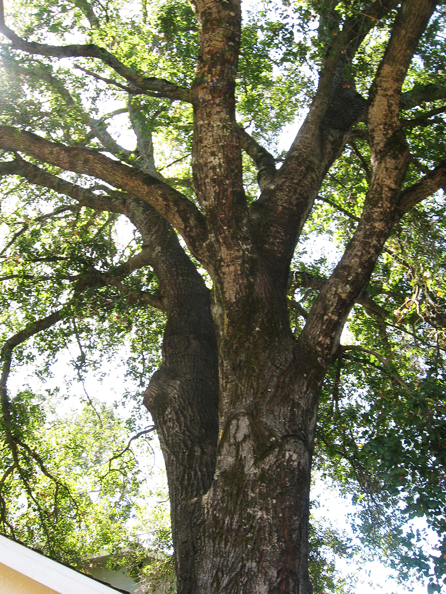
Flash forward to 2024. The tree is gone, its pleasant pool of shade just a memory. In the last two photos you can see that another tree, in the background, has also been removed (see the first photo), for fire safety, they say. Whether necessary or not, we always mourn the loss of a tree.
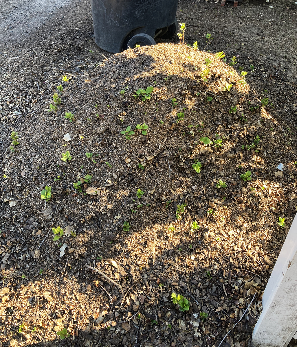
Below are photos of a mound of earth and wood chips next to the stump. It is absolutely covered in oak seedlings. Nature continues!
Public art grows in fits and starts hereabouts but we are starting to build up a nice stock of murals. Here we look at four of them.
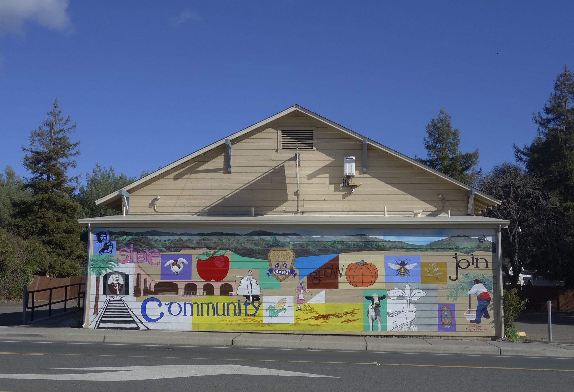
The mural on the front of the Sonoma Valley Grange building, located at 18627 Sonoma Highway. The Grange has owned the building, which was probably originally a dance hall, since 1934. See (https://springsmuseum.org/2022/06/28/the-sonoma-valley-grange-traditionchange-and-renewal/) for more about the Grange. Through the Redevelopment Façade Improvement project, the Grange got funding for the mural in 2010. It was designed by Michael Acker and painted in collaboration with Randy Sue Collins. It depicts a bit of Boyes Hot Springs and Grange history. It being on the west facing wall, it takes a terrific beating from the sun, and has been restored twice.
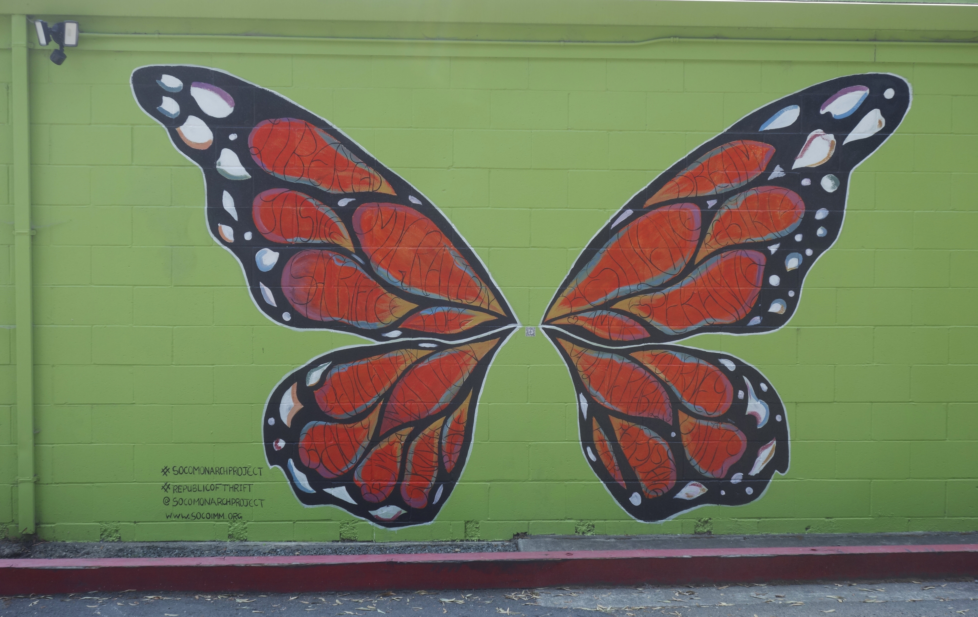
The Republic of Thrift building at 17496 Sonoma Highway has two murals sponsored by the Monarch Project (https://www.socoimm.org/) along with others. On the west facing wall is the giant Monarch butterfly, completed in June 2020. According to the Index Tribune, “Artist Rima Makaryan, just 17 years old, painted a Monarch butterfly as part of “The Monarch Project,” a Sonoma County nonprofit organization working to tell the stories of immigrants and empower the community.” “We are working to have a conversation about immigration through art,” said Makaryan. “Oftentimes immigrants are labeled aliens or talked about negatively. The goal of the Monarch Project is to find beauty in the subject.” The mural, painted on the west-facing wall of the thrift store, features a Monarch butterfly filled with words describing the immigrant experience, such as resilience, hope, amor, sacrifice and fear. Makaryan noted, “The words are meant to embody the journey and diversity of all migrants. It’s all about the beauty of the topic, good and bad.”
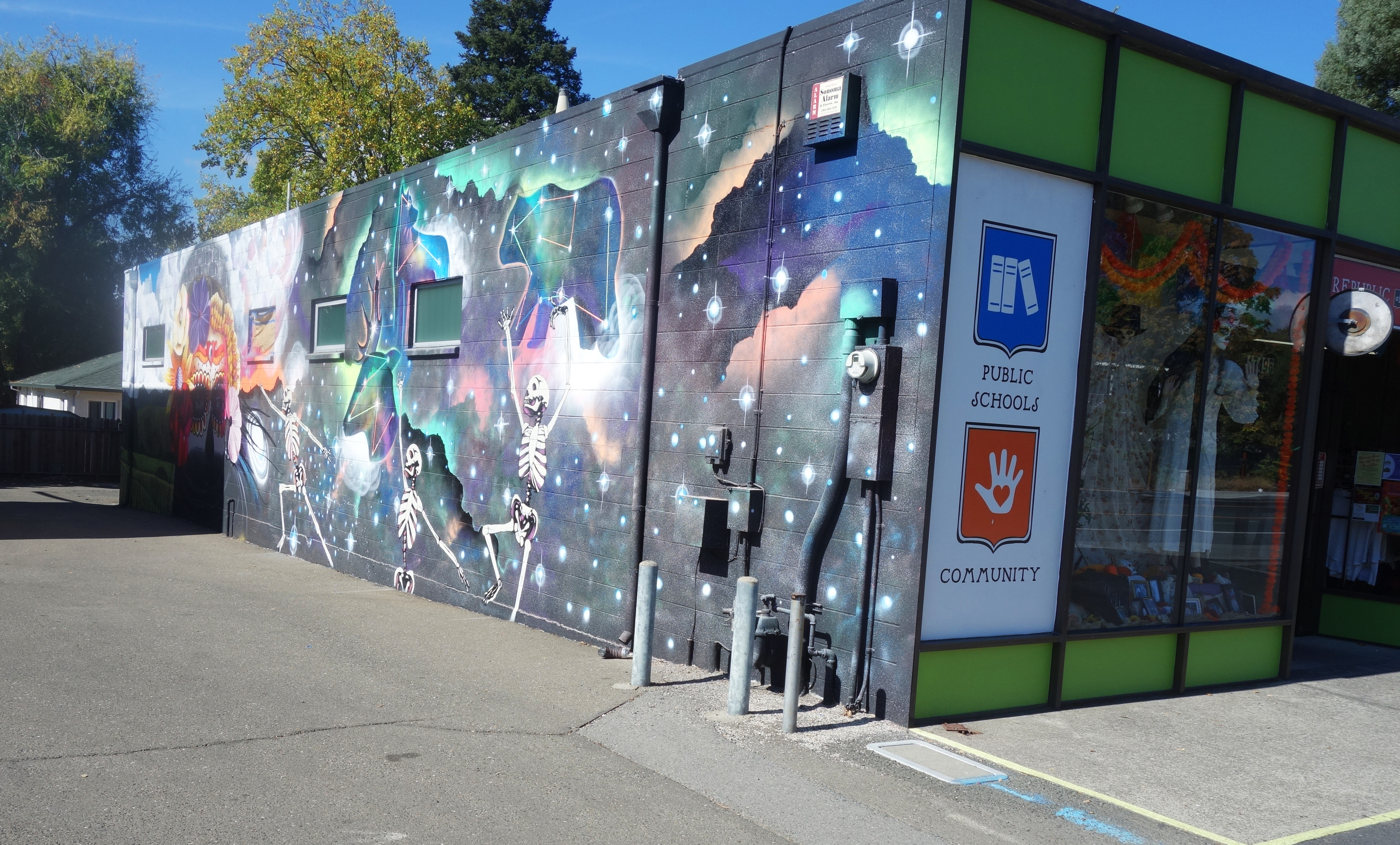
On the east wall a fantastical spray-paint mural by the artist Chor Boogie (https://chorboogie.com/), along with a crew of high school students was painted in 2018. the Led by Sonoma Valley Museum of Art, community partners were Artescape and La luz Center. Co-sponsors were the California Arts Council, the NEA, and the Bank of Marin.
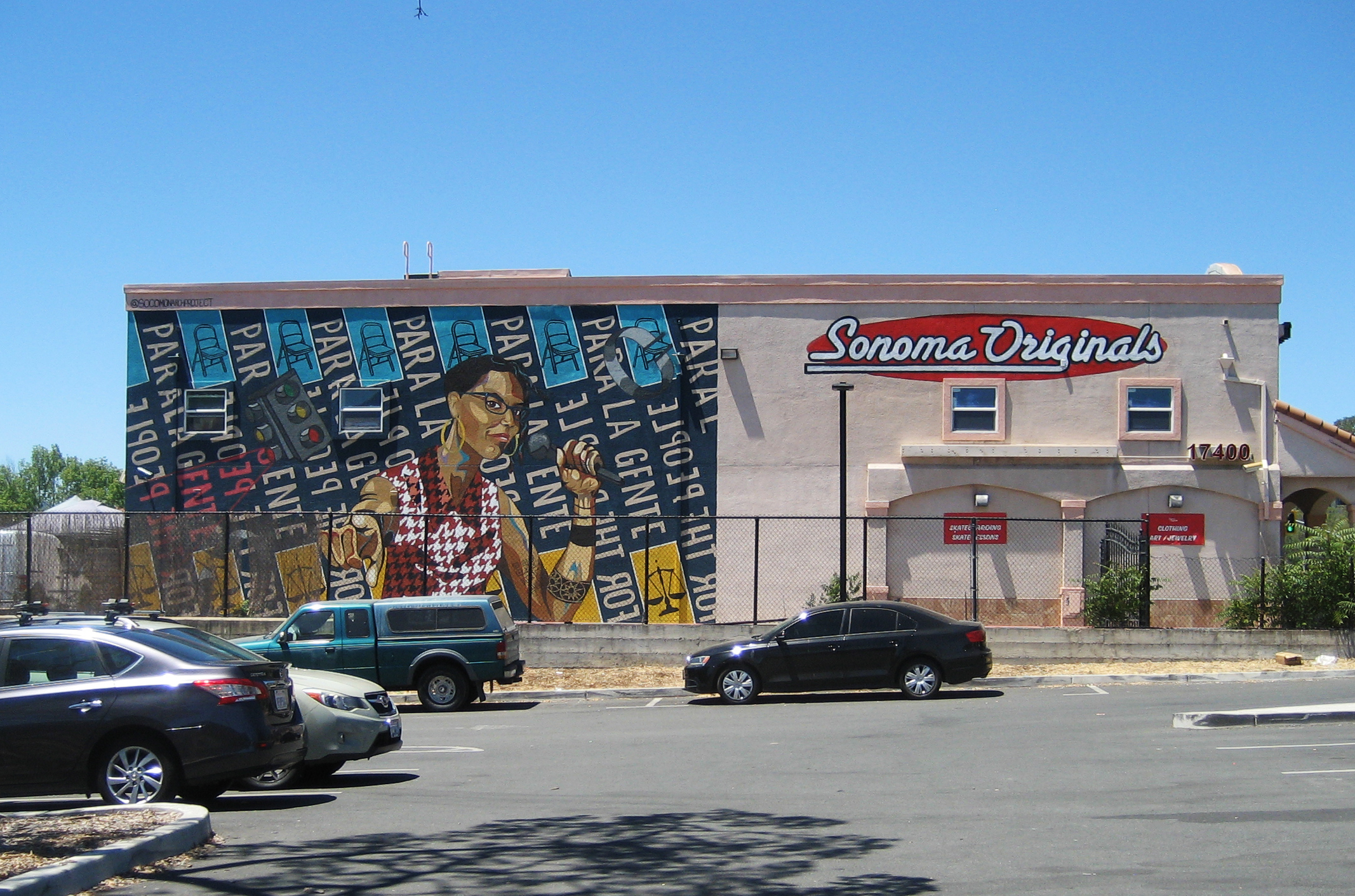
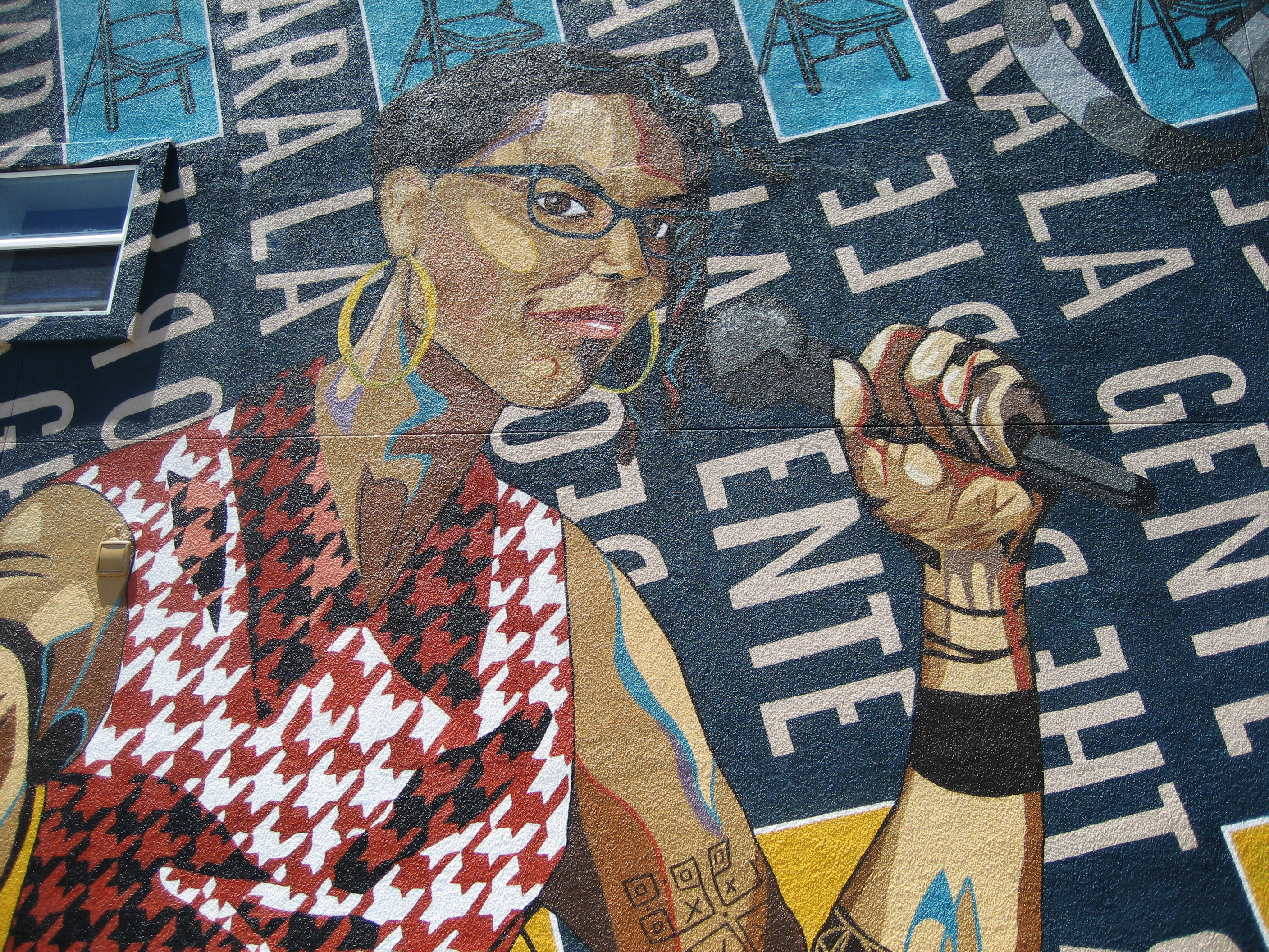
The building at 17400 Sonoma Highway displays yet another Monarch Project mural. Completed in June 2021, it features an image of Dmitra Smith, “…a powerful force fighting against racism in Sonoma County,” according to their website. “Ms. Smith is the former Chair of the Sonoma County Commission on Human Rights, and was the program manager for the Junior Commission, having mentored over 100 Sonoma County students between 2013- 2020. Smith is a co-founder of the essential workers’ mutual aid collective Food for All – Comida para Todos.”
At the time the mural was painted, the building was the home of Sonoma Originals skate shop. Sadly, it is now empty.
We actually have a lot of art in the Springs, some of it “official,” as the above are, some harder to find, personal expressions, often ephemeral, but worth noting, as we will do in future posts
Index Tribune courtesy of the Sonoma Valley Historical Society
David Douglas, the great English botanist, for whom the Douglas Fir, and many other plants is named, collected in the Pacific Northwest, the Eastern seaboard, and Hawaii, in the years 1823-1834. He also spent some time in California. (čəbidac is the Lushootseed name for D. Fir. Another Coast Salish name for the tree, used in the Halkomelem language, is lá:yelhp https://shoreline.libguides.com/treecampus/douglas_fir)
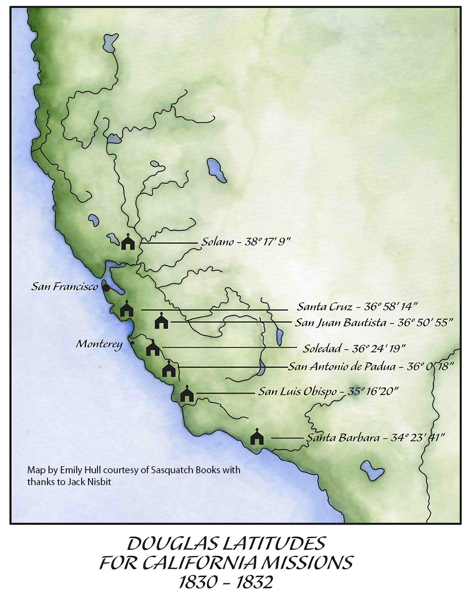
He traveled in there during the years 1830-32, collecting many species then unknown to botanists. He visited the colonial settlements from Santa Barbara to Sonoma, measuring the latitude and longitude at many of them. While in Sonoma he probably spent some time with the Mission fathers, as he had further south. He appreciated them as educated men who spoke fluent Latin.
Back in London in 1827, Douglas had trained in surveying with geographer and astronomer Edward Sabine. On his 1829 return voyage around the Horn to North America, Douglas practiced with the instruments and studied the math. He became proficient at the difficult task of measuring longitude, given the unreliability of chronometers at that time.
The longitude as measured today: 38° 17′ 41.2368” N.
According to Willis Jepson, the dean of California botany, writing in 1933, “He was the first botanical collector in California in residence for any extended period and during this time he traveled through the Coast Ranges from Monterey north to the Mission San Francisco De Solano (Sonoma) and south to the Mission of Santa Barbara. He was not only the first traveler to collect the extensively rich and varied spring flora of the Coast Ranges, nearly all the species of which were new to botanical science, but also the first to leave some written description of it. Hundreds of new species, our most familiar plants, were based on the Douglas collection…” And “It has been suggested that Douglas visited Mt. Diablo, but the form of Calochortus pulchellus which he obtained might have been collected in the Sonoma region.”
Willis Linn Jepson was a co-founder of the Sierra Club and founder of the California Botanical Society. The oldest known California Bay Laurel (Umbellularia californica) is named after him. https://www.smcgov.org/parks/what-see-crystal-springs-trail
Calflora: Information on California plants for education, research and conservation. [web application]. Berkeley, California: The Calflora Database [a non-profit organization]. Available: https://www.calflora.org/ (Accessed: April 30, 2023).
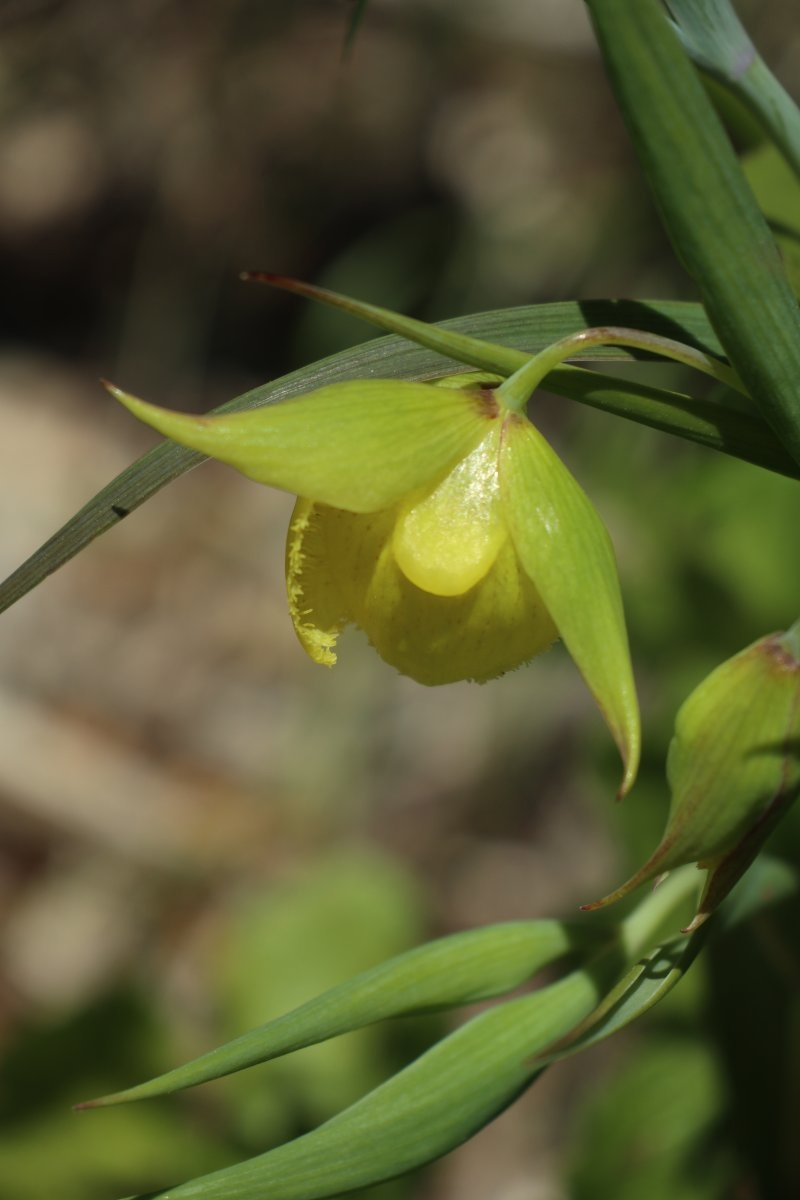
Calochortus pulchellus is a rare species of flowering plant in the lily family known by the common name Mt. Diablo fairy-lantern or Mount Diablo globelily.
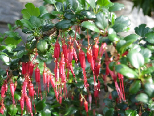
Of the first plant he encountered in California, Douglas stated (one-upping his mentor Menzies?), “Early as was my arrival on this Coast Spring had commenced. The first plant I took in my hand in full flower was Ribes Staminum, (Smith) remark able for the length and crimson splendour of its stamens, a plant not surpassed in beauty by the finest Fuchsia, for the discovery of which we are indebted to the good Sir Arch. Menzies in 1779.” The epithet Ribes staminum is way out of date. It has been suggested to me by the esteemed botanist Steve Acker, Phd. That the species described by Douglas would be Ribes divaricatum var. pubiflorum. However, given Douglas’ description it could be Fuchsiaflower Gooseberry, Ribes speciosum
My thanks to Peter Meyerhoff and Jack Nisbit for assistance. Jack is the author of two books about David Douglas, “The Collector: David Douglas and the Natural History of the Northwest” and “David Douglas: A Naturalist at Work” available from Sasquatch Books: https://sasquatchbooks.com/
Temporary, informal, unsanctioned, cryptic. Personal expression, job related. Faded, half-obscured.
Ephemeral and permanent.
Highway 12 through Boyes Hot Springs, Fetters Hot Springs, and Agua Caliente, California, though a heavily used commercial and residential street, had almost no sidewalks until 2009/2010. Dirt shoulders for walking was not a problem when traffic was light. Even at the height of the resort era (1950s), people would ride horses down the middle of the highway. That’s how quiet it could be.
Starting in the 1980s, locals started to agitate for a safer road. They wanted sidewalks and streetlights. Along came Redevelopment to provide the funds. Part of the project was completed by 2010 (a good twenty five years after agitation began). Redevelopment was abolished by dear old Jerry Brown. Thanks Jerry! The project languished. Finally, the Sonoma County Board of Supervisors came through with the money to finish. Thanks Susan Gorin!
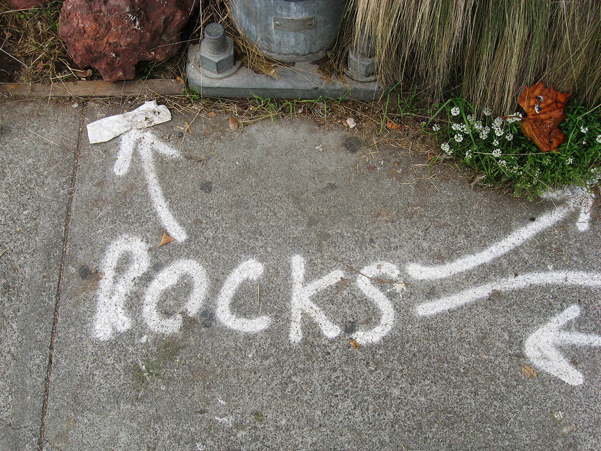
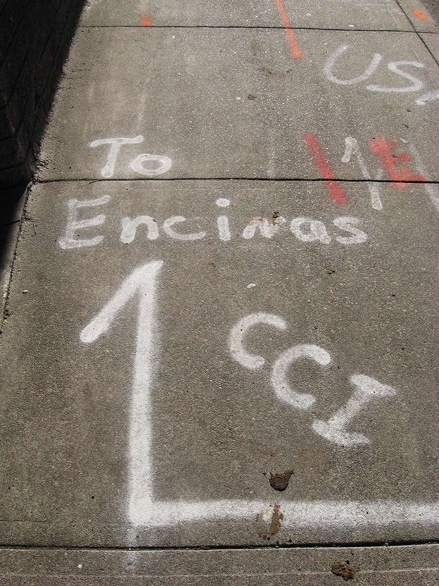
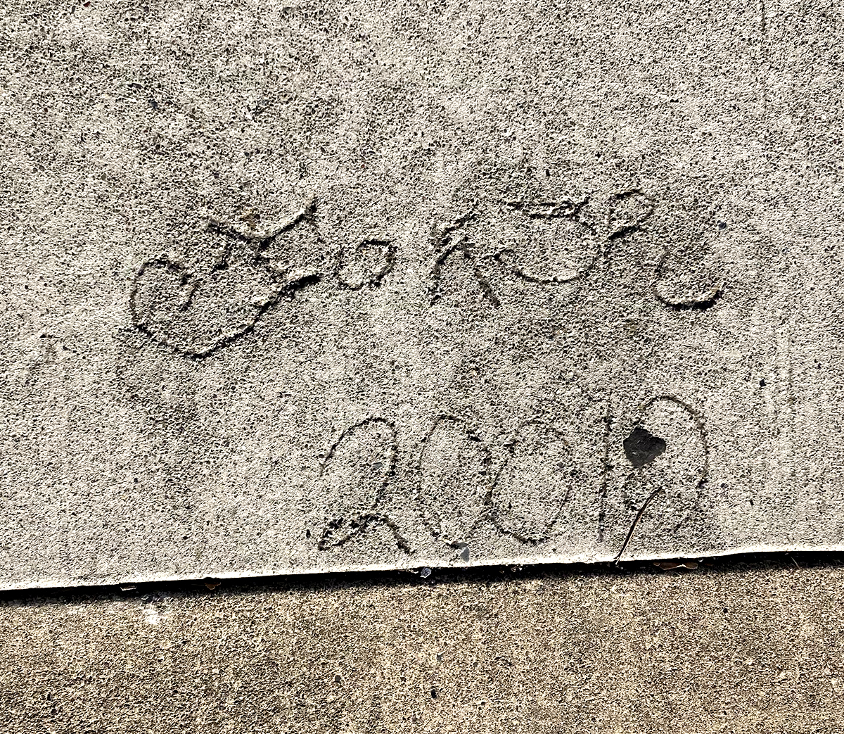
The following is a collection of street markings from before during and after sidewalks were installed. Some are the ephemeral spray paint graphics of the contractors, which can be interesting. The more enduring marks are by the people who happened to walk by when the concrete was wet. These are also interesting, even poetic at times. One example is pure nature.
2008-Before demolition started a lot of marks went down. Why was it necessary to point out the rocks?
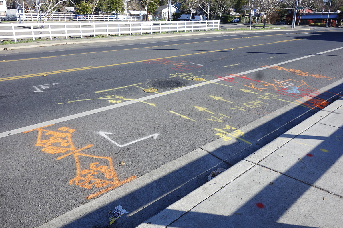
2009. Underground Service Alert (USA) finds all the pipes and wires and marks the surface. Not sure what “CCI” stands for.
2010 or “20010”. Our first folk marks! It’s an ornate tag that is hard to read.
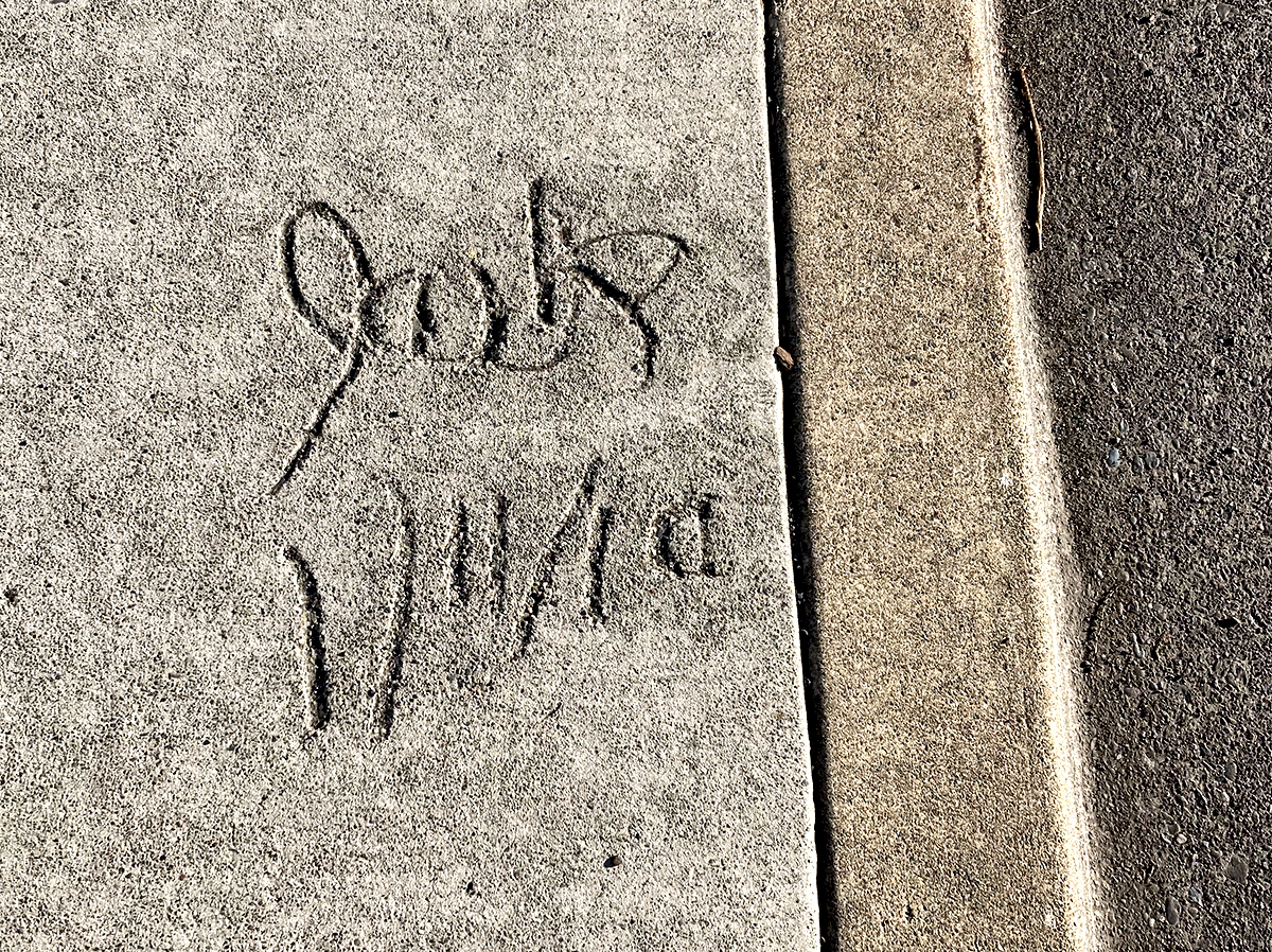
Jack has helpfully given us the day, month and year. I hope he went on to a career as an archivist.
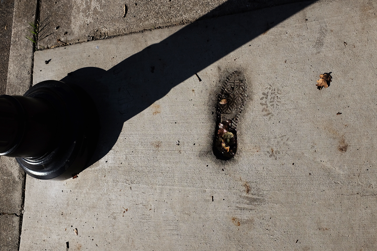
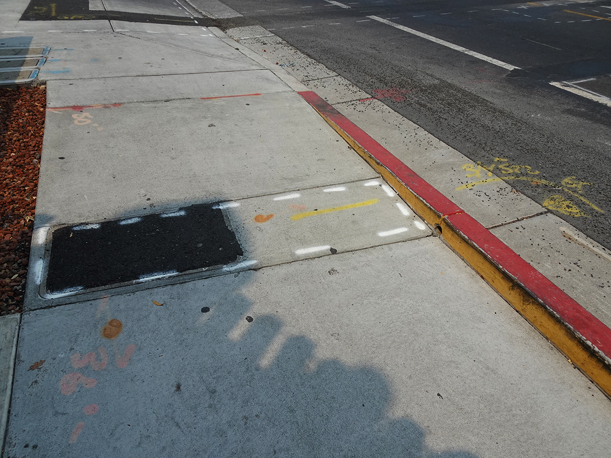
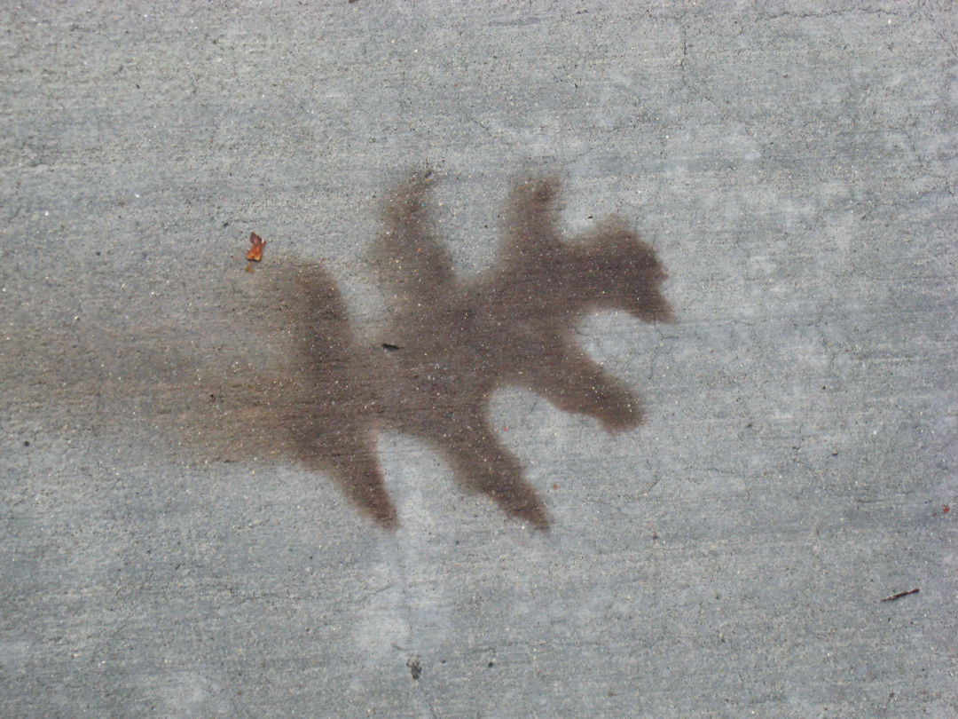
2016. Phase Two. The only actual footprint, gracefully holding leaves and water.
Year of mark unknown, but Phase Two. Someone is trying very hard with the use of a stencil. Is he offering free samples of tagging? Do people pay for tagging?
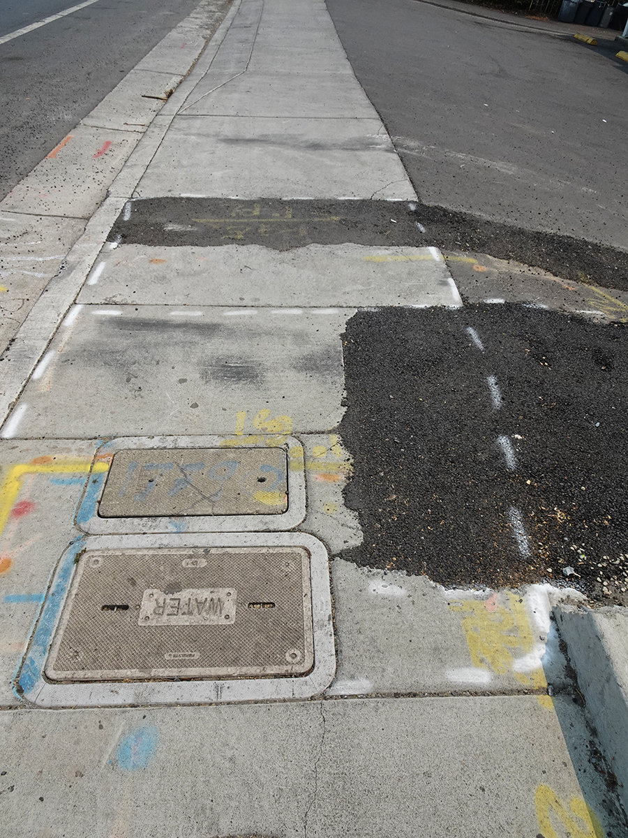
2019. Right after Phase Two was completed, some corrections that necessitated new concrete were needed. It looks like the left portion of this group of signifying friends was cut off.
In 2021 PGE had some business under the pavement. This tells you all about it, if you could only read it.
2021/ Nobody’s perfect!
2021. This one and the next two offer lush compositions of black and gray featuring inscribed and spray-painted lines and hard and soft textures.
2021. The lines, the colors, the textures, and, the shadows!
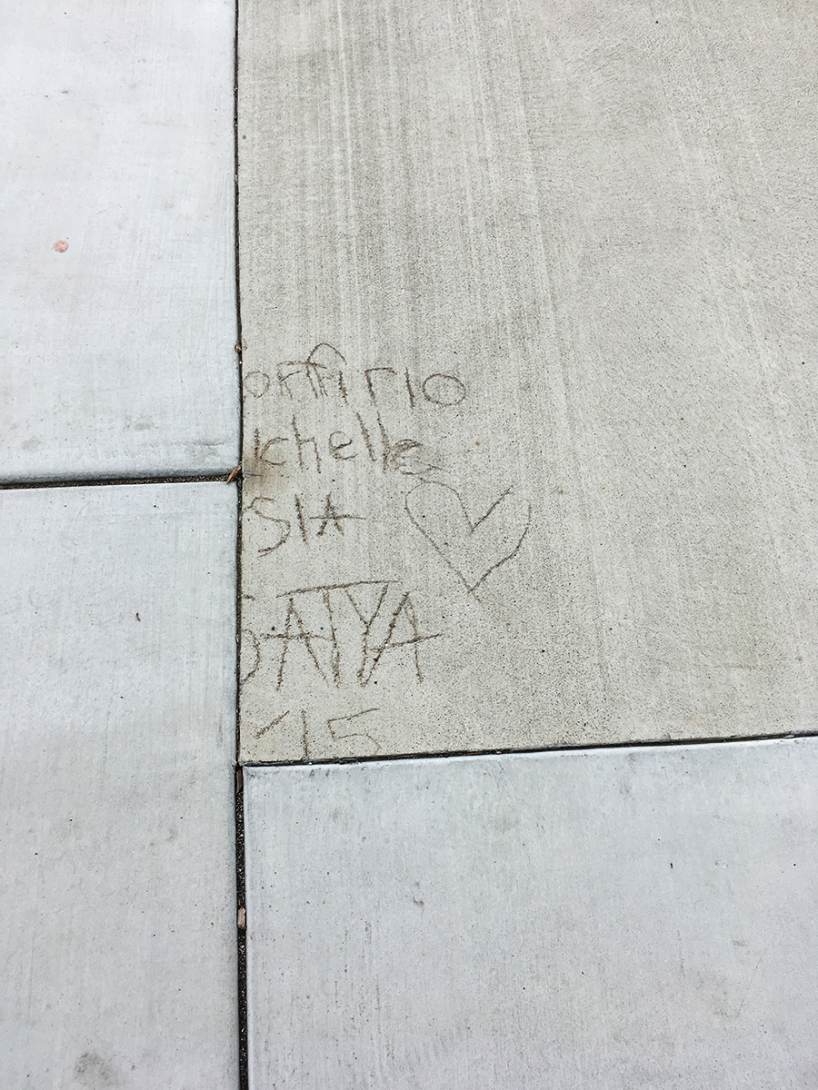
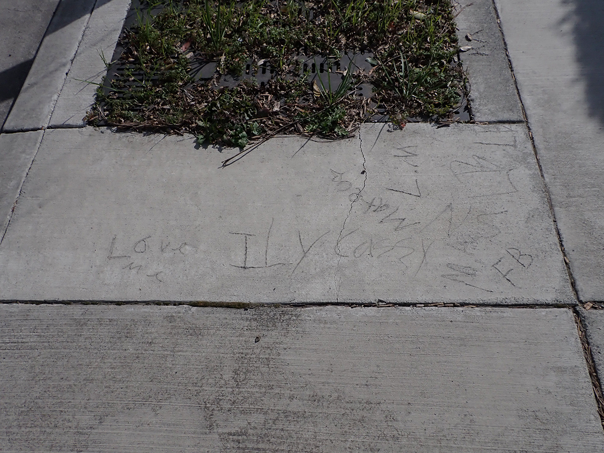
Photographed in 2023, actual date unknown, but Phase Two. “Love me.” “ILY Cazzy.” “Mateo.” “FB, LM”
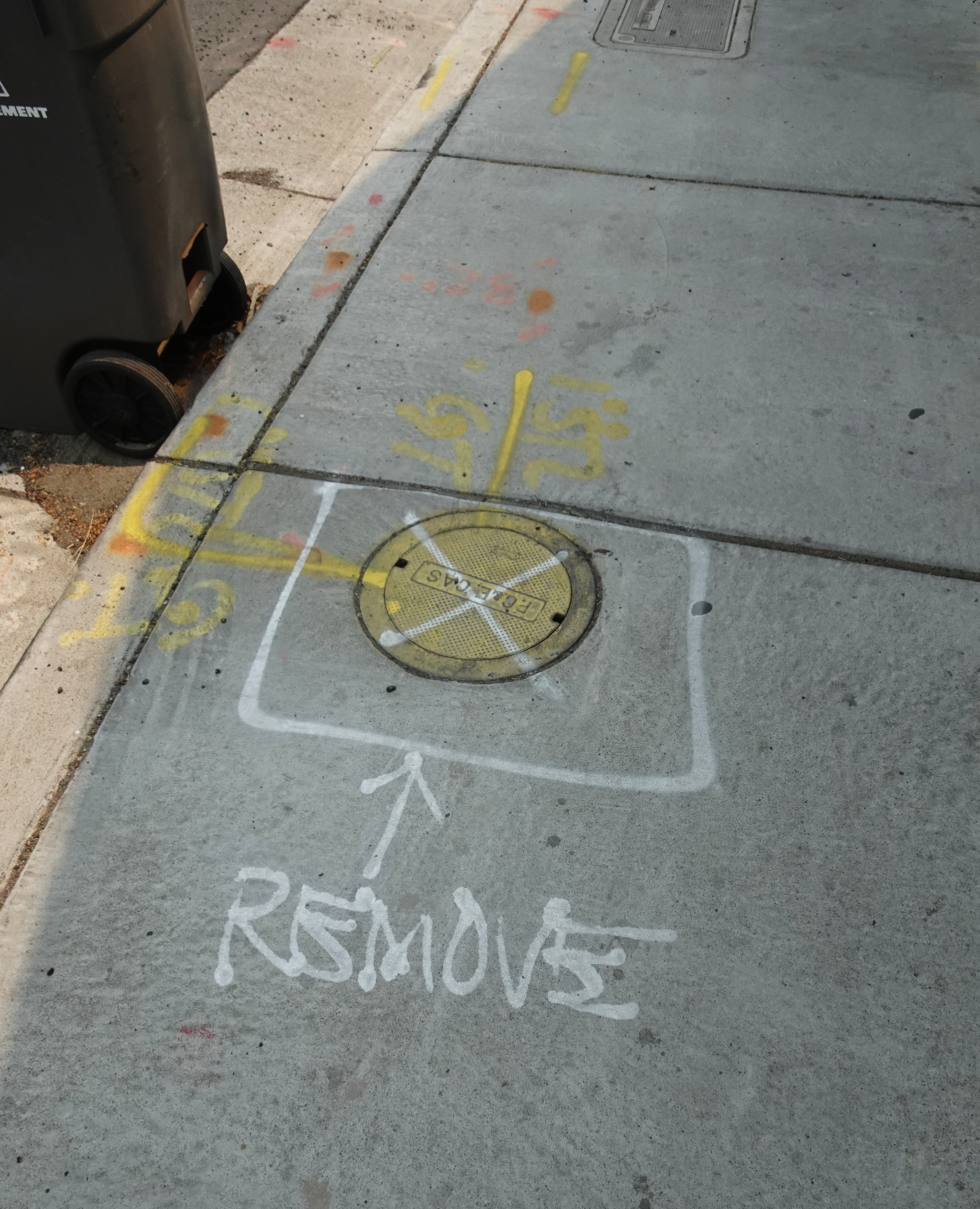
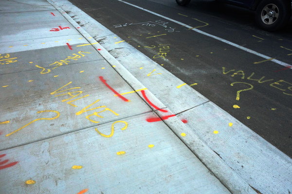
2021. Dude! Where’s my valves!
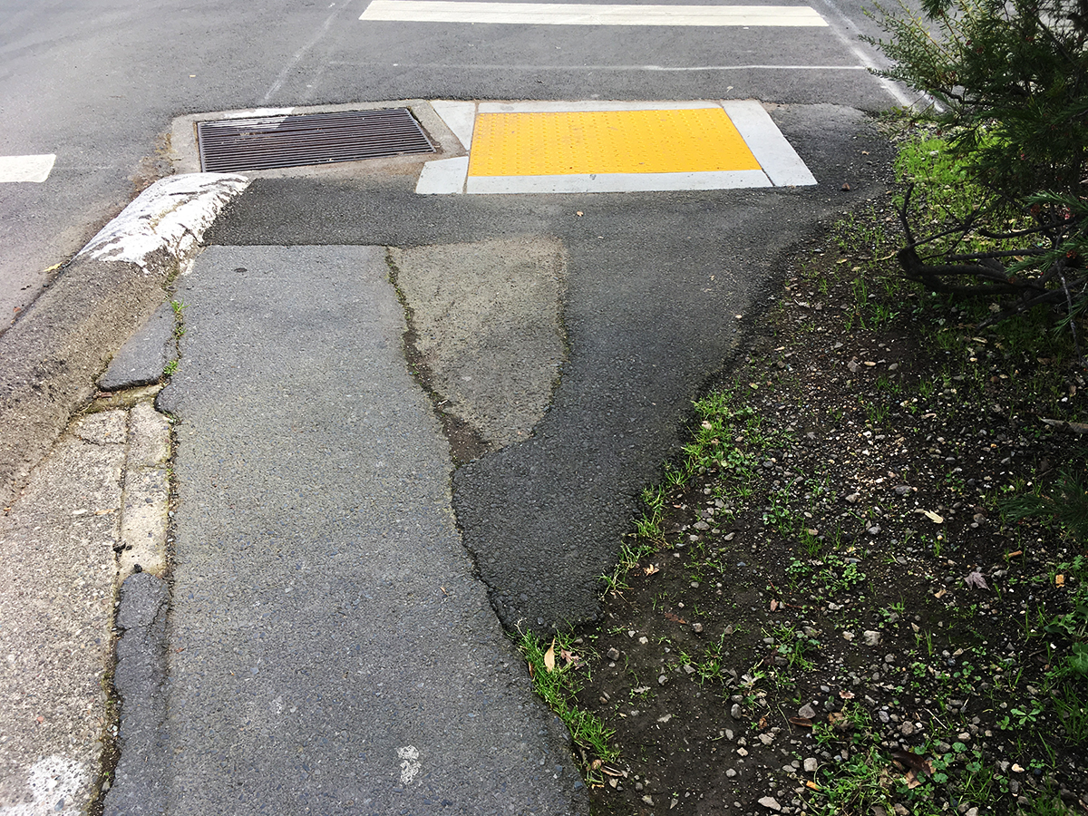
A bit off the highway, but such a lovely composition!
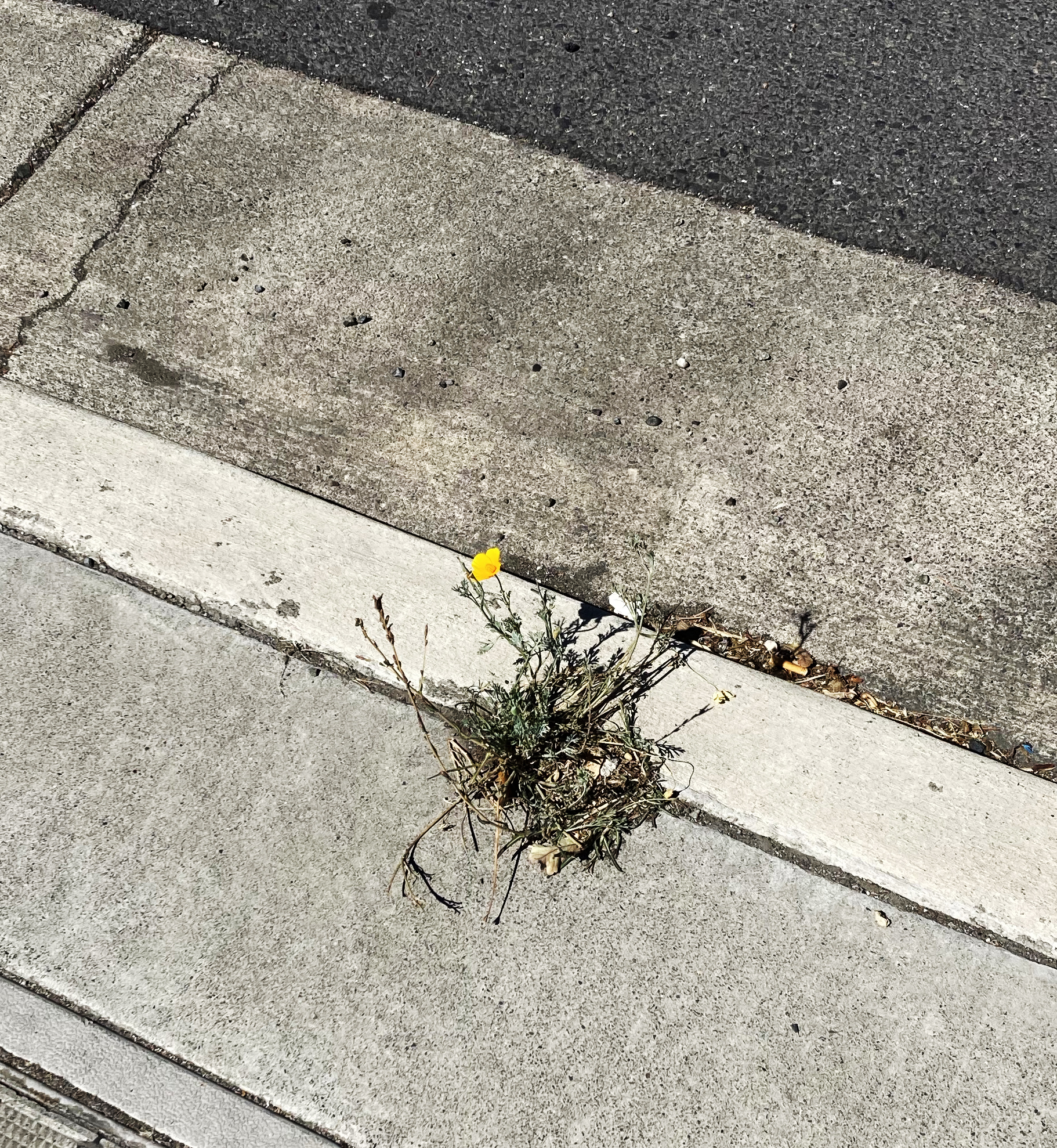
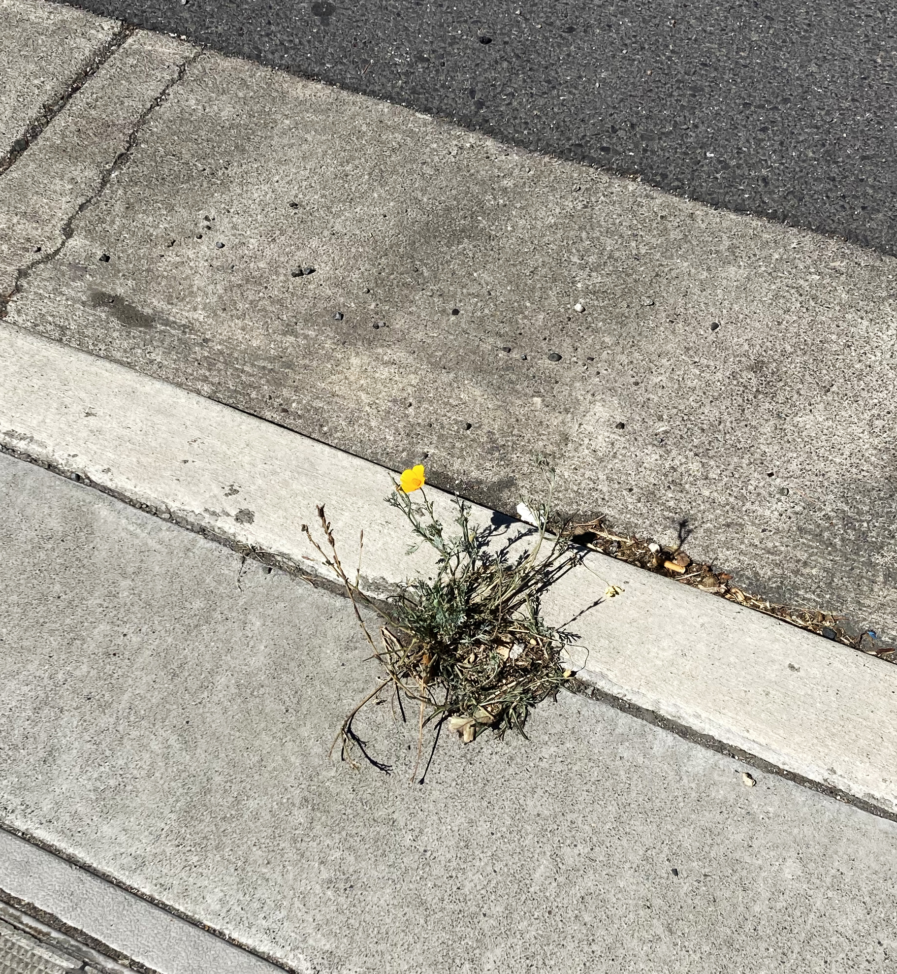
Observed within a few blocks of each other, two volunteers and a planting. The first one is a small agave planted in a hole in the sidewalk. A valiant effort indeed. Given Caltrans and/or Sonoma County’s neglect of these areas, it may survive a while. The second one looks like volunteer tomatoes springing up at a storm drain. I hope that’s what they are! Third is a humble little California poppy growing in a crack between the curb and sidewalk. Symbolic of California today?
Bonus photo: Tiny calendula in the asphalt, Arroyo Rd., BHS