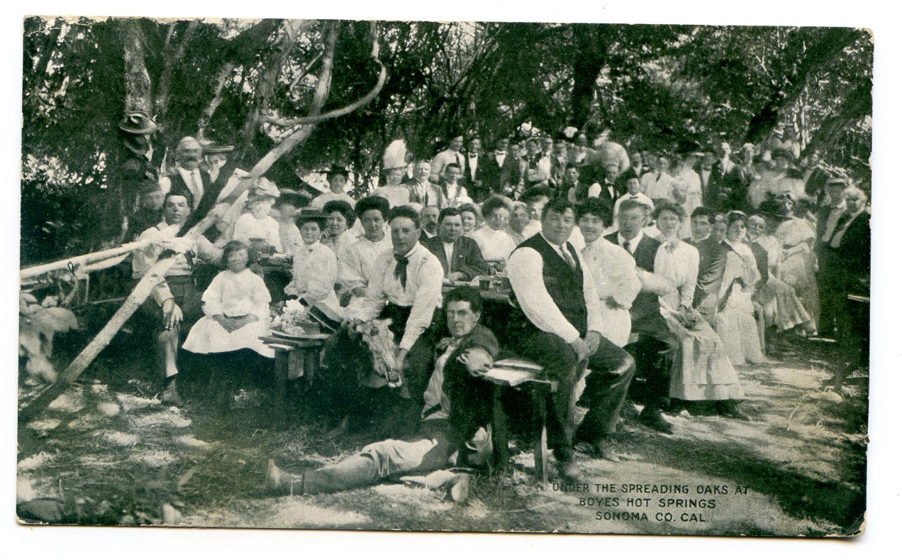
Circa 1910. Located in Boyes Hot Springs, adjacent to the railroad depot. This building may still exist.
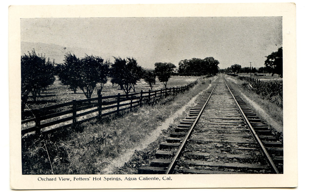
Circa 1910.
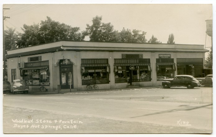
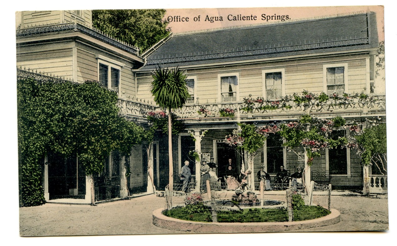
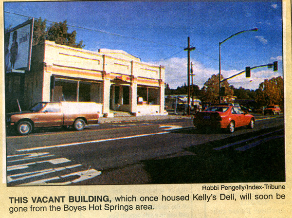
Post marked 1949. Built in 1924 or 1925. It’s future is in doubt. Currently unoccupied (2018).
Circa 1910. Located in Boyes Hot Springs, adjacent to the railroad depot. This building may still exist.
Circa 1910.
Post marked 1949. Built in 1924 or 1925. It’s future is in doubt. Currently unoccupied (2018).
This is the key historic building still standing in Agua Caliente. Apparently undergoing demolition-by-neglect, it has, in August 2018, gotten a set of new windows and a paint job. We can only hope that the structure behind the stucco still has integrity.
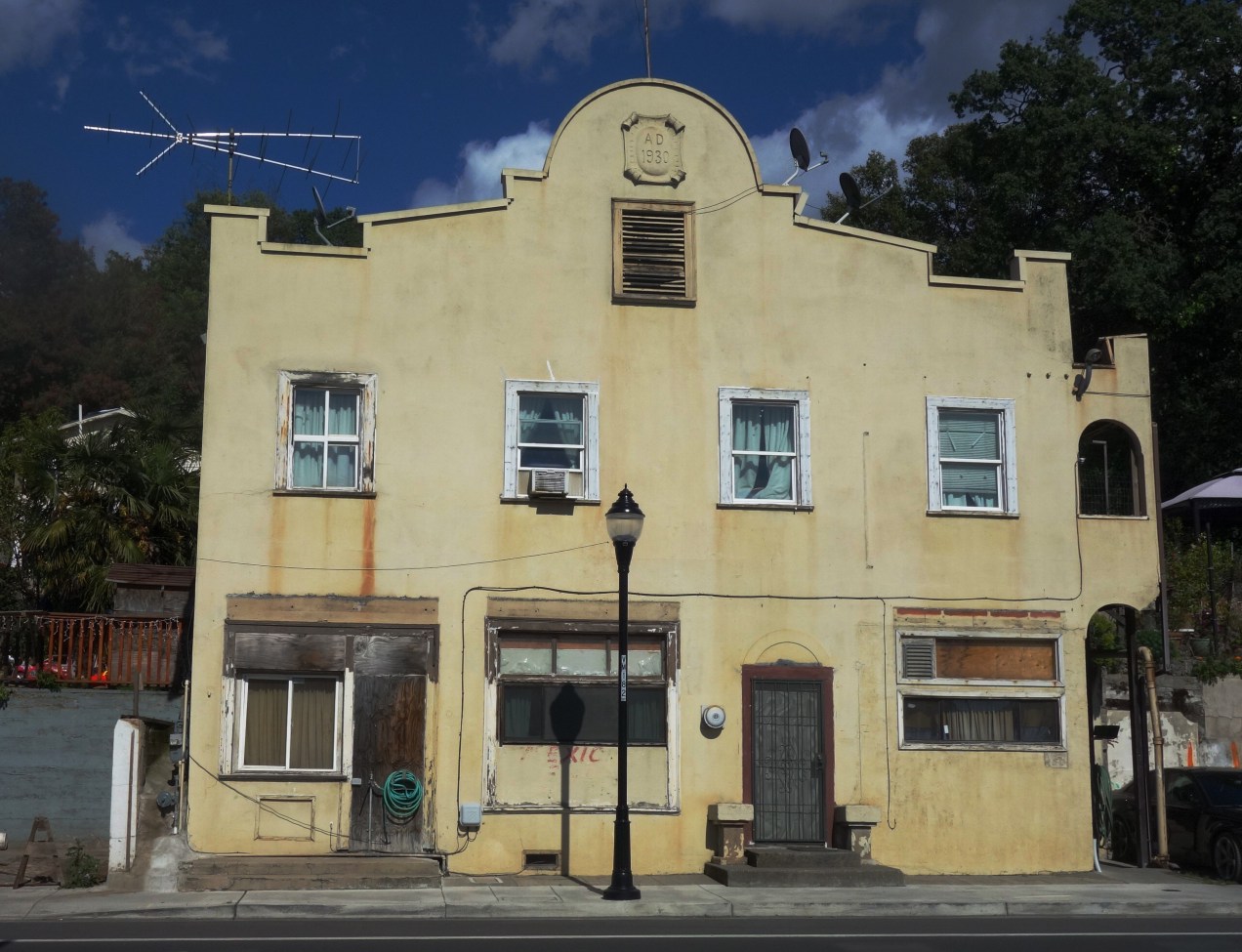
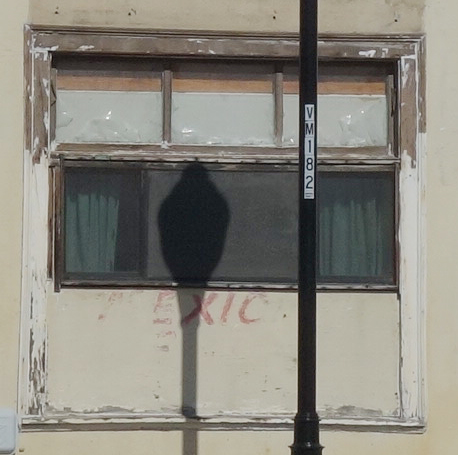
Before the new paint, the ghost of the word “Mexcian” could be seen near the sidewalk. Various restarants and markets have been housed in the building.
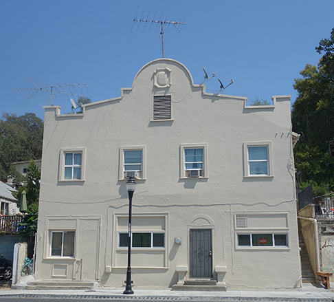
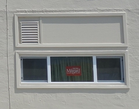
After paint. The windows still have the factory sticker.

In the days of Liexner’s Resort.
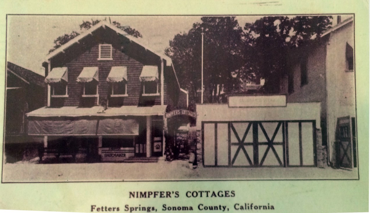
And Nimpfer’s.
Courtesy Robert Palmelee
The resort was located on the east side of Sonoma Highway, near the corner of what was then known as Sonoma Avenue, now Marin Avenue. The Agua Caliente post office was reportedly located in one of the resort buildings.
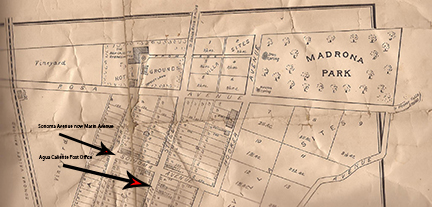
Map courtesy of Jeff Gilbert
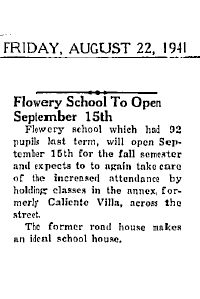
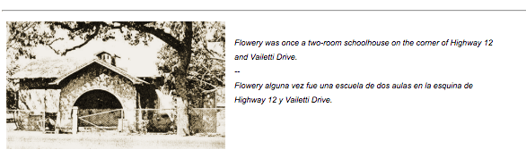
In a 1941 article, the Index Tribune located the resort across the road from (the old) Flowery School, which was at the corner of Vailetti Drive.
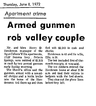
In this alarming article from 1972, the address is listed as 17127 Sonoma Highway.
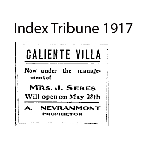
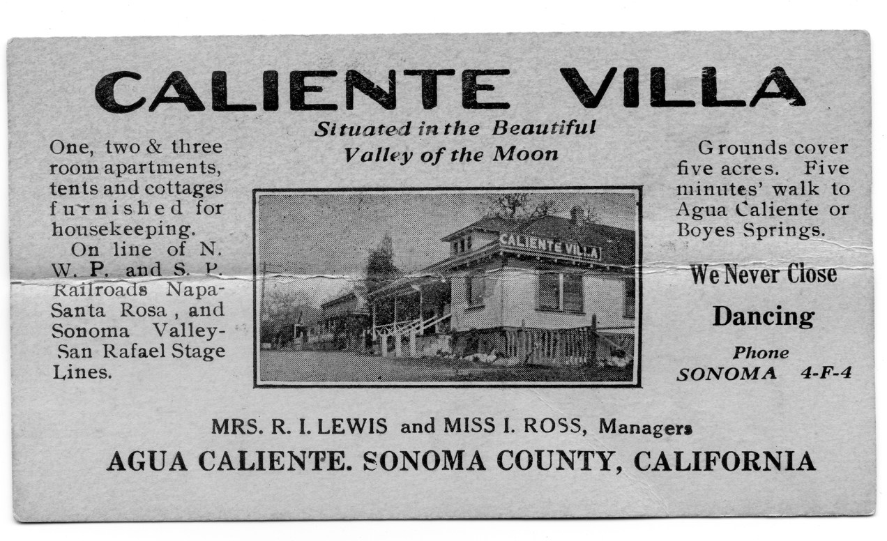
The founders of Caliente Villa in Agua Caliente are not known, but we do know the resort was owned by A. Nevraumont by 1917. Nevraumont was an early resort owner in El Verano, having established El Verano Villa before the turn of the 20th century.
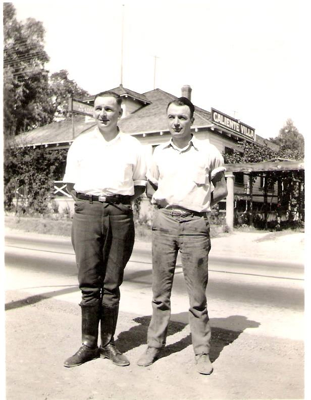
”My Great Uncle Joe Costa and My Great Uncle SFPD Officer Joe O’Rourke – Early 1930’s…Great Shot of Caliente Villa – Behind Them.” Jeff Gilbert via Facebook.
In 1923 the buildings changed hands.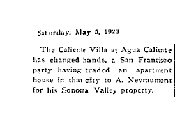
 Courtesy Lynn Downey
In fact, the Villa went through many owners and managers. In 1920 Mrs. Lewis and Miss Ross were in charge. They…”have leased the (resort) and will conduct the popular springs resort on the apartment plan…” Along with “modern conveniences and comforts,” the new proprietors would provide “a long distance phone” and a “classy jazz orchestra!”
That same year, Lewis and Ross entertained “twenty four members of the Salt Lake City baseball team…Mrs. Lewis and Miss Ross were assisted by a number of young ladies…There was dancing, music and card playing…” and “everything was complimentary, including the smokes, and the boys report a swell time.”
Courtesy California State Library
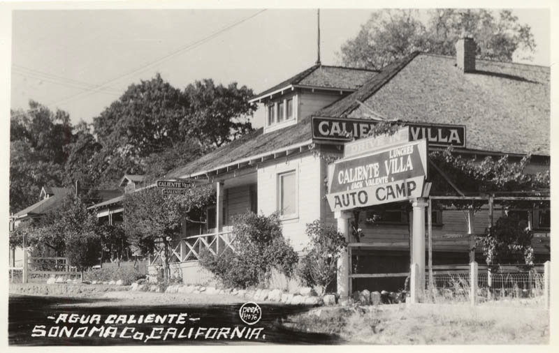
Jack Valente (his name is seen under Caliente Villa in the sign) ran the resort as of 1940. The term “auto camp,” however, was in use at least from the early 1920s. Automobile tourism in Sonoma Valley started before the opening of the Golden Gate Bridge.
Note the dormers on the three buildings shown in the photo.
Several of the buildings were in existence in 1984 when Dan Peterson made his Historic Resource report for Redevelopment.
The development proposal in 1986 probably resulted in the demolition of 17127, and it looks like the 20 multifamily units were indeed built.
17101 was still there in 2008.
In 2018 only one survives (17123).


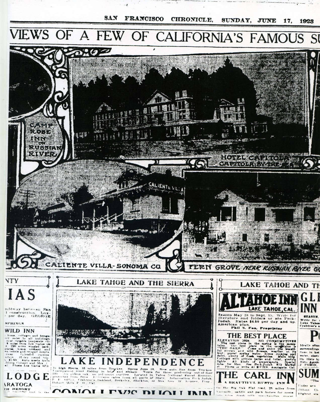
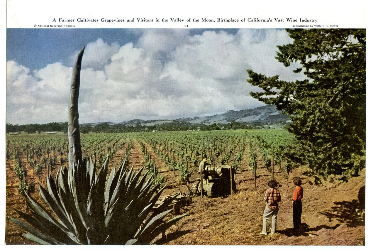
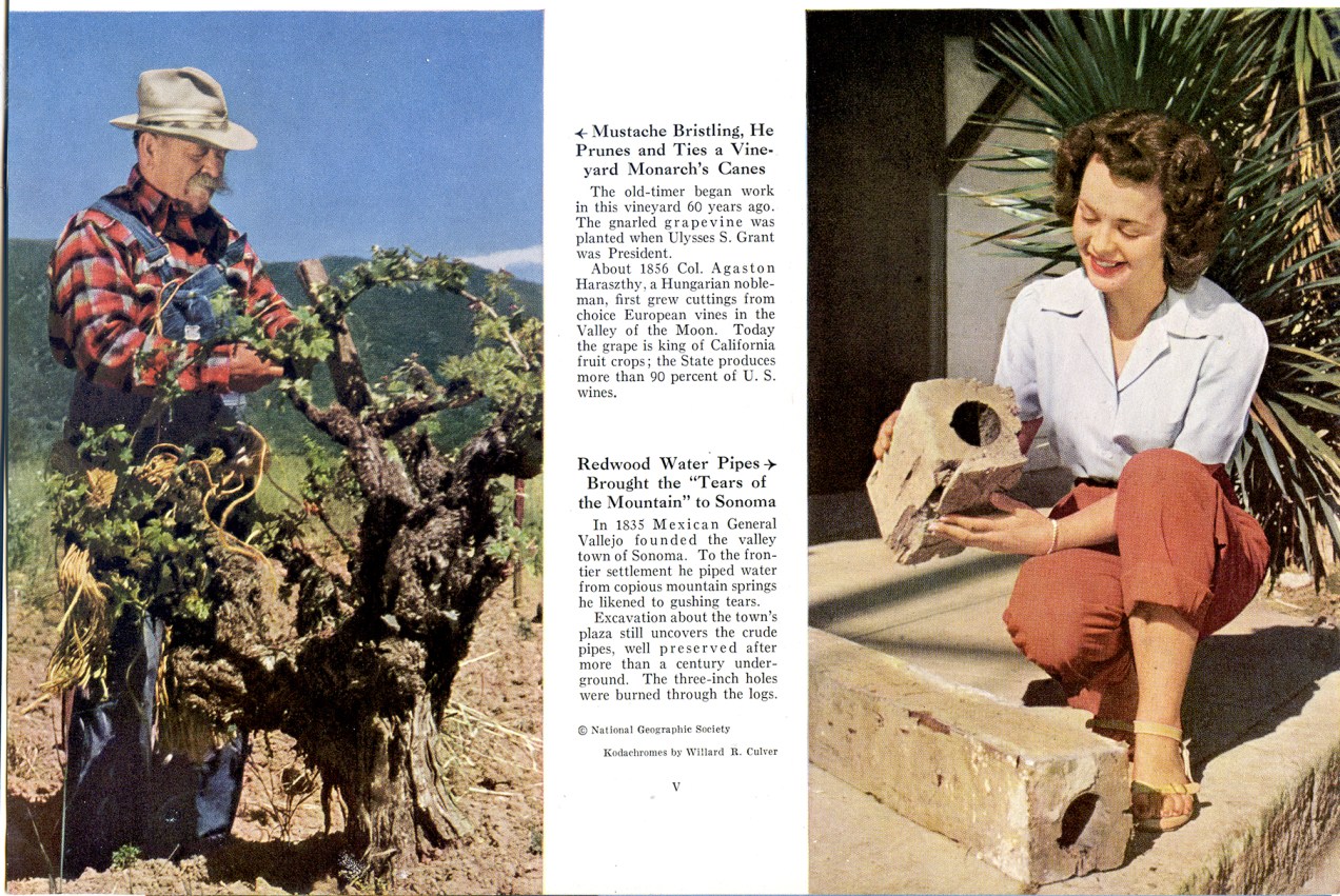
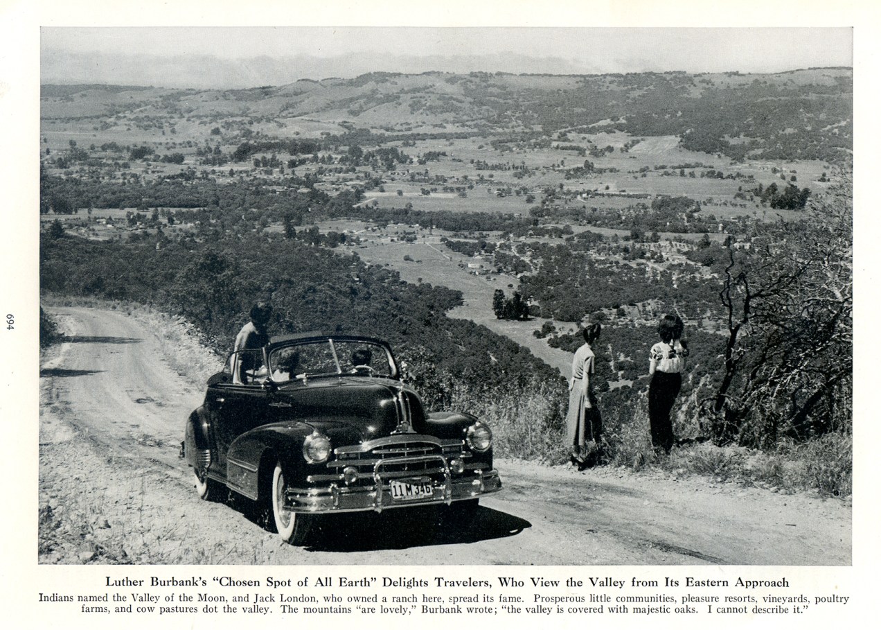
From the 1948 National Geographic article on “Hap Arnold’s Valley of the Moon.”
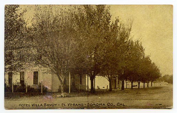
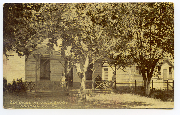
 Postmarked 1908
 Postmarked 1909
Thanks to the diligent work of Roy Tennant and Mike Acker, 78 images of Sonoma Valley by Alexander Stark have been digitized and are availalble online at https://searchworks.stanford.edu/?f%5Bcollection%5D%5B%5D=9157694
Some are well known, and some not.
 We thank archivist Franz Kunst and the rest of the staff at Special Collections for their kind assitance.
For more about Zan, read Frank Sternad’s wonderful article Stark for the San Francisco Post Card Club newsletter: ZanMonograph
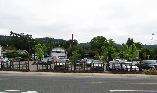
The site at the corner of Vallejo and Highway 12, now in use as the employee parking lot for the Sonoma Mission Inn, has a long history.
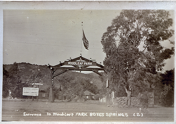
This postcard, post marked 1913, shows the entry arch, to Woodleaf Park (in the middle of the lot), which was one of the early subdivisions in Boyes Hot Springs. The sign at left reads “Desirable Summer and Winter Cottages for rent. J. W. Minges.” Minges was a prominent land owner and businessman in early twentieth century Boyes Hot Springs and was often referred to as the “mayor” of Boyes Springs.
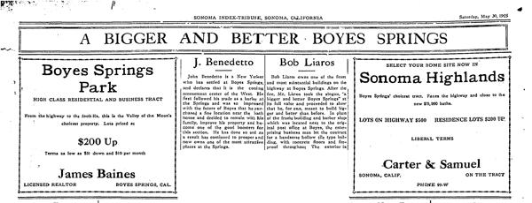
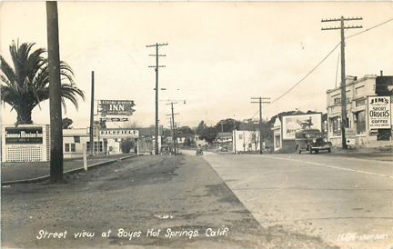
This is part of a full page ad (above) from 1925 promoting Boyes Hot Springs. It reads, in part, “In place of the frame building and barber shop that was located next to the original post Office at Boyes, the enterprising business man (Bob Liaros) let the contract for a handsome hollow-tile building with concrete floors and fireproof throughout.”
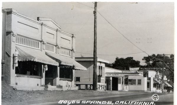
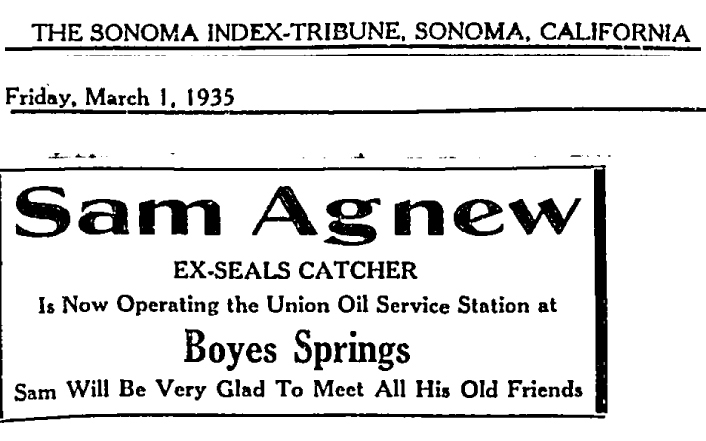
The view from the 1930s (below) shows the building mentioned above. Lairos was another Boyes booster and long-time business owner. Beyond the Liaros building are the ice plant and Sam Agnew’s service station at Vallejo St.
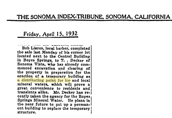
Liaros sold part of his land to the proprietor of the ice plant.
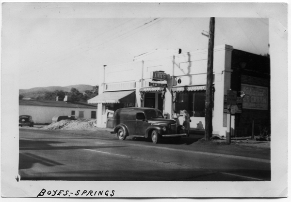
The building changed hands in 1949.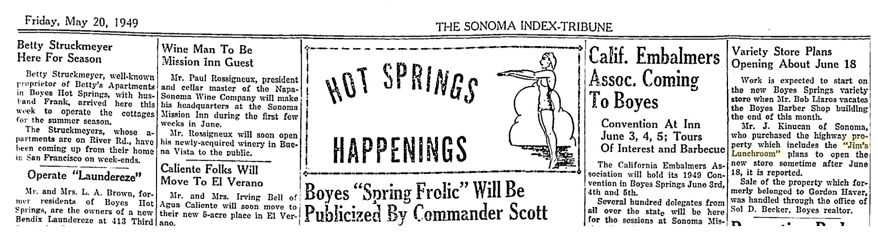
This article mentions that Jim’s Lunchroom is located in the building. If only we could get the Embalmers to come back! Perhaps they could “frolic?”
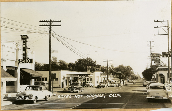
The above mentioned variety store, operated at one time by the Polidori family.
 1930s ?
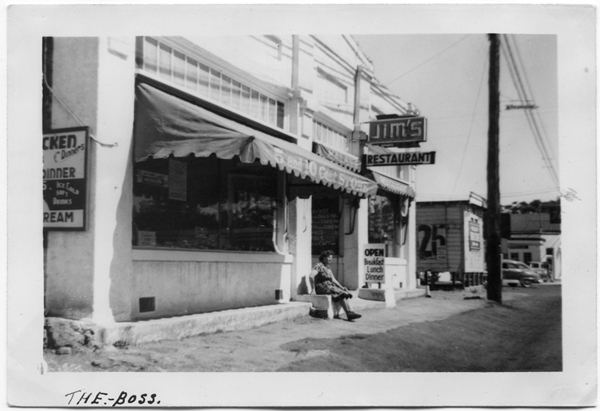
 1950s
1950s
 1992
1992
The building was demolished as an eyesore in 1992. Progress!?
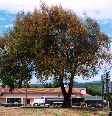
In 1997, a lone California Bay tree stood on the lot, but it was dying.
The merely functional parking lot in 2008.
Thanks to the Sonoma Valley Historical Society, Stanford University Library Special Collections, and Mr. Lloyd Cripps.
Addendum:
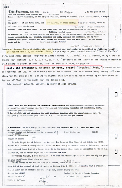
Document describing the land in Woodleaf Park that Bob Liaros bought in 1931, including the ornamental arch.
Thanks to the Sonoma Valley Historical Society for photos and the Index Tribune. If you enjoy the Springs Museum, please consider donating; use the button on theHome page! Thank you!
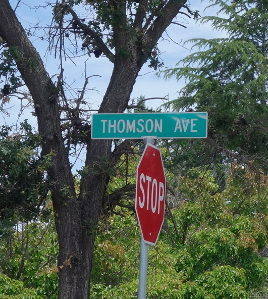
Thomson Avenue, not Thompson Avenue, was named for Dr. Allen Thomson, who had been physician to General Vallejo, and who married one of his granddaughters. Thomson was president of the company that developed the subdivision known as Boyes Springs Park . Thomson Street is its southern border.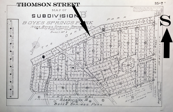
The building at the southeast corner was a Red Crown gas station circa 1930. It later became the Ferrando’s Plumbing building and now houses La Michoacana Ice Cream and Plain Janes. It was famously made over by Rico Martin in 2015.
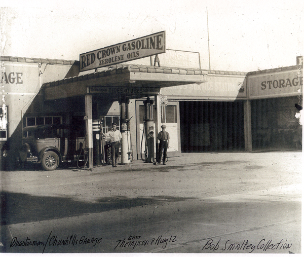
The caption says “Questerman/Churchill Garage.” Note the misspelling of the street name and the designation “east.”
Directly across Highway 12 from the end of Thomson (not East Thomson!) was Baker’s Drive In, established in 1957 (and open 24 hours per day!)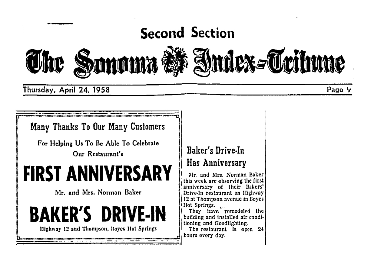 In 1958 Norman Baker had big plans to build a truck stop on this property, but the county would not approve the project.
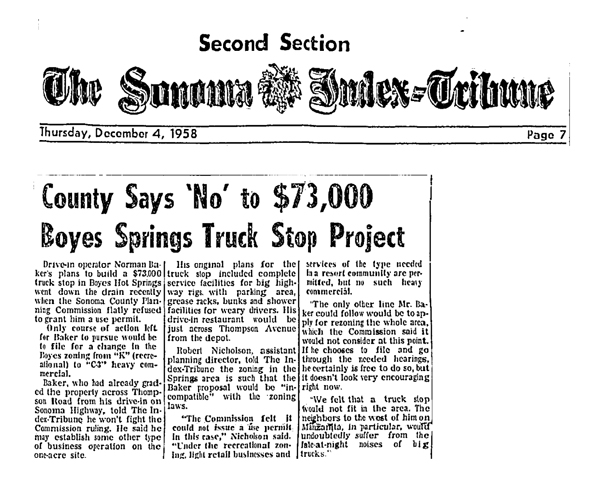
Looking South, Farrell’s sign at left, Baker’s Drive In at right.
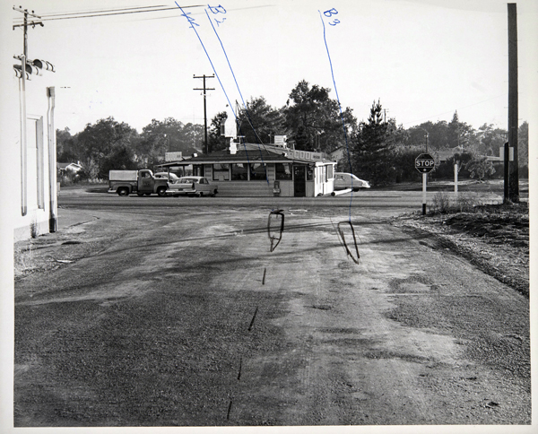
Looking at Bakers’ Drive In on Hwy 12, from Thomson. Red Crown building seen at left.
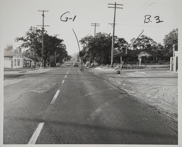
Looking North
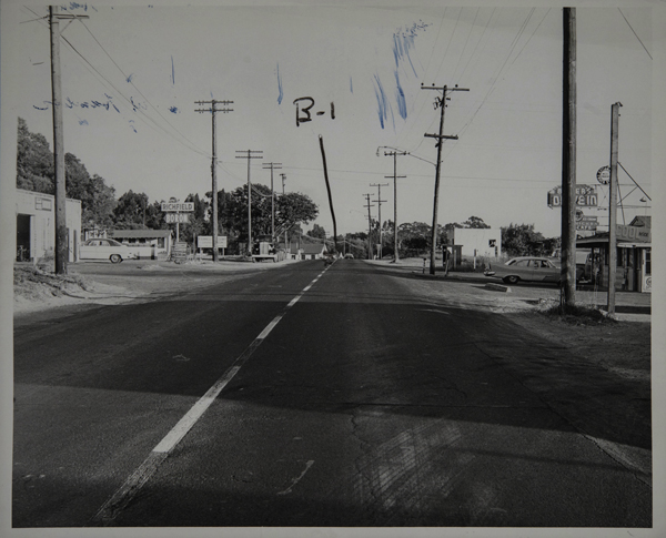
These photos from 1958, courtesy of the Sonoma County Library, were used in a court case, the nature of which is unknown, but could have been a suit over a traffic accident. In the photo of the highway looking south, a sign can be seen (below the Richfield sign) which proclaims Farrell’s Resort, which would have been on the property now partially occupied by Arroyo Vet Hospital.
In 1972, John Metallinos and family opened the Fruit Basket on Arnold Drive.
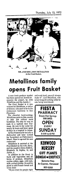
They opened their Boyes Springs branch sometime later, probably in the early 1980s, at the old Baker’s Drive In. On June 15, 1983, a fire destroyed that building.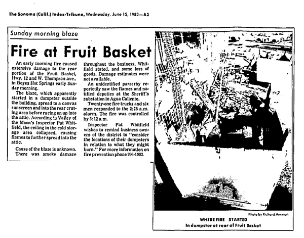
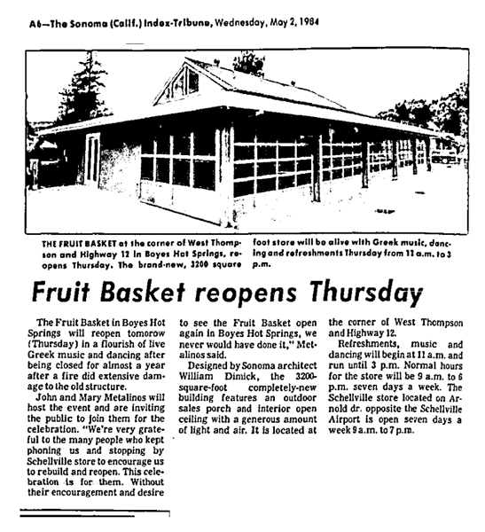
Nearly a year later, the Boyes Springs Fruit Basket reopened, “in a flourish of live Greek music and dancing,” in its new building, which was designed by architect William Dimick.
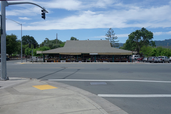
The Fruit Basket in 2107. It really is a graceful building.
My thanks to Mark Maberly for information about Dr. Thomson, and his general enthusiasm for our history. As always, contributions of knowledge are welcomed. Please leave a comment.