Architecture, Boyes Hot Springs, History, mid-century, Photographs

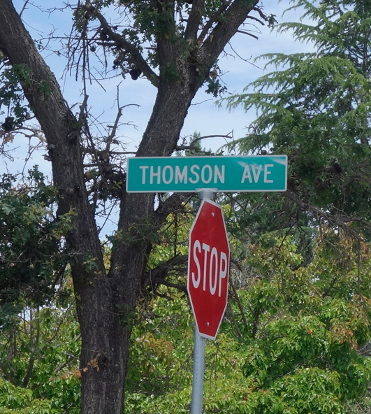
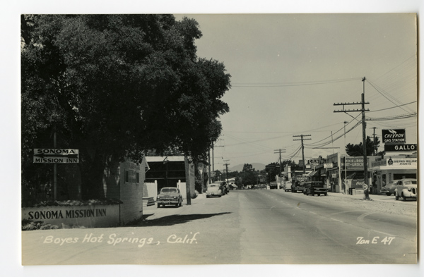
The Corner of Thomson Avenue and Highway 12

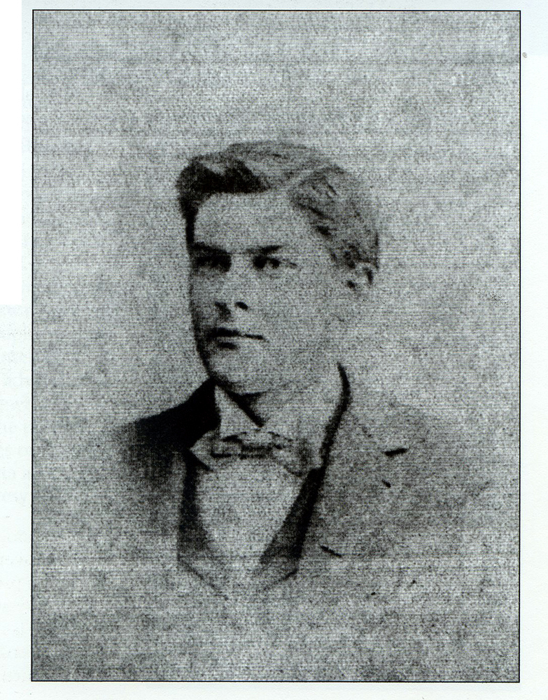
Dr. Allen Thompson, courtesy of the Sonoma Valley Historical Society

ThomsonSignweb

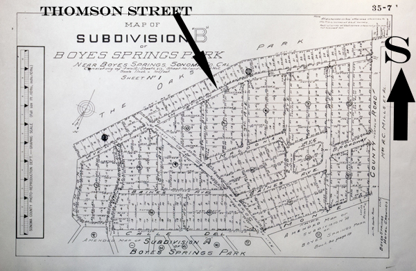
Thomson Avenue, not Thompson Avenue, was named for Dr. Allen Thomson, who had been physician to General Vallejo, and who married one of his granddaughters. Thomson was president of the company that developed the subdivision known as Boyes Springs Park . Thomson Street is its southern border.BHSSubDivBweb
The building at the southeast corner was a Red Crown gas station circa 1930. It later became the Ferrando’s Plumbing building and now houses La Michoacana Ice Cream and Plain Janes. It was famously made over by Rico Martin in 2015.
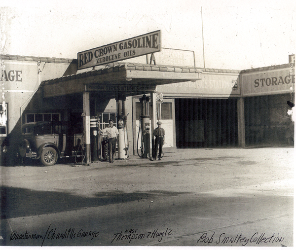
Ferrandosweb

The caption says “Questerman/Churchill Garage.” Note the misspelling of the street name and the designation “east.”

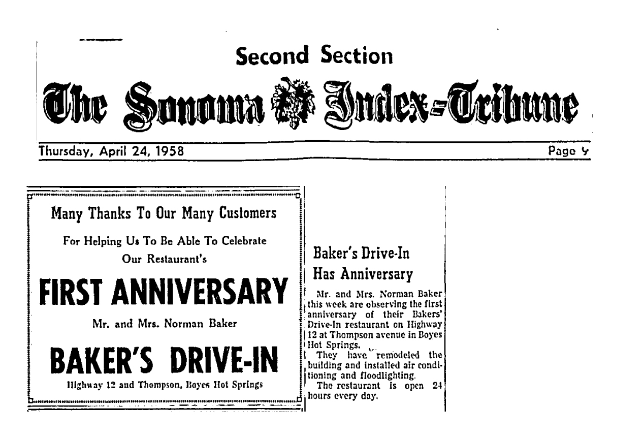
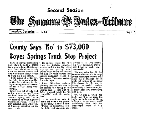
Directly across Highway 12 from the end of Thomson (not East Thomson!) was Baker’s Drive In, established in 1957 (and open 24 hours per day!)Baker'sArticleAd In 1958 Norman Baker had big plans to build a truck stop on this property, but the county would not approve the project.BakerTruckStopweb
IntersectionofThomsenStreetandCaliforniaHighway12.1web

Looking South, Farrell’s sign at left, Baker’s Drive In at right.
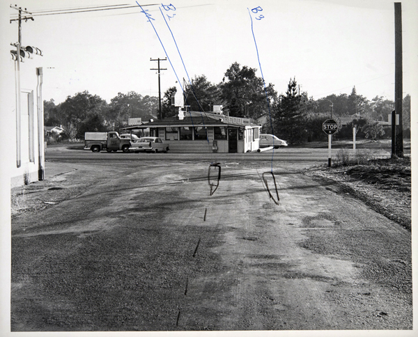
 

Intersection_of_ThomsenStreetandCaliforniaHighway12.3web

Looking at Bakers’ Drive In on Hwy 12, from Thomson. Red Crown building seen at left.
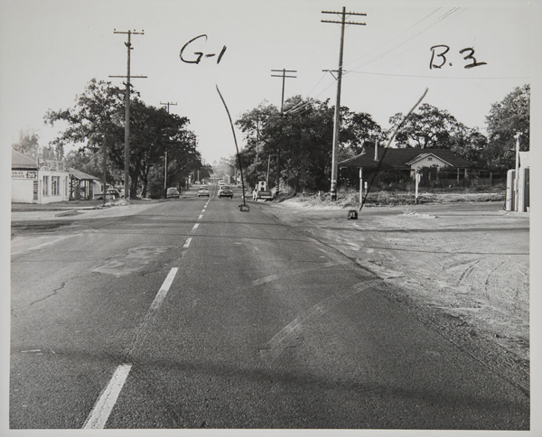
 

Intersection_of_Thomsen_Street_and_California_Highway_12web

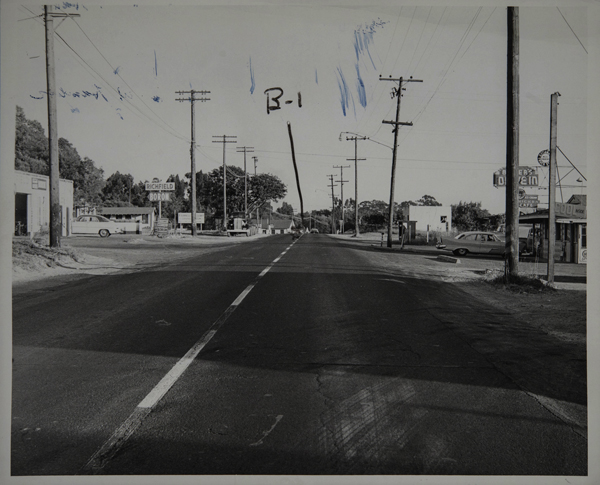
Looking North

These photos from 1958, courtesy of the Sonoma County Library, were used in a court case, the nature of which is unknown, but could have been a suit over a traffic accident. In the photo of the highway looking south, a sign can be seen (below the Richfield sign) which proclaims Farrell’s Resort, which would have been on the property now partially occupied by Arroyo Vet Hospital.

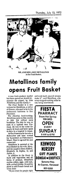
In 1972, John Metallinos and family opened the Fruit Basket on Arnold Drive.
FruitBasketOpensweb

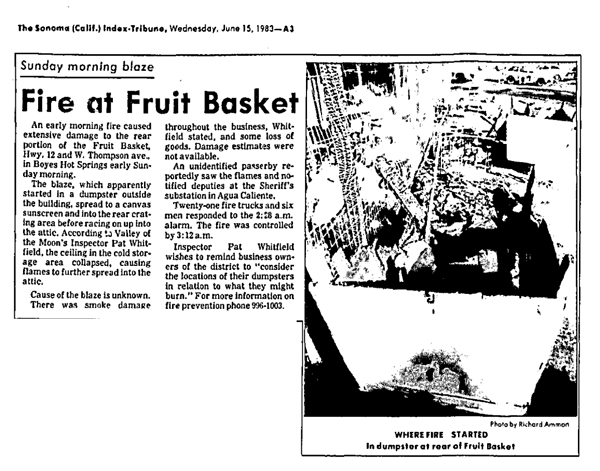
They opened their Boyes Springs branch sometime later, probably in the early 1980s, at the old Baker’s Drive In. On June 15, 1983, a fire destroyed that building.FruitBasketFireweb
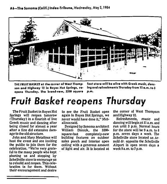
Nearly a year later, the Boyes Springs Fruit Basket reopened, “in a flourish of live Greek music and dancing,” in its new building, which was designed by architect William Dimick.
FruitBasketReopensweb

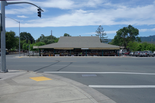
FruitBasket2017web

The Fruit Basket in 2017. It really is a graceful building.

My thanks to Mark Maberly for information about Dr. Thomson, and his general enthusiasm for our history. As always, contributions of knowledge are welcomed. Please leave a comment.
Standard
Bibliography, Collection/Obsession, History, Photographs, Resorts

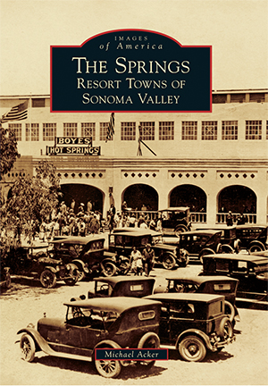
Images of America, The Springs:Resort Towns of Sonoma Valley

coverfinal

Michael Acker’s book will be out on March 27. There will be a book signing at Reader’s Books in Sonoma on March 30, 7PM. Other events to follow including one at the Depot Park Museum, date TBD.

The book features 210 photographs of the Springs from 1885 to 2016. Part history, part nostalgia, part pride of place in the here and now, it is sure to interest and delight residents, visitors, and the curious alike.

Buy it here: https://www.arcadiapublishing.com/Products/9781467124300


Standard
Art, Boyes Hot Springs, Photographs

Main Stem Project Photographs, East Side

CORRECTED LINK

Link to Flickr gallery of all the photographs of Highway 12 between Verano Blvd. and Agua Caliente Rd., on the east side, taken in 2008. These are the base photos the Main Stem Project. Only six years ago, but a lot has changed. Sidewalks! New businesses. Old businesses gone. A literal walk down memory lane.

West side to follow.

https://www.flickr.com/photos/83786542@N00/sets/72157648810262200/

Standard
Photographs

New to the Springs Historic Photo Database


1942Aerial1web

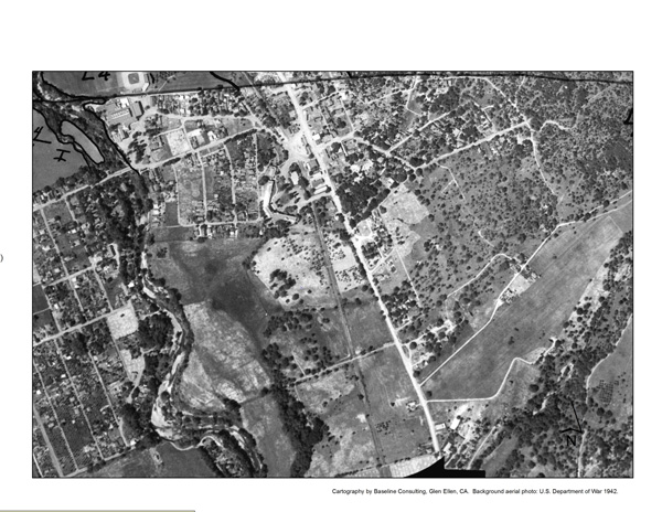
1942 War Department aerial photograph of Boyes Hot Springs. The Sonoma Mission Inn is clearly visible. (In the upper left hand corner you can see the Boyes Bath House complex and the baseball field.) There is not much building on Highway 12 south of The Inn. Is this because of the fire of 1923, or was this area just not developed by 1942?

Thanks to Arthur Dawson for this fascinating photo/map.


Standard
Photographs

New to the Springs Historic Photo Database

Grangedeedcoverweb

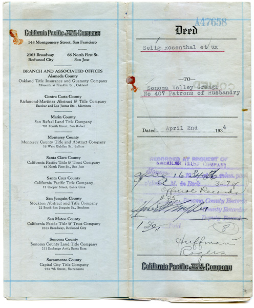
Cover of the deed conveying three parcels from Selig Rosenthal to the Sonoma Valley Grange (18627 Sonoma Highway), in 1934. These parcels comprise the hall itself and the parking lots on either side. Apparently, no money changed hands. Rosenthal was the proprietor of Rosenthal’s Resort, which occupied the property of the current (2014) trailer park, Thai restaurant, and abandoned restaurant.

Standard