Photographs courtesy of the Sonoma Valley Historical Society, Stanford University Library Special Collections, and the author.
Photographs courtesy of the Sonoma Valley Historical Society, Stanford University Library Special Collections, and the author.
Updated Below
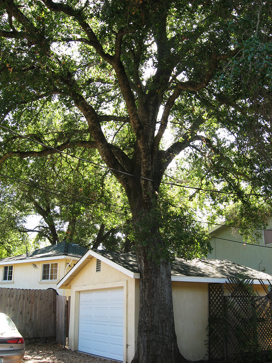
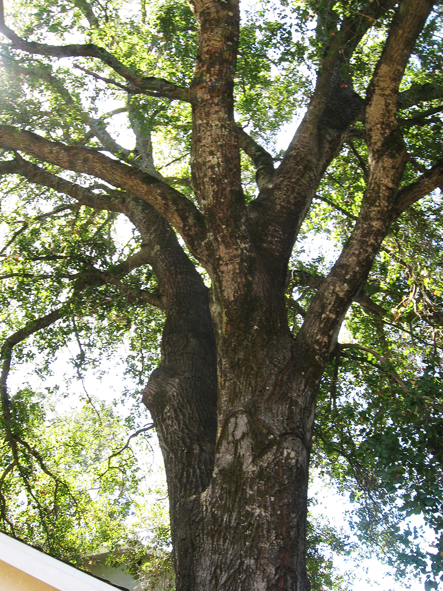
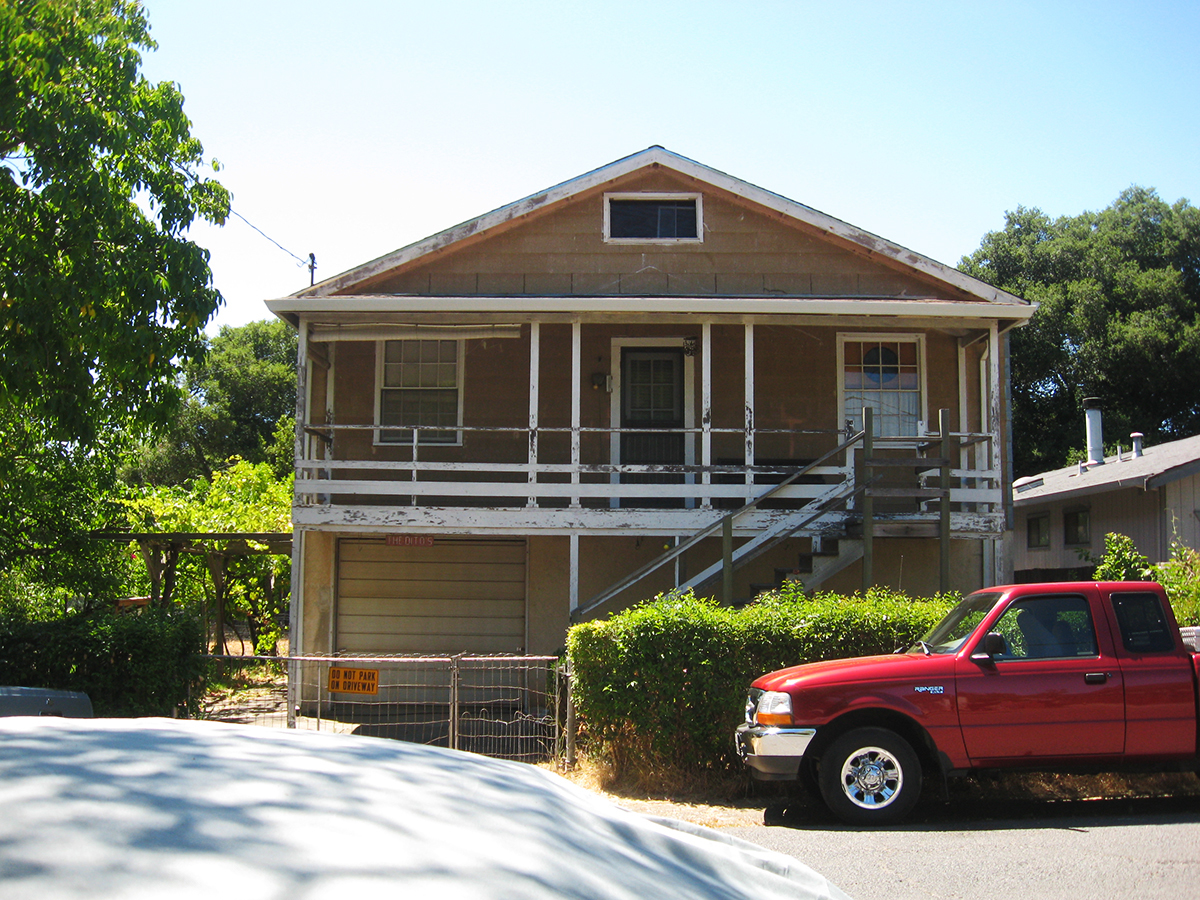
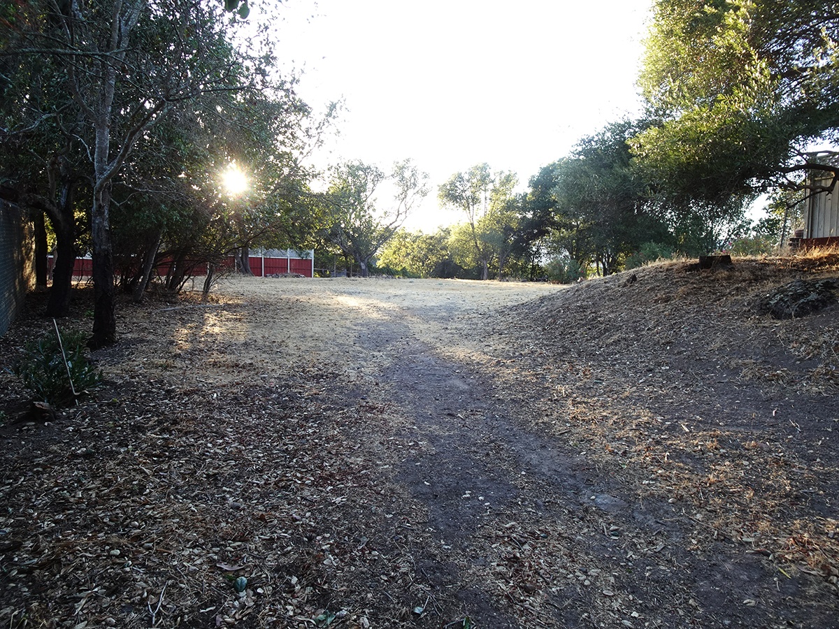
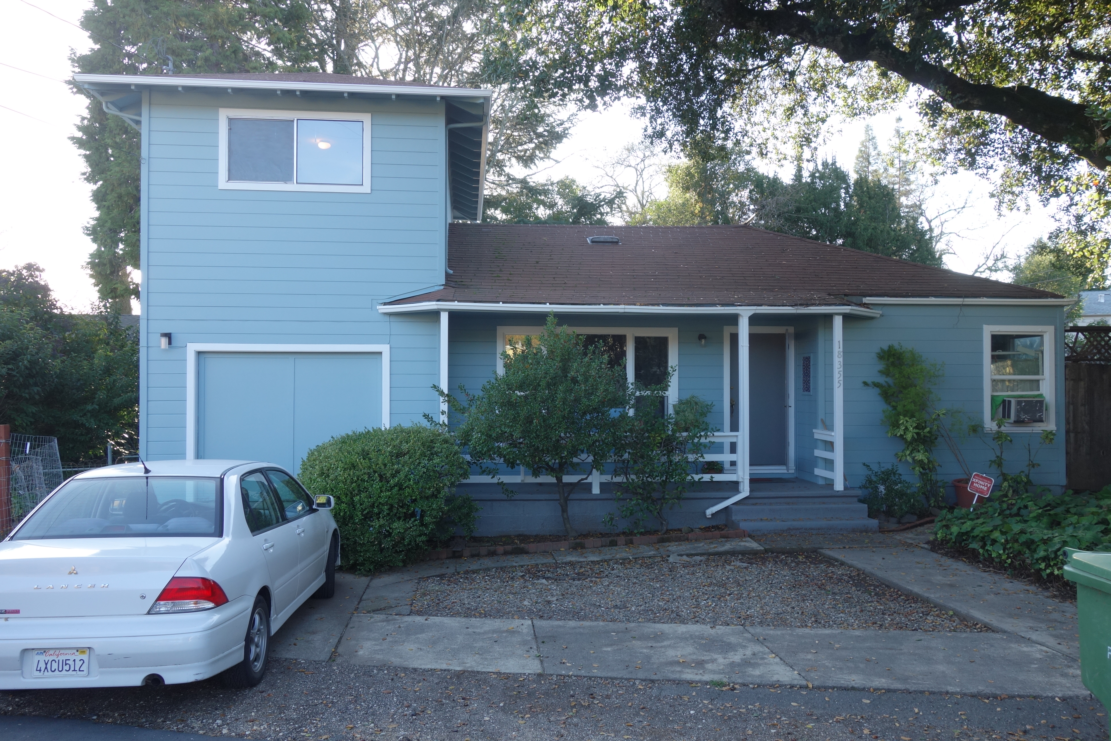
On Vallejo Ave. near the corner of Calle del Monte, in Boyes Hot Springs, there stood a prime example of the ongoing interaction between trees and the built environment: A garage was built next to an oak, the oak grew, humans adapted the structure to accommodate the native tree. This was a lovely thing to see.
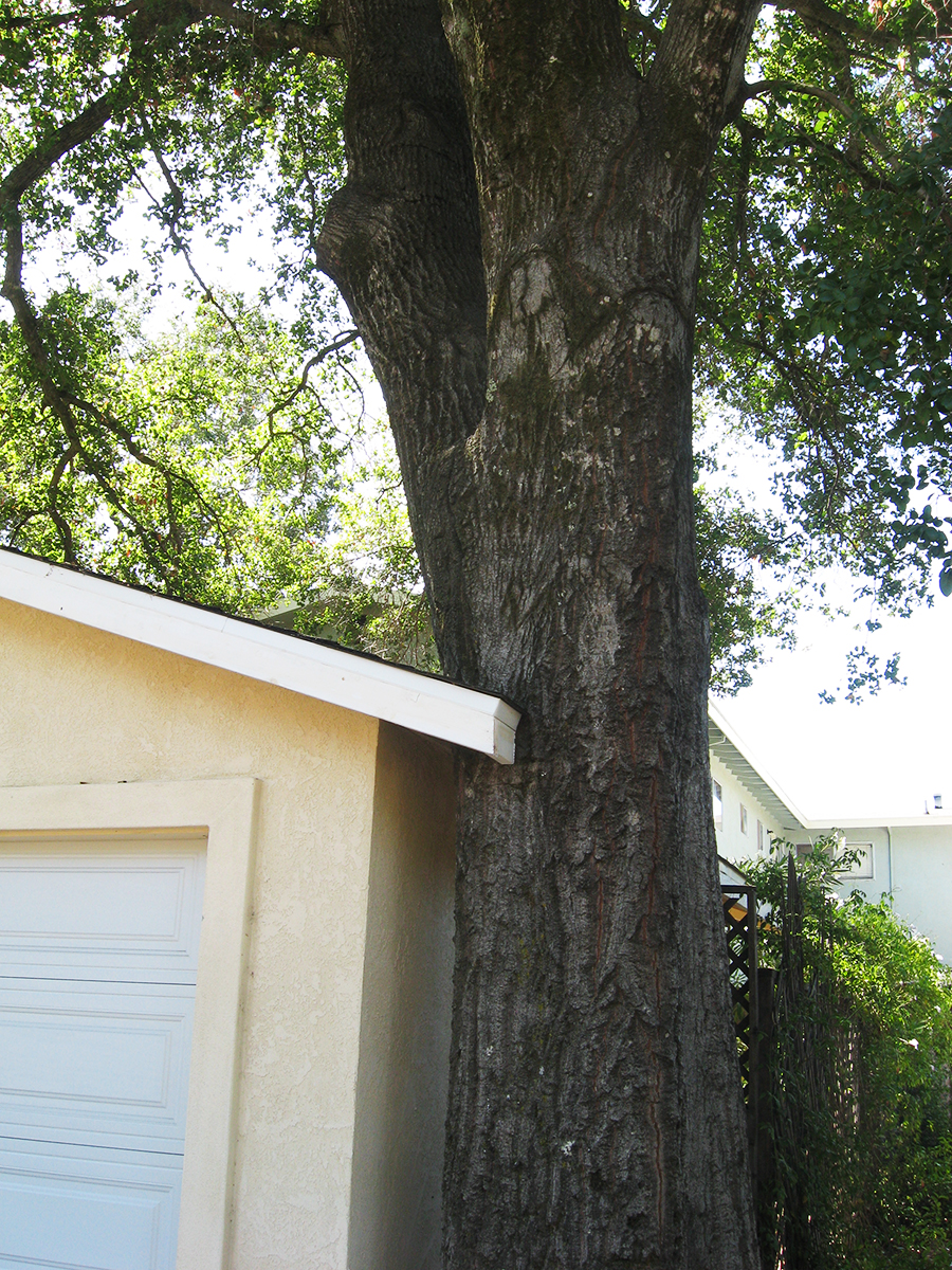
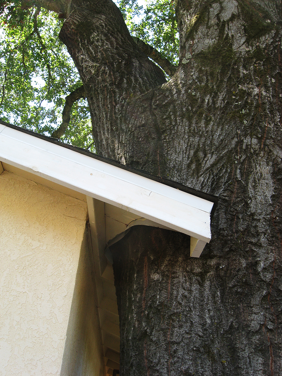
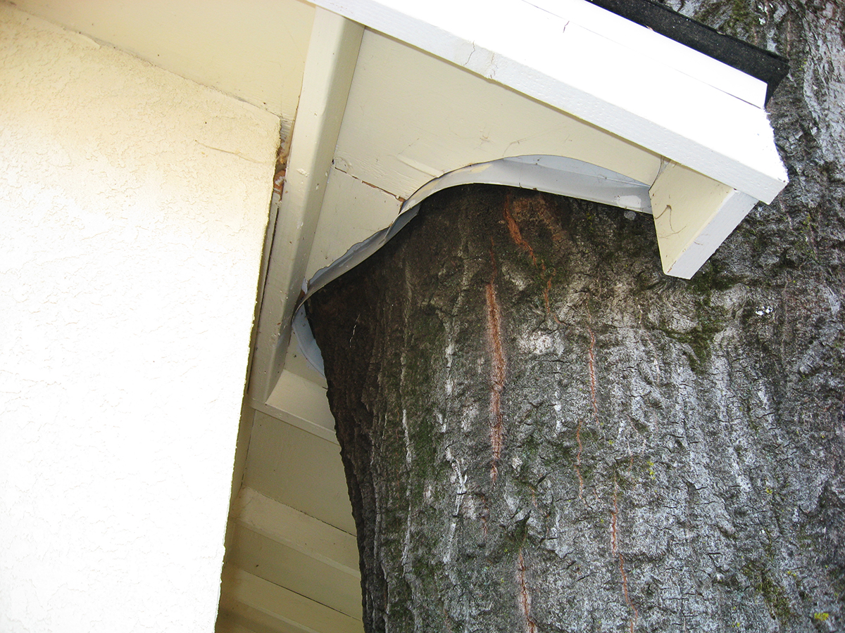
Prior to 2009 when I first photographed it, the structure had been so dilapidated that I was sure they were going to tear it down. But they restored it and did a neat job of cutting the roof overhang around the mighty Quercus.
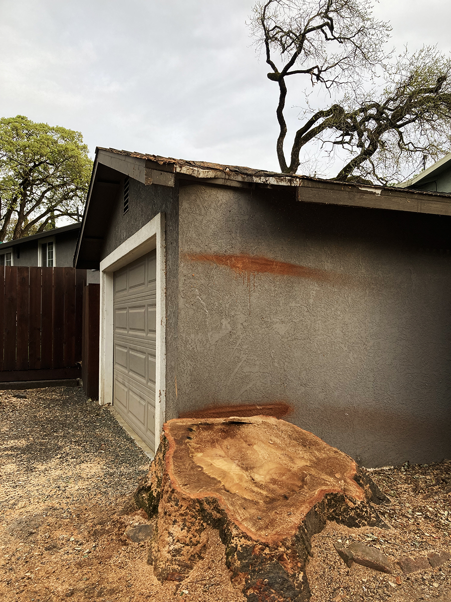
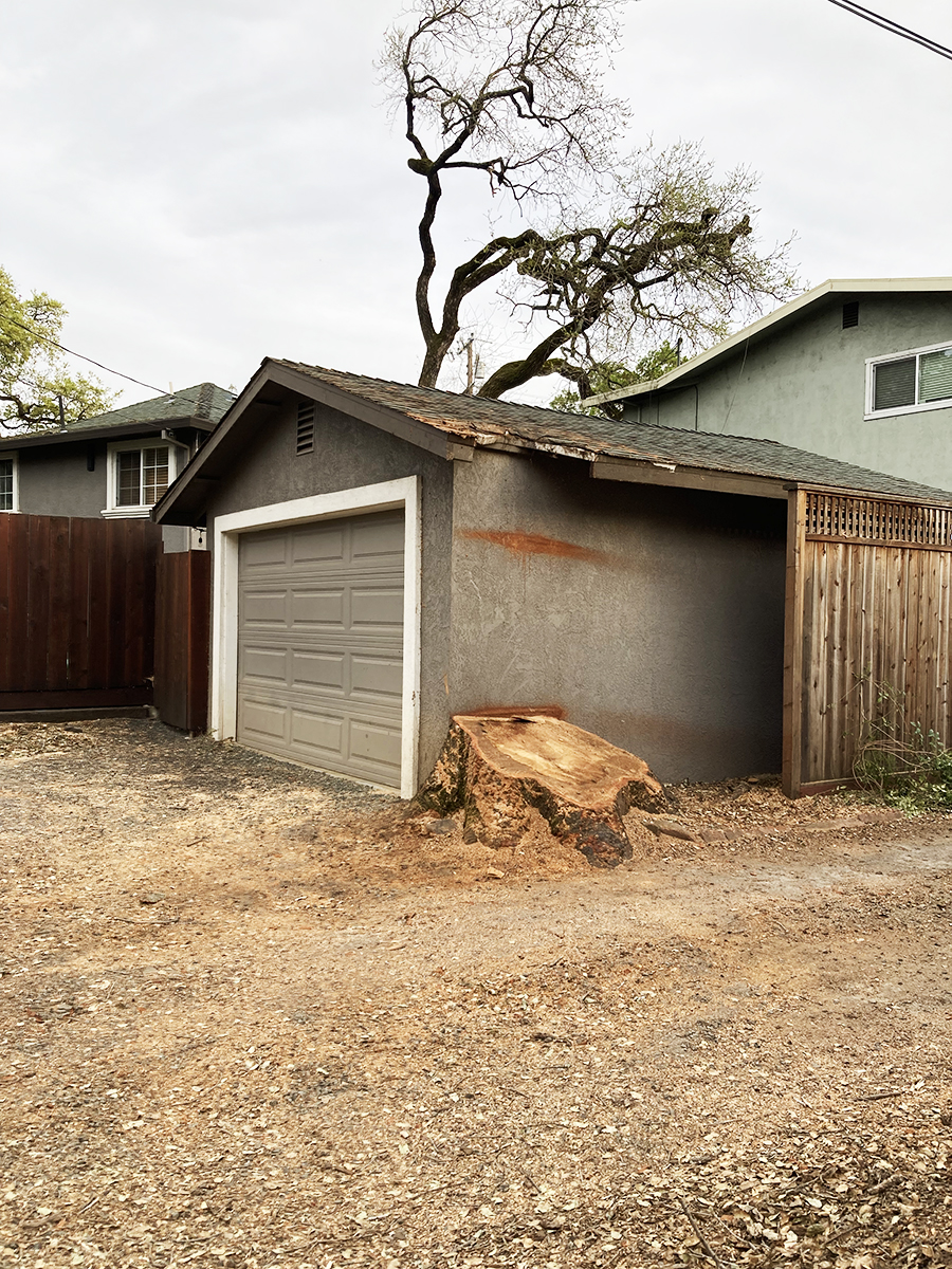
Flash forward to 2024. The tree is gone, its pleasant pool of shade just a memory. In the last two photos you can see that another tree, in the background, has also been removed (see the first photo), for fire safety, they say. Whether necessary or not, we always mourn the loss of a tree.
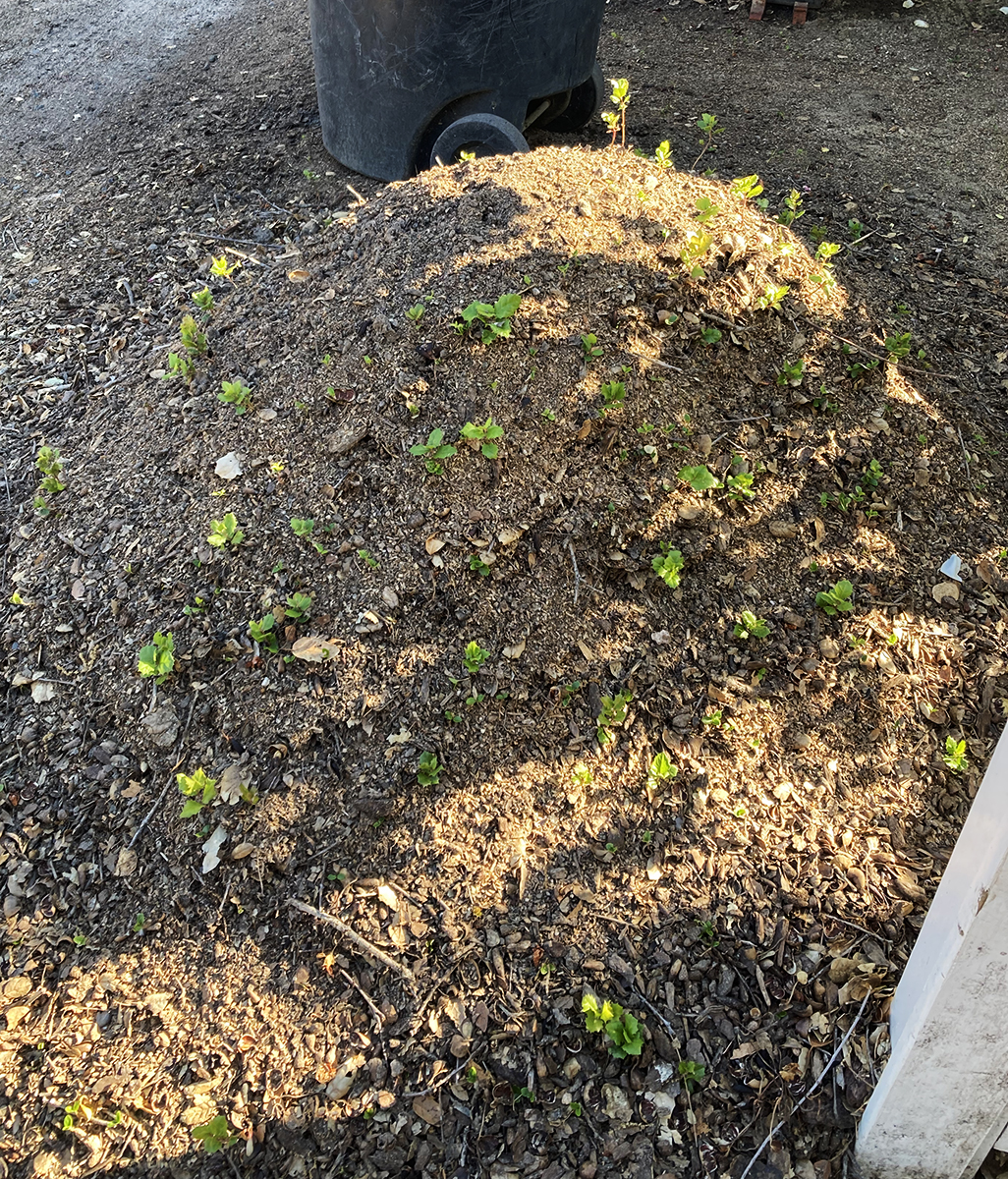
Below are photos of a mound of earth and wood chips next to the stump. It is absolutely covered in oak seedlings. Nature continues!
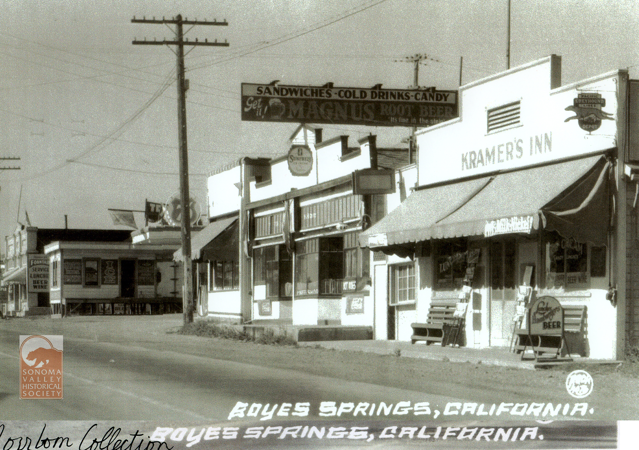
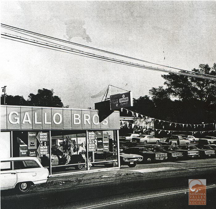
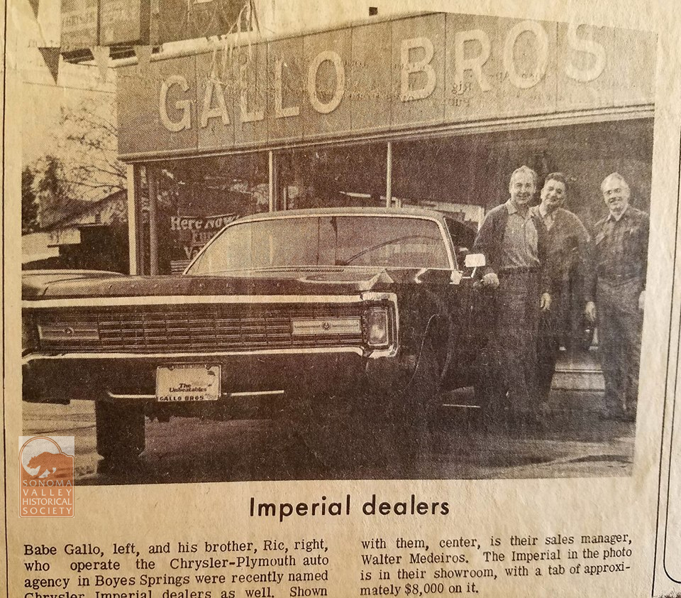
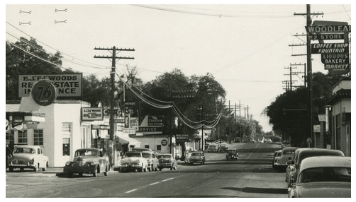
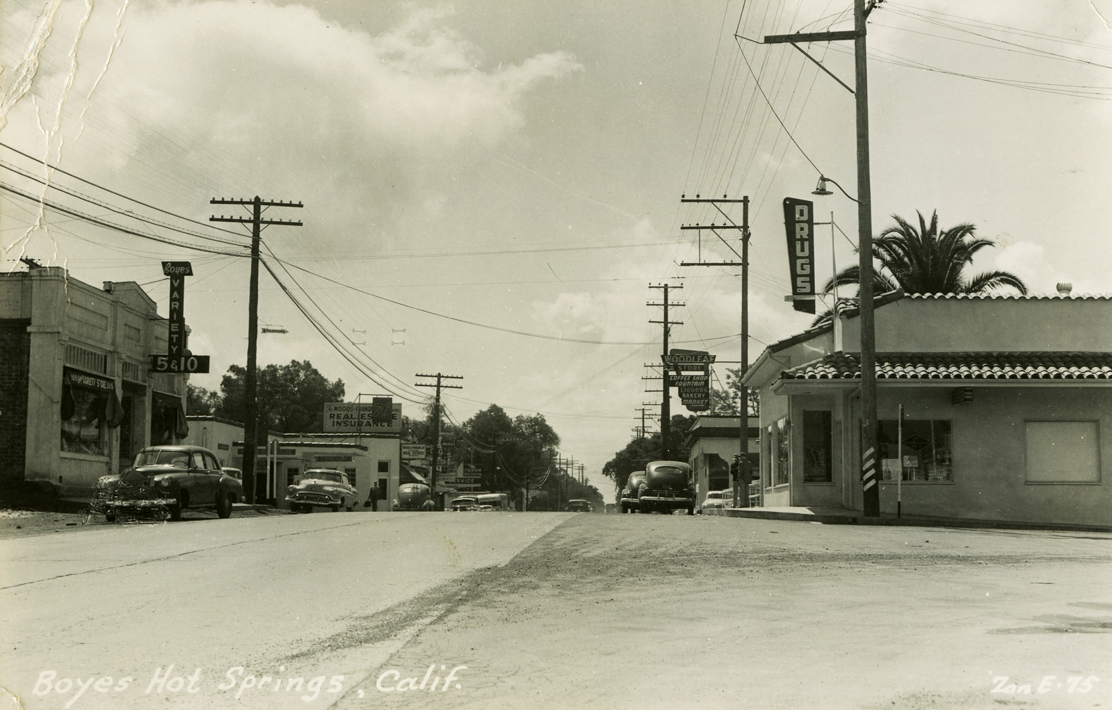
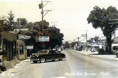
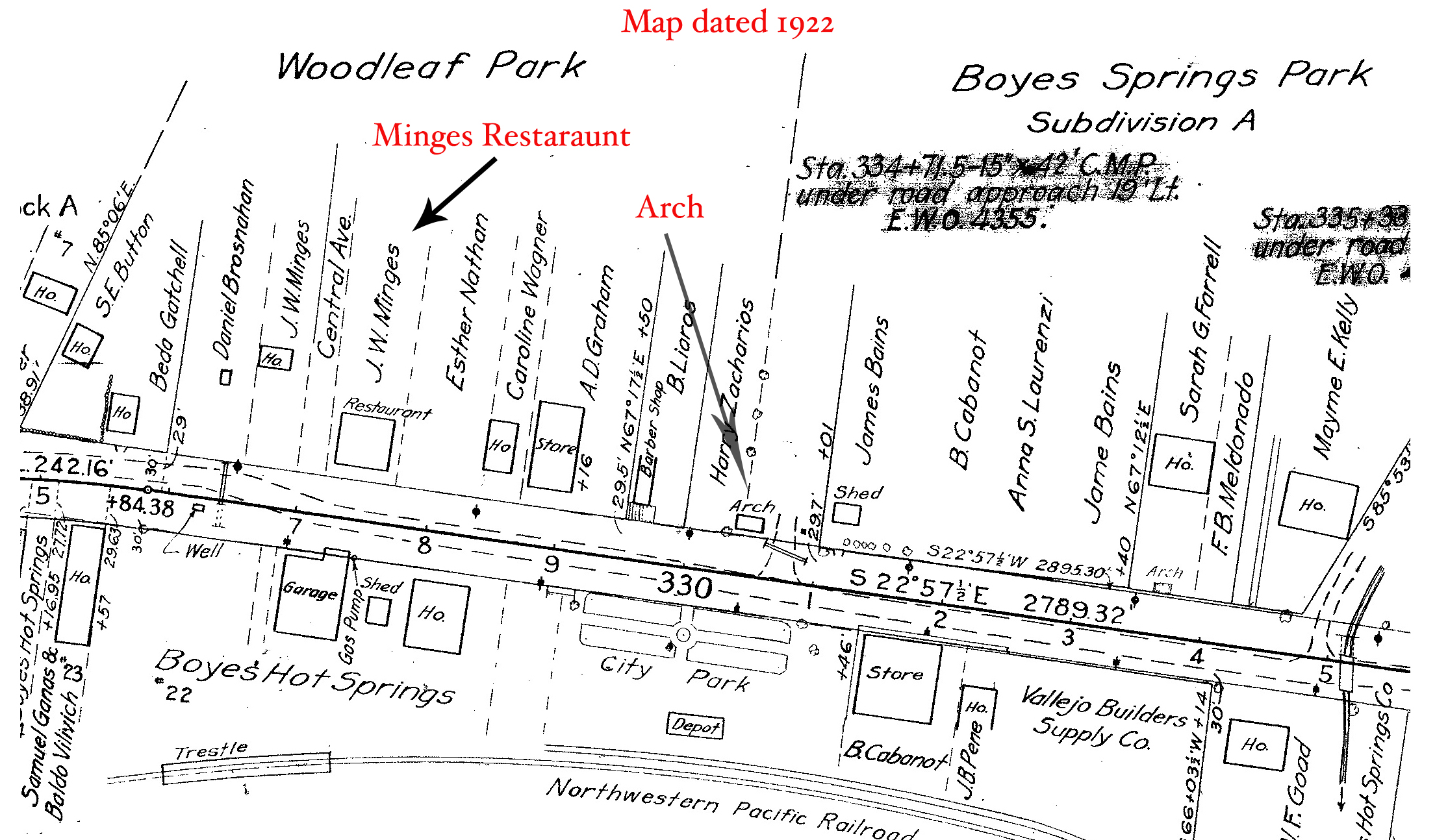
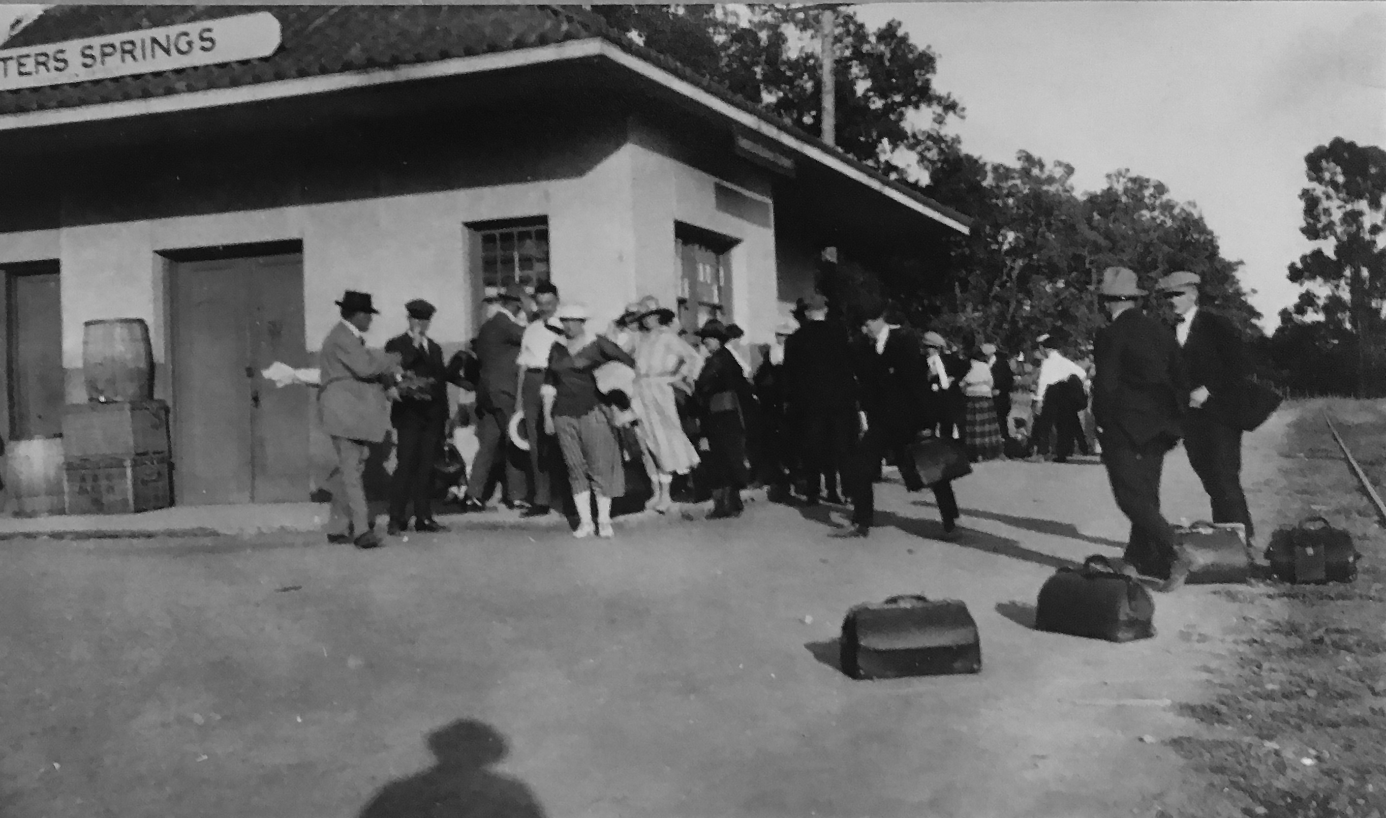
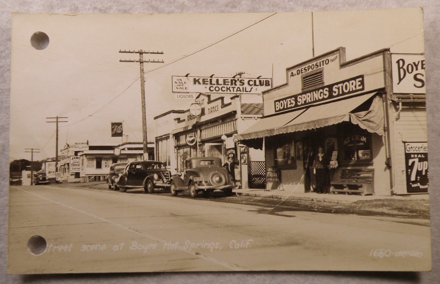
In 1923 a huge fire destroyed much of Boyes Hot Springs. Community spirit was strong, however, and rebuilding began immediately. One property owner, Bob Liaros, rebuilt on the highway.
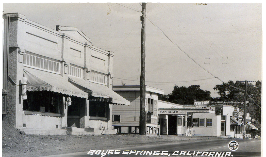
According to the Index Tribune, “Bob Liaros owns one of the finest and most substantial buildings on the highway in Boyes Springs. After the fire, Mr. Liaros took the slogan, “a bigger and better Boyes Springs” at its full value and proceeded to show that he, for one, meant to build bigger and better than before. In place of the frame building and barber shop which was located next to the original post office at Boyes, the enterprising business man let the contract for a handsome hollow tile type building, with concrete floors and fireproof throughout. The exterior is most attractive with its tile trim and plate glass front. The building is divided into two stores, in one of which Mr. Liaros has his beautifully appointed barber shop with its mirrors, three chairs and finest plumbing. He does bobbing for the ladies and has a competent assistant barber. Liaros has leased the store and living rooms in his building for an ice cream parlor and refreshment stand.” IT 1925.
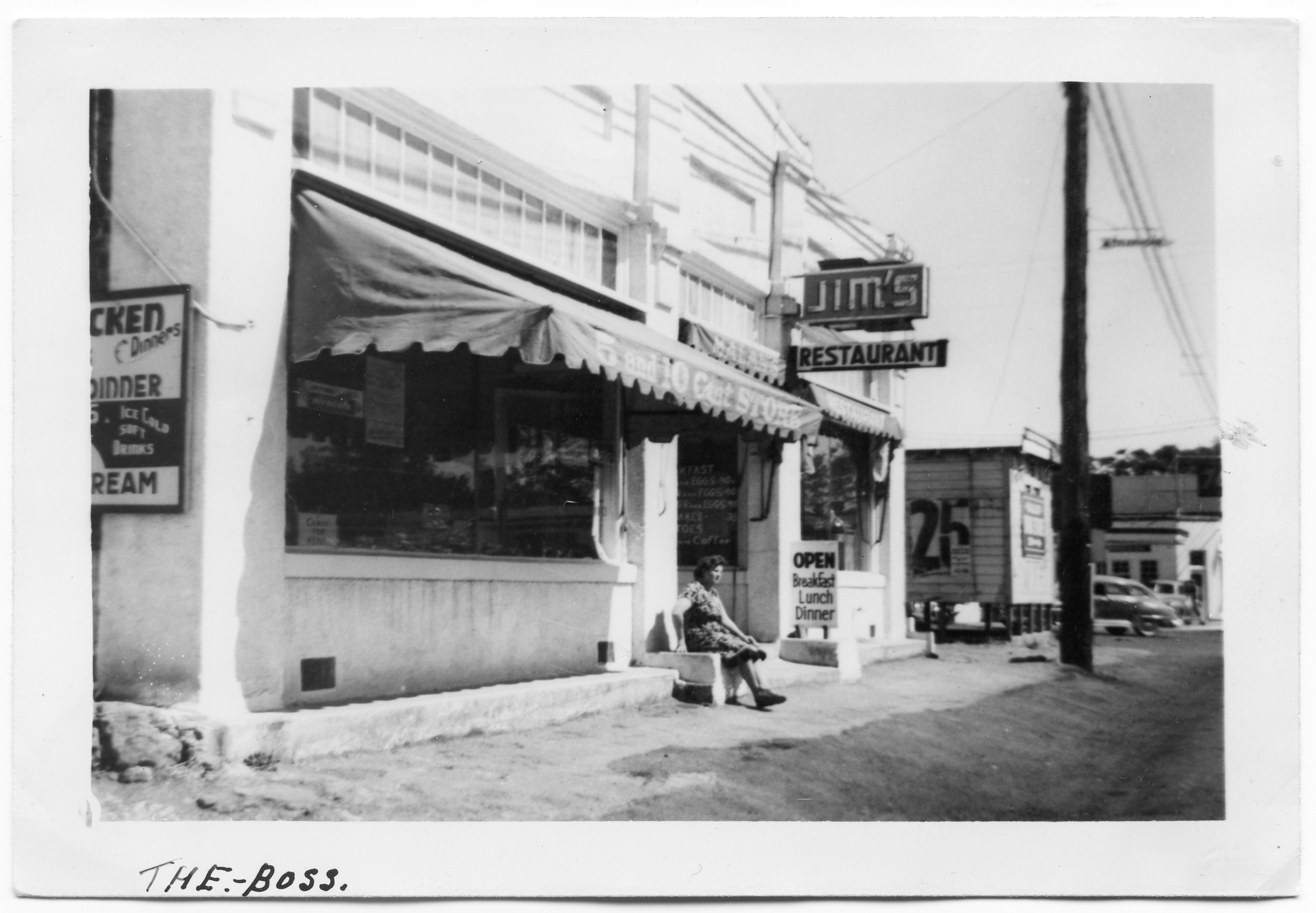
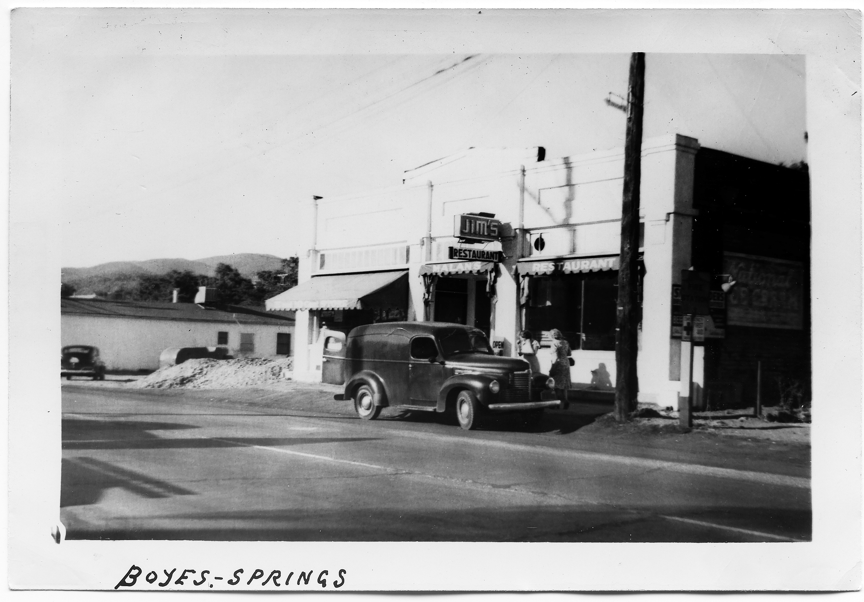
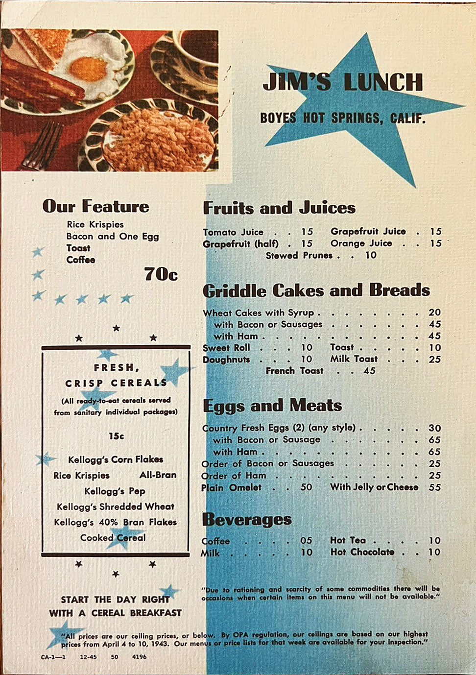
Jim Nichols opened his Jim’s Lunch restaurant on Napa St. in Sonoma, “at the entrance of the ball park,” in 1933. In 1937 Jim sold to Marie Tarrens and moved to Oregon. But, in 1938, “Jim Nicholas, who sold out and left Sonoma for Oregon, only to return convinced that there is no place like the Valley of the Moon, is opening up a coffee shop and café at Boyes Springs in the Bob Liaros building. In 1939, Evelyn Frank and Alice Jones applied for a liquor license under the name of Jim’s Lucnh Room. Not sure where Frank and Jones went but in 1941 Alice Norrbom bought the establishment from Katherine Ewert Jorgensen. I believe the two photographs of Jim’s date from Mrs. Norrbom’s ownership. In 1944 she sold to Mr. and Mrs. Lloyd Reynolds and I think they were the last owners of Jim’s.
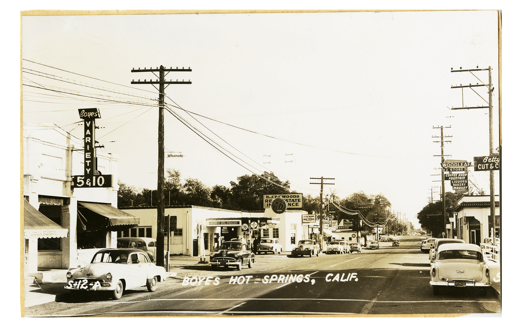
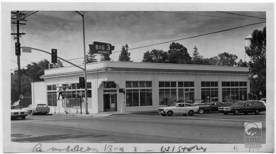
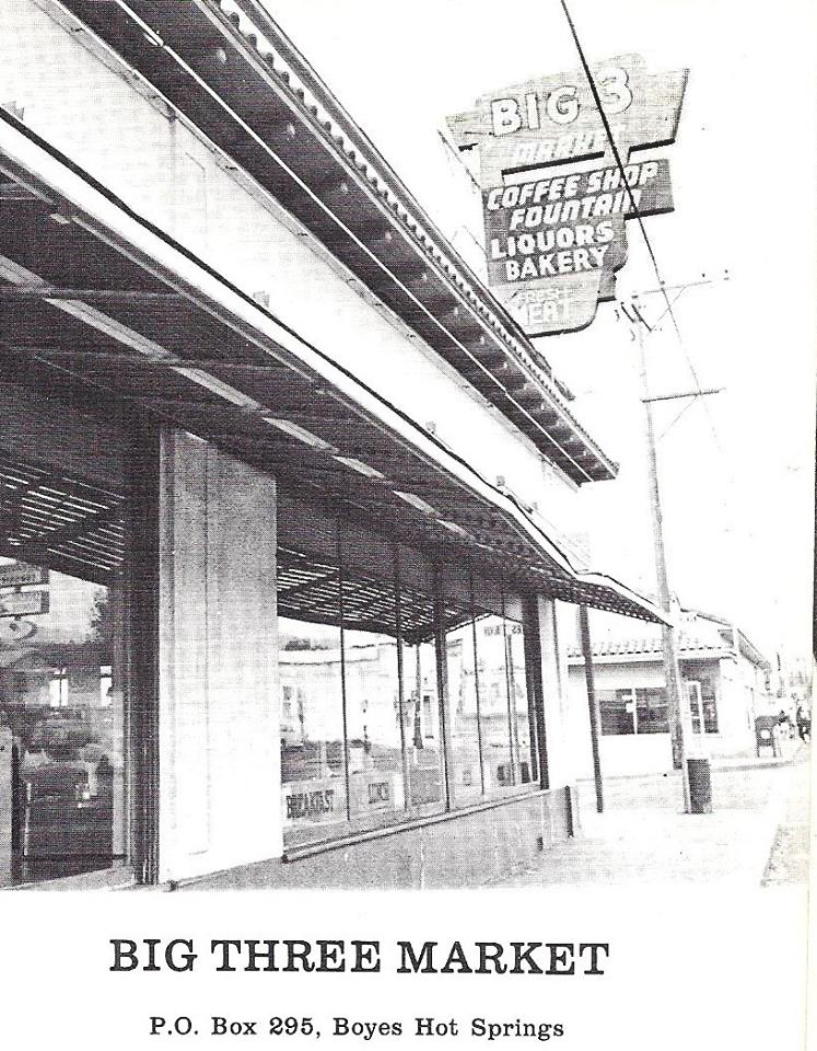
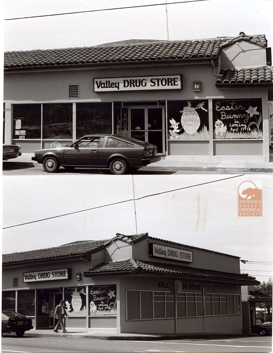
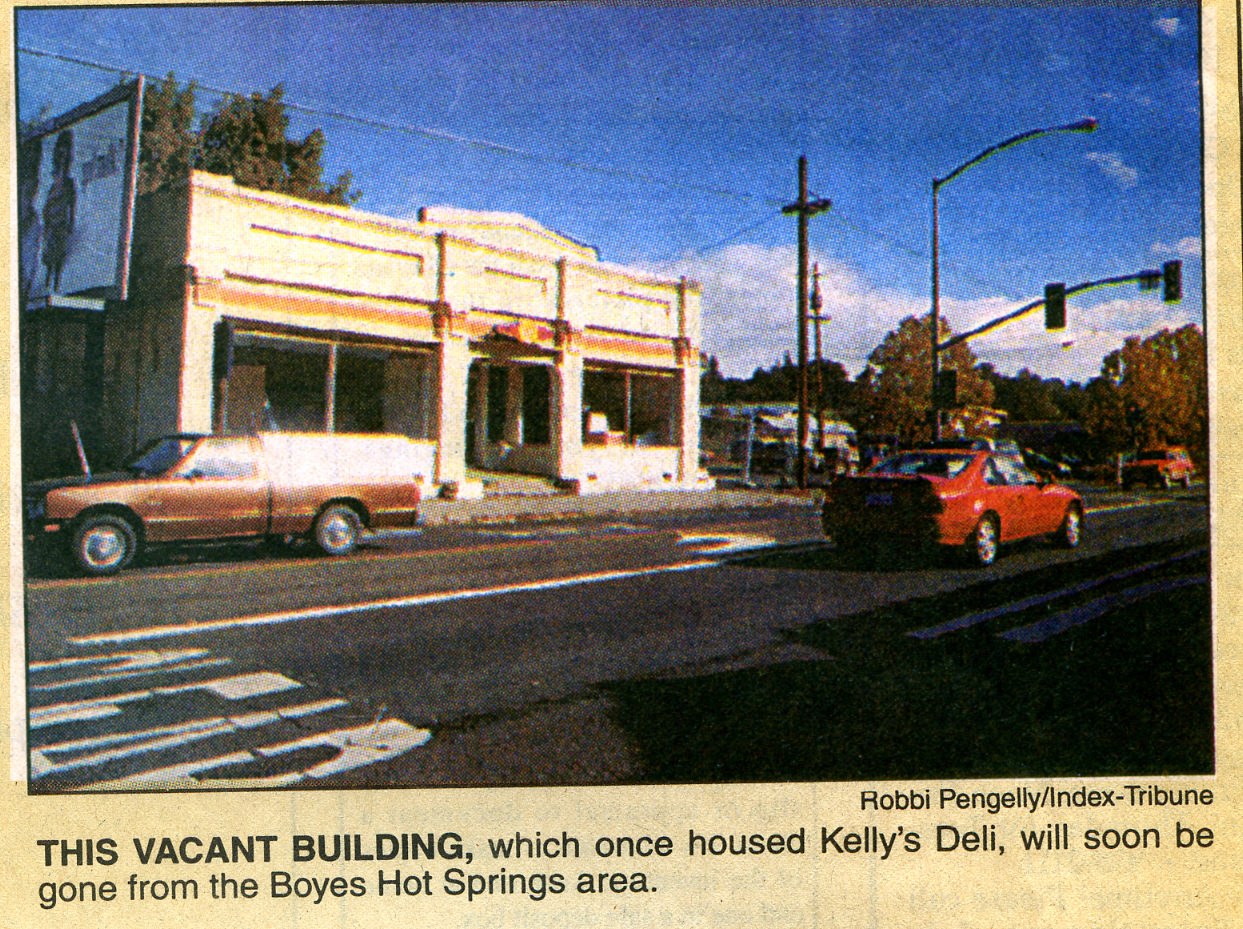
In the 1950s the Liaros building housed the Boyes Variety Store and Polidori’s store. Kelly’s Deli was there in the 1980s’90s. The building was torn down in 1992. The site now houses the Sonoma Mission Inn employee parking lot, alas.
ADDENDUM
In 1931 Bob Liaros bought “Lot Number 1, Woodleaf Park, being a part of Rancho Agua Caliente, T. 5 N., R. 6 W, M.D.M.,” (The letter-number combinations are Township and Range. MDM stands for Mount Diablo Meridian, a baseline used by the Public Land Survey System.)
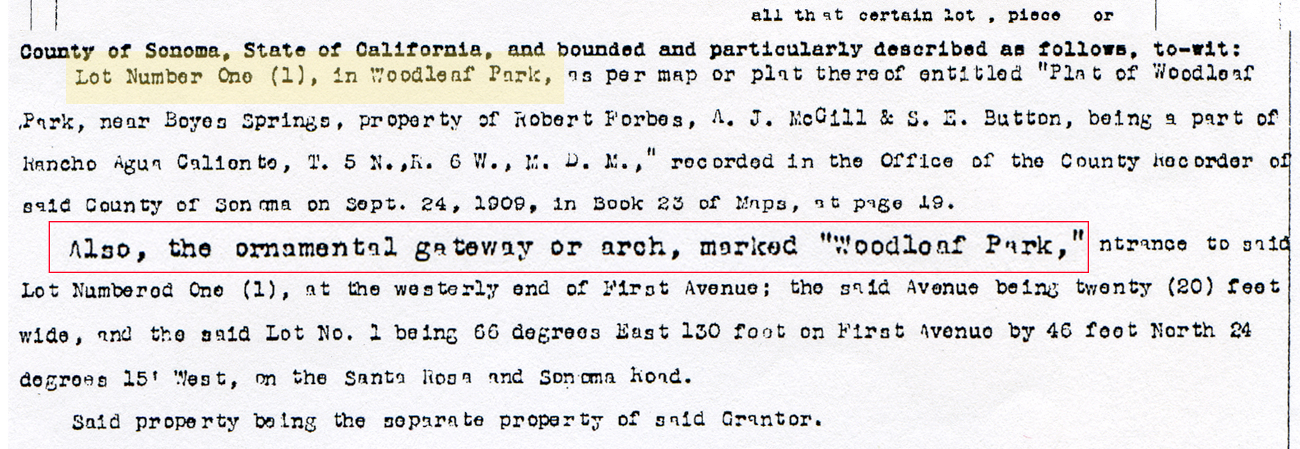
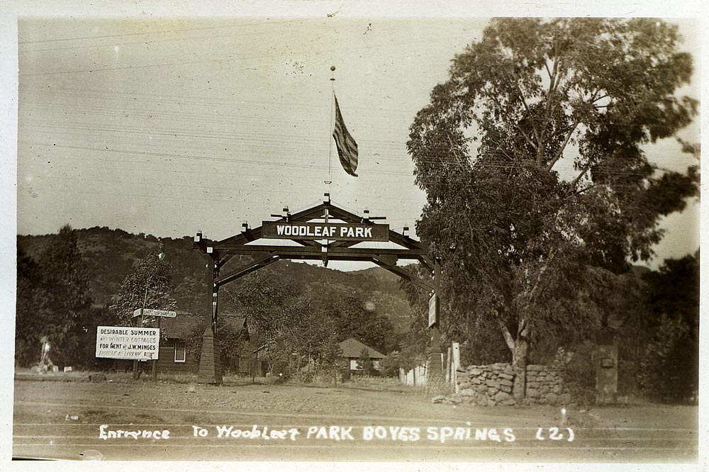
First Avenue became Vallejo Avenue, so this would be the corner of Vallejo and Hwy 12 (“Santa Rosa and Sonoma Road”.)
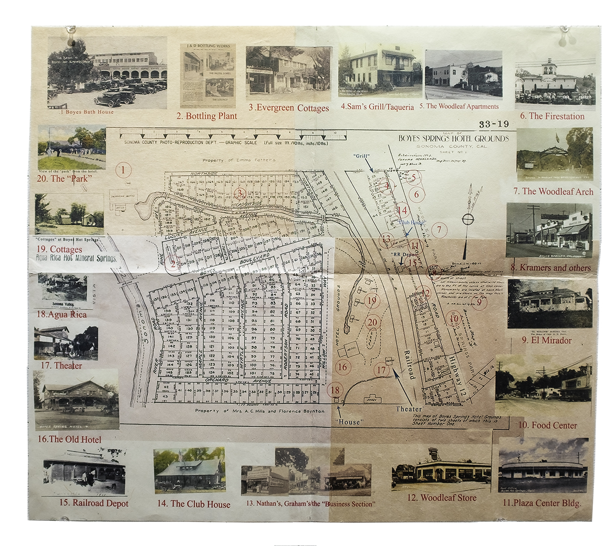
Thanks to the Sonoma Valley Historical Society for the Index Tribune and many photographs, Lloyd Cripps for the arch photo, Phil Danskin for the map, and Stanford University Library, Special Collections for the Zan Stark photo.
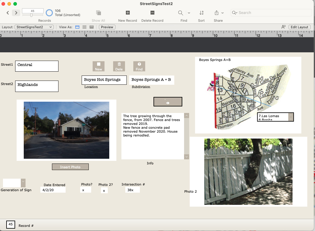
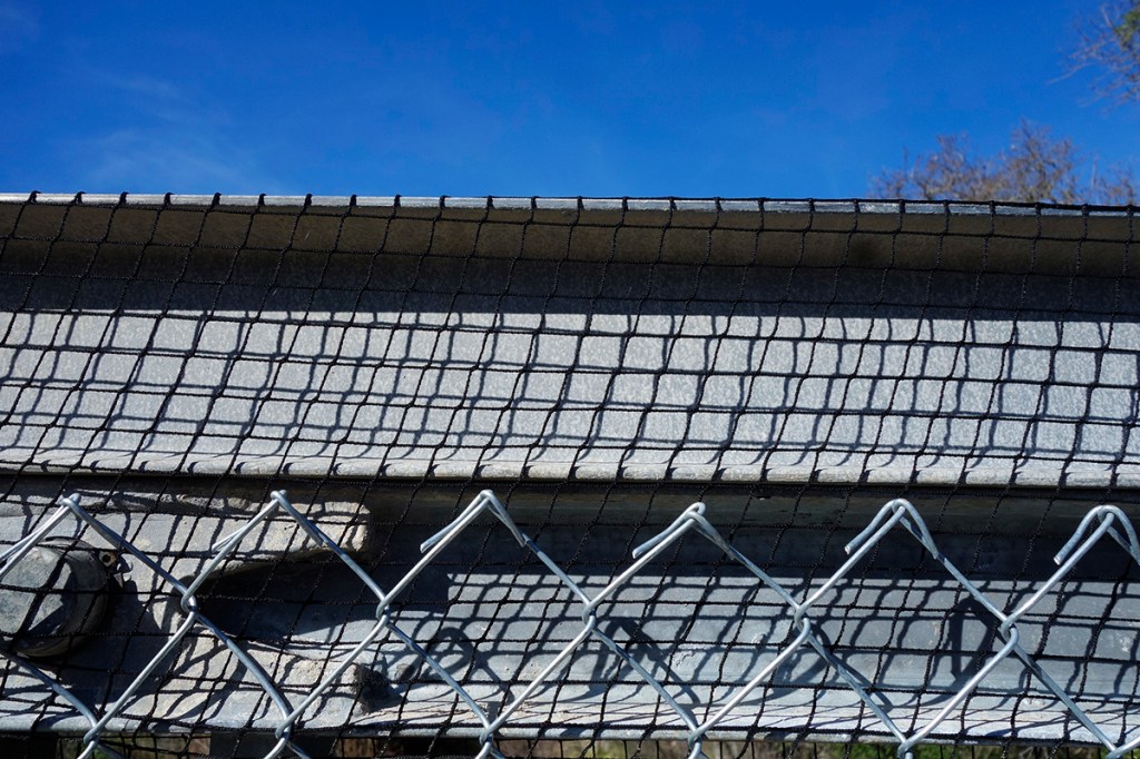
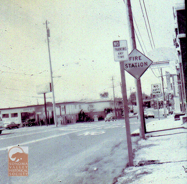
In 2020 I photographed every street sign in my immediate neighborhood with the intention of creating a database of intersections. Why? Obsessiveness. Completeness. The desire to record and collect (see website introduction.) Future use. It’s history. Because it might all burn down, and no one would remember what it looked like. (And, I really like databases and consider them an art medium.) I have also included photographs of the Neighborhood Phenomena in the vicinity of the intersections, such as, the tree growing through the fence above.
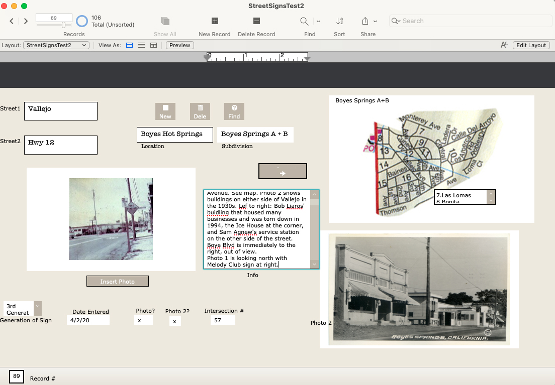
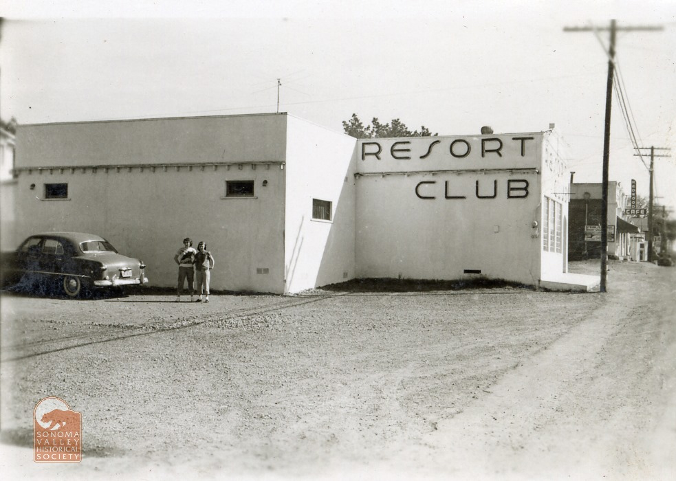
In addition to my photographs, I have included older (“historic”) ones, where they exist, newspaper clippings, and other ephemera. I know of no older photographs of intersections other than the ones at Highway 12, which were made primarily for commercial purposes.
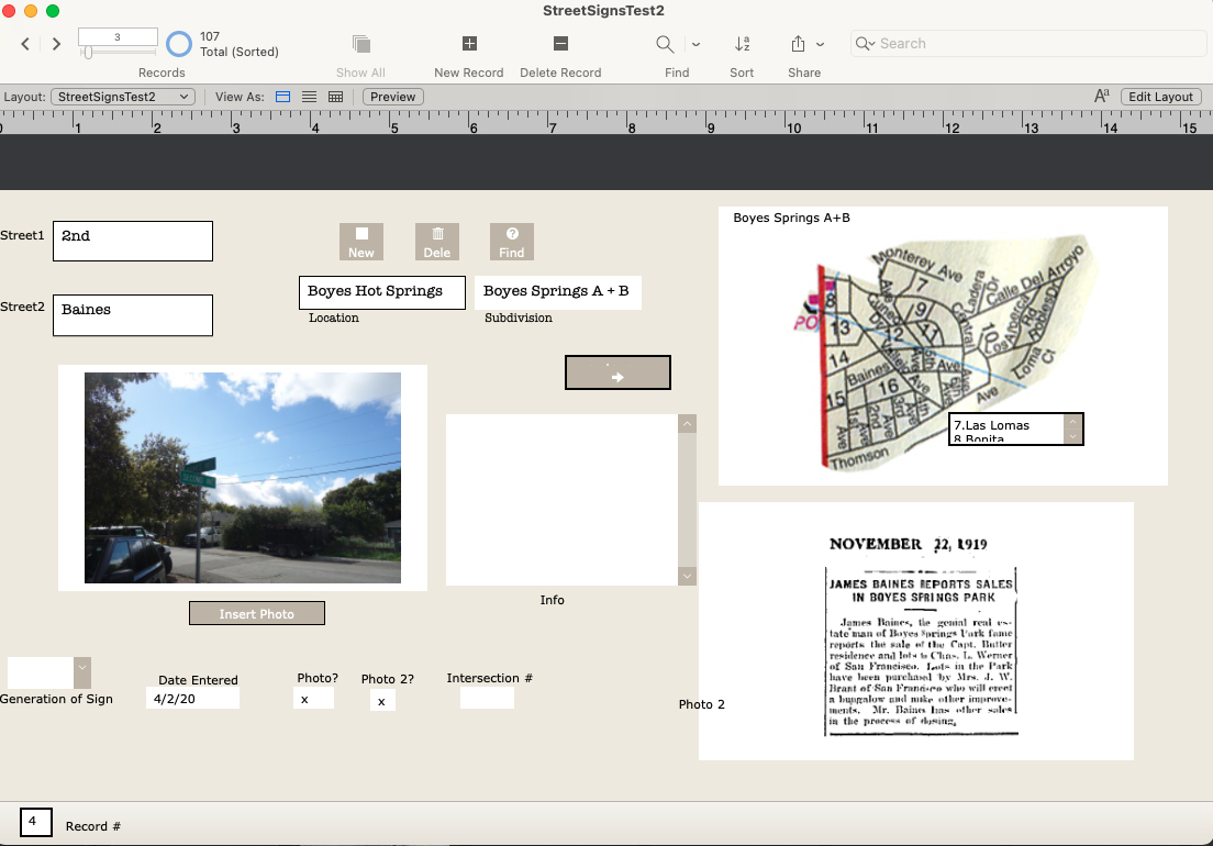
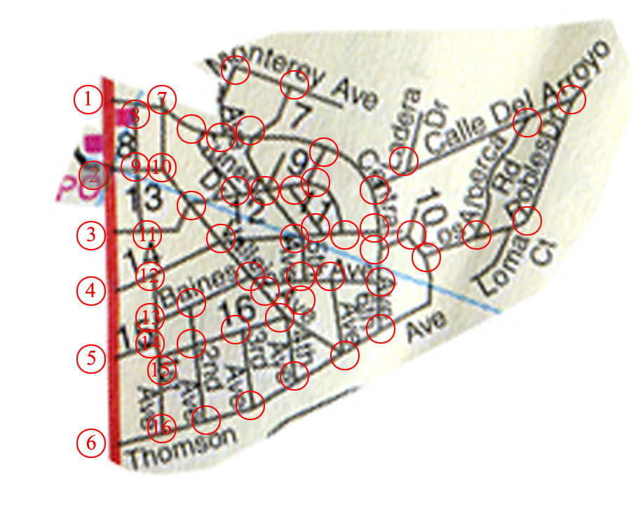
There are 107 records in the database (I probably missed some), one for each intersection in the Boyes Springs A and B subdivisions. The fields include “Generation of Sign” because three distinct styles of sign exist. Time permitting, the database would be expanded to include the surrounding subdivisions (more here) Sonoma Highlands, Woodleaf Park, etc.
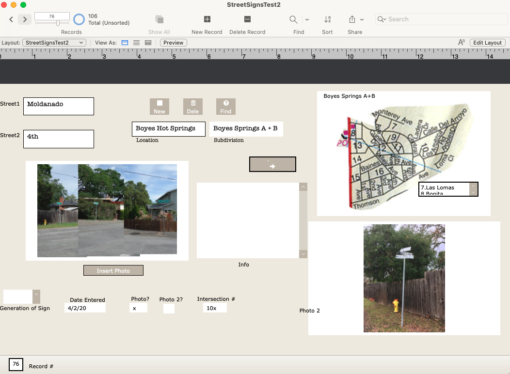
The corner of Maldonado, 4th, and Vallejo had three of the oldest style signs on one pole until recently. I realize I misspelled Maldonado in the db.
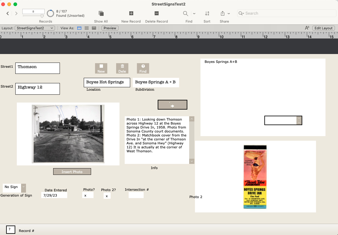
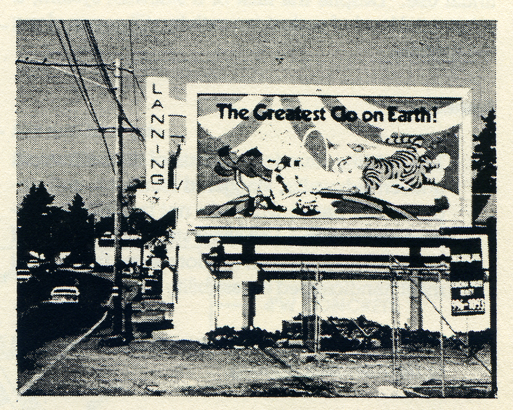
The Thomson and Highway 12 entry features a photo from 1958 and a matchbook cover.
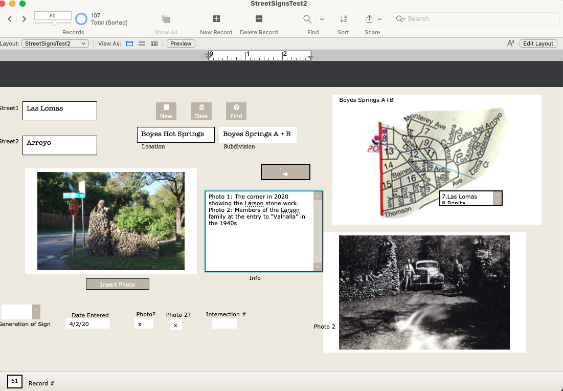
Las Lomas and Arroyo shows the stonework built by the Larson family, in 2020 and the 1940s, with family members.
The map is still under development (ie, my Filemaker skills need improving.)

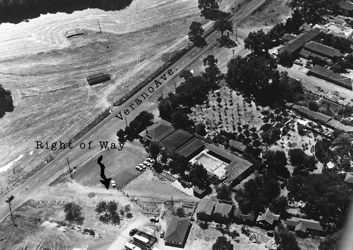
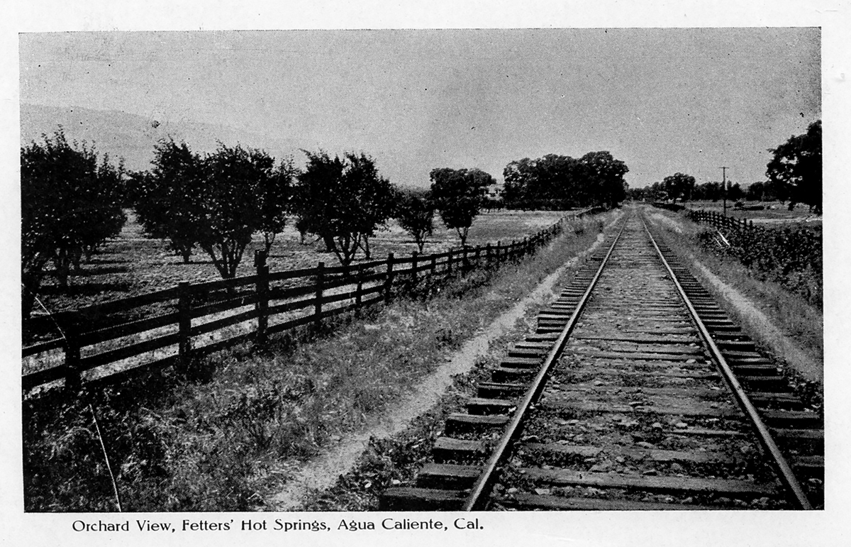
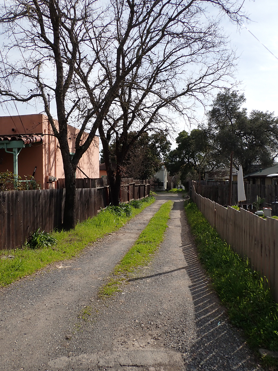
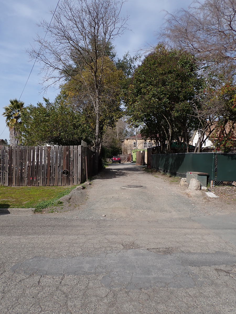
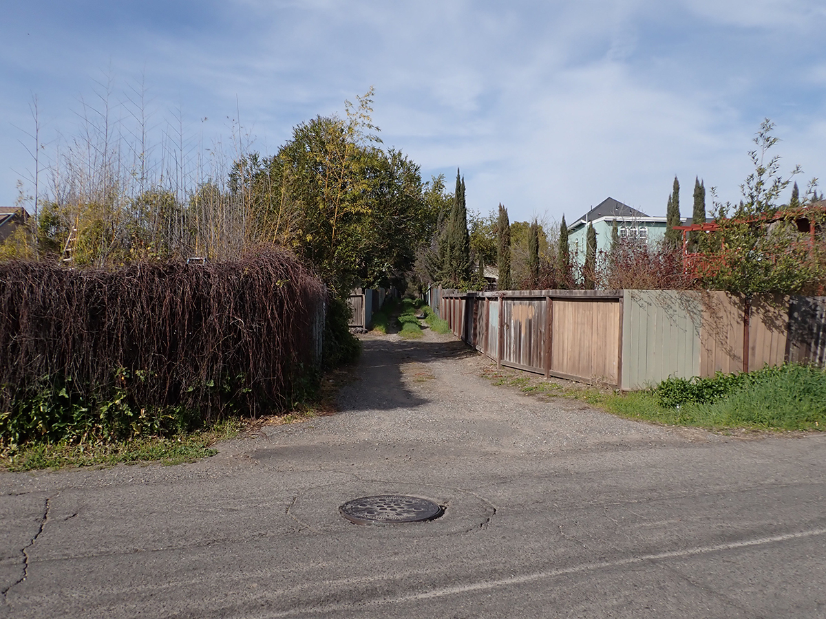
The last year of operation for the Northwest Pacific Railroad in Sonoma Valley, which ran on the east side of Sonoma Creek, was 1942. That year freight service ended, and the tracks were torn up for steel for the war effort. Traces of the right-of-way can be seen in several places in El Verano, Boyes Hot Springs, Fetters Hot Springs, and Agua Caliente.
In El Verano the tracks run through the Paul’s Resort property, where the Verano (not El Verano) depot was located.
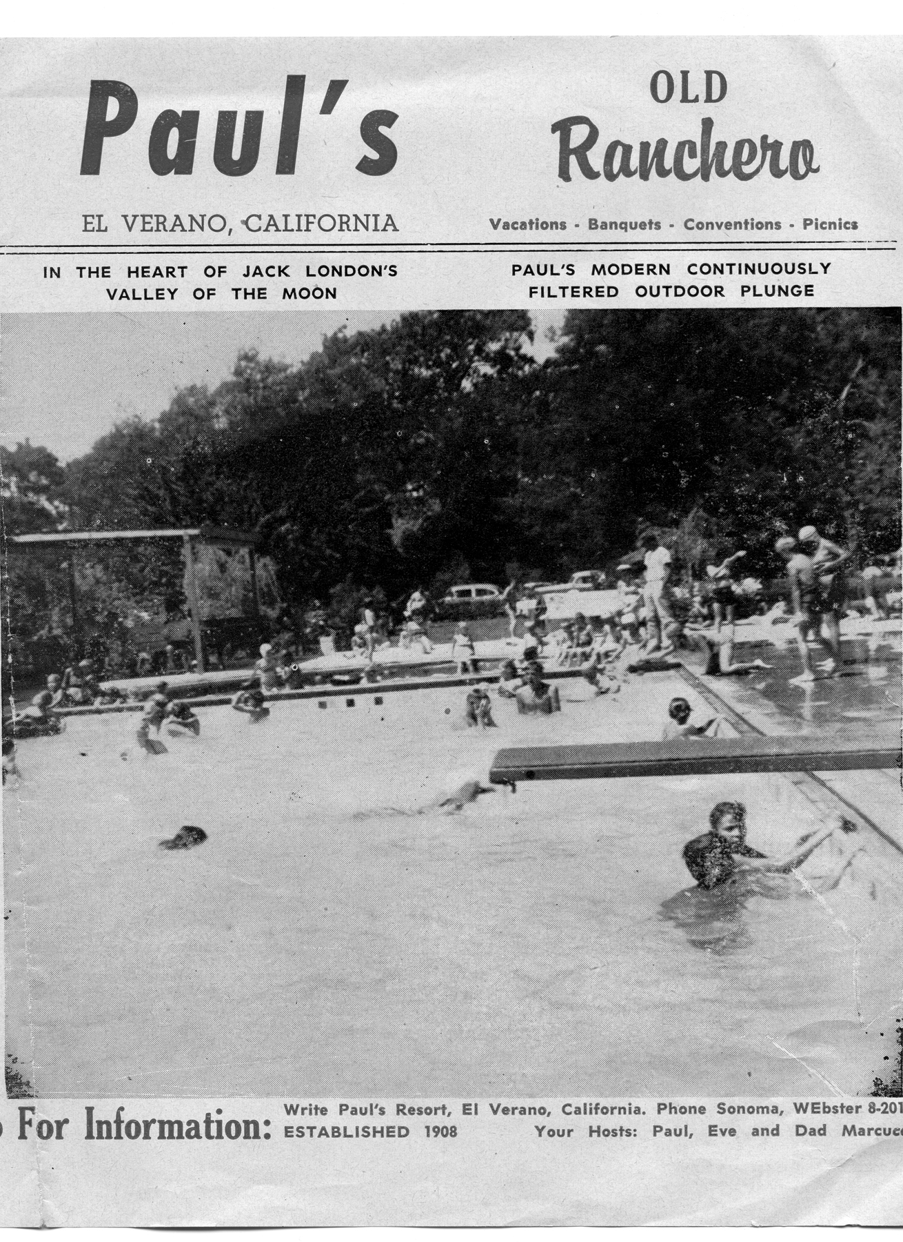
Paul’s Resort, 1960s
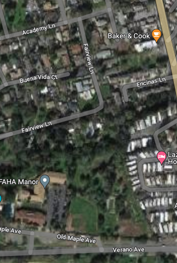
From there it parallels Fairview Ln. (which may have been right-of-way) until it gets to Thompson, where Sierra Dr., formerly Meinke Ave., takes over the roadbed. (More about Sierra and Mienke.) Manzanita St. might have been a spur. It features several buildings that look as if they could have been built by the railroad.
House on Manzanita near Academy Lane
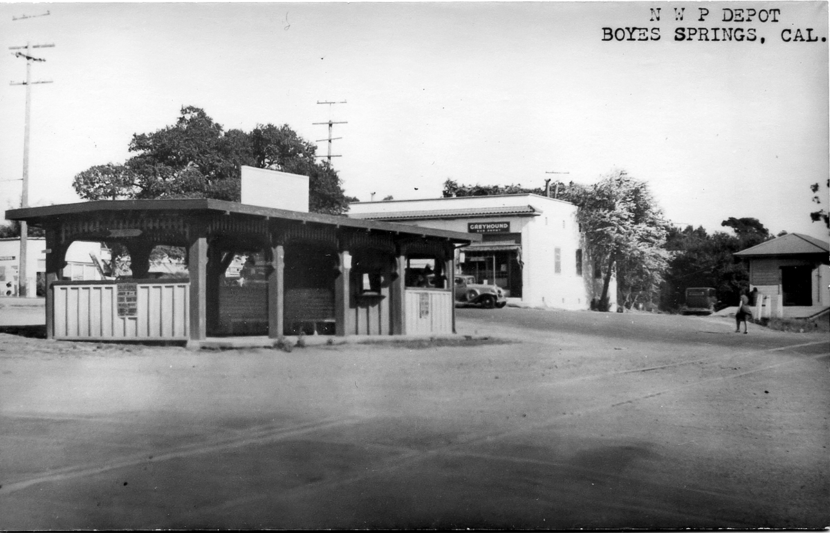
Where Sierra turns east to the Highway the right of way continues north through the Sonoma Mission Inn (originally the Boyes Hot Springs Resort) grounds and past the BHS depot, which land is now the parking lot for the Plaza Center building (More here).
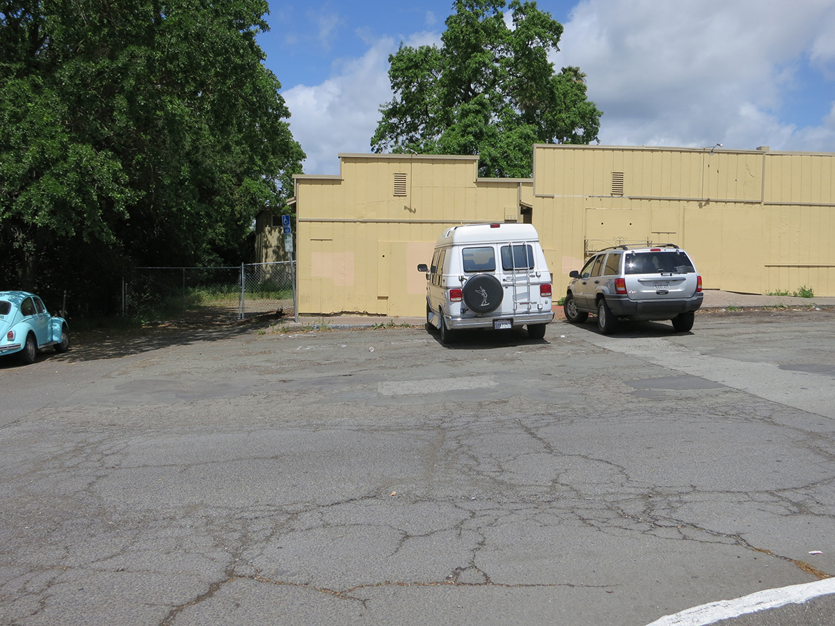
Right-of-way next to old commercial buildings at Boyes Plaza, which were demolished in 2018. Photo taken from the apporxiamte location of the Boyes Depot.
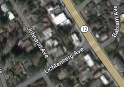
Continuing north it parallels the Highway and can be seen crossing Lichtenberg Ave, parallel to Johnson Ave.
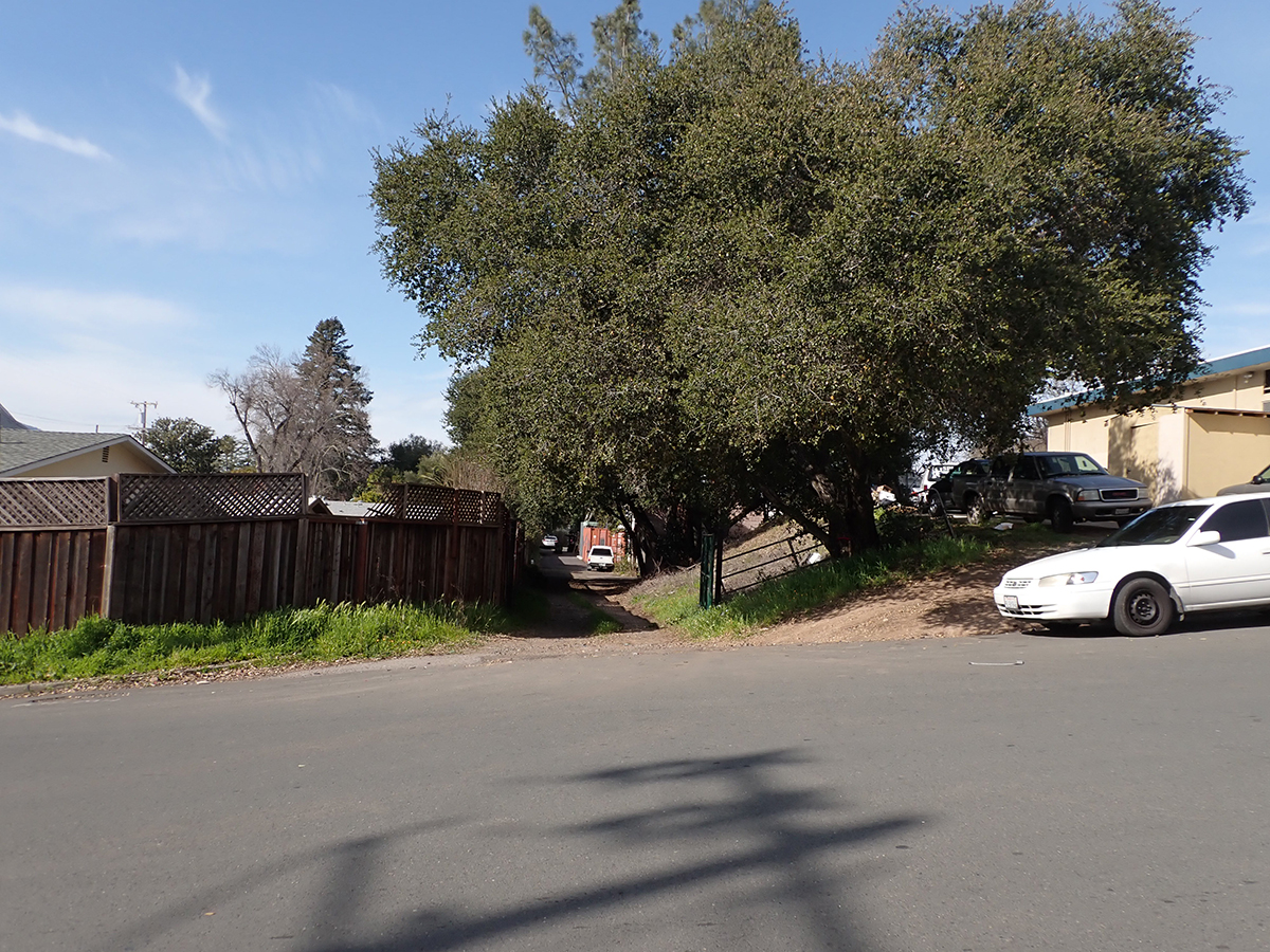
At Lichtenberg.
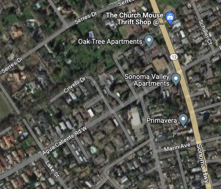
The next trace is the old Fetters Depot building on Depot Rd in front of Flowery School. It crosses the Fetters Apartments and Charter School properties and is seen again at Vialetti Dr. The old roadbed has become the alley the runs from Vailetti to Marin Ave. That is the last appearance of the right-of-way in the area.
Fetters Depot 1910s
1910s
At Marin Ave. looking south.
At Marin Ave. looking north.
At Vailetti Rd. looking north
Maps and photographs courtesy of the sonoma Valley Historical Society unless noted otherwise.
Some day we will organize actual tour groups to take this walk. In the mean time, there is the map and a book of the tour. Please see https://mca-studios.com/recent-work/ for each page of the book and a short video. (Click on the page images to magnify.)
Some things are obviously mysterious, others only become so when you start to wonder. Some are just hidden and you have to be shown.
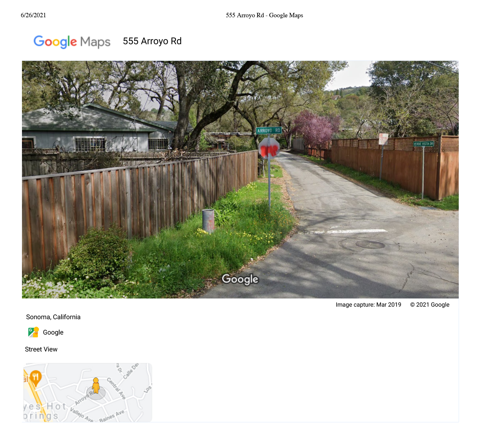
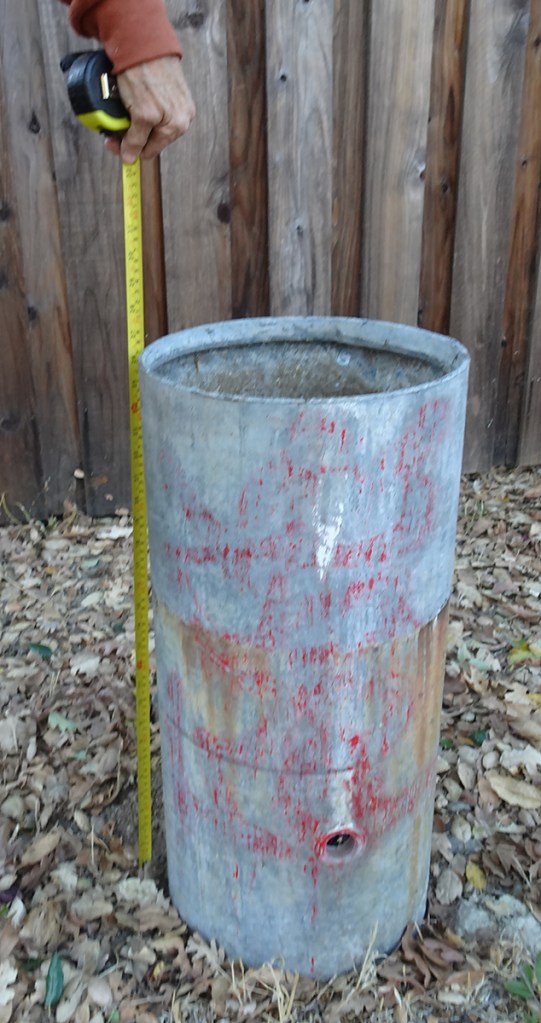
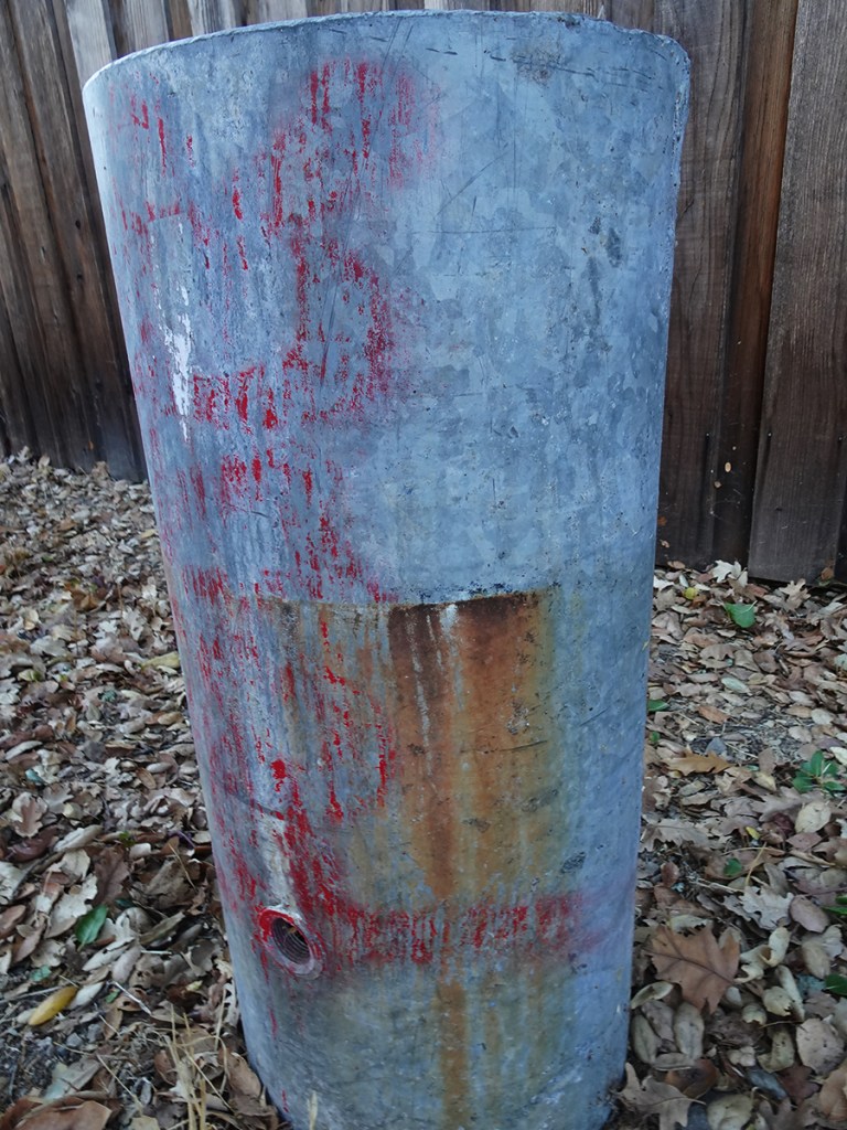
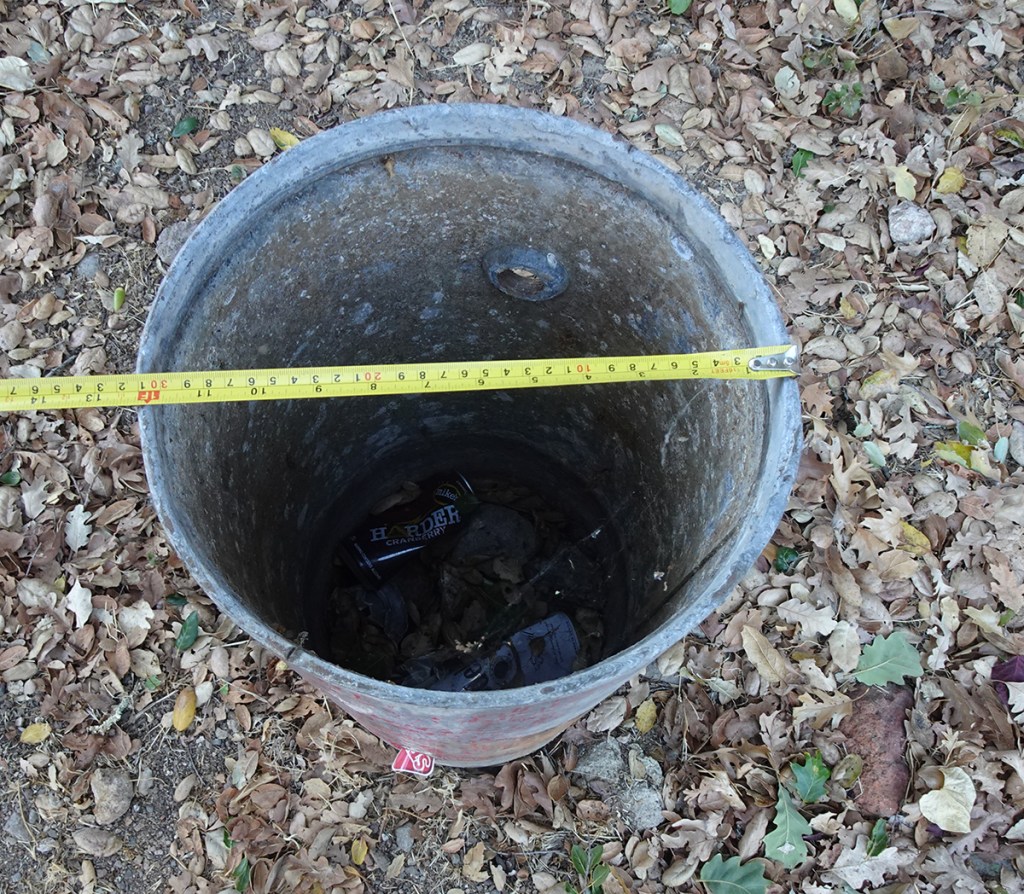
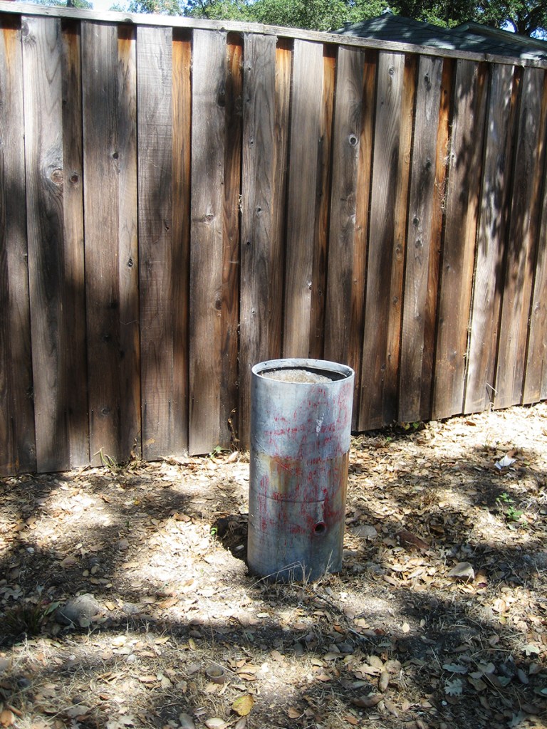
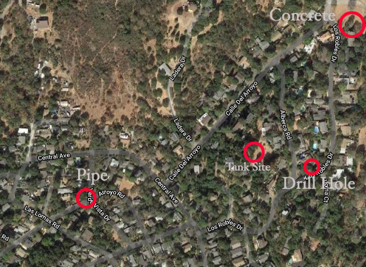
I have walked by the Mystery Pipe thousands of times, probably, and never given it a thought. Then I did. Not sure why. It’s an old, galvanized pipe or tank, about 12” in diameter, sticking out of the ground on the shoulder of Arroyo Road, near Verde Vista. It seems very solid and durable. What was its purpose? Perhaps it had something to do with an old water system, of which there were numerous over the course of the twentieth century in the Springs. It sits down the hill and not far from an old stone tank that was used in one of those systems.
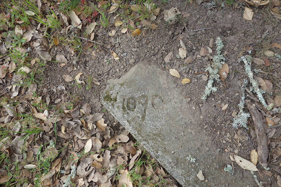
Higher up on the hill is a hidden feature that may also have something to do with a water system. In the back yard of a house on Los Robles Dr. is an ancient (by settler standards) slab of concrete with the year “1890” cut into it. The location is also near the stone tank, a little higher in elevation. Could it have been the location of a pump house or well head? Stay tuned for a comprehensive post on the history of water systems in the area.
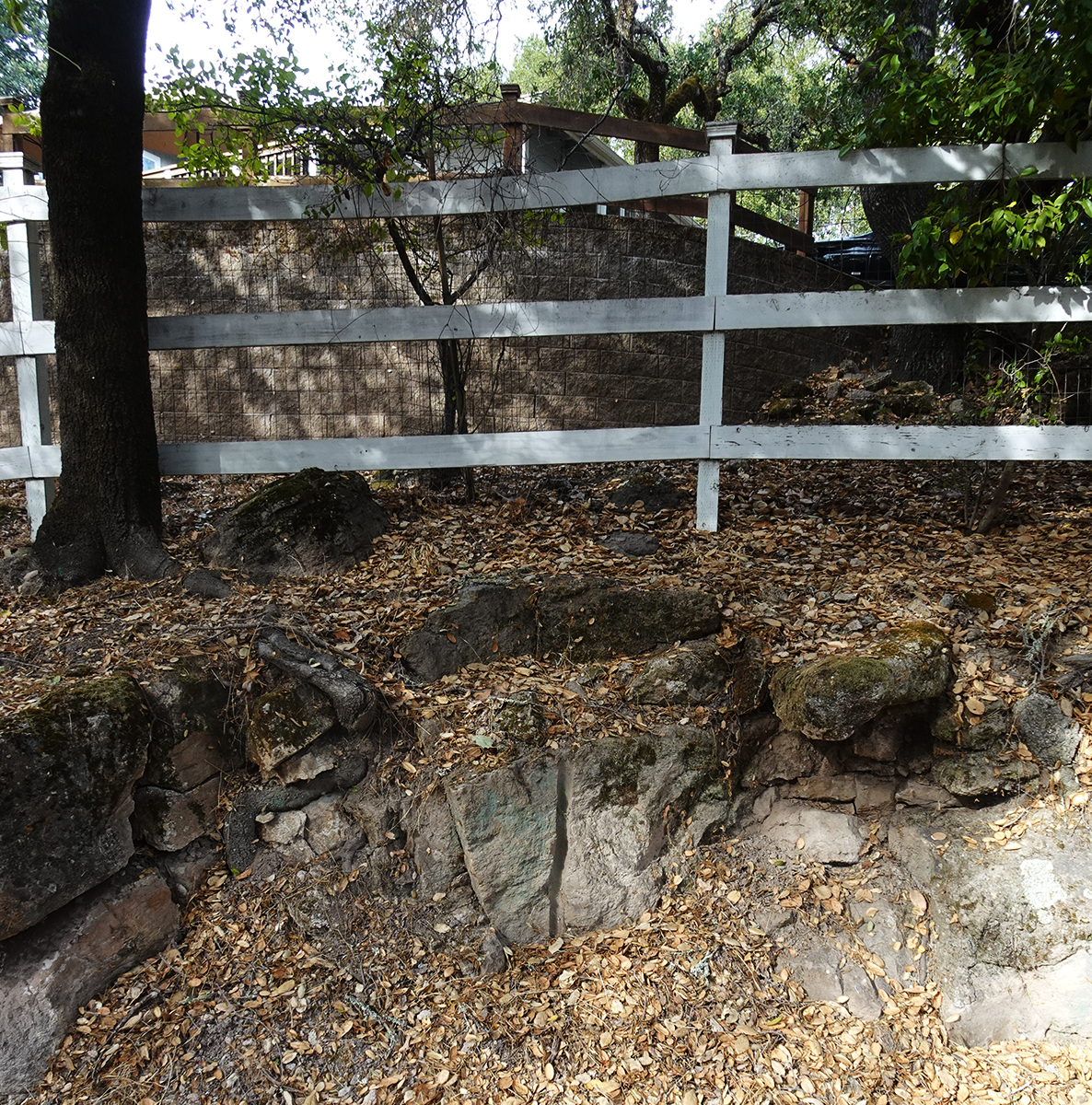
Further along Las Robles a neighbor told me that there had been a quarry on the hill. This would not be unusual. Our hills are all built on basalt and Sonoma is famous for the street paving blocks quarried there and used in San Francisco in the nineteenth century. Part way down the short side of the hill I saw something that I’d seen before, but now it had new meaning: on the embankment, a split boulder with what looks like a drill hole such as would be used in a quarry. The possible quarry actually has a water system connection. There was once another tank, off of Alberca St., just above the boulder (alberca means pool in Spanish). The tank site is a large flattened area. Maybe the area was leveled for the tank by blasting out rock, or the tank was built on the site of the old quarry. Investigations continue.
Photos by author and Google Maps.
On October 17, 1989, I was sitting in my studio in the Bayview neighborhood of San Francisco, listening to the start of the World Series game taking place about a mile away at Candlestick Park. What came to be known as the Loma Prieta earthquake struck around 5pm. I ran outside, just what you are NOT supposed to do, to see and feel the ground jumping up and down like I was on a trampoline. As the concrete building next door developed an alarming crack, I heard someone say “como Ciudad Mexico.” I rushed home to Potrero Hill to find the only damage at our place was three broken wine glasses. Fortunately we had more glasses and a supply of wine.
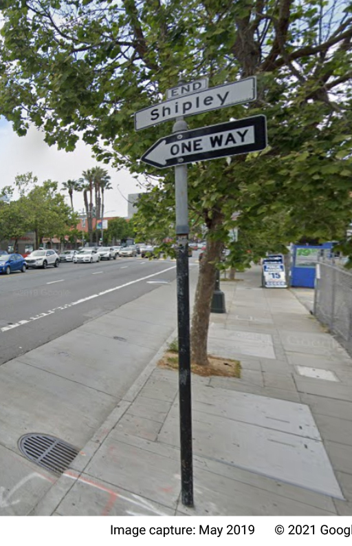
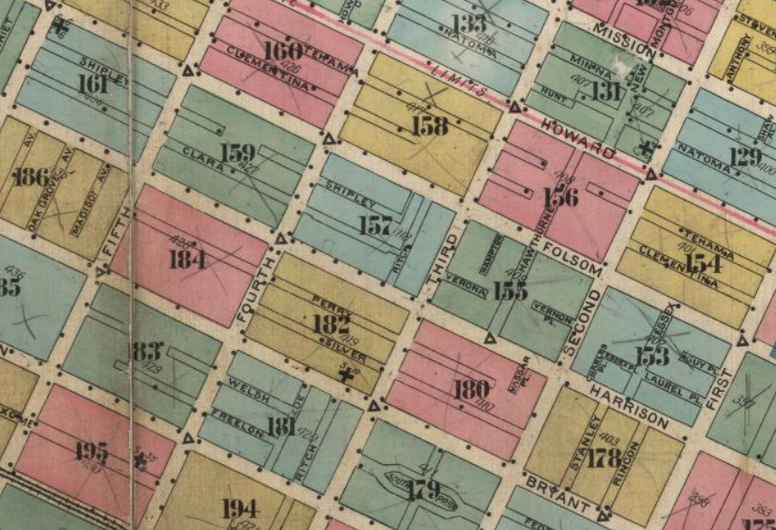
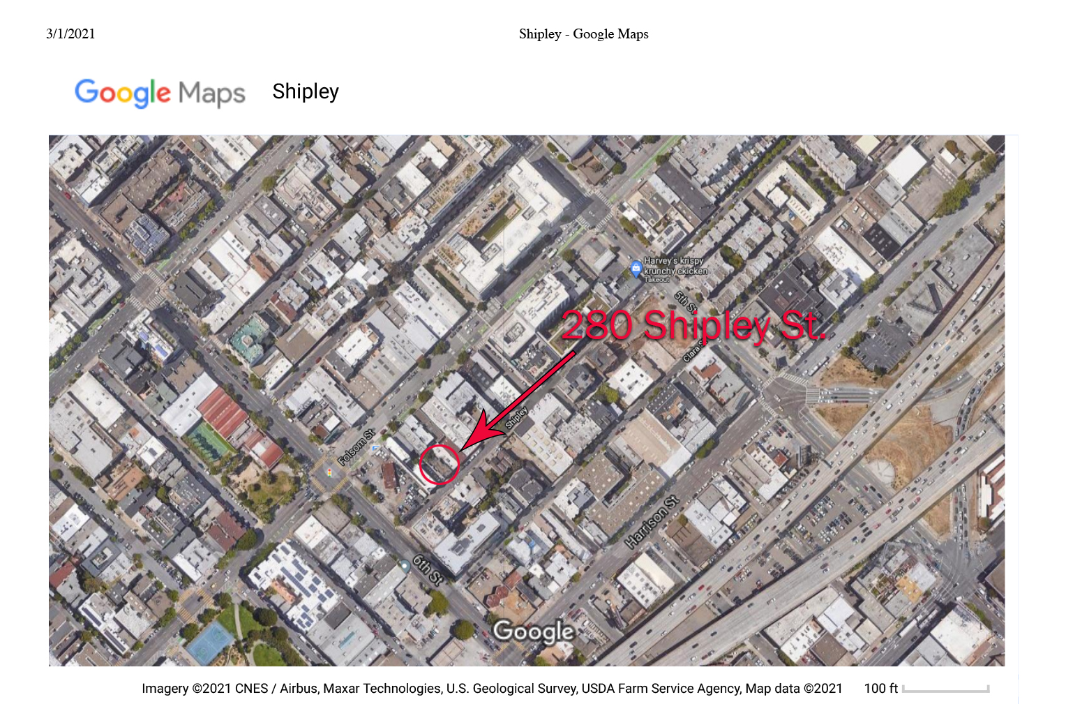
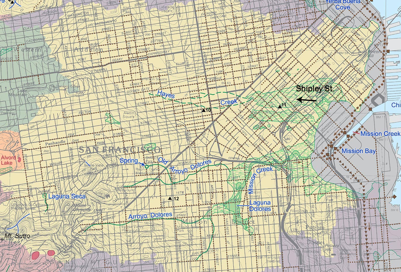
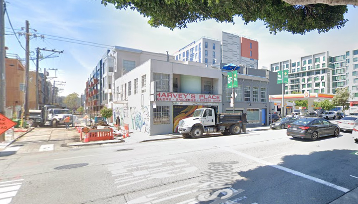
In December of that year, I was working for a contractor in San Francisco. He got the job of putting a damaged building at 280 Shipley Street, in the South of Market neighborhood, on a new foundation. Shipley runs from 3rd St. to 6th St. between Harrison and Folsom. Built in 1906, it was a two story place with four flats in it.
It was a dark and dreary fall and winter in the City. Everything seemed beaten down by the disaster. I had paid a brief visit to Tijuana the year before and I was struck by the polluted air and grime of the Avenida de la Revolution (I’m sure it’s very different now). Mission Street had that feeling to me in December of 1989. Yet I was full of energy and optimism. I had just finished my MFA at San Francisco State and I was beyond excited about making sculpture and having a brilliant career.
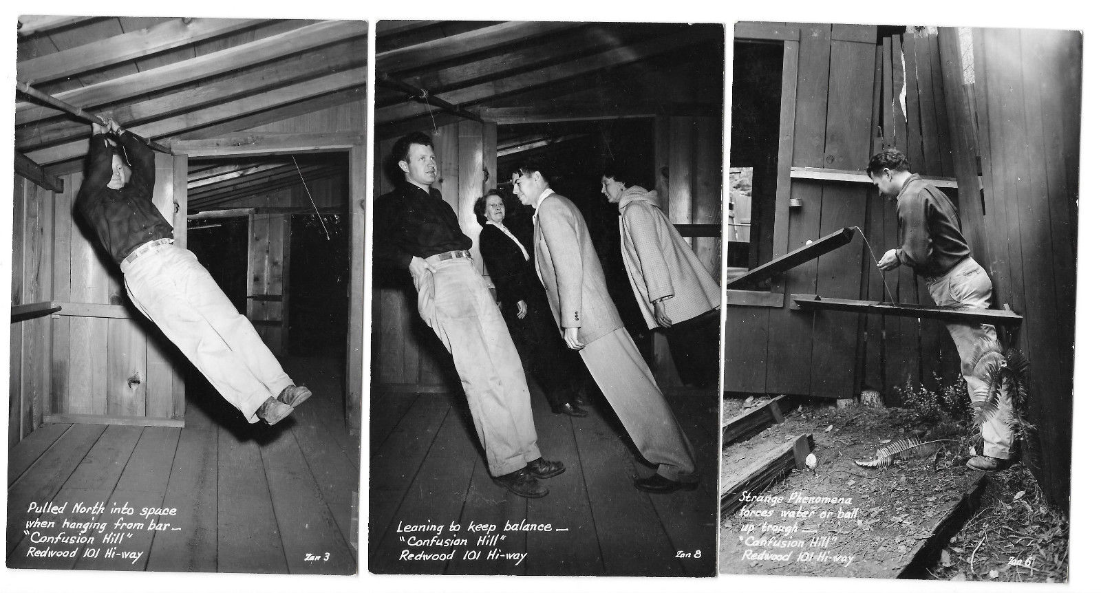
At first, the contractor, Dan, put me in the fallen building to erect some bracing to protect against further damage from after shocks. It was freaky being inside it. Everything leaned like the buildings at Confusion Hill, the venerable tourist trap in far northern California.
https://www.confusionhill.com/pictures
That part of SOMA is built on bay fill, and the streets were bulk-headed and raised (like Pioneer Square in Seattle was in the 1880s https://en.wikipedia.org/wiki/Seattle_Underground) after the 1906 quake. Because of that, they all had basements, which used to be at street level, and half submerged doors and windows.
I was poking around down there and found some artifacts belonging to a Leslie M.
Some facts about Leslie M.
On Sunday, February 4, 1989, at 12:27AM, Leslie M. was booked for an alleged crime committed at 507 Cole, San Francisco. He was 18 years old at the time. Charges are listed as N/W 11377 H&S, and 11357b H&S.
He was working at a welding shop in SOMA in 1989.
In 1987 his Grandma wrote him from Wyoming expressing her confidence in his abilities.
Sometime between 1985 and 1987, he was arrested in Casper Wy. as part of a meth operation.
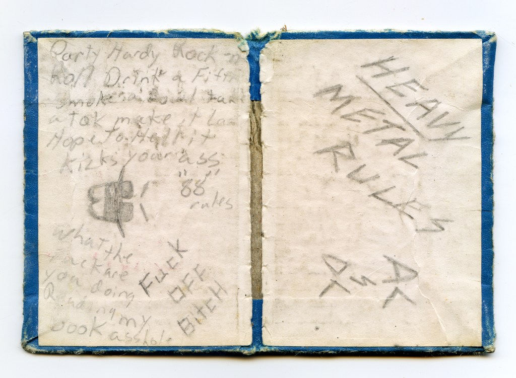
Inside the covers of a small address book he wrote the following:
“Party hardy Rock-n-Roll
Drink a fifth and smoke a bowl
Take a toke and make it last
Hope to hell it kicks your ass.
’88 Rules”
and
“what the fuck you doing reading my book asshole.”
and
“Fuck off bitch”
and
“Heavy Metal Rules AC & DC”
After initial bracing, the building was raised using hydraulic jacks and put on cribbing.
The building was raised and the cribbing placed by a house mover who lived in a compound out by Candlestick Point with a lot of dogs. His face was crisscrossed with scars from the explosion of one of his hydraulic lines, he told us. I only met him once, and that was probably enough.
Peter, the other carpenter, and I and some laborers worked digging out the basement by hand and with a jack hammer. The underside of the building was about ten feet over our heads. Freaky, when aftershocks hit. The design was to put a full height basement under it.
The ground was mostly sand, but when you got down a ways we hit jumbled brick that was dumped there after the ’06 quake. We found a lot of ceramic shards, pieces of glass, and other objects.
We eventually dug down to the little creek that still flowed under that part of SOMA. (Apparently part of Hayes Creek, which flows into Mission Creek.)
As we dug, we filled five gallon buckets with sand and debris, carried them to the front wall, boosted them up to the sidewalk level, and then into a dumpster. Eventually, through some of the hardest physical labor I’ve ever done, we got it excavated and filled with crushed rock, compacted, and concrete forms set. I used a builder’s level (for the first time) to level the forms.
Shipley really is an alley, and the back doors of buildings open on to it. Some of these buildings were full of women working at sewing machines. Clouds of industrial fragrance billowed out.
Every day at lunch time I would walk down Shipley to 5th and go to Harvey’s Café. Harvey’s was a famous hangout for bike messengers. Harvey Woo would loan them money or give them credit so they could eat when without funds. He had a big board behind his counter where he kept slips of paper with each person’s account.
Leslie Guttman, SF Chronicle, September 10, 1989: (Quake: October 17)
“It is Friday night. And, like the rest of San Francisco’s workers, the bike messengers head to their hangout, a grimy South of Market alley off Fifth Street, where their paychecks are cashed by their guardian angel and their dreams of the future have a brilliance that only a Friday night can bring. At least a couple hundred of the city’s approximately 400 bike messengers swarm, like bees to a hive, to Shipley alley, a narrow corridor between Folsom and Harrison streets, to let off steam after a week of dodging double- parked trucks, cars barreling through yellow lights and jay-walking office workers, their faces buried in their watches. Here, next to the alley, lives the man they call the Patron Saint of the Bike Messengers. Harvey Woo is the 49-year-old owner of Harvey’s Place, a little grocery store/lunch counter. In an era of bland chain superstores, Harvey’s is a relic: a first-names-only, family-run joint. As they say in the alley, “If you’re about to starve, you go to Harv.”
A dispatch from 2008 via Yelp:
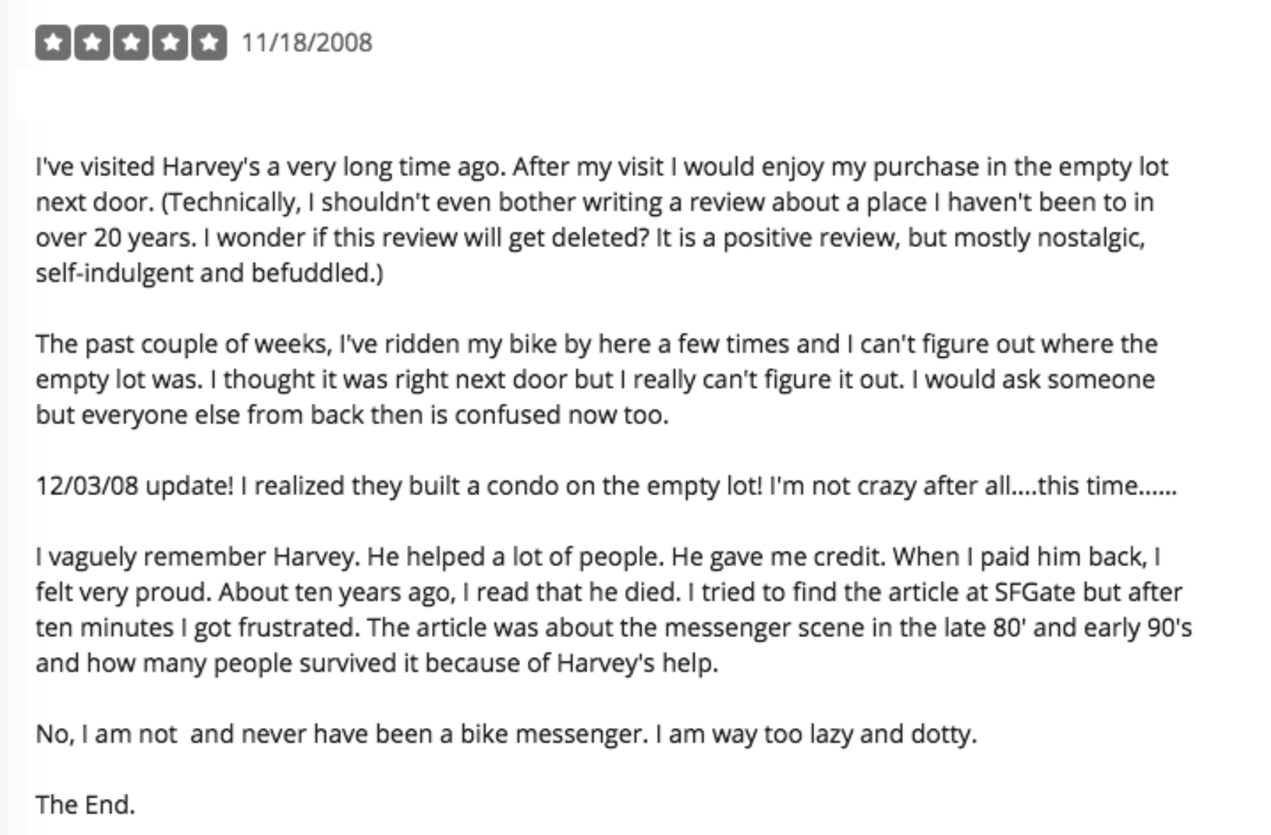
The condos and other new buildings have proliferated on Shipley and all over the City, particularly South of Market, but a few of us remember Harvey’s.
Michael Acker, april 2021
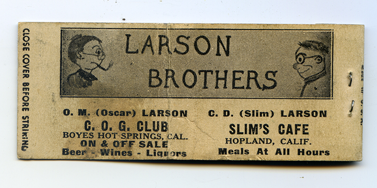
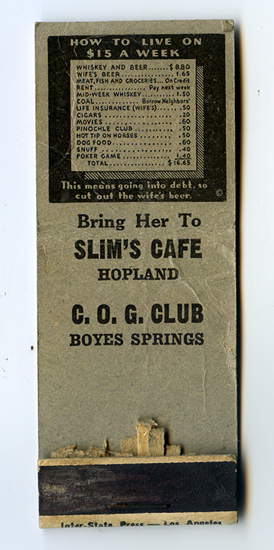
In April of 1939 the Index Tribune reported “The Larson brothers of Hopland have leased “Keller’s” at Boyes Hot Springs.” The Larson family, including Oscar’s wife Ophelia, came to California from Wisconsin around 1939.
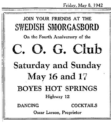
Oscar Larson promptly changed “Keller’s” to the C.O.G. Club, for Cal, Oscar and Gary Larson. The club was located near the corner of Vallejo St. and Sonoma Highway in the current Barking Dog Roaster space.
In 1942 they celebrated the fourth anniversary of the club with a Swedish smorgasbord.
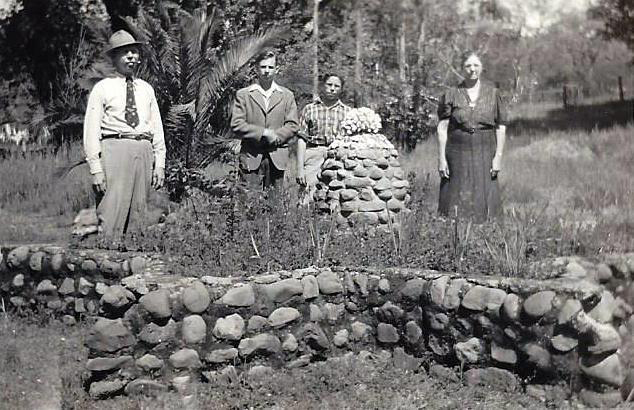
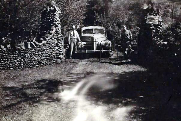
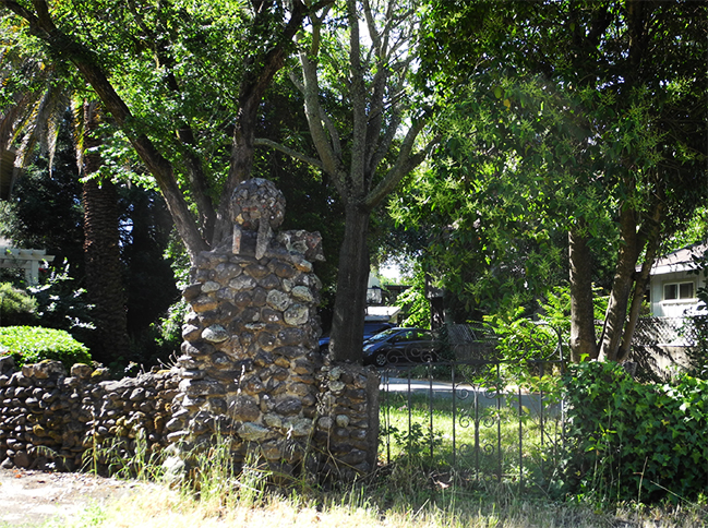
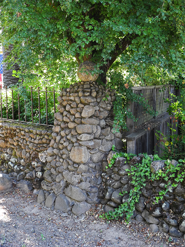
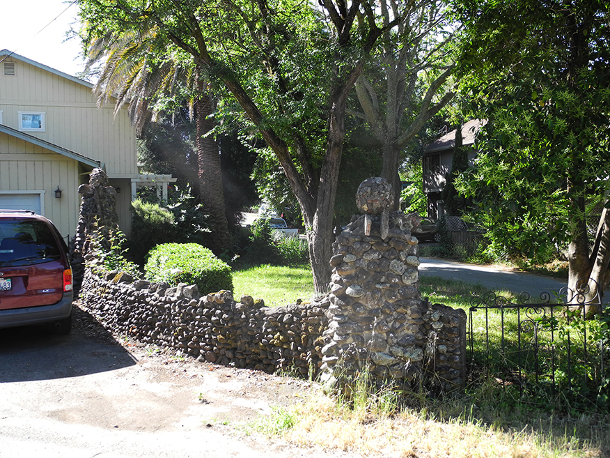
Also in 1939, they bought a stucco house on property near the corner of Verde Vista and Arroyo Rd. in Boyes Hot Springs. The house was known by neighbors as “Larson’s Villa,” and by the Larson family as “Valhalla.” The house still stands in 2021, though the land was sold and subdivided in 1989 and new houses were built. The original stone walls and pillars, some fairly recently restored, still grace the street, and continue to cause curiosity. Other stone work has not survived.
Gary Larson via email, 2018:
I remember the house well. We visited it as late as 1989 and held a small family reunion there right before they sold it. I believe an article was written in the local paper. I will never forget as kids playing in the canals (See Lily Creek!) that ran under the driveway and the beautiful stone star at the bottom of the hill. There was one big tree that was on the edge of the property that they told us was a redwood. Ophelia’s home was warm. She played piano.
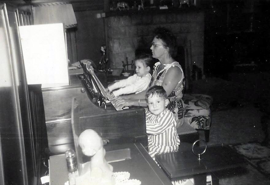
There was a bar in the corner of the living room for entertainment. There was a grill and huge outside patio and an apartment in the back. She always had a closet full of toys for us kids. We has a wonderful Christmas there one year in the 1960s.
Dad would put us to work raking and cleaning the yard when we would come to visit. Oh to be able to go back and visit my grandmother as an adult…I would have so much fun listening to the stories of their lives.
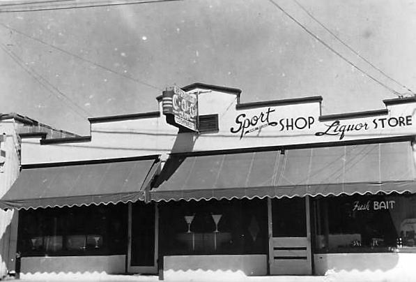
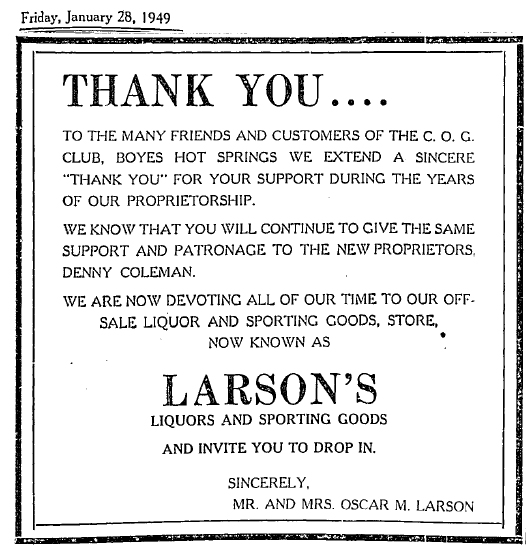
In 1949 Oscar and Ophelia Larson sold the club to Denny Coleman to concentrate on running Larson’s Sporting Goods and Liquor store, which he had opened in 1945, next door to the club.
Oscar Larson was very involved in civic groups. In 1943 he was elected president of the Sonoma Valley Chamber of Commerce. Other board members included luminaries whose names are still known in the Valley: Rudy Licthenberg, Dr. Andrews, Vic Leveroni, I.S. Shainsky, and John Dowdall.
In 1945 the Valley of the Moon Recreation District was formed. Oscar Larson was appointed to establish the district. In 1951 the district acquired four acres along Sonoma Creek in Fetters Hot Springs for development as a park. In 1955 the Lion’s Club erected a concrete block building for park use.
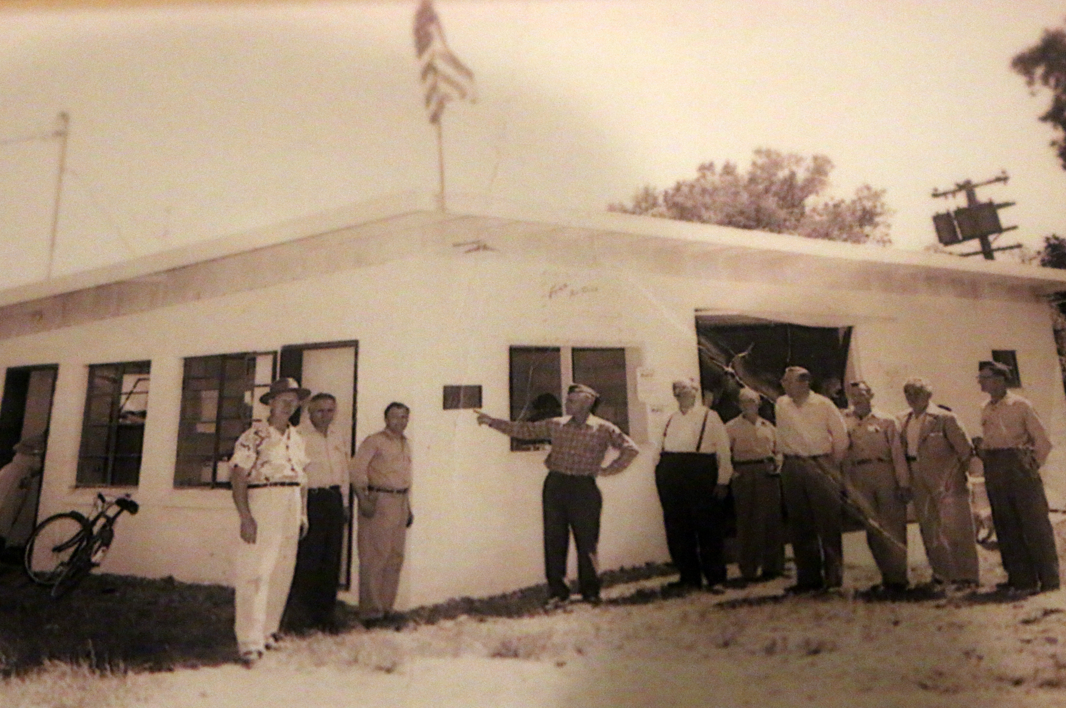
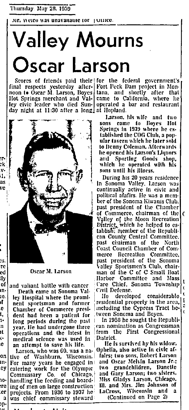
In 1959, what had been known as “Park #1,” was officially named Larson Park to honor Oscar Larson, who died in May of that year.
Iris Larson, Gary’s mother, 92 years old in 2019, told me via phone that Oscar bought war surplus houses from Mare Island and brought them to BHS. He installed them on lots he owned on Second Avenue. Some he joined together or stacked.
UPDATE: The Larson stonework in 2021.
Photographs courtesy of Gary Larson and author’s collection. Index Tribune courtesy of the Sonoma Valley Historical Society.
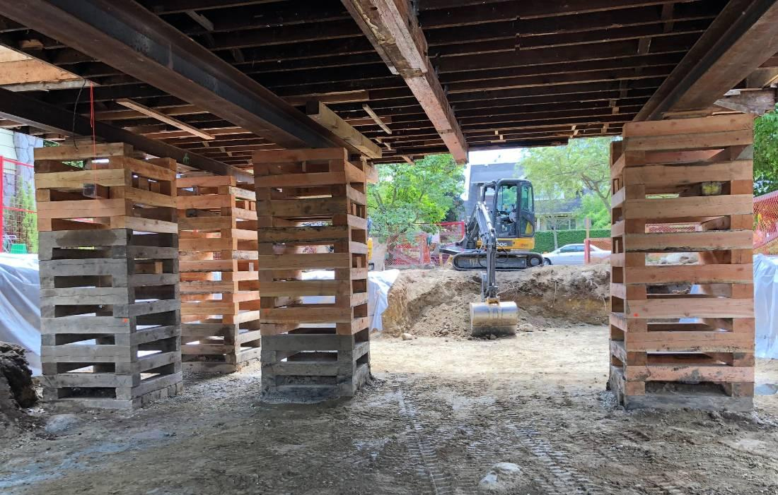
It was a different experience in 1955
On February 17, 1955, the Index Tribune reported
“A $12,987 contract for rebuilding the Boyes boulevard bridge across Sonoma Creek, near the Bath House in Boyes Hot Springs, was awarded by the county supervisors last week…The contractor will use existing abutments and piers for the bridge and will use but relocate existing steel stringer and add a reinforced concrete deck and sidewalks.”
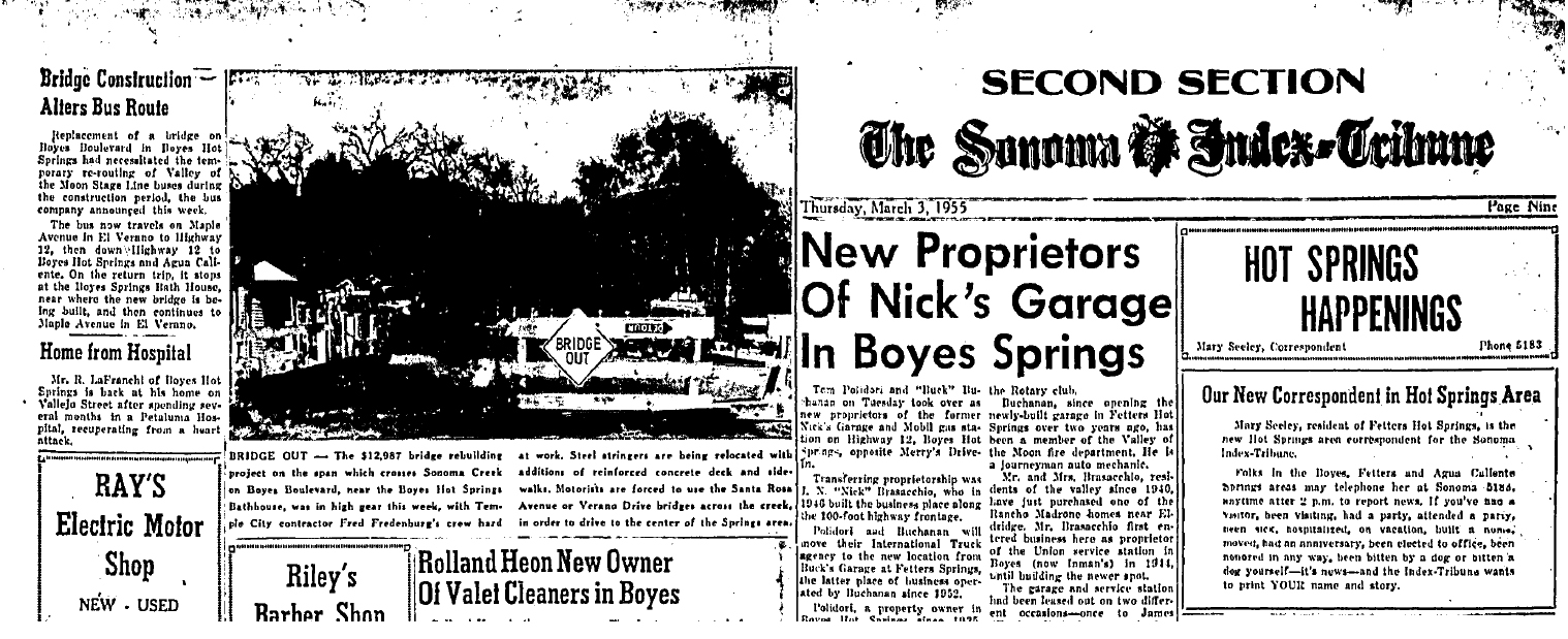
Thursday, March 3, 1955. Work was “in high gear” on the new Boyes Blvd. bridge.The caption notes that motorist will be forced to use “Verano Drive or Santa Rosa Avenue” to cross the creek. Verano Drive is now Verano Blvd. and Santa Rosa Avenue is West Agua Caliente Road.
Work went fast: On April 17th we learn,
“New Boyes Bridge May Open to Traffic This Weekend.”
“Possibility that the brand new bridge across Sonoma Creek at Boyes Boulevard, near the Bath House, will be open to traffic on Saturday was seen this week.
Painting of the new steel barriers and upper portion was completed on Tuesday with only the sand blasting and painting of the steel sections beneath the bridge remaining.
Normally, twenty-one days is allowed for the concrete to set after the deck has been poured. If this procedure were followed, the bridge would not open until next Monday. However, due to the excellent weather and the fact that the Boyes Hot Springs Bath House and facilities will be open for the season on Saturday, this weekend may possibly see the new bridge in use.
The Fred Fedenburg firm of Temple City has been the contractor for the $12,987 project, which was stared the last week of February.”
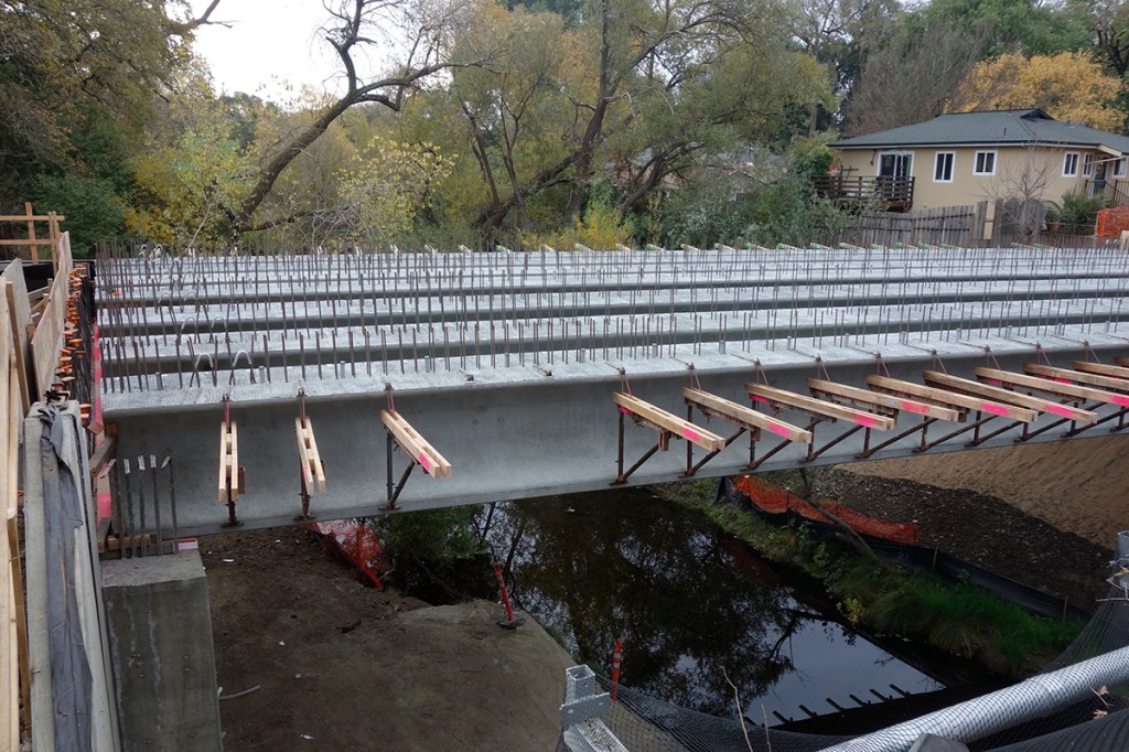
The work was fast because they did not replace the abutments, unlike the current project for which massive new concrete supports were poured. Still, the end of February to the end of April is rapid!
Fast forward to the year 2000. It was proposed to widen the bridge to three lanes, but neighbors worried about increased traffic.
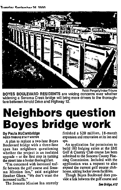
That project never came to pass.

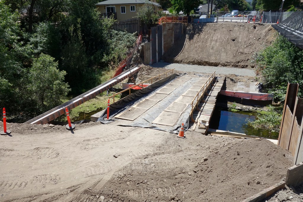
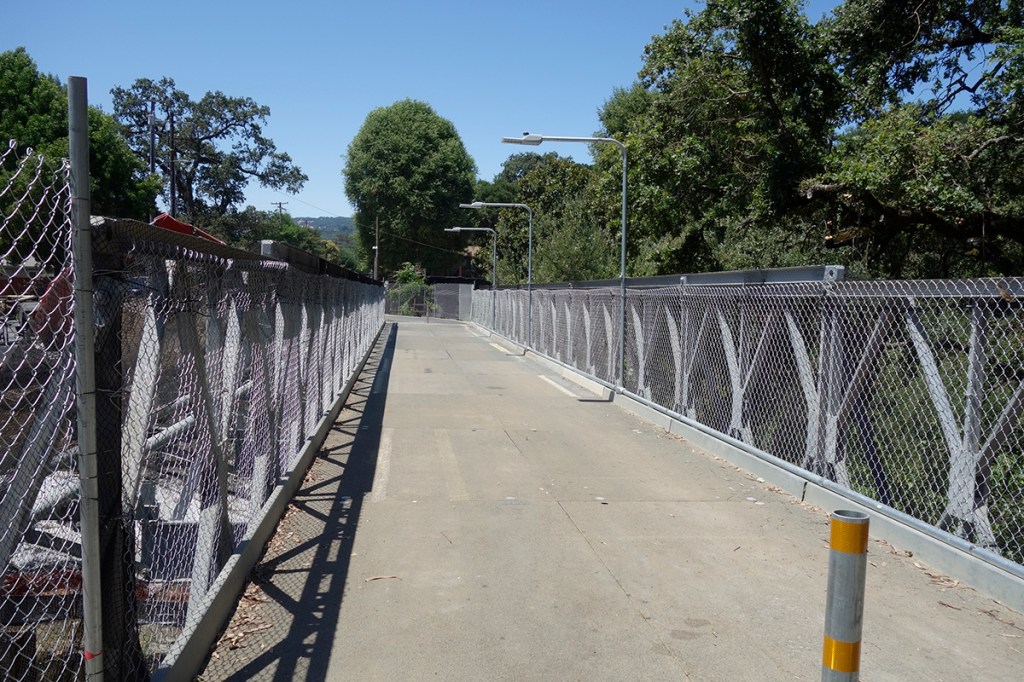
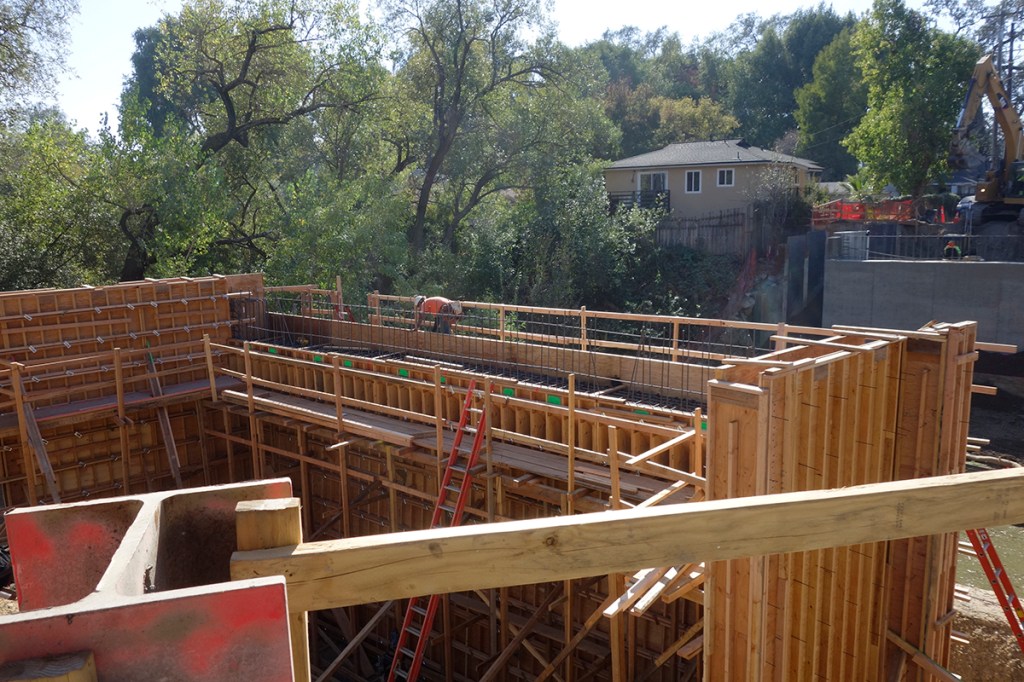
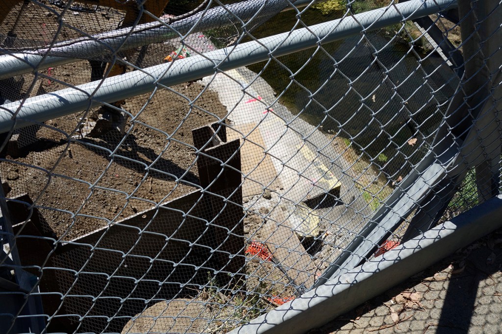
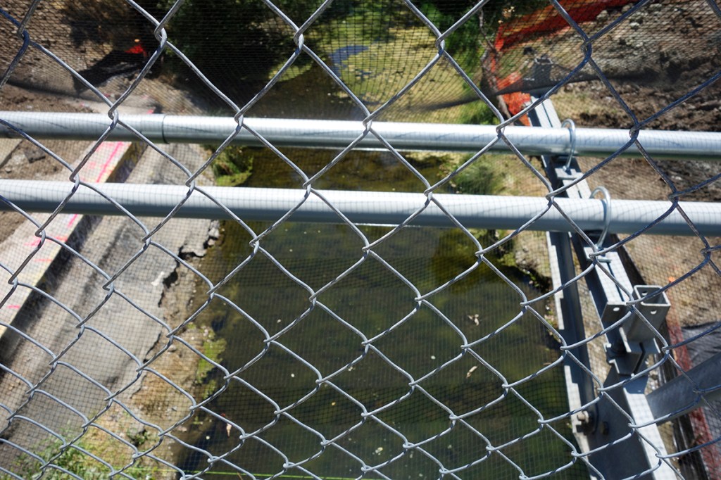
In December 2020 the County sent this notice informing us of a big step in the construction of the NEW new bridge.
We first learned of the current bridge project in July of 2019, when the Sonoma County Department of Transportation told the Index Tribune that the Boyes Blvd. bridge was “functionally obsolete.”
“The new replacement bridge will comply with current roadway, drainage and bridge standards…; it will not increase vehicular capacity but will provide shoulders for bicycles and a five-foot wide sidewalk for pedestrians” the IT reported.
Engineering work started in 2013. The funds were allocated in July of 2019.
“The entire project is expected to cost $5.13 million, almost 13 percent higher than originally estimated. Additional costs are said to stem from the temporary pedestrian bridge which will also provide a structure for water, gas and electric relocations, and the water systems improvements by the Valley of the Moon Water District (VOMWD).”
“Commencement of construction of the project has been delayed due to, among other things, a lengthy negotiation with a neighboring homeowners’ association in 2018,” said the summary report.
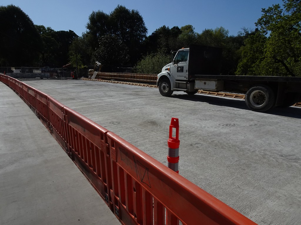
The “other things” causing delay now include a world-wide pandemic and a bad fire season in 2020. Currently the bridge is scheduled to open in July of this year (2021).
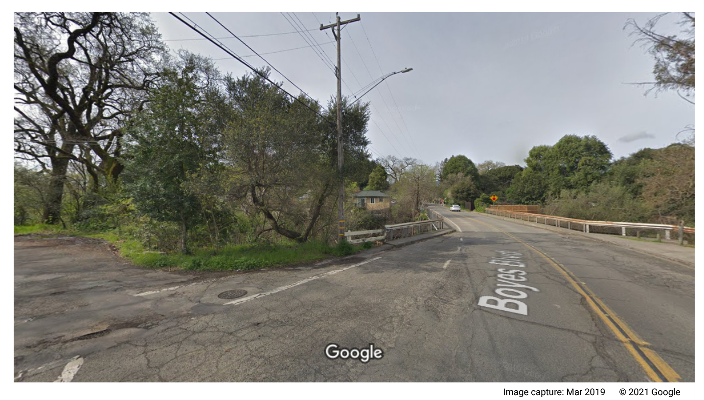
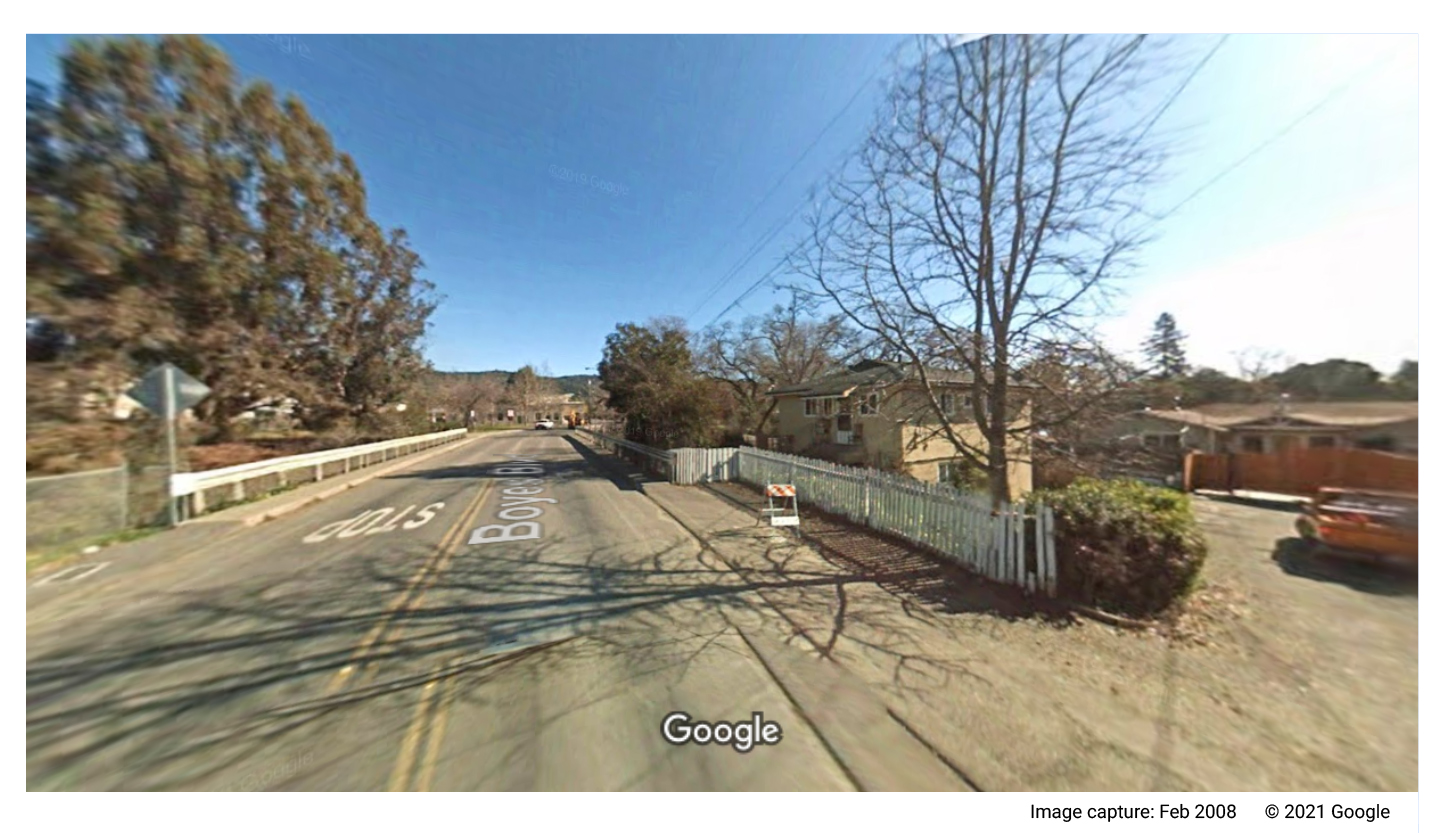
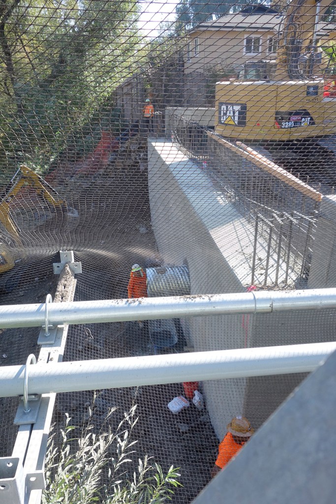
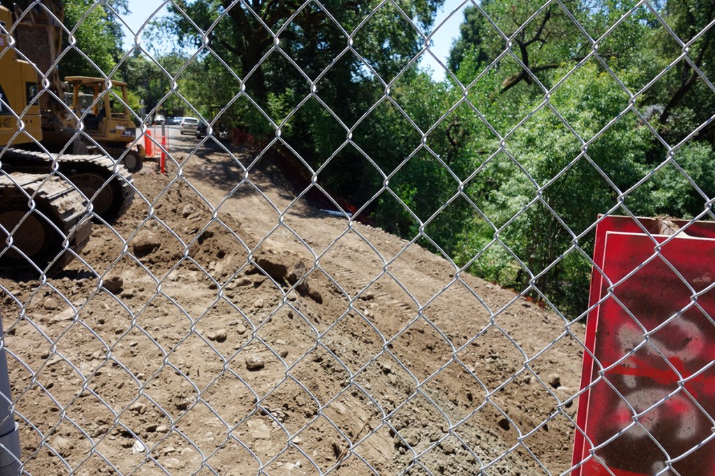
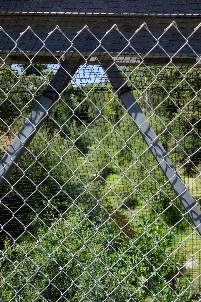
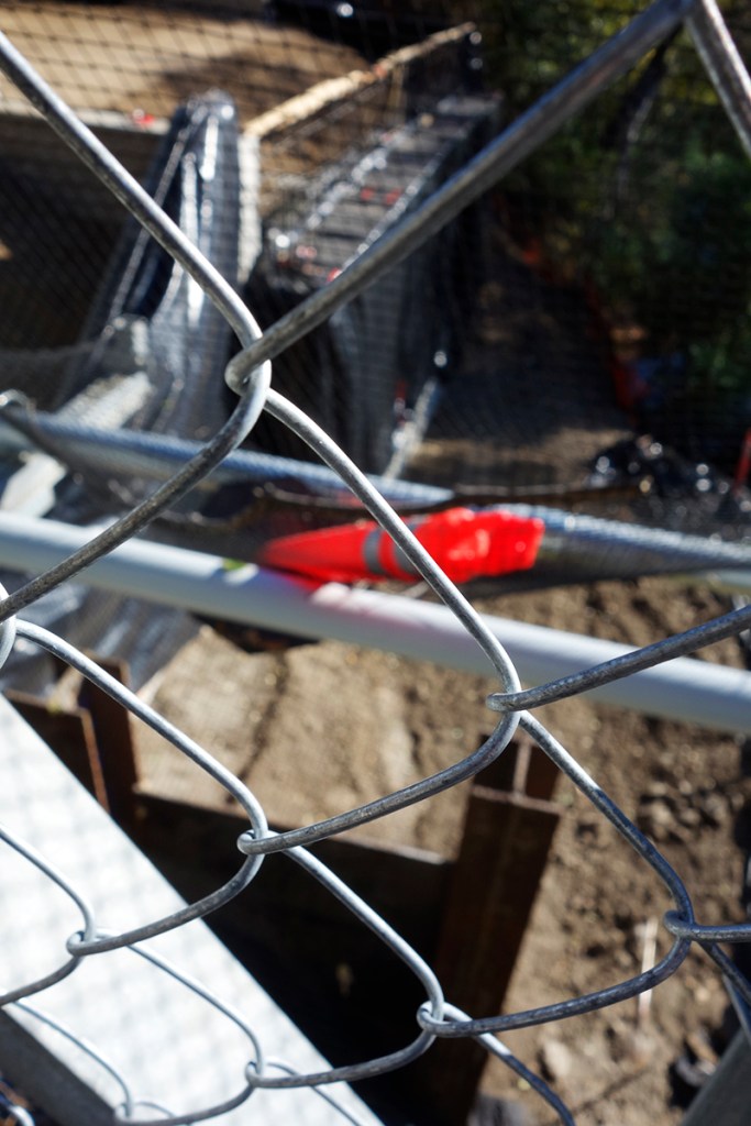
The photos below span November 2019 through April, 2021.
Bonus slideshow of arty construction images! You’re welcome.