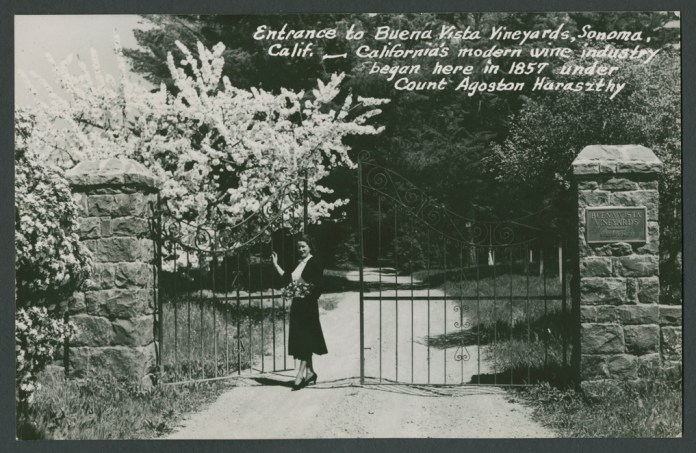
From the 1948 National Geographic article on “Hap Arnold’s Valley of the Moon.”


From the 1948 National Geographic article on “Hap Arnold’s Valley of the Moon.”
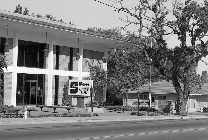
At the corner of Highway 12 and Sierra Drive stands the building housing Ross Drulis Cusenberry Architects. The building was built in 1966 for Sierra National Bank. It seems that the street, originally known as Meincke Road, was probably renamed for the bank. The street also has the distinction of being on the former Northwest Pacific Railroad right-of-way.
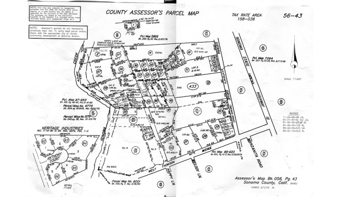
Assessor’s Parcel Map showing Meincke Road/Seirra Drive
On July 15, 1942, a hearing by the Interstate Commerce Commision in Santa Rosa pitted the War Department and the Southern Pacific Company against the Sonoma Valley Chanber of Commerce, Sonoma State Hospital, and the Sonoma Vista Improvement Club in a debate about whether the rail line between Sonoma and Glen Ellen should be abandoned (passenger service had ended in 1935). The Feds claimed that the line was not needed for the war effort as almost all frieght was brought into the valley by truck, and the SP pointed out that the line had lost money for years. However, Dr. Fred Bultler of the State Home said that his institution had been designated the main hospital for the region should a coastal evacuation be necessary. The Home had been mandated to provide 500 beds on two hours notice and that the rail connection would be required to supply this additional population. The Home had 3200 “inmates”, as he called them, and 450 employees at the time.
Southern Pacific prevailed, however, and by January of 1943, the rails were gone, freeing the stretch between the Mission Inn and West Thomson Ave. to become a road.
The street was probably originally named for George Meincke, a school bus driver, chauffer for the Spreckles family, fire commissioner, and local property owner. However, two other Meinckes were prominent enough in the Springs, midcentury and before, to also be the namesake: Charles Meincke and H. Meincke.
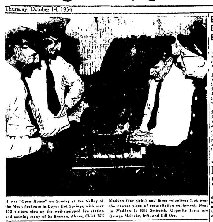
George Miencke with fellow Fire Commissioners at a fire station open house in 1954.
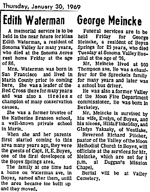
Interestingly, the obituaries for George Meincke and Edith Waterman appeared next to each other in the January 30, 1969 edition of the IT. Both had streets named for them, or their family in Ms. Waterman’s case. The Waterman family goes back a little farther than Miencke’s. Her obit notes that “When she and her parents first started coming to this area many years ago, they were guests of Capt. H. E. Boyes…”
The Boyes Hot Springs Company was incorporated in 1902, with August Waterman as one of the directors.
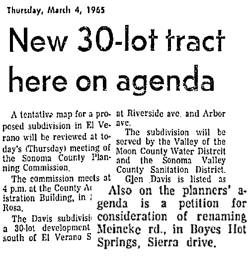
A very low key announcement of the proposed name change appeared in the IT in March of 1965.
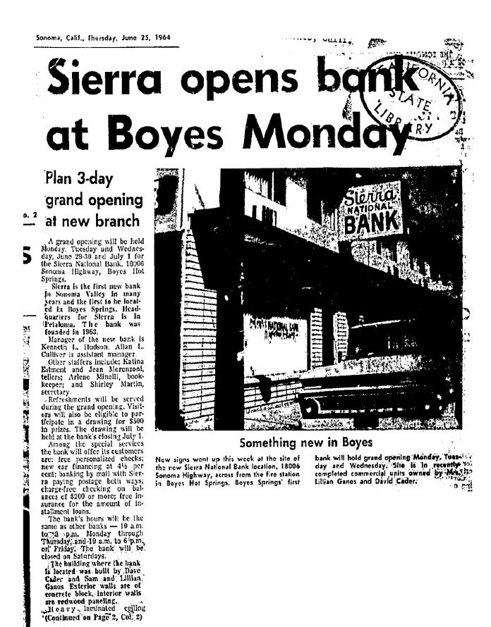
Sierra Bank first opened in a storefront on Highway 12 in 1964. The address was 18006, now a liquor store (2018). It was front-page news in the Index Tribune. This was the first bank to open in Sonoma Valley outside of the town of Sonoma.
The new bank building was also a major project for Boyes Hot Springs in 1965 when it was announced.
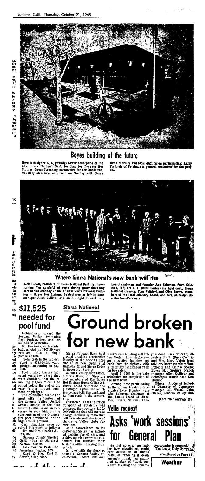
Among the luminaries attending the groundbreaking were Bud Castner, and Tom Polidori, prominent Springs businessmen. (Notice the article at bottom left. In 1965 they were fund raising for a new swimming pool.)
Just south of the Sonoma Mission Inn, on the west side of Highway 12, Sierra Drive intersects.
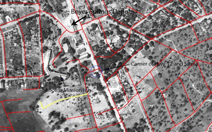
Aerial photo with streets courtesy of Arthur Dawson
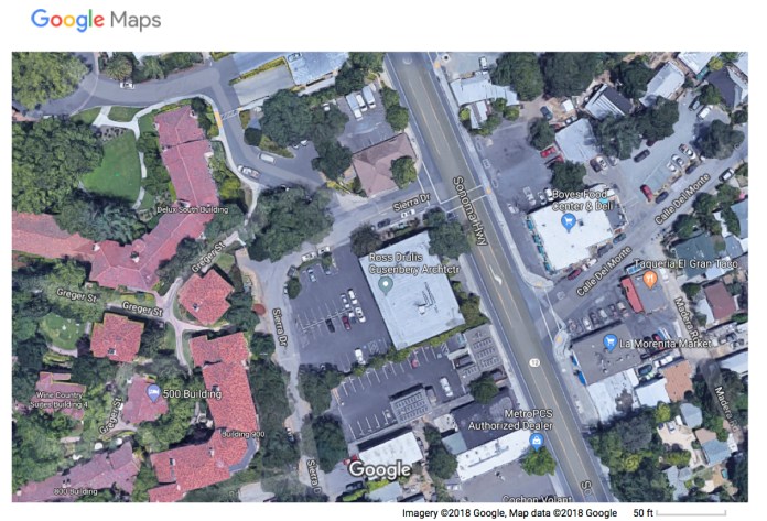
At that corner stands one of our landmark oak trees. The tree is in front of the building that now houses Ross Drulis Cusenberry Architects. The building was built in 1966 for Sierra National Bank. It seems that the street, originally known as Meincke Road (more on that later), was renamed for the bank. The street also has the distinction of being on the former NWPRR right-of-way (the tracks were removed in 1942).
Our tree is a Valley Oak, Quercus lobata. According to the California Native Plant Society (http://calscape.org/), the Valley Oak ranges over the interior valleys of the State, and needs to be near a source of water (Lily Creek*, which flows down Arroyo Road, tunnels under the highway very near the tree.) It can grow to 100’ in height and live for as many as 500 years. The tree in question, which has three trunks, certainly could be 100 years old. We have a photograph of the tree (and building) from 1973, which shows it to be in pretty poor shape. In 2018 it appears to be much healthier.
*Thanks to Greg Larson for the creek name.

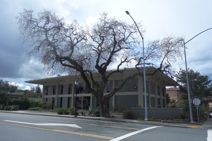
1973 top. 2018 bottom. Top photo courtesy of the Sonoma Valley Historical Society.
The tree may appear in some other historic photos.
Boyes Depot, 1930s, (approximately located in the parking lot behind the Plaza Center Building), looking north to Sonoma Mountain. The oak in the foreground is possibly the Sierra Drive tree.
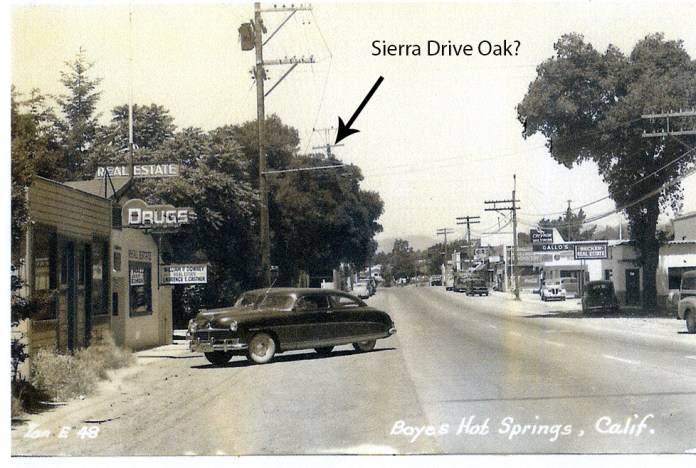
Photo by Zan Stark, 1950s. The location is opposite Arroyo Road on the Highway.
Oaks are never more beautiful than in winter.
Next post: About Sierra Drive/Meincke Road.
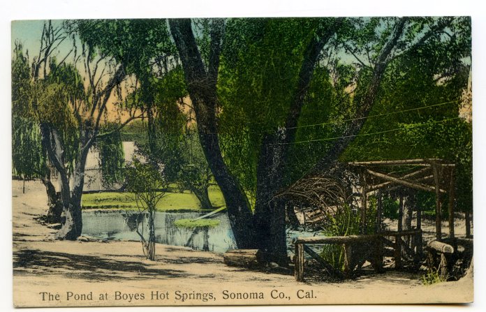
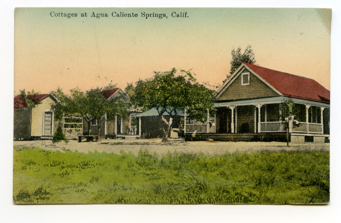
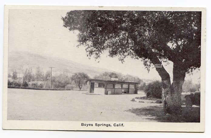
 Postmarked 1908
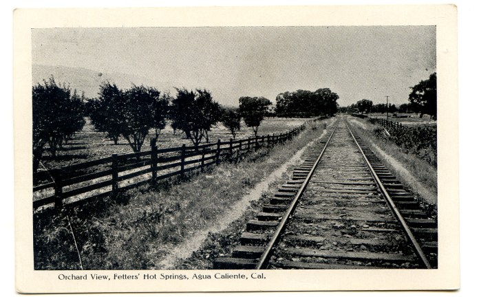
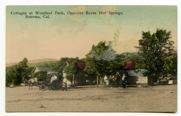
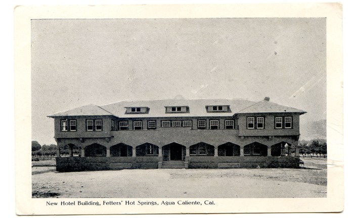
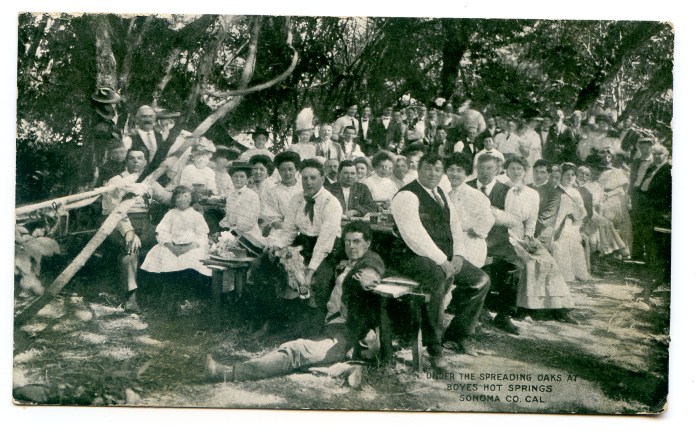
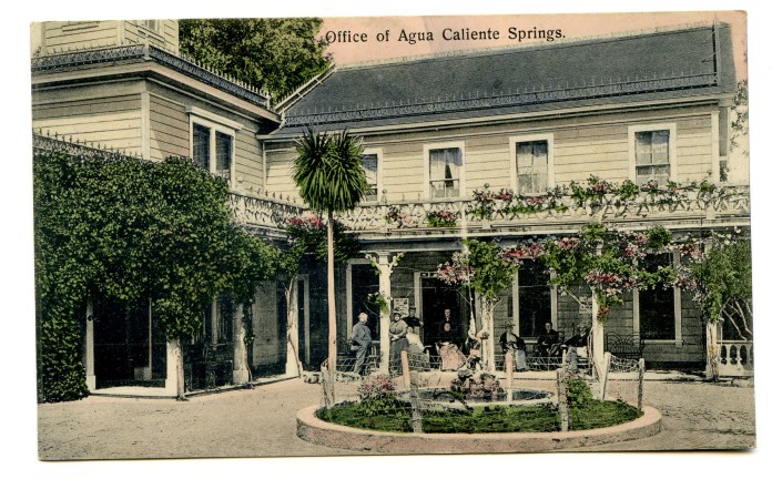 Postmarked 1909
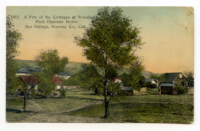
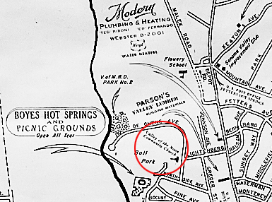
According to a Santa Rosa Press Democrat article from 1942, “Edwin P. Thomson, who many years ago owned the site of Fetters Springs…in 1887, planted the olive grove that now borders the highway between Fetters and Boyes Springs.” In 1946, the PD tells us that “Twenty-five acres of olive grove property fronting the state highway in Boyes Hot Springs and extending down to the ballpark, will soon be made available as an exclusive business and residential subdivision…” the owners were Bill Johnson and Rudy Lichtenberg, who also owned and managed the Boyes Bath House. Both men have streets named after them in that area.
Bill Johnson at the Boyes Bath House
(Courtesy of the Sonoma Valley Historical Society)
This map, from the website 321 Houses.com, shows an area which they call “Olive Grove.”
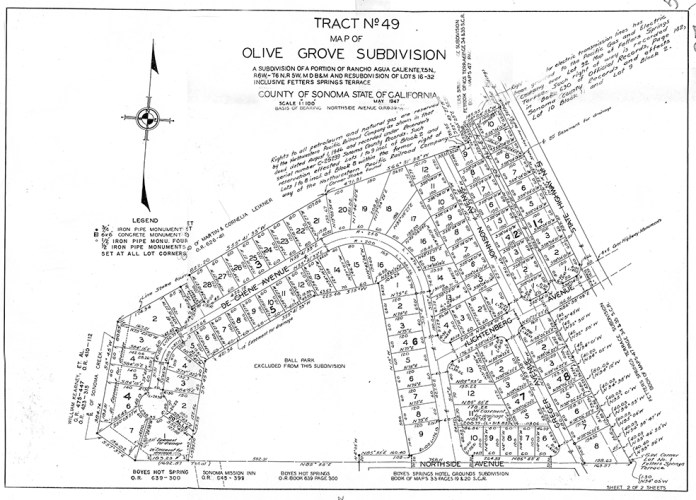
UPDATE: Below is the Recorder/Assessor map of the subdivision. It is dated 1947.
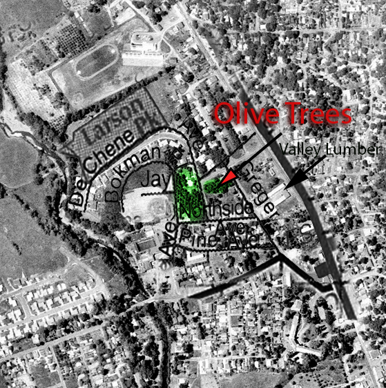
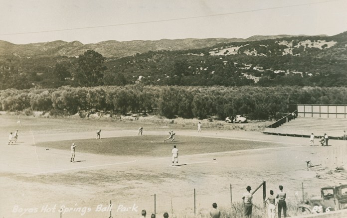
This is part of an aerial photograph from 1961, with a few street names superimposed. At that time, Bokman Avenue did not exist. Bokman approximately follows the outfield fence of the Boyes Springs Ball Park, which can be seen left center of the photo.
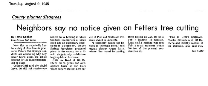
According to an IT article from 1988, the trees covered an area of 12.5 acres at that time. The trees were bulldozed in 1988, much to the dismay of local residents. See below.
Zan Stark photo showing olive grove behind the ball park (to the east.) Courtesy, Stanford University Library, Special Collections.
At various times, various people have made the claim that the trees in the Olive Grove tract were planted by M. G. Vallejo. This was asserted and denied in 1988 when the trees were removed. Real estate agents and B + B proprietors still use this “information.”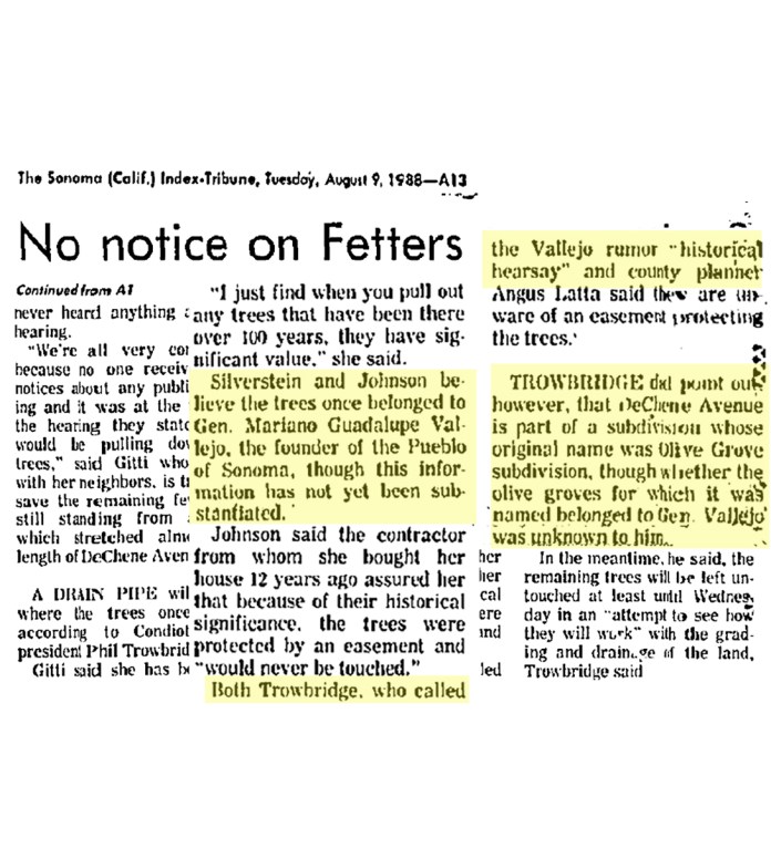
(Copy from online advertisment, below)
Property Details for 17600 Johnson Ave
This property is no longer available to rent or buy. This description is from May 03, 2010
Experience this darling 1949 Turn-Key home in the heart of the Wine Country! This meticulous 2 bedroom, 1 bath home features a spacious vintage kitchen, and a light and bright living room. The private back yard is a gardener’s delight that includes a patio, a deck and plenty of shade provided by two mighty olive trees that were once part of General Vallejo’s olive grove. Minutes from the Sonoma Plaza, restaurants and wineries.
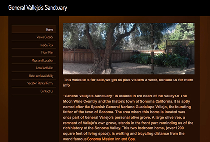
”The area where this home is located was once part of General Vallejo’s personal olive grove.”
As mentioned above, the remaining trees were removed in 1988.


Olive trees on DeChene Ave. in 2017. (Author’s photos) Many of the existing trees in the area seem very old. They could be survivors from Thomson’s orchard.
The Valley of the Moon Community Church was located in the Olive Grove tract.
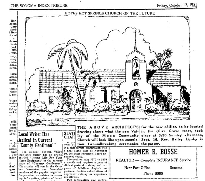
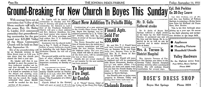
In September of 1951, the foundations were poured. Fourteen months later, “The handsome church building is slowly but surely nearing completion.” In August of 1953, the church building was in use.


This Chamber of Commerce map, courtesy of the Sonoma Valley Historical Society, from the 1955 shows the VOM Community church approximately where Lichtenberg St. comes into DeChene Ave.
This is the last mention of the Church in the IT. What happened to the congregation? What happened to the church building?
Many thanks to Joanna Kolosov of the Sonoma County History and Genealogy Library for information from the Press Democrat and other sources.
Regrettably, we have lost track of the name of the gentleman who loaned the 1961 aerial photograph. The photograph was provided to him by Sonoma County.
Antonio Juan, who took over Johnny Mazza’s barber shop in 2017, found this clock in the back of the shop.

Valley Watch Repair was started in 1954 by George R. Trueman, who previously ran a jewelry store in Sacramento. The shop was located in the Kinucan building, at first. This building, once called the Central building, was located on the highway, on the land that now features the Sonoma Mission Inn employee parking lot. At the time Trueman moved in, part of the building was used for the Boyes Springs Variety Store, run by the Polidori family.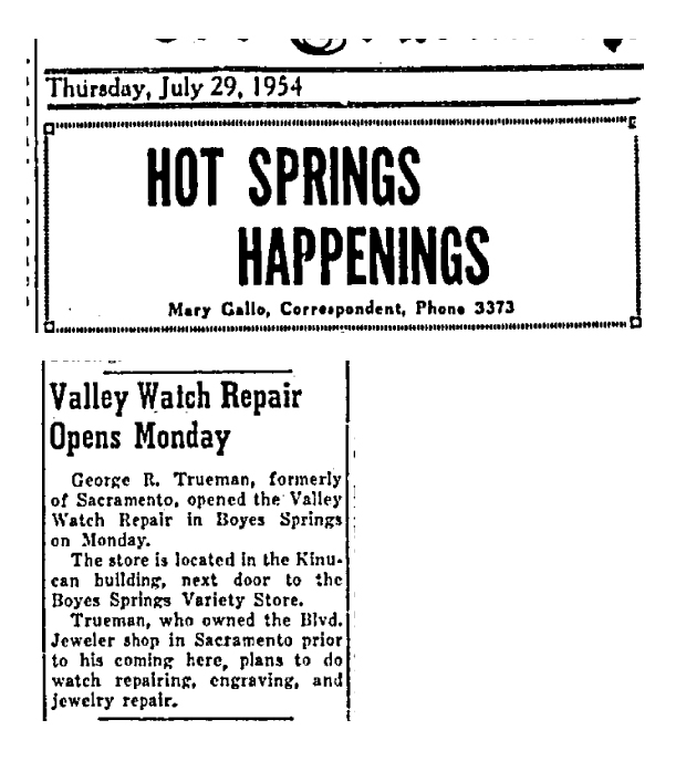

In this post card photo by Zan Stark, the Variety Store is at left. The cars date the scene to 1954.
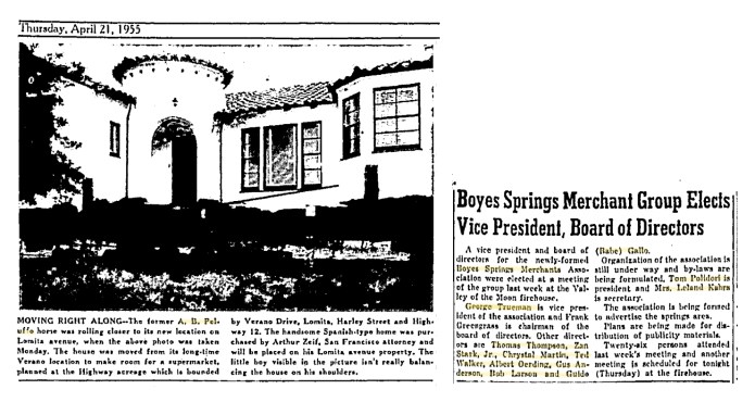
George Trueman became active in the business community. In 1955 he was elected vice president of the newly formed Boyes Springs Merchants Association. President was Tom Polidori. Zan Stark and Babe Gallo were directors.
(The photo caption on the same page tells of the former A.B. Peluffo house being moved from the site of the new shopping center at the corner of the highway and Verano Avenue. Pellufo was the developer of the Plaza Center building which houses the post office in Boyes Hot Springs.)
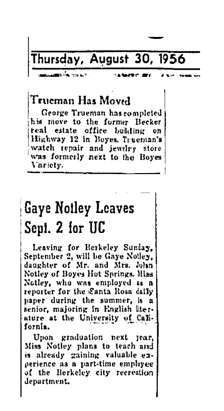
In 1956 Trueman moved his business to the former Saul Becker real estate office adjacent to Gallo’s Service station on the east side of the highway, near Arroyo Road. (Gaye Notely left for Berkeley a few days later, as we ;earn on the same page of the Index Tribune. Much later she would become Gaye Le Baron.)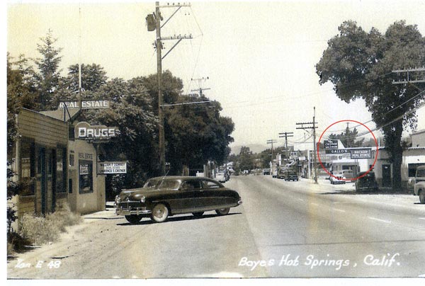

Mrs. Trueman opened her yardage and clothing store next to the Valley Watch Repair, “opposite the Mission Inn entrance on Highway 12…” in 1958. 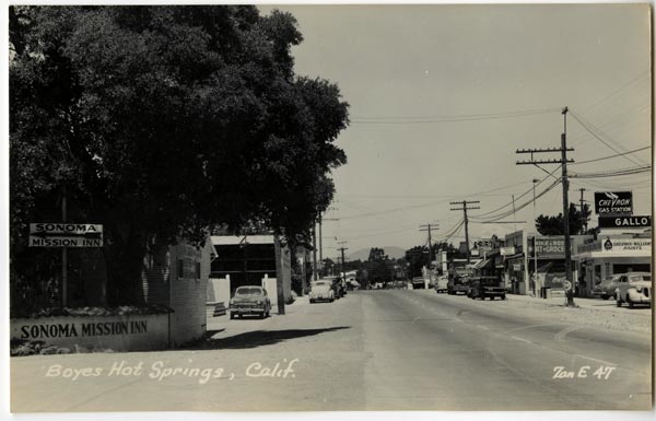
The indispensable Zan Stark provides a view of the Mission Inn entrance.
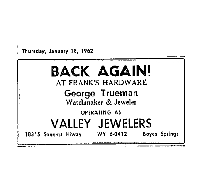
In 1961, the Truemans sold their businesses and embarked on a cross-country road trip, saying they would return to Sonoma Valley. And return they did, in 1962, and set up business in Frank’s Hardware.
Photographs courtesy of Michael Acker
A chronological sampling of e-media from the first two days of the fires. Please open the pdf.
Caution: may trigger post traumatic stress symptoms!

Thanks to the diligent work of Roy Tennant and Mike Acker, 78 images of Sonoma Valley by Alexander Stark have been digitized and are availalble online at https://searchworks.stanford.edu/?f%5Bcollection%5D%5B%5D=9157694
Some are well known, and some not.
 We thank archivist Franz Kunst and the rest of the staff at Special Collections for their kind assitance.
For more about Zan, read Frank Sternad’s wonderful article Stark for the San Francisco Post Card Club newsletter: ZanMonograph
In Sonoma Valley, as in many parts of California, fire is an important part of the environment. Before European settlement, the inhabitants of the area used fire as a tool of landscape management. In fact, what the early Spanish and American colonizers saw as an unaltered wilderness had been shaped and husbanded by humans for millennia, using fire and many other methods.
“At the time of Euro-American contact, California was more densely populated than any area of equal size in North America, north of central Mexico. Long before Europeans mapped the region, California’s tallest mountain peaks, its largest lakes, longest rivers, and its oldest trees all had names. The state’s promontories, declivities, and unusual rock formations were infused with human meaning. What is labeled as “wilderness” in today’s popular imagination and on current topographical maps actually harbored human gathering and hunting sites, burial grounds, work sites, sacred area, trails and village sites. Today’s wilderness was then human homeland.” (A World of Balance and Plenty, Land, Plants, Animals and Humans in a Pre-European California. M. Kat Anderson, Michael G. Barbour, and Valerie Whitworth; in Contested Eden, California Before the Gold Rush, UC Press, 1998.)
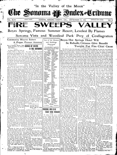
The “Boyes Springs Valley Vol. Fire Dept.” was about all they had in the way of first responders in 1923.
In 1964 and 1996, air tankers were vital to suppressing the fires. None existed in 1923, of course, but the Northwest Pacific Railroad sent a fire fighting crew, and mutual aid came from as far away as San Francisco.
It’s often stated of the 1923 fire that Boyes Springs and Fetters were completely destroyed. This is not the case. Many buildings survived. Since rebuilding was so urgently done, starting in October of 1923, it is often difficult to determine if a house or business survived the fire, but there is documentary evidence for some, such as the Sam’s Grill building. Please see https://springsmuseum.org/history/photographs/boyes-hot-springs/
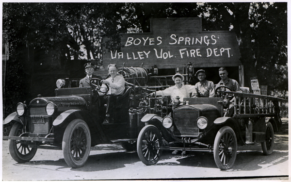
In 1936 the community built, partially with Federal funds, a new fire station.
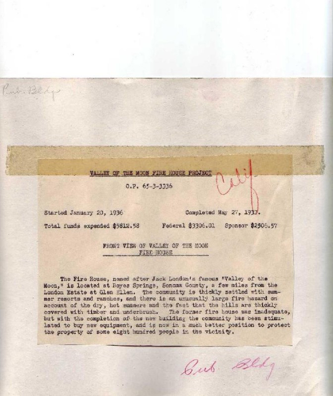
The text on the back of a WPA photo of the fire house inaccurately says it was named after the Valley of The Moon (it is so named because it is in the Valley of the Moon). However, it accurately states that the area has an “unusually large fire hazard…” See “The Living New Deal” https://livingnewdeal.org/projects/boyes-springs-sonoma-county-fire-station-sonoma-ca/ . It is a great project.
The building still stands in 2017, though greatly altered.
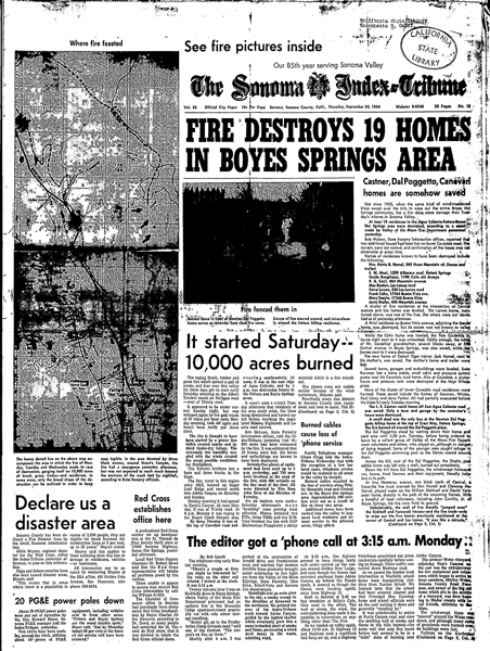
The 1964 fire was the worst since 1923. Hundreds of firefighters with dozens of engines and a lot of air support kept the damage lower than it would have been earlier in the century.
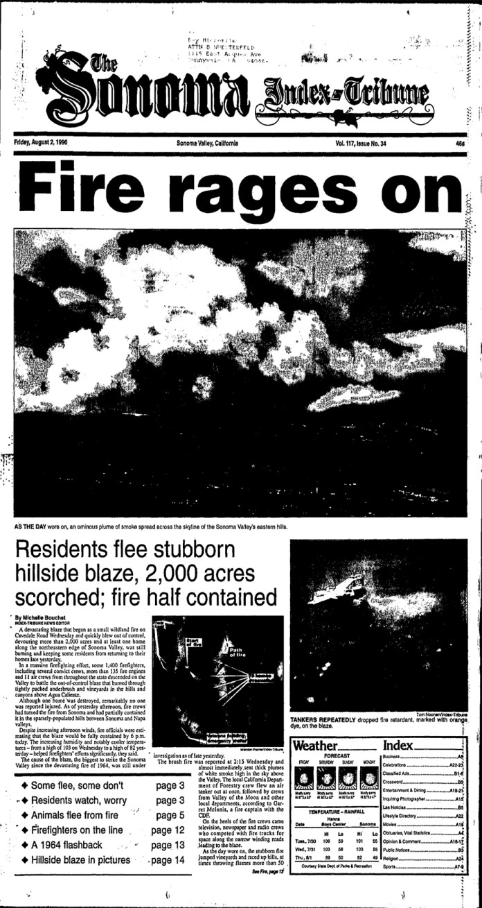
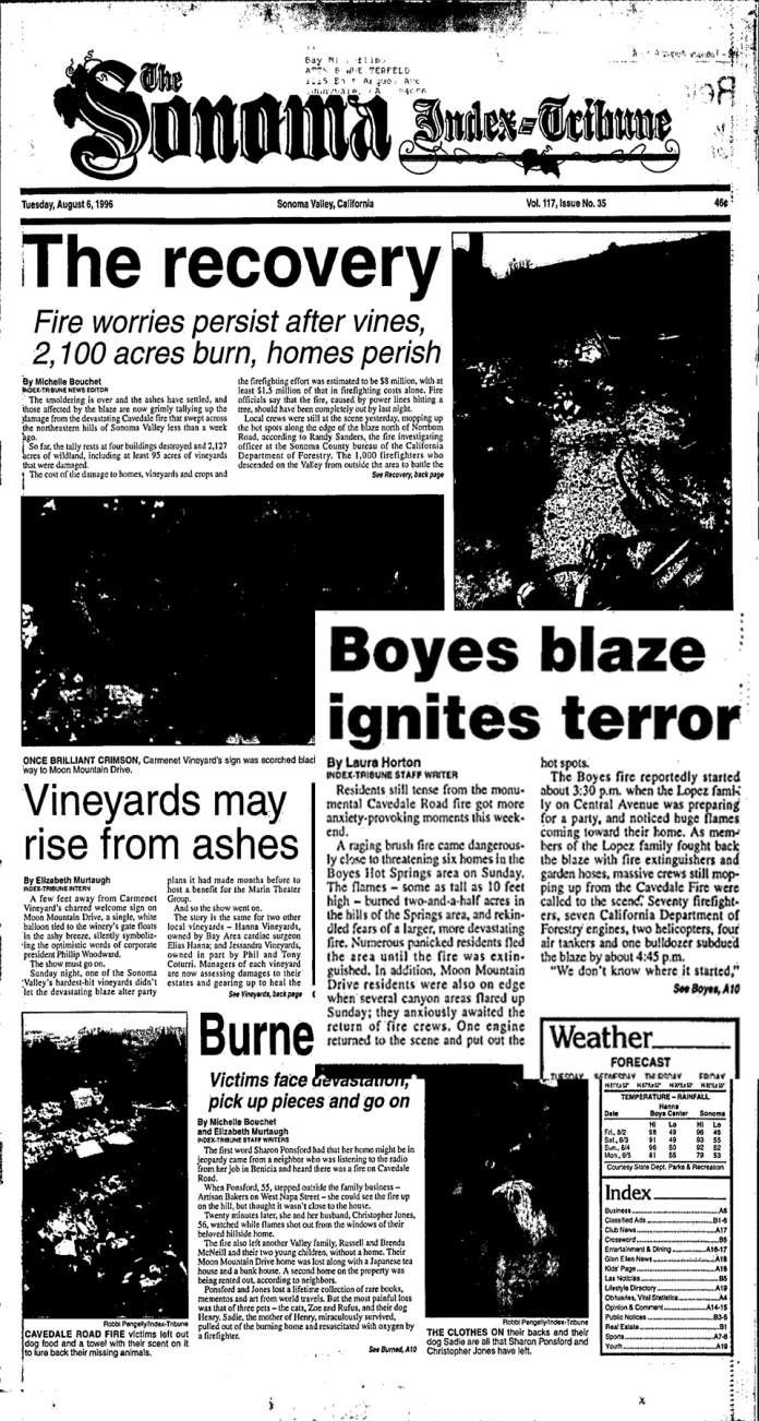
The 1996 fire was kept far smaller than ’23 or ’64 by the large number of firefighters and equipment quickly brought to bear.
In the Index Tribune of August 13, 1996, Harry Martin, a CDF officer, listed the following fire prone areas: Cavedale Rd., Nuns Canyon, Grove St., Seventh St. E., and Lovall Valley Rd. All but Grove St. are within the 2017 fire boundaries.
On Sunday, August 4, 1996, as the Cavedale Fire was being mopped up, a dangerous brushfire broke out in Boyes Hot Springs, adjacent to Central Avenue. Crews already fighting the big fire were able to subdue the Boyes blaze.
Jeff Baker’s Moon Mountain Road house survived the 1996 fire and the 2017 fire, as it was designed to do.
Fires in Sonoma Valley |
||||||
Date started |
Acreage |
Duration |
Origin/path/cause |
Buildings destroyed |
Number of firefighters |
|
| 1923 | 9/16 | 10,000 | 2 days | Napa County, Nuns Canyon/bee keepers | at least 119 | unknown |
| 1964 | 9/19 | 10,000 | 4 days | Nellligan Road/possibly power lines | 27 | 600 |
| 1996 | 8/2 | 2100 | 3 days | Cavedale Road/PGE accepted responsibility | 4 | 1500 |
| 2017 Nuns Fire only | 10/8 | 30,000 Sonoma Valley | 98% contained on 10/29 | Glen Ellen/under investigation | over 600 | At least 6,000 for all Sonoma County fires |
The Sonoma Valley Historical Society invites residents of the Sonoma Valley, the Springs, Glen Ellen and north to Kenwood to submit stories and photographs about how they and their families were affected by the October fires. These will be archived at the Historical Society in a special collection called “The Sonoma Fire Project” and will be used for research, local journalism, and possibly future publications.
If you’d like to submit your story and photos, send them to sonomafireproject@gmail.com. You can write in the body of the email, or attach a Word document. Photos can be attached in any format. It will also be helpful to have the following information:
Where you live (you don’t have to give an exact address, the general location is fine)
How long you have lived in the Sonoma Valley
Why you came here
What kind of work you do
Mailing address and phone number
The museum will send you a form to sign indicating that you give permission for your story and your photos to be used by researchers and journalists. Your name will always be associated with what you write and what you photographed.
We are doing this project to document the individual, personal side of this great regional tragedy, and are grateful to everyone who wants to participate.
If you have any questions, just send them along to project manager Lynn Downey at sonomafireproject@gmail.com.
707-694-0440